
Beantwoord enkele vragen, en binnen seconden geeft AI je een persoonlijk aankoopadvies op maat.
Beantwoord enkele vragen, en binnen seconden geeft AI je een persoonlijk aankoopadvies op maat.
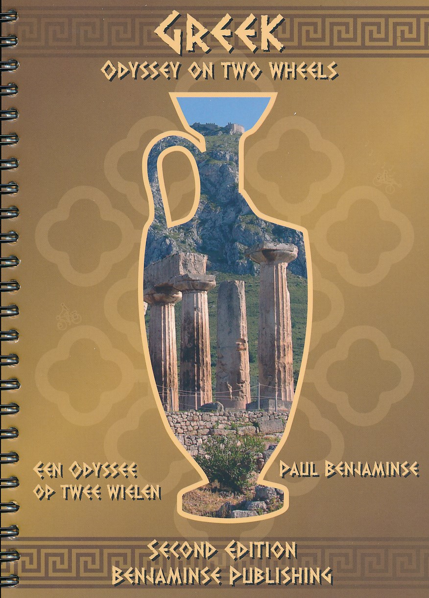
<p> Een rondreis door Griekenland van ongeveer 1800 km. Er zijn kortere afstanden mogelijk. Prachtige natuur, langs de belangrijkste historische plaatsen. Deze 112 pagina's dikke gids is in 2 talen geschreven (Engels en Nederlands) en is weer volledig actueel. Daarbij is er een uitgebreide overnachtingslijst aan de gids toegevoegd.</p> <div> Griekenland is niet voor doetjes. Er zitten behoorlijk wat klimmetjes en beklimmingen in het hele traject die helemaal niet lijken op de zachtglooiende heuvels van Limburg. Maar wat je er voor terug krijgt is fantastisch. Langs diepblauwe baaien en door witte stadjes met uitnodigende taverna's maak je in het binnenland van de Peloponessos een reis terug in de tijd. Dat is niet alleen Olympia, Mycene, Epidauros of Korinthos maar ook het archaïsche landschap in de bergen waar herders met hun kuddes geiten je pad kruisen door het woeste landschap. Is dit nog Europa? Ja, maar dan heel ver verwant, zo ongeveer bij de oorsprong van onze beschaving.</div> <div> </div> <div> Is fietsen in Griekenland alleen maar afzien? Welnee, er zijn dagen bij dat je met twee vingers in de neus door het landschap peddelt. We hebben de meeste delen van de route zo gekozen dat je met weinig verkeer nog steeds geleidelijk kan stijgen door het landschap. Er zijn echter zo weinig wegen dat je vaak geen andere keus hebt dan te klimmen. De drukke wegen hebben we wel kunnen vermijden. Alleen in de haven van Piraeus en bij de haven van Patras is het even afzien tussen het verkeer. Verder hebben we ook gebruik gemaakt van leuke veerdiensten om drukke stukken te ontwijken. Dat gaat prima.</div> <div> </div>
€24,50
Bekijk product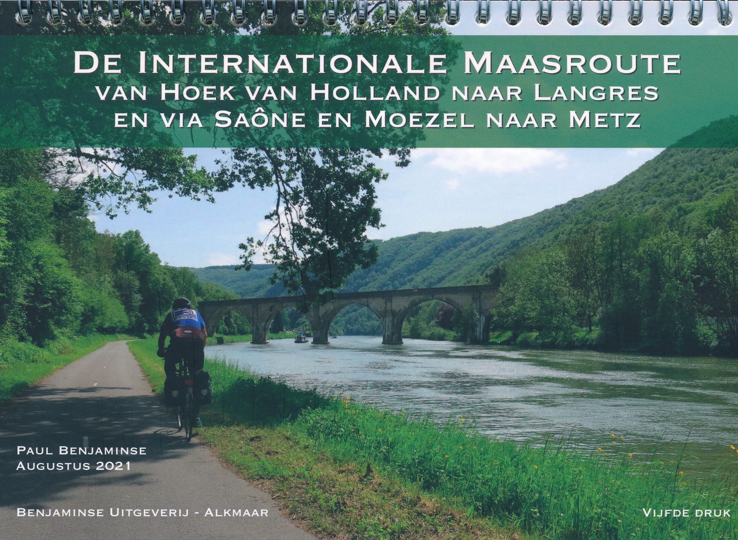
<div> De Internationale Maasroute is een bewegwijzerde fietsroute van monding tot aan de bron van de Maas. De totale lengte is 950 km. In deze gids wordt het traject beschreven tussen Hoek van Holland en de bron bij Langres via Luik, Namen, Charleville-Mézières en Verdun naar Langres, met zijtakken naar Florenville, Montmédy, Metz en Nancy. Om het mogelijk te maken ook kortere en langere reizen te maken, die aansluiten op spoorverbindingen terug naar huis, zijn meerdere varianten toegevoegd.</div> <div> </div> <div> Zoals gewoonlijk bij de gidsen van Benjaminse is het kaartmateriaal weer zeer goed verzorgd: duidelijk leesbaar, helder kaartbeeld, veel informatie en een goede indeling. Bij elke etappe wordt bovendien een hoogteprofiel gegeven waardoor je prima kunt inschatten hoe zwaar de dag gaat worden. De beschrijving van de route is accuraat en compleet, waardevol is de informatie over de te verwachten autovrije stukken en fietsvriendelijke accommodaties. </div> <div> </div> <div> </div> <div> </div>
€20,50
Bekijk product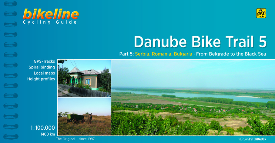
<div> The fifth part of the Danube Bike Trail begins in Belgrade and ends in Romania on the Black Sea.</div> <div> With a total length of 2,845 kilometres, the Danube is Europe’s second longest river (after the Volga with 3,534 kilometres), and the only one on which kilometres are counted in reverse direction, starting with kilometer zero at the mouth and ending upstream at the source.</div> <div> </div> <div> The total length of Part 5 of the Danube Bicycle Trail is about 1,400 kilometres. This does not include various side trips and alternative routes. The Danube Bike Trail is part of the Eurovelo-Route 6 and to a great extent identical.</div> <div> </div> <div> This last part of the Danube Bike Trail mostly follows paved main roads and secondary roads, which you share with a variety of other traffic. It is not unusual in some parts of Bulgaria and Romania that you encounter more horse or mule carts, pedestrians or roaming sheep or geese than motorized traffic. In and around the larger cities, however, you can expect heavy traffic and you should take particular care around trucks, which do not always give sufficient respect to cyclists. Between the urban centers you will encounter many long stretches on minor country roads with only little traffic.</div> <div> </div> <div> There are several stretches along unpaved dike roads or rural, earthern roads which can become difficult to negotiate during or just after wet weather. The main route follows dike roads of varying quality just after Belgrade, where alternative routes along paved roads are described. In Bulgaria there is one section in particular which has proven problematic for riders and one should consider using the main road (refer to map b27 and the tip on page 88). Other unpaved sections, such as that found on map C9 are less problematic or can easily be avoided using a given alternative route.</div> <div> </div> <div> Major climbs must be overcome through the Danube Gorge and the route through Bulgaria, as well as the first part of both of the last sections. The numerous smaller climbs, which occur particularly in the hilly regions along the Bulgarian route and the last two sections in Romania, should also not be underestimated. A good alternative to the hilly Bulgarian route is the Romanian route between Vidin and Calarasi. Compare the altitude profiles at the beginning of each section as well as the detail maps to get an idea of where the greatest climbs are to be expected.</div> <div> </div> <div> The route is completely signposted in Serbia, while in Bulgaria you will encounter signs only between Vidin and Nikopol. The signs bear the inscription "Dunavska ruta" and "Donauradweg" in Serbia and "Danube velo route" in Bulgaria. In both countries the signs also carry the "Eurovelo-Route 6" logo. In Romania there are no signs on any part of the route.</div>
€15,50
Bekijk product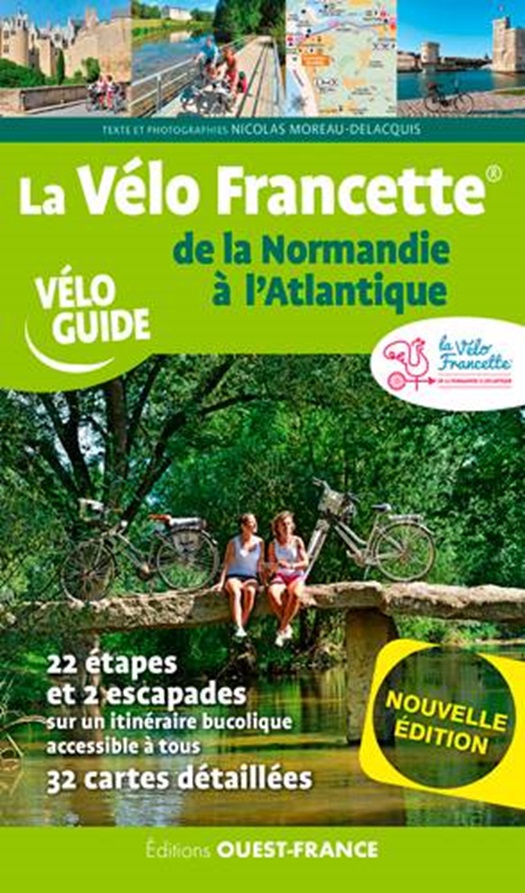
<div> Goede overzichtelijke fietsgids - Franstalig - met kaartmateriaal en praktische informatie. Achterin de gids een behoorlijk complete lijst met accomodatie, ook campings. </div> <div> </div> <div> La Vélo Francette® voert via rustige wegen en paden langs de landingsstranden van de Tweede Wereldoorlog, het Normandische coulisselandschap en volgt dan het oude jaagpad langs de rivier de Mayenne. In Val de Loire kunnen de fietsers afstappen om de troglodyten te bekijken, de intrigerende grotwoningen. Na de doorsteek van Angers naar Saumur volgen de prachtige Vallée du Thouet en het moerasgebied bij Poitiers, le Marais Poitevin. Bij aankomst in de schilderachtige, historische havenstad La Rochelle lonkt de Atlantische Oceaan, waarin na alle inspanningen natuurlijk een welverdiende duik mag worden genomen.</div> <div> </div> <div> Un itinéraire bucolique à vélo souvent au fil de l'eau, accessible à tous et riche en curiosités paysagères, historiques et gastronomiques !</div> <div> </div> <div> De la Normandie à l'Atlantique en passant par le Calvados, l'Orne, la Mayenne, Maine et Loire, Deux Sèvres et Charente Maritime</div> <div> Un guide en partenariat avec la Vélo Francette, itinéraire récent, balisé et soutenu par les organismes touristiques locaux.</div> <div> </div> <div> - 617 km d’itinéraire accessible à tous à travers la douce France et ses villages pittoresques,</div> <div> - 22 étapes entre 15 et 44 km,</div> <div> - 9 escapades en plus de 18 à 80 km,</div> <div> - 39 cartes détaillées,</div> <div> - Les visites, les détours, les grands sites, les bons plans,</div> <div> - 20 hébergements adaptés aux cyclistes.</div>
€16,50
Bekijk product
<div> This comprehensive guidebook offers a detailed stage-by-stage description of an epic 1370km route along the Rhine, one of Europe's great rivers, which passes through six countries on its way from Switzerland to the North Sea. The cycling is easy, downhill and along dedicated cycle routes, the countries visited are very cycle-friendly and the waymarking is excellent. The whole trip can be completed in two weeks by a fit cyclist.</div> <div> </div> <div> The guide includes plenty of information to help you plan your trip, with advice on travel, accommodation and facilities. The full route is then presented in 27 stages of 32-69km, with step-by-step route description, 1:100,000 mapping and notes on local points of interest. A facilities table, glossary and list of useful contacts can be found in the appendices.</div> <div> </div> <div> On its way, the Rhine Cycle Route passes the remains of Roman cities, medieval towns, castles, cathedrals, palaces, great cities of the industrial revolution and relics of 20th-century warfare – and it travels through a great range of stunning scenery. Starting in the Swiss Alps with high mountains, deep glacial valleys and gorges, it soon reaches Europe's third largest lake, the Bodensee, and its greatest mainland waterfall. After Basel, the Rhine becomes a broad river, now the world's busiest river trading artery. The middle Rhine, between Bingen and Koblenz, forces its way through the narrow rocky Rhine gorge, lined by romantic castles perched above Germany's finest vineyards. Finally, the river passes through low-lying Holland, famed for its many flood dykes and windmills.</div>
€23,95
Bekijk product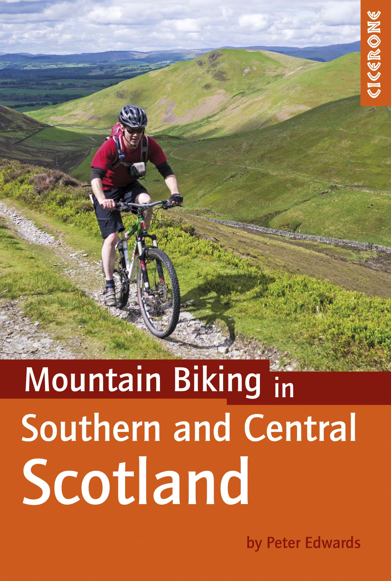
<div> Degelijke fietsgids met 21 mountainbike routes in zuid en midden Schotland. Goede beschrijvingen en duidelijke kaarten.</div> <div> </div> <div> <div> This guidebook describes 21 mountain biking routes in central and southern Scotland. It includes the 7stanes trail centre in Dumfries and Galloway, as well as cross-country routes in the Campsie Fells, Pentland Hills and Lammermuirs, the Galloway Forest, Tweed Valley, Cheviots and Lowther Hills. The routes range from 16.5 to 66km and are graded from moderate to very hard. Taking between 2 and 7 hours to complete, they are intended for reasonably fit mountain bikers with at least some experience.</div> <div> </div> <div> Detailed route descriptions are accompanied by 1:50,000 OS mapping, and the selected routes set out from various points across the area, including Greenock, Glentrool, Peebles and Milngavie, with good access from both Glasgow and Edinburgh. The guidebook also gives an overview of what the region's MTB trail centres have to offer, including the famous 7stanes trail centre, along with advice on equipment, maintenance and safety. </div> <div> </div> <div> Southern and Central Scotland is renowned for its superlative MTB trail centres, but the region's rolling hill country is also traversed by an extensive network of tracks, paths, forest roads and other trails providing endless possibilities for 'free range' mountain biking.</div> </div> <p> </p>
€24,95
Bekijk product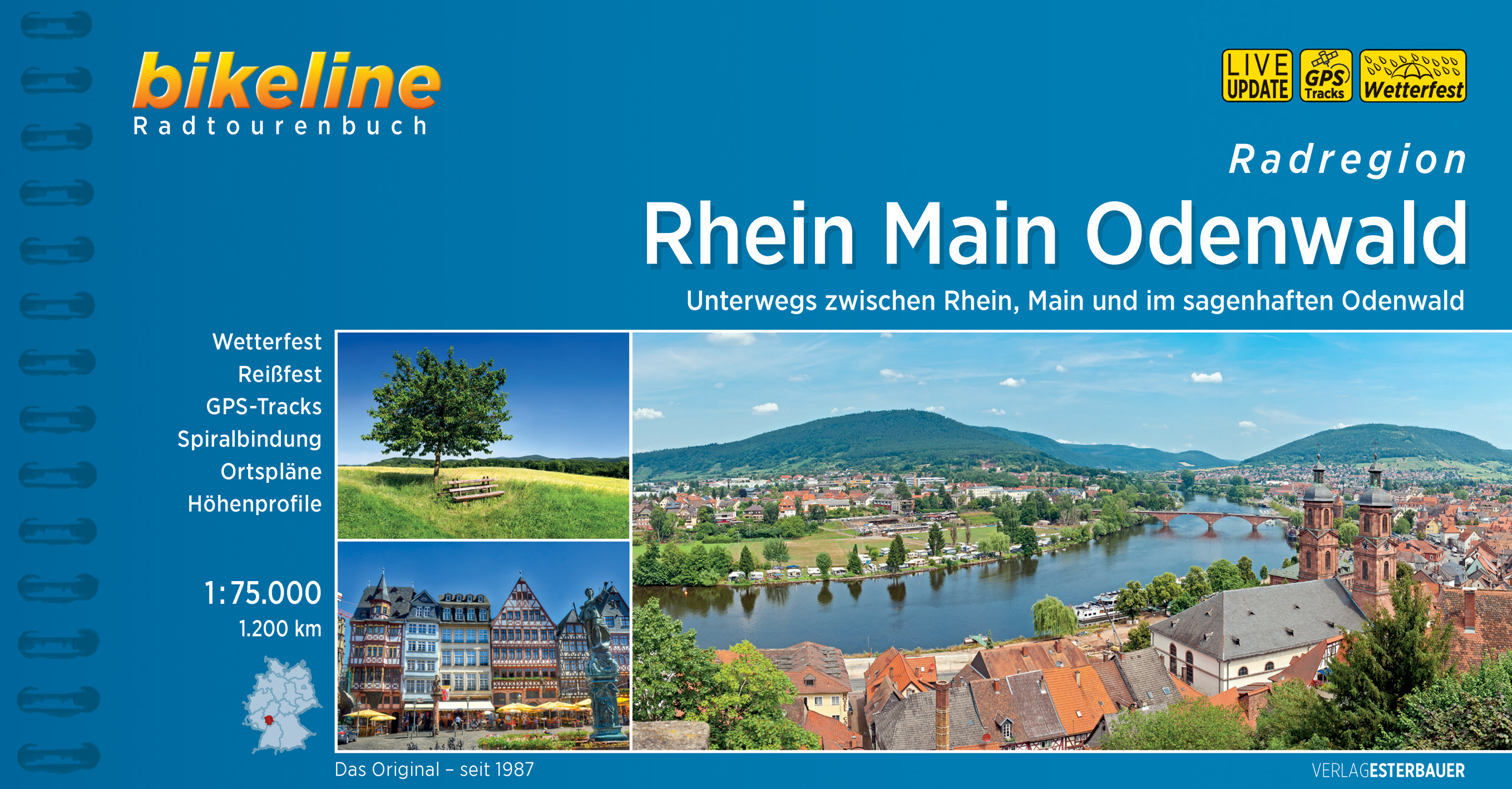
<p> Praktische fietsgids met detailkaarten, ingetekende route, informatie over overnachten en fietsenmakers, zwaarte en hoogteprofiel. In spiraalbinding. Duitstalig. </p> <div> Rhein Main Odenwald</div> <div> </div> <div> Es ist der Gegensatz zwischen den lebendigen Flussebenen von Rhein und Main und dem idyllischen Mittelgebirge des Odenwalds, der diese Region zu einer derart attraktiven Naturkulisse für Radfahrer macht.</div> <div> Von Flusstouren entlang der Gersprenz, der Mümling und natürlich des Rhein und des Main über genussvolle Radwege für Familien an der Bergstraße, bis hin zu anstrengenden, aber aussichtsreichen Touren im Odenwald ist für jeden das Richtige dabei. Dabei gibt es neben dem einen oder anderen UNESCO-Welterbe (Kloster Lorsch, Tour 3 und Grube Messel, Tour 8) und einem der schönsten Naturreservate Deutschlands (Kühkopf und Knoblochsaue,Touren 11, 12 und 13), auch zahlreiche außergewöhnliche Schlösser, Museen und Fachwerk-Altstädte zu bewundern. Schwierigkeitsgrad und Länge der Routen unterscheiden sich deutlich, lassen sich durch Varianten oder den abschnittsweisen Umstieg auf die Bahn aber anpassen.</div> <div> </div> <div> Streckencharakteristik</div> <div> </div> <div> Länge</div> <div> </div> <div> Die Gesamtlänge der 20 Touren beträgt rund 1196 Kilometer. Die längste Tour ist die 136 Kilometer lange Route am Mainradweg von Miltenberg nach Mainz, die kürzeste der 22 Kilometer lange Siegfried Radweg im Nibelungenland.</div> <div> Die meisten Touren können an verschiedenen Stellen aufgeteilt oder verkürzt werden. Sie können auch durch die Kombination verschiedener Touren individuelle Tagesetappen zusammenstellen.</div> <div> </div> <div> Wegequalität, Verkehr und Steigungen</div> <div> </div> <div> Die anspruchsvollen Touren führen mit zahlreichen Steigungen über die Wald- und Feldwege des Odenwalds, versöhnen aber mit traumhaften Aussichten. Die Touren durch die Flusstäler von Rhein, Main, Gersprenz oder Mümling wiederum sind sehr flach. Die Qualität der Wege wird in der Charakterisitk der einzelnen Touren separat behandelt.</div> <div> </div> <div> Beschilderung</div> <div> </div> <div> Bei den in diesem Buch beschriebenen Touren handelt es sich fast ausschließlich um beschilderte Radwege. Teilweise setzen sie sich aus verschiedenen, jeweils beschilderten Radwegen zusammen. Bei den wenigen nicht ausgeschilderten Touren haben wir den Routentext ausführlicher gestaltet. Nähere Informationen zur Beschilderung finden Sie in den Charakteristiken der einzelnen Touren.</div>
€15,50
Bekijk product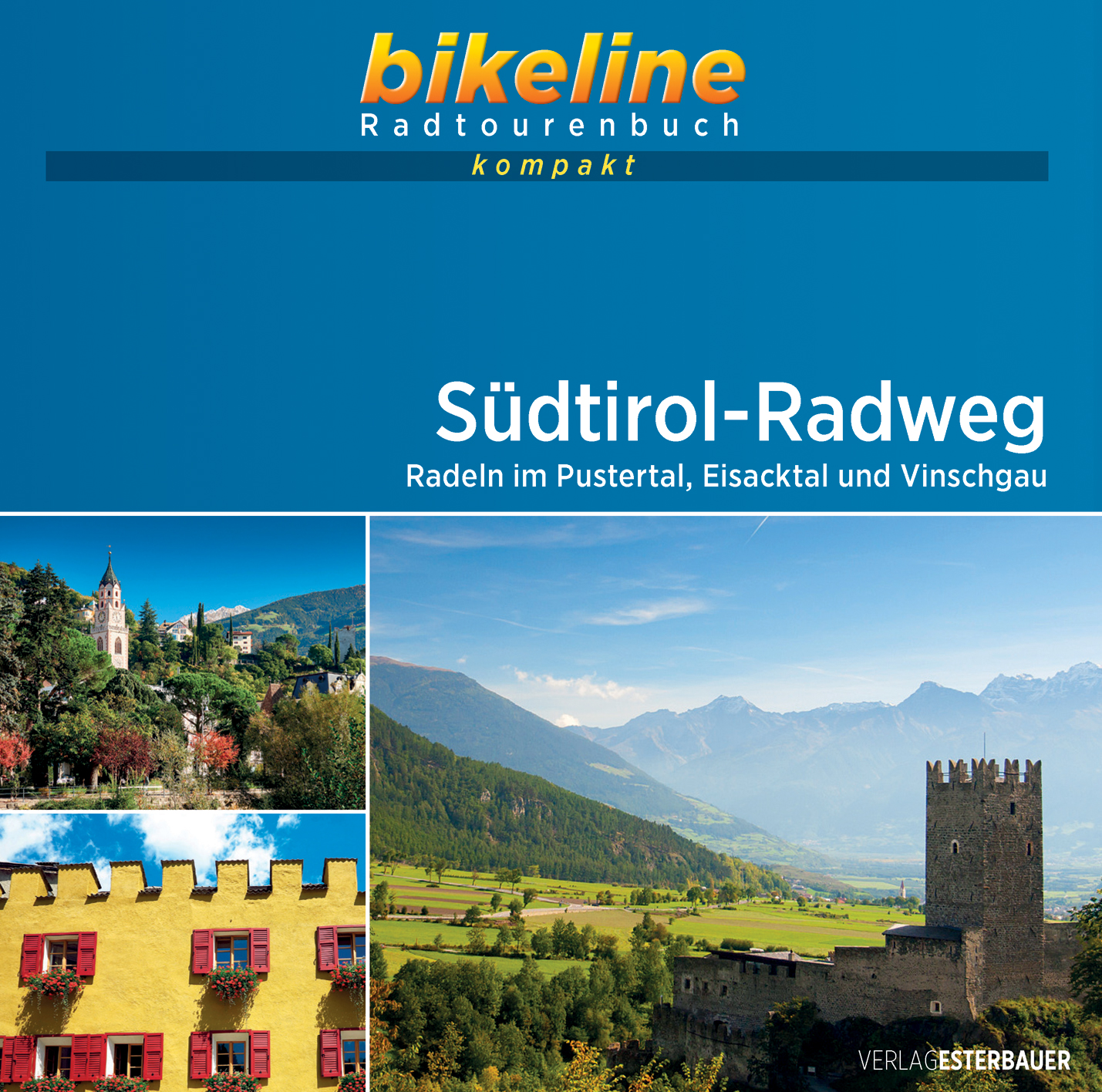
<p> Een serie van Bikeline waarin wat kortere meerdaagse fietsroutes op dezelfde manier als in de grote gidsen worden beschreven. Praktische fietsgids met detailkaarten, ingetekende route, informatie over overnachten en fietsenmakers, zwaarte en hoogteprofiel. klein vierkant formaat, 12 x 12 centimeter, ideaal klein formaat. </p> <div> In der autonomen Provinz Südtirol trifft alpine Atmosphäre auf mediterranes Flair, Apfelhaine treffen auf Weinhänge und die Dolomiten. Die Geschichte Südtirols ist ereignisreich und wechselhaft. Das Land und die Menschen sind geprägt durch Kontraste. Hier spricht man deutsch, italienisch und ladinisch.</div> <div> Auf dem Südtirol-Radweg durchfahren Sie die wichtigsten Täler der Provinz und können dabei alle ihre Städte besuchen. Sie begleiten den Eisack auf seinem Weg durch das untere Wipptal ins Eisacktal. Anschließend folgen Sie der Rienz, vorbei an der Mühlbacher Klause, durch das Pustertal nach Bruneck. Sie durchstreifen das Etschtal zwischen der Landeshauptstadt Bozen und der Kurstadt Meran. Schließlich führt Sie die letzte Etappe des Radwegs durch den Vinschgau bis nach Mals.</div>
€10,50
Bekijk product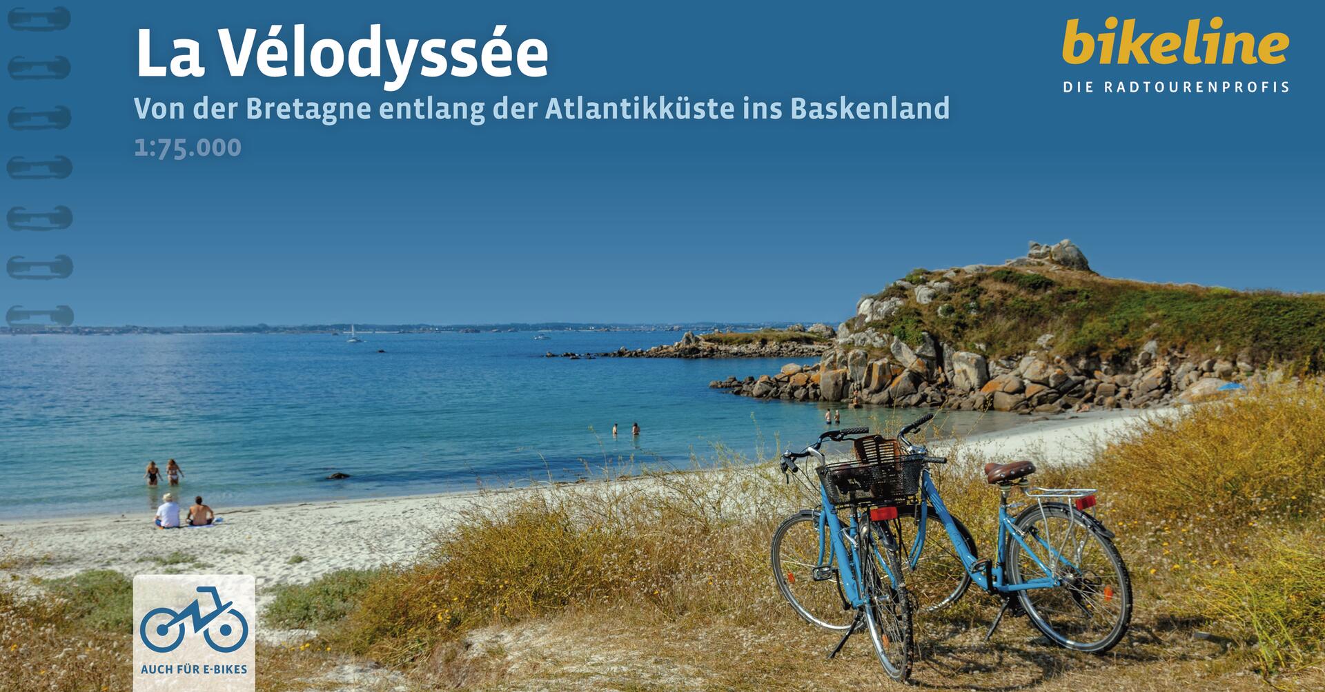
<div> Praktische fietsgids met detailkaarten, ingetekende route, informatie over overnachten en fietsenmakers, zwaarte en hoogteprofiel. In spiraalbinding, Duitstalig.</div> <div> </div> <div> Sandstrände bis zum Horizont, das Meer mit seiner unbändigen Kraft, ein Landstrich – dem faszinierenden Spiel der Gezeiten ausgesetzt – und Wellengänge, die Surferherzen höher schlagen lassen: der Atlantik. Dieser prächtige Ozean ist Gestaltgeber ihrer Reise auf La Vélodyssée und wird Sie mit ihrem liebsten Begleiter, dem Fahrrad, durch duftende Kiefernwälder, erstaunliche Salzgärten, entlang mächtiger Dünen, und durch charmante Küstenstädte à la Rochelle, mit Historie und dem Esprit des französischen „farniente“, führen. Sie dürfen sich gerne mit Genuss von französischen Köstlichkeiten wie etwa den Austern im Marennes-Oléron und einem guten Gläschen französischen Weins in ihren Pausen verwöhnen lassen. La Vélodyssée kann aber noch viel mehr: In der ersten Etappe schmückt sich der Radweg mit dem grünen Flair der Bretagne, reich verziert an mythischen Stätten von Dolmen und Menhiren. Sie fahren gemütlich entlang des Canal Brest à Nantes und weiter durch das Loiretal bis in das Delta des Flusses und seiner Vereinigung mit dem ozeanischen Gewässer. Der letzte Abschnitt der Reise überrascht im Baskenland noch mit viel Kultur, Lebendigkeit sowie der pulsierenden Metropole Biarritz.</div>
€18,50
Bekijk product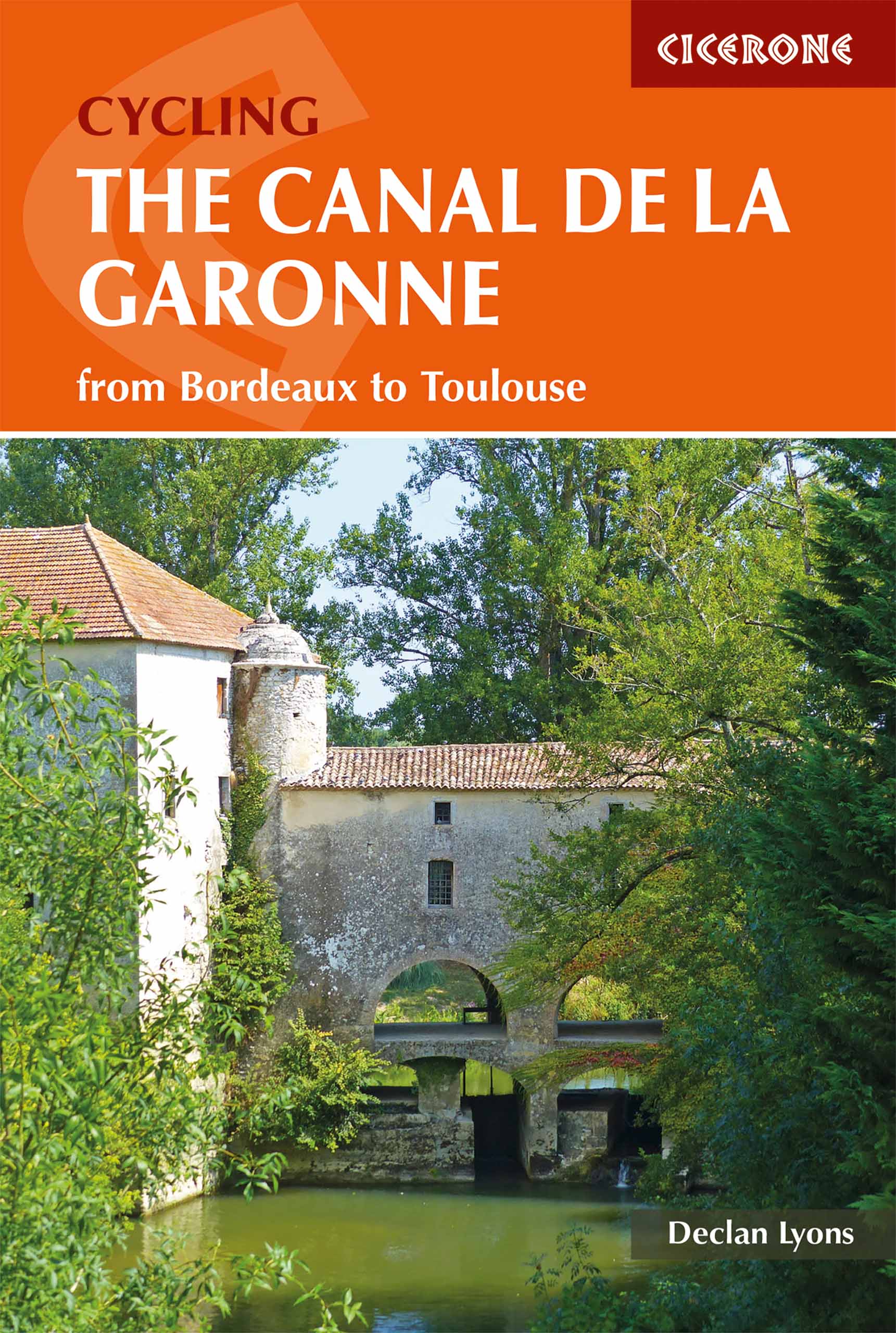
<div> Een gids voor het fietsen langs het Canal de la Garonne in Frankrijk, met een beschrijving van de 290 km lange fietsroute van Bordeaux naar Toulouse, waar deze verbinding maakt met het Canal du Midi. Beschrijft een 135 km lange excursie naar de Atlantische Oceaan, met omleidingen naar vele historische steden en dorpen langs de route. Met informatie over accommodatie, faciliteiten en fietswinkels op de route.</div> <div> </div> <div> This guidebook presents a cycle ride along the Canal de la Garonne in the south of France. The 260km route is covered in 7 stages from bustling Bordeaux to the splendid rose city of Toulouse, with a 135km excursion from to Lacanau on the Atlantic coast. Optional side trips explore the countryside and historical towns and villages, including Agen, Moissac, Marmande and Montauban. Mainly flat and easy cycling, including 193km along the main canal towpath, this is an easy route suitable for lone cyclists, families, groups and those using e-bikes. It is perfect for those planning a cycling holiday, and also for people boating on the canal or holidaying nearby who want to get out and explore.</div> <div> </div> <div> This guidebook presents a cycle ride along the Canal de la Garonne in the south of France. The 290km route is covered in 7 stages from bustling Bordeaux to the splendid rose city of Toulouse, with a 135km excursion from to Lacanau on the Atlantic coast. Optional side trips explore the countryside and historical towns and villages, including Agen, Moissac, Marmande and Montauban. Mainly flat and easy cycling, including 193km along the main canal towpath, this is an easy route suitable for lone cyclists, families, groups and those using e-bikes. It is perfect for those planning a cycling holiday, and also for people boating on the canal or holidaying nearby who want to get out and explore.</div> <div> </div> <div> A detailed route description is accompanied by 1:50,000 maps, with fascinating information about the places encountered along the route and notes on the region's history and the building of the canal. The guidebook also contains practical information on travel, choosing the right bike and equipment, facilities and cycle shops.</div> <div> </div> <div> <strong>Dorpen en Steden</strong></div> <div> <div> Atlantic coast, Bordeaux, Sauveterre-de-Guyenne, La Reole, Marmande, Buzet-sur-Bäise, Porte-Ste-Marie, Agen, Moissac, Montech, Montauban and Toulouse</div> <div> </div> </div> <p> </p>
€20,95
Bekijk product