
Beantwoord enkele vragen, en binnen seconden geeft AI je een persoonlijk aankoopadvies op maat.
Beantwoord enkele vragen, en binnen seconden geeft AI je een persoonlijk aankoopadvies op maat.
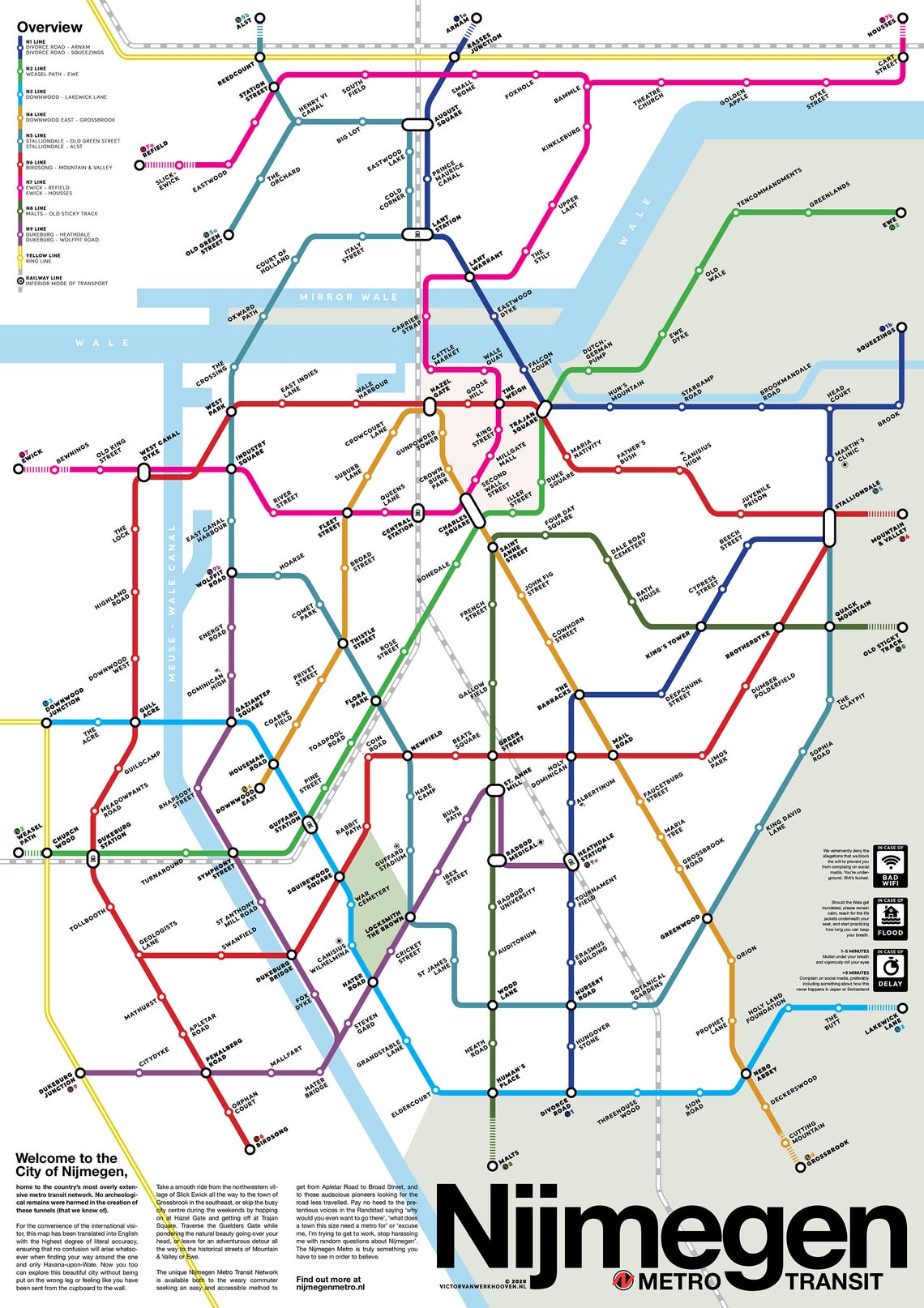
Op zoek naar super origineel kado voor een inwoner van Nijmegen? Deze metrokaart - formaat 42 x 59,4 cm - past zo ongeveer op elke muur en deur en levert altijd veel bekijks en gespreksstof op. Mooie heldere kleuren, goed leesbaar en origineel ontwerp. De kaart wordt verzonden in een koker . “Het vormgeven van de lijnen op de kaart was één ding, maar het bedenken van de namen was eigenlijk het leukste om te doen en ook hetgeen waar de mensen het meeste door zijn aangesproken”, zegt Van Werkhooven. “De reacties zijn van begin af aan gelijk heel leuk geweest. Je ziet echt heel veel mensen die elkaar taggen op Facebook
€17,95
Bekijk product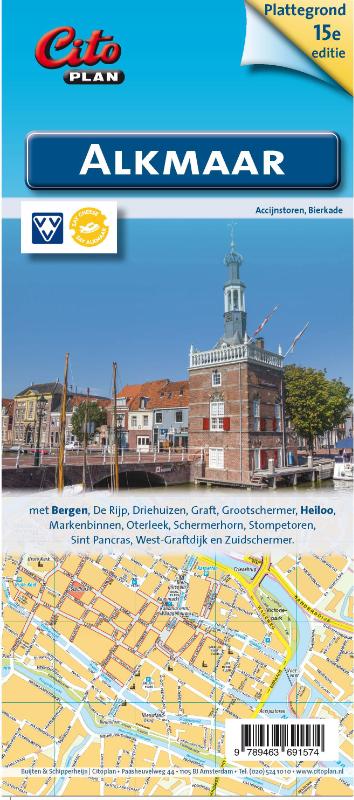
Uitstekende stadsplattegrond van Alkmaar. Met Bergen, de Rijp, Driehuizen, Graft, Grootschermer, Heiloo, Markenbinnen, Oterleek, Schermerhorn, Stompetoren, Sint Pancras, West Graftdijk, Zuidschermer
€8,90
Bekijk product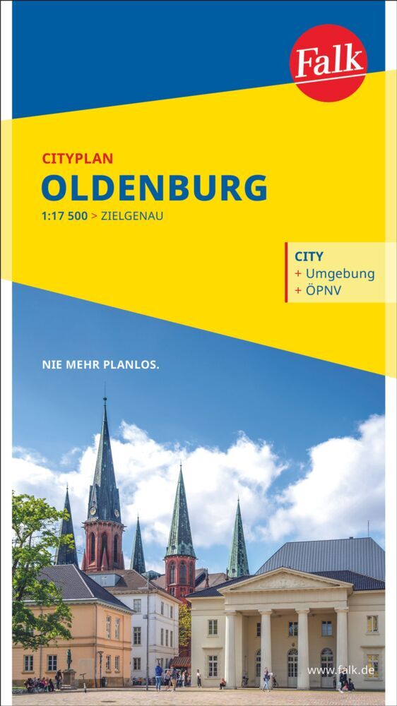
Goede uitgebreide stadsplattegrond van Oldenburg met een extra gedetailleerde kaart van het centrum en een register. Mit dem Falk Cityplan ist man im Kernbereich einer Großstadt unterwegs. Dieser handliche Plan ist der ideale Wegweiser für die schnelle Orientierung in der fremden Stadt. Für den Touristen ist dieser "kleine FALK" bei der Stadtbesichtigung nahezu unentbehrlich. Großflächige Nebenkarten geben wertvolle Auskünfte; man erhält hier Hinweise für eine gezielte Zufahrt, Detailinformationen zum Innenstadtbereich und lernt die schnellen öffentlichen Verkehrsmittel der Stadt kennen. Wird eine bestimmte Straße gesucht, so findet man diese im Straßenverzeichnis auf der Rückseite des Planes. Neben dem blauen Suchgitter enthalten alle Citypläne ein schwarzes UTM-Gitternetz (nicht bei den Hyperboloid-Projektionen). Das Netz hat eine Maschenweite von 2.000 Metern mit einer Feineinteilung von 100 Metern - einfach ideal zur Entfernungsabschätzung für die Entdeckungstouren durch die Stadt.
€10,95
Bekijk product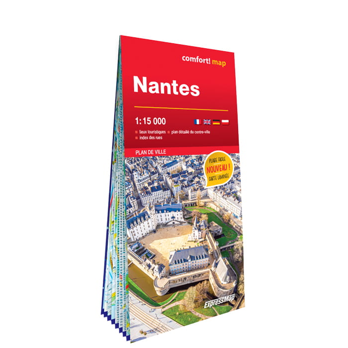
Heel handige stadsplattegrond van Nantes met naast het centrum ook een groot gedeelte van de buitenwijken. De kracht zit hem in het feit dat deze kaart in delen is geplastificeerd en daardoor ook - ondanks de plastic laag - makkelijk in delen is te vouwen. Met register. Ce plan de Nantes plastifié est d'une résistance à toute épreuve, et il peut être plié à l’infini. Il peut également être annoté au feutre puis effacé. Caractéristiques : - riches en informations touristiques : sites historiques, musées, hôtels, etc. - lignes et stations de métro, de trains urbains et d’autres transports en commun - index des rues - légende en quatre langues
€12,50
Bekijk product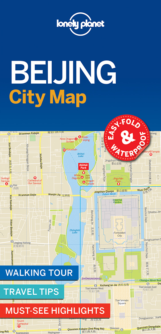
De stadsplattegronden van Lonely Planet zijn uitgevoerd op scheur- en watervast papier, zijn lichtgewicht en kennen een handig formaat. Het centrum van de stad is in heldere kleuren in beeld gebracht met straatnamen, bezienswaardigheden en symbolen voor openbaar vervoer. Op de achterzijde staat informatie over de toeristische hoogtepunten en in de meeste gevallen een schematische plattegrond van het openbaar vervoer. Met een register. Durable and waterproof, with a handy slipcase and an easy-fold format, Lonely Planet Beijing City Map is your conveniently-sized passport to traveling with ease. Get more from your map and your trip with images and information about top city attractions, walking tour routes, transport maps, itinerary suggestions, extensive street and site index, and practical travel tips and directory. With this easy-to-use, full colour navigation tool in your back pocket, you can truly get to the heart of Beijing, so begin your journey now! Durable and waterproof Easy-fold format and convenient size Handy slipcase Full colour and easy-to-use Extensive street and site index Images and information about top city attractions Handy transport maps Walking tour routes Practical travel tips and directory Itinerary suggestions Covers The Forbidden City, Dongcheng, Temple of Heaven Park, Beihai Park, Xicheng, Chaoyang, Haidian and more Check out Lonely Planet Beijing, our most comprehensive guidebook to the city, covering the top sights and most authentic off-beat experiences. Or check out Lonely Planet Pocket Beijing, a handy-sized guide focused on the can't-miss experiences for a quick trip.
€9,95
Bekijk product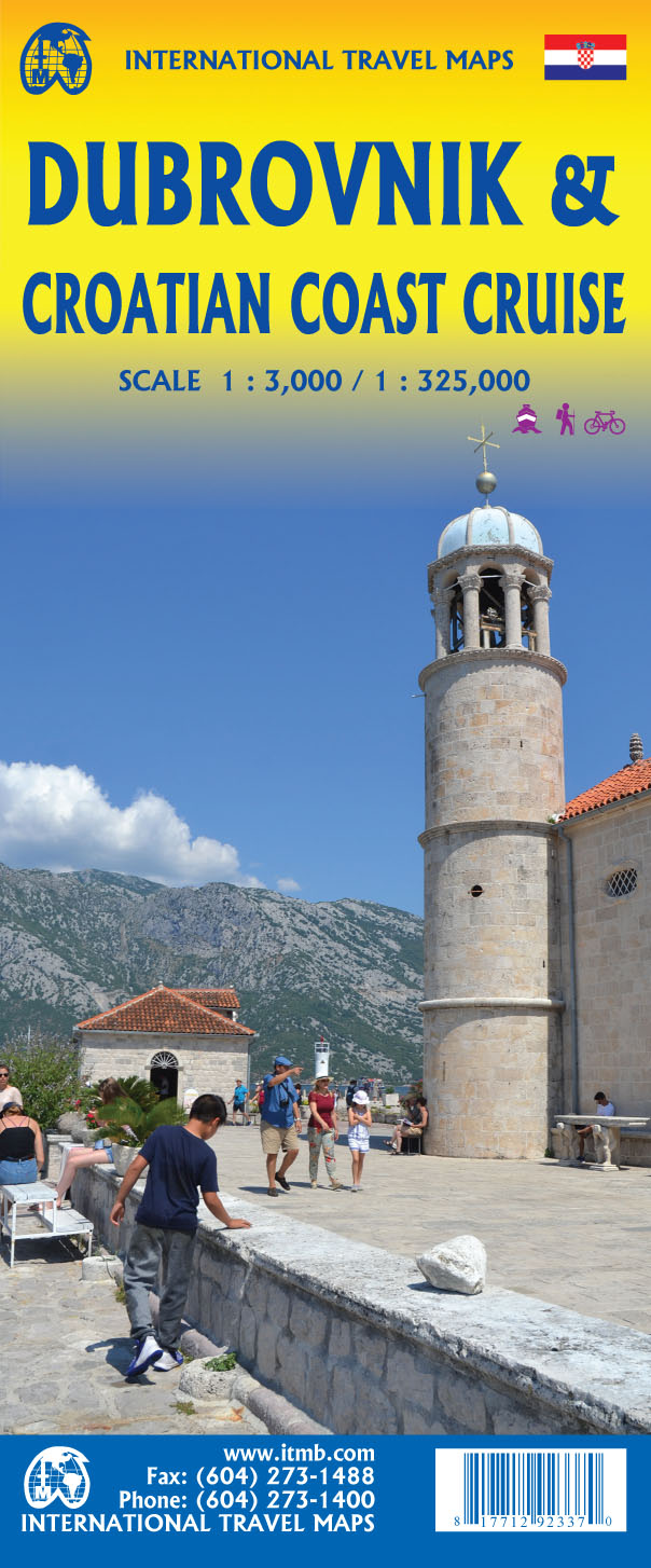
Goede plattegrond van Dubrovnik, schaal 1:3.000. Met aan de achterzijde een wegenkaart, schaal 1:325.000, met als extra informatie routes van veerboten en cruiseschepen ingetekend. The ancient port city of Dubrovnik, on the southern Croatian coastline, has evolved into a major tourist destination. The old walled city, normally entered through the famous Pile Gate, was so crowded with tourists when we arrived, that it took some time to get to the main street of Stradun. The city has completely recovered from the Montenegrin bombing during the breakup of Yugoslavia, with a few shellholes remaining just to show to tourists. The highlights of a visit are the Rector’s Palace, the Tvrdava fortress, and the cathedral. The map covers the urban area outside of the old town as well, as this is where most of the hotels and restaurants are located. The other side of the map shows the extensive coastline of Croatia in two parts – from the Italian border to Trogir, and from Split to the border with Montenegro. We travelled from Porec to Dubrovnik in a small cruise ship of 45 passengers, which enabled us to visit ports that larger ships could not reach. As a result, we visited islands we could not have otherwise visited. The cover picture shows grandson Johnny in one such small town. Legend Includes: Roads by classification, Rivers and Lakes, National Park, Airports, Points of Interests, Highways, Main Roads, Zoos, Fishing, and much more...
€13,95
Bekijk product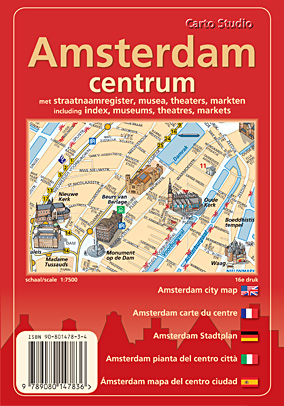
De Centrumkaart Amsterdam is ontwikkeld om bezoekers van Amsterdam op een aangename manier de stad te leren ontdekken. Wij hebben als makers er voor gekozen om een rustig ontwerp en daardoor inzichtelijk ontwerp te maken zonder toevoeging van reclame op de kaart. Wij zijn als ontwerpers twintig jaar geleden begonnen om de belangrijkste monumenten van de stad als 3-dimensionale gebouwtjes aan de kaart toe te voegen. De kaart is zeer gedetailleerd (schaal 1 : 7 500) en geeft alle straten met de namen weer. Het openbaar vervoer is in de kaart opgenomen, alsmede taxistandplaatsen, politiebureau’s, parkeergarages, etc. Op de achterzijde van de kaart is een volledig register opgenomen voor de bezienswaardigheden en de straten van de stad. Op de achterzijde van de kaart is ook een overzichtskaart geplaatst met alle toegangswegen, metro- en spoorlijnen rondom Amsterdam naar het centrumgebied.
€4,95
Bekijk product
Goede stadsplattegrond van Kalinigrad - Koningsberg, weliswaar in het cyrillisch schrift, maar best bruikbaar. Daarnaast op de acherzijde een kaart van het hele Russische gebied, deze is tweetalig, ook in het Duits.
€3,95
Bekijk product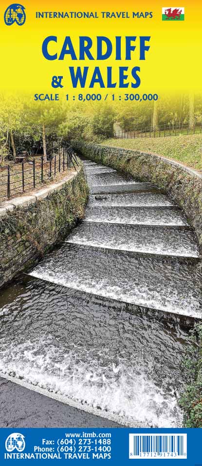
Een dubbelzijdige kaart met aan de ene zijde een plattegrond van Cardiff, schaal 1:8.000 en op de andere zijde een wegenkaart, schaal 1:300.000, met aanduidingen van o.a. nationale parken, vliegveld, benzinepompen. ITMB finds the UK to be a never-ending source of maps needing to be prepared, such as this one of Cardiff and Wales. Cardiff is the capital of Wales, and is also an international access point to the UK; a map seems desirable. The city is based at the mouth of the River Taff, with most touristic points being concentrated in the harbour area, the city centre, and a concentration of eateries along Albany Road. Cardiff is shaped by two parallel motorways; the A4232close to the waterfront, and the A48 near the northern extremities. Both are included in our map, which also shows historic sites, hotels, and tourist amenities. The reverse side shows all of Wales as an entity, showing roads, rail lines, ferry crossing points, and access routes to England. It also shows historic sites, tourist attractions, parks, airports, ferry terminals, and all the towns and villages. By the nature of the shape of Wales, adjacent portions of England also are included – Liverpool, Shrewsbury, Ludlow, and Hereford. Legend Includes: Roads by classification, Rivers and Lakes, National Park, Airports, Points of Interests, Highways, Main Roads, Zoos, Fishing, and much more...
€13,95
Bekijk product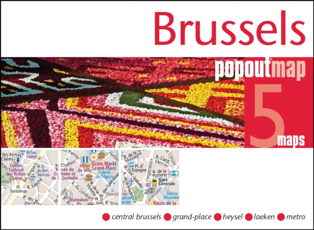
Handig ( borstzak- ) formaat stadsplattegrond met voldoende detail, zodat je ook de kleinere straatjes erop aantreft. Van veel wereldsteden inmidddels leverbaar en dat is mooi, want juist in dit soort steden wil je je handen liever vrij houden en niet teveel hoeven stoeien met het uitvouwen van een grote plattegrond, en/of teveel als "toerist" opvallen. Door het unieke vouwsysteem blijft alles zeer compact en biedt het kaartje een razendvlugge manier van orientatie. Wel is dit product alleen geschikt voor het ( grote ) centrum van de stad.Verder geven de kaartjes uit deze reeks ook de meeste highlights van de stad aan en ( indien van toepassing ) een overzichtskaartje van de metro. Explore the delights of the Belgian capital, Brussels, with the help of this genuinely pocket-sized, pop-up map. Small in size, yet big on detail, this compact, dependable Brussels city map will ensure you don't miss a thing.* Includes two pop-up maps covering central Brussels & greater Brussels Grand-Place (the heart of Brussels) * Additional maps covering Grand-Place (the heart of Brussels), Heysel Exhibition Park & Royal Castle of Laeken and the Metro are also included * Handy, self-folding tourist map is small enough to fit in your pocket yet offers extensive coverage of the city in an easy-to-use format * Thorough street index is also featured and cross-referenced to the map so you can easily find your destination * Hotels, restaurants, stores and attractions are all includedIdeal to pop in a pocket or bag for quick reference while exploring the city. Fold size: 3.75" x 5.25" (95mm x 130mm) Sheet size: 8.5" x 9.75" (215mm x 225mm)(per sheet; 2 sheets) Approx scale: 1:12000 Central Brussels Scale to be used as a guideline only. Contents include maps of: PopOut Map of greater Brussels PopOut Map of central Brussels Map of Grand-Place - the heart of Brussels Heysel Exhibition Park & Royal Castle of Laeken Metro
€7,95
Bekijk product