
Beantwoord enkele vragen, en binnen seconden geeft AI je een persoonlijk aankoopadvies op maat.
Beantwoord enkele vragen, en binnen seconden geeft AI je een persoonlijk aankoopadvies op maat.
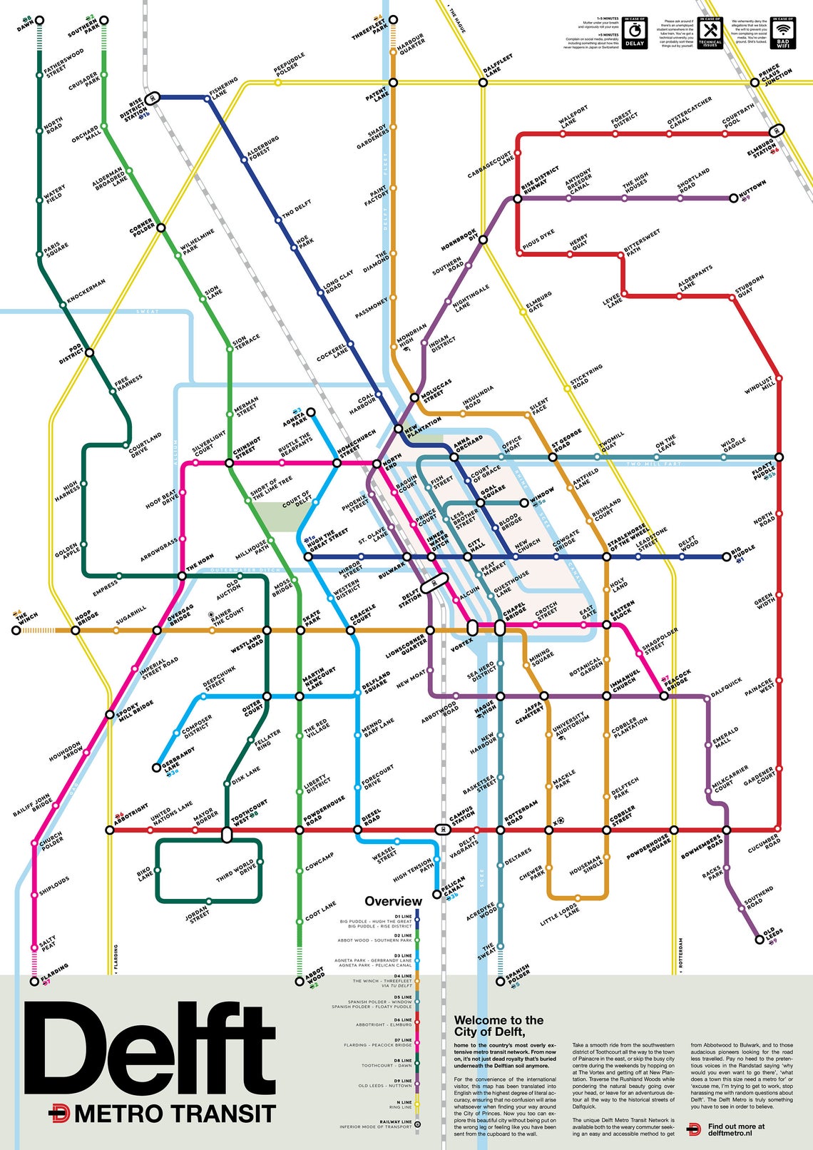
Op zoek naar super origineel kado voor een inwoner van Delft? Deze metrokaart - formaat 42 x 59,4 cm - past zo ongeveer op elke muur en deur en levert altijd veel bekijks en gespreksstof op. Mooie heldere kleuren, goed leesbaar en origineel ontwerp. De kaart wordt verzonden in een koker . “Het vormgeven van de lijnen op de kaart was één ding, maar het bedenken van de namen was eigenlijk het leukste om te doen en ook hetgeen waar de mensen het meeste door zijn aangesproken”, zegt Van Werkhooven. “De reacties zijn van begin af aan gelijk heel leuk geweest. Je ziet echt heel veel mensen die elkaar taggen op Facebook
€17,95
Bekijk product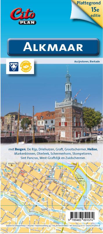
Uitstekende stadsplattegrond van Alkmaar. Met Bergen, de Rijp, Driehuizen, Graft, Grootschermer, Heiloo, Markenbinnen, Oterleek, Schermerhorn, Stompetoren, Sint Pancras, West Graftdijk, Zuidschermer
€8,90
Bekijk product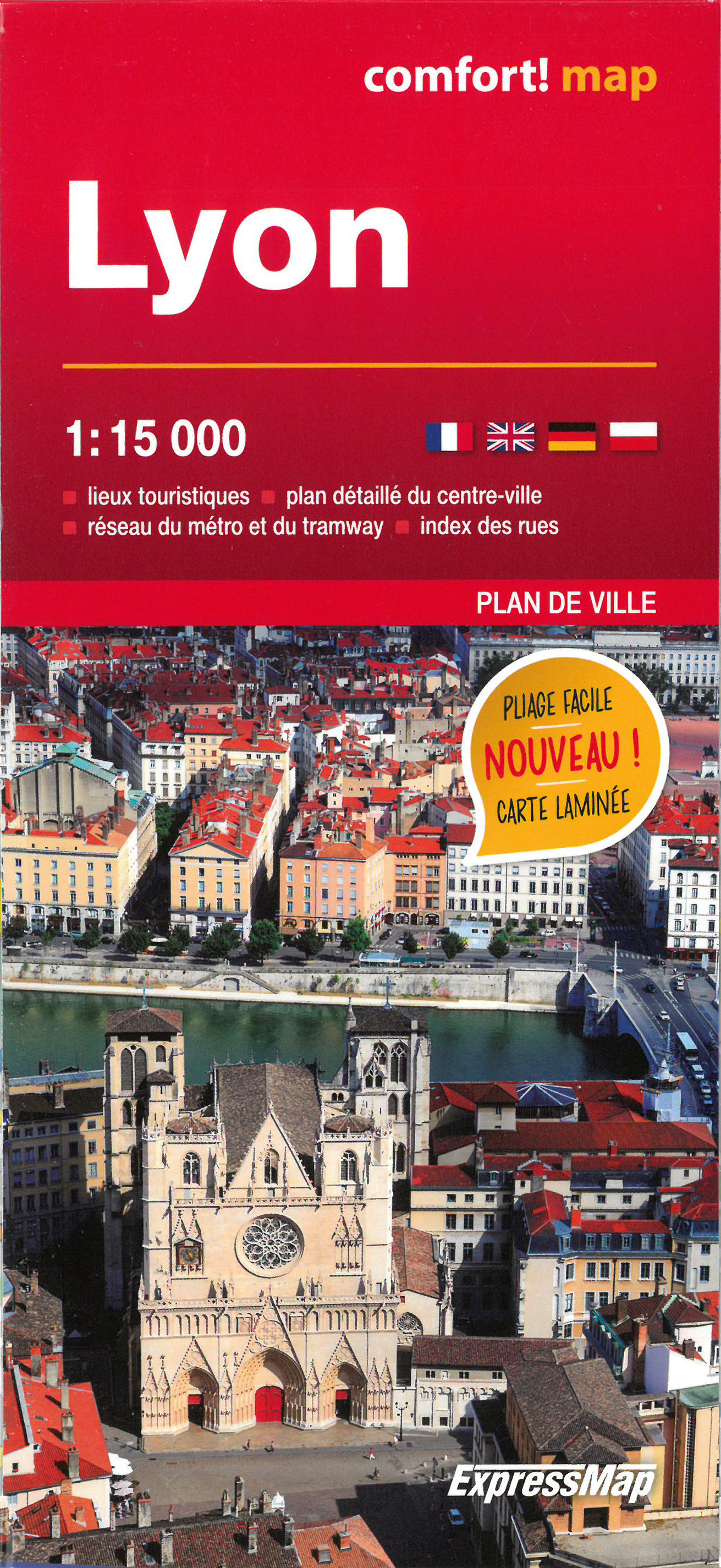
Heel handige stadsplattegrond van Lyon met naast het centrum ook een groot gedeelte van de buitenwijken. De kracht zit hem in het feit dat deze kaart in delen is geplastificeerd en daardoor ook - ondanks de plastic laag - makkelijk in delen is te vouwen. Met register. Ce plan de Lyon plastifié est d'une résistance à toute épreuve, et il peut être plié à l’infini. Il peut également être annoté au feutre puis effacé. Caractéristiques : - riches en informations touristiques : sites historiques, musées, hôtels, etc. - lignes et stations de métro, de trains urbains et d’autres transports en commun - index des rues - légende en quatre langues
€12,50
Bekijk product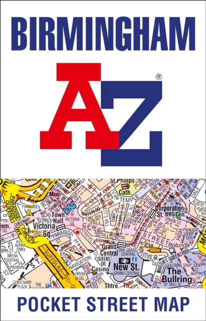
Handzame stadsplattegrond van het centrum van Birmingham. This up-to-date detailed A-Z street map includes more than 3,000 streets in and around Birmingham. As well as the city centre and St Philip’s Cathedral, the other areas covered include Moseley, Edgbaston, Small Heath, the Jewellery Quarter, Winson Green, Gib heath, Lozells, Saltley and Aston. The large-scale street map includes the following: • Places of interest • Postcode districts, one-way streets and car parks • Index to streets, places of interest, place and area names, park and ride sites, national rail stations, hospitals and hospices The perfect reference map for finding your way around Birmingham.
€7,95
Bekijk product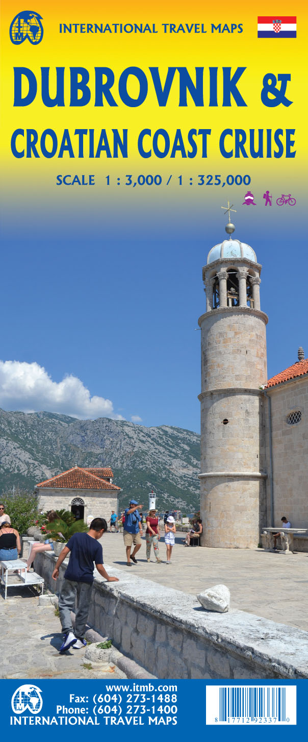
Goede plattegrond van Dubrovnik, schaal 1:3.000. Met aan de achterzijde een wegenkaart, schaal 1:325.000, met als extra informatie routes van veerboten en cruiseschepen ingetekend. The ancient port city of Dubrovnik, on the southern Croatian coastline, has evolved into a major tourist destination. The old walled city, normally entered through the famous Pile Gate, was so crowded with tourists when we arrived, that it took some time to get to the main street of Stradun. The city has completely recovered from the Montenegrin bombing during the breakup of Yugoslavia, with a few shellholes remaining just to show to tourists. The highlights of a visit are the Rector’s Palace, the Tvrdava fortress, and the cathedral. The map covers the urban area outside of the old town as well, as this is where most of the hotels and restaurants are located. The other side of the map shows the extensive coastline of Croatia in two parts – from the Italian border to Trogir, and from Split to the border with Montenegro. We travelled from Porec to Dubrovnik in a small cruise ship of 45 passengers, which enabled us to visit ports that larger ships could not reach. As a result, we visited islands we could not have otherwise visited. The cover picture shows grandson Johnny in one such small town. Legend Includes: Roads by classification, Rivers and Lakes, National Park, Airports, Points of Interests, Highways, Main Roads, Zoos, Fishing, and much more...
€13,95
Bekijk product
Goede stadsplattegrond van Kalinigrad - Koningsberg, weliswaar in het cyrillisch schrift, maar best bruikbaar. Daarnaast op de acherzijde een kaart van het hele Russische gebied, deze is tweetalig, ook in het Duits.
€3,95
Bekijk product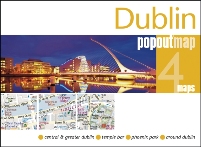
Handig ( borstzak- ) formaat stadsplattegrond met voldoende detail, zodat je ook de kleinere straatjes erop aantreft. Van veel wereldsteden inmidddels leverbaar en dat is mooi, want juist in dit soort steden wil je je handen liever vrij houden en niet teveel hoeven stoeien met het uitvouwen van een grote plattegrond, en/of teveel als "toerist" opvallen. Door het unieke vouwsysteem blijft alles zeer compact en biedt het kaartje een razendvlugge manier van orientatie. Wel is dit product alleen geschikt voor het ( grote ) centrum van de stad.Verder geven de kaartjes uit deze reeks ook de meeste highlights van de stad aan en ( indien van toepassing ) een overzichtskaartje van de metro. Experience the Irish charm of Dublin with the help of this genuinely pocket-sized, pop-up map. Small in size, yet big on detail, this compact, dependable Dublin city map will ensure you don't miss a thing.* Includes two pop-up maps covering central & greater Dublin * Additional maps covering Temple Bar, Phoenix Park and around Dublin are also included * Handy, self-folding tourist map is small enough to fit in your pocket yet offers extensive coverage of the city in an easy-to-use format * Thorough street index is also featured and cross-referenced to the map so you can easily find your destination * Hotels, restaurants, stores and attractions are all included on the mapsIdeal to pop in a pocket or bag for quick reference while exploring the city. Contents include maps of: Central Dublin Greater Dublin Temple Bar Phoenix Park Around Dublin
€7,95
Bekijk product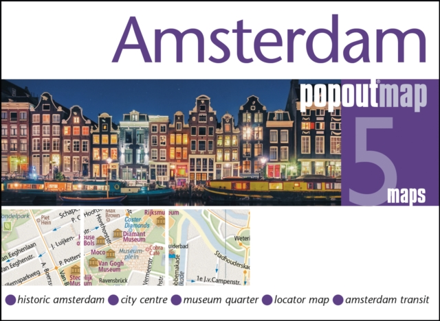
Handig ( borstzak- ) formaat stadsplattegrond met voldoende detail, zodat je ook de kleinere straatjes erop aantreft. Van veel wereldsteden inmidddels leverbaar en dat is mooi, want juist in dit soort steden wil je je handen liever vrij houden en niet teveel hoeven stoeien met het uitvouwen van een grote plattegrond, en/of teveel als "toerist" opvallen. Door het unieke vouwsysteem blijft alles zeer compact en biedt het kaartje een razendvlugge manier van orientatie. Wel is dit product alleen geschikt voor het ( grote ) centrum van de stad.Verder geven de kaartjes uit deze reeks ook de meeste highlights van de stad aan en ( indien van toepassing ) een overzichtskaartje van de metro. Explore vibrant Amsterdam, known as the 'Venice of the North', with this handy, genuinely pocket-sized, pop-up map. Small in size, yet big on detail, this compact, dependable Amsterdam city map will ensure you don't miss a thing. * Includes two pop-up maps covering historic Amsterdam & the city centre * Additional maps covering the museum quarter, transit system and a locator map are also included * Handy, self-folding tourist map is small enough to fit in your pocket yet offers extensive coverage of the city in an easy-to-use format * Thorough street index is also featured and cross-referenced to the map so you can easily find your destination * Hotels, restaurants, stores and attractions are all includedIdeal to pop in a pocket or bag for quick reference while you explore Amsterdam. Contents include maps of: Historic Amsterdam City Centre Museum Quarter Amsterdam transit Locator map Fold size: 3.75" x 5.25" (95mm x 130mm) Sheet size: 8.5" x 9.75" (215mm x 225mm) (per sheet; 2 sheets) Approx scale: 1:13 500 (Central) Scale to be used as a guideline only
€7,95
Bekijk product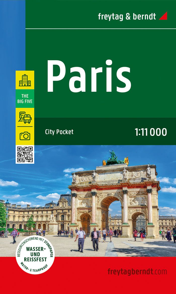
Der City Pocket Stadtplan "Paris 1:11.000" bietet zahlreiche Zusatzinformationen wie U-Bahn Plan und Sehenswürdigkeiten. Im umfangreichen Index finden Sie außerdem jede Adresse. Alle Inhalte werden natürlich regelmäßig aktualisiert. Die Titel der "City Pocket" - Reihe passen durch das handliche Format von 9 x 15 cm in jede Tasche. Sie sind wasserfest und strapazierfähig und daher für jedes Outdoor-Abenteuer geeignet! Details: Umgebungskarte, Straßenverzeichnis, U-Bahn, Touristische Informationen The Big Five: Einkaufen / Kulinarik / Kultur / Nachtleben / Sehenswürdigkeiten.
€8,95
Bekijk product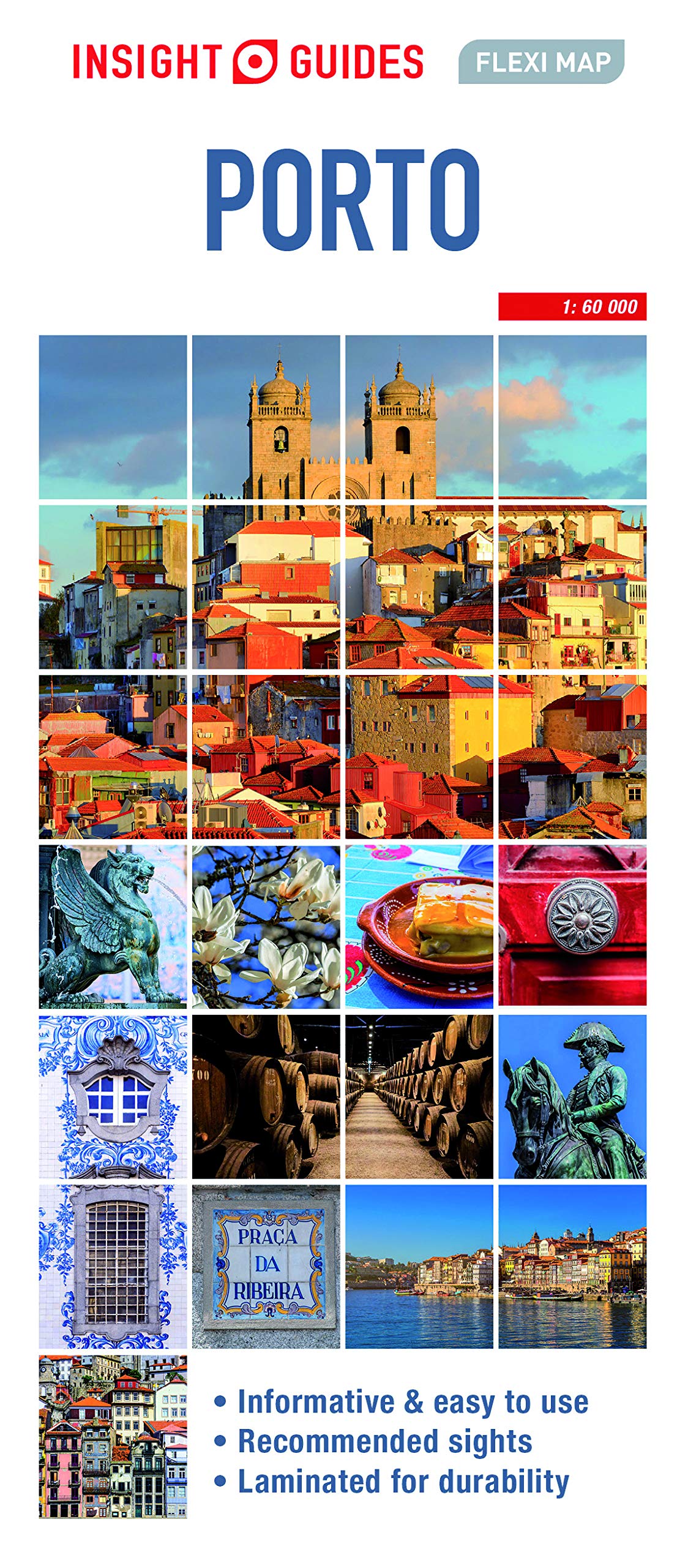
nsight Guides Flexi Map Porto Travel made easy. Ask local experts. Designed for easy usage and durability, this map is all you need to explore Porto. This easy to use, full-colour, waterproof map is all you need to navigate Porto. It also includes dotted highlight sights such as the Sé and Serralves, as well as essential information on getting around. Features of this map to Porto: - Detailed cartography: produced to the highest cartographic standards, highlighting all the main tourist sights, places to visit and transport networks - Informative text: useful travel information, essential facts about the destination, recommendations for the best places to see and tips for getting around - Easy to use: lightweight and wipe-clean in a handy pocket-size format. Sights linked to the mapping by numbered markers - Laminated finish: durable, weatherproof and easier to fold than conventional paper maps - Main map covering Porto city centre - Secondary map to cover excursions You may also be interested in: Insight Guides Pocket Porto, Insight Guides Portugal About Insight Guides: Insight Guides is a pioneer of full-colour guide books, with almost 50 years' experience of publishing high-quality, visual travel guides with user-friendly, modern design. We produce around 400 full-colour print guide books and maps, as well as phrase books, picture-packed eBooks and apps to meet different travellers' needs. Insight Guides' unique combination of beautiful travel photography and focus on history and culture create a unique visual reference and planning tool to inspire your next adventure.
€9,95
Bekijk product