
Beantwoord enkele vragen, en binnen seconden geeft AI je een persoonlijk aankoopadvies op maat.
Beantwoord enkele vragen, en binnen seconden geeft AI je een persoonlijk aankoopadvies op maat.
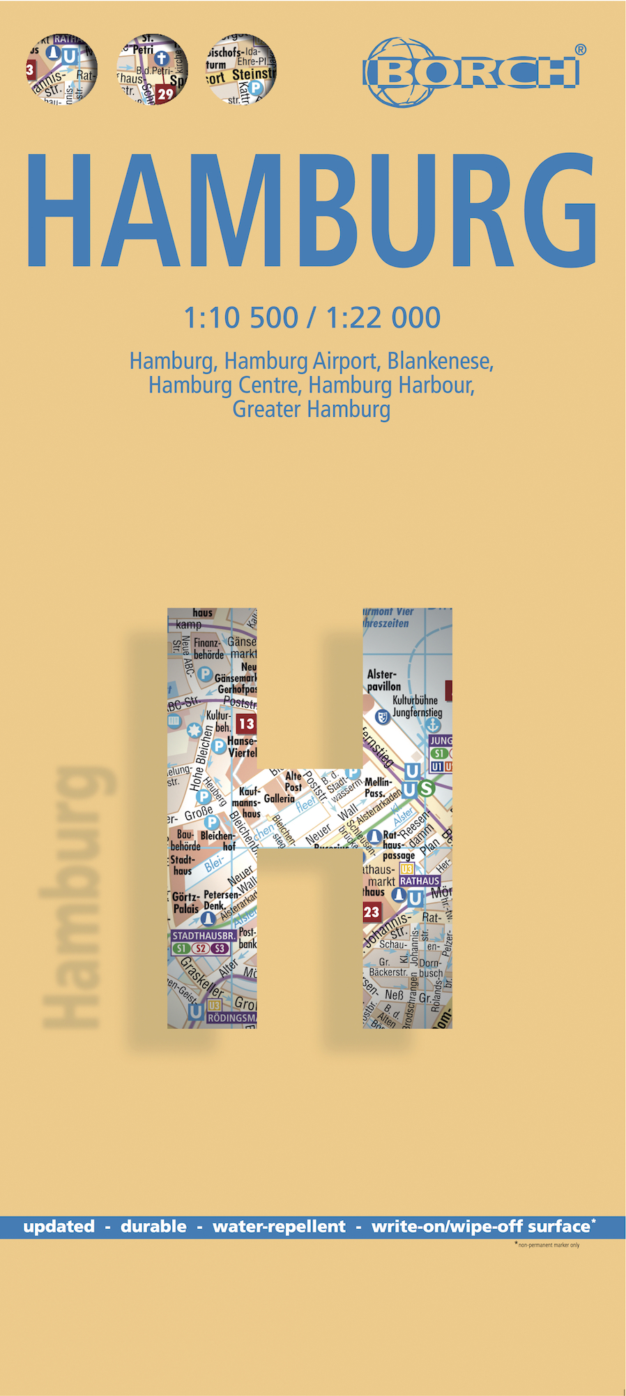
Borch Hamburg is een duidelijke, geplastificeerde plattegrond van het centrum met informatie over openbaar vervoer en bezienswaardigheden. Inclusief straatnamenregister. Our soft-laminated folded map of Hamburg shows: Hamburg 1:22 000, Hamburg Centre 1:10 500, Blankenese 1:22 000, Hamburg Airport 1:22 000, Hamburg Harbour 1:25 000, Greater Hamburg 1:130 000, public transport, Top 30 sights, Germany administrative & time zone. Borch Maps are easy to fold, durable and water-repellent with a wipeable surface. Borch Maps show hotels, museums, monuments, markets, public transport, top sights and points of interest, useful statistics, conversion charts for temperatures, weights and measurements, climate charts showing temperatures, sunshine hours, precipitation and humidity, overview maps, time zones, and much more... Located on the southern tip of the Jutland peninsula between continental Europe, Scandinavia, the North and the Baltic Sea, the Hanseatic City of Hamburg is Germany's second largest and has the world's eleventh largest port and one the world's most important transatlantic shipping hubs. Largely devastated by World War II air raids, modern Hamburg is the commercial and cultural center of northern Germany. Hamburg is the country's sports capital, home to Europe's tallest town hall, one of its largest planetariums, at least 79 museums, and is also a major theater hub and venue for many famous shows. Hamburg's most famous street, the "Reeperbahn" where the Beatles began their career, is the city's red-light district. Tourism plays a significant role in the city's economy, Hamburg's port and the Reeperbahn being the two most visited tourist sites in Germany. Sistered with Chicago, Marseille, Shanghai, Prague and others, the beautiful German maritime city of Hamburg is best visited in the spring or summer months.
€9,95
Bekijk product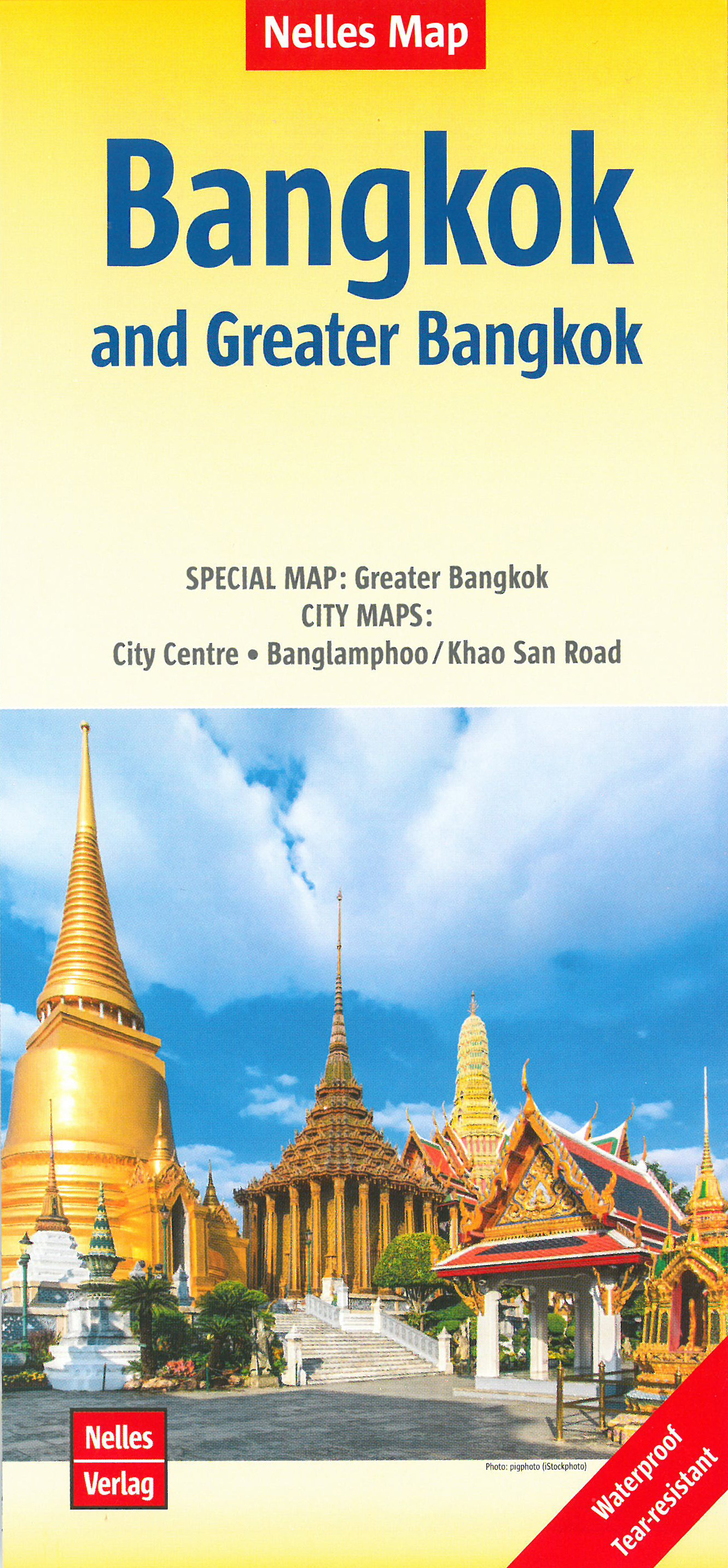
Goede stadskaart van Bangkok en omgeving. Aan beide kanten bedrukt. Met veel toeristische aanduidingen als culturele bezienswaardigheden en aanduidingen van bijvoorbeeld de grotere hotels. Prima leesbare kaart. Bangkok on a double-sided map from Nelles combining an indexed street plan of the city’s central districts at 1:15,000 with a more general plan of the capital with its outer suburbs presented at 1:75,000. Both plans highlight numerous places of interest. On one side the main, indexed plan covers the city’s inner districts showing public transport routes: metro and skytrain lines with stations, bus routes with line numbers, and express boat service along the river. Public buildings, including selected hotels, are clearly marked and named, and shopping centres or market streets are indicated. The main centre of tourist accommodation, Banglamphoo - Khao San Road area, is also shown in greater detail on a small enlargement. On the reverse a more general plan at 1:75,000 covers the city with its outer suburbs, highlighting main traffic arteries, including access to the international airport. Metro, skytrain and express boat lines are marked, plus the suburban railway lines with station names. In addition to information described above, the plan also gives names of numerous industrial and educational establishments, etc. Greater Bangkok 1 : 75.000 Banglamphoo / Khao San Road 1 : 7.900 City Centre 1 : 15.000
€11,95
Bekijk product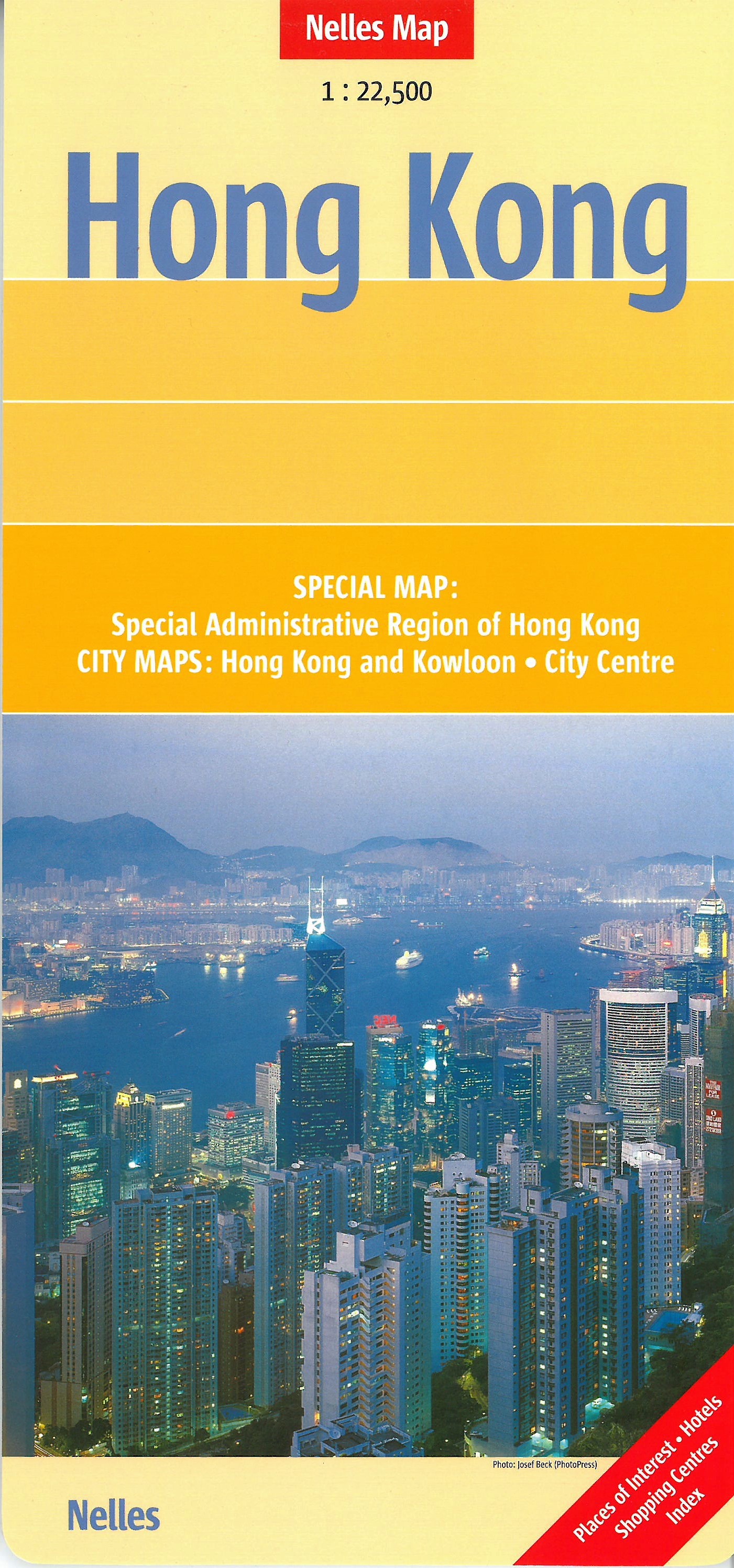
Goede stadskaart van Hong Kong en omgeving. Aan beide kanten bedrukt. Met veel toeristische aanduidingen als culturele bezienswaardigheden en aanduidingen van bijvoorbeeld de grotere hotels. Prima leesbare kaart. Detailkarte: Special Administrative Region of Hong Kong 1 : 125.000 Stadtplan: City Centre 1 : 15.000 Hong Kong and Kowloon 1 : 22.500
€11,95
Bekijk product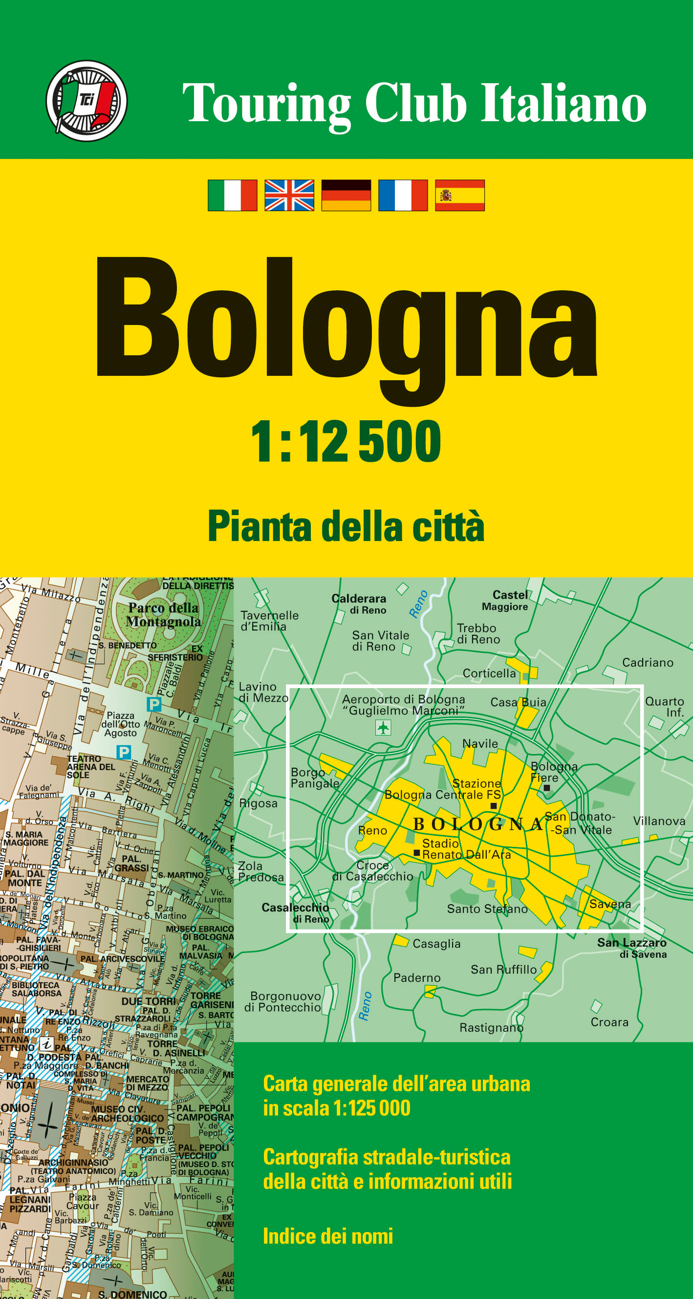
Uitstekende plattegrond van de schitterende stad Bologna! Viertalig, mooie schaal en met uitgebreide legenda.
€10,95
Bekijk product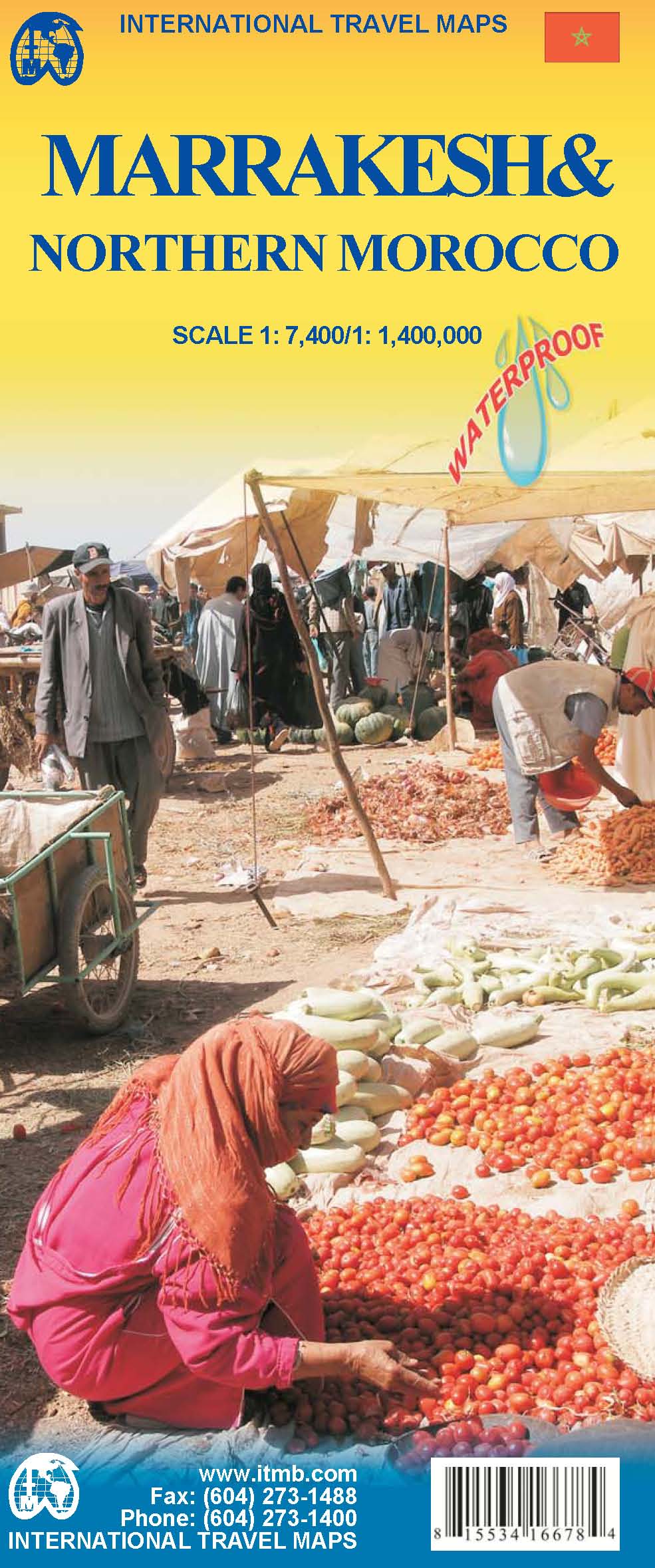
Een degelijke kaart met aanduidingen van o.a. nationale parken, vliegveld, benzinepomp, dirt-roads. The fabled city of Marrakesh (also can be spelled Marrakech), with its enormous Medina (old town) and its souks and mosques, is one of the most visited cities in Africa. This map is double-sided, with a very large-scale and detailed map of the city occupying one side, showing both the older Medina and the newer ‘French quarter’. Hotels, markets, squares, souks, palaces, and mosques are well-portrayed. The other side covers the northern half of Morocco and will assist drivers and those exploring Morocco as part of a tour. Insets of Rabat/Sale and Tangier are included. Printed on ITM plastic paper; Legend Includes: International and provincial borders, roads by classification, road distances, parks, lakes, rivers, contours, airports, hotels, car and scooter rental, places of interest, historic sites, and other information. Includes insets of: Casablanca, Rabat, Sale, Tangier and Medina
€13,95
Bekijk product
Handzame geplastificeerde stadsplattegrond van Straatsburg met toeristische informatie en een register. Die MARCO POLO Citypläne sind handlich und wetterfest. Ob Sonne oder Regen, der Entdeckung einer Stadt steht also nichts mehr im Wege. Die detailgenauen und dennoch übersichtlichen Citypläne sind eine ideale Orientierungshilfe für die nächste Städtereise. Auf der Vorderseite Cityplan, auf der Rückseite Straßenverzeichnis, Touristinformationen und hilfreiche Not-rufnummern - übersichtlich gegliedert auf einen Blick. Am Anfang weisen die MARCO POLO Citypläne auf die 10 TOP-Highlights der Stadt hin. Interessante Nebenkarten sind für einen schnellen Zugriff geschickt platziert und geben wertvolle Auskünfte. Detailinformationen zum Innenstadtbereich und eine Übersicht zum öffentlichen Nahverkehr.
€11,00
Bekijk product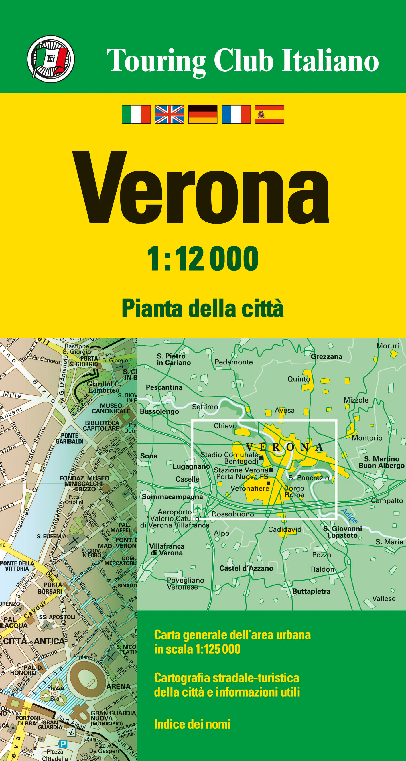
Goede overzichtelijke stadsplattegrond van Verona, met register
€10,95
Bekijk product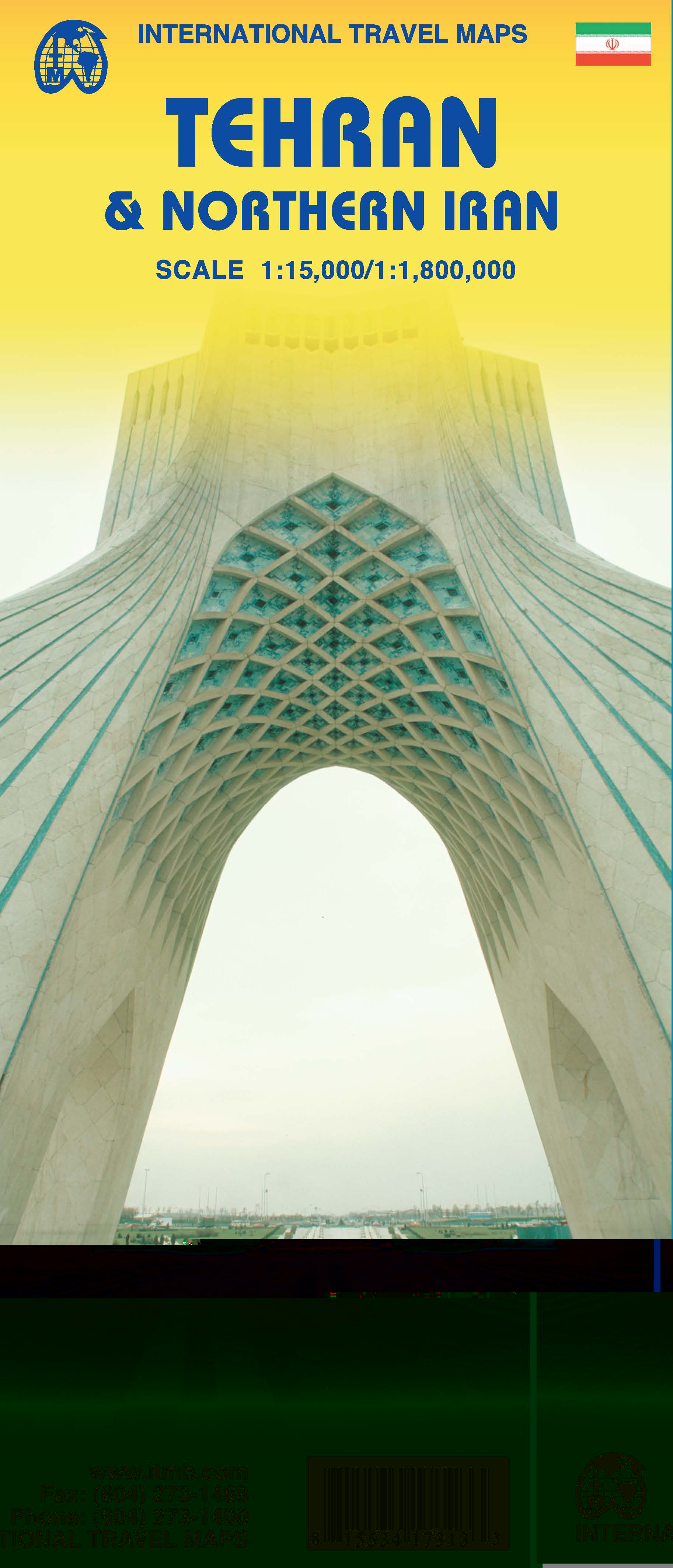
Een degelijke kaart met aanduidingen van o.a. nationale parken, vliegveld, benzinepomp, dirt-roads en kleine plattegrond van hoofdstad. Als overzichtskaart goed te gebruiken. For years, Iran has been vilified as a threat to world peace, a supplier of arms to fuel insurrections around the world, and an ‘enemy’ rogue state. Is it? This is a cultured and educated society that has its faults, but I suspect that much of its militancy is contrived and encouraged by a militant few to maintain their grip on power. Tehran is a huge urban area, modernizing and changing with each passing year, building subways and expressways, hotels, and schools. This is the first map of the city published outside of the country, and I think our team of researchers has created a lovely piece of artwork that can only get better as time passes. We have also updated and printed a very detailed sectional map of the northern half of Iran on the reverse side.
€13,95
Bekijk product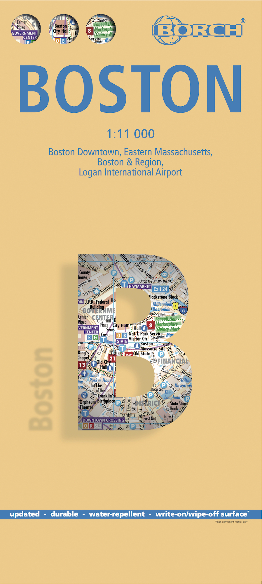
Borch Boston is een duidelijke, geplastificeerde plattegrond van het centrum met informatie over openbaar vervoer en bezienswaardigheden. Inclusief straatnamenregister. Our soft-laminated folded map of Boston shows: Boston Downtown 1:11 000, Eastern Massachusetts 1:600 000, Boston and Region 1:200 000, Logan International Airport 1:33 000, Public Transport Boston, Top 30 Sights and USA administrative and time zones. Borch maps are easy to fold, durable and water-repellent with a wipeable surface. Borch Maps show hotels, museums, monuments, markets, top sights and points of interest, useful statistics, conversion charts for temperatures, weights and measurements, climate charts showing temperatures, sunshine hours, precipitation and humidity, overview maps, time zones, and much more... Founded in 1630, Boston is often referred to as the cradle of American democracy, due to major events having taken place here during the American Revolution. Boston is an important port and manufacturing center and is today one of the new world's most culturally relevant old cities. Boston is the capital of the Commonwealth of Massachusetts and Greater Boston is America’s 11th largest metropolitan area. Boston's residents are known as "Bostonians" and the city is acclaimed as a center of education and healthcare, with a solid, long-standing economy based on finance, research and technology, primarily biotechnology. Re-live history along the famous Freedom Trail, experience the Irish Heritage Trail from the waterside, feel like a scholar on the campus grounds of Harvard University and M.I.T., visit the museums, theaters and markets; there's really something for everyone in Boston, a beautiful, historical city unquestionably worth a visit.
€9,95
Bekijk product
Duidelijke plattegrond van Wenen van de bekendste Oostenrijkse kaartenmaker. Met register en openbaar vervoer overzicht. Stadsplattegrond met register. Helder kaartbeeld waarbij de naamgeving goed leesbaar is weergegeven. Met de toeristische bezienswaardigheden in symbolen weergeven: monumenten, musea, stadions e.a. Daarnaast handige zaken als postkantoren, parkeergarages en stations. Veelal ook met een openbaar vervoer of metro kaart als inzet Der Stadtplan Wien 1:25.000 besticht durch ein ausgezeichnetes Kartenbild, welches trotz der Fülle an Details sehr gut lesbar ist. Der beigelegte Infoguide bietet viele Zusatzinformationen und beschreibt eine Auswahl der Sehenswürdigkeiten im Zentrum Wiens.Stadtplan Wien 1:25.000 Durchfahrtsplan Innenstadtplan Kurzparkzonen Straßenverzeichnis Öffentliche Verkehrsmittel Flughafen Wien
€13,95
Bekijk product