
Beantwoord enkele vragen, en binnen seconden geeft AI je een persoonlijk aankoopadvies op maat.
Beantwoord enkele vragen, en binnen seconden geeft AI je een persoonlijk aankoopadvies op maat.
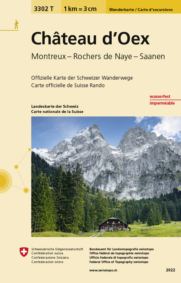
Een nieuwe serie van de Zwitserse topografische dienst, goede wandelkaarten met ingetekende wandelroutes op scheur- en watervast papier. Vooralsnog zijn ze uitgebracht van de populaire wandelgebieden en niet landelijk dekkend (zie overzicht). Op een gedetailleerde schaal van 1:33.333 met als ondergrond de onovertroffen topografische kaarten van Zwitserland zijn dit zeer bruikbare kaarten. Alle noodzakelijke topografische informatie, met ingetekende wandelroutes en bijvoorbeeld de locatie van berghutten. Ook zijn ze voorzien van een UTM grid en hoogtelijnen en daardoor bruikbaar in combinatie met een GPS.
€14,95
Bekijk product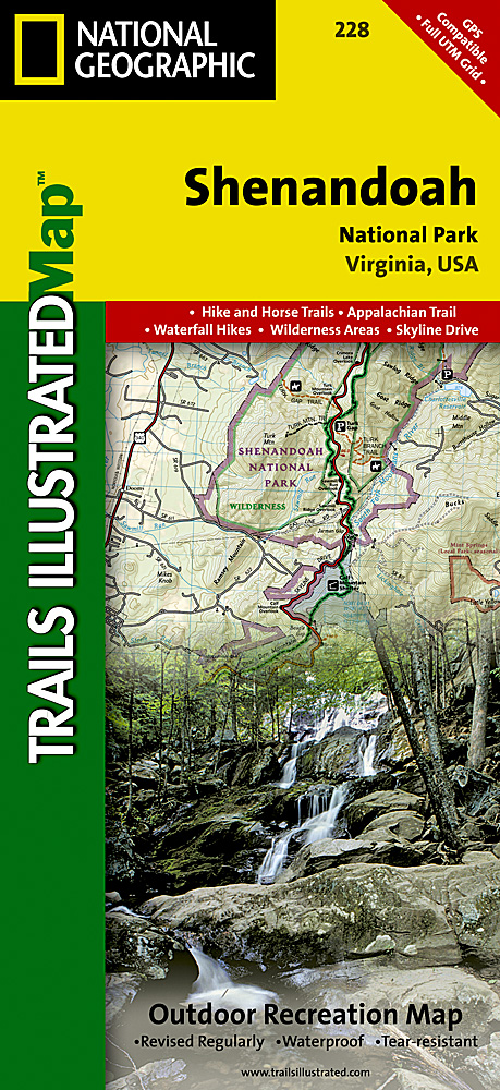
Prachtige geplastificeerde kaart van het nationaal park. Met alle recreatieve voorzieningen als campsites, maar ook met topografische details en wandelroutes ed. Door uitgekiend kleurgebruik zeer prettig in gebruik. Scheur en watervast! The map includes Shenandoah National Park in its entirety, wilderness areas, Rapidian Wildlife Management Area, Overall Run Waterfall, Whiteoak Canyon Waterfall, Cedar Run Waterfall, Rose River Waterfall, Dark Hollow Waterfall, Lewis Waterfall, South River Waterfall, Doyles River Waterfalls #1 and #1, Jones Run Waterfall, the citis of Front Royal, Waynesboro, Harrisonburg, Shenandoah, Elkton, Grottoes,and Charlottesville, George Washington National Forest, the Appalachian Trail, Shenandoah River, Skyline Drive, and much more. Includes UTM grids for use with your GPS unit.
€16,95
Bekijk product
Prachtige geplastificeerde kaart van het nationaal park. Met alle recreatieve voorzieningen als campsites, maar ook met topografische details en wandelroutes ed. Door uitgekiend kleurgebruik zeer prettig in gebruik. Scheur en watervast! This Trails Illustrated topographic map for Everglades National Park and surrounding area is the perfect map for hiking, boating, paddling, biking, fishing, exploring, camping, and sightseeing in this unique national treasure. This two-sided map includes the Key Largo, Everglades City, Chokoloskee, Everglades National Park, portions of Big Cypress National Preserve, Fakahatchee Strand State Preserve, Cape Romano Ten Thousand Islands Aquatic Preserve, Shark Valley Tram Road, Old Ingraham highway and campsite, North Nest Key, West Lake Canoe Trail, Snake Bight Trail, backcountry campsites, beach sites, ground sites, and chickees, and detailed insets of Flamingo, Whitewater Bay, Pineland Trails of the Long Pine Key area, and Nine Mile Pond. The map also shows the entire Wilderness Waterway, from the Gulf Coast Visitor Center near Everglades City to its terminus beyond the Flamingo Visitor Center. Includes UTM grids for use with your GPS unit.
€16,95
Bekijk product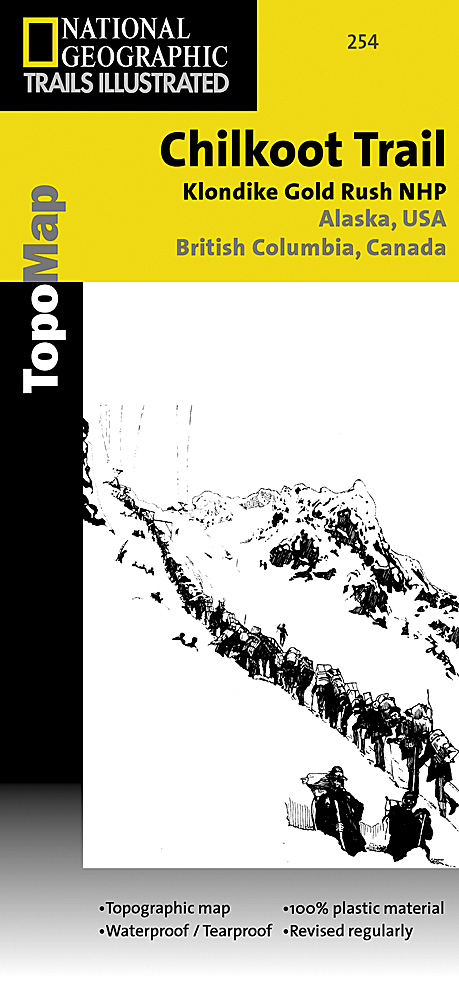
Prachtige geplastificeerde kaart van het nationaal park. Met alle recreatieve voorzieningen als campsites, maar ook met topografische details en wandelroutes ed. Door uitgekiend kleurgebruik zeer prettig in gebruik. Scheur en watervast! National Geographic's Trails Illustrated map for Chilkoot Trail in Klondike Gold Rush National Historic Park in the Alaskan panhandle is perfect for hiking, camping, and wildlife viewing in this scenic, rugged frontier. Created in partnership with local land management agencies, this expertly researched map features key areas of interest including Chilkoot Trail National Historic Site; portions of the Klondike Highway; Happy Camp; Taiya Inlet; the town of Skagway; Klondike Gold Rush National Historical Park; Skagway River; Dyea; and Deep, Bennett, Crater, Long, and Lindeman lakes. The print map includes insets of historic routes to the Klondike gold fields, Historic Dyea, and Skagway Historic District with some of the prominent gold rush-era buildings noted. There is a great deal of helpful material about traveling in the area, customs, permits and fees, safety tips, agency contact information, a suggested equipment list, and more. A trail profile of Chilkoot Trail is included as well. A table of featured hiking trails showing distance, approximate hiking time, elevation gain, difficulty, and features will help you choose a path that's right for you. The map base includes contour lines, shaded relief, and elevations for summits, passes and many lakes. Recreation features are clearly marked, including campgrounds, public use cabins, cross country ski and snowshoeing areas, interpretive areas, and scenic viewpoints. Every Trails Illustrated map is printed on "Backcountry Tough" waterproof, tear-resistant paper. A full UTM grid is printed on the map to aid with GPS navigation. Other features found on this map include: Klondike Gold Rush National Historical Park, Mount Foster, Tongass National Forest.
€16,95
Bekijk product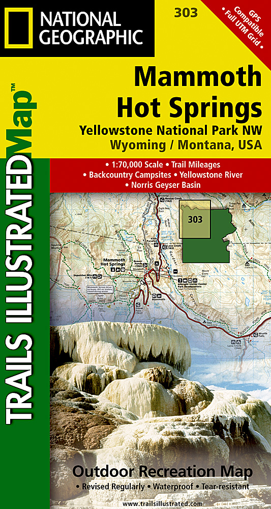
Prachtige geplastificeerde kaart van het nationaal park. Met alle recreatieve voorzieningen als campsites, maar ook met topografische details en wandelroutes ed. Door uitgekiend kleurgebruik zeer prettig in gebruik. Scheur en watervast! Coverage of the Old Faithful area of Yellowstone National Park includes Heart Lake BMA, Pitchstone Plateau, Bechler Ranger Station, South Entrance, Teton Wilderness, John D. Rockefeller Jr Memorial Parkway, Jedediah Smith Wilderness, Winegar Hole Wilderness, Bechler Canyon, Cascade Corner, Firehole BMA, Shoshone Lake, Western half of Yellowstone Lake. Includes UTM grids for use with your GPS unit.
€14,95
Bekijk product
Prachtige geplastificeerde kaart van het nationaal park. Met alle recreatieve voorzieningen als campsites, maar ook met topografische details en wandelroutes ed. Door uitgekiend kleurgebruik zeer prettig in gebruik. Scheur en watervast! Coverage of the Tower / Canyon area of Yellowstone National Park includes Canyon Village, Tower - RooseveltWashburn BMA, Antelope BMA, Mirror Plateau BMA, Absaroka Beartooth Wilderness, Gallatin National Forest, Northeast entrance. Includes UTM grids for use with your GPS unit.
€14,95
Bekijk product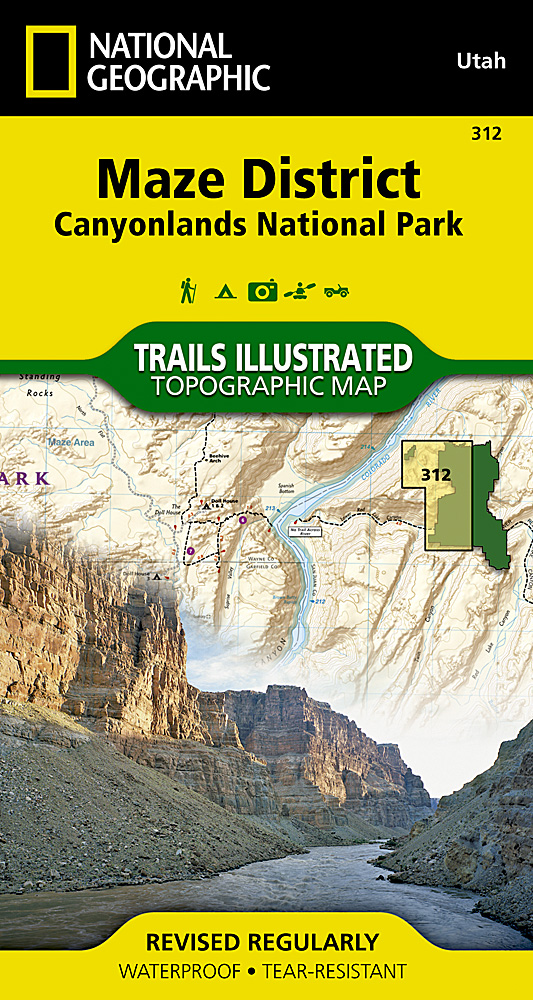
Prachtige geplastificeerde kaart van het bekende nationaal park. Met alle recreatieve voorzieningen als campsites, maar ook met topografische details en wandelroutes ed. Door uitgekiend kleurgebruik zeer prettig in gebruik. Scheur en watervast! This sectional map of Canyonlands National Park zooms in on the Maze District in the western area of the park. This map provides more detail of this area than the full Canyonlands National Park map with an enhanced scale. The map includes trail and backcountry road charts, backcountry zones and campsites, trail and road mileages, as well as backcountry permit and regulations information.
€14,95
Bekijk product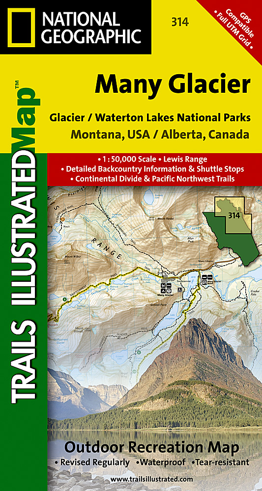
Prachtige geplastificeerde kaart van het bekende nationaal park. Met alle recreatieve voorzieningen als campsites, maar ook met topografische details en wandelroutes ed. Door uitgekiend kleurgebruik zeer prettig in gebruik. Scheur en watervast! Located just north of Kalispell in Montana's northwest corner, Glacier National contains an abundance of recreational opportunities for outdoor enthusiasts of all interests. This detailed topographic recreation map contains carefully researched trails, campsites, forest service roads, and points-of-interests, for the Many Glacier section of the park. Two additional maps for the North Fork and the Two Medicine regions of the park along with a comprehensive Glacier National Park Trails Illustrated map are also available. An enhanced scale of 1:50,000, useful UTM and Latitude/Longitude grids, mileage charts, and other navigation features make the North Fork sectional the best map available for the western side of the park. The North Side of the Map Includes: Waterton Lakes National Park, Lower, Middle, and Upper Waterton Lakes, Blakiston Falls, Prince of Wales Hotel, Upper Kintla Lake, Continental Divide Trail, Goat Haunt, Pacific Northwest Trail, and more.. The South Side of the Map Includes: Cosley Lake, Glenns Lake, Ipasha Glacier, Chaney Glacier, Lake Josephine, Lake Sherburne, St Mary Lake, Many Glacier Hotel, Swiftcurrent Pass, Continental Divide Trail, Pacific Northwest Trail, and more... Like all Trails Illustrated Maps, the Glacier Sectionals are printed on a highly durable waterproof, tear-resistant material designed to stand up to elements.
€14,95
Bekijk product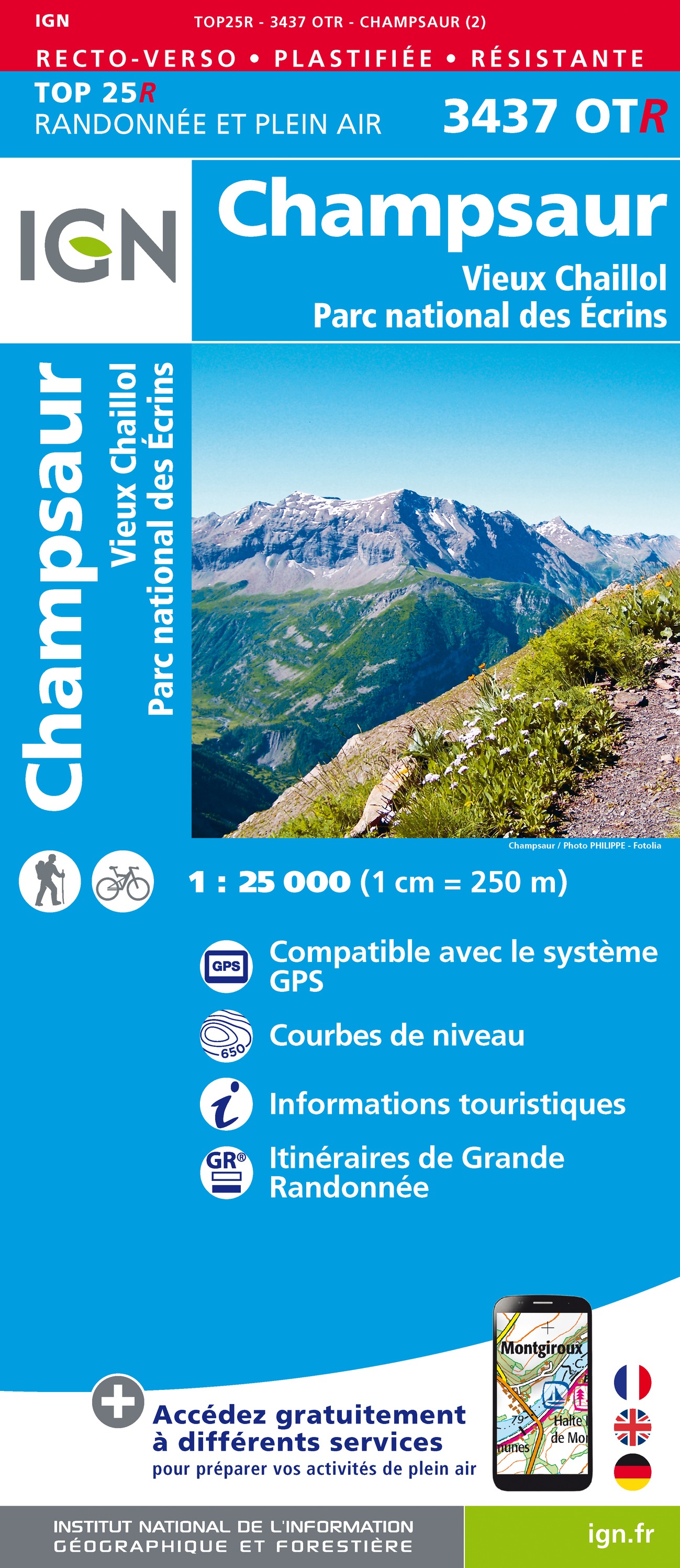
Geplastificeerde versie! De wandelkaart die de perfectie benadert! Werkelijk alle topografische details zijn er op te vinden; van hoogtelijnen tot aan bruggetjes en allerlei wandelpaden. Daarnaast hebben de makers een flinke dosis toeristische informatie op de kaart verwerkt: campings, gites d étape, restaurants en ingetekende doorgaande wandelpaden, de grandes randonnées. Het kleurgebruik is geweldig met schaduwzijdes, bos, weiland, etc goed te onderscheiden. De kaart is uitgevoerd met raster van graden, dus deze is GPS - toepasbaar! De TOP 25 kaarten (kaart nummers die eindigen op "T") hebben betrekking op gebieden van bijzonder toeristisch belang zoals de Alpen, de Pyreneeën,De Cevennes, de Vogezen, de Provence, en de Atlantische en Middellandse zeekusten. De kaarten hebben een opdruk en benadrukken zo de lokale wandelpaden, lange afstand GR routes en, in voorkomend geval, ski routes. Andere toeristische informatie omvat campings, paardensport of kanocentra, hutten, berghutten, etc. Elke "TOP 25" kaart bedekt een gebied van ongeveer 28 x 21 km. De rest van Frankrijk wordt in kaart gebracht met de "Série Bleu" (eindigend op O = ouest of E = est) welke geen speciale extra overdruk heeft om de wandelroutes aan te duiden. Op deze kaarten vind je dan ook geen toeristische informatie als campings en hutten; het zijn puur topografische kaarten, maar zoals gezegd bijzonder gedetailleerd. Elke "Série Bleu" kaart bedekt een gebied van ongeveer 20 x 14 km L'indispensable carte de randonnée IGN 3437OT. D'une très grande précision elle contient tous les détails existants sur le terrain : voies de communication jusqu'au moindre sentier, constructions jusqu'au hangar, bois, arbre isolé, rivière, source... Sans oublier la représentation du relief par des courbes de niveau. Les sentiers balisés et les informations touristiques sont également représentées. Communes couvertes : Saint-Jean-Saint-Nicolas, Ancelle, Laye, Chabottes, Saint-Laurent-du-Cros, Forest-Saint-Julien, La Rochette, Saint-Bonnet-en-Champsaur, Buissard, Champoléon, La Fare-en-Champsaur, La Chapelle-en-Valgaudémar, Saint-Julien-en-Champsaur, Saint-Michel Lieux à découvrir : Aiguilles de Morges, Pic de Colle Blanche, les Choucières Vertes, les Parias, Col Bayard, Col de Manse, le Chaperon, Pic de Mal Cros, Vieux Chaillol, le Sirac, Aiguille de Cédéra, Pic de Parières, Col de Vallonpierre, Pic de Pian, Grun de St-Maurice Dimensions : 96 cm x 132 cm
€21,95
Bekijk product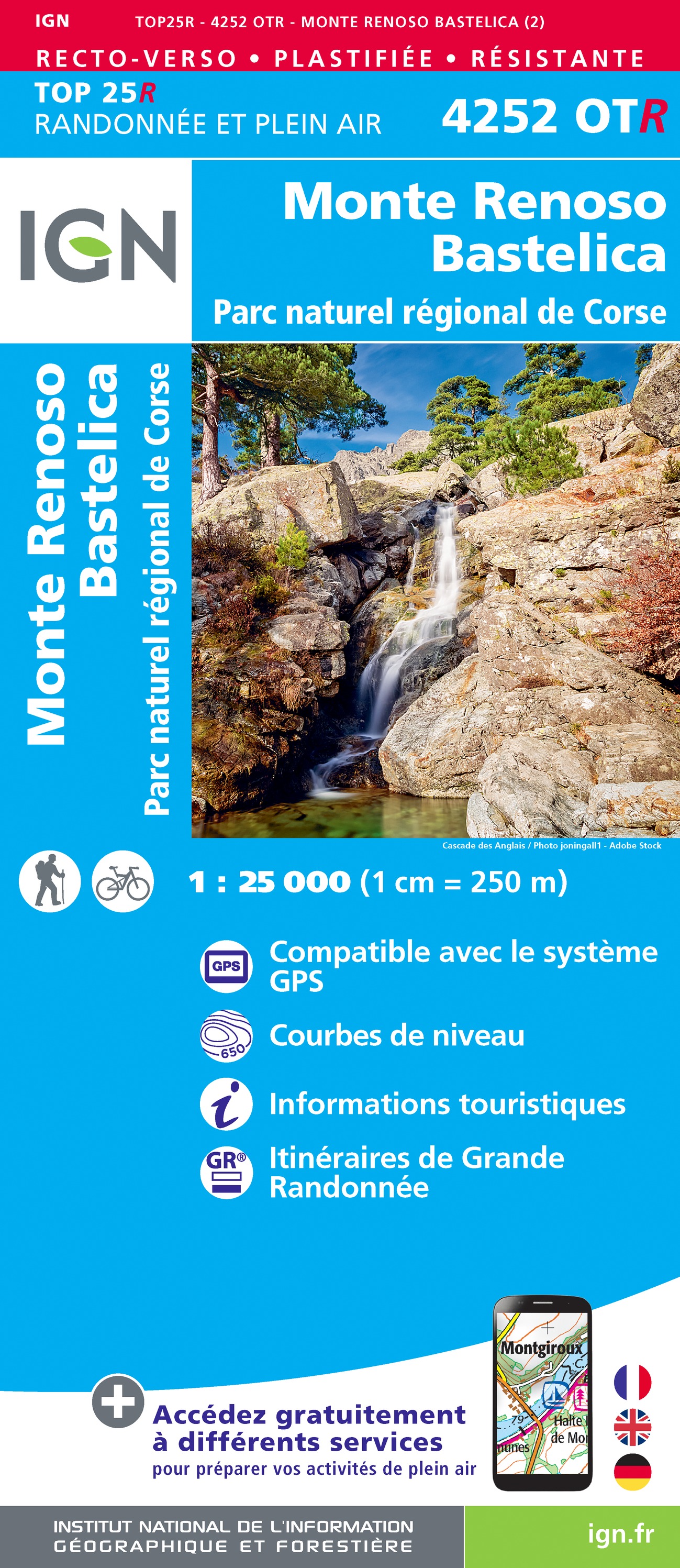
Geplastificeerde versie! De wandelkaart die de perfectie benadert! Werkelijk alle topografische details zijn er op te vinden; van hoogtelijnen tot aan bruggetjes en allerlei wandelpaden. Daarnaast hebben de makers een flinke dosis toeristische informatie op de kaart verwerkt: campings, gites d étape, restaurants en ingetekende doorgaande wandelpaden, de grandes randonnées. Het kleurgebruik is geweldig met schaduwzijdes, bos, weiland, etc goed te onderscheiden. De kaart is uitgevoerd met raster van graden, dus deze is GPS - toepasbaar! De TOP 25 kaarten (kaart nummers die eindigen op "T") hebben betrekking op gebieden van bijzonder toeristisch belang zoals de Alpen, de Pyreneeën,De Cevennes, de Vogezen, de Provence, en de Atlantische en Middellandse zeekusten. De kaarten hebben een opdruk en benadrukken zo de lokale wandelpaden, lange afstand GR routes en, in voorkomend geval, ski routes. Andere toeristische informatie omvat campings, paardensport of kanocentra, hutten, berghutten, etc. Elke "TOP 25" kaart bedekt een gebied van ongeveer 28 x 21 km. De rest van Frankrijk wordt in kaart gebracht met de "Série Bleu" (eindigend op O = ouest of E = est) welke geen speciale extra overdruk heeft om de wandelroutes aan te duiden. Op deze kaarten vind je dan ook geen toeristische informatie als campings en hutten; het zijn puur topografische kaarten, maar zoals gezegd bijzonder gedetailleerd. Elke "Série Bleu" kaart bedekt een gebied van ongeveer 20 x 14 km Carte RESISTANTE - Recto/Verso L'indispensable carte de randonnée IGN 4252OT. D'une très grande précision elle contient tous les détails existants sur le terrain : voies de communication jusqu'au moindre sentier, constructions jusqu'au hangar, bois, arbre isolé, rivière, source... Sans oublier la représentation du relief par des courbes de niveau. Les sentiers balisés et les informations touristiques sont également représentées. Communes couvertes : Bocognano, Ciamannacce, Cuttoli-Corticchiato, Carbuccia, Frasseto, Tavaco, Vero, Salice, Rosazia, Rezza, Lopigna, Tavera, Ucciani, Azzana, Peri, Ocana, Tolla, Ghisoni, Sampolo, Cozzano, Palneca, Bastelica, Tasso Lieux à découvrir : Corse, Forêt Territoriale de Vizzavona, Forêt Territoriale de Punta-Niella, Forêt Territoriale de Marmano, Forêt Communale de Ghisoni, Forêt Territoriale de Pineta, Forêt Territoriale de Marmano, Forêt Territoriale de Fium'Orbu, Forêt Territoriale de St,Monte Renoso, Col de Vizzavona, Punta Piaggiola, Punta Sant'Eliseo, Gorges du Prunelli, Col de Verde, Défilé e Strette,Château de Crans, Abbaye de Bonmont, Château, Cabane du Carroz, Sapins de Borsattaz, Saut du Day, Grotte de Réclère, Cabane les Pralets, Cabane Rochefort, Signal de Roche d'Or, Cabane Trois Chalets, Chalet de la Dent de Vaution, Résurgence de l'Orbe
€21,95
Bekijk product