
Beantwoord enkele vragen, en binnen seconden geeft AI je een persoonlijk aankoopadvies op maat.
Beantwoord enkele vragen, en binnen seconden geeft AI je een persoonlijk aankoopadvies op maat.
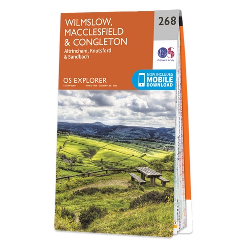
Met zijn 4cm voor 1 km (2 ½ cm voor 1 mijl) schaal, is de OS Explorer kaartenserie de ideale en meest gedetailleerde kaartenreeks voor mensen die graag outdoor-activiteiten zoals fietsen, wandelen, paardrijden, klimmen en watersporten. Deze kaart is nog gedetailleerder dan de 'gewone' Landranger maps. Voor- en achterzijde bedrukt! Zeker op de moors en andere natuurgebieden van onschatbare waarden met echt alle aspecten van het landschap op de kaart ingetekend. Zeer goede detailkaart met topografische ondergrond. Hierop zijn toeristische symbolen van bezienswaardigheden ingetekend, daarnaast staan bijvoorbeeld campings en jeugdherbergen vermeld en - voor wandelaars het belangrijkst - alle right of way paden en Lange afstands Wandelpaden zijn er op te vinden. De ideale kaart voor het wandelen in Engeland, Wales of Schotland. These highly detailed maps show all the administrative boundaries, settlements as small as isolated farms, the road network down to unfenced roads and country tracks, and field boundaries (hedges and drystone walls) which make navigation across the countryside much easier. Steep gradients on roads are indicated. Various landmarks, e.g. powerlines, archaeological sites, windmills, churches and lighthouses are shown and additional graphics indicate natural terrain features such as cliffs, scree, mud and vegetation variations. The contour interval is 5 metres in the lower parts of the country and 10 metres in the uplands, and spot heights are marked. Each map covers an area of 30 x 20km (i.e. approx. 19 x 12 miles), with some double-sided maps covering more, as indicated in the individual descriptions. The maps are fully GPS compatible, with the National Grid shown at 1km intervals and latitude and longitude indicated by margin ticks at 1'. The Explorer series has replaced the earlier, green-cover Pathfinder maps. The Explorer series is now complete and covers all of England, Wales & Scotland. Some sheets for popular areas like the National Parks are still branded as Outdoor Leisure (OL) maps, but are now included in this series as the cartography is the same as that in the Explorer Maps. The Explorer maps offer a substantial improvement on the Pathfinder series, with greater use of colour, larger area per map, and stronger emphasis on information for ramblers and tourists. This series is ideal for walking and other outdoor pursuits and each map shows a large amount of information for ramblers and tourists. Public rights of way are shown (except in Scotland), together with other routes with public access: National Trails and Recreational Paths, permitted paths and bridleways, and selected cycle routes. Open access land created under the Countryside and Rights of Way Act 2000 is marked. Tourist information includes caravan and camp sites, Park & Ride locations, recreation/leisure/sport centres, museums, historic buildings, English Heritage and National Trust sites, rural pubs, etc. The map legend is in English only, except for the tourist information content which is also in French and German
€19,50
Bekijk product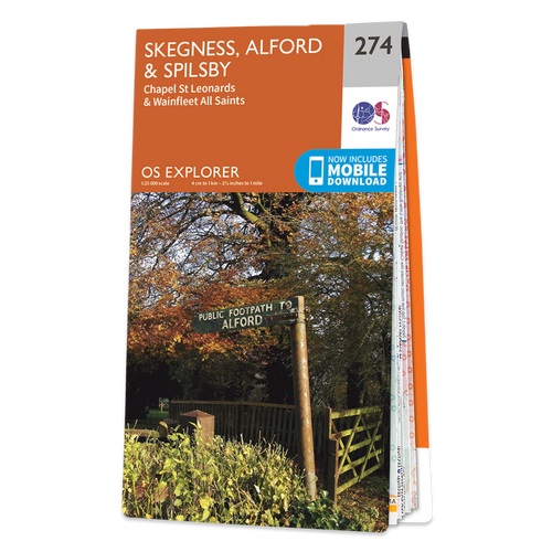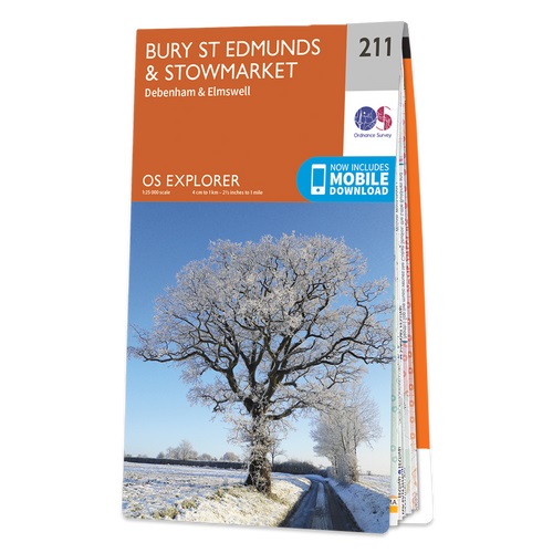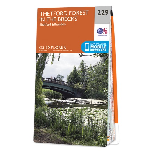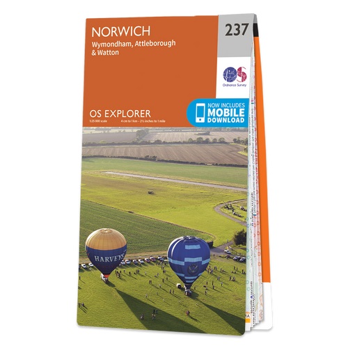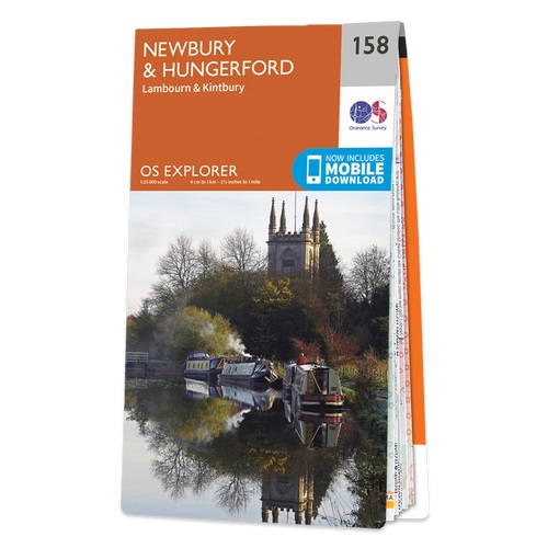
Enjoy everything rural Berkshire has to offer, from the iconic racecourse at Newbury to the beautiful Kennet & Avon Canal and Wilton Windmill, Wiltshire’s only working windmill. Base yourself in charming villages like Lambourn and Kintbury to explore the ‘Valley of the Racehorse’. Visit Highclere Castle, instantly recognisable as the real-life Downton Abbey and only six miles from Newbury Explore peaceful water meadows, rolling hills and ruined castles like Donnington among the stunning landscape of the North Wessex Downs Walk, hike or cycle along recreational paths including the Lambourn Valley Way, Test Way and Wayfarer’s Walk Met zijn 4cm voor 1 km (2 ½ cm voor 1 mijl) schaal, is de OS Explorer kaartenserie de ideale en meest gedetailleerde kaartenreeks voor mensen die graag outdoor-activiteiten zoals fietsen, wandelen, paardrijden, klimmen en watersporten. Deze kaart is nog gedetailleerder dan de 'gewone' Landranger maps. Voor- en achterzijde bedrukt! Zeker op de moors en andere natuurgebieden van onschatbare waarden met echt alle aspecten van het landschap op de kaart ingetekend. Zeer goede detailkaart met topografische ondergrond. Hierop zijn toeristische symbolen van bezienswaardigheden ingetekend, daarnaast staan bijvoorbeeld campings en jeugdherbergen vermeld en - voor wandelaars het belangrijkst - alle right of way paden en Lange afstands Wandelpaden zijn er op te vinden. De ideale kaart voor het wandelen in Engeland, Wales of Schotland. These highly detailed maps show all the administrative boundaries, settlements as small as isolated farms, the road network down to unfenced roads and country tracks, and field boundaries (hedges and drystone walls) which make navigation across the countryside much easier. Steep gradients on roads are indicated. Various landmarks, e.g. powerlines, archaeological sites, windmills, churches and lighthouses are shown and additional graphics indicate natural terrain features such as cliffs, scree, mud and vegetation variations. The contour interval is 5 metres in the lower parts of the country and 10 metres in the uplands, and spot heights are marked. Each map covers an area of 30 x 20km (i.e. approx. 19 x 12 miles), with some double-sided maps covering more, as indicated in the individual descriptions. The maps are fully GPS compatible, with the National Grid shown at 1km intervals and latitude and longitude indicated by margin ticks at 1'. The Explorer series has replaced the earlier, green-cover Pathfinder maps. The Explorer series is now complete and covers all of England, Wales & Scotland. Some sheets for popular areas like the National Parks are still branded as Outdoor Leisure (OL) maps, but are now included in this series as the cartography is the same as that in the Explorer Maps. The Explorer maps offer a substantial improvement on the Pathfinder series, with greater use of colour, larger area per map, and stronger emphasis on information for ramblers and tourists. This series is ideal for walking and other outdoor pursuits and each map shows a large amount of information for ramblers and tourists. Public rights of way are shown (except in Scotland), together with other routes with public access: National Trails and Recreational Paths, permitted paths and bridleways, and selected cycle routes. Open access land created under the Countryside and Rights of Way Act 2000 is marked. Tourist information includes caravan and camp sites, Park & Ride locations, recreation/leisure/sport centres, museums, historic buildings, English Heritage and National Trust sites, rural pubs, etc. The map legend is in English only, except for the tourist information content which is also in French and German
€19,50
Bekijk product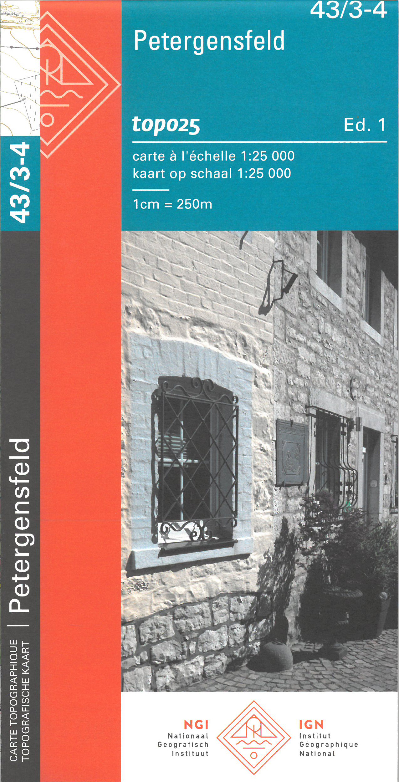
Zeer gedetailleerde topografische kaart van een deel van Belgie. Deze kaart is bijzonder geschikt voor wandeltochten, bijvoorbeeld in het heuvelachtige gebied van de Ardennen. Wel moet u bedenken dat op deze kaarten wandelroutes als zodanig niet staan ingetekend. Voorzien van alle topografische details als hoogtelijnen, waterlopen, bosgebieden, paden en brandgangen. Hoogtelijnen maken het mogelijk de moeilijkheidsgraad van een wandeling in te schatten. Belangrijke oriëntatiepunten, zoals solitaire bomen, kapelletjes, hoogspanningslijnen, en vele andere, zijn ingetekend. De kaarten zijn voorzien van een gradenoverzicht en UTM grid en daardoor dus te gebruiken voor GPS tochten. Elk kaartblad bedekt een gebied van 160 km2. In grensgebieden zijn de gebieden buiten België in zwart/wit met minder detail uitgevoerd. Op het bijgevoegde overzicht kun u zien waar deze kaart gelegen is: eerst zoekt u het hoofdcijfer waarna de 2 laatste cijfers de daadwerkelijke positie weergeeft. De kaart met het hoofdcijfer is ingedeeld in 4 delen: 1-2 (noordwest), 3-4 (noordoost), 5-6 (zuidwest)en 7-8 (zuidoost).
€10,95
Bekijk product
Zeer gedetailleerde topografische kaart met een aantal toegevoegde toeristische symbolen voor bijv. Bezienswaardigheden en campings. Met hoogtelijnen, mooi kleurgebruik en ingetekende fietsroutes.
€20,50
Bekijk product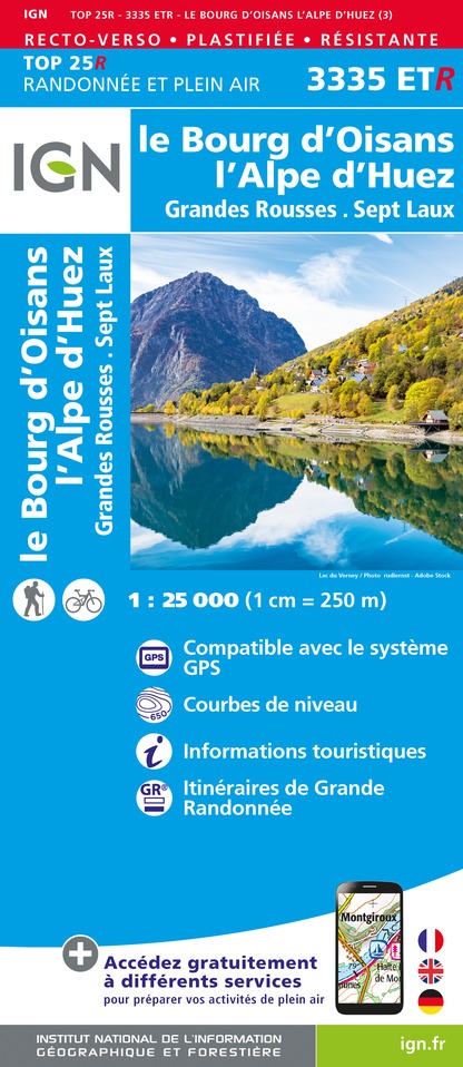
Geplastificeerde versie! De wandelkaart die de perfectie benadert! Werkelijk alle topografische details zijn er op te vinden; van hoogtelijnen tot aan bruggetjes en allerlei wandelpaden. Daarnaast hebben de makers een flinke dosis toeristische informatie op de kaart verwerkt: campings, gites d étape, restaurants en ingetekende doorgaande wandelpaden, de grandes randonnées. Het kleurgebruik is geweldig met schaduwzijdes, bos, weiland, etc goed te onderscheiden. De kaart is uitgevoerd met raster van graden, dus deze is GPS - toepasbaar! De TOP 25 kaarten (kaart nummers die eindigen op "T") hebben betrekking op gebieden van bijzonder toeristisch belang zoals de Alpen, de Pyreneeën,De Cevennes, de Vogezen, de Provence, en de Atlantische en Middellandse zeekusten. De kaarten hebben een opdruk en benadrukken zo de lokale wandelpaden, lange afstand GR routes en, in voorkomend geval, ski routes. Andere toeristische informatie omvat campings, paardensport of kanocentra, hutten, berghutten, etc. Elke "TOP 25" kaart bedekt een gebied van ongeveer 28 x 21 km. De rest van Frankrijk wordt in kaart gebracht met de "Série Bleu" (eindigend op O = ouest of E = est) welke geen speciale extra overdruk heeft om de wandelroutes aan te duiden. Op deze kaarten vind je dan ook geen toeristische informatie als campings en hutten; het zijn puur topografische kaarten, maar zoals gezegd bijzonder gedetailleerd. Elke "Série Bleu" kaart bedekt een gebied van ongeveer 20 x 14 km L'indispensable carte de randonnée IGN 3335ETR. D'une très grande précision elle contient tous les détails existants sur le terrain : voies de communication jusqu'au moindre sentier, constructions jusqu'au hangar, bois, arbre isolé, rivière, source... Sans oublier la représentation du relief par des courbes de niveau. Les sentiers balisés et les informations touristiques sont également représentées. Communes couvertes : Le Bourg d'Oisans, l'Alpe d'Huez, Grandes Rousses, Sept Laux, Oz, La Garde, Saint-Sorlin-d'Arves, Mizoën, Sainte-Agnès, Huez, Besse, Villard-Reculas, Auris, Le Freney-d'Oisans, Villard-Reymond, Oulles, Ornon, Allemond, Les Adrets, Saint-Colomban-des-Villards, Laval, Clavans-en-Haut-Oisans Lieux à découvrir : Lac du Chambon, Lac Blanc, Lac de Grand-Maison, Lac Besson,,Aiguilles de l'Argentière, Combe d'Olle, Massif d'Allevard, Col du Glandon, Gorges d'Infernet, Grande Lance d'Allemont, Cirque des Cascades du Boulon, Pic de l'Étendard, le Gros Feu, Pic Bayle, Pic du Lac Blanc, Grand Pic de Belledonne, Dôme de la Coc,Château de Crans, Abbaye de Bonmont, Cabane du Carroz, Sapins de Borsattaz, Saut du Day, Grotte de Réclère, Cabane les Pralets, Cabane Rochefort, Signal de Roche d'Or, Cabane Trois Chalets, Chalet de la Dent de Vaution, Résurgence de l'Orbe, Dimensions : 50 cm x 132 cm (Recto/Verso)
€21,95
Bekijk product
Geplastificeerde versie! De wandelkaart die de perfectie benadert! Werkelijk alle topografische details zijn er op te vinden; van hoogtelijnen tot aan bruggetjes en allerlei wandelpaden. Daarnaast hebben de makers een flinke dosis toeristische informatie op de kaart verwerkt: campings, gites d étape, restaurants en ingetekende doorgaande wandelpaden, de grandes randonnées. Het kleurgebruik is geweldig met schaduwzijdes, bos, weiland, etc goed te onderscheiden. De kaart is uitgevoerd met raster van graden, dus deze is GPS - toepasbaar! De TOP 25 kaarten (kaart nummers die eindigen op "T") hebben betrekking op gebieden van bijzonder toeristisch belang zoals de Alpen, de Pyreneeën,De Cevennes, de Vogezen, de Provence, en de Atlantische en Middellandse zeekusten. De kaarten hebben een opdruk en benadrukken zo de lokale wandelpaden, lange afstand GR routes en, in voorkomend geval, ski routes. Andere toeristische informatie omvat campings, paardensport of kanocentra, hutten, berghutten, etc. Elke "TOP 25" kaart bedekt een gebied van ongeveer 28 x 21 km. De rest van Frankrijk wordt in kaart gebracht met de "Série Bleu" (eindigend op O = ouest of E = est) welke geen speciale extra overdruk heeft om de wandelroutes aan te duiden. Op deze kaarten vind je dan ook geen toeristische informatie als campings en hutten; het zijn puur topografische kaarten, maar zoals gezegd bijzonder gedetailleerd. Elke "Série Bleu" kaart bedekt een gebied van ongeveer 20 x 14 km. L'indispensable carte de randonnée IGN 3528ETR. D'une très grande précision elle contient tous les détails existants sur le terrain : voies de communication jusqu'au moindre sentier, constructions jusqu'au hangar, bois, arbre isolé, rivière, source... Sans oublier la représentation du relief par des courbes de niveau. Les sentiers balisés et les informations touristiques sont également représentées. Communes couvertes : Essert-Romand, Bernex, Le Biot, Bonnevaux, Saint-Paul-en-Chablais, Abondance, La Côte-d'Arbroz, Les Gets, Lugrin, Maxilly-sur-Léman, Montriond, Morzine, Neuvecelle, Saint-Jean-d'Aulps, Thollon-les-Mémises, Vacheresse, Meillerie, Larringes, Châtel Lieux à découvrir : Lac de Tanay, Lac de Lovenex, Lac de Montriond, Vièze,Forêt de Grammont,Mont Gardy, Croix de Culet, le Grammont, Pointe de Mossette, le Pléney, Montagne des Mémises, Pointe de Nantaux, Portes du Soleil, Mont Chéry, Mont Chauffé, Gorges du Pont du Diable, Col de Sommand, Pointe de Nyon, le Roc d'Enfer, Tête de Linga, Den,Château de Crans, Abbaye de Bonmont Dimensions : 50 cm x 132 cm
€21,95
Bekijk product