
Beantwoord enkele vragen, en binnen seconden geeft AI je een persoonlijk aankoopadvies op maat.
Beantwoord enkele vragen, en binnen seconden geeft AI je een persoonlijk aankoopadvies op maat.
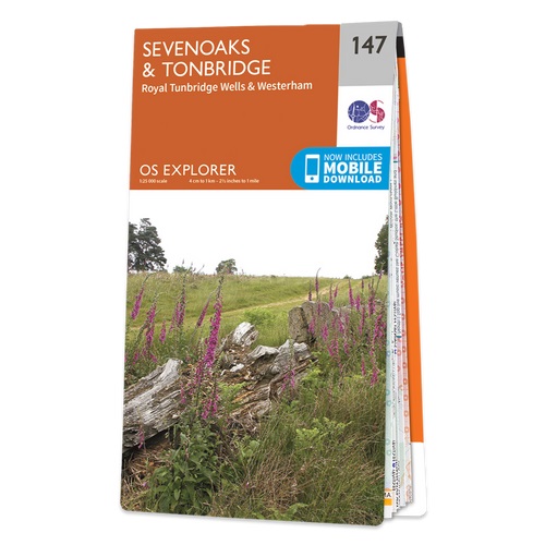
Met zijn 4cm voor 1 km (2 ½ cm voor 1 mijl) schaal, is de OS Explorer kaartenserie de ideale en meest gedetailleerde kaartenreeks voor mensen die graag outdoor-activiteiten zoals fietsen, wandelen, paardrijden, klimmen en watersporten. Deze kaart is nog gedetailleerder dan de 'gewone' Landranger maps. Voor- en achterzijde bedrukt! Zeker op de moors en andere natuurgebieden van onschatbare waarden met echt alle aspecten van het landschap op de kaart ingetekend. Zeer goede detailkaart met topografische ondergrond. Hierop zijn toeristische symbolen van bezienswaardigheden ingetekend, daarnaast staan bijvoorbeeld campings en jeugdherbergen vermeld en - voor wandelaars het belangrijkst - alle right of way paden en Lange afstands Wandelpaden zijn er op te vinden. De ideale kaart voor het wandelen in Engeland, Wales of Schotland. These highly detailed maps show all the administrative boundaries, settlements as small as isolated farms, the road network down to unfenced roads and country tracks, and field boundaries (hedges and drystone walls) which make navigation across the countryside much easier. Steep gradients on roads are indicated. Various landmarks, e.g. powerlines, archaeological sites, windmills, churches and lighthouses are shown and additional graphics indicate natural terrain features such as cliffs, scree, mud and vegetation variations. The contour interval is 5 metres in the lower parts of the country and 10 metres in the uplands, and spot heights are marked. Each map covers an area of 30 x 20km (i.e. approx. 19 x 12 miles), with some double-sided maps covering more, as indicated in the individual descriptions. The maps are fully GPS compatible, with the National Grid shown at 1km intervals and latitude and longitude indicated by margin ticks at 1'. The Explorer series has replaced the earlier, green-cover Pathfinder maps. The Explorer series is now complete and covers all of England, Wales & Scotland. Some sheets for popular areas like the National Parks are still branded as Outdoor Leisure (OL) maps, but are now included in this series as the cartography is the same as that in the Explorer Maps. The Explorer maps offer a substantial improvement on the Pathfinder series, with greater use of colour, larger area per map, and stronger emphasis on information for ramblers and tourists. This series is ideal for walking and other outdoor pursuits and each map shows a large amount of information for ramblers and tourists. Public rights of way are shown (except in Scotland), together with other routes with public access: National Trails and Recreational Paths, permitted paths and bridleways, and selected cycle routes. Open access land created under the Countryside and Rights of Way Act 2000 is marked. Tourist information includes caravan and camp sites, Park & Ride locations, recreation/leisure/sport centres, museums, historic buildings, English Heritage and National Trust sites, rural pubs, etc. The map legend is in English only, except for the tourist information content which is also in French and German Locations ,Ash cum Ridley,Bidborough, Biggin Hill, Borough Green, Brasted, Bromley, Bromley Common and Keston, Cage Green, Castle, Chelsfield and Goddington, Chelsham and Farleigh, Chevening, Chiddingstone, Crofton, Culverden, Darwin, Dormans, Dunton Green, East Grinstead North, Edenbridge, Eynsford, Farnborough, Farningham, Hadlow, Halstead, Knockholt and Badgers Mount, Higham, Hildenborough, Ightham, Judd, Kemsing, Knockholt, Leigh, Limpsfield, Lingfield and Dormansland, Medway, Otford, Otford Kemsing, Oxted South, Pantiles, Park, Pembury, Penshurst, Platt, Plaxtol, Royal Tunbridge Wells, Rusthall, Sevenoaks, Sevenoaks Weald and Underriver, Sherwood, Shipbourne, Shoreham, Southborough, Speldhurst, Speldhurst and Bidborough, St. James, St. Johns, St. Marks, Stansted, Sundridge, Tatsfield, Titsey, Tonbridge, Tonbridge and Malling, Trench, Vauxhall, West Kingsdown, Westerham, Wrotham, North Downs Way, Eden Valley walk, E2, Medway, Eden, Bough Beech Reservoir, Kent Downs, High Weald, Surrey Hills, Kent, Middlesex, ,
€19,50
Bekijk product
Met zijn 4cm voor 1 km (2 ½ cm voor 1 mijl) schaal, is de OS Explorer kaartenserie de ideale en meest gedetailleerde kaartenreeks voor mensen die graag outdoor-activiteiten zoals fietsen, wandelen, paardrijden, klimmen en watersporten. Deze kaart is nog gedetailleerder dan de 'gewone' Landranger maps. Voor- en achterzijde bedrukt! Zeker op de moors en andere natuurgebieden van onschatbare waarden met echt alle aspecten van het landschap op de kaart ingetekend. Zeer goede detailkaart met topografische ondergrond. Hierop zijn toeristische symbolen van bezienswaardigheden ingetekend, daarnaast staan bijvoorbeeld campings en jeugdherbergen vermeld en - voor wandelaars het belangrijkst - alle right of way paden en Lange afstands Wandelpaden zijn er op te vinden. De ideale kaart voor het wandelen in Engeland, Wales of Schotland. These highly detailed maps show all the administrative boundaries, settlements as small as isolated farms, the road network down to unfenced roads and country tracks, and field boundaries (hedges and drystone walls) which make navigation across the countryside much easier. Steep gradients on roads are indicated. Various landmarks, e.g. powerlines, archaeological sites, windmills, churches and lighthouses are shown and additional graphics indicate natural terrain features such as cliffs, scree, mud and vegetation variations. The contour interval is 5 metres in the lower parts of the country and 10 metres in the uplands, and spot heights are marked. Each map covers an area of 30 x 20km (i.e. approx. 19 x 12 miles), with some double-sided maps covering more, as indicated in the individual descriptions. The maps are fully GPS compatible, with the National Grid shown at 1km intervals and latitude and longitude indicated by margin ticks at 1'. The Explorer series has replaced the earlier, green-cover Pathfinder maps. The Explorer series is now complete and covers all of England, Wales & Scotland. Some sheets for popular areas like the National Parks are still branded as Outdoor Leisure (OL) maps, but are now included in this series as the cartography is the same as that in the Explorer Maps. The Explorer maps offer a substantial improvement on the Pathfinder series, with greater use of colour, larger area per map, and stronger emphasis on information for ramblers and tourists. This series is ideal for walking and other outdoor pursuits and each map shows a large amount of information for ramblers and tourists. Public rights of way are shown (except in Scotland), together with other routes with public access: National Trails and Recreational Paths, permitted paths and bridleways, and selected cycle routes. Open access land created under the Countryside and Rights of Way Act 2000 is marked. Tourist information includes caravan and camp sites, Park & Ride locations, recreation/leisure/sport centres, museums, historic buildings, English Heritage and National Trust sites, rural pubs, etc. The map legend is in English only, except for the tourist information content which is also in French and German
€19,50
Bekijk product
Met zijn 4cm voor 1 km (2 ½ cm voor 1 mijl) schaal, is de OS Outdoor Leisure kaartenserie de ideale en meest gedetailleerde kaartenreeks voor mensen die graag outdoor-activiteiten zoals fietsen, wandelen, paardrijden, klimmen en watersporten. Deze kaart is nog gedetailleerder dan de 'gewone' Landranger maps. Voor- en achterzijde bedrukt! Zeker op de moors en andere natuurgebieden van onschatbare waarden met echt alle aspecten van het landschap op de kaart ingetekend. Zeer goede detailkaart met topografische ondergrond. Hierop zijn toeristische symbolen van bezienswaardigheden ingetekend, daarnaast staan bijvoorbeeld campings en jeugdherbergen vermeld en - voor wandelaars het belangrijkst - alle right of way paden en Lange afstands Wandelpaden zijn er op te vinden. De ideale kaart voor het wandelen in Engeland, Wales of Schotland. Map sheet number OL 58 covers Braemar, Tomintoul and Glen Avon. Highlights include Beinn a' Bhuird and Meikle Geal Charn. Also includes Monadh Fergie, Big Garvoun and Culardoch. This map replaces the previous OS Explorer map 404 for this area These highly detailed maps show all the administrative boundaries, settlements as small as isolated farms, the road network down to unfenced roads and country tracks, and field boundaries (hedges and drystone walls) which make navigation across the countryside much easier. Steep gradients on roads are indicated. Various landmarks, e.g. powerlines, archaeological sites, windmills, churches and lighthouses are shown and additional graphics indicate natural terrain features such as cliffs, scree, mud and vegetation variations. The contour interval is 5 metres in the lower parts of the country and 10 metres in the uplands, and spot heights are marked. Each map covers an area of 30 x 20km (i.e. approx. 19 x 12 miles), with some double-sided maps covering more, as indicated in the individual descriptions. The maps are fully GPS compatible, with the National Grid shown at 1km intervals and latitude and longitude indicated by margin ticks at 1'. This series is ideal for walking and other outdoor pursuits and each map shows a large amount of information for ramblers and tourists. Public rights of way are shown (except in Scotland), together with other routes with public access: National Trails and Recreational Paths, permitted paths and bridleways, and selected cycle routes. Open access land created under the Countryside and Rights of Way Act 2000 is marked. Tourist information includes caravan and camp sites, Park & Ride locations, recreation/leisure/sport centres, museums, historic buildings, English Heritage and National Trust sites, rural pubs, etc. The map legend is in English only, except for the tourist information content which is also in French and German
€19,50
Bekijk product
Met zijn 4cm voor 1 km (2 ½ cm voor 1 mijl) schaal, is de OS Explorer kaartenserie de ideale en meest gedetailleerde kaartenreeks voor mensen die graag outdoor-activiteiten zoals fietsen, wandelen, paardrijden, klimmen en watersporten. Deze kaart is nog gedetailleerder dan de 'gewone' Landranger maps. Voor- en achterzijde bedrukt! Zeker op de moors en andere natuurgebieden van onschatbare waarden met echt alle aspecten van het landschap op de kaart ingetekend. Zeer goede detailkaart met topografische ondergrond. Hierop zijn toeristische symbolen van bezienswaardigheden ingetekend, daarnaast staan bijvoorbeeld campings en jeugdherbergen vermeld en - voor wandelaars het belangrijkst - alle right of way paden en Lange afstands Wandelpaden zijn er op te vinden. De ideale kaart voor het wandelen in Engeland, Wales of Schotland. These highly detailed maps show all the administrative boundaries, settlements as small as isolated farms, the road network down to unfenced roads and country tracks, and field boundaries (hedges and drystone walls) which make navigation across the countryside much easier. Steep gradients on roads are indicated. Various landmarks, e.g. powerlines, archaeological sites, windmills, churches and lighthouses are shown and additional graphics indicate natural terrain features such as cliffs, scree, mud and vegetation variations. The contour interval is 5 metres in the lower parts of the country and 10 metres in the uplands, and spot heights are marked. Each map covers an area of 30 x 20km (i.e. approx. 19 x 12 miles), with some double-sided maps covering more, as indicated in the individual descriptions. The maps are fully GPS compatible, with the National Grid shown at 1km intervals and latitude and longitude indicated by margin ticks at 1'. The Explorer series has replaced the earlier, green-cover Pathfinder maps. The Explorer series is now complete and covers all of England, Wales & Scotland. Some sheets for popular areas like the National Parks are still branded as Outdoor Leisure (OL) maps, but are now included in this series as the cartography is the same as that in the Explorer Maps. The Explorer maps offer a substantial improvement on the Pathfinder series, with greater use of colour, larger area per map, and stronger emphasis on information for ramblers and tourists. This series is ideal for walking and other outdoor pursuits and each map shows a large amount of information for ramblers and tourists. Public rights of way are shown (except in Scotland), together with other routes with public access: National Trails and Recreational Paths, permitted paths and bridleways, and selected cycle routes. Open access land created under the Countryside and Rights of Way Act 2000 is marked. Tourist information includes caravan and camp sites, Park & Ride locations, recreation/leisure/sport centres, museums, historic buildings, English Heritage and National Trust sites, rural pubs, etc. The map legend is in English only, except for the tourist information content which is also in French and German
€19,50
Bekijk product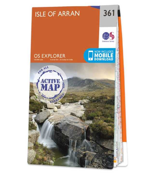
Met zijn 4cm voor 1 km (2 ½ cm voor 1 mijl) schaal, is de OS Explorer kaartenserie de ideale en meest gedetailleerde kaartenreeks voor mensen die graag outdoor-activiteiten zoals fietsen, wandelen, paardrijden, klimmen en watersporten. Deze kaart is nog gedetailleerder dan de 'gewone' Landranger maps. Voor- en achterzijde bedrukt! Zeker op de moors en andere natuurgebieden van onschatbare waarden met echt alle aspecten van het landschap op de kaart ingetekend. Zeer goede detailkaart met topografische ondergrond. Hierop zijn toeristische symbolen van bezienswaardigheden ingetekend, daarnaast staan bijvoorbeeld campings en jeugdherbergen vermeld en - voor wandelaars het belangrijkst - alle right of way paden en Lange afstands Wandelpaden zijn er op te vinden. De ideale kaart voor het wandelen in Engeland, Wales of Schotland. Experience ‘Scotland in miniature’ on the Isle of Arran, with its rocky, wild highlands in the north and lush lowlands in the south. Climb Goat Fell, the highest point on the Isle of Arran, for spectacular panoramic views or explore the mysterious standing stones on Machrie Moor. Take the Arran Coastal Way to discover the King’s Cave in the sandstone cliffs and the beaches of Blackwaterfoot Visit Brodick Castle, with its subline views across to the Ayrshire coast, or take a boat to Holy Isle with its ancient spiritual heritage and unspoiled beauty Walk, hike or cycle along the Arran Coastal Path, climb jagged summits and rocky ridges and glimpse red squirrels, red deer, golden eagles and otters OS Explorer Active Maps: 1:25 000 scale (4 cm to 1 km – 2½ inches to 1 mile). Laminated with a weatherproof finish, also suitable for dry-wipe pens. Great for walkers, hikers, cyclists, families, dog walkers, and horse riders. Includes roads, rights of way, permissive paths and bridleways, plus essential visitor information. Free digital download included. Other Ordnance Survey Explorer maps of Kintyre include Kintyre South map 356 and Kintyre North map 357
€25,96
Bekijk product
Zeer gedetailleerde topografische kaart van een deel van Belgie. Deze kaart is bijzonder geschikt voor wandeltochten, bijvoorbeeld in het heuvelachtige gebied van de Ardennen. Wel moet u bedenken dat op deze kaarten wandelroutes als zodanig niet staan ingetekend. Voorzien van alle topografische details als hoogtelijnen, waterlopen, bosgebieden, paden en brandgangen. Hoogtelijnen maken het mogelijk de moeilijkheidsgraad van een wandeling in te schatten. Belangrijke oriëntatiepunten, zoals solitaire bomen, kapelletjes, hoogspanningslijnen, en vele andere, zijn ingetekend. De kaarten zijn voorzien van een gradenoverzicht en UTM grid en daardoor dus te gebruiken voor GPS tochten. Elk kaartblad bedekt een gebied van 160 km2. In grensgebieden zijn de gebieden buiten België in zwart/wit met minder detail uitgevoerd. Op het bijgevoegde overzicht kun u zien waar deze kaart gelegen is: eerst zoekt u het hoofdcijfer waarna de 2 laatste cijfers de daadwerkelijke positie weergeeft. De kaart met het hoofdcijfer is ingedeeld in 4 delen: 1-2 (noordwest), 3-4 (noordoost), 5-6 (zuidwest)en 7-8 (zuidoost).
€10,95
Bekijk product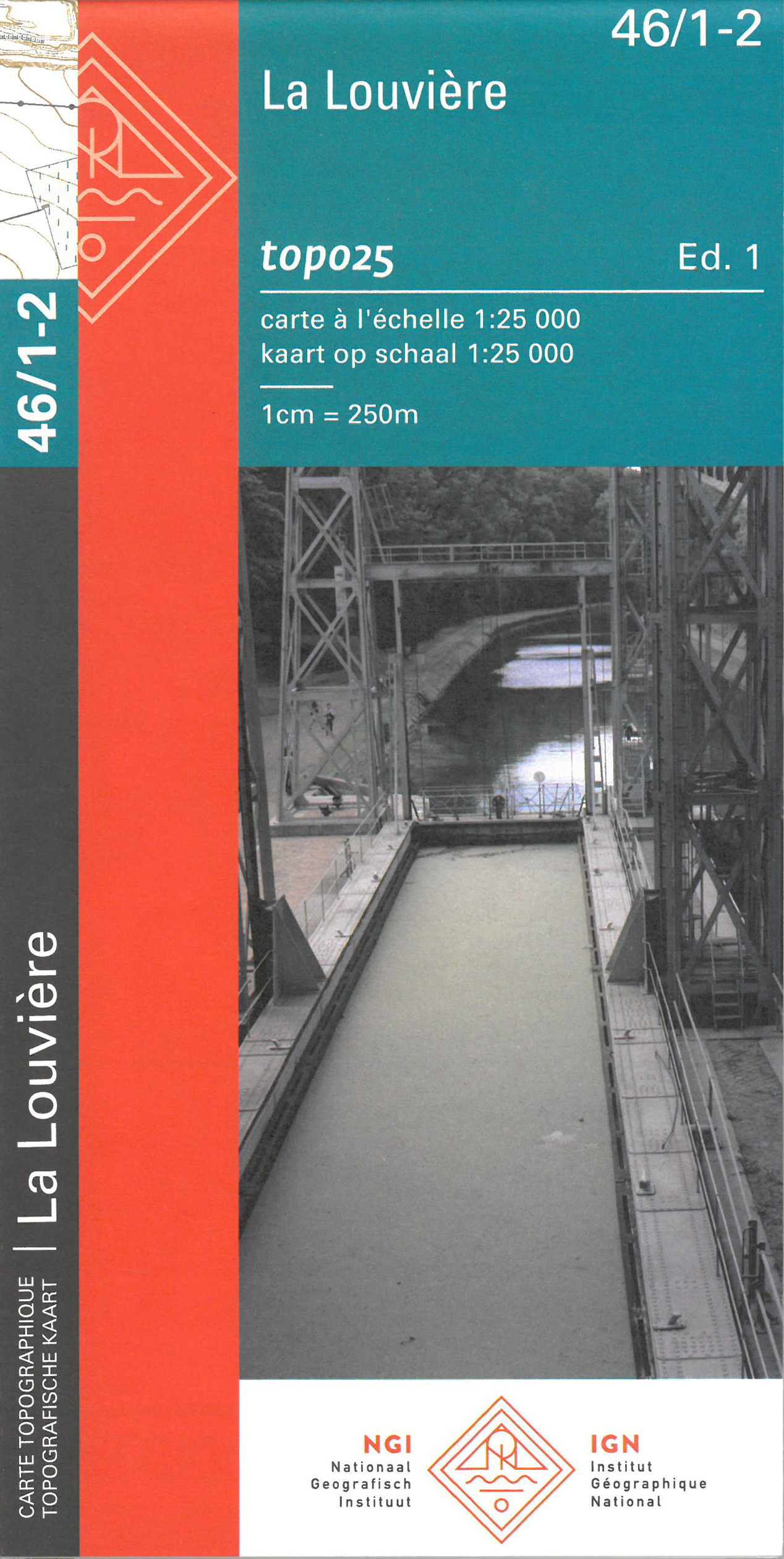
Zeer gedetailleerde topografische kaart van een deel van Belgie. Deze kaart is bijzonder geschikt voor wandeltochten, bijvoorbeeld in het heuvelachtige gebied van de Ardennen. Wel moet u bedenken dat op deze kaarten wandelroutes als zodanig niet staan ingetekend. Voorzien van alle topografische details als hoogtelijnen, waterlopen, bosgebieden, paden en brandgangen. Hoogtelijnen maken het mogelijk de moeilijkheidsgraad van een wandeling in te schatten. Belangrijke oriëntatiepunten, zoals solitaire bomen, kapelletjes, hoogspanningslijnen, en vele andere, zijn ingetekend. De kaarten zijn voorzien van een gradenoverzicht en UTM grid en daardoor dus te gebruiken voor GPS tochten. Elk kaartblad bedekt een gebied van 160 km2. In grensgebieden zijn de gebieden buiten België in zwart/wit met minder detail uitgevoerd. Op het bijgevoegde overzicht kun u zien waar deze kaart gelegen is: eerst zoekt u het hoofdcijfer waarna de 2 laatste cijfers de daadwerkelijke positie weergeeft. De kaart met het hoofdcijfer is ingedeeld in 4 delen: 1-2 (noordwest), 3-4 (noordoost), 5-6 (zuidwest)en 7-8 (zuidoost).
€8,95
Bekijk product
Topografische kaart van een deel van Belgie, zie overzicht voor de juiste lokatie. Veel details met alle noodzakelijke informatie als hoogtelijnen, helder kleurgebruik voor onderscheid in bos, agrarische gebied, heide etc. Met grid, dus GPS toepasbaar. Het is een zuiver topografische kaart, de bewandelbare paden staan wel met lijntjes ingetekend, maar zijn niet met kleur als zodanig aangeduid. Voor de geoefende kaartlezer zal het geen probleem zijn, maar de 'gewone' wandelaar' vereist het enige oefening of een andere kaart (al zijn die van een groot deel van Belgie niet beschikbaar)
€10,95
Bekijk product
Geplastificeerde versie Met zijn 4cm voor 1 km (2 ½ cm voor 1 mijl) schaal, is de OS Explorer kaartenserie de ideale en meest gedetailleerde kaartenreeks voor mensen die graag outdoor-activiteiten zoals fietsen, wandelen, paardrijden, klimmen en watersporten. Deze kaart is nog gedetailleerder dan de 'gewone' Landranger maps. Voor- en achterzijde bedrukt! Zeker op de moors en andere natuurgebieden van onschatbare waarden met echt alle aspecten van het landschap op de kaart ingetekend. Zeer goede detailkaart met topografische ondergrond. Hierop zijn toeristische symbolen van bezienswaardigheden ingetekend, daarnaast staan bijvoorbeeld campings en jeugdherbergen vermeld en - voor wandelaars het belangrijkst - alle right of way paden en Lange afstands Wandelpaden zijn er op te vinden. De ideale kaart voor het wandelen in Engeland, Wales of Schotland. The area covered is home to popular destinations such as: The Lake District National Park Derwent Water Skiddaw Great Gable Catbells The Cumbrian Way Cockermouth Keswick Buttermere Admire the views of Derwent Water from the top of Catbells near Keswick. If you’re more energetically inclined. For a bigger challenge, standing at 3,054 ft above sea level, Skiddaw provides an easy in-road to mountain climbing, for occasional walkers looking to push their boundaries. The OS Explorer Active map range are Ordnance Survey's most detailed maps. Laminated with a weatherproof finish, also suitable for dry-wipe pens. 1:25 000 scale: 4cm on the map = 1km on the ground. They are ideal for outdoor activities like walking, horse riding and off-road cycling. They show roads and rights of way, permissive paths and bridleways, plus essential visitor information. Free digital version included.
€25,95
Bekijk product
Topografische kaart van een deel van Belgie, zie overzicht voor de juiste lokatie. Veel details met alle noodzakelijke informatie als hoogtelijnen, helder kleurgebruik voor onderscheid in bos, agrarische gebied, heide etc. Met grid, dus GPS toepasbaar. Het is een zuiver topografische kaart, de bewandelbare paden staan wel met lijntjes ingetekend, maar zijn niet met kleur als zodanig aangeduid. Voor de geoefende kaartlezer zal het geen probleem zijn, maar de 'gewone' wandelaar' vereist het einge oefening of een andere kaart (al zijn die van een groot deel van Belgie niet beschikbaar)
€10,95
Bekijk product