
Beantwoord enkele vragen, en binnen seconden geeft AI je een persoonlijk aankoopadvies op maat.
Beantwoord enkele vragen, en binnen seconden geeft AI je een persoonlijk aankoopadvies op maat.

Prachtige geplastificeerde kaart van het bekende nationaal park. Met alle recreatieve voorzieningen als campsites, maar ook met topografische details en wandelroutes ed. Door uitgekiend kleurgebruik zeer prettig in gebruik. Scheur en watervast! Completely revised and expanded our Colorado National Monument Trails Illustrated map details the high use recreation areas throughout Colorado's Grand Valley surrounding the towns of: Grand Junction, Fruita, Palisade, and Loma. This popular region features some of the State's most acclaimed mountain biking, hiking and ATV trails including the start of the renowned Kokepelli Trail, which extends down to Moab, UT. Like all National Geographic Trails Illustrated maps, Colorado National Monument is printed on durable waterproof-tear-resistant material which is designed to stand up to whatever conditions you encounter on the trail. Coverage Highlights: • Black Ridge Canyons Wilderness • Little Book Cliffs WSA • James E. Robb – Colorado River State Parks • Colorado River Access Points • Westwater, Cisco and Loma Raft Floats • Grand Valley Mountain Bike Trails • Kokopelli's Trail • Rattlesnake Arches • OHV Staging Areas and Trails • Bangs Canyon, North Fruita, and East Desert Special Recreation Management Areas • Diamond Dinosaur Prehistoric Highway
€16,95
Bekijk product
Prachtige geplastificeerde kaart van het bekende nationaal park. Met alle recreatieve voorzieningen als campsites, maar ook met topografische details en wandelroutes ed. Door uitgekiend kleurgebruik zeer prettig in gebruik. Scheur en watervast! This Trails Illustrated topographic map for Dinosaur National Monument, which straddles the state lines of northwest Colorado and northeast Utah, is the perfect recreational map for this stunning monument. Within its craggy hills, you can discover pieces of a long ago world where the largest land creatures of all time once roamed and died. The map includes the entire national monument area, with detailed trails and topographic information. Included are the Lodore Nature Trail, The Green River, Yampa River, Jenny Lind Rock, Harpers Corner Nature Trail, Rainbow Park, Dinosaur Quarry, the Green Riuver Campground, and much more. The map is full of detailed trail information, park information, history and culture, geology, and natural history.
€16,95
Bekijk product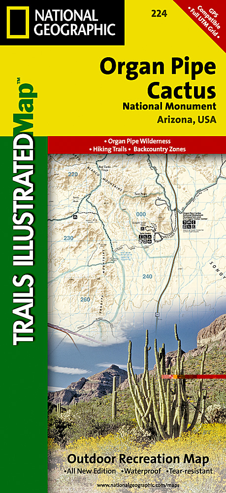
Prachtige geplastificeerde kaart van het nationaal park. Met alle recreatieve voorzieningen als campsites, maar ook met topografische details en wandelroutes ed. Door uitgekiend kleurgebruik zeer prettig in gebruik. Scheur en watervast! This Trails Illustrated topographic map for Organ Pipe Cactus National Monument, straddling southern Arizona, and northern Sonora, Mexico, is the perfect recreational map for this beautiful Sonoran desert wilderness. The map includes the entire Organ Pipe Cactus national monument area, with detailed topographic information. Included on the map are the Ajo Range, the Ajo Mountain Drive, Arch Canyon, Bates Mountains, Cipriano Hills, the Puerto Blanco Mountains, and much more. Includes UTM grids for use with your GPS unit.
€16,95
Bekijk product
Prachtige geplastificeerde kaart van het nationaal park. Met alle recreatieve voorzieningen als campsites, maar ook met topografische details en wandelroutes ed. Door uitgekiend kleurgebruik zeer prettig in gebruik. Scheur en watervast! This Trails Illustrated topographic map for Everglades National Park and surrounding area is the perfect map for hiking, boating, paddling, biking, fishing, exploring, camping, and sightseeing in this unique national treasure. This two-sided map includes the Key Largo, Everglades City, Chokoloskee, Everglades National Park, portions of Big Cypress National Preserve, Fakahatchee Strand State Preserve, Cape Romano Ten Thousand Islands Aquatic Preserve, Shark Valley Tram Road, Old Ingraham highway and campsite, North Nest Key, West Lake Canoe Trail, Snake Bight Trail, backcountry campsites, beach sites, ground sites, and chickees, and detailed insets of Flamingo, Whitewater Bay, Pineland Trails of the Long Pine Key area, and Nine Mile Pond. The map also shows the entire Wilderness Waterway, from the Gulf Coast Visitor Center near Everglades City to its terminus beyond the Flamingo Visitor Center. Includes UTM grids for use with your GPS unit.
€16,95
Bekijk product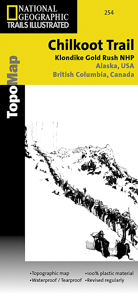
Prachtige geplastificeerde kaart van het nationaal park. Met alle recreatieve voorzieningen als campsites, maar ook met topografische details en wandelroutes ed. Door uitgekiend kleurgebruik zeer prettig in gebruik. Scheur en watervast! National Geographic's Trails Illustrated map for Chilkoot Trail in Klondike Gold Rush National Historic Park in the Alaskan panhandle is perfect for hiking, camping, and wildlife viewing in this scenic, rugged frontier. Created in partnership with local land management agencies, this expertly researched map features key areas of interest including Chilkoot Trail National Historic Site; portions of the Klondike Highway; Happy Camp; Taiya Inlet; the town of Skagway; Klondike Gold Rush National Historical Park; Skagway River; Dyea; and Deep, Bennett, Crater, Long, and Lindeman lakes. The print map includes insets of historic routes to the Klondike gold fields, Historic Dyea, and Skagway Historic District with some of the prominent gold rush-era buildings noted. There is a great deal of helpful material about traveling in the area, customs, permits and fees, safety tips, agency contact information, a suggested equipment list, and more. A trail profile of Chilkoot Trail is included as well. A table of featured hiking trails showing distance, approximate hiking time, elevation gain, difficulty, and features will help you choose a path that's right for you. The map base includes contour lines, shaded relief, and elevations for summits, passes and many lakes. Recreation features are clearly marked, including campgrounds, public use cabins, cross country ski and snowshoeing areas, interpretive areas, and scenic viewpoints. Every Trails Illustrated map is printed on "Backcountry Tough" waterproof, tear-resistant paper. A full UTM grid is printed on the map to aid with GPS navigation. Other features found on this map include: Klondike Gold Rush National Historical Park, Mount Foster, Tongass National Forest.
€16,95
Bekijk product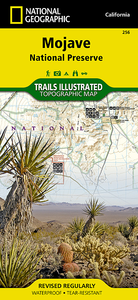
Prachtige geplastificeerde kaart van het nationaal park. Met alle recreatieve voorzieningen als campsites, maar ook met topografische details en wandelroutes ed. Door uitgekiend kleurgebruik zeer prettig in gebruik. Scheur en watervast! This beautiful waterproof and tear-resistant map of the Mojave National Preserve is useful for all types of recreational activities. Trails are classified by use - hiking, horse and hike, mountain bike, shared use, or motorized - and includes a trail chart showing trail name, location, and allowed use.
€17,95
Bekijk product
Prachtige geplastificeerde kaart van het nationaal park. Met alle recreatieve voorzieningen als campsites, maar ook met topografische details en wandelroutes ed. Door uitgekiend kleurgebruik zeer prettig in gebruik. Scheur en watervast! Coverage of the Old Faithful area of Yellowstone National Park includes Heart Lake BMA, Pitchstone Plateau, Bechler Ranger Station, South Entrance, Teton Wilderness, John D. Rockefeller Jr Memorial Parkway, Jedediah Smith Wilderness, Winegar Hole Wilderness, Bechler Canyon, Cascade Corner, Firehole BMA, Shoshone Lake, Western half of Yellowstone Lake. Includes UTM grids for use with your GPS unit.
€14,95
Bekijk product
Prachtige geplastificeerde kaart van het nationaal park. Met alle recreatieve voorzieningen als campsites, maar ook met topografische details en wandelroutes ed. Door uitgekiend kleurgebruik zeer prettig in gebruik. Scheur en watervast! Coverage of the Tuolomne Meadows and Hoover Wilderness area of Yosemite National Park includes Ansel Adams Wilderness, Yosemite Wilderness, Mono Basin National Forest Scenic Area, Monroe Hall Research Natural Area, Humbolt - Toiyabe National Forest, Twin Lakes. Includes UTM grids for use with your GPS unit.
€14,95
Bekijk product
Prachtige geplastificeerde kaart van het nationaal park. Met alle recreatieve voorzieningen als campsites, maar ook met topografische details en wandelroutes ed. Door uitgekiend kleurgebruik zeer prettig in gebruik. Scheur en watervast! This sectional map of Canyonlands National Park zooms in on the Island in the Sky District in the northern area of the park. This map provides more detail of this area than the full Canyonlands National Park map with an enhanced scale. The map includes trail and backcountry road charts, backcountry zones and campsites, trail and road mileages, as well as backcountry permit and regulations information.
€14,95
Bekijk product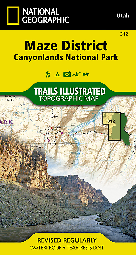
Prachtige geplastificeerde kaart van het bekende nationaal park. Met alle recreatieve voorzieningen als campsites, maar ook met topografische details en wandelroutes ed. Door uitgekiend kleurgebruik zeer prettig in gebruik. Scheur en watervast! This sectional map of Canyonlands National Park zooms in on the Maze District in the western area of the park. This map provides more detail of this area than the full Canyonlands National Park map with an enhanced scale. The map includes trail and backcountry road charts, backcountry zones and campsites, trail and road mileages, as well as backcountry permit and regulations information.
€14,95
Bekijk product