
Beantwoord enkele vragen, en binnen seconden geeft AI je een persoonlijk aankoopadvies op maat.
Beantwoord enkele vragen, en binnen seconden geeft AI je een persoonlijk aankoopadvies op maat.
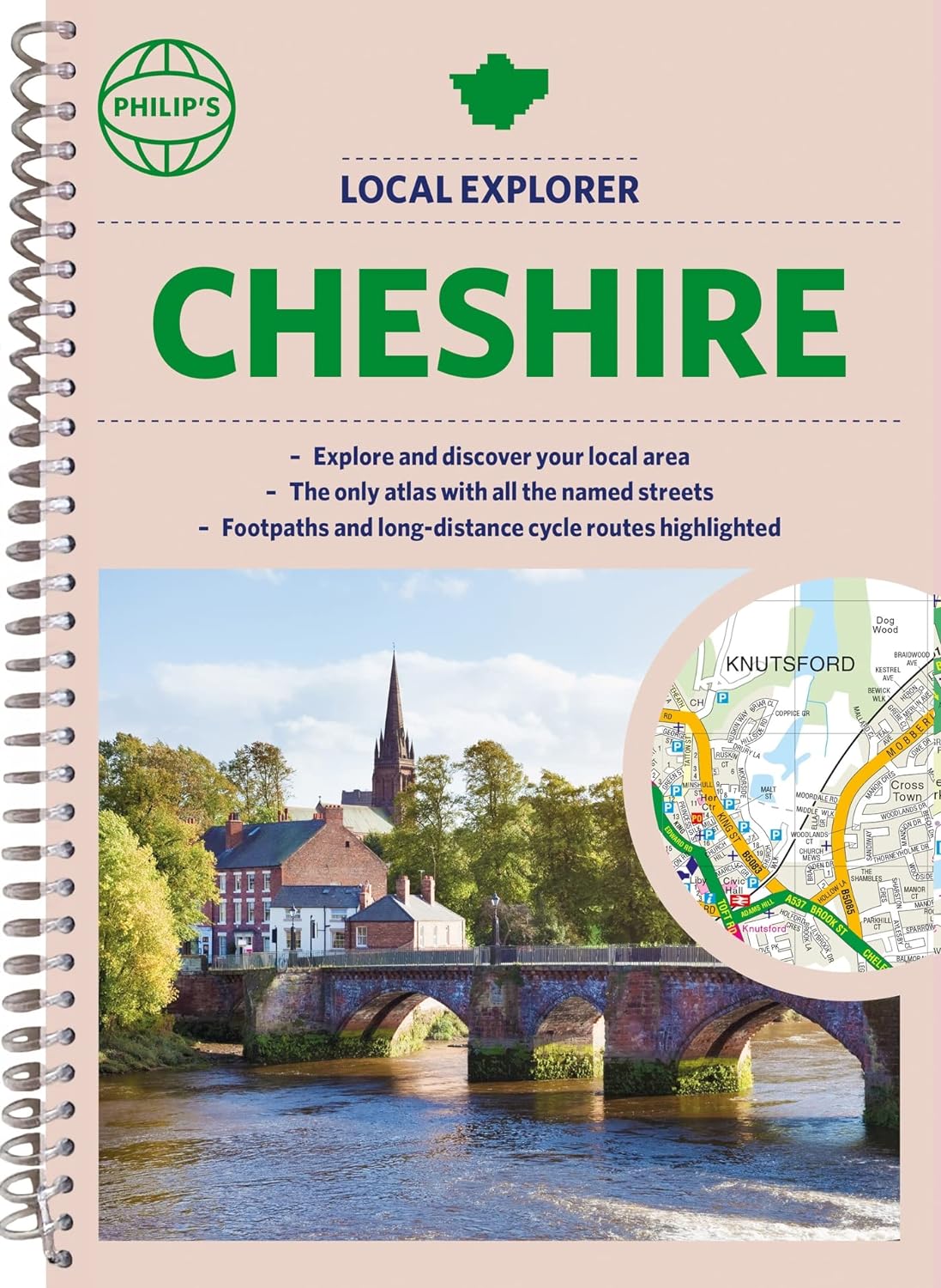
Who hasn't explored and enjoyed their surrounding area recently and come to appreciate what is on our respective doorsteps? Philip's have created this new series for walkers, cyclists and local explorers at a scale that provides greener options to uncover all the nature and hidden gems in your local area. The detailed scale allows explorers, walkers and cyclists to avoid main roads and select pathways, bridleways and lanes for optimum enjoyment. Whether it's meandering through the local parks or historic houses, exploring neighbourhood nature spots or the local town, we have the clear mapping and information you need. If you do have to travel to reach areas you'd like to explore, all A and B roads are clearly shown on our Route Planner and we include all the large-scale town and city plans. Exceptional detail allows the user to pinpoint exactly where they need to go and the best route to follow. · The only atlas with every road, street and lane in the county named, along with the best pedestrian routes, long-distance cycle routes. · Highlighting lanes, alleyways, footpaths and bridleways, camping and caravan sites, golf courses, parks, gardens and many, many other places of interest · Contains all the usual one-way streets, barriers, car parks, railway and bus stations, hospitals, colleges and schools, police and fire stations, places of worship, post offices, shopping and leisure centres
€23,95
Bekijk product
National Geographic's Road Atlas: Scenic Drives Edition, is the ideal companion for the next time you hit the road for an unforgettable road trip. Includes up-to-date road maps for all 50 U.S. States, plus Canada, Mexico, and Puerto Rico. Major cities and metropolitan areas are shown in detail with inset maps that include popular attractions, infrastructure and points-of-interest. Setting this atlas apart from all others is the inclusion of selection of 20 carefully researched scenic drives to help you plan the road trip of a lifetime. A map and guide section is also included for the 20 most popular National Parks. Take the guesswork out of traveling and trip planning with a comprehensive index, mileage charts, and cross-referenced pages. The Road Atlas: Scenic Drives Edition is printed in North America and it is a convenient letter-size format that fits comfortably into glove compartments or car side door pockets.
€17,95
Bekijk product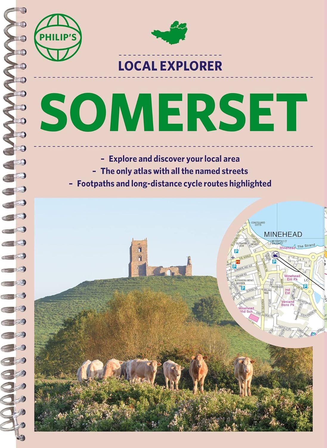
Prachtige wegenatlas van Somerset voor fietsers en wandelaars op een super gedetaileerde schaal! Met Lange afstandsfietsroutes en wandelroutes. Who hasn't explored and enjoyed their surrounding area recently and come to appreciate what is on our respective doorsteps? Philip's have created this new series for walkers, cyclists and local explorers at a scale that provides greener options to uncover all the nature and hidden gems in your local area. The detailed scale allows explorers, walkers and cyclists to avoid main roads and select pathways, bridleways and lanes for optimum enjoyment. Whether it's meandering through the local parks or historic houses, exploring neighbourhood nature spots or the local town, we have the clear mapping and information you need. If you do have to travel to reach areas you'd like to explore, all A and B roads are clearly shown on our Route Planner and we include all the large-scale town and city plans. Exceptional detail allows the user to pinpoint exactly where they need to go and the best route to follow. · The only atlas with every road, street and lane in the county named, along with the best pedestrian routes, long-distance cycle routes. · Highlighting lanes, alleyways, footpaths and bridleways, camping and caravan sites, golf courses, parks, gardens and many, many other places of interest · Contains all the usual one-way streets, barriers, car parks, railway and bus stations, hospitals, colleges and schools, police and fire stations, places of worship, post offices, shopping and leisure centres
€23,95
Bekijk product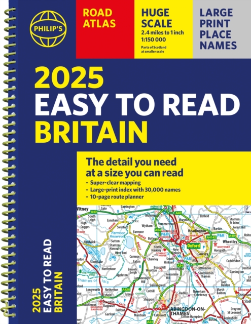
"The detail you need at a size you can read". The latest 2025 Philip's Easy to Read Road Atlas of Britain from the best-selling Road Atlas range has over 350 pages packed with exceptionally clear mapping and everything you need for exploring Britain. Practical A4-size with lie-flat spiral binding, it will enhance any journey. · Clear maps packed with extra details for a better journey · Huge 1:150,000 scale (approx 2.4 miles to 1 inch) · Large print place names · Large print index · Super-clear 10-page route planner to create the best journeys · Thousands of attractions clearly mapped, including castles, theme parks, gardens, zoos and more. · Lie-flat spiral binding for easy use and planning At last, a road atlas that everyone can read easily, in or out of the car, no matter what the conditions. With up-to-date mapping technology, your travels have never been easier to plan. This edition contains a wealth of useful information, including tourist attractions, to ensure the best possible journey. Whether it's getting dark, or if you just can't find your glasses, the 2025 Philip's Easy to Read Road Atlas of Britain is the ultimate road companion.
€27,50
Bekijk product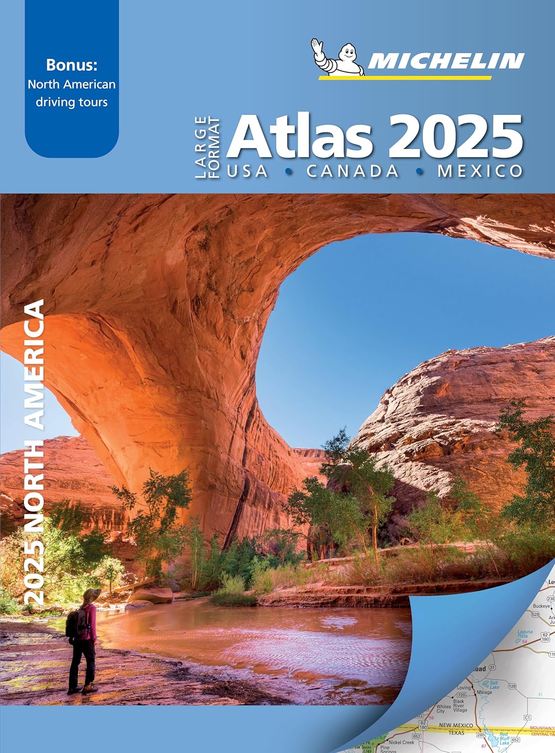
De beroemde wegenatlas van Rand McNally nu als Michelin atlas op groot formaat, bijna dubbel A4. Elke staat een eigen, of soms zelfs twee pagina's. Uitgebreid register. Zoals de Amerikanen zelf zeggen: America's number 1 Road Atlas! Canada en Mexico staan er zeer beperkt in. Highlighting 51 road trips and scenic drives the Michelin's updated Large Format North America Road Atlas 2025 helps you enjoy the planning and the journey. Large-format maps and larger lettering for towns and sites (compared to the midsize atlas) make for easier reading while the tiled format flows maps from page to page—the ideal complement to GPS and online directions. Four jam-packed pages highlight selected US and Canadian national parks, with points of interest, hikes and drives. Covers US, Canada & Mexico. Large grid map to quickly locate atlas pages. Easy-read text and mapping. Map pages are 36% larger than midsize atlas. Inspired ideas for outdoor fun and road trip adventures in the US and Canada with four jam-packed pages highlighting selected national and provincial parks. Michelin's renowned travel guides are the resource for points of interest, hikes and scenic drives. Tiled atlas format: user-friendly, convenient and logical to use, offering continuity when driving and providing the big picture to round out GPS and online directions. Detailed place name index to quickly pinpoint destinations and sights. 50+ large-scale city maps for navigating in and around cities. Distance chart for major US and Canadian cities, as well as convenient city-to-city mini distance chart on each two-page map spread, for more effective trip planning. Tire tips to improve consumer driving safety.
€19,95
Bekijk product
Handzame A5 wegenatlas van Engeland, Wales, Schotland en Ierland met register en stadsplattegronden This easy-to-use, handy A5 sized road atlas with popular lie-flat spiral binding features extremely clear route planning maps of Britain and Ireland and fits neatly into your glove box or bag. The maps of Britain are at 10 miles to 1 inch (1:625,000) and the whole of Ireland is covered at 15.8 miles to 1 inch (1:1,000,000). There are also a selection of more detailed urban area maps at 4.5 miles to 1 inch (1:285,000) to aid route planning in these busy areas. Main features: Road maps that focus on the main roads, motorways and settlementsMore detailed maps of London, Manchester, Merseyside and West MidlandsPark & Ride locations (for bus and rail)Handy distance calculator chart highlighting distances between the major towns
€9,95
Bekijk product
Neben der detaillierten Autokarte 1:150.000 bietet der Große Reise-Atlas Österreich eigene Karten für die Gebiete um München, Brünn, Bozen, Budweis und das Drautal. Diese erweiterte Ausgabe beschreibt zudem 100 sehenswerte Freizeitziele, bietet ein Verzeichnis aller Camping- und Stellplätze und gibt Kurzinfos zu 14 Radrouten, darunter etwa den Donau-Radweg und Tauernradweg. Auto- und Freizeitkarte Österreich 1:150.000 Camping & Stellplätze 100 Freizeitziele Radwege Planungskarte Österreich Autokarte Europa 1:3,5 Mio. Ortsregister Citypläne der Landeshauptstädte Deutsch / Englisch
€29,50
Bekijk product
Wegenatlas op prima schaal, geschikt voor automobilisten, maar bij gebrek aan beter ook voor fietsers! Er staat veel informatie op ingetekend. Met inleidende tekst en register. Der MARCO POLO Reiseatlas zeichnet sich durch moderne Kartographie aus und bildet Polen im optimalen Maßstab 1:300 000 ab. Mit Highlights aus Kultur und Natur und landschaftlich schönen Strecken wird dein Roadtrip damit zum echten Erlebnis. Länder- und Reiseinformationen bewahren dich vor dem Knöllchen, und das praktischen Zoom-System bietet von der Europakarte bis zum Stadtplan immer das richtige Kartendetail, sowohl für die Planung als auch während der Fahrt. Blattübersichtskarte zum Ausklappen, Fernfahrtenkarte mit Kartenübersicht und Marco-Polo-Highlight-Sternen, Kartenübersicht mit Verwaltungsgliederung, Erläuterung des Zoomsystems (4-farbiges Leitsystem), Marco-Polo-Highlights, Mehrsprachige Legende (PL, D, GB, F, I, P, E, NL, CZ, SK, H, DK), Kartenteil Europa im Maßstab 1 : 4 500 000, Hauptkarten im Maßstab 1 : 300 000, Tabelle der Entfernungen und Fahrzeiten, 6 Transitkarten 1 : 100 000: - Gliwice - Katowice - Kraków - Lódz - Warszawa - Wroclaw 17 Citypläne 1:20 000 mit mehrsprachiger Legende: - Bialystok - Bielsko-Biala - Czesochowa - Gdansk - Gliwice - Jelenia Góra - Katowice - Kraków - Lódz - Lublin - Olsztyn - Poznan - Szczcin - Tarnów - Torun - Warszawa - Wroclaw Reiseinformationen/ Verkehrsinformationen/ Liste der UNESCO Welterbestätten Polens/ Ortsnamenverzeichnis mit Postleitzahl, Woiwodschaft und Suchfeldangabe. Fully updated and now with ZOOM system for even better orientation! Unique spiral binding with wrap-around spine. High quality cartography with distance indicators and scale converters to aid route planning.
€16,95
Bekijk product
Deze atlas omvat tien landen in zuidelijk Afrika en is speciaal gericht op reizigers die zelf rijden. De betrokken landen zijn: Angola, Botswana, Lesotho, Malawi, Mozambique, Namibië, Zuid-Afrika, Swaziland, Zambia en Zimbabwe. De Atlas bevat 223 kaartpagina's met hetzelfde vertrouwde kaartdetail waarvoor Tracks4Africa bekend is. De wegenatlas is afgedrukt in A3 formaat, weegt 2750g, heeft een stevige omslag, spiraal gebonden en de pagina's zijn afgedrukt op dik papier. Bigger coverage than ever before: 1:4m maps for Southern and Eastern Africa – ideal for macro planning. 1:1m maps for Southern Africa, covering the following countries: Angola, Botswana, eSwatini, Lesotho, Malawi, Mozambique, Namibia, South Africa, Zambia and Zimbabwe. 1:500k maps for South Africa, Malawi, most part of Zambia and the area around Moremi/Chobe in Botswana. Road coverage: This Atlas is designed for overland travel and compiled from the same data used on our famous GPS maps. Use it for trip planning or on the road as a companion for your GPS navigation system. The detailed road network covers 518 350km. All major and secondary routes feature distances and travel times (1m and 500k maps only). Each country page features a table with the times and distances between major towns. Vital information needed for planning an extended self-drive trip: Per country information includes legal requirements for your vehicle, road conditions, traffic rules, signals used by locals as well as general tips such as fuel availability. Comprehensive information of what you need to transit borders. Featuring 127 border posts with opening times. Valuable information while on the road: This Atlas is jam-packed with as much detail as possible on protected areas, major and minor attractions, places to stay and activities. You can also see which services like fuel, bank/ATM, shopping, restaurant, hospital, police or auto repair are available in each town. The Atlas features 223 map pages with the same trusted map detail for which Tracks4Africa is renowned. Map features include: Map scales include 1:4000 000, 1:1000 000; 1:500 000 518 350km of off-road tracks and major roads. Distance and travel time between towns. Essential facilities available in towns. Camping and lodging. Tourist attractions. All border crossings, with opening times. All international airports, with IATA/ICAO codes. Protected areas. The first section of the Atlas includes valuable travel information about each of the ten countries. The information about border crossings and top tourist attractions will help you to be well-prepared for your trip and the sections on driving conditions will assist you while on the road.
€79,95
Bekijk product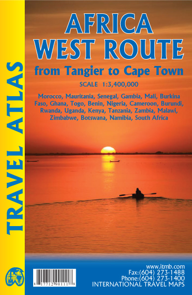
Handzame wegenatlas, formaat A5, van de hele route van Tanger naar Kaapstad langs de westelijke kant van Afrika. Naast de wegenkaarten bevat deze atlas ook een aantal centrumkaarten van de belangrijkste steden die je onderweg tegenkomt. There are three routes one can follow on an overland expedition from Europe to Cape Town (or the reverse). Last year, ITMB published the eastern route, via Cairo and Sudan to Ethiopia and Kenya. This year, we are pleased to announce the publication of a more practical route to follow, via Tangier, Morocco, Mauritania, Senegal, Mali and Ghana, through the Congo to Uganda, and then south over a variety of options to Namibia and South Africa. The advantage of this route is that it avoids the conflict-ridden countries closest to infection from the extremist Islam movement. It also avoids the current difficulties of the central route through Algeria (the Hoggar route) and Niger. We do have to caution that all routes through Africa contain risks. Routes are not well-developed and are subject to disruption; also, by the nature of extremist Islam, those countries with a sizeable Muslim population tend to be under threat, although at this time the route should be considered safer than the other two routes. Having used this route myself many years ago, I can attest to its attractiveness. Crossing the Sahara is challenging, due to shifting sand dunes, but the new coastal highway through Morocco and Mauritania makes reaching Senegal much easier than previously. Crossing the Congo also remains a challenge, due to poor infrastructure, but once one reaches Uganda several options are available for southward travel. As we focused on the eastern routes in our first volume (Africa Overland), in this volume we provide more westerly routes. We have chosen to ignore Angola for now, due to lack of knowledge of travel conditions in that country, but we know of no reason for travellers to avoid that country. In addition to providing route maps through all the countries involved (shown on the back cover of the book), 43 full-page maps of cities along the route are included, such as Casablanca, Nouakchott, Banjul, Bobo Diolasso, Lome, Douala, Kigali, Abuja, Livingstone and other cities never before included in a travel atlas of Africa. Legend Includes: Roads by classification, UNESCO World Heritage, National Parks, Hotels, Point of interest, Airports, Tourist information, Hospitals, Shopping centre, Lake, River, Golf course, museums, and much more.
€16,50
Bekijk product