
Beantwoord enkele vragen, en binnen seconden geeft AI je een persoonlijk aankoopadvies op maat.
Beantwoord enkele vragen, en binnen seconden geeft AI je een persoonlijk aankoopadvies op maat.
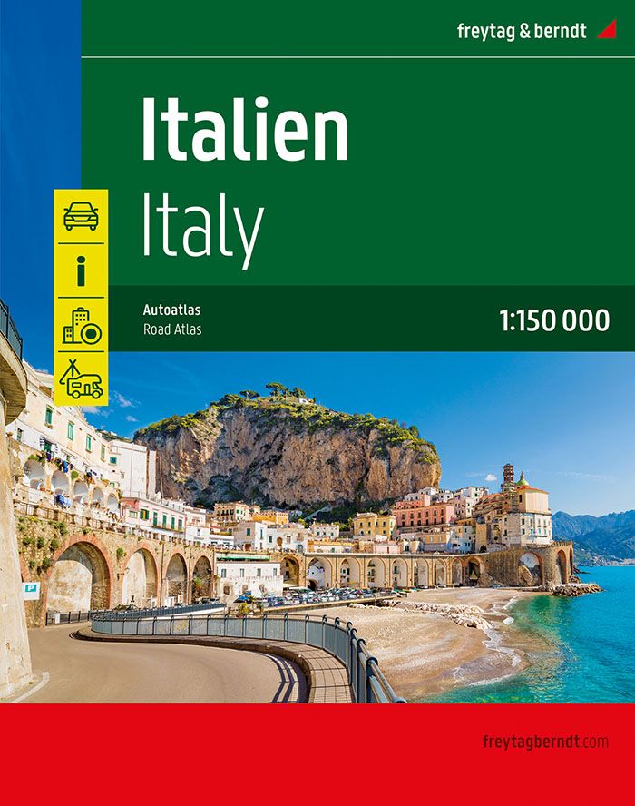
De kaarten van Freytag in een dikke atlas op A4 formaat met ringband. Groot register achterin, 24 stadsplattegronden. Heel Italië in 1:150.000 ! Zeer gedetaileerd kaartwerk met allerlei symbolen voor toeristische bezienswaardigheden. De berijdbare wegen zijn goed weergeven, zowel de hoofdwegen als provinciale en lokale wegen; wegnummers worden vermeld. Afstanden tussen plaatsen zijn in kilometers op de kaart ingetekend, daarnaast worden ook op belangrijke plekken benzinepompen gemarkeerd. In het kaartbeeld wordt door middel van schaduw het reliëf weergegeven en soms enkele punten in het landschap met de daadwerkelijke hoogte. Provinciegrenzen zijn goed terug te vinden, nationale parken en reservaten ook. Met allerhande symbolen worden toeristische bezienswaardigheden weergegeven als monumenten, historisch belangrijke plekken en uitzichtpunten. In bepaalde plaatsen zijn hotels en campings te vinden, luchthavens, treinverbindingen en havens vindt u er ook op! Neben der übersichtlichen Gestaltung verfügt der Große Autoatlas Italien über zahlreiche Zusatzinformationen wie z.B. Straßenbeschaffenheit, Sehenswürdigkeiten und diverse Stadtpläne. Ein extra Kapitel beschäftigt sich außerdem mit allen Campingplätzen und Stellplätzen Italiens. Mit dem umfangreichen Ortsregister gelingt zudem eine rasche Orientierung. Details: Touristische Informationen, Ortsregister mit Postleitzahlen, Campingplatz, Wohnwagen Stellplatz, Citypläne von Ancona, Aosta, Bari, Bologna, Bozen, Cágliari, Campobasso, Catanzaro, Florenz, Genua, L’Aquila, Meran, Mailand, Neapel, Palermo, Perúgia, Potenza, Rom, Turin, Trento, Triest, Venedig, Vatikan, San Marino, Straßenverzeichnis
€37,95
Bekijk product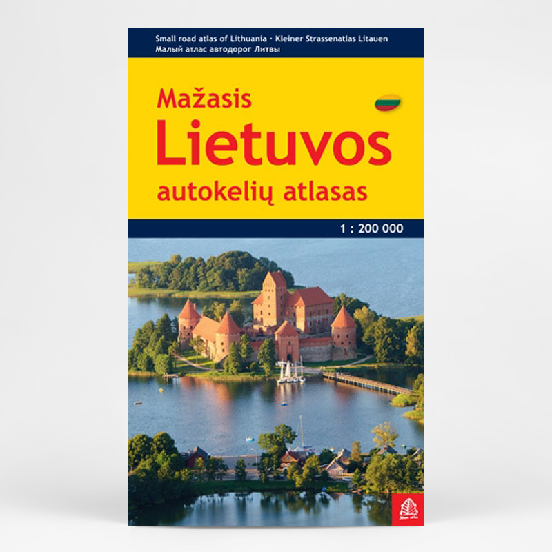
Lithuania Road Atlas from the Riga based Jana Seta, in handy glovebox paperback format with street plans of 19 towns, including an enlargement for city centre of Vilnius, The whole country is covered at 1:200,000, showing detailed classification of road network with petrol stations, and railway lines with stops. Boundaries of national parks and other protected areas are marked and a range of symbols indicate tourist accommodations, campsites, various places of interest, etc. Picturesque towns and villages are highlighted. Colouring and graphics show forested areas and swamps and the atlas also shows the country’s administrative divisions. Latitude lines are at intervals of 5’ intervals and longitude at 10’. The atlas has an extensive index of localities. The atlas also includes street plans of 19 towns at 1:20,000 or 1:25,000, annotated with places of interest and various facilities. For Vilnius the atlas has a plan of its central districts, plus a road map of the surrounding area highlighting main traffic routes to the centre. Also included is road a map of the eastern Baltic Sea region, physical, administrative and route planning maps of Lithuania, general information for drivers and a distance table. *Map legend, conveniently placed on a flap of the cover, includes English.* * The same atlas is also available in a larger, A4 format with street plans of 57 towns.
€24,50
Bekijk product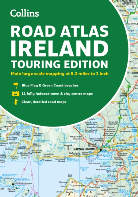
Explore Ireland with this accurate and fully updated road atlas. This road atlas is at A4 size, covering the whole of Ireland and features clear and detailed Collins colour mapping at a scale of 5.2 miles to 1 inch. Perfect for both residents and visitorstouring Ireland. This revised edition includes: Places of tourist interestContact information for Tourist Information Centres with grid references to the mappingFully indexed street maps of 11 cities and towns - Dublin, Belfast, Cork, Limerick, Waterford,Londonderry (Derry), Galway, Bangor, Dun Laoghaire, Drogheda and KillarneyBlue Flag & Green Coast beachesFerry and airport information; Distance chart; Distances marked on the roads in miles and kilometresRoute planning map of the whole of Ireland at 15.8 miles to 1 inchAdministrative map of Irish counties and districts.
€9,95
Bekijk product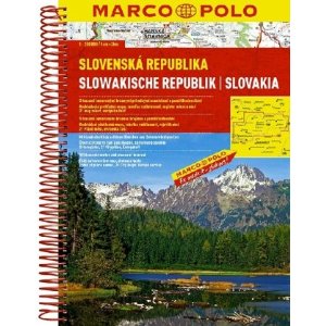
Wegenatlas op goede schaal met register / in spiraalbinding Mit landschaftlich schönen Strecken und Sehenswürdigkeiten, Übersichtskarte zum Ausklappen, Entfernungstabelle, Ortsregister, Citypläne, Europateil, Fernstraßenkarte, länderspezifische Verkehrsregelung, Spiralbindung. -Maßstab 1:200.000 -Übersichtskarte zum Ausklappen --7 MARCO POLO mark-it-sticker -Landschaftlich schöne Strecken und Sehenswürdigkeiten -Format 22,5 x 29,5 cm
€10,95
Bekijk product
Handzame gedetailleerde wegenatlas van Schotland. Navigate your way around Scotland with this detailed, full-colour and easy-to-use A-Z Road Atlas. From the border to the north coast, the mainland pages scale is 3.5 miles to 1 inch and the Western Isles, Shetland Islands and Orkney Islands scale is 4.5 miles to 1 inch. Covering the entire country, this road atlas includes the following features: • Motorways with full junction detail, primary routes and destinations, A & B roads, under construction and proposed roads, service areas, tolls, mileages, national, county and unitary authority boundaries • Cairngorms and Loch Lomond & The Trossachs National Park boundaries • Selected places of interest and tourist information centres 20 city and town street maps are included for Aberdeen, Aviemore, Ayr, Dumfries, Dundee, Dunfermline, Edinburgh, Glasgow, Falkirk, Fort William, Hamilton, Inverness, Kilmarnock, Kirkcaldy, Motherwell, Oban, Paisley, Perth, St Andrews and Stirling. Also included is a comprehensive index to cities, towns, villages, hamlets and locations. Also included are 20 city and town plans for: Aberdeen Aviemore Ayr Dumfries Dundee Dunfermline Edinburgh Glasgow Falkirk Fort William Hamilton Inverness Kilmarnock Kirkcaldy Motherwell Oban Paisley Perth St Andrews Stirling There is a comprehensive index to cities, towns, villages, hamlets and locations.
€13,50
Bekijk product
Goede wegenatlas van Munchen. Der ADAC StadtAtlas mit Farbleitsystem, CityPilot für die schnelle und unkomplizierte Anreise, topaktuelle, lückenlose Stadtplankartographie und Ausflugskarten mit allen wichtigen Informationen zu Verkehr und Freizeit. ADAC StadtAtlanten: Schnelle und einfache Orientierung! Die ADAC StadtAtlanten mit der praktischen Spiralbindung sind die handliche Alternative zum Stadtplan. Übersichtlich gegliedert zeigen diese StadtAtlanten bis zu 578 Städte und Gemeinden eines dargestellten Großraums im Maßstab 1:20.000; die Stadtzentren werden in diesem Produkt im Maßstab 1:10.000 dargestellt. Der Citypilot®, die Stadtdurchfahrtskarte im Maßstab 1:100.000 macht es möglich, dass man sein Zielgebiet schnell und problemlos findet # ohne aufwändiges Blättern! Eine Ausflugskarte im Maßstab 1:200.000 zeigt die zahlreichen touristischen Sehenswürdigkeiten in der Umgebung des abgebildeten Großraums. Sonderkarten sorgen schließlich für Informationen zu den lokalen Einrichtungen, wie Flughafen, Messe und öffentlicher Nahverkehr. Zusammen mit dem umfangreichen Straßenverzeichnis, den Postleitzahlen und den Kurzinformationen zu Städten und Gemeinden sind die ADAC StadtAtlanten wohl die zuverlässigsten Wegweiser, mit denen man gesuchten Ziele und Adressen schnell und zweifelsfrei auffindet.
€26,95
Bekijk product
Handige wegenatlas van Ierland en Noord-Ierland, schaal 1:200.000. Met 10 stadsplattegronden: Belfast, Cork, Londonderry, Dublin, Galway, Killarney, Kilkenny, Limerick, Sligo and Waterford. Created from brand new mapping data, this atlas includes AA inspected camping sites and AA listed golf courses, picnic sites, port plans and ferry routes. Plus, motorway strip maps detailing all of Ireland's motorway junctions. Toll motorways are clearly highlighted.There are 10 detailed city and town plans with street indexes: Belfast, Cork, Londonderry, Dublin, Galway, Killarney, Kilkenny, Limerick, Sligo and Waterford and an easy-to-read place name index, with top tourist sites highlighted.New district maps of Dublin and Belfast show the surrounding area in more detail.
€11,95
Bekijk product
De wegenatlas Slovenië bevat 109 gedetailleerde wegenkaarten op een schaal van 1: 75.000 met 11 centrum plattegronden, gemeenten, verkeersinformatie. Een legenda en de tabel van de afstanden tussen de grote steden in Slovenië. Op de kaarten, staan naaste de normale typeringen (wegcategorisering, kilometers, benzinestations, electro bottelen, indicatie van wegen ...) ook toeristische thema's (hotels, pensions, kuuroorden, berghutten, natuur en bezienswaardigheden, kerken, kastelen, musea, archeologische vindplaatsen ...). De kaarten zijn voorzien van geografische coördinaten zodat behulp van GPS en de index de zoektocht naar de dorpen en steden te vergemakkelijken. Kaarten van steden hebben ook een straatnamenindex. De Atlas heeft afmetingen van 20 x 30 cm en een paperback binding.
€25,95
Bekijk product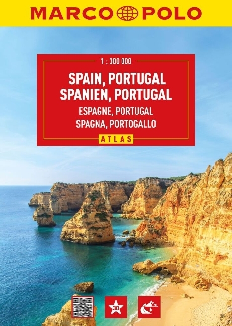
Gloednieuwe wegenatlas op prima schaal, geschikt voor automobilisten, maar bij gebrek aan beter ook voor fietsers! Er staat veel informatie op ingetekend. Met inleidende tekst en register. Mit landschaftlich schönen Strecken und Sehenswürdigkeiten, Übersichtskarte zum Ausklappen, Entfernungstabelle, Ortsregister, Citypläne, Europateil, Fernstraßenkarte, länderspezifische Verkehrsregelung, Spiralbindung. Der Kartenteil: Hauptkarte im Maßstab 1:300 000 mit mehrsprachiger Legende (D, GB, E, P, I, F, NL, PL, CZ, H, DK, S) Fernfahrtenkarte mit Kartenübersicht Kartenübersicht mit Verwaltungsgliederung 58 Citypläne 1:20 000 mit mehrsprachiger Legende: - Albacete - Alicante (Alacant) - Almería - Ávila - Badajoz 1:15 000 - Barcelona - Bilbao - Burgos - Cáceres 1:15 000 - Cádiz - Castellón de la Plana 1:15 000 - Ceuta - Ciudad Real - Córdoba - Cuenca - A Coruña - Donostia-San Sebastián 1:10 000 - Gijón - Girona - Granada - Guadalajara 1:15 000 - Huelva - Huesca - Jaén 1:15 000 - León 1:15 000 - Lisboa - Lleida 1:10 000 - Logroño - Lugo - Madrid - Málaga - Melilla - Mérida 1:15 000 - Murcia - Ourense (Orense) - Oviedo - Palencia - Palma de Mallorca - Las Palmas de Gran Canaria - Pamplona (Iruña) - Pontevedra 1:15 000 - Porto 1:10 000 - Salamanca - Santa Cruz de Teneriffe - Santander - Santiago de Compostela 1:15 000 - Segovia 1:15 000 - Sevilla - Soria 1:15 000 - Tarragona 1:15 000 - Teruel 1:10 000 - Toledo 1:10 000 - Valencia - Valladolid - Vigo - Vitoria-Gasteiz - Zamora - Zaragoza 9 Stadtumgebungskarten 1:150 000: - Barcelona - Bilbao - A Coruña - Lisboa - Madrid - Málaga - Oviedo - Sevilla - Valencia Europateil im Maßstab 1:4 500 000 Der Serviceteil: Tabelle der Entfernungen und Fahrzeiten Verkehrsinfos von Spanien, Portugal und Andorra Ortsnamenverzeichnis mit Postleitzahl, Provinz und Suchfeldangabe von Spanien und Portugal Ausgewählte Sehenswürdigkeiten, Landschafts- und Gewässernamen mit Suchfeldangabe
€19,95
Bekijk product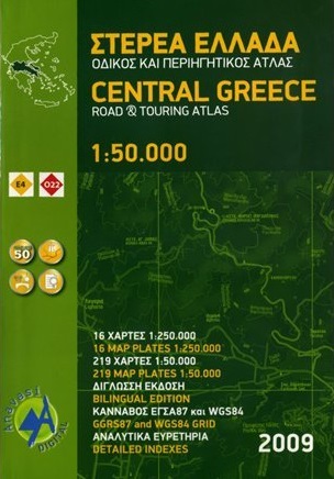
Gedetailleerde atlas van het centrale gedeelte van Griekenland, 16 bladzijdes met 1/250.000 en 219 blz. 1/50.000, hoogtelijnen ,tweetalig met grid GGR87 en WGS84 en een uitgebreid register. Zeer geschikt voor de wandelaar en de fietser ; de wandelroutes E4 en 022 staan ingetekend. Qua jaartal van uitgave een tikkie oud, maar op dit gedetailleerd nivo in Centraal Griekenland is nog nauwelijks wat veranderd. The map background includes all available cartographic information and allows accurate geographic reference for each topic: hiking, monuments, place names, geography. Geophysical relief, complete hydrography and place names. Greek, English and German Introduction. Legend in 4 languages (Greek, English, French, German). Bilingual edition: Greek and Latin letters on maps, indexes in Greek and latin characters in settlements, religious and archaeological monuments. Hardcover edition.
€26,95
Bekijk product