
Beantwoord enkele vragen, en binnen seconden geeft AI je een persoonlijk aankoopadvies op maat.
Beantwoord enkele vragen, en binnen seconden geeft AI je een persoonlijk aankoopadvies op maat.
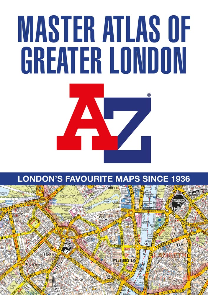
De ultieme stratengids van Londen en directe omgeving. Super gedetailleerd en alle straten staan er op, met een enorm register bovendien. The ultimate street atlas to navigate your way around London. A comprehensive paperback street atlas of London encompassing an area of 1450 square miles with coloured street mapping, and including more than 90,000 streets and other addresses. The coverage extends beyond the Greater London and M25 area to: Hemel Hempstead, St. Albans, Potters Bar, Waltham Cross, Epping, Brentwood, Thurrock, Stanford-le-Hope, Gravesend, Wrotham, Sevenoaks, Westerham, Oxted, Redhill, Reigate, Leatherhead, Great Bookham, Woking, Egham, Windsor, Slough, Chalfont St. Peter, Chorleywood, Bovingdon There are eighteen pages of large scale (9" to 1 mile) street mapping of central London which gives additional clarity and detail, this mapping extends to: Regent's Park, St. Pancras International Station, Old Street, Tower Bridge, Bricklayer's Arms Junction, Vauxhall Bridge, South Kensington, Paddington Station and Lord's Cricket Ground. Postcode districts and one-way streets are included on the street mapping. Other features include:* The Congestion Charging Zone (CCZ) boundary which is shown on both scales of mapping and an overview map of the zone is also included. * The Greater London Low Emission Zone boundary is shown on the street mapping and an overview map of the zone is also included. * The Ultra Low Emission Zone (ULEZ) boundary* There are eight pages of road mapping at 3 miles to 1 inch that cover much of the Home Counties area. * The London Underground map. * The London Rail Connections map. * West End Cinema and Theatre maps. The index section of the atlas lists streets, selected flats, walkways and places of interest, junction, place and area names; hospitals, hospices and NHS Walk-in Centres. Also included are National Rail stations, Croydon Tramlink stops, Docklands Light Railway stations, London Underground stations and River Boat stops covered by this atlas.
€29,95
Bekijk product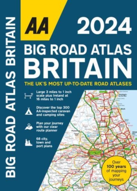
This best-selling A3 format atlas is available in two binding styles; paperback and spiral bound. Up-to-date mapping from the experts at the AA this atlas has large 3 miles to 1 inch scale including Ireland at 16 miles to 1 inch. Each page has been titled with its geographical location so you can turn to the page you need more easily. Wide minor roads (more than and less than 4m wide), National Trust, English and World Heritage sites, crematorium locations and other hard-to-find places are indicated on the mapping. 4 page clear route planner map. There are 68 city, town and port plans including central London and a list of tourist sites with satnav friendly post codes. Top 300 AA-Inspected caravan and camping sites listed and marked on map, over 1,800 golf courses, plus scenic routes and over 240 service areas.
€21,95
Bekijk product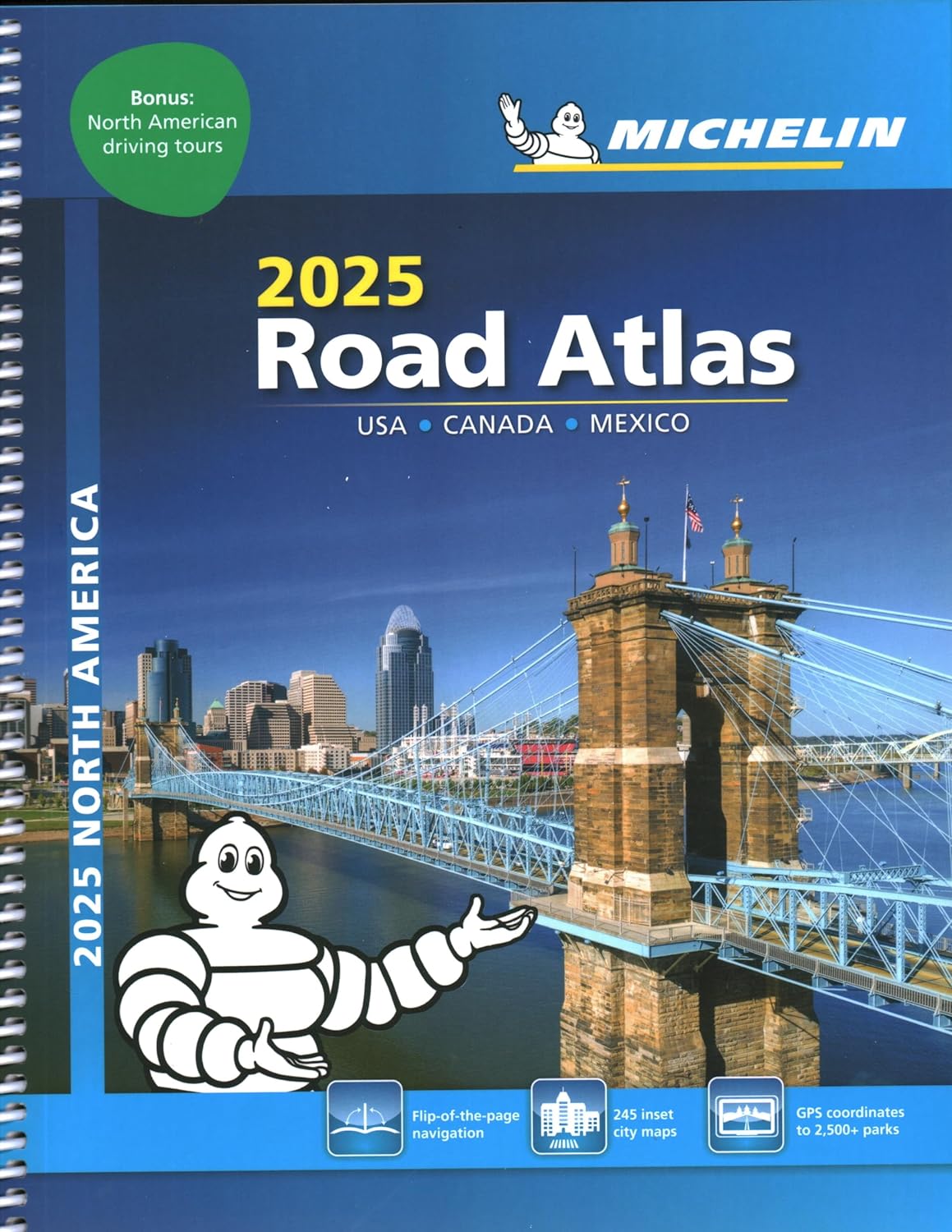
De beroemde wegenatlas van Rand McNally nu als Michelin atlas. Super handige atlas van Michelin in A4 formaat met stevige ringband. Let op: Canada en Mexico staan er zeer beperkt in. For inspiring road trips and scenic drives, Michelin's updated, spiral-bound North America Road Atlas 2024 suggests 52 routes. The tiled atlas, with its clear, accurate mapping, complements online navigation while its big picture and road details aid in advance planning and en route decisions. For outdoor fun and adventure, look for inspiration among the highlights from national and provincial parks, including the parks' GPS coordinates. Rely with confidence on Michelin's deluxe atlas to get you there. Covers USA, Canada and Mexico. Scale 1:625,000 - 1:9,018,000. Spiral bound for lay-flat convenience. More than 240 large-scale city maps for navigating in and around urban areas. Bonus Northeast Corridor maps provide extra detail between Boston and Washington DC for easier driving. Six-page travel inspiration section focusing on selected national and provincial parks in the US and Canada; points of interest, activities and suggested drives pulled from Michelin's famed travel guides. 1000+ travel center locations clearly indicated on atlas pages for convenient stops while en route. 12 full pages of GPS coordinates to US and Canadian national, state & provincial parks to help you directly plot your path to outdoor fun. Extensive 96-page place name index for rapid look-up. Layout of tiled atlas pages is user-friendly, offering continuity when driving, and logically complements online navigation systems. 100+ year history of mapmaking - recognized for accuracy and clarity. * More than 240 large-scale city maps for navigating urban areas. * Bonus Northeast Corridor maps provide extra detail between Boston and Washington DC for better navigation. * Extensive 96-page place name index for rapid look-up. * 100+ year history of mapmaking - recognized for accuracy and clarity.
€21,95
Bekijk product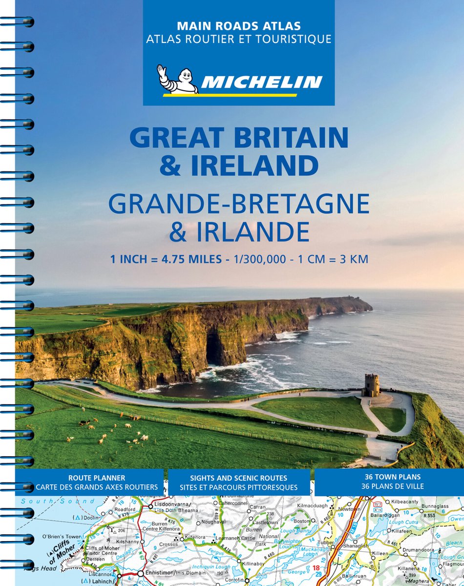
Zoals je mag verwachten van Michelin ook voor Engeland, Schotland en Ierland weer een handige atlas in ringband op A4 formaat. De kaarten zijn goed leesbaar, altijd een pluspunt bij Michelin! Full of practical features, the Michelin Great Britain & Ireland 2025 - Main Roads Atlas (A4-Spiral) is the perfect companion for your everyday journey and holiday planning. Updated every year, it gives you clear and accurate information for a safe and enjoyable journey thanks to a detailed mapping scale of 1/300 000. The route planner as well as the time and distance charts will help you plan and optimise your journey. Michelin's safety alerts warn you about dangerous driving areas, such as steep hills, level crossing as well as risk zone subject to tighter speed check. The Great Britain & Ireland 2025 - Main Roads Atlas (A4-Spiral) also shows tourist sights, leisure facilities, as well as scenic routes so that you can make the most of your journey. The Michelin Great Britain & Ireland 2025 - Main Roads Atlas (A4-Spiral) features: Detailed mapping with a scale 1/300 000 (4.75 miles to 1 inch) Mileage chart and journey times to help you plan your journey Key to Map Pages to quickly access your region of interest Practical street plan section for an easy navigation in urban areas: 52 town plans embedded in the mapping of their surrounding area. Easier navigation thanks to the location map featured on top of each page. An extensive place name index to easily identify the destination of your choice Comprehensive and detailed key to symbols used Fuel station and service areas Tourist information with place of interest and leisure facilities, as well as scenic routes, cross-referenced with the famous Michelin Green Guides, with towns underlined in green
€21,95
Bekijk product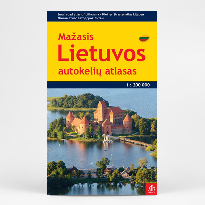
Lithuania Road Atlas from the Riga based Jana Seta, in handy glovebox paperback format with street plans of 19 towns, including an enlargement for city centre of Vilnius, The whole country is covered at 1:200,000, showing detailed classification of road network with petrol stations, and railway lines with stops. Boundaries of national parks and other protected areas are marked and a range of symbols indicate tourist accommodations, campsites, various places of interest, etc. Picturesque towns and villages are highlighted. Colouring and graphics show forested areas and swamps and the atlas also shows the country’s administrative divisions. Latitude lines are at intervals of 5’ intervals and longitude at 10’. The atlas has an extensive index of localities. The atlas also includes street plans of 19 towns at 1:20,000 or 1:25,000, annotated with places of interest and various facilities. For Vilnius the atlas has a plan of its central districts, plus a road map of the surrounding area highlighting main traffic routes to the centre. Also included is road a map of the eastern Baltic Sea region, physical, administrative and route planning maps of Lithuania, general information for drivers and a distance table. *Map legend, conveniently placed on a flap of the cover, includes English.* * The same atlas is also available in a larger, A4 format with street plans of 57 towns.
€24,50
Bekijk product
A full-colour, paperback road atlas of Great Britain, now fully revised and updated. Clear detailed road mapping at a scale of 3.5 miles to 1 inch. Presented in a large, easy to read A3 format. This essential road atlas includes the following; 11 pages of main route mapping covering Greater London, Birmingham and Manchester Mileage chart with average journey times Information on motorway junctions with limited interchanges 70 city and town centre street plans 16 port and airport plans Channel Tunnel terminus maps Map reference information also in French and German Also included is a full index to cities, towns, villages, hamlets, major destinations and selected places of interest with postcodes for sat-nav use. Instantly recognisable and easy to use, the road mapping has been specifically tailored for the smaller scale featuring: clear standard road classification colours for easy identification, motorway junction symbols, under construction and proposed roads, primary route destinations, service areas, National and county boundaries, and a wide range of tourist and ancillary information, including Blue Flag Beaches. The combination of map scale and large format gives a double-page driving range of 60 miles north to south and 80 miles east to west, making this publication the ideal motoring companion.
€18,95
Bekijk product
National Geographic's Road Atlas: Scenic Drives Edition, is the ideal companion for the next time you hit the road for an unforgettable road trip. Includes up-to-date road maps for all 50 U.S. States, plus Canada, Mexico, and Puerto Rico. Major cities and metropolitan areas are shown in detail with inset maps that include popular attractions, infrastructure and points-of-interest. Setting this atlas apart from all others is the inclusion of selection of 20 carefully researched scenic drives to help you plan the road trip of a lifetime. A map and guide section is also included for the 20 most popular National Parks. Take the guesswork out of traveling and trip planning with a comprehensive index, mileage charts, and cross-referenced pages. The Road Atlas: Scenic Drives Edition is printed in North America and it is a convenient letter-size format that fits comfortably into glove compartments or car side door pockets.
€17,95
Bekijk product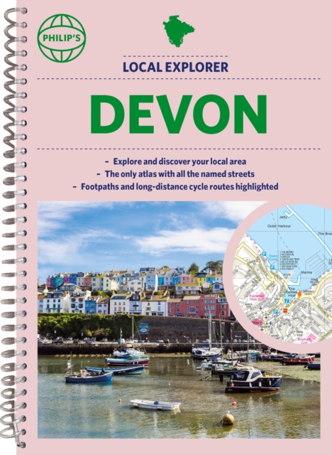
Prachtige wegenatlas van Devon voor fietsers en wandelaars op een super gedetaileerde schaal! Philip's created this new series for walkers, cyclists and local explorers at a scale that provides greener options to uncover all the nature and hidden gems in your local area. From Barnstaple to Totnes, we cover Devon in exceptional detail. Who hasn't explored and enjoyed their surrounding area in recent years and come to appreciate what is on our respective doorsteps? Includes all the 28,000 streets in BARNSTAPLE, EXETER, EXMOUTH, PAIGNTON, PLYMOUTH, TORQUAY, Appledore, Axminster, Bideford, Brixham, Buckfastleigh, Crediton, Dartmouth, Dawlish, Great Torrington, Honiton, Ilfracombe, Ivybridge, Kingsbridge, Newton Abbot, Okehampton, Salcombe, Seaton, Sidmouth, South Molton, Tavistock, Teignmouth, Tiverton, Totnes... and every town and village. The detailed scale allows explorers, walkers and cyclists to avoid main roads and select pathways, bridleways and lanes for optimum enjoyment. Whether it's meandering through the local parks or historic houses, exploring neighbourhood nature spots or the local town, we have the clear mapping and information you need. If you do have to travel to reach areas you'd like to explore, all A and B roads are clearly shown on our Route Planner and we include all the large-scale town and city plans. Exceptional detail allows the user to pinpoint exactly where they need to go and the best route to follow. · The only atlas with every road, street and lane in the county named, along with the best pedestrian routes, long-distance cycle routes. · Highlighting lanes, alleyways, footpaths and bridleways, camping and caravan sites, golf courses, parks, gardens and many, many other places of interest. · Contains all the usual one-way streets, barriers, car parks, railway and bus stations, hospitals, colleges and schools, police and fire stations, places of worship, post offices, shopping and leisure centres.
€23,95
Bekijk product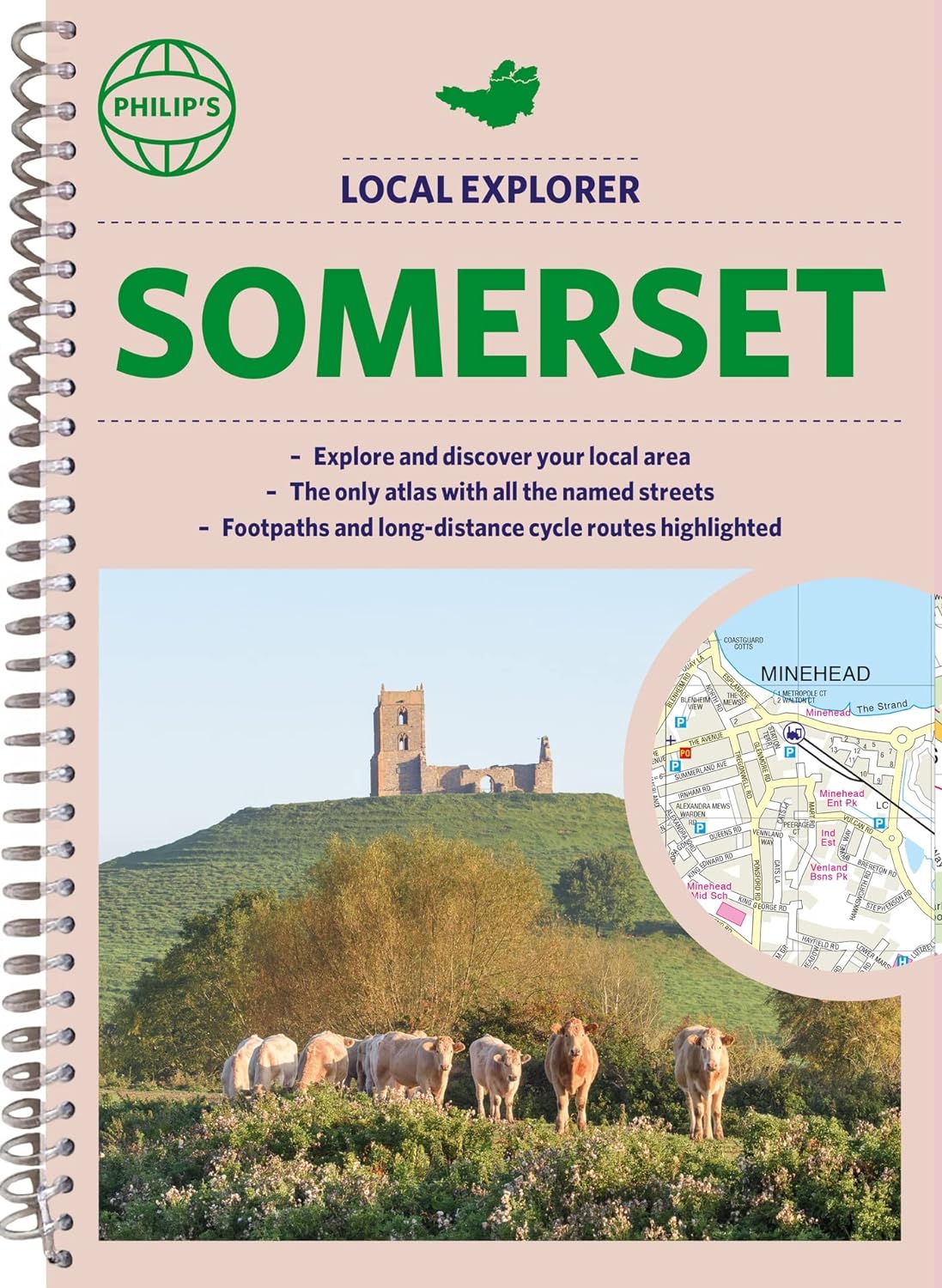
Prachtige wegenatlas van Somerset voor fietsers en wandelaars op een super gedetaileerde schaal! Met Lange afstandsfietsroutes en wandelroutes. Who hasn't explored and enjoyed their surrounding area recently and come to appreciate what is on our respective doorsteps? Philip's have created this new series for walkers, cyclists and local explorers at a scale that provides greener options to uncover all the nature and hidden gems in your local area. The detailed scale allows explorers, walkers and cyclists to avoid main roads and select pathways, bridleways and lanes for optimum enjoyment. Whether it's meandering through the local parks or historic houses, exploring neighbourhood nature spots or the local town, we have the clear mapping and information you need. If you do have to travel to reach areas you'd like to explore, all A and B roads are clearly shown on our Route Planner and we include all the large-scale town and city plans. Exceptional detail allows the user to pinpoint exactly where they need to go and the best route to follow. · The only atlas with every road, street and lane in the county named, along with the best pedestrian routes, long-distance cycle routes. · Highlighting lanes, alleyways, footpaths and bridleways, camping and caravan sites, golf courses, parks, gardens and many, many other places of interest · Contains all the usual one-way streets, barriers, car parks, railway and bus stations, hospitals, colleges and schools, police and fire stations, places of worship, post offices, shopping and leisure centres
€23,95
Bekijk product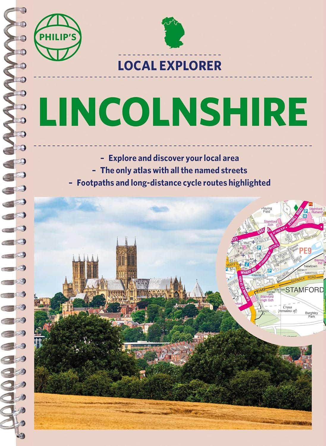
Who hasn't explored and enjoyed their surrounding area recently and come to appreciate what is on our respective doorsteps? Philip's have created this new series for walkers, cyclists and local explorers at a scale that provides greener options to uncover all the nature and hidden gems in your local area. The detailed scale allows explorers, walkers and cyclists to avoid main roads and select pathways, bridleways and lanes for optimum enjoyment. Whether it's meandering through the local parks or historic houses, exploring neighbourhood nature spots or the local town, we have the clear mapping and information you need. If you do have to travel to reach areas you'd like to explore, all A and B roads are clearly shown on our Route Planner and we include all the large-scale town and city plans. Exceptional detail allows the user to pinpoint exactly where they need to go and the best route to follow. · The only atlas with every road, street and lane in the county named, along with the best pedestrian routes, long-distance cycle routes. · Highlighting lanes, alleyways, footpaths and bridleways, camping and caravan sites, golf courses, parks, gardens and many, many other places of interest · Contains all the usual one-way streets, barriers, car parks, railway and bus stations, hospitals, colleges and schools, police and fire stations, places of worship, post offices, shopping and leisure centres
€23,95
Bekijk product