
Beantwoord enkele vragen, en binnen seconden geeft AI je een persoonlijk aankoopadvies op maat.
Beantwoord enkele vragen, en binnen seconden geeft AI je een persoonlijk aankoopadvies op maat.
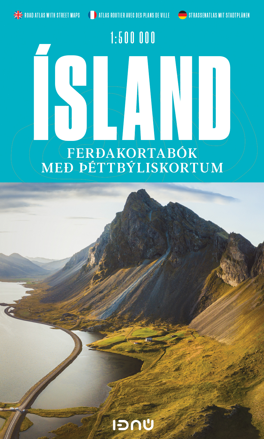
Super handige kleine wegenatlas van IJsland (schaal 1:500.000) met vooral een enorme hoeveelheid plattegronden van steden en dorpen, enkele themakaarten en een groot register. De kaarten zijn uitstekend leesbaar en de atlas in in een mooie ringband uitgevoerd. Road Atlas of Iceland at 1:500,000 from Ferðakort, published in a handy 15x25cm spiral-bound format, with an index of over 3,000 entries, a comprehensive distance table, 46 street plans including Reykjavik and several thematic map sincluding cultural heritage and geology. The whole of Iceland is covered at 1:500,000 with the road network distinguishing between paved and gravel roads, and showing which small local roads are maintained by the country’s government. Fords, locations of petrol stations, driving distances and car ferry routes are marked. National parks and other protected areas are highlighted and symbols mark locations of various places of interest: different types of tourist accommodations including campsites, refuges and emergency shelters, museums and cultural centres, sport and recreational facilities, local airfields, hydro-electric and thermal power stations, etc. The maps have relief shading with spot heights and plenty of names of various geographical features. Lava fields and glaciers are shown and hot springs are prominently marked. The maps have latitude and longitude lines at intervals of 20’ and 30’ respectively. Comprehensive index of over 3,000 place names includes geographical features such as mountain ranges, volcanoes, etc. The atlas includes street plans of 46 towns, highlighting places of interest and various facilities; Reykjavik is covered on 10 pages with an additional enlargement for the town centre. Also provided are a comprehensive distance table and several thematic maps: protected natural areas, historical heritage, orientation table for viewing the surrounding landscape, administrative divisions, radio reception areas, geology, and vegetation, etc. Map legend and all the text include English.
€30,95
Bekijk product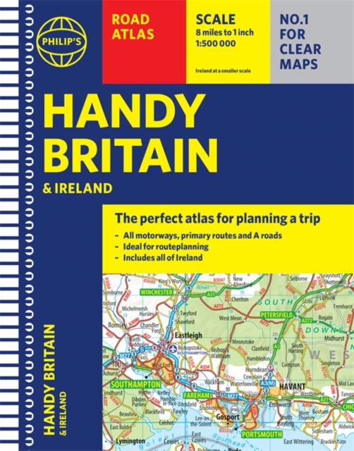
"The perfect atlas for planning a trip anywhere in the UK and Ireland"The essential handy road atlas for planning a trip in Britain and Ireland. Keep it in the glove box or your travel bag for quick and easy reference. This gem of a glove-box sized atlas has all the core information you need for driving around the British Isles. It includes all the motorways, primary roads and A Roads and they are clearly shown - ideal for route planning. There is a separate 4-page road map of Ireland for easy use. Alongside that, this handy atlas includes a key map, a distance table and useful counties map. All the towns and villages listed within are indexed and all the information comes in a handy glove-box size format with practical, lie-flat spiral binding. With the scale at a user-friendly 8 miles to 1 inch / 1:500,000 (Ireland 19 miles to 1 inch /1:1,200,000) and fully up-to-date using Philip's clear mapping, you will never be at a loss to establish the best route. Keep in the car or sling in your bag before travelling, the Philip's Handy Road Atlas of Britain is also great value at only GBP5.99.
€9,95
Bekijk product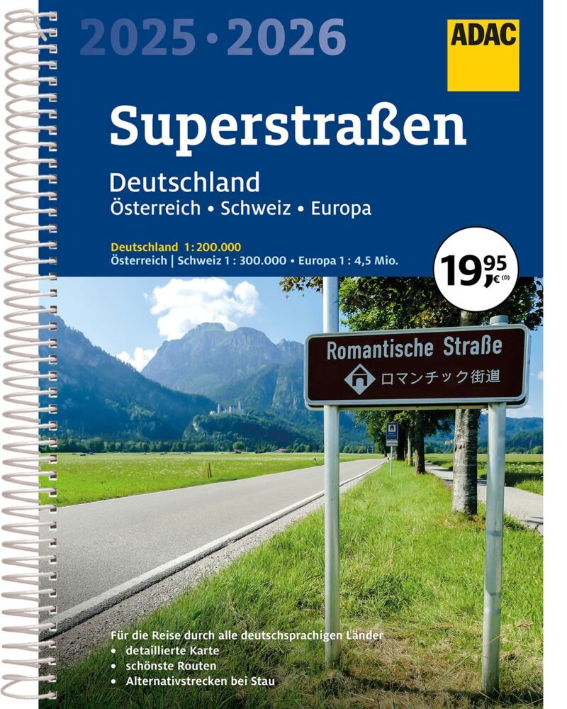
Der Praktische Superstraßenatlas für Deutschland, die Schweiz und Österreich. Die Spiralbindung bietet bestmögliches Handling und der Maßstab steuert eine optimale Orientierung hinzu. "Der Kartenteil: Deutschland 1:200 000 mit mehrsprachiger Legende (D, GB, F)/ Schweiz 1:301 000 mit mehrsprachiger Legende (D, GB, F, I)/ Österreich 1:300 000 mit mehrsprachiger Legende (D, GB, F, I)/ 46 Durchfahrtspläne 1:100 000 und dazugehörige Citypläne 1: 20 000 mit mehrsprachigen Legenden (D, GB, F) von folgenden Städten: - Aachen - Augsburg - Berlin - Bielefeld - Bonn - Braunschweig - Bremen - Chemnitz - Dortmund - Duisburg/ Essen - Düsseldorf - Erfurt - Frankfurt am Main - Freiburg im Breisgau - Göttingen - Hamburg - Hannover - Karlsruhe - Kassel - Kiel - Koblenz - Köln - Leipzig - Lübeck - Magdeburg - Mainz - Mannheim/Ludwigshafen - München - Münster - Nürnberg - Osnabrück - Paderborn - Potsdam - Regensburg - Rostock - Saarbrücken - Schwerin - Stuttgart - Trier - Ulm - Weimar - Wiesbaden - Würzburg/ Europa 1:4 500 000 mit mehrsprachiger Legende ( D, GB, F, NL, I, E, DK, S, PL, CZ, SK, H)/ Fernfahrtenkarte Deutschland/ Übersichtskarte der Rastanlagen an deutschen Autobahnen; Der Serviceteil: - Für die jeweiligen Kartenteile von Deutschland, Schweiz und Österreich gibt es das entsprechende Ortsregister. - Eine Fernfahrtenkarte fungiert gleichzeitig als Seitenübersicht für Deutschland 1:200 000 - Entfernungen und Fahrzeiten in Deutschland - deutsche Kfz-Kennzeichen - Adressen der Stromtankstellen in Deutschland, Österreich und in der Schweiz
€22,50
Bekijk product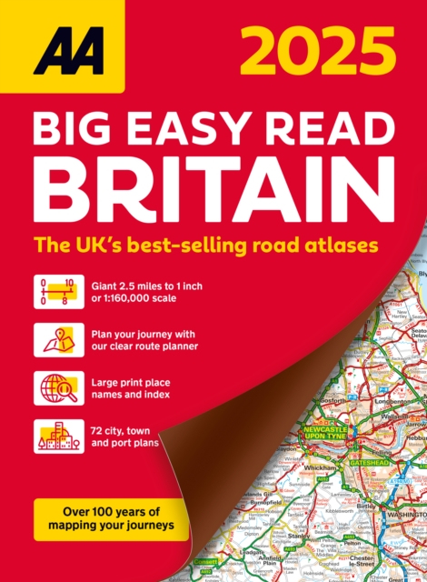
AA Publishing brings you the UK’s most up-to-date road atlases Over 100 years of mapping your journeys • Giant scale mapping at 2.5 miles to 1 inch = 1:25,000 • A3 format completely revised and updated for 2024 • Practical spiral bound, lie-flat format • 19th Edition • 208 pages of fully updated giant scale mapping This A3 format atlas provides giant scale mapping and type throughout making it very easy to use. It is available in two binding styles; paperback and spiral bound. Each page has been titled with its geographical location so you can turn to the page you need more easily, plus large print place names and index. Wide minor roads (more than and less than 4m wide), National Trust, English and World Heritage sites, crematorium locations and other hard-to-find places are indicated on the mapping. There are 72 city, town and port plans including a central district map of London and a full-colour admin map showing all the latest unitary authority areas and a 4 page route planner. Plus, scenic routes and tourist sites with satnav friendly post codes. Features the top 300 AA-Inspected caravan and camping sites and over 1,800 golf courses.
€23,95
Bekijk product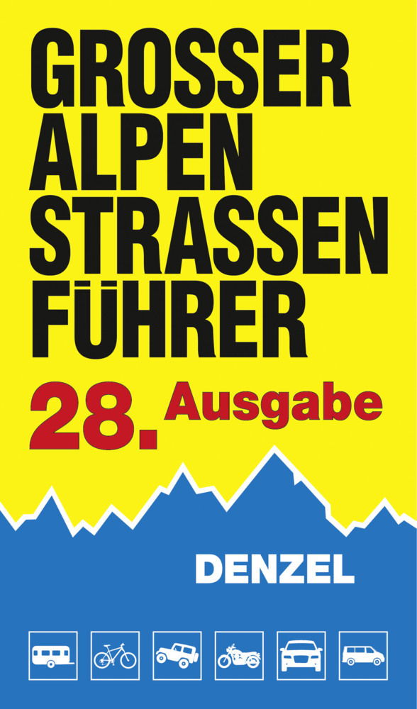
Das international bewährte Standardwerk für sportlich-touristisch eingestellte Auto- und Zweiradfahrer! Aus der Vielzahl anfahrbarer Hochpunkte innerhalb des weiten Alpenbogens von Wien bis Marseille wurden rund 700 der interessantesten Hochstraßen und Ziele gewählt, sowohl asphaltierte als auch geschotterte Strecken berücksichtigt. Detailliert beschrieben werden alle landschaftlich besonders reizvollen Touristen- und Panoramastraßen, die letzten "wilden Pässe", ehem. Militärsträßchen, Schluchtstrecken und sonstigen kuriosen Fahrwege im Gebirge. Gegenüber der vorigen Ausgabe wurden zusätzliche Routen aufgenommen, es gibt nun 518 Kennzahlen auf 624 Seiten. Ausführliche Schilderungen der Straßenverhältnisse und aktuellen Zustände.345 Farbfotos, 109 farbige Kartenskizzen, 2 Sprechende Grafiken. Höhenprofile (Längsschnitte) geben Auskunft über den Verlauf von Steigungen bzw. Gefälle. Steigungsangaben für alle Straßen in Prozent. Für Wohnmobil- und Busfahrer wichtige Tunnel- und Galeriehöhen. Die Bewertung der fahrtechnischen Schwierigkeiten erfolgt in differenzierter Weise nach der Denzel-Alpenstraßen-Skala von 1 bis 5 und den Zwischenstufen. Für die landschaftlichen Klassifikationen werden 0 bis 3 Sterne vergeben. Länderweises Farbleitsystem, Symbole für leichte und schwierige Schotterpisten, Symbole für Mautstraßen. Übersichtliches Layout. Handliches, bequem mitzuführendes Format 12,5 x 22 cm, strapazierbarer Einband. Ein Spezialführer, welcher die Herzen leidenschaftlicher Alpenfahrer höher schlagen lässt! Eingeteilt in 518 Kennzahlen werden rund 700 Hochpunkte in den Alpen (Asphalt- und Schotterstraßen) beschrieben. Ein länderweises Farbleitsystem macht das Buch besonders benützerfreundlich. Symbole für leichte und schwierige Schotterstrecken geben einen schnellen Überblick, wie eine Straße einzuschätzen ist. Fahrtechnische Beurteilungen nach Schwierigkeitsgraden von 1 bis 5. Symbole für Mautstraßen.
€52,40
Bekijk product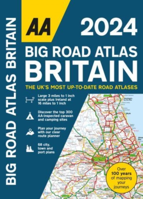
This best-selling A3 format atlas is available in two binding styles; paperback and spiral bound. Up-to-date mapping from the experts at the AA this atlas has large 3 miles to 1 inch scale including Ireland at 16 miles to 1 inch. Each page has been titled with its geographical location so you can turn to the page you need more easily. Wide minor roads (more than and less than 4m wide), National Trust, English and World Heritage sites, crematorium locations and other hard-to-find places are indicated on the mapping. 4 page clear route planner map. There are 68 city, town and port plans including central London and a list of tourist sites with satnav friendly post codes. Top 300 AA-Inspected caravan and camping sites listed and marked on map, over 1,800 golf courses, plus scenic routes and over 240 service areas.
€21,95
Bekijk product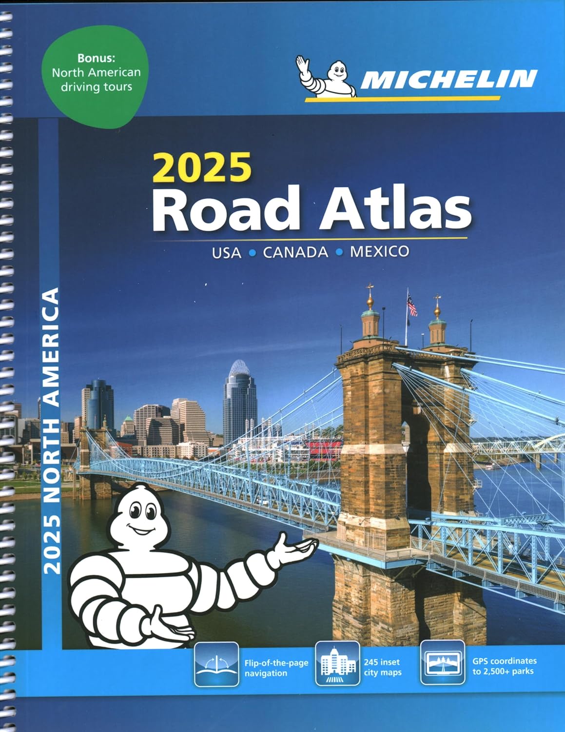
De beroemde wegenatlas van Rand McNally nu als Michelin atlas. Super handige atlas van Michelin in A4 formaat met stevige ringband. Let op: Canada en Mexico staan er zeer beperkt in. For inspiring road trips and scenic drives, Michelin's updated, spiral-bound North America Road Atlas 2024 suggests 52 routes. The tiled atlas, with its clear, accurate mapping, complements online navigation while its big picture and road details aid in advance planning and en route decisions. For outdoor fun and adventure, look for inspiration among the highlights from national and provincial parks, including the parks' GPS coordinates. Rely with confidence on Michelin's deluxe atlas to get you there. Covers USA, Canada and Mexico. Scale 1:625,000 - 1:9,018,000. Spiral bound for lay-flat convenience. More than 240 large-scale city maps for navigating in and around urban areas. Bonus Northeast Corridor maps provide extra detail between Boston and Washington DC for easier driving. Six-page travel inspiration section focusing on selected national and provincial parks in the US and Canada; points of interest, activities and suggested drives pulled from Michelin's famed travel guides. 1000+ travel center locations clearly indicated on atlas pages for convenient stops while en route. 12 full pages of GPS coordinates to US and Canadian national, state & provincial parks to help you directly plot your path to outdoor fun. Extensive 96-page place name index for rapid look-up. Layout of tiled atlas pages is user-friendly, offering continuity when driving, and logically complements online navigation systems. 100+ year history of mapmaking - recognized for accuracy and clarity. * More than 240 large-scale city maps for navigating urban areas. * Bonus Northeast Corridor maps provide extra detail between Boston and Washington DC for better navigation. * Extensive 96-page place name index for rapid look-up. * 100+ year history of mapmaking - recognized for accuracy and clarity.
€21,95
Bekijk product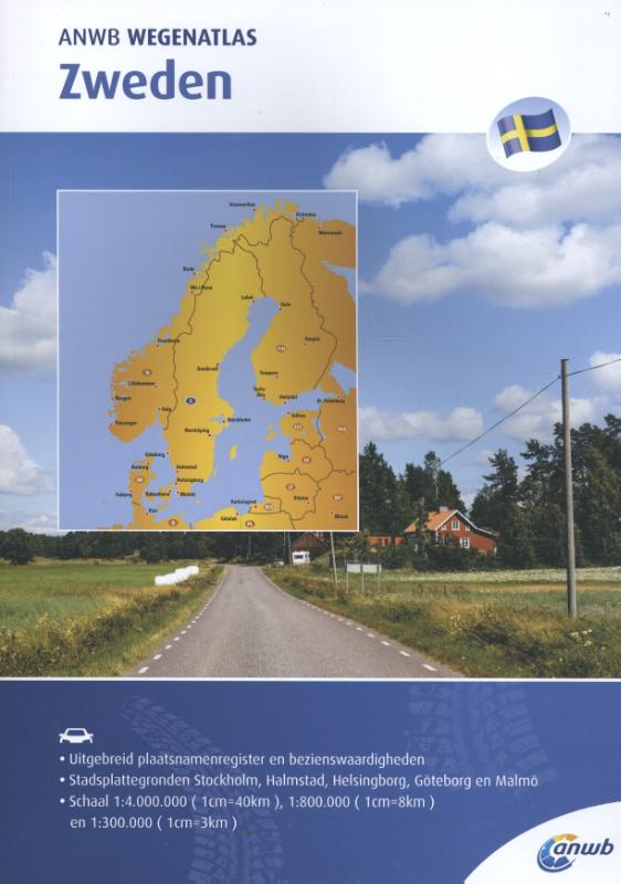
ANWB Wegenatlas Zweden Ga goed voorbereid op reis met de nieuwe ANWB Wegenatlas Zweden. De ANWB Wegenatlas Zweden is gedetailleerd en mooi van vormgeving. Met informatie over cultuur, actieve recreatie en een uitgebreid plaatsnamenregister. De atlas bevat kaarten op schaal 1:4.000.000 (Europese hoofdwegen), 1:800.000 (wegenkaarten Zweden noord) en 1:300.000 (wegenkaarten Zweden zuid). Inclusief stadsplattegronden van Stockholm, Halmstad, Helsingborg, Göteborg en Malmö op schaal 1:100.000 en 1:15.000. De ANWB Wegenatlas is al jaren de best verkochte atlas van Nederland. Er is een ANWB Wegenatlas van de volgende gebieden of landen: Alpen, Benelux, Duitsland, Europa, Italië, Frankrijk, Spanje & Portugal, Scandinavië, Australië, Verenigde Staten & Canada, Noorwegen en Zweden.
€15,99
Bekijk product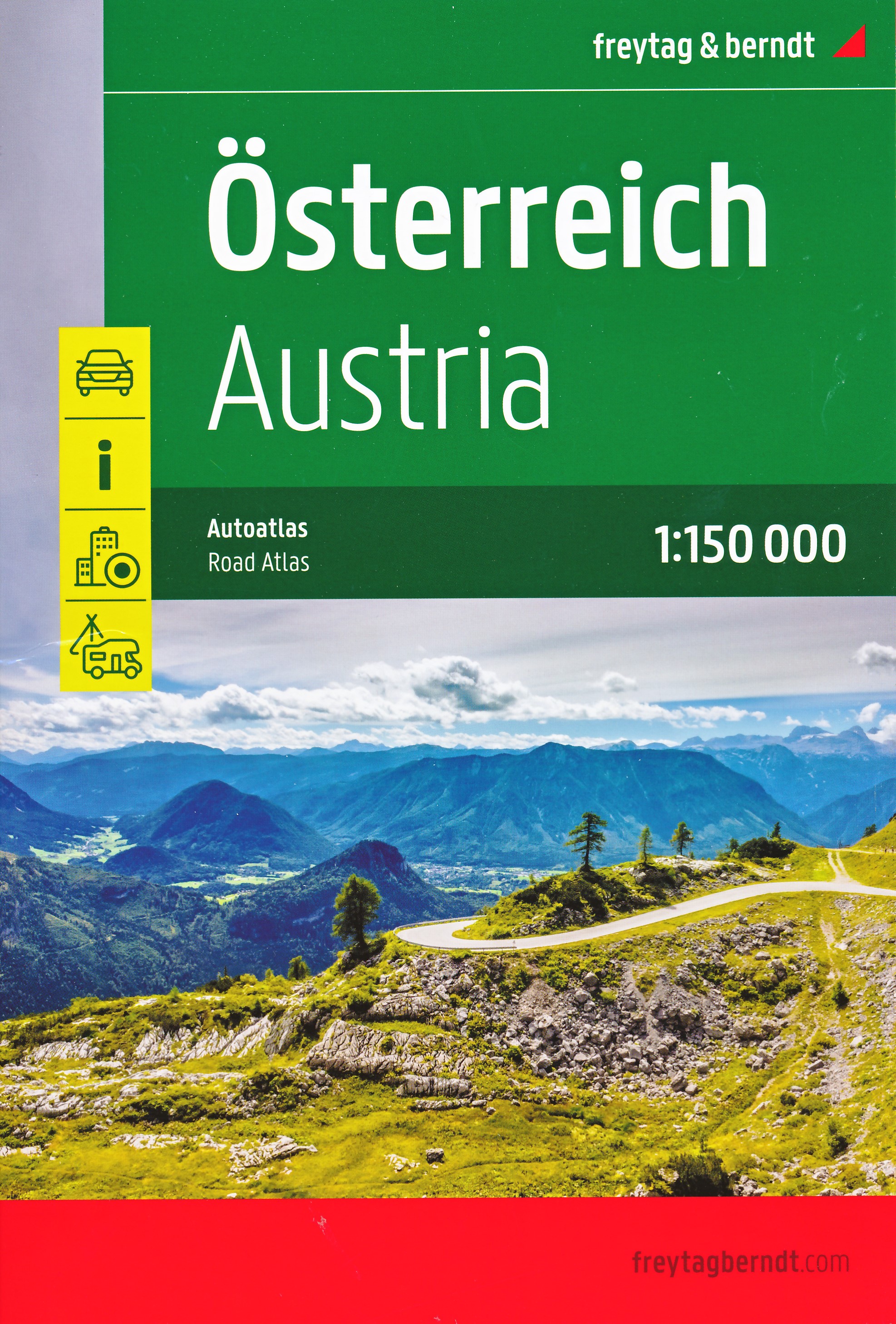
Zeer goede wegenatlas van Oostenrijk met gedetailleerde kaarten, helder kaartbeeld en een uitgebreid register. In een ringband uitgevoerd, dus praktisch in gebruik. Met campings. Neben der übersichtlichen Gestaltung bietet der Autoatlas Österreich Supertouring 1:150.000 zahlreiche Zusatzinformationen wie z.B. Straßenbeschaffenheit, Sehenswürdigkeiten, Campingplätze und zahlreiche Innenstadtpläne. Mit dem umfangreichen Ortsregister gelingt zudem eine rasche Orientierung. Details: Erweiterter Kartenteil, Autobahnprofile, Stadtpläne der Bundeshauptstädte und zahlreicher weiterer Städte, Ortsregister mit Postleitzahlen, Übersicht über Campingplätze und Wohnwagen Stellplätze, Spiralbindung; freytag & berndt Autoatlanten sind für viele Länder und Regionen weltweit erhältlich.
€23,50
Bekijk product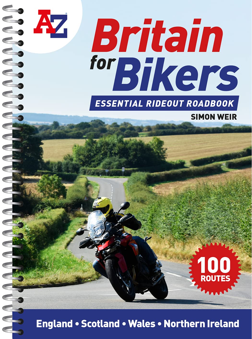
Discover the best biking routes around Great Britain and Northern Ireland. Your essential rideout roadbook covering the best biking routes around Great Britain and Northern Ireland, including short trips and longer tours. Discover the best motorcycling roads around Great Britain and Northern Ireland, chosen by the biking route expert, Simon Weir. Each one is explained in depth with all key attractions highlighted in the detailed A-Z mapping. Stunning photographs and easy-to-follow road book directions throughout. * Simple turn-by-turn directions and clear maps for every route * Ideal size for fitting in a tank bag * Short, practical rides for the weekend, most lasting 1-2 hours * Comprehensive coverage of every corner of the country * 100 great rideouts to discover with your friends
€20,95
Bekijk product