
Beantwoord enkele vragen, en binnen seconden geeft AI je een persoonlijk aankoopadvies op maat.
Beantwoord enkele vragen, en binnen seconden geeft AI je een persoonlijk aankoopadvies op maat.
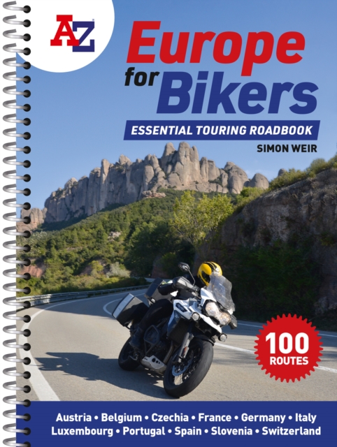
Discover the best biking routes around Europe. The definitive European motorcycle touring bible, with the best biking roads presented in 100 easy-to-follow, tried-and-tested routes from motorcycle journalist, author and traveller Simon Weir. From the peaks of the Picos de Europa to the sun-kissed shores of Sicily, from Alpine passes to dramatic gorges, atmospheric forests and fabulous historic sites, A-Z Europe for Bikers is packed with fantastic places to ride. With full-day and multi-day touring rides across the whole of western Europe, each route is presented with turn-by-turn directions and detailed mapping, with all the key attractions highlighted. Printed on high-durability paper and spiral bound to fit in a tankbag, you need never end up on a dull road again. Packed with practical advice and stunning photography, there are memorable rides to be discovered in every corner of Portugal, Spain, France, Belgium, Luxembourg, Germany, Austria, Czechia, Switzerland, Slovenia and Italy. Features include: 100 great biking routes to discover on your European adventureClear, detailed maps to help you planRoutes for short days and long daysIdeal size for fitting in a tank bag
€20,95
Bekijk product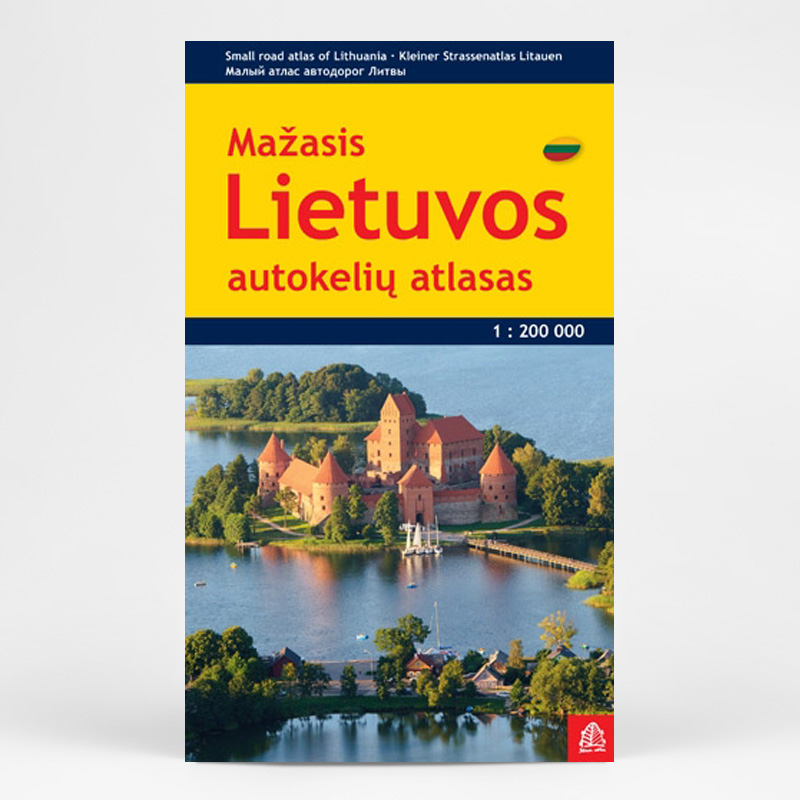
Lithuania Road Atlas from the Riga based Jana Seta, in handy glovebox paperback format with street plans of 19 towns, including an enlargement for city centre of Vilnius, The whole country is covered at 1:200,000, showing detailed classification of road network with petrol stations, and railway lines with stops. Boundaries of national parks and other protected areas are marked and a range of symbols indicate tourist accommodations, campsites, various places of interest, etc. Picturesque towns and villages are highlighted. Colouring and graphics show forested areas and swamps and the atlas also shows the country’s administrative divisions. Latitude lines are at intervals of 5’ intervals and longitude at 10’. The atlas has an extensive index of localities. The atlas also includes street plans of 19 towns at 1:20,000 or 1:25,000, annotated with places of interest and various facilities. For Vilnius the atlas has a plan of its central districts, plus a road map of the surrounding area highlighting main traffic routes to the centre. Also included is road a map of the eastern Baltic Sea region, physical, administrative and route planning maps of Lithuania, general information for drivers and a distance table. *Map legend, conveniently placed on a flap of the cover, includes English.* * The same atlas is also available in a larger, A4 format with street plans of 57 towns.
€24,50
Bekijk product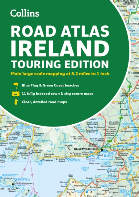
Explore Ireland with this accurate and fully updated road atlas. This road atlas is at A4 size, covering the whole of Ireland and features clear and detailed Collins colour mapping at a scale of 5.2 miles to 1 inch. Perfect for both residents and visitorstouring Ireland. This revised edition includes: Places of tourist interestContact information for Tourist Information Centres with grid references to the mappingFully indexed street maps of 11 cities and towns - Dublin, Belfast, Cork, Limerick, Waterford,Londonderry (Derry), Galway, Bangor, Dun Laoghaire, Drogheda and KillarneyBlue Flag & Green Coast beachesFerry and airport information; Distance chart; Distances marked on the roads in miles and kilometresRoute planning map of the whole of Ireland at 15.8 miles to 1 inchAdministrative map of Irish counties and districts.
€9,95
Bekijk product
A full-colour, paperback road atlas of Great Britain, now fully revised and updated. Clear detailed road mapping at a scale of 3.5 miles to 1 inch. Presented in a large, easy to read A3 format. This essential road atlas includes the following; 11 pages of main route mapping covering Greater London, Birmingham and Manchester Mileage chart with average journey times Information on motorway junctions with limited interchanges 70 city and town centre street plans 16 port and airport plans Channel Tunnel terminus maps Map reference information also in French and German Also included is a full index to cities, towns, villages, hamlets, major destinations and selected places of interest with postcodes for sat-nav use. Instantly recognisable and easy to use, the road mapping has been specifically tailored for the smaller scale featuring: clear standard road classification colours for easy identification, motorway junction symbols, under construction and proposed roads, primary route destinations, service areas, National and county boundaries, and a wide range of tourist and ancillary information, including Blue Flag Beaches. The combination of map scale and large format gives a double-page driving range of 60 miles north to south and 80 miles east to west, making this publication the ideal motoring companion.
€18,95
Bekijk product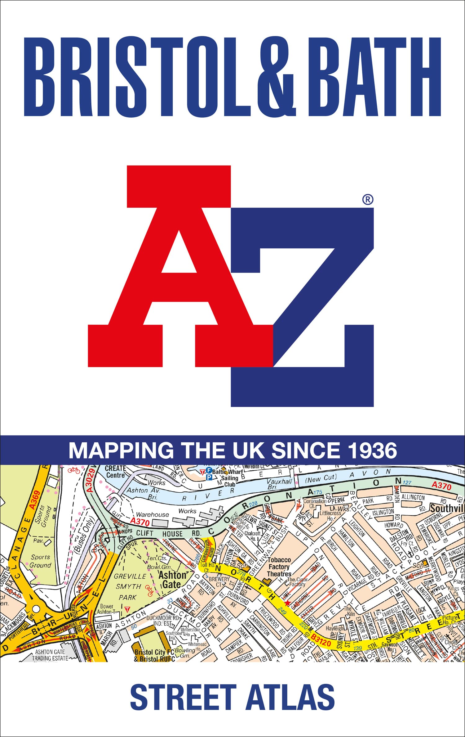
Navigate your way around Bristol and Bath with this detailed and easy-to-use A-Z Street Atlas. Printed in full-colour, paperback format, this atlas contains 104 pages of continuous street mapping. More than 12,800 streets indexed. Large scale 6.25 inches to 1 mile map. Areas covered include: Avonmouth, Bradley Stoke, Filton, Keynsham, Kingswood, Mangotsfield, Portishead, Yate, Frampton Cotterell, Chipping Sodbury, Oldland, Swainswick, Batheaston, University of Bath, Combe Down, Bath Spa University, Saltford, Whitchurch, Bedminster, Long Ashton, Easton-in-Gordano, Cribbs Causeway. Also included are large scale city centre maps of both Bristol and Bath and a postcode map of the atlas area. Postcode districts, one-way streets and safety camera locations with their maximum speed are featured on the street mapping. A comprehensive index lists streets, selected flats, walkways and places of interest, place, area and station names. Additional healthcare (hospitals, walk-in centres and hospices) and transport connections are indexed as well.
€20,95
Bekijk product
This handy atlas fits in the glovebox of your car, perfect for quick referencing on the move. The clear mapping includes a range of essential motoring and useful touring information so you can find your way and discover places to visit whilst on your travels. Including information such as road tolls, service areas, road distances, national parks, places to visit and viewpoints this is the perfect glovebox companion for travelling through Britain and Ireland.
€8,50
Bekijk product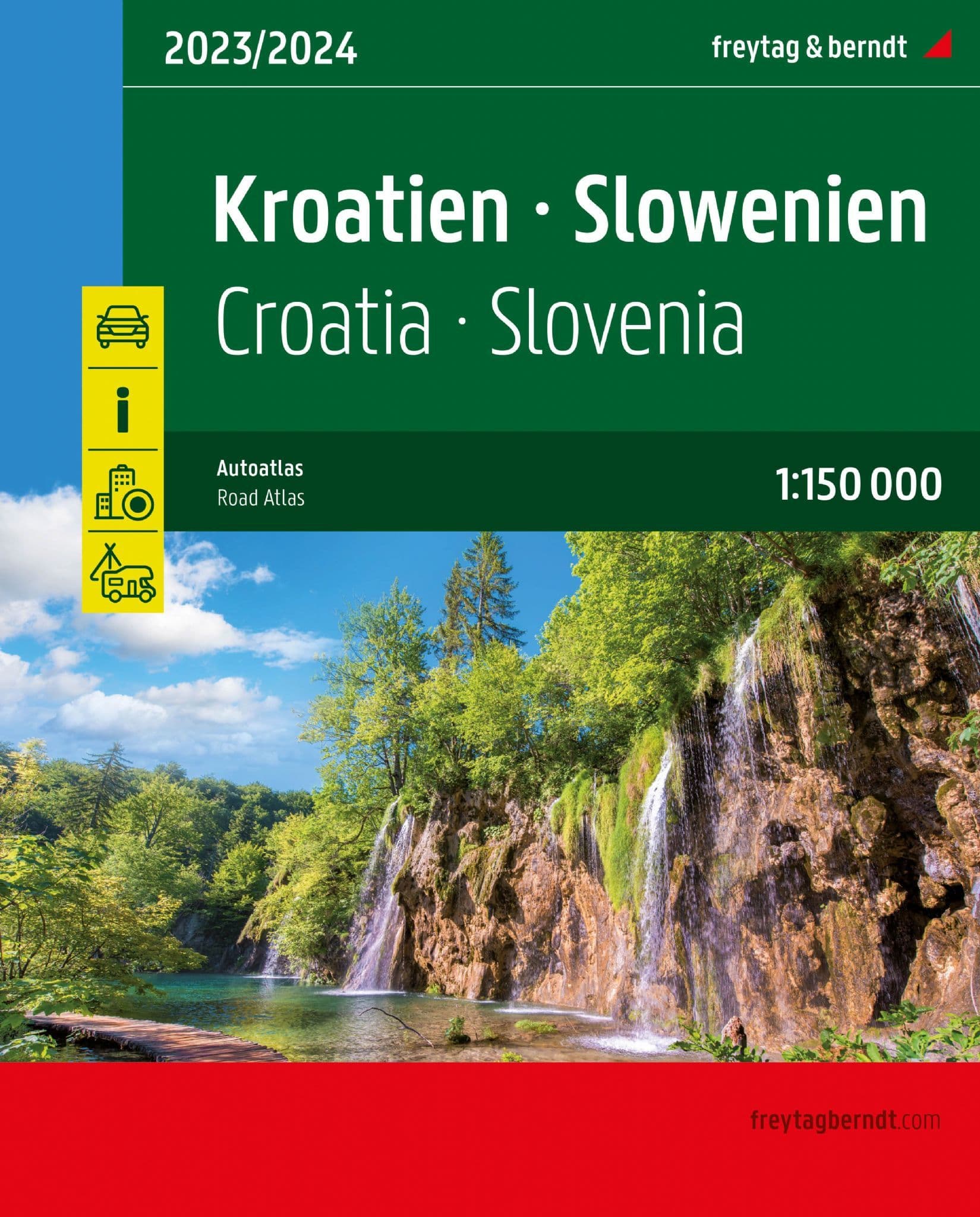
Goede wegenkaarten van zowel Kroatië en Slovenië met veel symbolen waarmee bijvoorbeeld campings ook worden vermeld. A4 formaat in ringband. De berijdbare wegen zijn goed weergeven, zowel de hoofdwegen als provinciale en lokale wegen; wegnummers worden vermeld. Afstanden tussen plaatsen zijn in kilometers op de kaart ingetekend, daarnaast worden ook op belangrijke plekken benzinepompen gemarkeerd. In het kaartbeeld wordt door middel van schaduw het reliëf weergegeven en soms enkele punten in het landschap met de daadwerkelijke hoogte. Provinciegrenzen zijn goed terug te vinden, nationale parken en reservaten ook. Met allerhande symbolen worden toeristische bezienswaardigheden weergegeven als monumenten, historisch belangrijke plekken en uitzichtpunten. In bepaalde plaatsen zijn hotels en campings te vinden, luchthavens, treinverbindingen en havens vindt u er ook op! Der Autoatlas Kroatien - Slowenien 1:150.000 ist der ideale Begleiter für alle, die mit dem Auto unterwegs sind und dabei nicht nur die Hauptstraßen und Autobahnen nutzen möchten. Er ist ideal für die Planung und erweist sich auch während der Reise als unverzichtbare Orientierungshilfe. Mit dem detaillierten Kartenbild und dem genauen Maßstab lassen sich auch weniger befahrene Nebenstraßen entdecken, die in Übersichtskarten meist gar nicht eingezeichnet sind. Landschaftlich schöne Strecken sind farblich hervorgehoben. Informationen zum Straßenatlas Kroatien - Slowenien Kroatien - Slowenien 1:150.000 Europa 1:3.500.000 Spiralbindung verdeckt Camping- und Stellplätze Touristische Informationen Ortsregister mit Postleitzahlen 19 Innenstadtpläne Format 23 x 29,7 cm Der ideale Autoatlas für Kroatien und Slowenien Das dichte Straßennetz ist exakt abgebildet, landschaftlich schöne Abschnitte und Touristenstraßen sind farblich hervorgehoben und viele Ausflugsziele sind in der Karte eingezeichnet. Auto- und Motorradfahrer schätzen die exakte Kartographie von freytag & berndt besonders für die Planung und Orientierung vor Ort. Damit die Reise auch mit Wohnmobil, Wohnwagen oder Camper gut planbar ist, sind alle Camping- und Stellplätze im Atlas eingezeichnet. Verdeckte Spiralbindung Der Autoatlas Kroatien - Slowenien ist besonders komfortabel in der Handhabung da er sich durch die Spiralbindung bequem aufklappen lässt. So bleibt die gewünschte Seite auch während der Fahrt immer geöffnet. Innenstadtpläne Mit den enthaltenen Cityplänen kann man sich in den Städten gut orientieren, darunter etwa Dubrovnik, Pula, Rijeka, Split, Zagreb, Ljubljana und Maribor;. Gedruckt in Österreich
€32,95
Bekijk product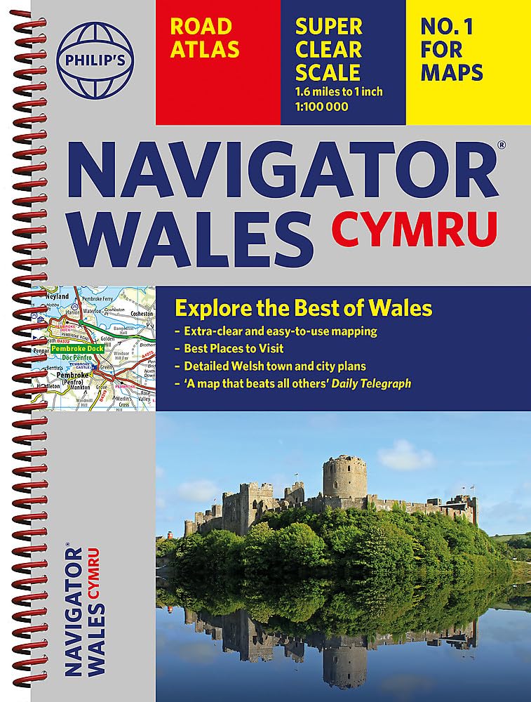
Ideaal voor fietsers! Explore the many attractions of Wales with this easy-to-use road atlas showing all the top spots. Easy-to-read mapping, superb extra detail, and a great lie-flat format make this the ultimate Welsh road trip companion. – Unrivalled level of detail from motorways to country lanes. – Exceptional clarity at a scale of 1.6 miles to 1 inch (1:100,000). – Ideal for explorers: heritage sites, spectacular sights, and the best walks around Snowdonia, the Brecon Beacons, the Pembrokeshire Coast and more. – Tourist attractions and places of interest clearly highlighted, from Caernarfon Castle to St David’s Cathedral. – Indexed town plans for all major centres, including Aberystwyth, Bangor, Cardiff, Holyhead, Llandudno, Llanelli, Merthyr Tydfil, Newport, Newtown, Swansea, and Wrexham. – Packed with hundreds of individually named farms, houses, and hamlets, alongside airports, airfields, stations, ferries, canals, and harbours. – Key to map symbols are clearly indexed and shown in English and Welsh. With its large scale and wealth of travel information, the Navigator atlas is perfect for both leisure and business.
€14,95
Bekijk product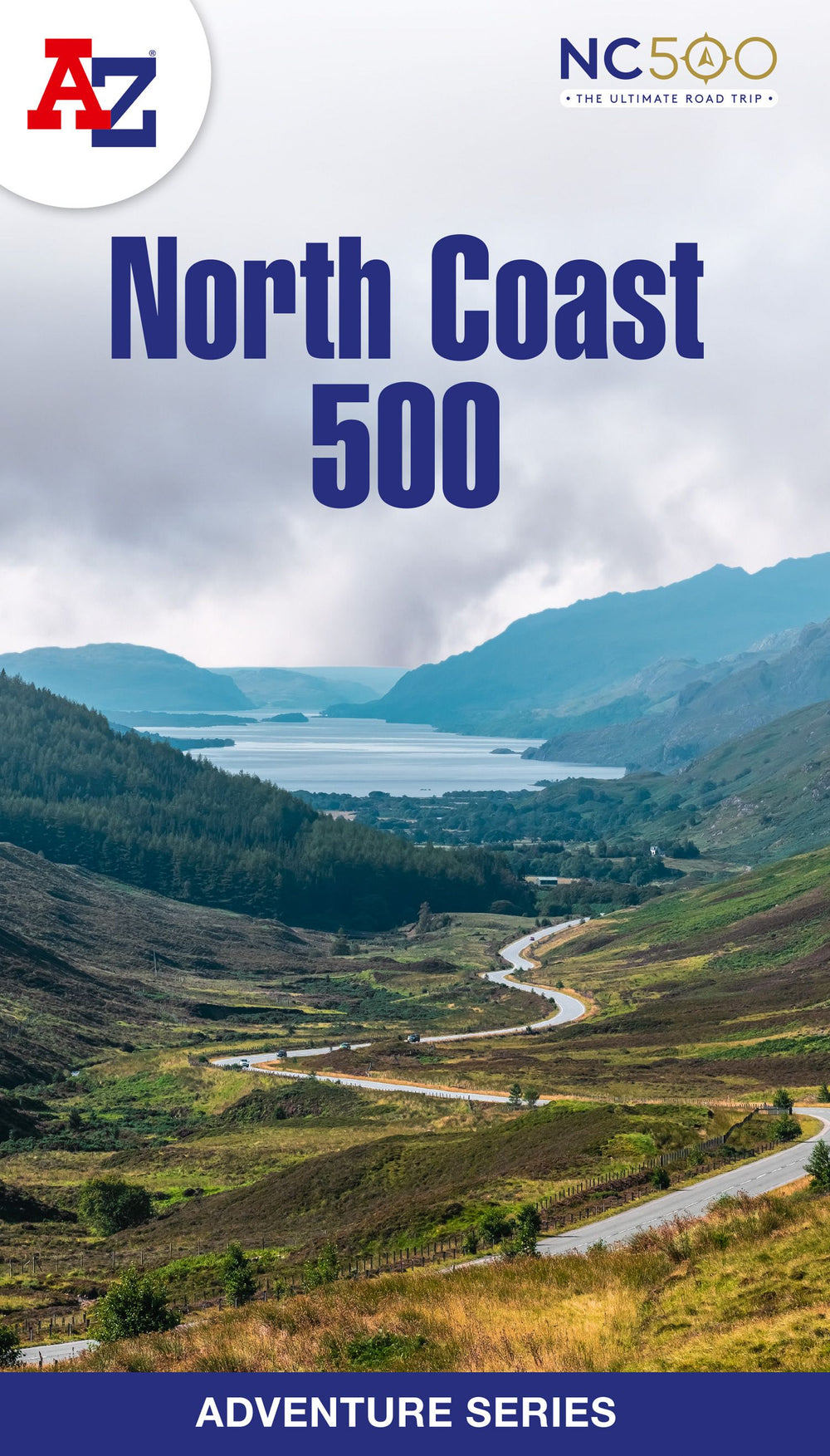
The A-Z Adventure Series of maps is the perfect companion for walkers, off-road cyclists, and anyone wishing to explore the great outdoors. The scenic North Coast 500 is one of the most popular routes in Scotland and journeying along it makes for an incredible adventure. The 516 mile (830 km) route passes through picturesque landscapes and abundant wildlife, linking a wide range of tourist destinations in the Highlands. This A-Z North Coast 500 Adventure Atlas features more than 90 pages of continuous 1:50 000 mapping, providing detailed coverage of the entire route. A route planner showing distances between places and the amenities available is also included, along with the locations of: Campsites (seasonal opening) Information Centres Hotels/B&Bs Youth Hostels Pubs, Restaurants and Cafes Shops Petrol Stations Now with NEW electric charge point data from Zapmap! Other walks available in the A-Z Adventure series include: Cotswold Way, Peddars Way and Norfolk Coast Path, Coast to Coast Path, South Downs Way and The Pembrokeshire Coast Path.
€13,95
Bekijk product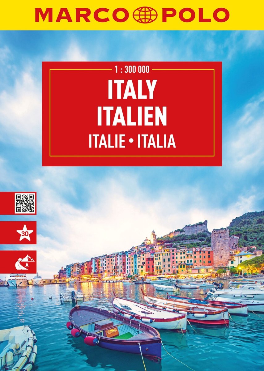
Mooie wegenatlas van Marco Polo van Italie. Veel detail met wegenummers, onderscheid in verschillende wegen, afstanden tussen dorpen en steden. Ook bezienswaardigheden en andere toeristische aspecten staan met symbolen ingetekend. Achterin nog een behoorlijk aantal stadsplattegronden en een uitgebreid register. Spiraalbinding, A4 formaat.
€16,95
Bekijk product