
Beantwoord enkele vragen, en binnen seconden geeft AI je een persoonlijk aankoopadvies op maat.
Beantwoord enkele vragen, en binnen seconden geeft AI je een persoonlijk aankoopadvies op maat.

Zeer overzichtelijke wegenatlas in vernieuwde uitvoering. Met vele highlights, bezienswaardigheden en landschappelijk fraaie routes. Bevat praktische transitmaps voor een aantal stedelijke regio’s én 56 stadsplattegronden in schaal 1:20.000. Voorzien van afstandentabel, uitgebreid plaatsnamenregister en beknopte landspecifieke info.
€18,95
Bekijk product
Handige wegenatlas van Duitsland. Op A4 formaat, gebonden. De kaarten in deze wegenatlas van Duitsland hebben een schaal van 1:300.000 Op de heldere en gedetailleerde wegenkaarten staat ook toeristische informatie zoals bijvoorbeeld campings en uitzichtpunten. Landschappelijk mooie routes staan aangegeven in groen. De atlas heeft een plaatsnamenregister en er staan 35 stadsplattegronden van Duitse steden in. Een paginaoverzicht en een afstandentabel zitten vooraan in de binnenflap. Achterin is er nog een atlas van heel Europa op een schaal van 4.500.000. De legenda is ook in het Nederlands. Ideaal voor in de auto. Der MARCO POLO Reiseatlas bildet Deutschland im optimalen Maßstab 1:300 000 ab. Sehenswerte Highlights aus Kultur und Natur werden farblich hervorgehoben. Zusätzlich enthalten ist eine Planungskarte von Europa, die bis nach Moskau und der Türkei reicht." Ein MARCO POLO Reiseatlas ist der ideale Begleiter auf Ihren Fahrten, wo auch immer es mit ihm hingehen soll. Die praktische Spiralbindung unterstützt das perfekte Handling. "Der Kartenteil: Europa im Maßstab 1:4 500 000 mit Legende und Flaggen; Hauptkarte im Maßstab 1:300 000 mit mehrsprachiger Legende (D, GB, I, F, NL, E, P, CZ, PL, H, DK, S)/ Erklärung ZoomSystem (4-farbiges Leitsystem)/ Navigator Blattübersicht Atlas 300T, 100T, 20T/ Übersichtskarte mit Marco Polo-Highlights/ 16 Stadtdurchfahrskarten 1:100 000: - Berlin - Bochum / Dortmund - Bremen - Duisburg / Essen - Frankfurt am Main - Hamburg - Hannover - Köln / Leverkusen - Leipzig - Ludwigshafen / Mannheim - Mönchengladbach / Düsseldorf - München - Nürnberg - Saarbrücken - Solingen / Wuppertal - Stuttgart/ - Sonderkarte Flughafen München 100T/ 38 Citypläne: - Augsburg - Berlin - Bielefeld - Bochum - Bonn - Bremen - Chemnitz - Cottbus - Duisburg - Dortmund - Düsseldorf - Dresden - Erfurt - Essen - Frankfurt am Main - Hamburg - Hannover - Kassel - Kiel - Köln - Leipzig - Lübeck - Ludwigshafen - Madgeburg - Mainz - Mannheim - Mönchengladbach - Münster - München - Nürnberg - Potsdam - Rostock - Saarbrücken - Schwerin - Stuttgart - Ulm - Wiesbaden - Würzburg - Wuppertal/ Der Serviceteil: Reise- und Verkehrsinformationen/ Ortsregister der selbstständigen Städte und Gemeinden mit Bundesland, Postleitzahl und Suchfeldangabe/ Tabelle der Entfernungen und Fahrzeiten/ "Mit landschaftlich schönen Strecken und Sehenswürdigkeiten, Citypläne, landessprachliche Beschriftung, mehrsprachige Legende, Übersichtskarte zum Ausklappen, Reise- und Verkehrsinfos, Entfernungstabelle, Ortsregister, Zoom-System
€18,95
Bekijk product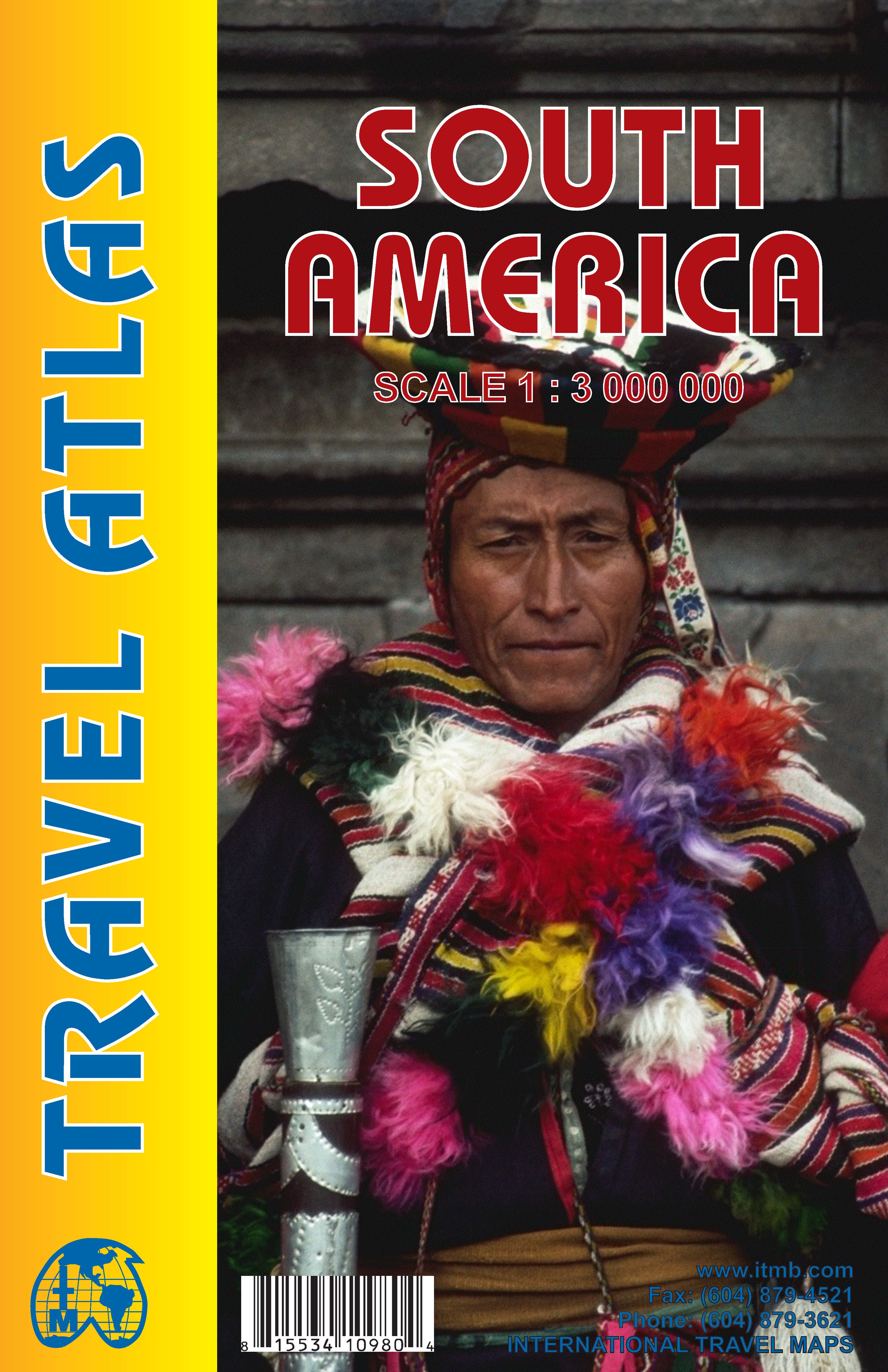
De eerste gedegen wegenatlas van Zuid Amerika: handig boekje met slappe kaft op A5 formaat. This is unique! ALL of the continent of South America is now available in an easy-to-read, easy-to-use, easy-to-store road atlas at a superb scale. In addition to showing each country systematically, logically, and in great detail, physical features, points of interest, beaches, reefs, parks and reserves, major airports, and roads are shown. The atlas is 5 1/2" wide by 8 1/2" high (15cmx22cm), the same size as our Mexico Road Atlas. This atlas is 112 pages in length, is fully indexed, and has a hard card cover, and a spine. The advantage of this book format is that visitors to more than one country can save money and gain ease of use through a conveniently-sized and attractively presented book format. There is nothing equivalent to this in the world!
€16,50
Bekijk product
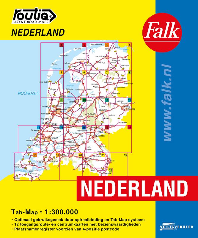
De meest gebruiksvriendelijke wegenkaart van Nederland is ongetwijfeld de Falk Routiq Tab Map. De Routiq Tab Map bladen zijn in een handige ringband gebonden, waar je op de rechterzijde inzoomt op het gebied waar je je bevindt en de linkerzijde geeft aan waar je je globaal bevindt. Het perfecte formaat van de individuele kaarten maakt dat je deze gemakkelijk kunt lezen in de auto. De nummer 1 wegenkaart voor professionele bestuurders! De meest actuele kaart van Nederland Optimaal gebruiksgemak door het Tab Map systeem Wire-O Spiraalbinding. Uitgebreid met toegangsroute- en centrumkaarten met Insider Tips Plaatsnamenregister, afstandentabel
€19,99
Bekijk product

Looking for inspiration to hit the open road? Fancy exploring the best routes Britain and Ireland has to offer? This user-friendly atlas is designed to make your road trips both effortless and exhilarating. Why not embark on an unforgettable adventure with Philip's Great Road Trip Atlas and satisfy your inner explorer? Or perhaps you fancy a delightful meander through valleys and dales, or skirting snow-capped mountains and ending up cruising along the coast? Wherever you want to travel, we have the inspirational mapping, route planning tools and essential information that you need to set off on the open road. * Featuring specially easy-to-read maps and clear directions * Navigating through scenic routes and bustling cities has never been easier * Discover charming roadside attractions and picturesque villages alongside dramatic scenery and wildly thrilling drives. * From the North Coast 500 in the Highlands to the Atlantic Highway in Devon and Cornwall, or the Wild Atlantic Way in Ireland, Philip's Great Road Trip Atlas ensures that every mile is filled with excitement and discovery. So fasten your seatbelt, wind down the windows, and embark on the road trip of a lifetime or just a restorative roll through the countryside. There's an adventure around every bend - are you ready to hit the open road?
€12,95
Bekijk product