
Beantwoord enkele vragen, en binnen seconden geeft AI je een persoonlijk aankoopadvies op maat.
Beantwoord enkele vragen, en binnen seconden geeft AI je een persoonlijk aankoopadvies op maat.
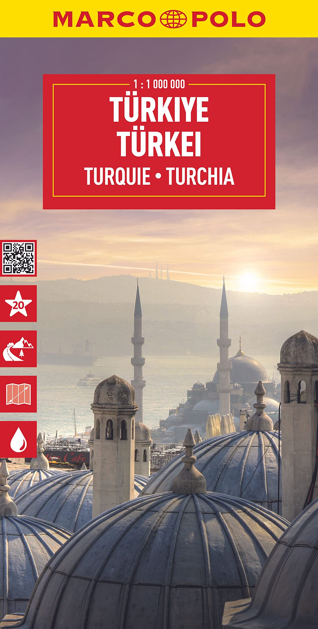
Duidelijke wegenkaart van Marco Polo: alle wegen, zowel de verharde als belangrijke onverharde wegen zijn weergegeven. Mooie toeristisch interessante wegen die de moeite waard zijn, zijn groen gearceerd. Veel toeristische informatie is toegevoegd zoals de nationale parken, campings, kastelen en vliegvelden. Afstanden tussen belangrijke steden en benzinestations staan ook op de kaart. Een plaatsnamenregister ontbreekt niet. Let the Marco Polo Türkiye / Turkey Road Map guide you around this stunning country. From the Turquoise Riviera to the Fairy Chimneys of Cappadocia this highly durable, detailed touring map of Turkey will ensure you don’t miss a thing. It folds away easily and is always on standby to help when you're stuck. Perfect touring map - the scale is 1 : 800 000 ideal to help you tour the country by car or campervan Easy to use - the superbly clear mapping in strong colours and easy to read text will help you navigate the country like a local Durable, tear-resistant map - designed to withstand the rigors of the road, the map is printed on tear-resistant, water repellent and writeable paper Highlights included - major sights and key points of interest are marked on the map by numbered stars. Further information about these key sights can be downloaded via a QR code where you’ll find a brief description to help you pick the best places to see en-route Dream routes – inspirational routes with beautiful scenery are included on the maps to guide you on your next adventure Extensive index - the thorough index, also included on the QR code, is fully cross-referenced to the map to help you pinpoint your destination quickly For the big trips and the little detours, trust Marco Polo's clear mapping and thorough index to guide you around Turkey / Türkiye. Die Karten bestechen durch eine leicht lesbare, neue Kartografie, in der durchgängig landschaftlich schöne Strecken und Orte markiert sind. Die Reiseroute gefunden? Mit den in der Umschlagklappe untergebrachten, selbstklebenden mark-it-Stickern lässt sich das angepeilte Ziel hervorheben und somit beim nächsten Blick auf die Karte leicht wiederfinden. Schon in der im Kartendeckel befindlichen, ausklappbaren Übersichtskarte sind die schönsten Orte mit gelben oder grünen Markierungen unterlegt, um unterwegs auch wirklich nichts zu verpassen. Die Distanzenkarte sagt, wie weit es noch ist bis zur nächsten größeren Stadt. Und mit den wichtigsten Cityplänen lässt es sich auch im Großstadtdschungel leicht navigieren. Wo alle Orte auf der Karte zu finden sind, ist im Registerheft nachzuschlagen.
€14,95
Bekijk product
Deze kaart is niet waterproof maar van gewoon papier! Prima overzichtskaart van Vancouver Island waarmee je alle activiteiten kunt plannen. Alle campsites staan vermeld, maar ook picknickspots, waar het goed kanoën is en er is een register bijgevoegd. Folded road and travel map, in color. Scale 1:270,000. Distinguishes roads ranging from four lane highways to logging/dirt roads. Legend includes trails, ferry routes/terminals, railways, international/domestic airports, lighthouses, protected areas, military areas, glaciers, reefs/rock ledges, falls, rapids, campgrounds, points of interest, tourist information centres, museums, picnic grounds, fishing areas, canoeing/kayaking, hiking trails, golf courses, downhill skiing areas, rock climbing, beaches, hot springs, viewpoints, mines/abandoned mines. Includes inset map of Victoria. Indexed.
€13,95
Bekijk product
Stadsplattegrond van Montreal met register. Op de achterzijde een kaart van het zuiden van Quebec. 1:12,500/1:850,000 on waterproof paper. In this third, updated, edition of Canada's third largest city, we have added a user-friendly bonus. As is common now to most of our city maps, we have included a regional map of the hinterland of the urban area, so buyers won't have to purchase a second map to explore the environs of the city being presented. In the case of Montreal, being in a huge geographic country, this means Southern Quebec which, because of its size, dictates a map of more than one to a million scale. In the European context this would be the equivalent of Paris and all of France as a 'regional' map of the surrounds of Paris - but that's France and this is Canada. Montreal (or Mont Royale in its original) was a village called Hochelaga when the early French explorers arrived in the early 1600s. They established a trading fort and, generally speaking, maintained good relations with the established natives for the next century or so. The English arrived in 1760, having defeated the French under Montcalm at Quebec City the year previously, and English dominance was reaffirmed by the Treaty of Versailles that ended the Seven Years War. The English allowed the continuation of the French language and legal system throughout Quebec and Montreal prospered. They also got on fairly well with the indigenous tribes. The North American fur trade, with its long transportation routes covering the navigable waters of interior rivers and lakes brought wealth and power to the city by exchanging furs for goods. Legend Includes: Roads by classification, Points of Interest, Hotels, Mines, Museums, Churches, Airports, National Parks, Rivers, Lakes, Mountain Peaks, Waterfalls, Border Crossings, Rest Areas, Hospitals, Campgrounds, Picnic Sites, Ski Areas, Ports, Tourist Information, Golf Courses, Fishing Areas, Post Offices, Bicycle Routes, Police Stations, Schools, Monuments, Live Theatres, Cinemas, Bus Stops, and much more.
€13,95
Bekijk product
Tweetalige kaart (Engels en Duits). Door ingetekende lengte- en breedtegraden is het gebruik van GPS mogelijk. Met hoogtelijnen en uitgebreid wegennetwerk: daarnaast worden ook de afstanden tussen belangrijke plaatsen duidelijk leesbaar weergegeven. Het kleurgebruik is zodanig dat je een goede indruk krijgt van hoogteverschillen en soorten landschap. Natuurlijk staan de toeristische bezienswaardigheden duidelijk vermeld. Gedrukt op water- en scheurvast papier! Polyart is een synthetisch product vrij van giftige stoffen dus duurzaam. Het papier gaat echt lang mee. Topography is indicated by altitude colouring with numerous spot heights and names of mountain ranges and passes. Salt lakes, swamps, seasonal rivers and glacier are also shown. Detailed presentation of the road network includes minor roads and tracks and railways are also shown. Internal administrative units are presented with their boundaries and names. National parks and other protected areas are highlighted. A wide range of symbols mark various places of interest. Map legends include English and all the maps have an index of localities.
€11,50
Bekijk product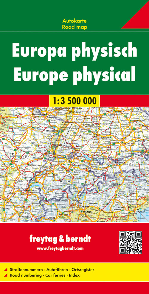
Landkaart van heel Europa waarbij vooral de natuurkundige aspecten worden getoond. Dit geldt met name voor de hoogte verschillen, de gebergten komen minder naar voren. Van de uitgever Neben der übersichtlichen Gestaltung bietet die Straßenkarte "Europa physisch, 1:3,5 Mio." verschiedene Zusatzinformationen wie z.B. Straßennummern und Autofähren. Mit dem umfangreichen Ortsregister gelingt zudem eine rasche Orientierung. Details: Straßennummern, Autofähren, Ortsregister. freytag & berndt Autokarten sind für viele Länder und Regionen weltweit erhältlich.
€14,95
Bekijk product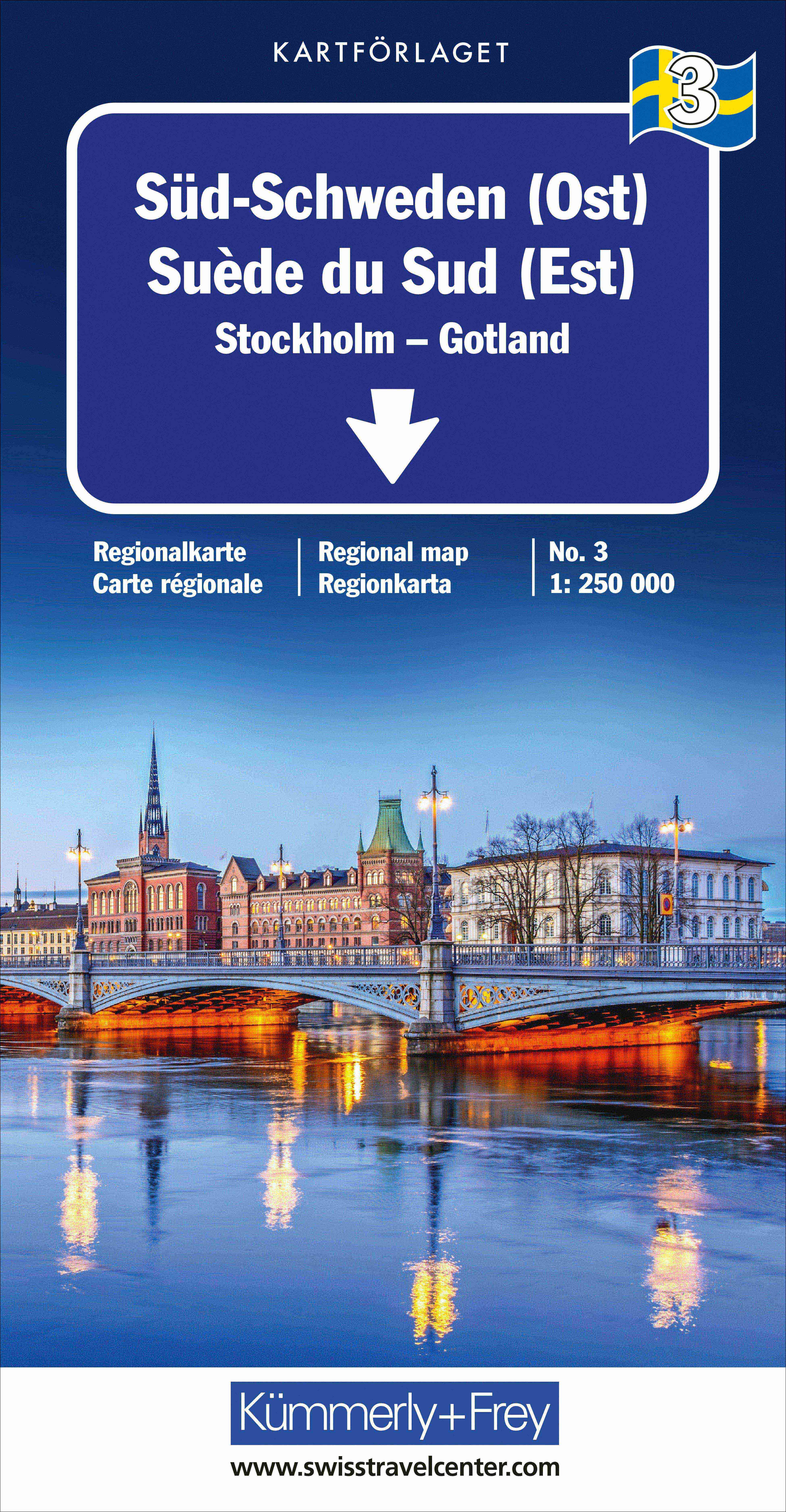
Mooie duidelijke wegenkaart van West Zweden, van Stockholm tot Göteborg. Met o.a. campings, jeugdherbergen, wegnummers en bezienswaardigheden aangegeven. Optimale Orientierung - die Regionalkarten helfen weiter. Mit den Regionalkarten von Kümmerly+Frey fühlen Sie sich auch in den Ferien wie zu Hause. Sie wissen immer, wo Sie sind und wie weit es bis zur nächsten Sehenswürdigkeit ist. Die Regionalkarten sind Lizenzausgaben namhafter kartografischer Verlage. Es gibt sie von folgenden Ländern: Deutschland, Österreich, Italien, Frankreich, Grossbritannien, Spanien/Portugal, Norwegen, Schweden und Dänemark. Beachten Sie dazu die detaillierten Blattschnitte. Massstab 1: 250 000
€14,75
Bekijk product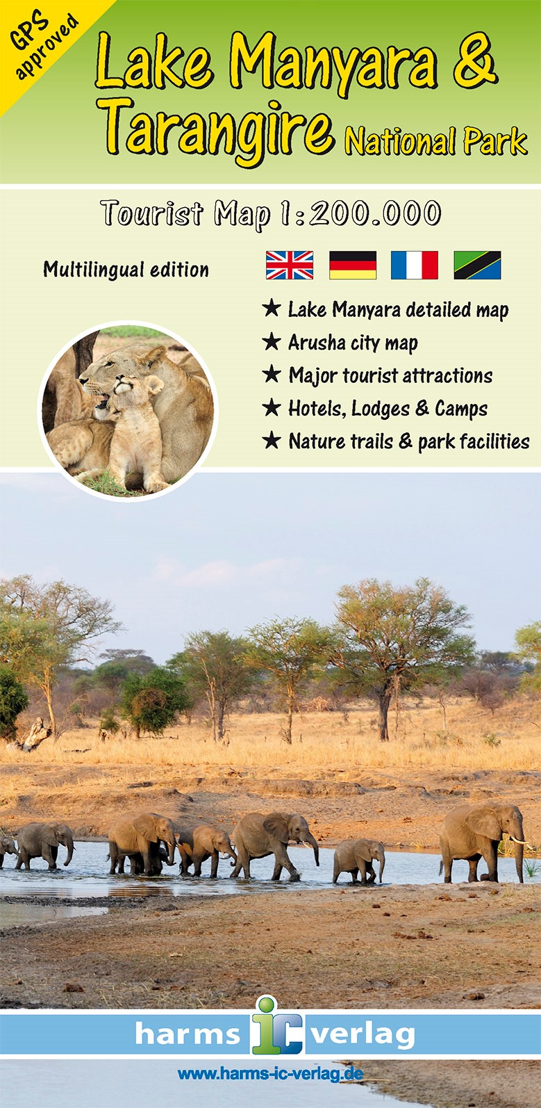
Toeristische kaart van Lake Manyara en Tangarire National Park in drie talen (Duits, Frans en Engels). Helder en duidelijk leesbaar kaartbeeld met topografische informatie, alle wegen en de accommodaties als lodges en campsites. Die Karte im Maßstab 1: 200.000 zeigt das Gebiet der benachbarten Nationalparks Lake Manyara und Tarangire in der Gesamtschau. Zahlreiche Symbole markieren Sehenswürdigkeiten, Hotels, Lodges, Camps, Campsites und andere Parkeinrichtungen. Straßen, Pisten und touristisch bedeutsame Karteninhalte wurden mit GPS neu vermessen. Außerdem sind eine Detailkarte des Lake Manyara Nationalparks im Maßstab 1:100.000 sowie ein Stadtplan von Arusha enthalten. Viersprachige Legende: Englisch, Deutsch, Französisch und Kisuaheli.
€10,95
Bekijk product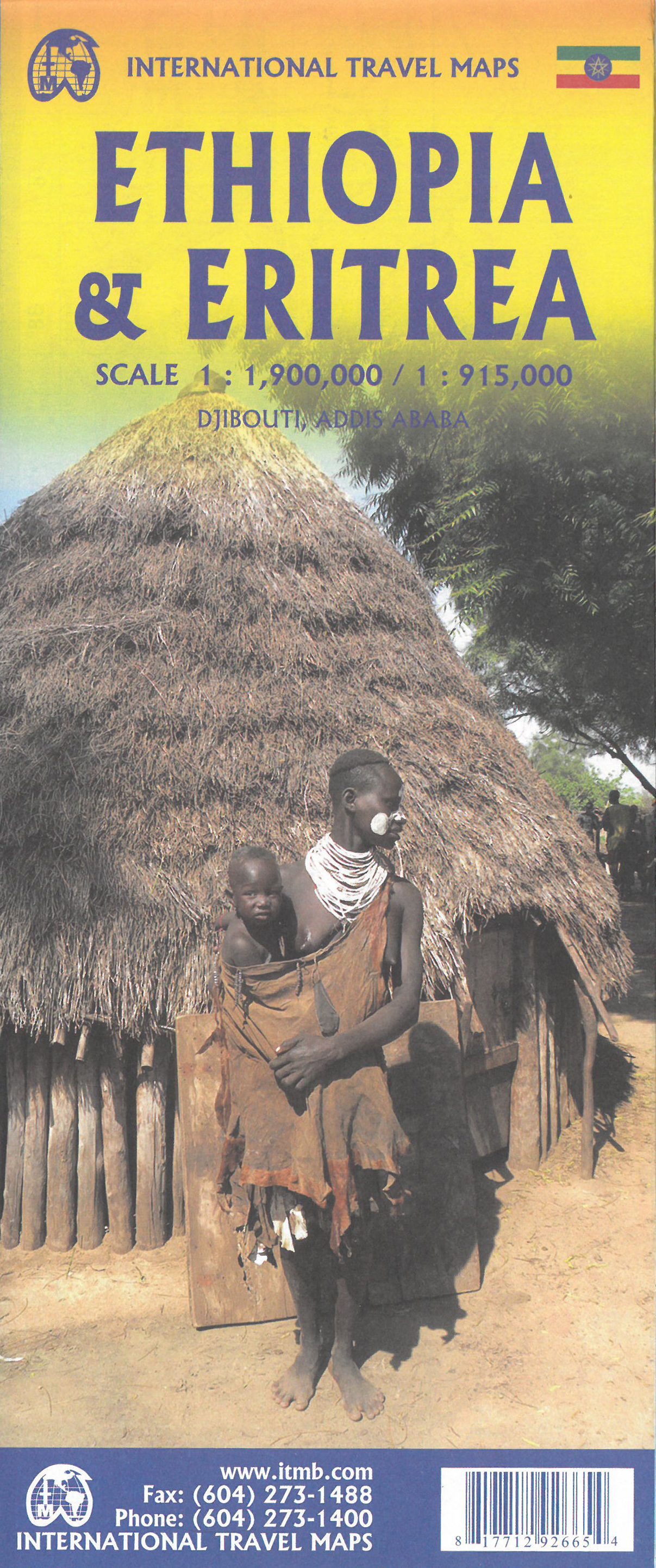
Een degelijke kaart met aanduidingen van o.a. nationale parken, vliegveld, benzinepomp, dirt-roads en kleine plattegrond van hoofdstad. Als overzichtskaart goed te gebruiken. This is the latest updating of one of the most interesting countries in Africa. There isn’t anything brilliantly innovative to report. We have tidied up the different layers of the artwork, have updated the road system, and have added more tourist information. We have also modernized the cover design and changed the ISBN – printed on paper, single-sided, inset map of Addis Ababa. Legend Includes: roads by classification, Airports, Ports, Gasolines, Polices, Post Offices, Bus Stations, Hospitals, Schools, Universities, Buildings, Point of Interests, Bridges, Lodgings, Campsites or Huts, Museums, and many more Double-sided map from ITMB presenting on one side a road map of Ethiopia at 1:2,000,000 accompanied by a street plan of Addis Ababa, with on the reverse Eritrea at 1:900,000 with a plan of Asmara. Both road maps are indexed and show the topography by altitude colouring: in Ethiopia with bands in metres and peak heights given in both metres and feet, and in Eritrea with bands in feet and peak heights either in feet and metres or in feet only. Road network indicates unpaved roads and seasonal tracks, with driving distances shown on main routes. Also marked in both countries are locations of petrol stations and border crossings. The map indicates local airports and landing grounds and in Ethiopia railway lines are shown. Symbols highlight various places of interest. Latitude and longitude lines are drawn at 1º intervals. Each country has a separate index. Street plans of Addis Ababa and Asmara highlight various places of interest including selected hotels and other tourist facilities. The map also includes notes on the history, geography, etc, of both countries.
€13,95
Bekijk product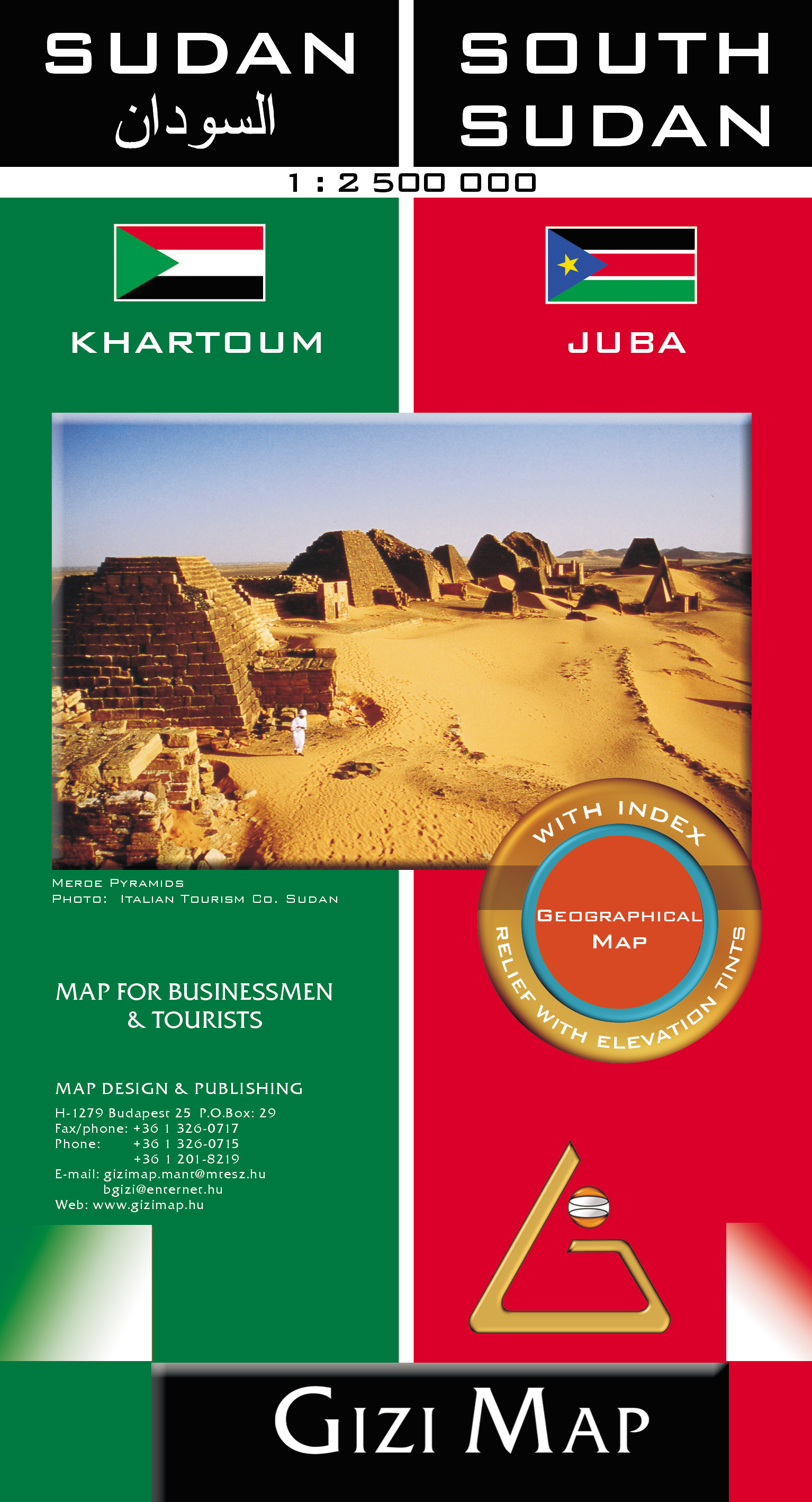
Sudan and South Sudan as separate countries on an excellent indexed map at 1:2,500,000 from Gizi Maps with detailed presentation of the topography, administrative divisions, street plans of Khartoum and Juba, etc. Excellent presentation of the terrain in the publisher’s characteristic style provides a vivid picture of the region’s geography: bold altitude colouring with plenty of spot heights and names of peaks, mountain ranges, etc, plus additional graphics for flood plains, swamps, salt flats, deserts, lava fields, wadis and water wells. National parks or other protected areas and interesting natural sites are highlighted. The map indicates the boundary of the disputed Abyei area and shows the internal administrative boundaries and names of the provinces. Within North Sudan names of larger towns and of the provinces are also given in Arabic. Where appropriate, alternative versions of town names are provided (Khartoum/Al Khartum, Omdurman/Umm Durman, etc). The map shows the road network with desert tracks, indicating distances on main routes and locations of border crossings. Railway lines are included, local airports are marked, and also shown is the ferry connection on the Nile between Aswan and Wadi Halfa . Various places of interest are highlighted, including UNESCO World Heritage sites, pyramids, archaeological remains, etc. Also shown are areas of oil extraction and oil pipelines. The map has latitude and longitude lines at intervals of 1°. The index is on the reverse. Multilingual map legend includes English. Also provided are large, clear street plans of Khartoum and Juba, annotated with places of interest and various facilities.
€15,95
Bekijk product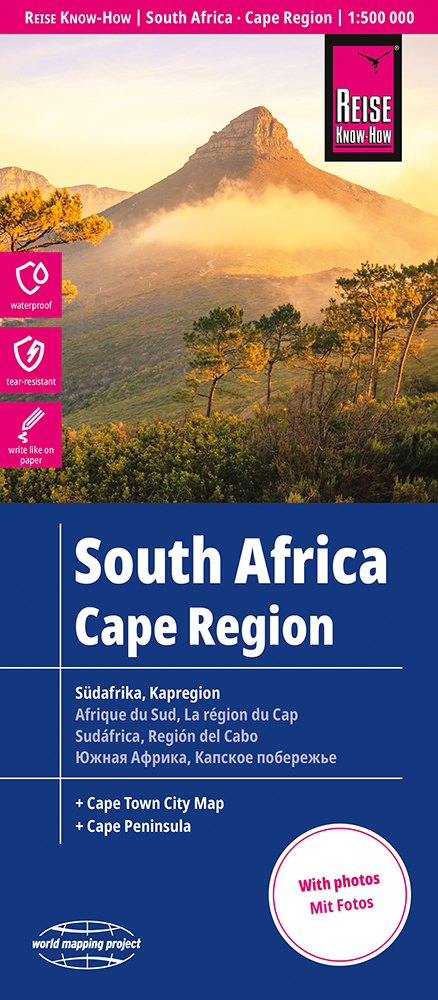
Tweetalige kaart (Engels en Duits). Door ingetekende lengte- en breedtegraden is het gebruik van GPS mogelijk. Met hoogtelijnen en uitgebreid wegennetwerk: daarnaast worden ook de afstanden tussen belangrijke plaatsen duidelijk leesbaar weergegeven. Het kleurgebruik is zodanig dat je een goede indruk krijgt van hoogteverschillen en soorten landschap. Natuurlijk staan de toeristische bezienswaardigheden duidelijk vermeld. Gedrukt op water- en scheurvast papier! Polyart is een synthetisch product vrij van giftige stoffen dus duurzaam. Het papier gaat echt lang mee. Cape Region of South Africa, including the whole of the Garden Route, at 1:500,000 on a light, waterproof and tear-resistant, indexed road map with a street plan of Cape Town and a map of the Cape Peninsula, published by Reise Know-How as part of their highly acclaimed World Mapping Project. The map is double-sided to provide the best balance between a good scale and a convenient size sheet, and divides the region east/west. On the western part coverage within the Western Cape Province extends north to just beyond Bitterfontein and 31° latitude, and includes part of the Northern Cape Province with the Hantamdberg, Roggeveldberge and Komsberge mountains and the Tankwa-Karoo National Park. The eastern half of the map extends beyond Port Elizabeth to Grahamstown and inland to Karoo National Park and Camdeboo NP and Mountain Zebra NP. Topography is indicated by altitude colouring with numerous spot heights and names of mountain ranges and passes. Salt lakes, swamps, seasonal rivers and glacier are also shown. Detailed presentation of the road network includes minor roads and tracks and railways are also shown. Internal administrative units are presented with their boundaries and names. National parks and other protected areas are highlighted. A wide range of symbols mark various places of interest. Map legends include English and all the maps have an index of localities.
€15,95
Bekijk product