
Beantwoord enkele vragen, en binnen seconden geeft AI je een persoonlijk aankoopadvies op maat.
Beantwoord enkele vragen, en binnen seconden geeft AI je een persoonlijk aankoopadvies op maat.
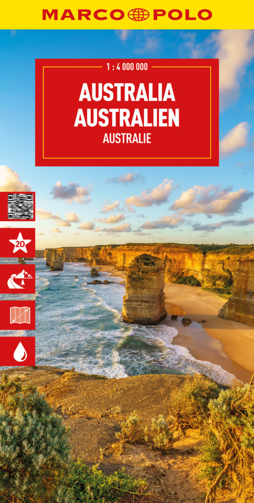
Duidelijke wegenkaart van Marco Polo: alle wegen, zowel de verharde als belangrijke onverharde wegen zijn weergegeven. Mooie toeristisch interessante wegen die de moeite waard zijn, zijn groen gearceerd. Veel toeristische informatie is toegevoegd zoals de nationale parken, campings, kastelen en vliegvelden. Afstanden tussen belangrijke steden en benzinestations staan ook op de kaart. Een plaatsnamenregister ontbreekt niet. Entdecken Sie mit dieser MARCO POLO Karte das Land der Gegensätze . . . Die Karten bestechen durch eine leicht lesbare, neue Kartografie, in der durchgängig landschaftlich schöne Strecken und Orte markiert sind. Schon in der im Kartendeckel befindlichen, ausklappbaren Übersichtskarte sind die schönsten Orte mit Highlightsternen gekennzeichnet und gelben oder grünen Markierungen unterlegt, um unterwegs auch wirklich nichts zu verpassen. Wo alle Orte auf der Karte zu finden sind, ist im Registerheft nachzuschlagen.
€14,95
Bekijk product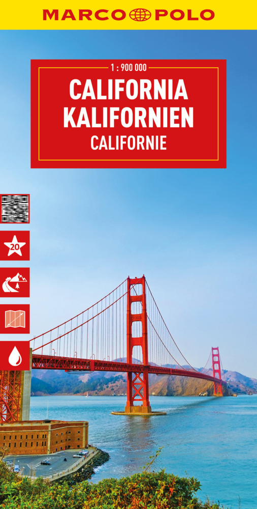
Duidelijke wegenkaart van Marco Polo: alle wegen, zowel de verharde als belangrijke onverharde wegen zijn weergegeven. Mooie toeristisch interessante wegen die de moeite waard zijn, zijn groen gearceerd. Veel toeristische informatie is toegevoegd zoals de nationale parken, campings, kastelen en vliegvelden. Afstanden tussen belangrijke steden en benzinestations staan ook op de kaart. Een plaatsnamenregister ontbreekt niet. --- This Marco Polo map features really easy to read cartography. Topography is highlighted with relief shading and loads of spot heights and the road network is clearly shown with roads ranging from motorways all the way through to minor secondary roads. The map also clearly indicates airports, places of interest, scenic/tourist routes, view points etc. The map includes a booklet attached to the cover that contains some useful information and a very extensive index that covers locations, places of interest and geographical features. Also included are a distance/driving time chart and a fold out flap on the cover with an overview map of the region covered. The legend is in a multitude of languages including English. --- Die Karten bestechen durch eine leicht lesbare, neue Kartografie, in der durchgängig landschaftlich schöne Strecken und Orte markiert sind. Die Reiseroute gefunden? Mit den in der Umschlagklappe untergebrachten, selbstklebenden mark-it-Stickern lässt sich das angepeilte Ziel hervorheben und somit beim nächsten Blick auf die Karte leicht wiederfinden. Schon in der im Kartendeckel befindlichen, ausklappbaren Übersichtskarte sind die schönsten Orte mit gelben oder grünen Markierungen unterlegt, um unterwegs auch wirklich nichts zu verpassen. Die Distanzenkarte sagt, wie weit es noch ist bis zur nächsten größeren Stadt. Und mit den wichtigsten Cityplänen lässt es sich auch im Großstadtdschungel leicht navigieren. Wo alle Orte auf der Karte zu finden sind, ist im Registerheft nachzuschlagen.
€14,95
Bekijk product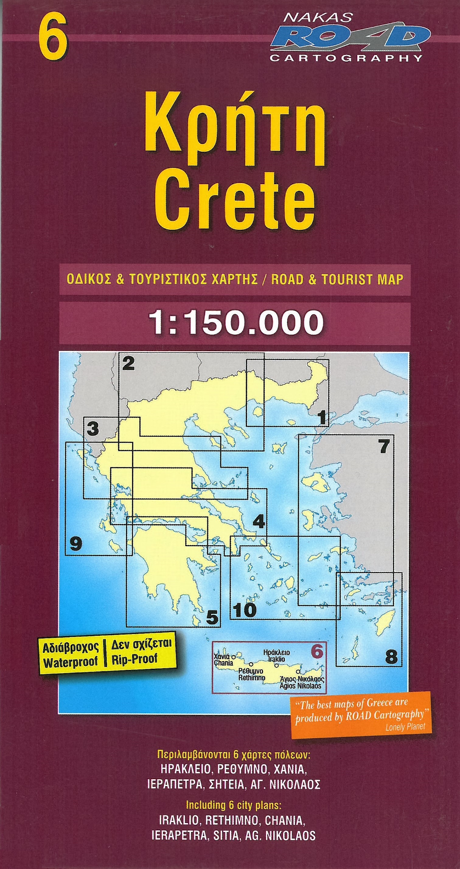
Uitstekende landkaart van Kreta. Gedetailleerde wegenkaart met aanduidingen van o.a. benzinepompen, kleine- en grotere wegen, toeristische informatie. Met vier stadsplattegronden. Iraklio, Agh Nikolaos, Rethymno, Hania
€11,95
Bekijk product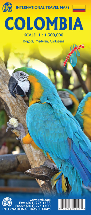
Goede wegenkaart waarbij naast de gebruikelijke zaken als wegen en plaatsen ook veel aandacht is voor de natuurkundige aspecten van het land. Door het kleurgebruik wordt goed duidelijk waar bos, oerwoud, rivieren, meren liggen. Hoogtes zijn zichtbaar door gebruik van verschillende kleuren. Vaak is op de kaart nog een kleine plattegrond van het centrum van de belangrijkste stad te vinden. Colombia is growing in popularity as a travel destination. It is also changing quickly as peace and stability return to a lovely country. We have updated the map to the best of our ability and now have detailed inset maps of Bogota, Medellin, and Cartagena. The border to Ecuador is now an improved crossing. We have printed this updated edition on plastic paper, another improvement, in line with our policy of converting most hot, humid, country maps to plastic. Legend Includes: Roads by classification, Rivers and Lakes, National Park, Airports, Points of Interests, Mining, Archaeological sites, Beach and Skiing, Zoos, Fishing, Handicrafts, Universities, Lighthouses, Border Crossing, Hot Springs, Cultural World Heritage Sites, Natural World Heritage Sites, and much more...
€13,95
Bekijk product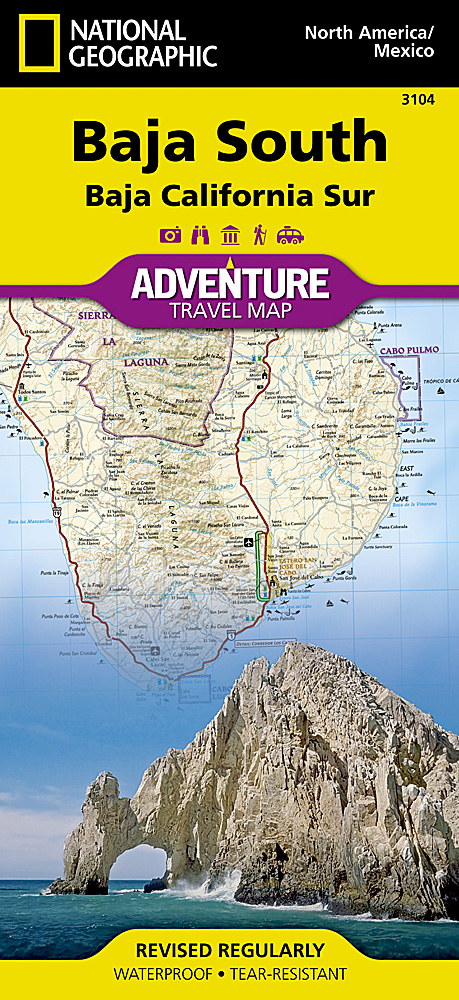
Wegenkaart van Baja California Zuid met vermelding van veel bezienswaardigheden, nationale parken en attrakties. Watervast en scheurvast. Juist door deze vermeldingen onderscheidt de kaart zich van andere wegenkaarten. National Geographic’s Baja South Adventure Map combines detailed terrain with local information on the entire State of Baja California Sur. Together with the Baja North Adventure Map, it covers the entire Baja peninsula and includes detailed insets of Tijuana, Mexicali, Ensenada, La Paz, San Jose Del Cabo, Cabo San Lucas, and the Cabo Resort Corridor. Coverage Highlights: Federally Protected Areas, including parks and reserves, provided by the Nature Conservancy of Mexico; detailed road network, ferry routes, and mileage charts; UNESCO World Heritage Sites; historic mission locations; popular diving, surfing, fishing, snorkeling, whale watching, and scenic viewpoint locations; detailed terrain with shaded relief; useful travel information.
€17,50
Bekijk product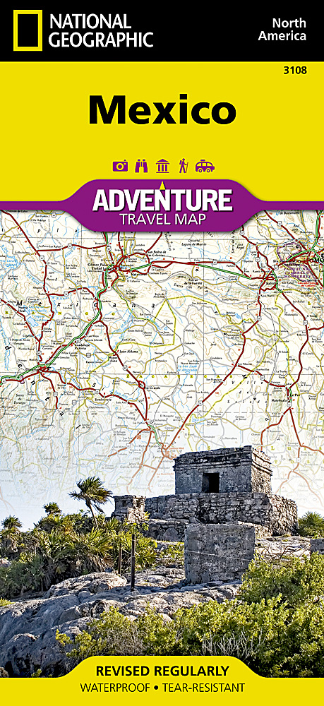
Wegenkaart van Mexico met vermelding van veel bezienswaardigheden, nationale parken en attrakties. Watervast en scheurvast. Juist door deze vermeldingen onderscheidt de kaart zich van andere wegenkaarten. National Geographic's Mexico AdventureMap is designed to meet the unique needs of adventure travelers with its durability and accurate information. This folded map provides global travelers with the perfect combination of detail and perspective, highlighting hundreds of points of interest and the diverse and unique destinations within the country. The map includes the locations of cities and towns with a user-friendly index, plus a clearly marked road network complete with distances and designations for major highways, main roads, and tracks and trails for those seeking to explore more remote regions. The north side of the Mexico map details from the U.S. Border south to Aguascalientes, including Baja California, Chihuahua, Tijuana, Mazatlan, and Monterrey. The south side overlaps with northern side and covers the remainder of the country, plus Belize and nearly all of Guatemala at the same scale. Some of the major cities included on the southern side are Acapulco, Cancun, Mexico City, and Guadalajara.
€17,50
Bekijk product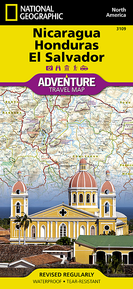
Wegenkaart van Nicaragua, Honduras, en El Salvador met vermelding van veel bezienswaardigheden, nationale parken en attrakties. Watervast en scheurvast. Juist door deze vermeldingen onderscheidt de kaart zich van andere wegenkaarten. National Geographic's Nicaragua, Honduras, El Salvador AdventureMap is designed to meet the unique needs of adventure travelers with its durability and accurate information. This folded map provides global travelers with the perfect combination of detail and perspective, highlighting hundreds of points of interest and the diverse and unique destinations within the country. The map includes the locations of cities and towns with a user-friendly index, plus a clearly marked road network complete with distances and designations for major highways, main roads, and tracks and trails for those seeking to explore more remote regions. Every AdventureMap is printed on durable synthetic paper, making them waterproof, tear-resistant and tough — capable of withstanding the rigors of international travel. Each is two-sided and can be folded to a packable size of (4.25” x 9.25”); unfolded size is (26” x 38”). Key Features: Waterproof and tear-resistant Accurate topography/terrain with a clearly labeled road network Hundreds of points of interest, including the locations parks and nature reserves, protected lands, historical and cultural attractions Thousands of place names including towns and natural features; detailed place names index Important travel networks including airports, lighthouses, ferry routes and rail lines Updated regularly to ensure accuracy
€17,50
Bekijk product
Een degelijke wegenkaart met aanduidingen van o.a. nationale parken, vliegveld, benzinepomp, dirt-roads. Als overzichtskaart goed te gebruiken. Aan de ene zijde de Rocky Mountains in Canada, schaal 1:1.300.000 en aan de andere zijde de Rocky Mountains in de Verenigde Staten, schaal 1:1.600.000
€13,95
Bekijk product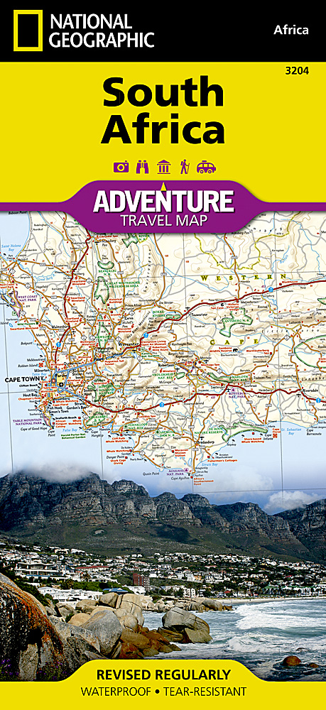
Wegenkaart van Zuid Afrika met vermelding van veel bezienswaardigheden, nationale parken en attrakties. Watervast en scheurvast. Juist door deze vermeldingen onderscheidt de kaart zich van andere wegenkaarten. National Geographic’s South Africa Adventure Map is designed to meet the unique needs of adventure travelers—detailed, durable, and accurate. It includes the locations of thousands of major cities and towns with an index for easily locating them, plus a clearly marked road network complete with distances and designations for major highways, limited access highways, and more. Both paved and unpaved roads, tracks, and trails are marked for those adventurers who wish to explore less traveled routes. What sets National Geographic Adventure Maps apart from traditional road maps are the hundreds of points-of-interest that highlight the diverse, unique, and exotic destinations within South Africa including national parks and reserves, sanctuaries, World Heritage sites, archeological sites, museums, and important travel aids like airports, airfields, rail lines, ferry routes, and lighthouses. The west side of the South Africa map includes the Northern Cape, Western Cape, Eastern Cape, and portions of the North West and Free State provinces. Diverse points of interest are featured including the Western Cape’s wine regions and spas. Along the coast between Cape Town, the legislative capital, and Port Elizabeth, areas for whale watching and shark-cage diving are noted. Johannesburg and neighboring city Pretoria (administrative capital) are included on the east side of the map along with Bloemfontein (judicial capital) and the coastal city of Durban. South Africa’s many national parks, reserves, and wildlife sanctuaries are clearly marked, as are other natural points of interest and scenic viewpoints. Dozens of beaches are noted from the Sunshine Coast to the North Coast for travelers wishing to soak up some sun. Coverage highlights: Kruger Park, Table Mountain, The Garden Route, Real de Catorce, Soweto, Cradle of Humankind, Sterkfotein Caves, and Blyde River Canyon.
€17,50
Bekijk product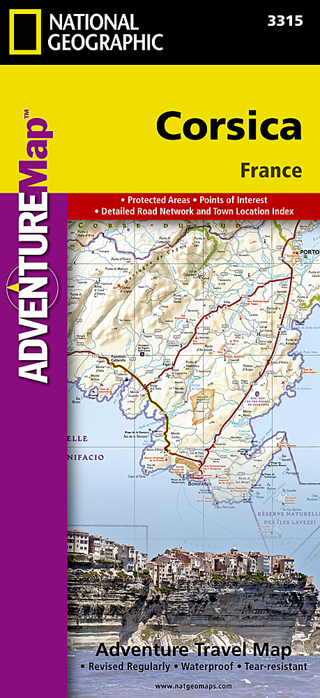
Wegenkaart van Corsica met vermelding van veel bezienswaardigheden, nationale parken en attrakties. Watervast en scheurvast. Juist door deze vermeldingen onderscheidt de kaart zich van andere wegenkaarten. National Geographic's Corsica Adventure Map is designed to meet the unique needs of adventure travelers with its durability and accurate information. Each folded map provides global travelers with the perfect combination of detail and perspective, highlighting the area’s terrain and best locations for adventure activities like snorkeling, surfing, fishing, and more. Adventure Maps include hundreds of points of interest that highlight diverse and unique destinations within the country. The map includes the locations of thousands of cities and towns with a user-friendly index, plus a clearly marked road network complete with distances and designations for major highways, main roads, and tracks and trails for those seeking to explore more remote regions. The front side of the Corsica map details the northern region of this island country; bordering Golfe de Sagone and Golfe de Porto to the west, Tyrrhenian Sea to the east, and the Ligurian Sea and Golfe de St.-Florent to the north. The reverse side of the map details the southern region; from its border with the Bouches de Bonifacio to the south, to the Tyrrhenian Sea, Golfe de Santa-Manza and Golfe de Porto-Vecchio to the east, and the Mediterranean Sea, Golfe de Sagone, Golfe de Valinco and Golfe d’ Ajaccio to the west. This island is located west of Italy, southeast of the French mainland and north of the Italian island of Sardinia. Adventure Maps are printed in the United States on a durable synthetic paper, making it waterproof, tear-resistant and tough—capable of withstanding the rigors of international travel. Key Features: Waterproof and tear-resistant Detailed interpretive information and local travel tips Detailed topography complete with activity symbols, ideal for exploring the country City overview maps Hundreds of points of interest, including the location of World Heritage sites, national parks and nature reserves, aboriginal settlements and protected lands, mines, archeological sites, wildlife parks and more Thousands of place names Important travel aids including airports, lighthouses, ferry routes and rail lines Developed in cooperation with local agencies Updated regularly to ensure accuracy
€17,50
Bekijk product