
Beantwoord enkele vragen, en binnen seconden geeft AI je een persoonlijk aankoopadvies op maat.
Beantwoord enkele vragen, en binnen seconden geeft AI je een persoonlijk aankoopadvies op maat.
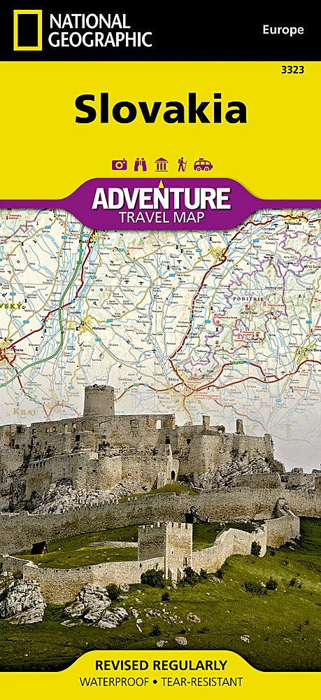
Wegenkaart van Slowakije met vermelding van veel bezienswaardigheden, nationale parken en attrakties. Watervast en scheurvast. Juist door deze vermeldingen onderscheidt de kaart zich van andere wegenkaarten. National Geographic's Slovakia Adventure Map is designed to meet the unique needs of adventure travelers with its durability and accurate information. Each folded map provides global travelers with the perfect combination of detail and perspective, highlighting the area’s terrain and best locations for adventure activities like snorkeling, surfing, fishing, and more. Adventure Maps include hundreds of points of interest that highlight diverse and unique destinations within the country. The map includes the locations of thousands of cities and towns with a user-friendly index, plus a clearly marked road network complete with distances and designations for major highways, main roads, and tracks and trails for those seeking to explore more remote regions. Key Features: Waterproof and tear-resistant Detailed interpretive information and local travel tips Detailed topography complete with activity symbols, ideal for exploring the country City overview maps Hundreds of points of interest, including the location of World Heritage sites, national parks and nature reserves, aboriginal settlements and protected lands, mines, archeological sites, wildlife parks and more Thousands of place names Important travel aids including airports, lighthouses, ferry routes and rail lines Developed in cooperation with local agencies Updated regularly to ensure accuracy
€17,50
Bekijk product
Goede wegenkaart van de Benelux. Met register en enkele stadsplattegronden. De berijdbare wegen zijn goed weergeven, zowel de hoofdwegen als provinciale en lokale wegen; wegnummers worden vermeld. Afstanden tussen plaatsen zijn in kilometers op de kaart ingetekend, daarnaast worden ook op belangrijke plekken benzinepompen gemarkeerd. In het kaartbeeld wordt door middel van schaduw het reliëf weergegeven en soms enkele punten in het landschap met de daadwerkelijke hoogte. Provinciegrenzen zijn goed terug te vinden, nationale parken en reservaten ook. Met allerhande symbolen worden toeristische bezienswaardigheden weergegeven als monumenten, historisch belangrijke plekken en uitzichtpunten. In bepaalde plaatsen zijn hotels en campings te vinden, luchthavens, treinverbindingen en havens vindt u er ook op!
€14,95
Bekijk product
Goede tweezijdige wegenkaart van het hele land. Met register en enkele stadsplattegronden. De berijdbare wegen zijn goed weergeven, zowel de hoofdwegen als provinciale en lokale wegen; wegnummers worden vermeld. Afstanden tussen plaatsen zijn in kilometers op de kaart ingetekend, daarnaast worden ook op belangrijke plekken benzinepompen gemarkeerd. In het kaartbeeld wordt door middel van schaduw het reliëf weergegeven en soms enkele punten in het landschap met de daadwerkelijke hoogte. Provinciegrenzen zijn goed terug te vinden, nationale parken en reservaten ook. Met allerhande symbolen worden toeristische bezienswaardigheden weergegeven als monumenten, historisch belangrijke plekken en uitzichtpunten. In bepaalde plaatsen zijn hotels en campings te vinden, luchthavens, treinverbindingen en havens vindt u er ook op!Explore Ireland with this Freytag & Berndt double-sided road map. The best way to plan your trip, prepare your itinerary, and to travel independently in this country. As with all Freytag & Berndt maps the cartography is clear and detailed with the topography shown by relief shading with plenty of spot heights. The map includes a localities index and inset maps of Dublin, Belfast, Galway, Limerick and Waterford in a booklet attached to the cover. Major city names are written in English and in Gaelic. Tourist information and places of interest are clearly marked by a range of icons, including: airports monasteries and churches manor-houses, castles and ruins camping sites lighthouses marinas monuments golf-courses national parks Distances between points are shown as well as indications of steep gradients, all distances are in kilometres. The legend is in English, Gaelic, Spanish, German, Dutch, Italian, French, Czech, Slovak, and Hungarian.
€14,95
Bekijk product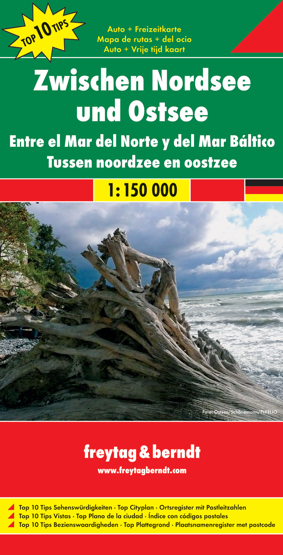
Een aangepaste versie van de Duitse provinciekaarten van Freytag & Berndt: duidelijk veel meer toegespitst op de toeristische aspecten van de streek. Deze bijzonder gedetailleerde Freytag & Berndt Wegenkaart van Noordzee & Baltische zee heeft een schaal van 1:150.000. Op deze kaart staan o.a. fietsroutes, lange afstandswandelpaden, toeristische wegen en bezienwaardigheden aangegeven. In de omslag van de kaart is een apart boekje geniet met een korte beschrijving van de TOP 10 van bezienswaardigheden, een uitgebreide index en plattegrondjes van enkele toeristische plaatsen.
€14,95
Bekijk product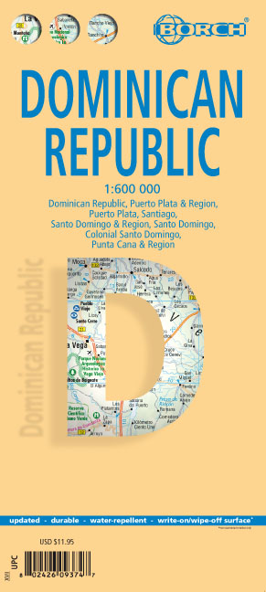
Mooie geplasticieerde kaart van de Dominicaanse Republiek. Deze kaart biedt een goed overzicht van het land met detailkaarten. Our soft-laminated map of the Dominican Republic includes: Dominican Republic 1:600 000, Puerto Plata & Region 1:250 000, Puerto Plata 1:20 000, Santiago 1:17 500, Santo Domingo & Region 1:250 000, Santo Domingo 1:22 500, Colonial Santo Domingo 1:10 000, Punta Cana & Region 1:185 000, Dominican Republic administrative / time zones; interesting statistics: conversion chart for temperatures, weights and measures; climate chart with temperatures, sunshine hours, precipitation and humidity; table of distances; hotels, museums, markets, public transport and much more. Christopher Columbus discovered the island of Hispaniola on December 5th 1492 and founded "La Navidad", said to be the first European settlement in the New World. He became viceroy of Hispaniola and settled in the place where today's capital, Santo Domingo, is situated. During the following centuries, innumerable pirate raids gradually brought the export trade to a standstill, but French colonialists who settled in the west of the island managed to drive them off. Thus, the first independent black republic of the world was founded: République d'Haiti. In 1844 the former Spanish settlers declared their independence from Spain and founded the Dominican Republic. The Dominicans are a very hospitable, open-minded and peace-loving people. Stress and hectic are unknown to them - quite understandable as they are blessed with almost constant holiday temperatures and idyllic surroundings. Travellers are welcome to enjoy the beauty of ca. 1600km (979 miles) of coast, with marvellous palm beaches and snug bays, or the mountains with their lavish profusion of flora and fauna.
€11,50
Bekijk product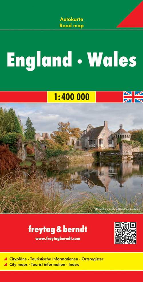
Gedetailleerde, tweezijdige landkaart van Engeland en Wales op schaal 1:400.000, prima geschikt voor planning en rondtrekken. De berijdbare wegen zijn goed weergeven, zowel de hoofdwegen als provinciale en lokale wegen; wegnummers worden vermeld. Afstanden tussen plaatsen zijn in kilometers op de kaart ingetekend, daarnaast worden ook op belangrijke plekken benzinepompen gemarkeerd. In het kaartbeeld wordt door middel van schaduw het reliëf weergegeven en soms enkele punten in het landschap met de daadwerkelijke hoogte. Provinciegrenzen zijn goed terug te vinden, nationale parken en reservaten ook. Met allerhande symbolen worden toeristische bezienswaardigheden weergegeven als monumenten, historisch belangrijke plekken en uitzichtpunten. In bepaalde plaatsen zijn hotels en campings te vinden, luchthavens, treinverbindingen en havens vindt u er ook op! Explore England and Wales with this double-sided Freytag & Berndt road map. Topography is depicted using colour shading. The map features maps on both sides, as well an inset of the Channel Islands. Icons and markings are used to show tourist information and sites of interest. These include: Motorways, carriageways, toll roads and railway lines Car ferry routes and airports Places of interest such as wildlife parks, reserves, camping sites Distances between points are shown in kilometres. Also included is a booklet. Within this booklet you will find localities listed, along with their postcodes. There is also city plans for London.
€14,95
Bekijk product
Bijzonder gedetailleerde wegenkaart van Zuid-Tirol, Alto Adige & Bolzano met alle belangrijke aanduidingen en toeristische symbolen. Met register en aanduiding van campings en afstanden. Goede wegenkaart van dit deel van Italië. Met register en enkele stadsplattegronden. De berijdbare wegen zijn goed weergeven, zowel de hoofdwegen als provinciale en lokale wegen; wegnummers worden vermeld. De grotere doorgaande wandelpaden vind je zelfs terug op deze kaart! Afstanden tussen plaatsen zijn in kilometers op de kaart ingetekend, daarnaast worden ook op belangrijke plekken benzinepompen gemarkeerd. In het kaartbeeld wordt door middel van schaduw het reliëf weergegeven en soms enkele punten in het landschap met de daadwerkelijke hoogte. Provinciegrenzen zijn goed terug te vinden, nationale parken en reservaten ook. Met allerhande symbolen worden toeristische bezienswaardigheden weergegeven als monumenten, historisch belangrijke plekken en uitzichtpunten. In bepaalde plaatsen zijn hotels te vinden, luchthavens, treinverbindingen en havens vindt u er ook op! Belangrijk is ook dat op deze kaartenserie de campings ingetekend staan
€14,95
Bekijk product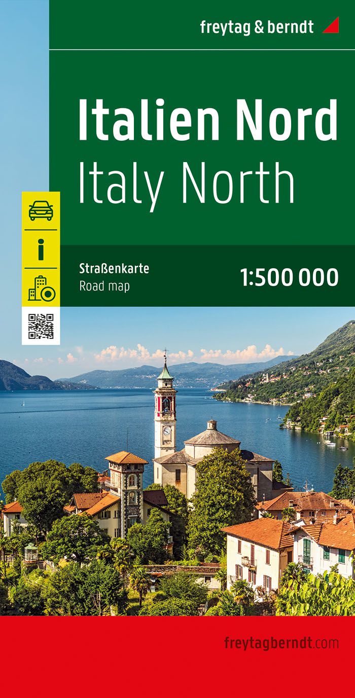
Gedetailleerde wegenkaart van het noordelijke deel van Italië met alle belangrijke aanduidingen en toeristische symbolen. Met register en aanduiding van campings en afstanden. De berijdbare wegen zijn goed weergeven, zowel de hoofdwegen als provinciale en lokale wegen; wegnummers worden vermeld. Afstanden tussen plaatsen zijn in kilometers op de kaart ingetekend, daarnaast worden ook op belangrijke plekken benzinepompen gemarkeerd. In het kaartbeeld wordt door middel van schaduw het reliëf weergegeven en soms enkele punten in het landschap met de daadwerkelijke hoogte. Provinciegrenzen zijn goed terug te vinden, nationale parken en reservaten ook. Met allerhande symbolen worden toeristische bezienswaardigheden weergegeven als monumenten, historisch belangrijke plekken en uitzichtpunten. In bepaalde plaatsen zijn hotels en campings te vinden, luchthavens, treinverbindingen en havens vindt u er ook op!
€14,95
Bekijk product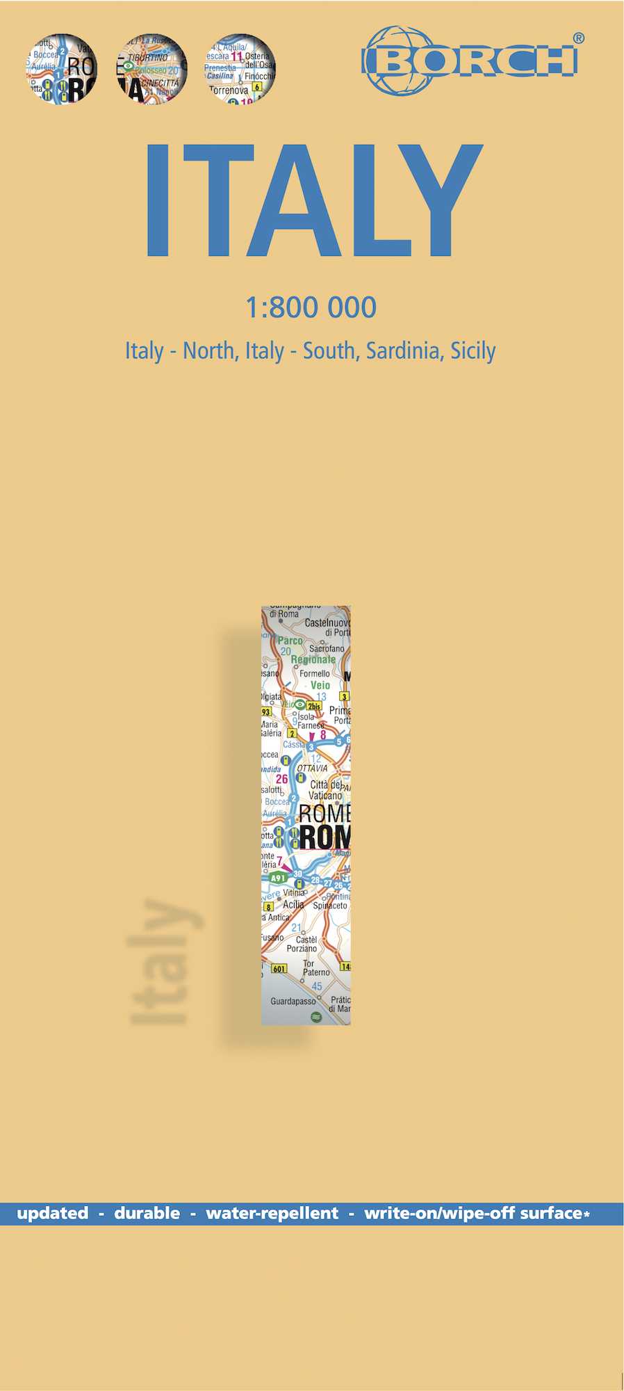
Mooie geplasticieerde kaart van Italië. Deze kaart biedt een goed overzicht van het land met detailkaarten. Our soft-laminated folded map of Italy shows: Italy North, Italy South, Sardinia and Sicily 1:800 000, Italy administrative, Europe time zones. Borch Maps are easy to fold, durable and water-repellent with a wipeable surface. Borch Maps show hotels, museums, monuments, markets, public transport, top sights and points of interest, useful statistics, conversion charts for temperatures, weights and measurements, climate charts showing temperatures, sunshine hours, precipitation and humidity, overview maps, time zones, and much more... Art, architecture, ancient Rome, Vatican City, San Marino, sculpture, culture, operas and arenas, beaches and mountains, music and dance, friendly and energetic people, delicious food, world-class fashion and design, splendid wines - just a few impressions of the beautiful Italian peninsula. Today Italy is a highly developed country and politically speaking a significant power. Its nominal GDP is rated 9th highest in the world per capita and its Human Development Index (HDI) is ranked 25th in the world. Italy was a founding member of the European Union and is a G-8, G-20 and NATO member country. Italy is a country of beauty and endless cultural highlights, romantic villages and breathtaking landscapes combined with that charming, unique Italian style of life. Italy is a country worth experiencing at least once.
€11,50
Bekijk product
Mooie geplasticieerde kaart van Spanje. Deze kaart biedt een goed overzicht van het land met detailkaarten. Our soft-laminated folded map of Spain shows: Spain East 1:875 000, Spain West 1: 875 000, Canary Islands 1:1 875 000, Spain administrative and Europe time zones. Borch Maps are easy to fold, durable and water-repellent with a wipeable surface. Borch Maps show hotels, museums, monuments, markets, public transport, top sights and points of interest, useful statistics, conversion charts for temperatures, weights and measurements, climate charts showing temperatures, sunshine hours, precipitation and humidity, overview maps, time zones, and much more... The Kingdom of Spain is the twelfth-largest economy in the world and was once the leading power and colonial empire in Europe. Spain has suffered its share of wars, invasions, inquisitions, and isolation, contributing to the rich and diverse culture that democratic Spain today represents. Its territory covers the central and eastern Iberian peninsula, which it shares with Portugal and its territory includes the Balearic and Canary Islands, as well as several other islands and autonomous communities. Its climate is as diverse as its languages, with Spanish classified as the main language and Catalan, Basque and Galician recognized as co-official languages. But Spain's regions also differ in landscape, customs and cuisine; from the Basques who live in the forested, mountainous region on the northern coast, through Castile in central Spain: a land of plains separated by barren ravines, to Andalusia in the south: famous for its bullfights, dances and castagnets. Sandy beaches and dramatic landscapes, friendly people, superb food and a diverse heritage are just a few of many reasons to visit wonderful Spain.
€11,50
Bekijk product