
Beantwoord enkele vragen, en binnen seconden geeft AI je een persoonlijk aankoopadvies op maat.
Beantwoord enkele vragen, en binnen seconden geeft AI je een persoonlijk aankoopadvies op maat.

Gedetailleerde, tweezijdige landkaart van Myanmar - Birma, prima geschikt voor planning en rondtrekken over alle eilanden. De berijdbare wegen zijn goed weergeven, zowel de hoofdwegen als provinciale en lokale wegen; wegnummers worden vermeld. Afstanden tussen plaatsen zijn in kilometers op de kaart ingetekend, daarnaast worden ook op belangrijke plekken benzinepompen gemarkeerd. In het kaartbeeld wordt door middel van schaduw het reliëf weergegeven en soms enkele punten in het landschap met de daadwerkelijke hoogte. Provinciegrenzen zijn goed terug te vinden, nationale parken en reservaten ook. Met allerhande symbolen worden toeristische bezienswaardigheden weergegeven als monumenten, historisch belangrijke plekken en uitzichtpunten. In bepaalde plaatsen zijn hotels en campings te vinden, luchthavens, treinverbindingen en havens vindt u er ook op!
€14,95
Bekijk product
Tweetalige kaart (Engels en Duits). Door ingetekende lengte- en breedtegraden is het gebruik van GPS mogelijk. Met hoogtelijnen en uitgebreid wegennetwerk: daarnaast worden ook de afstanden tussen belangrijke plaatsen duidelijk leesbaar weergegeven. Het kleurgebruik is zodanig dat je een goede indruk krijgt van hoogteverschillen en soorten landschap. Natuurlijk staan de toeristische bezienswaardigheden duidelijk vermeld. Gedrukt op water- en scheurvast papier! Polyart is een synthetisch product vrij van giftige stoffen dus duurzaam. Het papier gaat echt lang mee. Topography is indicated by altitude colouring with numerous spot heights and names of mountain ranges and passes. Salt lakes, swamps, seasonal rivers and glacier are also shown. Detailed presentation of the road network includes minor roads and tracks and railways are also shown. Internal administrative units are presented with their boundaries and names. National parks and other protected areas are highlighted. A wide range of symbols mark various places of interest. Map legends include English and all the maps have an index of localities.
€15,95
Bekijk product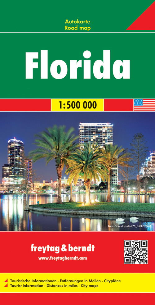
Gedetailleerde, tweezijdige landkaart van Florida, prima geschikt voor planning en rondtrekken . De berijdbare wegen zijn goed weergeven, zowel de hoofdwegen als provinciale en lokale wegen; wegnummers worden vermeld. Afstanden tussen plaatsen zijn in kilometers op de kaart ingetekend, daarnaast worden ook op belangrijke plekken benzinepompen gemarkeerd. In het kaartbeeld wordt door middel van schaduw het reliëf weergegeven en soms enkele punten in het landschap met de daadwerkelijke hoogte. Provinciegrenzen zijn goed terug te vinden, nationale parken en reservaten ook. Met allerhande symbolen worden toeristische bezienswaardigheden weergegeven als monumenten, historisch belangrijke plekken en uitzichtpunten. In bepaalde plaatsen zijn hotels en campings te vinden, luchthavens, treinverbindingen en havens vindt u er ook op!
€14,95
Bekijk product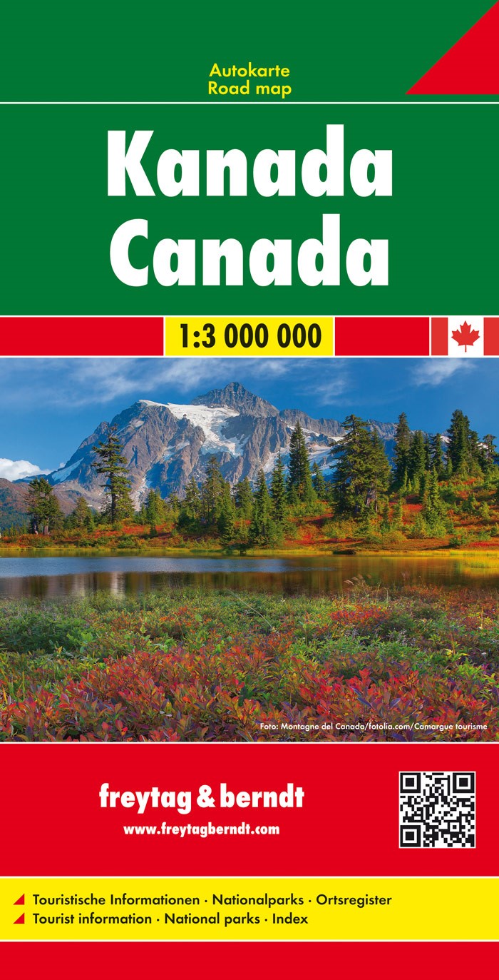
Gedetailleerde, tweezijdige landkaart van Canada, prima geschikt voor planning en rondtrekken . De berijdbare wegen zijn goed weergeven, zowel de hoofdwegen als provinciale en lokale wegen; wegnummers worden vermeld. Afstanden tussen plaatsen zijn in kilometers op de kaart ingetekend, daarnaast worden ook op belangrijke plekken benzinepompen gemarkeerd. In het kaartbeeld wordt door middel van schaduw het reliëf weergegeven en soms enkele punten in het landschap met de daadwerkelijke hoogte. Provinciegrenzen zijn goed terug te vinden, nationale parken en reservaten ook. Met allerhande symbolen worden toeristische bezienswaardigheden weergegeven als monumenten, historisch belangrijke plekken en uitzichtpunten. In bepaalde plaatsen zijn hotels en campings te vinden, luchthavens, treinverbindingen en havens vindt u er ook op!
€14,95
Bekijk product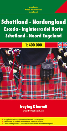
Goede tweezijdige wegenkaart van het Noord Engeland en Schotland. Met register en enkele stadsplattegronden. De berijdbare wegen zijn goed weergeven, zowel de hoofdwegen als provinciale en lokale wegen; wegnummers worden vermeld. Afstanden tussen plaatsen zijn in kilometers op de kaart ingetekend, daarnaast worden ook op belangrijke plekken benzinepompen gemarkeerd. In het kaartbeeld wordt door middel van schaduw het reliëf weergegeven en soms enkele punten in het landschap met de daadwerkelijke hoogte. Provinciegrenzen zijn goed terug te vinden, nationale parken en reservaten ook. Met allerhande symbolen worden toeristische bezienswaardigheden weergegeven als monumenten, historisch belangrijke plekken en uitzichtpunten. In bepaalde plaatsen zijn hotels en campings te vinden, luchthavens, treinverbindingen en havens vindt u er ook op! Neben der übersichtlichen Gestaltung bietet die Straßenkarte "Schottland - Nordengland 1:400.000" zahlreiche Zusatzinformationen wie z.B. Sehenswürdigkeiten, Campingplätze und einen Innenstadtplan von Edinburgh. Mit dem umfangreichen Ortsregister gelingt eine rasche Orientierung. Schottland - Nordengland 1:400.000 Maßstab 1:400.000 Entfernungen in km Aussichtspunkte Ortsregister Touristische Informationen Cityplan Edinburgh Doppelseitig
€14,95
Bekijk product
Mooie geplasticieerde kaart van Hawaiï. Deze kaart biedt een goed overzicht van deze eilanden met detailkaarten. Our soft-laminated folded map of Hawaii shows: Hawaii (Big Island) 1:400 000, Kilauea Caldera 1:150 000, Hilo 1:70 000, Maui, Molokai / Lanai / Kahoolawe 1:200 000, Wailuku & Kahului 1:35 000, Hawaiian Islands 1:4 000 000, Niihau 1:400 000, Kauai / Oahu 1:200 000, Honolulu & Pearl Harbour 1:26 000, Honolulu Downtown 1:15 500, USA administrative & time zones. Borch Maps are easy to fold, durable and water-repellent with a wipeable surface. Borch Maps show hotels, museums, monuments, markets, public transport, top sights and points of interest, useful statistics, conversion charts for temperatures, weights and measurements, climate charts showing temperatures, sunshine hours, precipitation and humidity, overview maps, time zones, and much more... Borne of fire and water barely 300 million years ago, the eight islands of the Hawaiian Archipelago together form the 50th US state of Hawaii, the only state not located on the North American continent. Situated in the mid-Pacific, Hawaii is the only state besides Alaska that is not bordered by another US state. The Hawaiian language has unfortunately become almost obsolete, but the roots of today's hula-hula dance, surf-riding and the lovely leis are firmly anchored in Hawaii's age-old heritage and traditions, which today play an increasingly important role as this state strives to retain its unique cultural heritage. Be welcomed with a friendly "aloha" and a colorful lei and step into the splendour of an unforgettable island paradise. Or, as Mark Twain described the islands: "The most charming fleet of islands that ever set sail"!
€11,50
Bekijk product
Regionale kaart met veel praktische informatie als campings, bezienswaardigheden, fietsroutes etc. Een handige kaart als je vanuit een bepaalde standplaats de omgeving wilt verkennen. Geplastificeerd Zoals op het overzicht te zien is, blijkt niet heel Duitsland gedekt door deze serie. Zo zijn de landsgrenzen met Nederland niet in kaart gebracht door Marco Polo. Kijk dus goed op het overzicht hoe deze kaart uitgesneden is. Im praktischen Set: Freizeitkarte und Freizeitführer für die schönsten Ausflüge für Freizeit und Familie. * 66 spannende Freizeittipps. * 8 bis 10 abwechslungsreiche Radtouren * Viele Symbole zeigen die Sehenswürdigkeiten * Ausführliche Beschreibung der Freizeittipps. * Detailierte Beschreibung der Radtouren Freizeitkarte: 66 Tipps sind in der Karte farblich nach Themen gekennzeichnet, am Kartenrand als Kurz-Orientierung durch Bild und Text erklärt und im Extra Guide ausführlich beschrieben. Mit Tipps zu Erlebnis, Natur und Kultur und 20-30 in der Karte eingezeichneten Wanderparkplätzen. Zusätzliche Hinweise am Kartenrand. Empfehlungen für Familien mit Kindern und Empfehlungen bei Schlechtwetter . Der Extra Guide: Im Extra Guide sind die 66 Tipps aus der Karte beschrieben. Zusätzlich enthalten und in der Karte eingezeichnet sind ca. 10 Fahrradtouren und ca. 20-30 Biergärten und Ausflugslokale.
€11,50
Bekijk product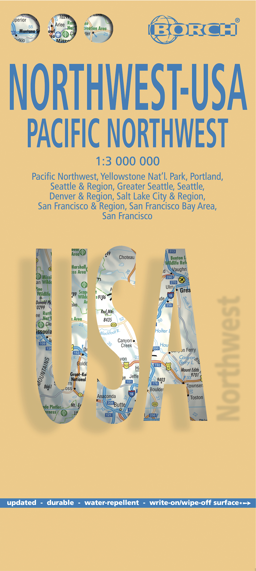
Mooie geplasticieerde kaart van het Noordwesten van de USA. Deze kaart biedt een goed overzicht van het land met detailkaarten. Our soft-laminated map of USA Northwest - USA 1 includes: Pacific Northwest 1:3 000 000, San Francisco 1:15 000, San Francisco Bay Area 1:400 000, San Francisco & Region 1:1 000 000, Seattle 1:13 000 and Greater Seattle 1:350 000, Seattle & Region 1:1 000 000, Portland 1:20 000, Denver & Region 1:1 000 000, Salt Lake City & Region 1:1 000 000, Yellowstone National Park 1:1 000 000, USA administrative & time zones, interesting statistics, conversion chart for temperatures, weights and measures, climate chart with temperatures, sunshine hours, precipitation and humidity and much more. The beautiful landscape of Oregon and Washington includes rugged coastline, mountain ranges, lakes, rivers, rich farmland and burgeoning wine country, as well as the magnificent cities of Portland and Seattle with their bustling cosmopolitan flair. While Seattle is renowned as the "San Francisco of the North", the states of Montana, Wyoming, Idaho, Colorado and Utah, dominated by the Rocky Mountains and their foothills, are home to some of America's most spectacular scenery. Yellowstone National Park - the world's largest supervolcano - is a highlight, with boiling geysers, mud volcanos, frozen lakes, deep pine forests, steep waterfalls, fossilized trees and an array of wildlife. Interesting cities include Salt Lake City - terminus of the Mormons great overland trek and Denver - a modern city that has retained its heritage as a wild frontier town.
€11,50
Bekijk product
Mooie geplasticieerde kaart van het Zuidoosten van de USA. Deze kaart biedt een goed overzicht van het land met detailkaarten. Our soft-laminated map of the southeast of the USA - USA 6 includes: The South & Florida 1:3 000 000, Central Florida 1:1 350 000, Atlanta & Region 1:1 000 000, Atlanta Downtown 1:15 000, Miami & Florida Keys 1:1 000 000, Miami Downtown 1:20 000, South Miami Beach 1:20 000, New Orleans & Region 1:1 000 000, New Orleans French Quarter 1:13 000, USA administrative & time zones, interesting statistics, conversion chart for temperatures, weights and measures, climate chart with temperatures, sunshine hours, precipitation and humidity and much more. From Washington D.C. along the Atlantic coast to Florida and west to Louisiana and Arkansas, this is original plantation country, which has long since "gone with the wind". Yet traces of the charming Old South can still be found in the historic cities of Alexandria, Williamsburg, Charleston, and Savannah, and along the Mississippi River in Louisiana and Mississippi. However, the impressive cities of Atlanta, New Orleans and Miami have shaped the face of the progressive New South with their multicultural vitality and fascinating mix of old and new architecture. Florida, the "Sunshine State", offers perfect beaches for relaxing holidays, very friendly locals, and the magnificent reefs of the Florida Keys are renowned among snorkellers and divers.
€11,50
Bekijk product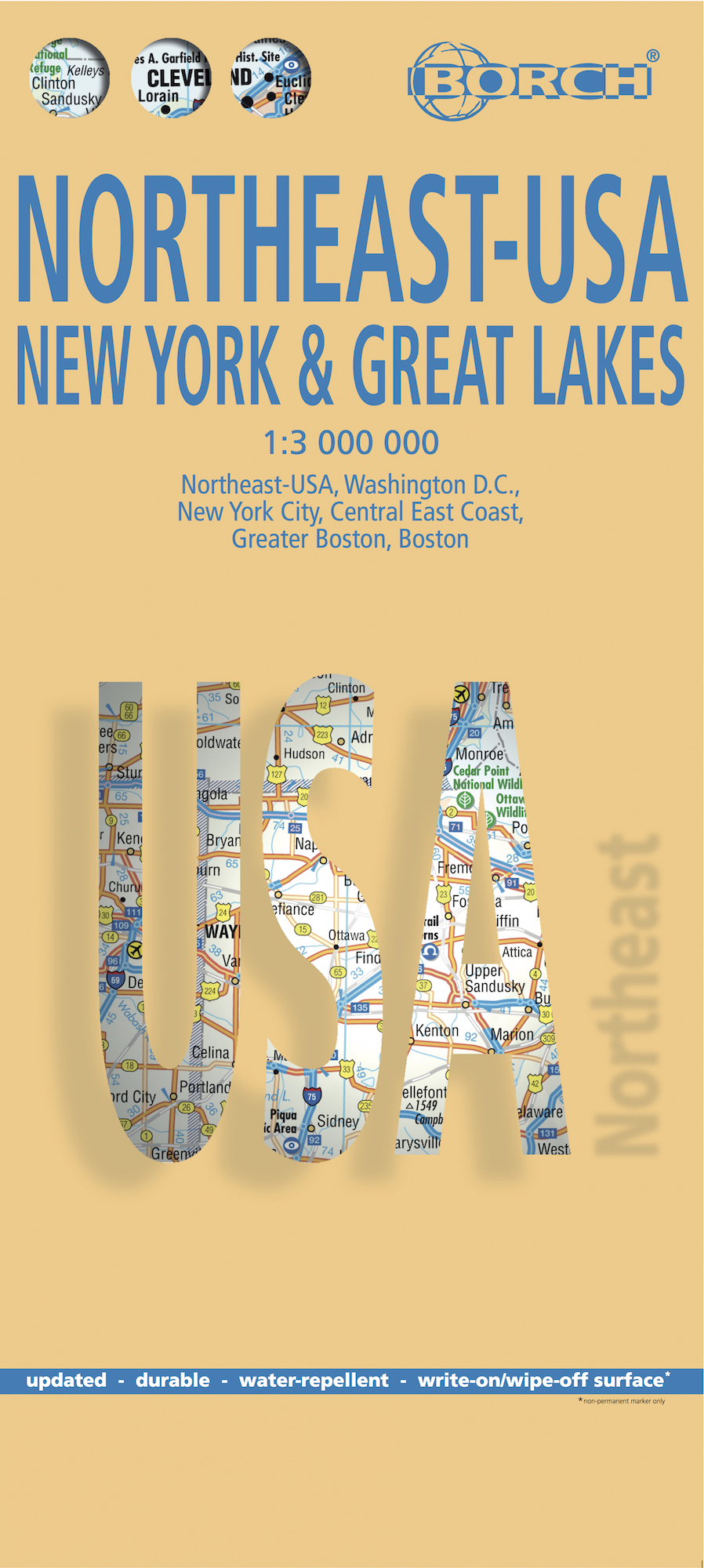
Mooie geplasticieerde kaart van het Noordoosten van de USA. Deze kaart biedt een goed overzicht van het land met detailkaarten. Our soft-laminated folded map of Northeast-USA - New York & Great Lakes shows: Northeast USA 1:3 000 000, Greater Boston 1:1 000 000, Central East Coast 1:1 000 000, Boston 1: 14 000, New York City 1:20 000, Washington DC 1:15 000, USA administrative & time zones. Borch maps are easy to fold, durable and water-repellent with a wipeable surface. Borch Maps show hotels, museums, monuments, markets, public transport, top sights and points of interest, useful statistics, conversion charts for temperatures, weights and measurements, climate charts showing temperatures, sunshine hours, precipitation and humidity, overview maps, time zones, and much more... From Philadelphia's Independence Park to Boston's Freedom Trail, New York's Federal Hall to Washington's Capitol Hill, from the Potomac to the "honeymooners' paradise" of Niagara Falls, New England and the mid-Atlantic States are brimming with history and tantalising beauty. Those who want to escape the frenetic pace of New York and Boston will be delighted by New England's old charm: the timeless beauty of "America's Rhine" (Hudson River Valley north of New York); the wildlife refuges of Long Island; the unique flavour of Cape Cod; the historic cities of Worcester and Providence. Washington D.C., the nation's magnificent capital, provides opportunity for fascinating excursions into the beautiful history-laden hinterland, including Manassas and Fredericksburg - former battlefields of the Civil War, Pennsylvania Dutch Country, the intriguing Appalachian ridges where the first Irish and German settlers established their roots and the enchanting scenery around Virginia's Tidewater region.
€11,50
Bekijk product