
Beantwoord enkele vragen, en binnen seconden geeft AI je een persoonlijk aankoopadvies op maat.
Beantwoord enkele vragen, en binnen seconden geeft AI je een persoonlijk aankoopadvies op maat.
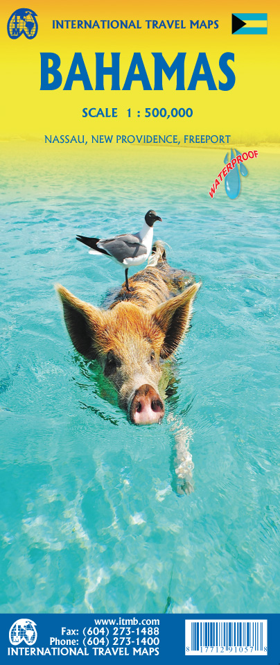
Een degelijke kaart met aanduidingen van o.a. nationale parken, vliegveld, benzinepomp, dirt-roads en kleine plattegrond van hoofdstad. As overzichtskaart goed te gebruiken. The Bahamas is one of the most touristic Caribbean island countries, with huge resort complexes in Nassau and in Freeport. We visited Grand Bahama Island earlier this month and can attest to the friendliness of the people and the attractiveness of the island. This map shows all of the many islands that comprise The Bahamas. There isn’t a lot of contouring, as the country’s highest point is only 36 feet above sea level. An inset map expanding the island of New Providence, and separate inset maps of Nassau and of Freeport, are included. The map is double-sided, east half-west half, printed on waterproof paper for durability.
€13,95
Bekijk product
Central Italy at 1:400,000 from the Touring Club Italiano, printed on light, waterproof and tear-resistant plastic paper; one of the titles in a series of three touring maps conveniently grouping together several popular holiday areas. The maps very effectively present the country’s topography with attractive altitude colouring, supplemented by names of numerous hill and mountain ranges, valleys, etc, plus spot heights for selected peaks. National parks and scenic routes are highlighted. National parks and scenic routes are highlighted. Grading according to the degree of importance and interest is given not only to towns, villages and historical or architectural sites, but also to holiday resorts and natural curiosities. Symbols highlight churches, monasteries, castles, palaces, ruins and archaeological sites, caves and waterfalls, etc. The maps also provide some information on accommodation, indicating selected isolated hotels, refuges, tourist villages and campsites, Road network stands out clearly against the background information. Railways, ferry routes and the country’s regional and provincial boundaries are also marked. The maps have no geographical coordinates or an index. Map legend includes English.
€13,95
Bekijk product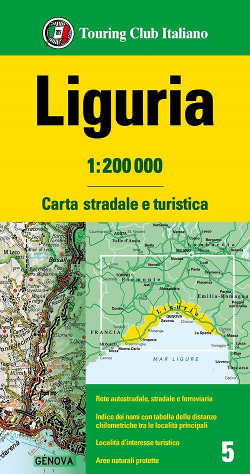
De detail en leesbaarheid van de informatie maken deze kaarten een perfect hulpmiddel voor de reiziger. Legenda in 5 talen: Italiaans, Engels, Duits, Frans en Spaans In de wegen- en toeristische kaarten op schaal 1:200.000 wordt de details van het wegennet aangevuld met de toeristische valorisatie van de plaatsen, met de weergave van de panoramische routes en de beschamde natuurgebieden. Op de achterkant van de kaarten de naamindex vergezeld van de kilometertabel tussen de belangrijkste plaatsen
€13,95
Bekijk product

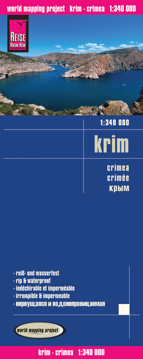
Tweetalige kaart (Engels en Duits). Door ingetekende lengte- en breedtegraden is het gebruik van GPS mogelijk. Met hoogtelijnen en uitgebreid wegennetwerk: daarnaast worden ook de afstanden tussen belangrijke plaatsen duidelijk leesbaar weergegeven. Het kleurgebruik is zodanig dat je een goede indruk krijgt van hoogteverschillen en soorten landschap. Natuurlijk staan de toeristische bezienswaardigheden duidelijk vermeld. Gedrukt op water- en scheurvast papier! Polyart is een synthetisch product vrij van giftige stoffen dus duurzaam. Het papier gaat echt lang mee. On one side is the whole of Crimea. On the reverse coverage of the southern part of Ukraine extends west to Odessa, north to Krivyi Rih, and east to just beyond Nikopol. Topography is indicated by altitude colouring with numerous spot heights and names of mountain ranges and passes. Salt lakes, swamps, seasonal rivers and glacier are also shown. Detailed presentation of the road network includes minor roads and tracks and railways are also shown. Internal administrative units are presented with their boundaries and names. National parks and other protected areas are highlighted. A wide range of symbols mark various places of interest. Map legends include English and all the maps have an index of localities.
€11,50
Bekijk product


Tweetalige kaart (Engels en Duits). Door ingetekende lengte- en breedtegraden is het gebruik van GPS mogelijk. Met hoogtelijnen en uitgebreid wegennetwerk: daarnaast worden ook de afstanden tussen belangrijke plaatsen duidelijk leesbaar weergegeven. Het kleurgebruik is zodanig dat je een goede indruk krijgt van hoogteverschillen en soorten landschap. Natuurlijk staan de toeristische bezienswaardigheden duidelijk vermeld. Gedrukt op water- en scheurvast papier! Polyart is een synthetisch product vrij van giftige stoffen dus duurzaam. Het papier gaat echt lang mee. Topography is indicated by altitude colouring with numerous spot heights and names of mountain ranges and passes. Salt lakes, swamps, seasonal rivers and glacier are also shown. Detailed presentation of the road network includes minor roads and tracks and railways are also shown. Internal administrative units are presented with their boundaries and names. National parks and other protected areas are highlighted. A wide range of symbols mark various places of interest. Map legends include English and all the maps have an index of localities.
€11,50
Bekijk product