
Beantwoord enkele vragen, en binnen seconden geeft AI je een persoonlijk aankoopadvies op maat.
Beantwoord enkele vragen, en binnen seconden geeft AI je een persoonlijk aankoopadvies op maat.
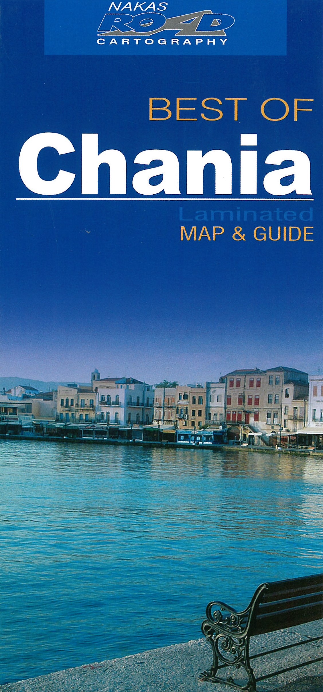
Chania / Chania Overall Map gepubliceerd door Road Editions, met overzicht, in het Engels, de belangrijkste bezienswaardigheden in de omgeving.
€7,95
Bekijk product


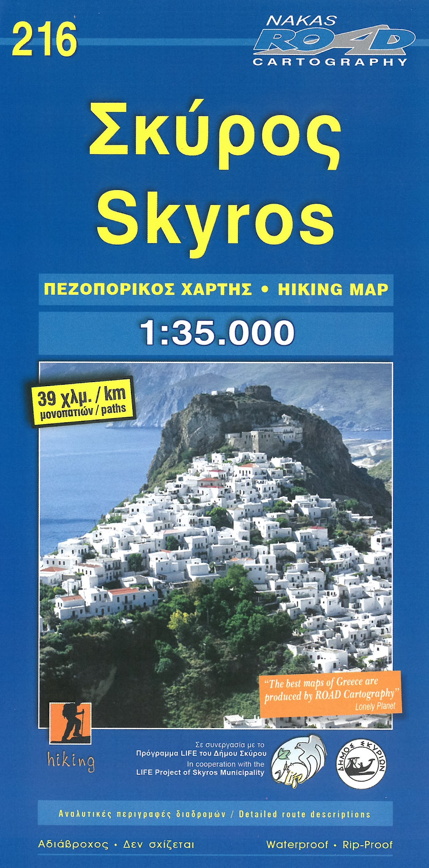
Gedetailleerde wegenkaart met aanduiding van de wandelwegen, lijst van hotels en toeristische informatie. Voor alle doeleinden een zeer geschikte kaart. At last, a reliable and accurate map of Skyros island is available to the demanding traveler! Although Skyros(located in the central Aegean Sea, 22 nautical miles east of Evia Prefecture) is not a popular touristic destination, ROAD Editions published this map to contribute to the touristic development of this beautiful greek island. This Skyros island map incorporates the new specifications of ROAD Editions' Greek Islands Map Series: the backside of the map is a mini travel guide in full color, with many images and all the nessesary information on the touristic sights and the individual character of this island. It also includes a complete list of the hotels and rooms to let in the island, many usefull telephone numbers, and a note on the island's history. The map of Skyros presents the complete road network of the island, against a geophysical background of high accuracy (Map Datum ED50)with contour intervals of 20 meters. In cooperation with the local mountaineering club, all major footpaths are clearly marked on the map. With clear symbols, bright colors and easy to read lettersets, you can see all the touristic sights of the island, castles, archaeological sites, beaches, country churches, fountains, gorges, and many more. Skyros island map is available without hard cover, well protected in a rigid plastic folder. This allows the user to fold the map in a pattern other than the preselected, or fold it in a much smaller final size to fit in a pocket etc.
€9,95
Bekijk product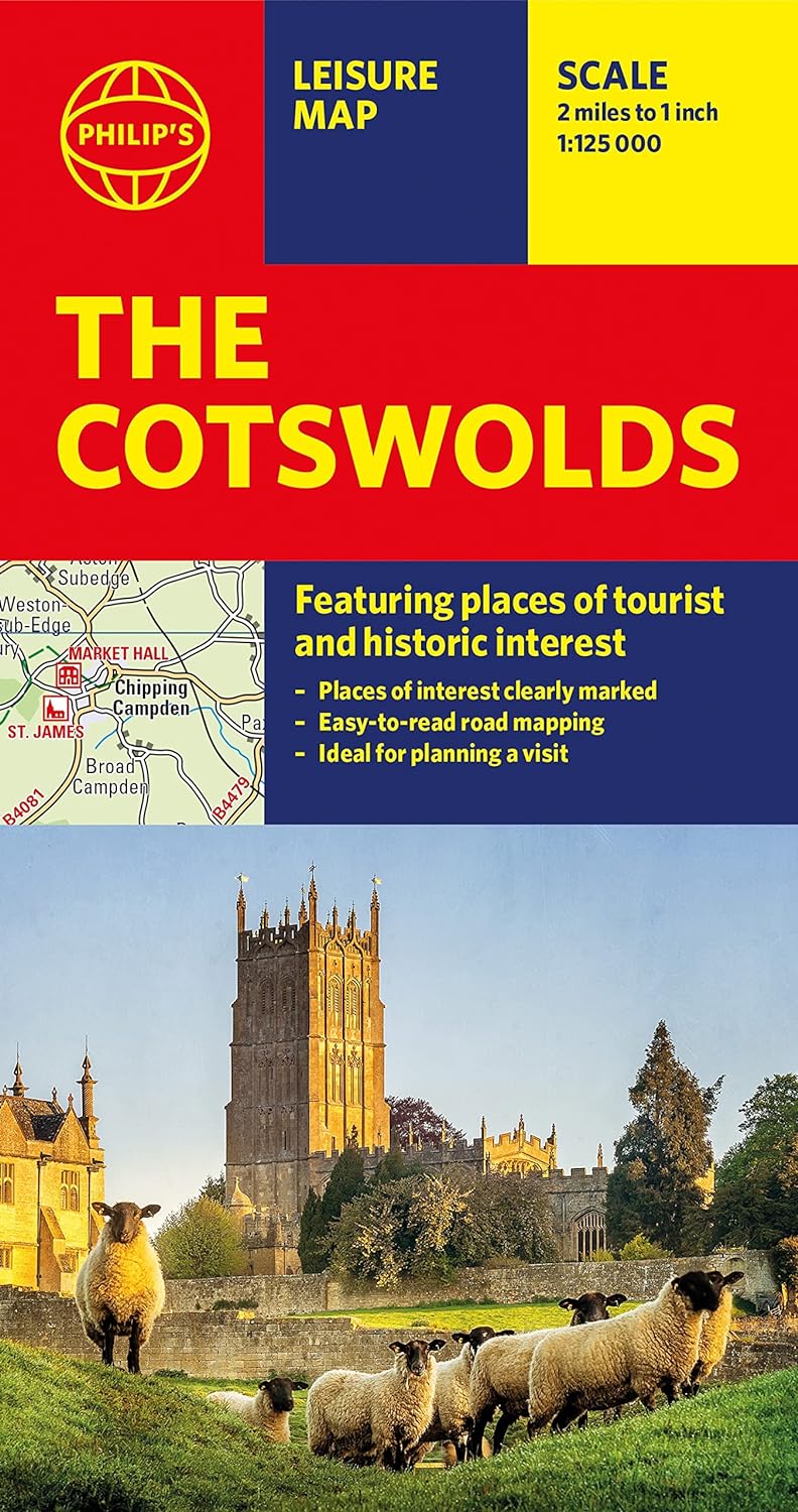
A new edition of this double-sided map of the Cotswolds clearly featuring places of tourist and historic interest in an easy-to-read style of mapping, alongside six handy town centre plans. This leisure and tourist map of the Cotswolds gives detailed coverage of the area's road network at a scale of approximately 2 miles to 1 inch (1:125,000). The coverage stretches from Abingdon in the east to Gloucester in the west, and from Swindon in the south to Great Malvern in the north. The map shows places of tourist and historic interest, including castles, camping and caravanning sites, country parks, galleries, gardens, golf courses, museums, nature trails, historic sites, sports venues, theatres and wildlife parks. An index to principal places of interest is also featured. With some of the most enchanting towns and cities in England in the area - all with extraordinary history and notable natural beauty - use the Philip's Leisure Map to explore and delight in the Cotswold magic. Included in the mapping are indexed town-centre street maps for Bourton-on-the-Water, Cheltenham, Cirencester, Gloucester, Tewkesbury and Winchcombe for easy navigation and enjoyment. In a convenient folded format, this double-sided sheet map is ideally suited for both leisure and business use, whether by locals or visitors.
€11,50
Bekijk product
ANWB Wegenkaart Nederland – Set noord, midden, zuid Voor iedereen die graag goed voorbereid door Nederland rijdt, is er de handzame set ANWB Wegenkaart Nederland op 3 deelkaarten. De kaarten hebben door de schaal 1:200.000 (1cm = 2 km) een gedetailleerd kaartbeeld. De drie kaarten bevatten in totaal 93 plattegronden van toeristisch interessante plaatsen. De compacte wegenkaarten zijn gemaakt van een stevig, duurzaam materiaal, waardoor ze veelvuldig kunnen worden in- en uitgevouwen. De ANWB Wegenkaart Nederland is al jaren de beste routekaart van Nederland. Ook verkrijgbaar in deze reeks: heel Nederland op schaal 1:300.000 en de losse kaarten Nederland noord, midden en zuid op schaal
€28,99
Bekijk product
&; Waterproof &; Tear-Resistant &; Travel Map National Geographic's Sierra Nevada Destination Map strikes the perfect balance between map and guidebook and is an ideal resource for touring the rugged landscape of this culturally and geographically unique region of California and Nevada. The front side of the print map reveals a detailed map of the region stretching from the Oregon border to California's Eldorado National Forest, bordered by the Sacramento Valley to the west and Nevada's Great Basin to the east. Modoc, Shasta-Trinity, Lassen, Plumas, and Humbolt-Toiyabe National Forests are also included on the map. The map features a comprehensive road network including scenic byways as well as areas of interest such as Indian Reservations, National Parks and Monuments, and Recreation Areas. Trails, historic sites, museums, cultural centers, scenic areas, state parks and other points of interest are also included. In addition, the map features beautiful photographs and information on the region's culture, heritage and outdoor adventures. The reverse side of the map features a detailed map of the area stretching from California's Eldorado National Forest to Sequoia National Forest. Other areas of interest included on the map are Stanislaus, Humbolt-Toiyabe, Sequoia, Sierra, and Inyo National Forests, Yosemite National Park and Wilderness, John Muir Wilderness, Kings Canyon National Park, and Sequoia National Park. In addition, the map includes a chart of the region's National Parks and Monuments as well as travel tips, photographs and information on the natural beauty of the region and its changing landscapes. Key Features: Chart of national parks and monuments highlighting services, recreation opportunities and contact information Colorful photographs featuring the region's diverse terrain Comprehensive road network, scenic byways, local infrastructure, and abundant natural, historical, and cultural places Beautiful photographs and valuable travel information aids travelers with pre-trip planning and on-the-ground adventures Every Destination Map is printed on durable synthetic paper, making them waterproof, tear-resistant and tough &; capable of withstanding the rigors of any kind of travel. Map Scale = 1:543,000 Sheet Size = 25.5'' x 37.75'' Folded Size = 4.25'' x 9.25'
€17,50
Bekijk product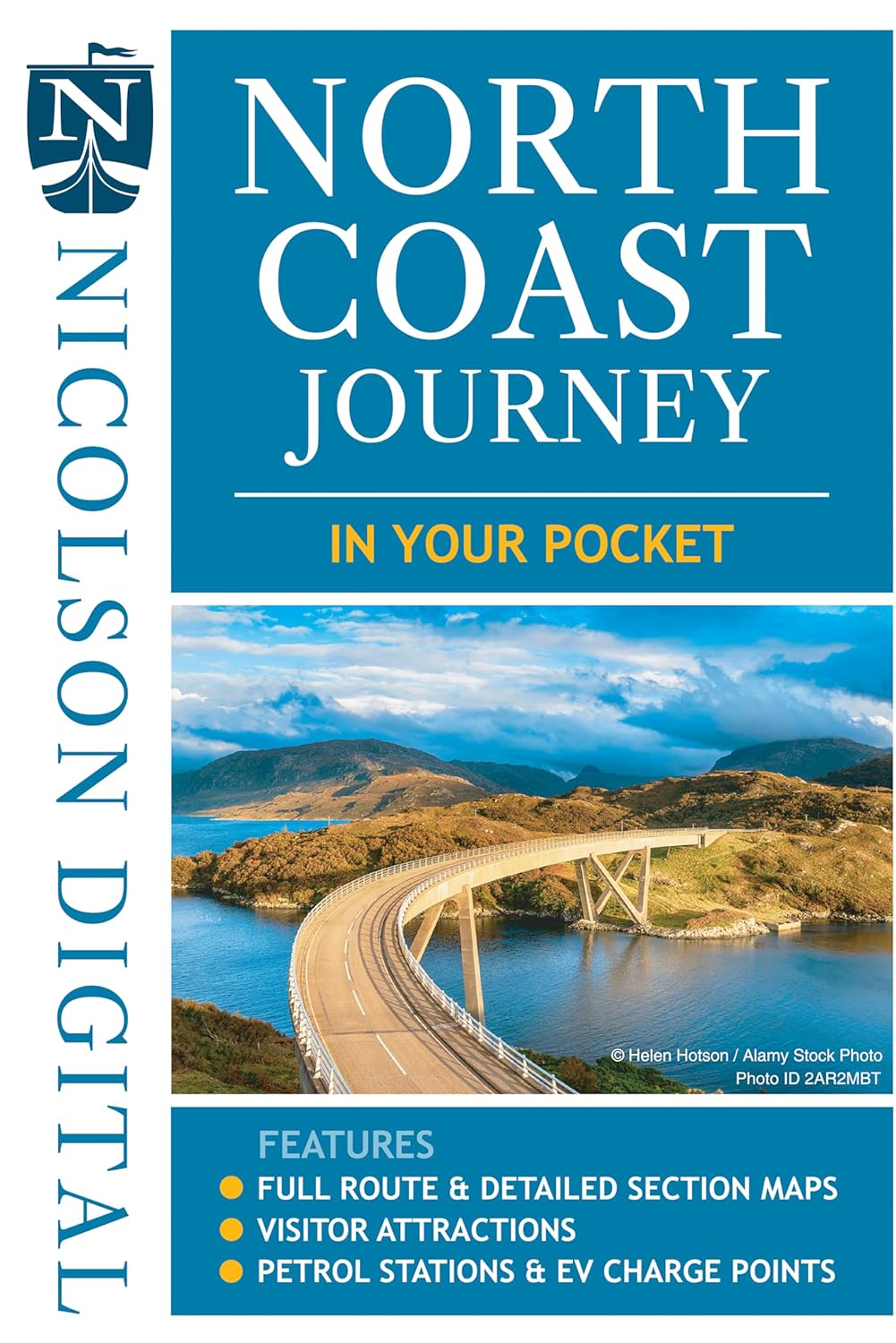
The North Coast Journey In Your Pocket is the essential guide to driving the 500 miles around the Scottish Coast. The front has a full route overview map with main tourist attractions. Ten detailed routes are shown on the reverse clearly showing petrol stations, EV charging points and tourist attractions. Both sides highlight alternative routes for large vehicles and mileage pins between various points ensuring that you don't get stranded! Don't leave home without it! Featuring: Full 500 mile driving route overview map at 6.2 miles to the inch Ten detailed individual route maps at 3.6 miles to the inch Petrol stations, EV charging points and tourist attractions shown Alternative route for large vehicles clearly marked
€7,95
Bekijk product