
Beantwoord enkele vragen, en binnen seconden geeft AI je een persoonlijk aankoopadvies op maat.
Beantwoord enkele vragen, en binnen seconden geeft AI je een persoonlijk aankoopadvies op maat.
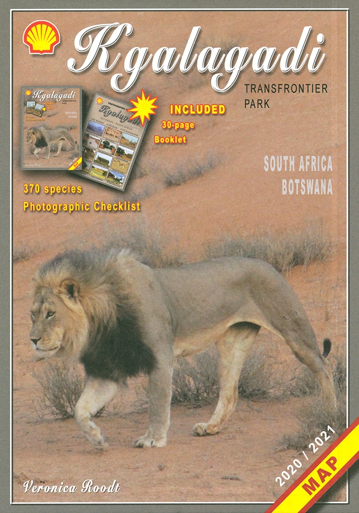
Zeer bijzondere landkaart van het grensgebied van Botswana en Zuid Afrika. Uitermate handig zijn de GPS coordinaten van de meest belangrijke punten als campings of uitzichtpunten. De kaart is gebaseerd op een luchtfoto, waarbij alle details zijn ingetekend. The map: The map consists of a large map of the entire Park on the front of the map. On the back is enlargements of six maps - the South African side, Mabuasehube, Swart Pan area, Gemsbok Wilderness Trail, Mabuasehube Wilderness Trail and of the Kaa Kalahari Concession. Satellite images were used and the roads were tracked by GPS. There are 168 GPS coordinates on this map. Establishment of a Transfrontier Park: On the 7 th of April 1999 Botswana and South Africa signed a bilateral agreement in which they agreed to manage their adjacent national parks, Gemsbok National Park in Botswana and Kalahari Gemsbok National Park in South Africa, as a single ecological unit – the Kgalagadi Transfrontier Park. It is the first formally declared Transfrontier Park in southern Africa, but there are more underway. There were no human made barriers in the past but the parks were managed separately. Tourists are able to move freely within the park and they have a unified set of regulations. Management of internal affairs remain separate. Entry and camping fees on both sides are similar, depending on the exchange rate. Botswana side: The Botswana side of the park has been maintained in a natural condition as far as possible. The camping sites – there are no lodges or chalets – are in harmony with nature without any form of above-ground masonry. There are five areas of focus as far as visitors are concerned – the Nossob river valley, Mabuasehube, Swart Pan area and the two Wilderness trails (Mabuasehube 4x4 Trail and the Gemsbok Wilderness Trail). There are three public access routes - from Kaa gate to Nossob Camp, from Mabuasehube gate to Nossob and from Two Rivers to the Nossob valley. South African side: The game-drive routes are mainly in the two river valleys – the Nossob valley in the north and the Auob Valley in the south. Most of the roads do not require 4x4 vehicles. The three main camps have small shops, fuel, chalets, accommodation and camping. Apart from the two roads linking the valley routes, there is now a 4x4 route that passes Bitter Pan where there is a beautiful lodge open to 4x4 travelers on advanced bookings only. Where to stay or to camp: Botswana side: On the Botswana side is only camping. All the sites are in natural settings, completely free of fences, giving one the opportunity to enjoy the Kalahari in its natural state. There are camping sites at Rooiputs and at Polentswa in the Nossob valley and several sites on the Swart Pan circuit and in the Mabuasehube area. South Africa: There are three very well-equipped camps with chalets and huts, namely Twee Rivieren, Nossob and Mata Mata. They are all well developed and at Twee Rivieren there is also a restaurant. Each one of these camps has a small shop with meat, ice, soft and alcoholic drinks. There is fuel available at all three camps. All three camps offer night drives as well. There are also five new bush camps – Kalahari Tented Camp near Mata Mata, Bitterpan Bush Camp on the 4x4 route, Kielie Krankie, Grootkolk and Urikaruus, the latter three situated at the pans with the same names. They offer exclusivity, which one is not able to enjoy in the other camps.
€17,50
Bekijk product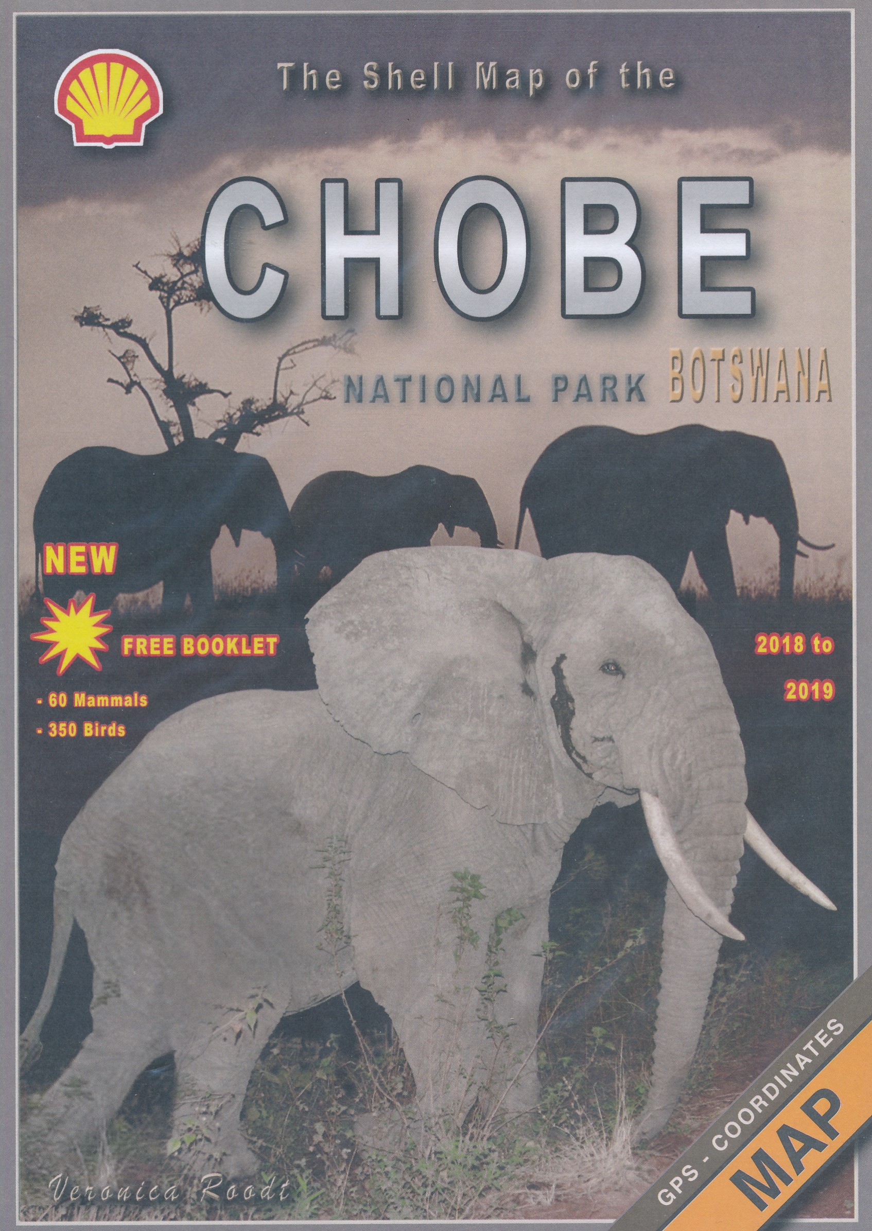
Zeer bijzondere goede landkaart van Chobe National Park in Botswana. Uitermate handig zijn de GPS coordinaten van de meest belangrijke punten als campings of uitzichtpunten. De kaart is gebaseerd op een luchtfoto, waarbij alle details zijn ingetekend. The map: The Chobe map consists of a complete map of Chobe on the front of the map and there are 5 individual maps of the major tourist areas on the back of the map. These are Chobe river front east, Chobe river front west, Nogatsaa, Savute and a small orientation map. The map was compiled by using satellite images, giving one a birds eye-view of the area. The roads were tracked by means of a GPS and then super-imposed on the photographs. Detailed GPS co-ordinates are supplied for game-drive areas. The Chobe map contains 126 GPS co-ordinates. The four main tourist areas: The Chobe National Park consists of a variety of vegetation types and geological features, offering extreme contrasts and a wide range of wildlife experiences within the confines of one park. Four main tourist areas have been developed. They are as follows: Chobe River Front - The Chobe is proud of and very famous for its abundance of elephants – the highest concentration anywhere in the world! There are also huge herds of buffalo, the Chobe bushbuck, the puku (an antelope), its rich birdlife and, not least, for its exquisite sunsets. Linyanti - There are only 7 km of riverfront that can be used for game-drives and the road to get there is very sandy. To truly enjoy the Linyanti area one should visit one of the lodges but it is only possible to get to the lodges by air. Savute - In sharp contrast to the lush Chobe riverfront is the almost desert-like landscape of the Savute. A scorching sun, loose, hot sand, animals escaping the heat by clumping together in the limited available shade and elephants impatiently lining up to get to the ever dwindling water supply. All of the above, offer a wildlife experience unique to Savute. Nogatsaa area - When the pans have water, game viewing in this area is very good. Elephant activity is rife and one can watch the animals from the comfort of a hide at many of the water holes. This area is not open to the general public for camping but it is possible to visit the area on day-trips.
€17,50
Bekijk product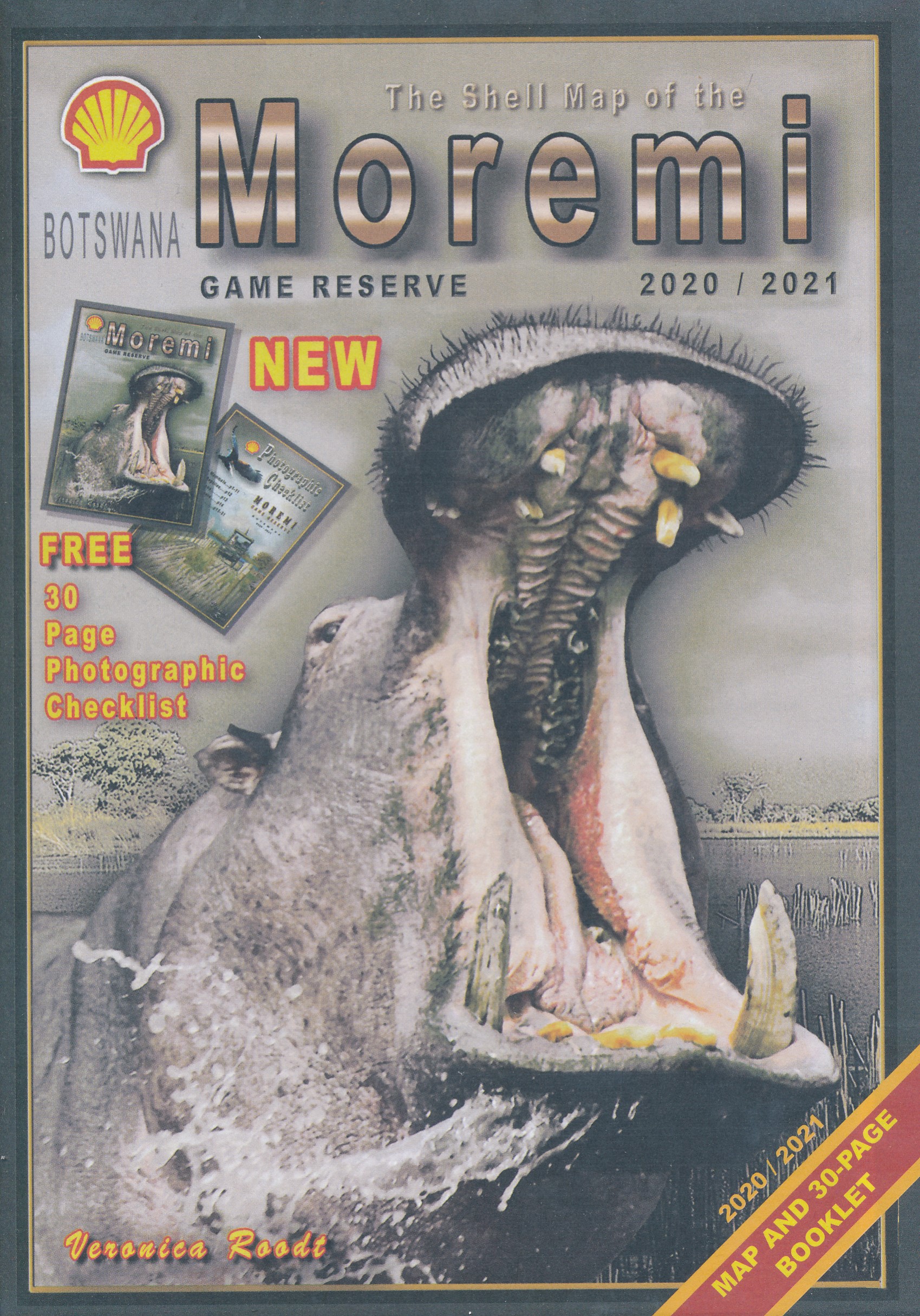
Zeer bijzondere landkaart van Moreni Game Reserve in Botswana. Uitermate handig zijn de GPS coördinaten van de meest belangrijke punten als campings of uitzichtspunten. De kaart is gebaseerd op een luchtfoto, waarbij alle details zijn ingetekend. The map: The Moremi map is based on satellite photos. The front of the map consists of a map of the entire Reserve and on the back are six separate maps of Khwai river-front east, Khwai river-front west, an orientation map of Moremi, Xakanaxa area and the Moanachira river, Xakanaxa game-drive area and Bodumatau area. The roads were tracked by GPS and there are 162 GPS co-ordinates on the map. General: As part of the Okavango Delta, Moremi consists of permanent swamp, seasonally swamped areas and dry land. It is one of the prime tourist destinations in Botswana and offers water activities, top game-viewing, some of the best bird-life in Africa and incredible scenery. Not to be missed! Locality and size: The Moremi Game Reserve is nestled within the Okavango Delta and completely buffered by wildlife management areas. When it was first established in 1963, it covered only the dry-land triangle but today it comprises 4 871 km2. How to get there: All the camps are accessible by air but only the dry-land triangle between South Gate, Mboma Island, Xakanaxa and North Gate is accessible by road. From Maun one travels north-east for 100 km to get to South Gate. From Kasane one travels south-west for about 265 km. Where to stay: All the camps around Moremi are indicated on the map. Detailed address references are supplied in the Shell Tourist Travel Guide of Botswana, which is presented as a package with the Botswana map. Best season to visit: Winter is the best time to visit (from May to August) but September to December is the best time for bird-watching. The roads are very difficult to negotiate during the rainy season and the animals are more scattered.
€17,50
Bekijk product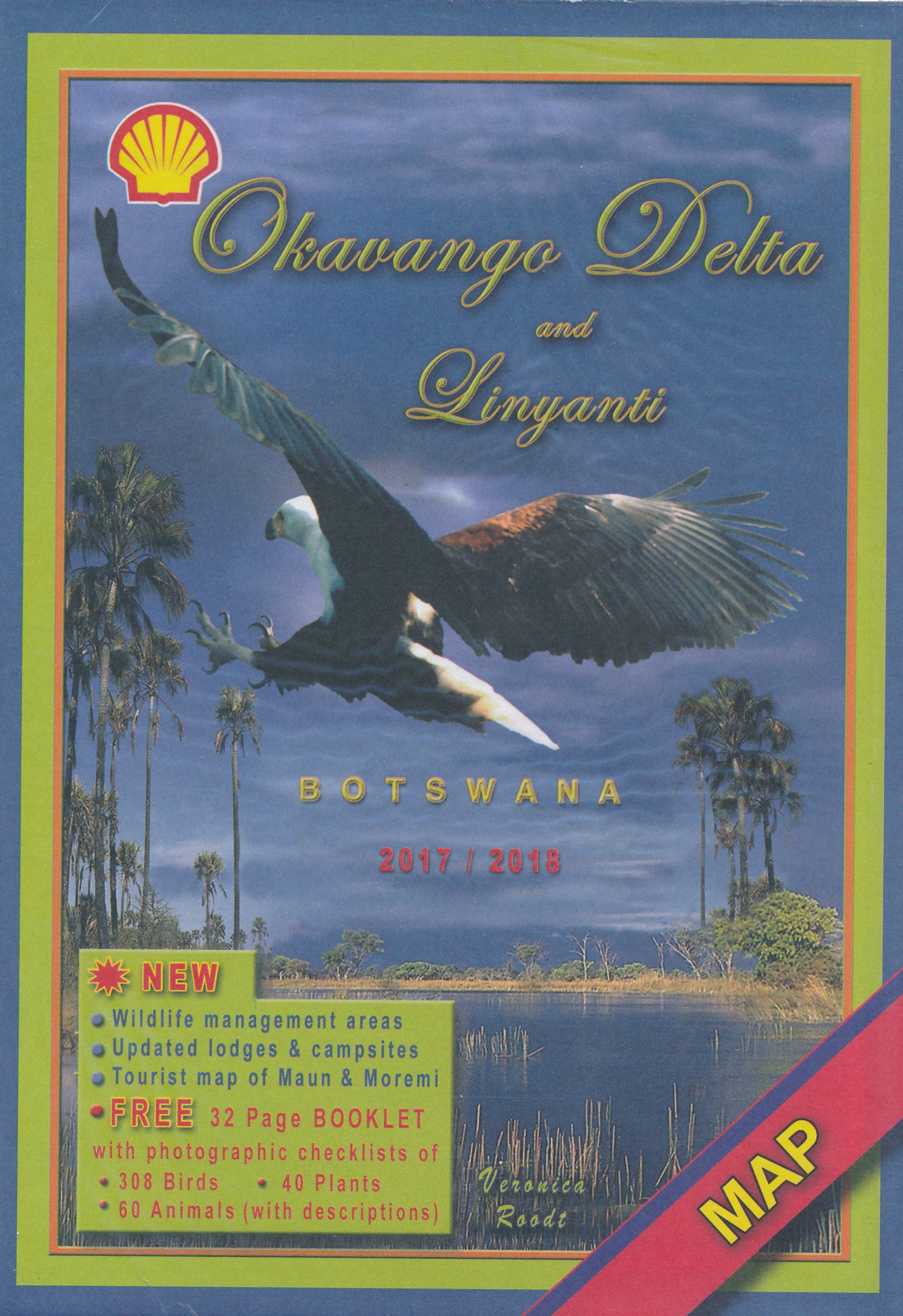
Zeer bijzondere landkaart van de Okavango Delta en Linyanti. Uitermate handig zijn de GPS coördinaten van de meest belangrijke punten als campings of uitzichtpunten. De kaart is gebaseerd op een luchtfoto, waarbij alle details zijn ingetekend. The map: The map of the Okavango and Linyanti was compiled by using LANDSAT satellite images. The main reason for a tourist map of the area is to indicate the localities of the lodges as well as the wildlife management areas in which they occur. Tourists to the Okavango often visit more than one lodge and this will give them a good idea of where they have been. On the back of the map are enlargements of the different tourist areas, which shows more detail of the landscape. There are no GPS co-ordinates on the Okavango map as all the Wildlife areas consist of private concessions, which are not open to the general public. The roads in the private concessions have also not been indicated as this may mislead the self-driving public, making them think that they are public roads. All the localities of lodges were done by means of GPS references. General: The Okavango Delta is a unique ecosystem situated in the middle of the largest stretch of continuous sand in the world – the Kalahari basin. This wetland lies like an oasis in an otherwise inhospitable landscape. The vegetation is lush, but very fragile and the wildlife is of the best to be seen in Africa. The Linyanti area lies to the north-east of the Okavango and forms part of the same ecosystem. How to get there: Most visitors fly to Maun or to Kasane and fly to their various destinations. The only areas open to the self-driving public is the western pan-handle, the eastern pan-handle, the Moremi Game Reserve and the public road to Savute from Maun. Where to stay: All the lodges are indicated on the map and their contact details are provided in detail in the directory of the Botswana Travel Guidebook which is discussed elsewhere on this site.
€17,50
Bekijk product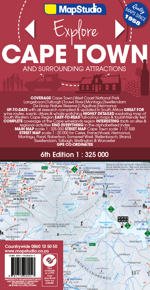
Het overzicht is soms misschien een beetje onduidelijk. maar de details in de inzetten en delen van de kaart zijn prima en voldoen goed voor het rondrijden met een eigen auto. Double-sided map, with a general road map on one side, plus numerous street plans and descriptions of four special routes on the reverse. The main map covers an area within reach as day trips from Cape Town, extending east to Swellendam and north to Langebaan. Road classification includes unsurfaced roads, intermediate driving distances on main and secondary roads, toll routes with gates, and mountain passes. Railways are shown with local stations. An impression of relief is provided by elevation tinting (perhaps somewhat confusing for regular map users - the higher the altitude, the greener the colour!), spot heights for main peaks, and names of mountain ranges. Nature and forest reserves, plus salt pans and marshes are indicated. Symbols mark local airfields, historical sites, caravan parks, many wine estates, selected hotels and other accommodation, whale watching and diving sites, and other places of interest. The map has an index of localities, and shows no geographical coordinates. Four suggested scenic routes are highlighted on the map: the Cape Winelands, the Breede River Valley, the Whale Route, and the Heart of Route 62. All four are described on the reverse of the map, with street plans at 1:20,000 for main town along each route and lists of places of interest with their contact numbers. Each street plan highlights museums and other places of interest, plus selected accommodation and services. Also included is a street plan of central Cape Town itself at 1:17,500. In addition to the information provided on other street plans it also includes traffic lights and one way streets.
€16,95
Bekijk product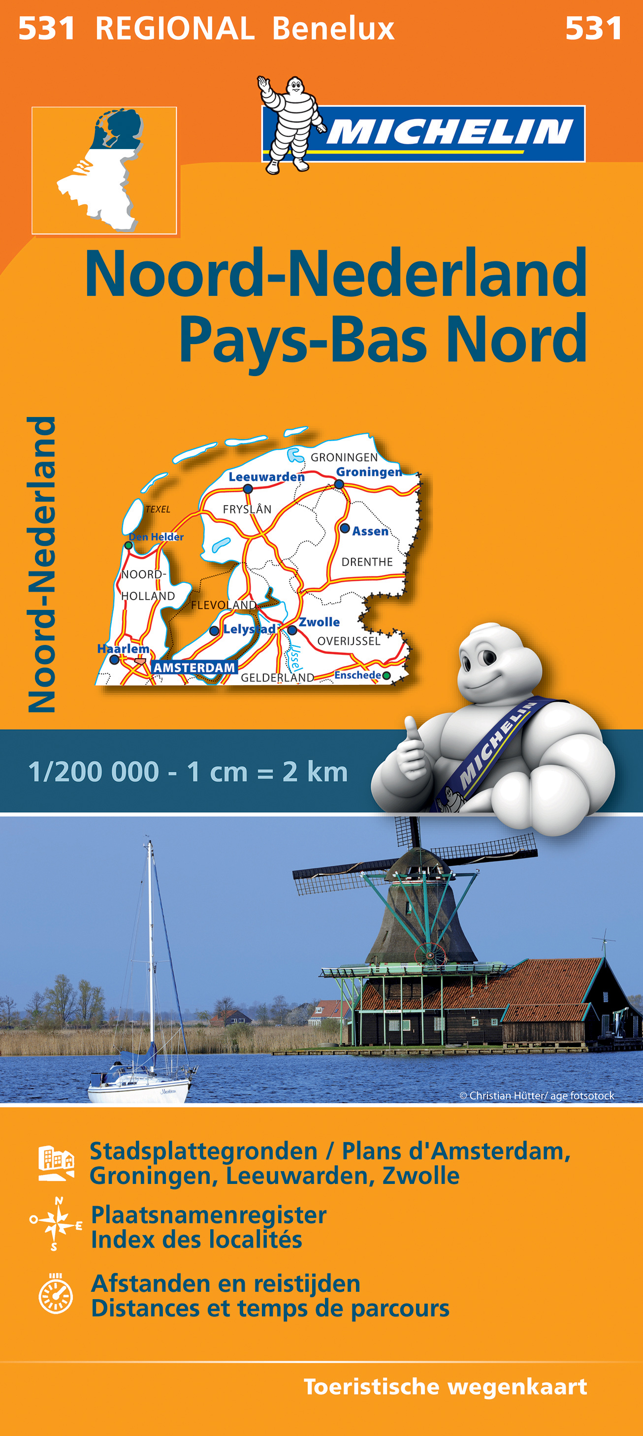
Zoals je van Michelin mag verwachten is deze wegenkaart zeer overzichtelijk en heeft een duidelijk helder kaartbeeld. De kaart geeft uitgebreid toeristische informatie weer. Michelin wegenkaarten behoren nog altijd tot de beste in hun soort. De goed uitgebalanceerde cartografie toont precies datgene wat de lezer wil zien (en ook niet meer dan dat!), dat wil zeggen een duidelijke en contrastrijke weergave van alle wegen (van groot tot klein), veel details voor zowel automobilisten als fietsers (kilometerafstanden, pompstations, wegnummers, campings, reliëf, ), gedetailleerde weergave van woonkernen (bij een schaal van 1:200.000 of fijner) en tenslotte een prettig spaarzaam gebruik van toeristische symbolen en weergave landschappelijke details. Pays-Bas
€11,95
Bekijk product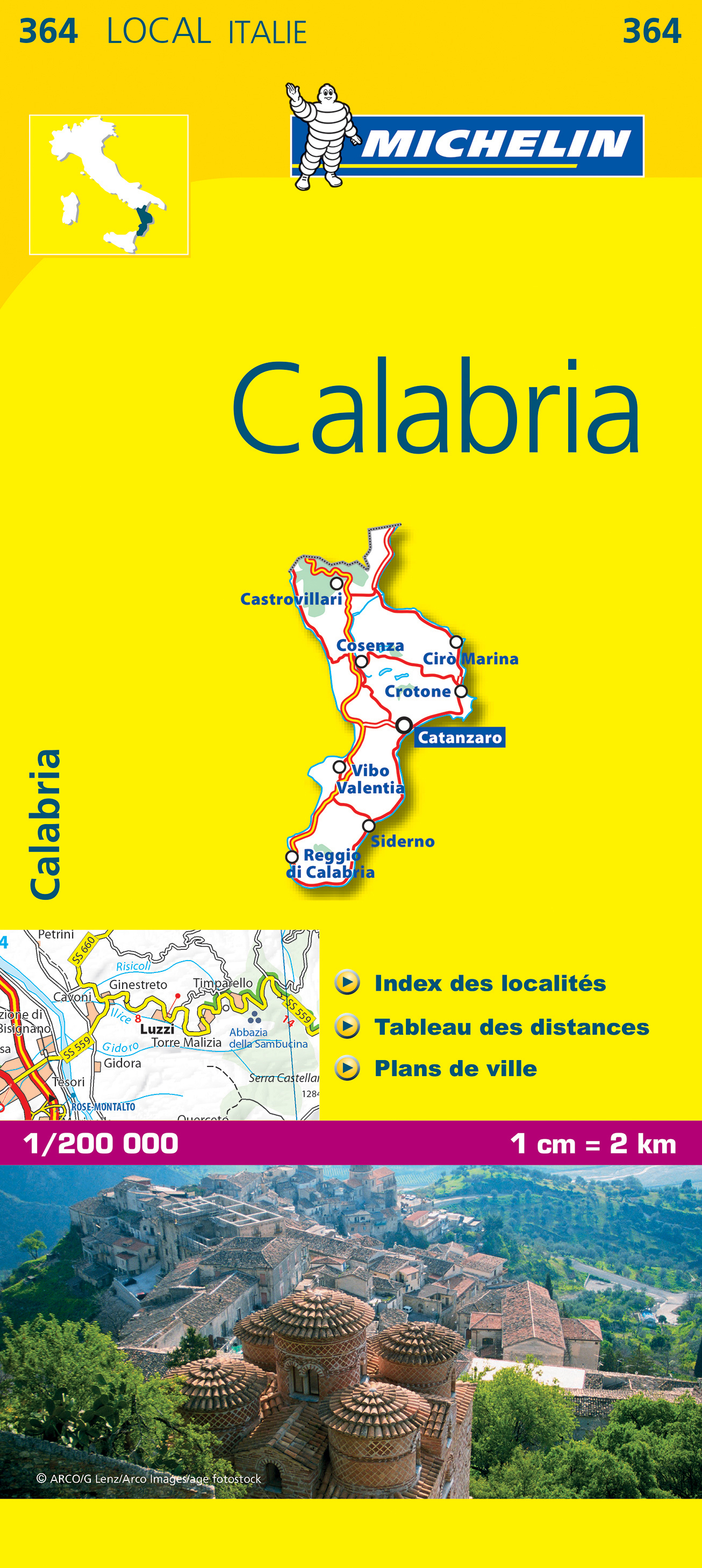
De Michelin kaart is actueel, gedetailleerd, nauwkeurig, praktisch en internationaal. De Lokale Michelin streekkaart biedt u: nauwkeurige en toeristische informatie over een streek of regio, een plaatsnamenregister om uw route gedetailleerd uit te stippelen, een nog waarheidsgetrouwere weergave van de topografie door het satellietbeeld en een selectie van de mooiste plekken. From Michelin's yellow Local series of Europe maps comes this map of Calabria at 1:200 000, showing excellent detail in this region of Italy. The map has the usual excellent road detail characteristic of Michelin maps, with everything from motorways down to rough tracks and footpaths marked out clearly. The number of lanes is indicated on most roads, with intermediate road distances, European route numbers and tolled roads also shown. The map includes highly detailed relief shading that's derived from satellite photos, with plenty of spot heights also. View points, scenic routes, religious and historic buildings, caves, palaces and villas, parks and loads of other places of touristic interest are marked out with symbols. The legend is in a few lanaguages, one of them is English. The map also has a table gving distances and driving times between major towns and citites throughout the region and an extensive index of places. Calabre, Crotone, Italie, Lamezia Terme, Reggio de Calabre, Tropea
€10,95
Bekijk product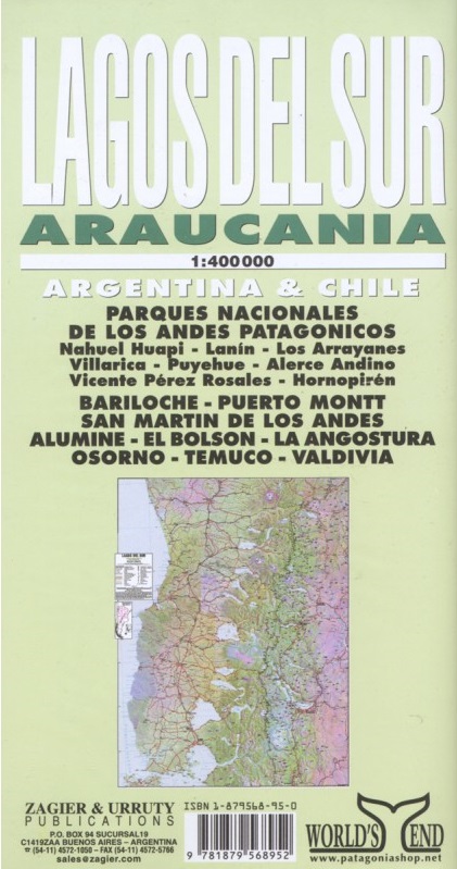
Overzichtskaart van dit met name door Zuidamerikanen zelf veel bezocht gebied. The most popular Parks of northern Patagonia: Nahuel Huapi, Lanin, Los Arrayanes, Villarrica, Puyehue, Alerce Andino, Vicente Perez Rosales, Hornopiren. Relief, roads, trails, distances, camping, fishing, etc. Roads to Bariloche, Puerto Montt, San Mart�n de los Andes, Alumine, El Bolson, La Angostura, Osorno, Temuco, Valdivia. afmeting 70 x 95 cm
€17,95
Bekijk product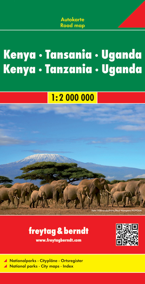
Bijzonder gedetailleerde wegenkaart van Kenia, Tanzania en Oeganda met alle belangrijke aanduidingen en toeristische symbolen. Met register en afstanden. Een goede wegenkaart met een natuurlijke uitstraling en met uitstekende reliëfschaduwen. Bevat een aantal belangrijke culturele en natuurlijke toeristische bezienswaardigheden. Daarnaast bevat de kaart een uitgebreide index waarin dorpen en steden eenvoudig op te zoeken zijn. Het geeft daarnaast ook informatie over de ligging van een aantal toegankelijke campings. Gedetailleerde informatie over wegen is ook aangegeven: tolwegen, privé wegen, wintersluitingen, mooie routes, maar ook de rijafstanden zijn aangegeven. Kortom, een uitstekende kaart voor onderweg.
€14,95
Bekijk product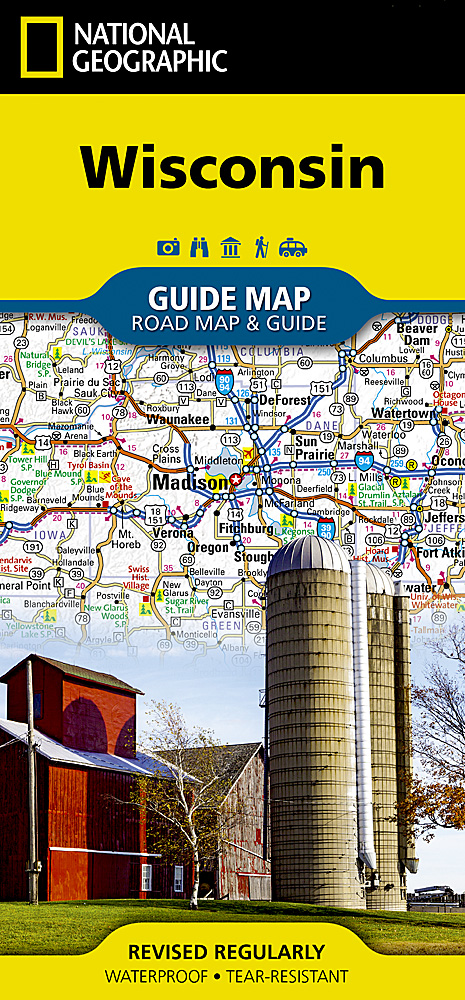
Makkelijk leesbare kaart aan 2 zijden bedrukt. De ene kan met informatie en beperkte stadsplattegronden, de andere met de daadwerkelijke kaart. De kaart is geplastificeerd en dus watervast! The front side is an easy-to-read road map with insets of: - Superior - Appleton - Oshkosh - Racine / Kenosha - Eau Claire - Green Bay - Milwaukee The back includes: - Maps and information for Milwaukee and Madison - Information for Apostle Islands National Lakeshore - St. Croix Scenic Riverway - Points of interest - Scenic drive - Park Service sites in Wisconsin
€12,95
Bekijk product