
Beantwoord enkele vragen, en binnen seconden geeft AI je een persoonlijk aankoopadvies op maat.
Beantwoord enkele vragen, en binnen seconden geeft AI je een persoonlijk aankoopadvies op maat.
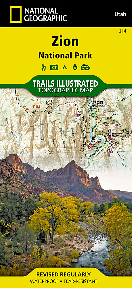
<p> Prachtige geplastificeerde kaart van het bekende nationaal park. Met alle recreatieve voorzieningen als campsites, maar ook met topografische details en wandelroutes ed. Door uitgekiend kleurgebruik zeer prettig in gebruik. Scheur en watervast!</p> <p> This National Geographic Trails Illustrated folded map offers comprehensive coverage of Zion National Park in Utah. Provides valuable wilderness tips and Leave No Trace guidelines, along with updated trails, trailheads, points of interest, campgrounds and much more. Printed on waterproof, tear-resistant material with a plastic coating that offers the durability needed for outdoor use. Includes selected waypoints in both lat./lon. and UTM coordinate systems as well as GPS-compatible UTM grid lines for easy navigation. Measures 9.25 x 4 in. folded and 37.75 x 25.5 in. fully opened; scale of 1:37,70</p> <p> </p>
€16,95
Bekijk product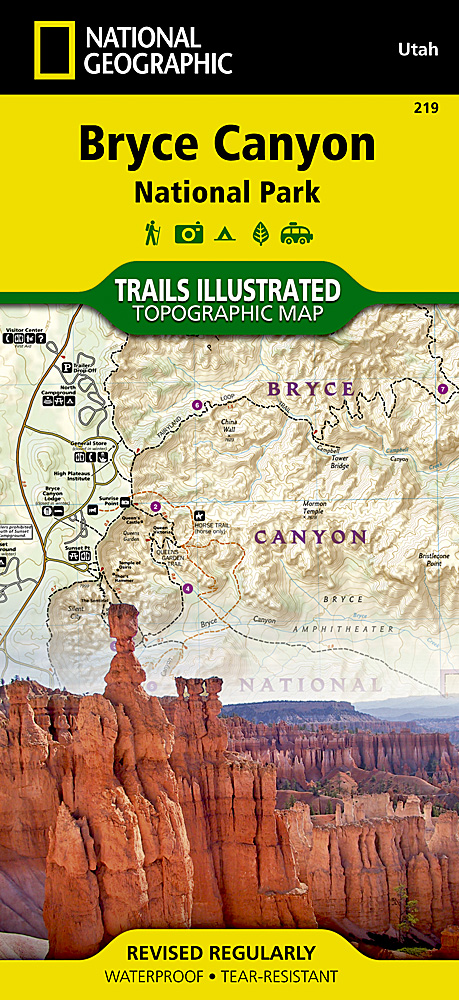
<p> Prachtige geplastificeerde kaart van het bekende nationaal park. Met alle recreatieve voorzieningen als campsites, maar ook met topografische details en wandelroutes ed. Door uitgekiend kleurgebruik zeer prettig in gebruik. Scheur en watervast!</p> <p> This informative Trails Illustrated map will help you plan trips and explore the area in and around Utah's Bryce Canyon National Park. Printed on durable, tear-resistant, waterproof material, this map can go virtually anywhere you go. Covers multiple USGS quadrangles with the convenience of a single map. Based on exact reproductions of USGS topo map information—updated, customized and enhanced to accurately detail the unique features of the area. Highlights hiking trails, cross-country ski trails, bike trails, campgrounds and many other subjects of interest. Measures 9.25 x 4.25 in. folded and 37.75 x 25.5 in. fully opened; scale of 1:20,000 and 1:35,000.</p> <p> </p>
€16,95
Bekijk product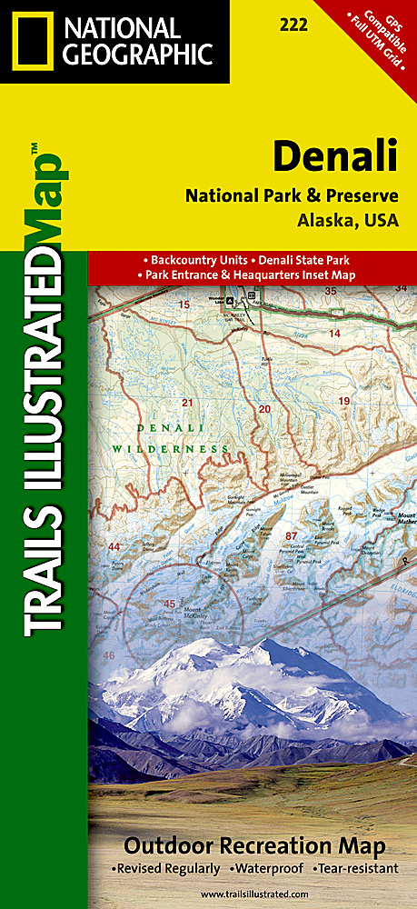
<p> Prachtige geplastificeerde kaart van het bekende nationaal park. Met alle recreatieve voorzieningen als campsites, maar ook met topografische details en wandelroutes ed. Door uitgekiend kleurgebruik zeer prettig in gebruik. Scheur en watervast!</p> <p> This colorful Trails Illustrated folded map offers detailed coverage of Alaska's Denali National Park. Provides valuable wilderness tips and Leave No Trace guidelines, along with updated trails, trailheads, points of interest, campgrounds and much more. Printed on waterproof, tear-resistant material with a plastic coating that offers the durability needed for outdoor use. Includes selected waypoints in both lat./lon. and UTM coordinate systems as well as GPS-compatible UTM grid lines for easy navigation. Measures 9.25 x 4.25 in. folded and 37.75 x 25.5 in. fully opened; scale of 1:225,000. National Geographic Maps</p> <p> </p>
€16,95
Bekijk product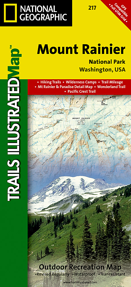
<p> Prachtige geplastificeerde kaart van het bekende nationaal park. Met alle recreatieve voorzieningen als campsites, maar ook met topografische details en wandelroutes ed. Door uitgekiend kleurgebruik zeer prettig in gebruik. Scheur en watervast!</p> <p> Within the park, there is detailed coverage of Mount Rainier and its many glaciers, Eagles Roost, Cataract Valley, Mystic, Emmons Overlook, Indian Bar, Maple Creek, Snow Lake, Paradise River, Jackson, and many other camping areas. A detailed inset gives you a close-up view of the peak and trails leading to its glaciers. The trails have been enhanced and road and trail mileage have been added to create a more usable map. UTM grids have also been added to make it more usable with your GPS.</p>
€16,95
Bekijk product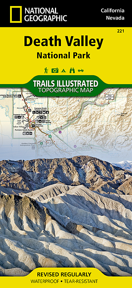
<p> Prachtige geplastificeerde kaart van het bekende nationaal park. Met alle recreatieve voorzieningen als campsites, maar ook met topografische details en wandelroutes ed. Door uitgekiend kleurgebruik zeer prettig in gebruik. Scheur en watervast!</p> <p> This Trails Illustrated topographic map for Death Valley National Park, which straddles the state lines of eastern California and western Nevada, is the perfect recreational map for this dramatic park, which encompasses the hottest, driest, and lowest places in the US. Within its three million acres you will find oceans of sand dunes, dramatic snow-capped mountains, spectacular geological formations, and breathtaking views.</p> <p> The map includes the entire national park area, with detailed trails and topographic information. The trails have been enhanced and road and trail mileage have been added to create a map that is an essential guide for the area. Includes UTM grids for use with your GPS unit.</p>
€16,95
Bekijk product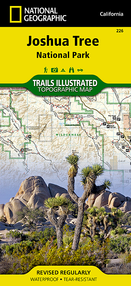
<p> Prachtige geplastificeerde kaart van het bekende nationaal park. Met alle recreatieve voorzieningen als campsites, maar ook met topografische details en wandelroutes ed. Door uitgekiend kleurgebruik zeer prettig in gebruik. Scheur en watervast!</p> <div> This Trails Illustrated topographic map for Joshua Tree National Park and the surrounding area in California is the perfect recreational map for this fascinating land of surreal geologic features shaped by strong winds, unpredictable torrents of rain, and climatic extremes.</div> <div> </div> <div> The map includes Joshua Tree National Park in its entirety, the Little San Bernardino Mountains, Nexie Mountains, Lost Horse Valley, Quail Springs Historic Trail, Black Rock Canyon, Hidden Valley, Pinto Basin, Chuckwalla Valley, Cottonwood Mountains, Pinto Mountains, Cottonwood Spring Nature Trail, and more. The trails have been enhanced and road and trail mileage have been added for additional accuracy. Includes UTM grids for use with your GPS unit.</div> <p> </p>
€17,95
Bekijk product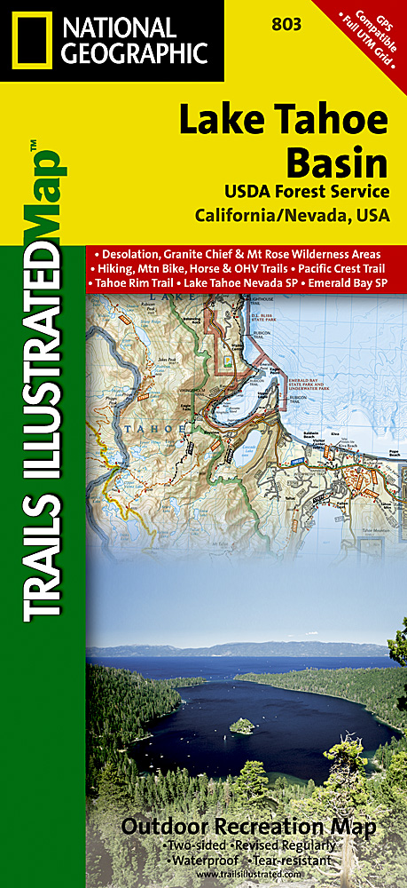
<p> Prachtige geplastificeerde kaart van het bekende nationaal park. Met alle recreatieve voorzieningen als campsites, maar ook met topografische details en wandelroutes ed. Door uitgekiend kleurgebruik zeer prettig in gebruik. Scheur en watervast!</p> <div> The largest alpine lake in North America, Lake Tahoe straddles the border of California and Nevada. It's unusually clear waters and surrounding Sierra Nevada mountains make it one of the most beautiful lakes in the world. National Geographic's Trails Illustrated map of Lake Tahoe Basin delivers unmatched detail and valuable information to assist you in enjoying the year-round recreational opportunities this region offers. Expertly researched and created in partnership with local land management agencies, this map includes Desolation Wilderness; Prosser Creek Reservoir; Granite Chief and Mount Rose wilderness areas; and El Dorado, Humboldt-Toiyabe and Tahoe National Forests. In addition, the following state parks are included: Donner Memorial, Ed Z'berg Sugar Pine Point, Emerald Bay, D.L. Bliss, Lake Tahoe Nevada, Burton Creek, and Washoe Lake.</div> <div> </div> <div> Whether you're exploring Lake Tahoe Basin on foot, or by horse, motorcycle or ATV, the handy trail chart will prove a useful tool in your travels. The popular Pacific Crest and Tahoe Rim trails are clearly noted. A chart of ski and snowboard resorts includes their location on the map, as well as the number of lifts and runs. The map base includes contour lines and elevations for summits, passes and many lakes. The bathymetry of Lake Tahoe is shown with both contours and hill shading. Recreation features are clearly marked, including campgrounds, trailheads, swimming areas, fishing access and scuba diving areas.</div> <div> </div> <div> Every Trails Illustrated map is printed on "Backcountry Tough" waterproof, tear-resistant paper. A full UTM grid is printed on the map to aid with GPS navigation.</div> <div> </div> <div> Other features found on this map include: Carson Range, Desolation Wilderness, Donner Pass, Eldorado National Forest, Granite Chief Wilderness, Mt. Rose Wilderness, South Lake Tahoe, Tahoe National Forest, Toiyabe National Forest, Truckee, Washoe Lake.</div>
€17,95
Bekijk product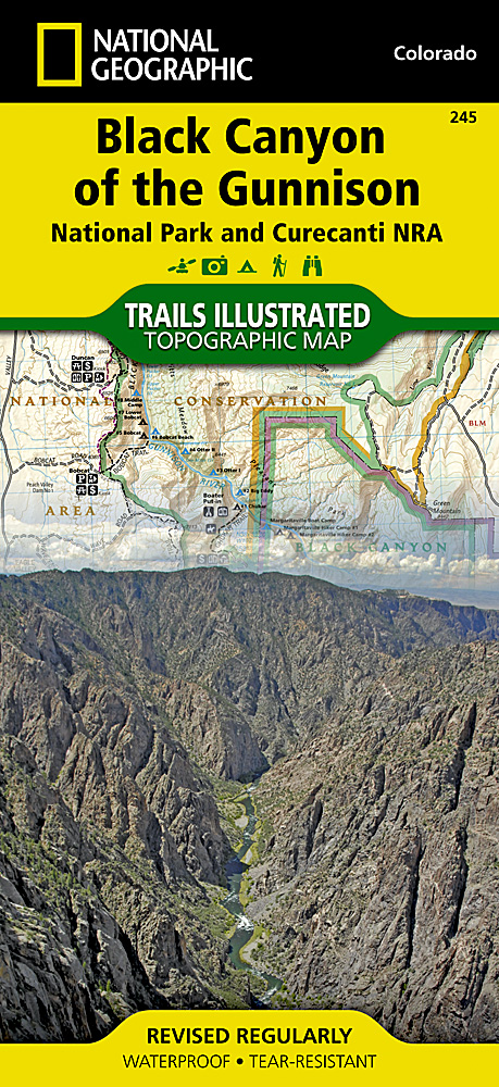
<p> Prachtige geplastificeerde kaart van het bekende nationaal park. Met alle recreatieve voorzieningen als campsites, maar ook met topografische details en wandelroutes ed. Door uitgekiend kleurgebruik zeer prettig in gebruik. Scheur en watervast!</p> <p> Beautiful waterproof and tear-resistant topographical hiking map of a well-loved National Park, with campsites and walking routes clearly marked. This two-sided map includes Black Canyon National Park in its entirety, and Gunnison Gorge Wilderness, and portions of Gunnison Gorge National Conservation Area. South Rim trails include Rim Rock Trail, Uplands Trail, Oak Flat Loop, Cedar Point Trail, and Warner Point Trail. The North Rim trails include Chasm View Trail, North Vista Trail, and Deadhorse Trail. Campgounds, fishing spots, overlooks, view points, visitor centers, and cultural sites thoughout the park are shown, as well as rapids and ratings along the Gunnison River. Includes UTM grids for use with your GPS unit.</p>
€16,95
Bekijk product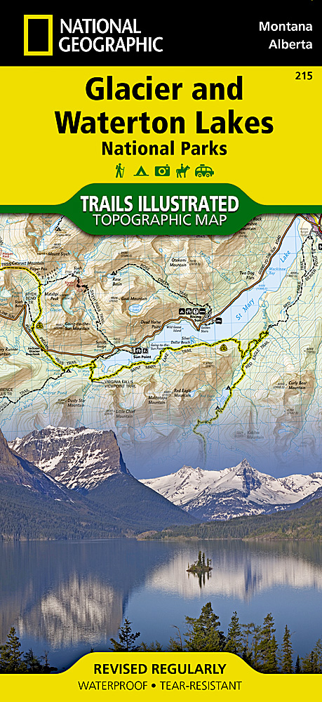
<p> Prachtige geplastificeerde kaart van het bekende nationaal park. Met alle recreatieve voorzieningen als campsites, maar ook met topografische details en wandelroutes ed. Door uitgekiend kleurgebruik zeer prettig in gebruik. Scheur en watervast!</p> <p> Waterton Lakes National Park, Canada includes Waterton Park, Upper and Middle Waterton Lakes, The Border Ranges, Akamina Kishinena Provincial Park, Blood Timber Reserve, and more. Glacier National Park, Montana includes the entire national park area, with detailed trails, and topographic information. Includes the Lewis and Clark Range, Many Glacier, Lake McDonald, Great Bear Wilderness, Flathead National Forest, Columbia Falls, Horse Reservoir, St. Mary Lake, and much more. Includes UTM grids for use with your GPS unit.</p>
€16,95
Bekijk product
<p> Zeer gedetailleerde wandelkaart van een deel van Zwitserland. De topografische details van deze kaarten zijn onovertroffen; de werkelijkheid is perfect weergegeven op deze kaart van uitzonderlijk hoog niveau. Ze zijn geschikt voor alle soorten gebruik: voor eenvoudige wandeltochten in simpel terrein tot zware bergtochten en beklimmingen van de grote toppen in de Alpen. Bedenk wel dat de kaart in uiterlijk beperkt blijft tot de topografische details: er is geen toeristische informatie ingetekend als camping of gemarkeerde paden. Wandelpaden staan er wel op in gestippelde zwarte lijnen, maar zijn ondergeschikt aan de topografie. Als kaart is het de meest gedetailleerde die er te vinden is en - zoals gezegd - van topkwaliteit. De kaarten worden gemiddeld om de 3 tot 4 jaar vernieuwd, maar er zijn ook oudere kaarten die gewoon nog de laatste editie zijn.</p> <p> Voor de 'gewone' bergwandelaar zijn de Kompass-wandelkaarten die inmiddels bijna heel Zwitserland dekken wellicht nuttiger: schaal 1:50.000 met ingetekende wandelroutes en andere informatie.</p> <div> <strong>Steden/dorpen/gebieden/bergen/dalen/rivieren/meren:</strong></div> <div> Luzern, Emmen, Ebikon, Littau, Kriens, Malters, Buchrain, Meggen, Adligenswil, Neuenkirch, Eigenthal, Hellbühl, Schwarzenberg, Horw, Kastanienbaum, Hombrig, Blatterberg, Vierwaldstettersee, Luzernersee, Reusstal, Kleine Emme</div>
€15,95
Bekijk product