
Beantwoord enkele vragen, en binnen seconden geeft AI je een persoonlijk aankoopadvies op maat.
Beantwoord enkele vragen, en binnen seconden geeft AI je een persoonlijk aankoopadvies op maat.

<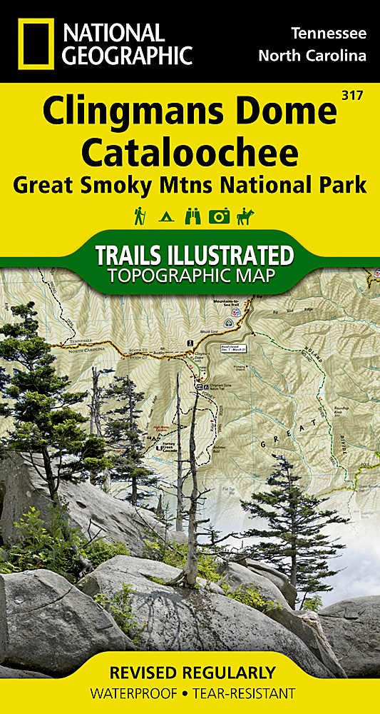
<p> Prachtige geplastificeerde kaart van het bekende nationaal park. Met alle recreatieve voorzieningen als campsites, maar ook met topografische details en wandelroutes ed. Door uitgekiend kleurgebruik zeer prettig in gebruik. Scheur en watervast!</p> <div> This title provides an increased scale of one of the most visited National Parks in the US, and one of our more popular map titles. This increased scale will provide greater detail to the backcountry users and Appalachian Trail through-hikers.</div> <div> </div> <div> Great Smoky Mountains National Park is a hiker's paradise with over 800 miles of maintained trails ranging from short legstretchers to strenuous treks that may require backcountry camping. But hiking is not the only reason for visiting the Smokies. Car camping, fishing, picnicking, wildlife viewing and auto touring are popular activities.</div> <div> </div> <div> Coverage Highlights</div> <div> Areas and places featured in this map series (TI316 and TI317) include:</div> <div> • Appalachian Trail</div> <div> • Benton Mackaye Trail</div> <div> • Mountains-to-Sea Trail</div> <div> • Backcountry Campsites</div> <div> • Detailed Trail Mileages</div> <div> • Footbridges</div> <div> • Fords/Stream Crossings</div> <div> • Nature/Interpretive Trails</div> <div> • Scenic Overlooks/Roadside Pull-outs</div> <div> • Cades Cove Driving Loop</div> <div> • Chilowee Mountain, Little Mountain, and Cataloochee Divide</div> <div> • Blue Ridge Parkway</div> <div> • National Forest Service Lands (Cherokee, Pisgah and Nantahala National Forests)</div> <div> • Little Tennessee and Tuckasegee Rivers</div> <div> • Chilhowee and Fontana Lakes</div> <div> • Maryville, Tennessee - Gatlinburg, Tennessee - Waynesville, North Carolina</div>
€14,95
Bekijk product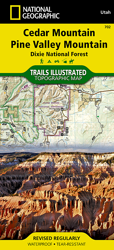
<p> Prachtige geplastificeerde kaart van het bekende nationaal park. Met alle recreatieve voorzieningen als campsites, maar ook met topografische details en wandelroutes ed. Door uitgekiend kleurgebruik zeer prettig in gebruik. Scheur en watervast!</p> <p> Coverage includes Dixie National Forest, Ashdown Gorge Wilderness, Cedar Breaks National Monument, Brian Head, Navajo Lake, Haycock Mountain, Panguitch Lake, Long Valley Junction and Duck Creek. Includes UTM grids for use with your GPS unit.</p>
€17,95
Bekijk product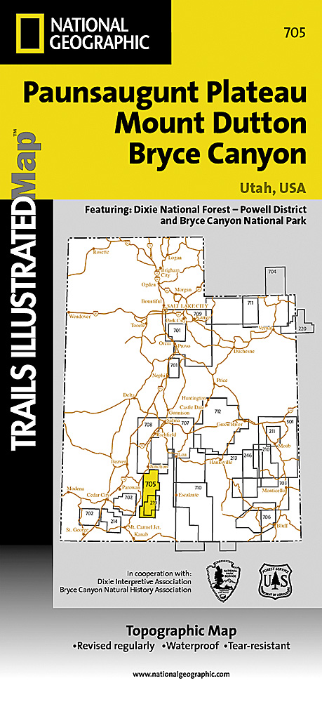
<p> Prachtige geplastificeerde kaart van het bekende nationaal park. Met alle recreatieve voorzieningen als campsites, maar ook met topografische details en wandelroutes ed. Door uitgekiend kleurgebruik zeer prettig in gebruik. Scheur en watervast!</p> <p> Coverage includes Dixie National Forest. Bryce Canyon National Park; Paunsaugunt Plateau; Red Canyon, Sunset and Pink Cliffs, Johns Valley, Casto Canyon, Swallow Park Ranch, Sevier Plateau and Pole Canyon; Tropic Reservoir, Cottonwood Creek and Sevier Creek.</p>
€17,95
Bekijk product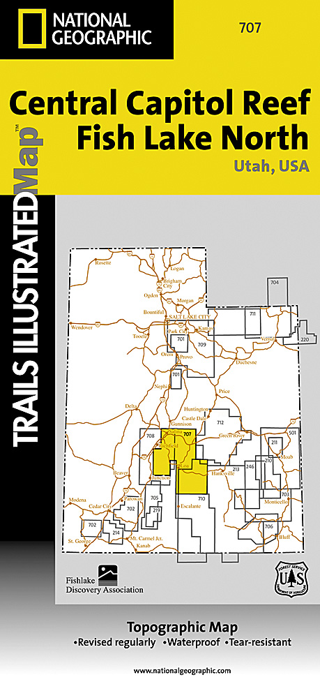
<p> Prachtige geplastificeerde kaart van het bekende nationaal park. Met alle recreatieve voorzieningen als campsites, maar ook met topografische details en wandelroutes ed. Door uitgekiend kleurgebruik zeer prettig in gebruik. Scheur en watervast!</p> <p> Coverage includes Fishlake National Forest; Capitol Reef National Park; Freemont, Torrey, Waterpocket Fold and Fremont Junction, Salina, Burrville, Thousand Lake Mountain, Monroe Mountain, Gooseberry Area and Boulder Mountain; Fish Lake, Bown's, Sheep Valley and Rocky Ford Reservoirs; Great Western Trail.</p>
€17,95
Bekijk product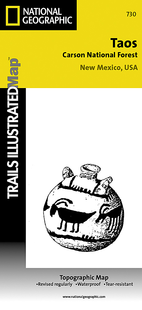
<p> <font face="Helvetica Neue, Helvetica, sans-serif, Arial"><span style="line-height: 16.363636016845703px;">Prachtige geplastificeerde kaart van het bekende nationaal park. Met alle recreatieve voorzieningen als campsites, maar ook met topografische details en wandelroutes ed. Door uitgekiend kleurgebruik zeer prettig in gebruik. Scheur en watervast!</span></font></p> <p> Coverage includes Carson National Forest, Taos, Rancho de Taos, Agua Fria, Black Lake, Valle Escondido, Penasco, Chacon, and Northern Pecos Wilderness.</p>
€17,95
Bekijk product
<p> Prachtige geplastificeerde kaart van het bekende nationaal park. Met alle recreatieve voorzieningen als campsites, maar ook met topografische details en wandelroutes ed. Door uitgekiend kleurgebruik zeer prettig in gebruik. Scheur en watervast!</p> <div> Coverage includes Pharaoh Lake and Hoffman Notch Wilderness Areas; Lake George, Hammond Pond, and Wilcox Lake Wild Forests; Ticonderoga, Schroon Lake, Warrensburg, and Lake Luzerne. Includes UTM grids for use with your GPS unit and a trail mileage matrix. <span style="font-size: 12px;">This map was produced in cooperation with the Adirondack Mountain Club (ADK). </span></div>
€17,95
Bekijk product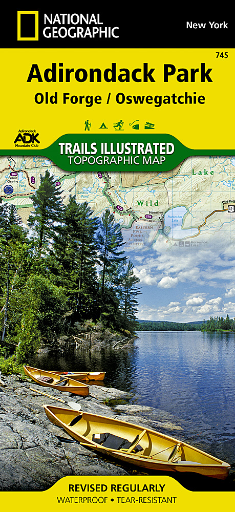
<p> Prachtige geplastificeerde kaart van het bekende nationaal park. Met alle recreatieve voorzieningen als campsites, maar ook met topografische details en wandelroutes ed. Door uitgekiend kleurgebruik zeer prettig in gebruik. Scheur en watervast!</p> <div> National Geographic's Trails Illustrated map of Adirondack Park Old Forge/Oswegatchie is a two-sided, waterproof, topographic trail map designed to meet the needs of outdoor enthusiasts with unmatched durability and detail. This map was created in cooperation with the Adirondack Mountain Club and is loaded with valuable recreation information, no matter the season. Trails and major roads are clearly distinguished, along with canoe access and snowmobile trails. Places of interest, including the Cranberry Lake 50 Trail, campgrounds, and fishing easements, are labeled and easy to find. The map also features color coded boundaries for parklands, primitive, forest, and private property. Discover the Adirondack's wild, rugged and beautiful terrain, with detailed elevation contours, shaded relief, vegetation, and water features.</div> <div> </div> <div> Map coverage includes western and southwestern Adirondacks, including Five Ponds Wilderness, William C. Whitney Wilderness, Round Pond Wilderness, Pepperbox Wilderness, Ha-de-ron-dah Wilderness, Cranberry Lake Wild Forest, Black River Wild Forest, Independence River Wild Forest, Aldrich Pond Wild Forest, Sargent Ponds Wild Forest, Horseshoe Lake Wild Forest, Watsons East Triangle Wild Forest, and Grasse River Wild Forest. A Western Trail Chart inset, along with UTM grids for use with your GPS unit and a trail mileage matrix, keep you on course.</div> <div> </div> <div> The Adirondack Park Old Forge/Oswegatchie map is designed and printed in the United States on durable synthetic paper, making it waterproof, tear-resistant, and trail tough – made to head outside and go anywhere you do. The map is two-sided, and is folded to a packable size of 4.25" x 9.25"; unfolded size is 26" x 38".</div> <div> </div> <div> Key Features:</div> <div> • Waterproof and tear-resistant</div> <div> • Updated regularly</div> <div> • Designed and printed in the U.S.A.</div> <div> • Detailed road network, including designations for off-highway roads</div> <div> • Clearly marked trails for hiking, canoeing and more</div> <div> • Detailed topography with shaded relief and clearly defined, color-coded boundaries for parks, recreation areas, wilderness areas, forest and primitive areas.</div> <div> • Hundreds of places-of-interest, including campgrounds, information centers, boat launches, canoe carry downs, fishing access points, ski areas, and specialty content unique to each area</div> <div> • UTM and Latitude/Longitude coordinate grid, as well as selected waypoints, and a scale bar for easy and accurate navigation.</div> <div> </div>
€17,95
Bekijk product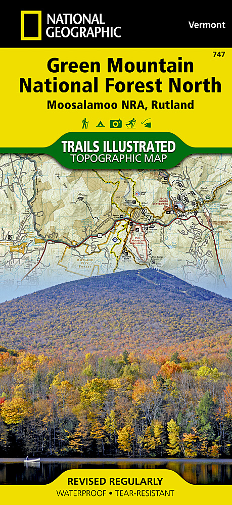
<p> Prachtige geplastificeerde kaart van het bekende nationaal park. Met alle recreatieve voorzieningen als campsites, maar ook met topografische details en wandelroutes ed. Door uitgekiend kleurgebruik zeer prettig in gebruik. Scheur en watervast!</p> <div> National Geographic's Green Mountain National Forest North Trails Illustrated topographic map is the most comprehensive available for outdoor enthusiasts of all types. Designed to be easy-to-read, yet highly detailed – this map includes a comprehensive road and trail network distinguishing between major, secondary and 4x4 roads, hiking, horse, biking, multi-use and non-motorized winter trails. All forest roads are labeled with their official road number and trails are clearly identified with their given name. Land management boundaries are color-coded showing National Forest, Ranger District, Wilderness Areas, Conservation Areas and more, plus the locations of private land within the Green Mountain National Forest. The renowned Appalachian Trail, Catamount Trail, and Long Trails are highlighted on the map.</div> <div> </div> <div> An extensive collection of important and unique locations are pinpointed on the map including: visitor centers, campgrounds and backcountry shelters, picnic facilities, parking areas, RV dump sites, interpretive trails, boat launches, swimming holes, fishing areas, downhill and cross-country ski areas, waterfalls, viewpoints, museums, concessions, and Vermont's scenic covered bridges.</div> <div> </div> <div> Every National Geographic Trails Illustrated map is an essential tool for safely navigating the backcountry with GPS or compass as they are clearly marked with both Latitude/Longitude and UTM coordinate grids, compass rose with magnetic declination, scale bar, and full legend.</div> <div> </div> <div> Some of the places shown on the west side of the Green Mountain N.F. map are: Moosalamoo National Recreation Area, Joseph Battell Wilderness, Bristol Cliffs Wilderness, Breadloaf Wilderness, Rutland, Killington, Pico Ski Area, Sugarbush Ski Area, Lake Bomoseen, and more.</div> <div> </div> <div> The east side of the map features: Hanover (NH), White River Junction, Woodstock, Quechee, Killington, White River, Connecticut River, Suicide Six Ski Area, Les Newell Wildlife Management Area, Granville Reservation, Roxbury State Forest, and more.</div> <div> </div> <div> This Trails Illustrated map is printed in the U.S.A. on a durable synthetic paper, making it waterproof, tear-resistant, and capable for withstanding any condition mother nature can dish out. The map is two-sided, and can be folded to a packable size of (4.25" x 9.25"), unfolded size is (26" x 38")."</div> <div> </div> <div> Green Mountains National Forest North adjoins the Green Mountains National Forest South map providing seamless coverage of Vermont's Green Mountain National Forest.</div>
€17,95
Bekijk product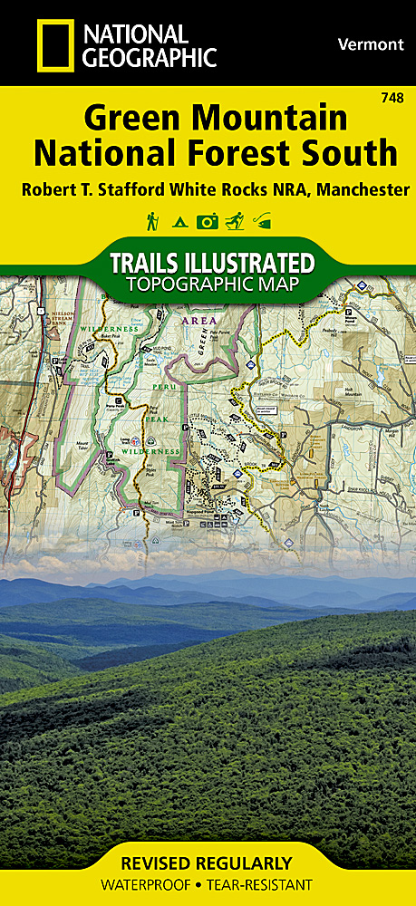
<p> Prachtige geplastificeerde kaart van het bekende nationaal park. Met alle recreatieve voorzieningen als campsites, maar ook met topografische details en wandelroutes ed. Door uitgekiend kleurgebruik zeer prettig in gebruik. Scheur en watervast!</p> <div> National Geographic's Green Mountain National Forest South Trails Illustrated topographic map is the most comprehensive available for outdoor enthusiasts of all types. Designed to be easy-to-read, yet highly detailed – this map includes a comprehensive road and trail network distinguishing between major, secondary and 4x4 roads, hiking, horse, biking, multi-use and non-motorized winter trails. All forest roads are labeled with their official road number and trails are clearly identified with their given name. Land management boundaries are color-coded showing National Forest, Ranger District, Wilderness Areas, Conservation Areas and more, plus the locations of private land within the Green Mountain National Forest. The renowned Appalachian Trail, Catamount Trail, and Long Trails are highlighted on the map.</div> <div> </div> <div> An extensive collection of important and unique locations are pinpointed on the map including: visitor centers, campgrounds and backcountry shelters, picnic facilities, parking areas, RV dump sites, interpretive trails, boat launches, swimming holes, fishing areas, downhill and cross-country ski areas, waterfalls, viewpoints, museums, concessions, and Vermont's scenic covered bridges.</div> <div> </div> <div> Every National Geographic Trails Illustrated map is an essential tool for safely navigating the backcountry with GPS or compass as they are clearly marked with both Latitude/Longitude and UTM coordinate grids, compass rose with magnetic declination, scale bar, and full legend.</div> <div> </div> <div> Some of the places shown on the north side of the Green Mountain N.F. map are: Robert T. Stafford White Rocks National Recreation Area, Big Brand Wilderness, Peru Peak Wilderness, Lye Brook Wilderness, Rutland, Killington, Coolidge State Forest, Stratton Mountain, Jamaica State Park, Lake Saint Catherine State Park, and more.</div> <div> </div> <div> The south side of the map features: George D. Aiken Wilderness, Glastenbury Wilderness, Mt. Snow Ski Area, Harriman Reservoir, Somerset Reservoir, Battenkill River, Lake Shaftsbury State Park, and more.</div> <div> </div> <div> This Trails Illustrated map is printed in the U.S.A. on a durable synthetic paper, making it waterproof, tear-resistant, and capable for withstanding any condition mother nature can dish out. The map is two-sided, and can be folded to a packable size of (4.25" x 9.25"), unfolded size is (26" x 38")."</div> <div> </div> <div> Green Mountains National Forest South adjoins the Green Mountains National Forest North map providing seamless coverage of Vermont's Green Mountain National Forest.</div>
€17,95
Bekijk product