
Beantwoord enkele vragen, en binnen seconden geeft AI je een persoonlijk aankoopadvies op maat.
Beantwoord enkele vragen, en binnen seconden geeft AI je een persoonlijk aankoopadvies op maat.

<div> Take a trip on 28 beautiful walks across Sherwood Forest & East Midlands with the OS Pathfinder Guidebooks, graded by length and ranging from 3 to 11 miles.</div> <div> </div> <div> The area comprises of Nottinghamshire, Leicestershire, Rutland, and Northamptonshire. The routes range from extended strolls to longer hikes, something for all levels! Each walk includes a detailed description, an OS map, GPS waypoints and notes of key features and things to see.</div> <div> </div> <div> Routes include the Nene Valley, Geddington Chase, Rutland Water and Bosworth battlefield.</div> <div> </div> <div> This is one of a series of books with great walking routes covering the most popular and scenic areas of Britain. Printed with weather-resistant covers featuring durable rounded corners, they are the perfect companion for country walking throughout Britain.</div>
€18,50
Bekijk product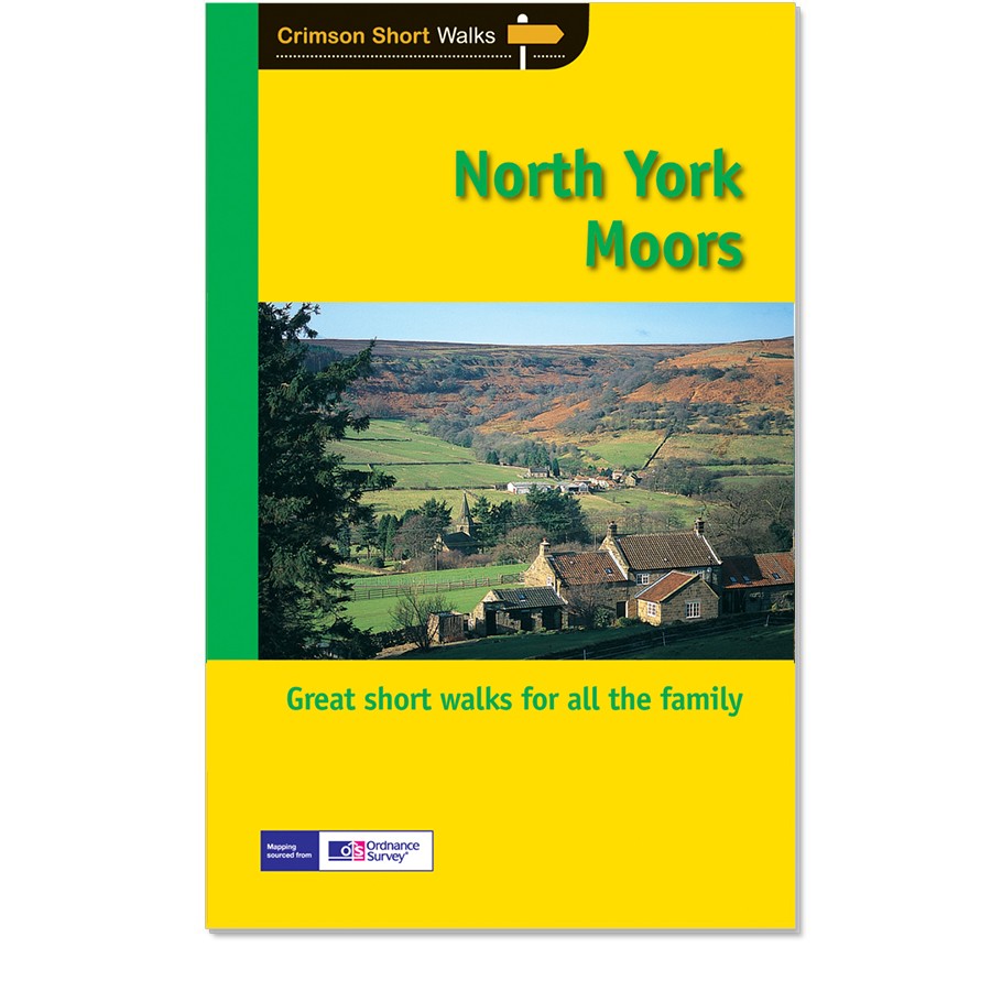
<div> Get lost in 28 beautiful walks exploring the North York Moors with the OS Pathfinder Guidebooks, graded by length and ranging from 3.5 to 11 miles.</div> <div> </div> <div> Make the most out of your next trip to the York Moors! Some of the more popular walks feature in this guide are Robin Hood's Bay, Rivaulx Abbey, the River Esk valley, and the Cook Monument. Each walk includes easy-to-follow route directions and accompanied by large-scale Ordnance Survey route maps, GPS waypoints, and captivating photographs.</div> <div> </div> <div> Walks in this guide include routes across wild and remote moorland, such as Ingleby Moor, Westerdale Moor, and Ainthorpe Rigg are contrasted with coastal and clifftop walks around Runswick Bay and Staithes, Whitby, and Saltwick bay and Ravenscar.</div> <div> </div> <div> This is one of a series of books with great walking routes covering the most popular and scenic areas of Britain.</div>
€18,50
Bekijk product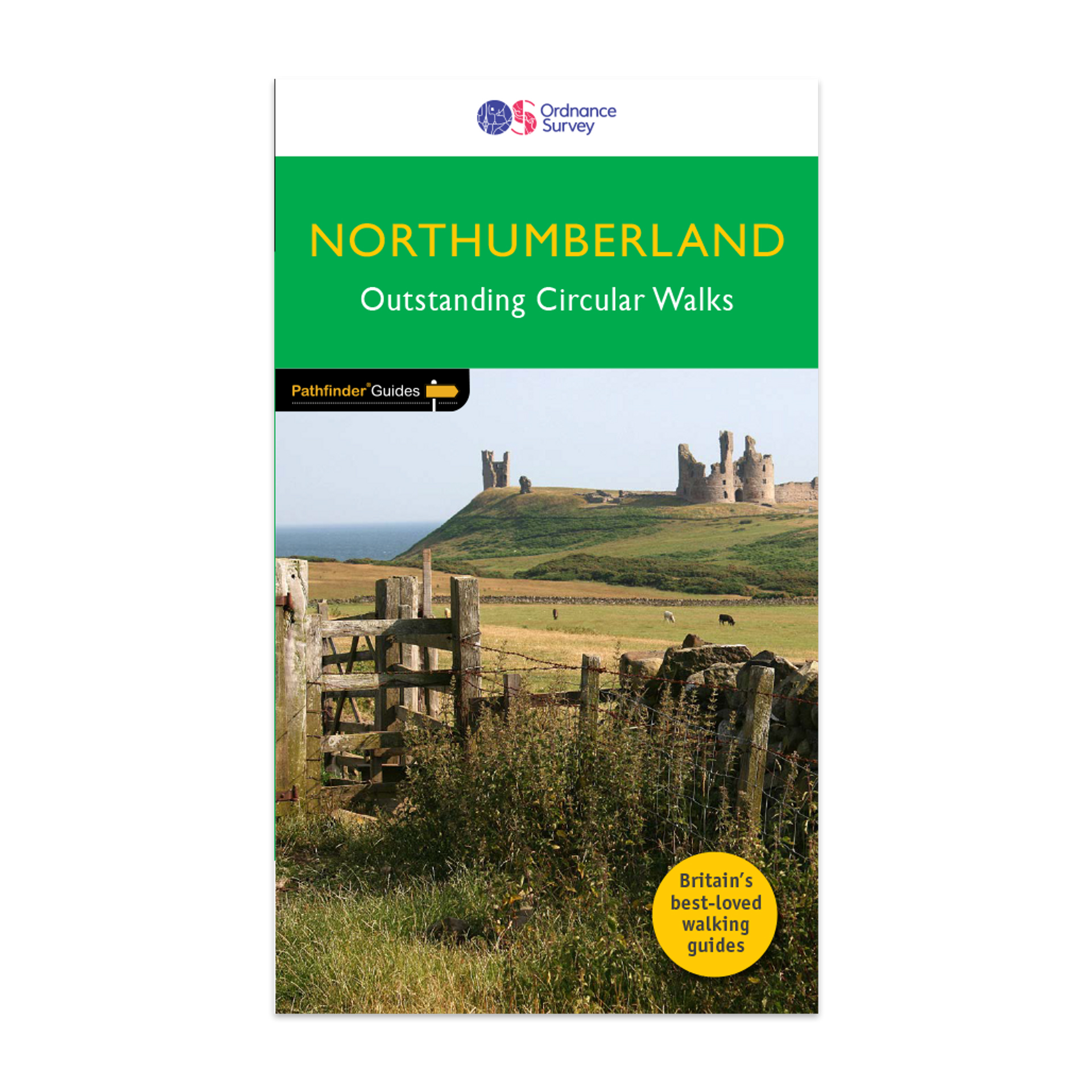
<div> <div> Pathfinder® Guide to Northumberland, featuring 28 outstanding walks designed for a range of abilities covering 180 miles of walking.</div> <div> </div> <div> Features:</div> <div> </div> <div> 28 guided walks for a range of abilities</div> <div> Large detailed Ordnance Survey map extracts</div> <div> Key information such as parking and type of terrain</div> <div> GPS waypoints for each route</div> <div> Weather-resistant book cover</div> <div> Durable rounded corners</div> <div> </div> <div> This new guide to Northumberland has ten brand-new Pathfinder walks across the county. There are new short walks at Berwick-upon-Tweed, Almouth and Bellingham. There are new half-day walks in the Coquet Valley at Felton, in the Humbleton Hills from Wooler, exploring the countryside south of the River Tyne from Hexham, and taking you along the scenic Wansbeck Valley to Morpeth from Bothal. And there are new longer walks in Hulne Park, Alnwick; along the coast and inland from Bamburgh; and a lengthy but hugely enjoyable ramble in a circuit from Druridge Bay to Warkworth and a return via Amble along the Northumberland Coast Path/England Coast Path.</div> <div> </div> <div> The other much-loved walks in the book feature circuits along the most impressive sections of Hadrian’s Wall; in the Northumberland National Park and the Cheviot Hills; and along stretches of the stunning Northumbrian coastline at Holy Island and Dunstanburgh Castle.</div> <div> </div> <div> Walks are professionally authored and depicted with GPS waypoints, Ordnance Survey maps and beautiful photography.</div> </div> <div> </div>
€18,50
Bekijk product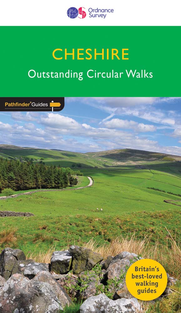
<div> 175 miles of delightfully pastoral country walking from Thurstaston Common on the Wirral to Tegg's Nose on the north-western fringes of the Peak District National Park . . .</div> <div> </div> <div> Uncover 28 beautiful walks around Cheshire with the OS Pathfinder Guidebooks, graded by length and ranging from 3 ½ to 10 ½ miles.</div> <div> </div> <div> The routes range from extended strolls to longer hikes, something for all levels! Each walk includes a detailed description, an OS map, GPS waypoints, and notes of key features and things to see.</div> <div> </div> <div> This is one of a series of books with great walking routes covering the most popular and scenic areas of Britain. Printed with weather-resistant covers featuring durable rounded corners, they are the perfect companion for country walking throughout Britain.</div> <div> </div> <div> Publication Date: 2019</div> <div> </div> <div> Walks in this book:</div> <div> </div> <ul> <li> Wirswall Hill and Big Mere</li> <li> Bollington and Nab Head</li> <li> Little Budworth Country Park</li> <li> Styal and the Bollin Valley</li> <li> Dane Valley</li> <li> Chester and the River Dee</li> <li> Boothsdale</li> <li> Astbury mere and Village</li> <li> Delamere Forest</li> <li> Audlem and the Shropshire Union Canal</li> <li> Bulkeley Hill and Raw Head</li> <li> Sandbach</li> <li> Disley and Lyme Park</li> <li> Dunham Park and the Bridgewater Canal</li> <li> Wybunbury</li> <li> Farndon and Churton</li> <li> Gawsworth Hall and North Rode</li> <li> Trent and Mersey Canal and Great Budworth</li> <li> Beeston Castle and the Shropshire Union Canal</li> <li> Caldy Hill, Thurstaston and the Wirral Way</li> <li> Wirral Way, Parkgate and the Dee Estuary</li> <li> Above Helsby and Frodsham</li> <li> Mow Cop and Litle Moreton Hall</li> <li> Timberbrook and the Cloud</li> <li> Shutlingsloe</li> <li> Mapas</li> <li> Tegg's Nose and Macclesfield Forest</li> <li> Etherow and Goyt Valley</li> </ul>
€18,50
Bekijk product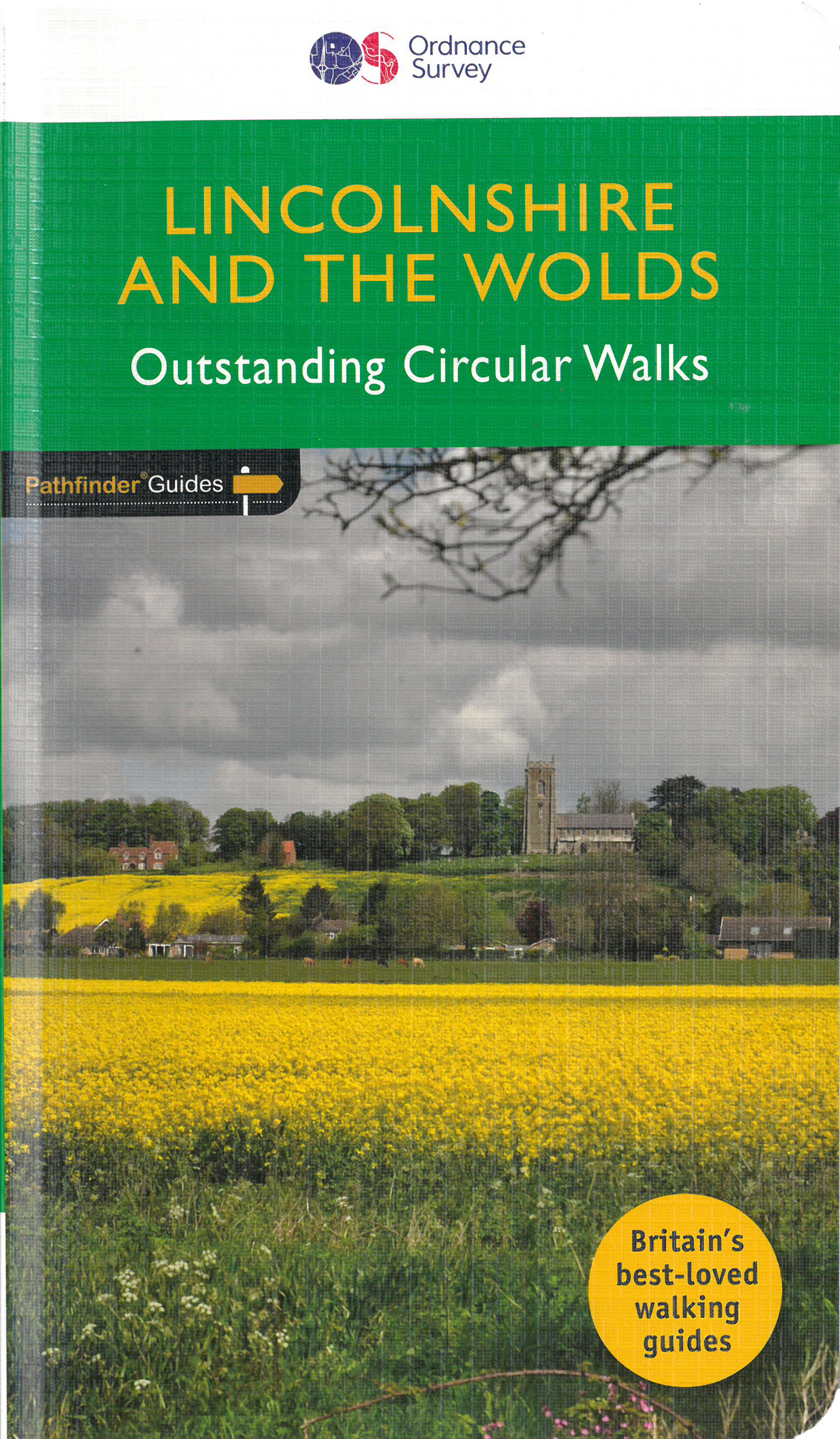
<div> Discover 28 beautiful walks across Lincolnshire & the Wolds with the OS Pathfinder Guidebooks, graded by length and ranging from 3 to 11 miles.</div> <div> </div> <div> Explore the second largest county in England, Lincolnshire. The county is largely unspoilt and offers a great opportunity for new and unique walking experiences. Routes in this book include Thornton Abbey, Sway Valley, Horncastle, the Vale of Belvoir, and Frampton Marsh.</div> <div> </div> <div> Each walk includes a detailed description, an OS map, GPS waypoints and notes of key features and things to see.</div> <div> </div> <div> This is one of a seriess of books with great walking routes covering the most popular and scenic areas of Britain. Printed with weather-resistant covers featuring durable rounded corners, they are the perfect companion for country walking throughout Britain.</div>
€18,50
Bekijk product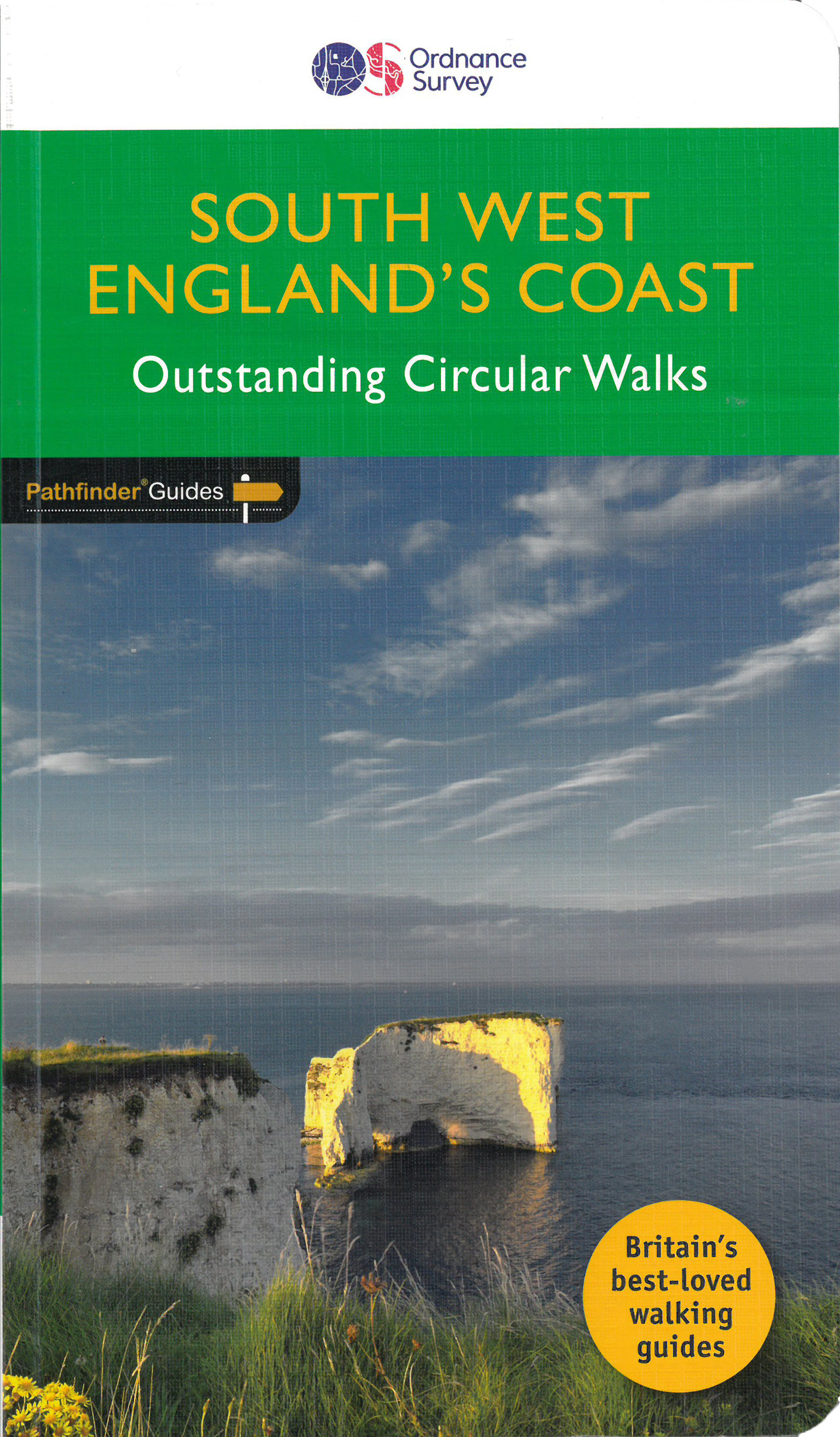
<div> Immerse yourself in 28 beautiful walks along the South West Coast of England with the OS Pathfinder Guidebooks, graded by length and ranging from 3 to 9 miles.</div> <div> </div> <div> The routes range from extended strolls to longer hikes, something for all levels! Each walk includes a detailed description, an OS map, GPS waypoints and notes of key features and things to see.</div> <div> </div> <div> Routes include Lulworth Cove, Old Harry rocks, Chesil beach, Lizard Point, and Sidmouth.</div> <div> </div> <div> This is one of a series of books with great walking routes covering the most popular and scenic areas of Britain. Printed with weather-resistant covers featuring durable rounded corners, they are the perfect companion for country walking throughout Britain.</div>
€18,50
Bekijk product
<div> The all-revised edition contains 27 carefully selected walks, all chosen to be easily accessible from London's main railway stations. The routes lie across Essex, Bedfordshire, Oxfordshire, Surrey, West Sussex, East Sussex, and Kent. With routes ranging from 2 to 11 miles - offering something for everyone.</div> <div> </div> <div> Each route includes the station (and time from Central London), an extract of the OS Explorer map showing the route and waypoints, notes on the route, and useful information on this history of the area.</div> <div> </div> <div> This is the perfect book for those looking to find beautiful countryside walks accessible from the capital.</div> <div> </div> <div> Previous editions of this book were called 'Country walks near London'.</div>
€18,50
Bekijk product
<div> This companion to the Pathfinder Peak District Guidebook contains 28 additional circular walks of 3 to 10.5 miles. Like the main book, each is graded length difficulty, and ranger from relatively easy strolls to some of the more challenging routes with considerable vertical ascent.</div> <div> </div> <div> Each route includes a detailed description, a clear, large scale OS map, GPS waypoints and details of where to park, good pubs, and places of interest en route. Routes featured in the book include Stanage Edge, Jacob's Ladder, Lantern Pike, and Stanton Moor.</div>
€18,50
Bekijk product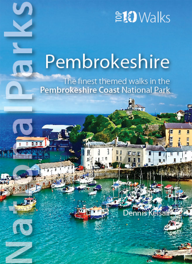
<div> This superbly-written and good looking book will take you on ten short circular walks to the very best stretches of coast, pubs, tea shops, and viewpoints that the beautiful Pembrokeshire coast, in West Wales, has to offer.</div> <div> </div> <div> Defining the south-westernmost tip of Wales, Pembrokeshire’s coastline is arguably the most beautiful and varied in the British Isles. Virtually all of it lies within the Pembrokeshire Coast National Park. Relative isolation has left it largely untouched by modern development and most of its length is a wild frontier where the endless confrontation between sea and land is played out. Long stretches of coast face the fury of Atlantic storms and weakness and faults in the high cliffs are eroded into caves, coves and inlets. However, the harder rock, some of which is 700 million years old, resists the onslaught and stands out in rugged promontories and headlands.</div> <div> </div> <div> Elsewhere, sheltered landings and harbours, fine beaches and secluded bays reveal other aspects of this glorious landscape. In spring and summer the cliff tops break out in the pink, blue, white and yellow of countless flowers and sea crags are alive with nesting birds, while some of Britain’s largest seal populations arrive in autumn to give birth.</div> <div> </div> <div> It was this wild beauty that prompted the establishment of the Pembrokeshire Coast National Park in 1952. Despite being one of the UK’s smaller National Parks, it embraces a third of the county including all the offshore islands, the Daugleddau estuary, and the Preseli Hills. The Park is also home to the popular Pembrokeshire Coast Path — now part of the larger Wales Coast Path. </div> <div> </div> <div> Discover dramatic coastlines at St Davids Head and Strumble Head, Manorbier and Tenby. Climb to lofty coastal panoramas at Carn Ingli and Carn Llidi. Enjoy characterful waterside pubs at Porthgain and Cresswell Quay. Or relax over a quiet cup of coffee or tea and cake at two of Pembrokeshire’s cosiest and most welcoming tea shops and cafés. </div> <div> </div> <div> Unmissable.</div>
€10,95
Bekijk product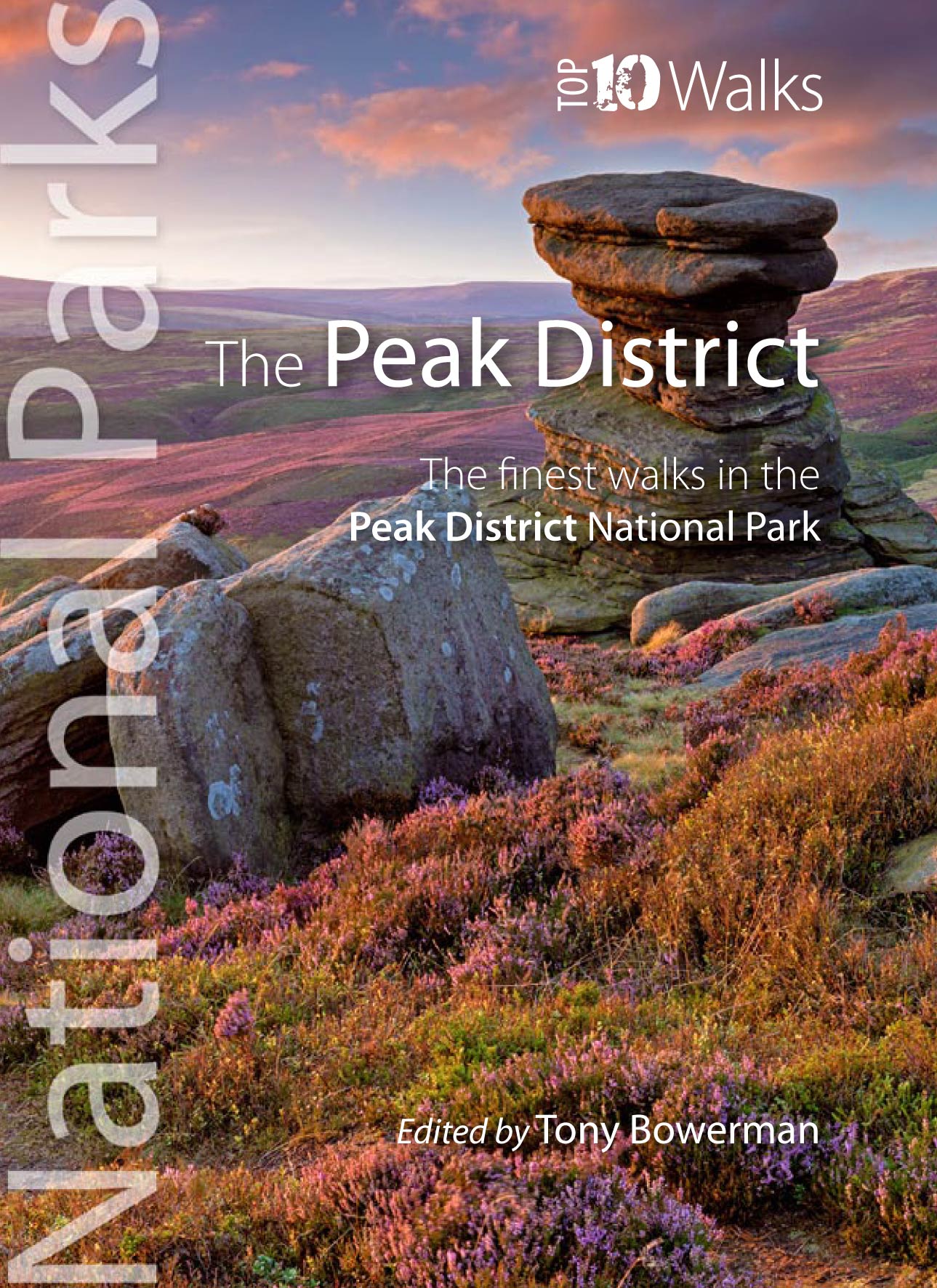
<p> Klein, handzaam wandelgidsje met wandelingen in het Peak District. Met goede kaartjes van Ordnance Survey.</p> <div> Discover the very best of the Peak District.</div> <div> </div> <div> These ten themed walks explore the contrasting faces of the Peaks — the gentle White and rugged Dark Peak. </div> <div> </div> <div> Discover clear rivers and streams, ancient packhorse bridges and stepping stones. Walk through winding dales and valleys bright with wildflowers. Visit stately Chatsworth or marvel at the panorama from Monsal Head.</div> <div> </div> <div> Tour upland reservoirs and dramatic rocky edges popular with climbers. Slog up Shutlingsloe or explore the open moorland and strangely eroded tors on Kinder Edge. Every one is a walk to remember.</div>
€10,95
Bekijk product