
Beantwoord enkele vragen, en binnen seconden geeft AI je een persoonlijk aankoopadvies op maat.
Beantwoord enkele vragen, en binnen seconden geeft AI je een persoonlijk aankoopadvies op maat.
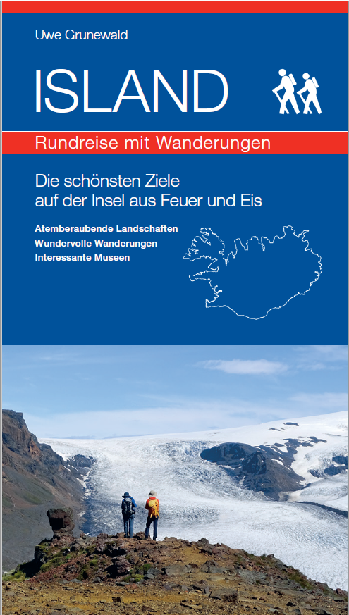
<div> Willkommen in Island, einer Insel voller beeindruckender Naturwunder, einer über tausendjährigen Geschichte sowie einer einzigartigen und vielschichtigen Kultur. Kaum ein anderes Land auf der Welt hat auf so kleinem Raum, eine solche Vielfalt an atemberaubenden Landschaften zu bieten. Jedes der hier vorgestellten Reiseziele ist außergewöhnlich und besitzt seine eigenen Besonderheiten.</div> <div> </div> <div> Gleichgültig wie lange oder wie oft Sie in Island sind oder welche Art des Reisens Sie bevorzugen, das vorliegende Buch ist für alle der perfekte Reisebegleiter, denn es stellt eine umfassende Zusammenstellung der schönsten Orte auf dieser Vulkaninsel dar. Dabei lässt sich die Einzigartigkeit der unterschiedlichen Landschaften Islands am besten zu Fuß erkunden. Aus diesem Grund wurden 80 Wanderungen ausgewählt und beschrieben, um den Besuchern die Vielfalt Islands näher zu bringen. Dabei werden sowohl kurze als auch lange Strecken vorgestellt, welche in drei unterschiedlichen Schwierigkeitsgrade unterteilt werden. Einige sind Standardwege, welche bereits seit vielen Jahren von Reisenden besucht werden. Andere Wanderrouten sind neu zusammengestellt und werden hier zum ersten Mal veröffentlicht. Gleichzeitig werden die wichtigsten Städte und Gemeinden erwähnt, die interessantesten Museen vorgestellt und andere sehenswerte Orte beschrieben.</div> <div> </div> <div> Zusätzlich gibt es in vielen Kapiteln spezielle Informationsboxen mit besonderen Inhalten, welche das jeweilige Gebiet betreffen. Oft handelt es sich dabei um geologische Themen, wobei auch einige fachliche Begriffe verwendet werden. Aus diesem Grund gibt es im hinteren Teil des Buches ein Glossar, in welchem diese Begriffe kurz erklärt werden. Es bleibt mir zu hoffen, dass das vorliegende Buch für alle Leser eine interessante Lektüre vor, während und auch nach der Reise ist und dass es Ihnen hilft, dass jeder Besuch auf der größten Vulkaninsel der Erde zu einem unvergesslichen Erlebnis für Sie wird.</div> <div> </div> <div> <ul> <li> Zahlreiche Natursehenswürdigkeiten und touristische Attraktionen</li> <li> Über 50 einzigartige Wasserfälle</li> <li> Tourbezogene Internetadressen</li> <li> 80 Wanderungen durch grandiose Landschaften, von kurzen Spaziergängen bis zu längeren Tagestouren</li> <li> Detaillierte Wanderkarten mit GPS-Punkten</li> <li> Wissenswerte Informationen: Geologie, Landschaften, Flora & Fauna sowie geschichtliche Ereignisse</li> <li> Über 200 Farbfotos</li> </ul> </div> <div> </div> <div> </div>
€25,95
Bekijk product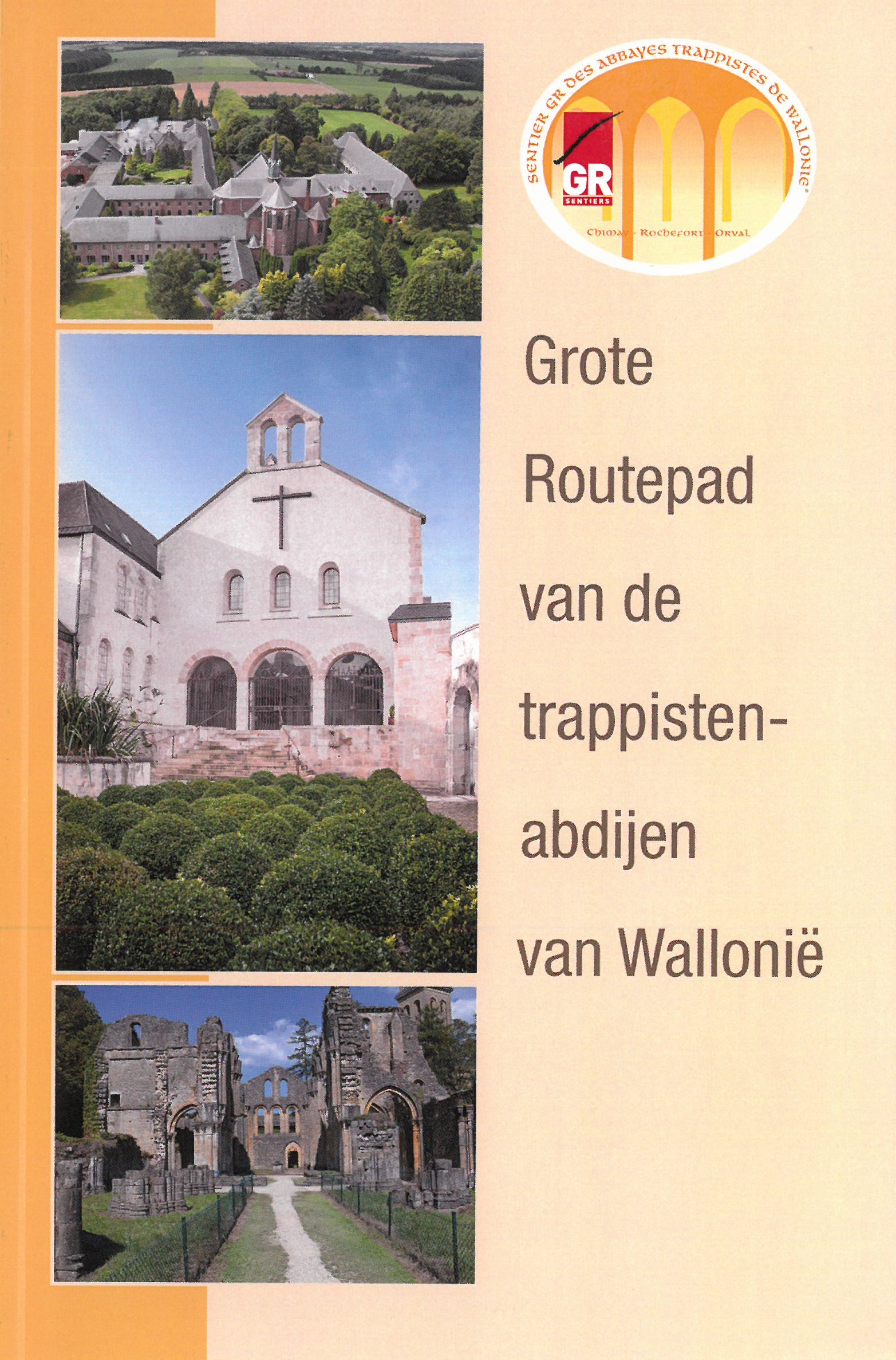
<div> De vernieuwde en verhoogde 2021 uitgave van de NL-SAT Topogids bevat de volledige beschrijving van de route in de beide richtingen, alsook kaarten, toeristische en praktische informatie over de doorkuiste streken.</div> <div> </div> <div> Stappen van abdij naar abdij in Wallonië.</div> <div> </div> <div> Het Grote Routepad van de trappistenabdijen van Wallonië. Dat is de naam van het nieuwe Grote Routepad dat je meeneemt van abdij naar abdij in Wallonië. Ga wandelend op ontdekking naar de abdij van Orval, de abdij Notre-Dame de Saint-Rémy in Rochefort en de abdij van Scourmont in Chimay, evenals de Espace Chimay, gelegen langsheen deze route van 260 km die in 1 stuk is opgedeeld.</div> <div> </div> <div> Deze route is de eerste themaroute uitgestippeld door Les Sentiers de Grande Randonnée. Ze is volledig bewegwijzerd en kan op ieders ritme gewandeld worden, of je nu een ervaren wandelaar bent of gewoon een wandelliefhebber.</div>
€18,50
Bekijk product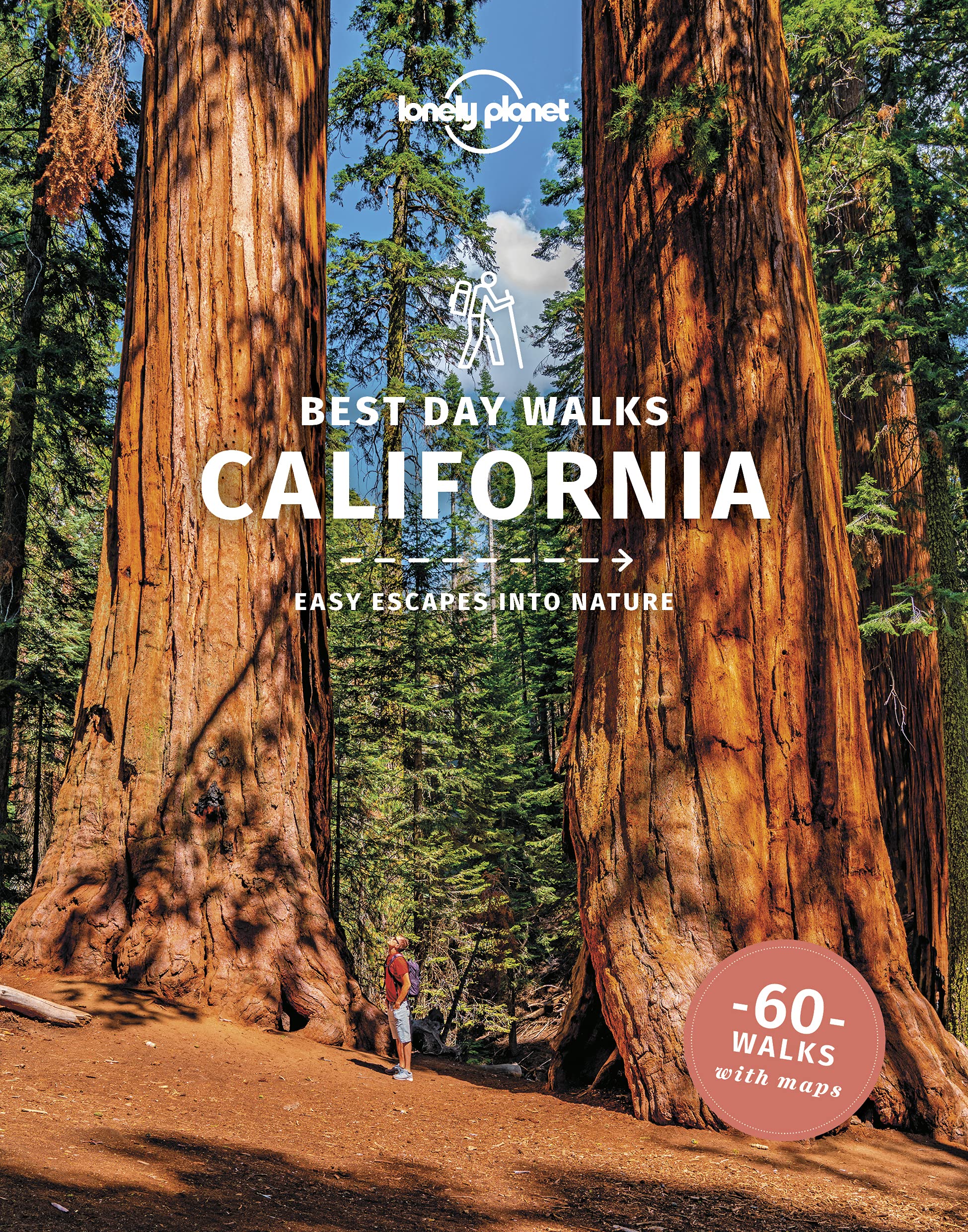
<p> Lonely Planet heeft een nieuwe serie uitgebracht: Best Day Walks in verschillende landen. Het zijn de - door Lonely Planet uitgekozen - mooiste wandelingen verspreid over het land. Goed beschreven, met een schetsmatige kaart erbij ... het werkt heel stimulerend met mooie foto's!</p> <p> <b>Lonely Planet's</b> <b><i>Best Day Walks California</i></b>is your passport to 60 easy escapes into nature. Stretch your legs away from the city by picking a walk that works for you, from just a couple of hours to a full day, from easy to hard. Explore Yosemite National Park, marvel at redwoods, and hike through Gold Country.</p> <p> Inside<b>Lonely Planet's</b> <b><i>Best Day Walks California</i></b><b>Travel Guide:</b></p> <p> <b>Colour</b> maps and images throughout</p> <p> <b>Special features -</b>on California's highlights for walkers, kid-friendly walks, accessible trails and what to take<br /> <b>Best for...</b>section helps you plan your trip and select walks that appeal to your interests<br /> <b>Region profiles</b>cover when to go, where to stay, what's on, cultural insights, and local food and drink recommendations to refuel and refresh. Featured regions include:<br /> Northern Coast & Redwoods, Marin County & the Bay Area, California's Central Coast, SoCal Coast, Southern Deserts, Kings Canyon, Sequoia & the Southern Sierras, Yosemite National Park, Lake Tahoe & Gold Country, Northern Mountains</p> <p> <b>Essential info</b><b>at your fingertips</b>- walk itineraries accompanied by illustrative maps are combined with details about walk duration, distance, terrain, start/end locations and difficulty (classified as easy, easy-moderate, moderate, moderate-hard, or hard)</p> <p> <b>Over 60 maps</b></p> <p> <b>The Perfect Choice:</b> <b>Lonely Planet's</b> <b><i>Best Day Walks California</i>,</b>our most comprehensive guide to walking in California, is perfect for those planning to explore California on foot.</p> <p> </p>
€22,50
Bekijk product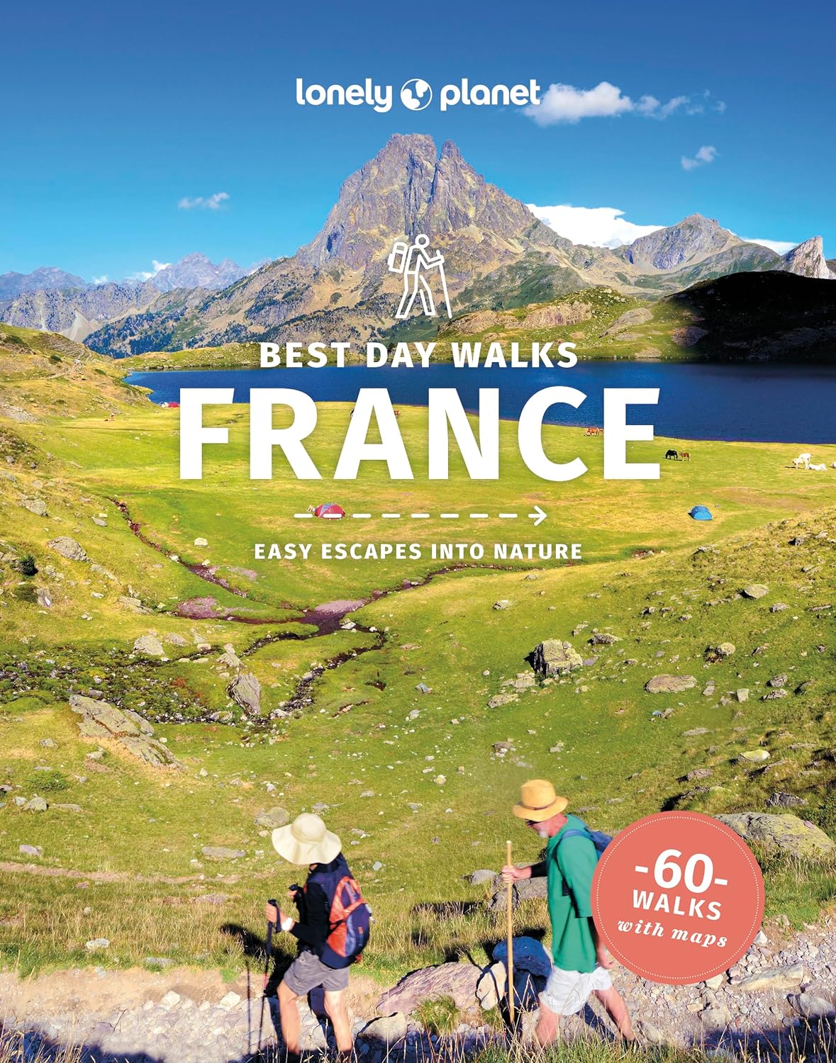
<p> Lonely Planet heeft een nieuwe serie uitgebracht: Best Day Walks in verschillende landen. Het zijn de - door Lonely Planet uitgekozen - mooiste wandelingen verspreid over het land. Goed beschreven, met een schetsmatige kaart erbij ... het werkt heel stimulerend met mooie foto's!</p> <div> Lonely Planet's Best Day Walks France is your passport to 60 easy escapes into nature. Stretch your legs away from the city by picking a walk that works for you, from just a couple of hours to a full day, from easy to hard. Hike the Alps and the Pyrenees and admire lavender fields in Provence.</div> <div> </div> <div> </div> <div> </div> <div> </div> <div> Inside Lonely Planet's Best Day Walks France Travel Guide:</div> <div> </div> <div> Colour maps and images throughout</div> <div> </div> <div> Special features - on France's highlights for walkers, kid-friendly walks, accessible trails and what to take</div> <div> Best for… section helps you plan your trip and select walks that appeal to your interests</div> <div> Region profiles cover when to go, where to stay, what's on, cultural insights, and local food and drink recommendations to refuel and refresh. Featured regions include:</div> <div> Brittany, Normandy, Lille, the Somme, the French Alps, Jura, central France, Provence, the Cote D'Azur, Languedoc-Roussillon, the Pyrenees and Corsica</div> <div> </div> <div> Essential info at your fingertips - walk itineraries accompanied by illustrative maps are combined with details about walk duration, distance, terrain, start/end locations and difficulty (classified as easy, easy-moderate, moderate, moderate-hard, or hard)</div> <div> </div> <div> Over 60 maps</div> <div> </div> <div> The Perfect Choice: Lonely Planet's Best Day Walks France, our most comprehensive guide to walking in France, is perfect for those planning to explore France on foot.</div> <div> </div> <div> Looking for more information on France? Check out Lonely Planet's France guide for a comprehensive look at what the country has to offer.</div> <div> </div> <div> About Lonely Planet: Lonely Planet is a leading travel media company, providing both inspiring and trustworthy information for every kind of traveller since 1973. Over the past four decades, we've printed over 145 million guidebooks and phrasebooks for 120 languages, and grown a dedicated, passionate global community of travellers. You'll also find our content online, and in mobile apps, videos, 14 languages, armchair and lifestyle books, ebooks, and more, enabling you to explore every day.</div> <p> </p>
€25,95
Bekijk product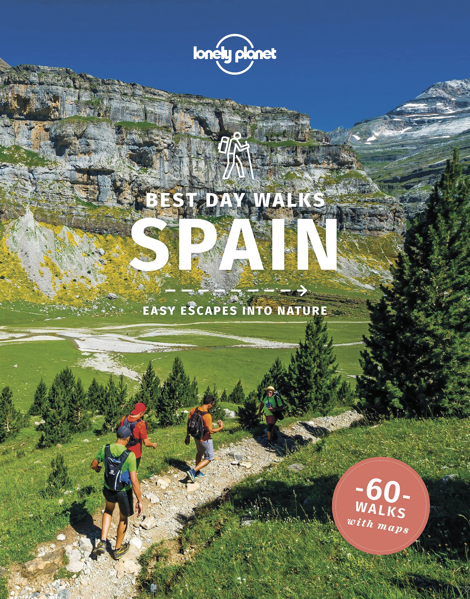
<p> Lonely Planet heeft een nieuwe serie uitgebracht: Best Day Walks in verschillende landen. Het zijn de - door Lonely Planet uitgekozen - mooiste wandelingen verspreid over het land. Goed beschreven, met een schetsmatige kaart erbij ... het werkt heel stimulerend met mooie foto's!</p> <p> <b>Lonely Planet's</b> <b><i>Best Day Walks Spain</i></b>is your passport to 60 easy escapes into nature. Stretch your legs away from the city by picking a walk that works for you, from just a couple of hours to a full day, from easy to hard. Marvel at the Pyrenees, hike along the Mediterranean coast, and experience island walks in Mallorca.</p> <p> Inside<b>Lonely Planet's</b> <b><i>Best Day Walks Spain</i></b><b>Travel Guide:</b></p> <p> <b>Colour</b> maps and images throughout</p> <p> <b>Special features -</b>on Spain's highlights for walkers, kid-friendly walks, accessible trails and what to take<br /> <b>Best for...</b>section helps you plan your trip and select walks that appeal to your interests<br /> <b>Region profiles</b>cover when to go, where to stay, what's on, cultural insights, and local food and drink recommendations to refuel and refresh. Featured regions include:<br /> Pyrenees, Picos & Northern Spain, Galicia, the Mediterranean Coast, Central Spain, Andalucia, Mallorca & Menorca</p> <p> <b>Essential info</b><b>at your fingertips</b>- walk itineraries accompanied by illustrative maps are combined with details about walk duration, distance, terrain, start/end locations and difficulty (classified as easy, easy-moderate, moderate, moderate-hard, or hard)</p> <p> <b>Over 60 maps</b></p> <p> <b>The Perfect Choice:</b> <b>Lonely Planet's</b> <b><i>Best Day Walks Spain</i>,</b>our most comprehensive guide to walking in Spain, is perfect for those planning to explore Spain on foot.</p> <p> </p>
€22,50
Bekijk product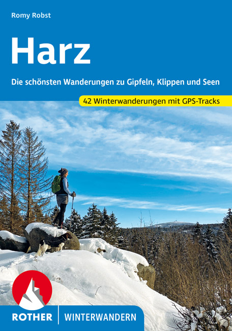
<p> Leuke wandelgids met een groot aantal winter wandelingen in de Harz. Goed beschreven, veel praktische informatie, beperkte kaartjes. Wel met gradaties voor zwaarte van de dagtochten!</p> <div> Der Harz, die zauberhafte Gebirgsinsel am Rand der Norddeutschen Tiefebene, gerade einmal 110 km lang und etwa 40 km breit, ist nicht nur im Sommer einen Besuch wert, sondern auch in der kalten Jahreszeit. Der Winter verpasst dem Mittelgebirge ein Facelift und rückt es ins richtige Licht. Ob außergewöhnliche Eisgebilde, schneebedeckte Kolonnenwege, tief hängende Nebelschwaden oder gefrorene Seen, Bäche und Wasserfälle – alles wirkt im winterlichen Harz wie verwandelt.</div> <div> </div> <div> Für diesen Rother Winterwander-Titel hat Romy Robst 42 abwechslungsreiche Touren zusammengestellt – nahezu jede mit einem kleinen Highlight: eine rasante Rodelfahrt als »alternativer« Abstieg, eine alte, geschichtsträchtige Burgruine, ein Gang an der ehemaligen innerdeutschen Grenze oder eine Kraxeleinlage an einer der bizarren Harzklippen.</div> <div> </div> <div> Die Autorin präsentiert sorgfältig recherchierte Wanderstrecken mit Rodeltipps, Stempelstellen der Harzer Wandernadel und gemütlichen Einkehrtipps. Verlässliche Wegbeschreibungen, Informationen zu den Anforderungen (auch für Hunde) sowie aussagekräftige Höhenprofile und detaillierte Kartenausschnitte machen alle Tourenvorschläge leicht und sicher nachvollziehbar. Ergänzend stehen GPS-Daten zum Download bereit. Zahlreiche Fotos stimmen auf ein erlebnisreiches Wandern ein.</div>
€17,50
Bekijk product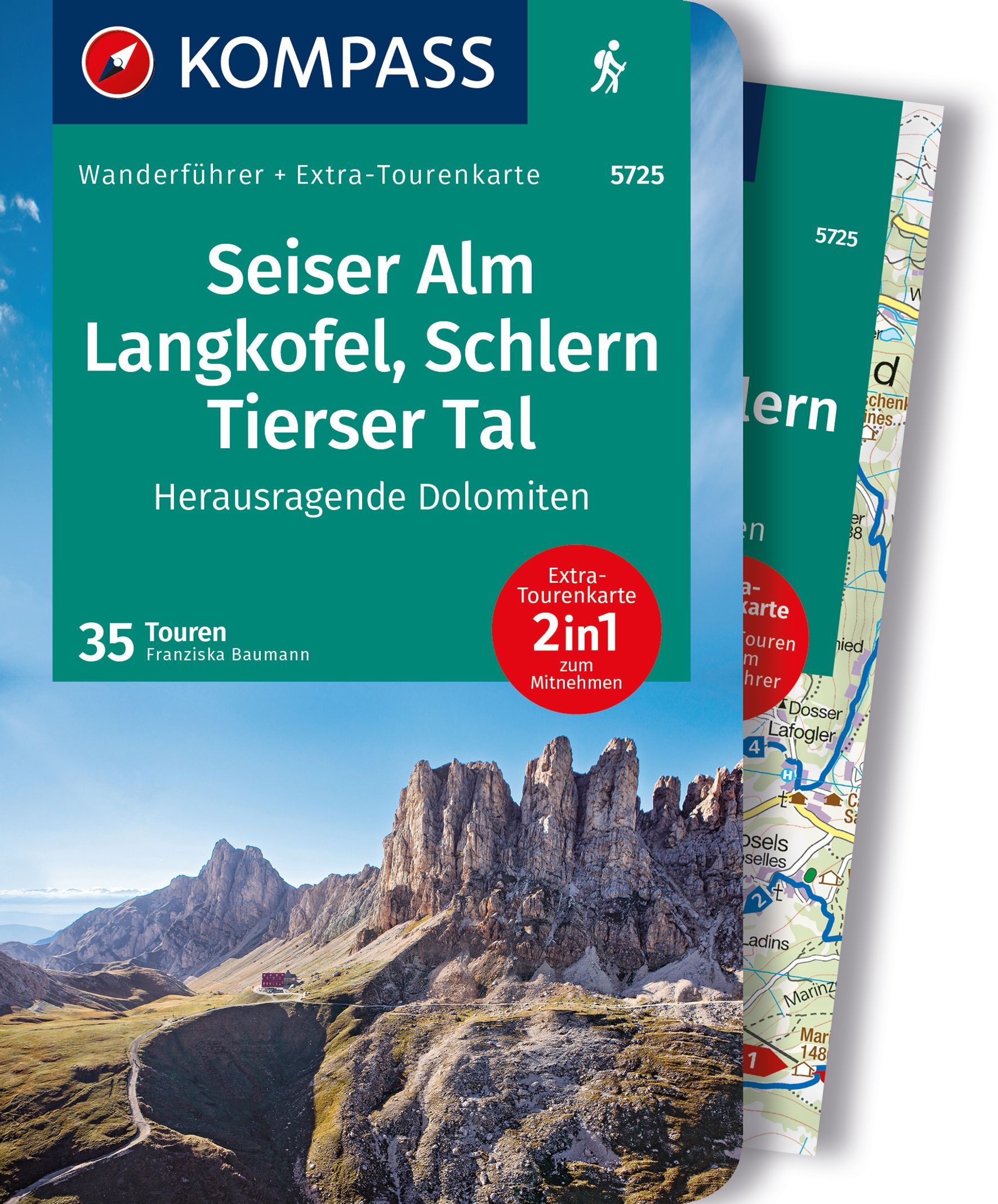
<div> Goede Duitstalige wandelgids met heldere beschrijvingen van de wandeltochten. Met hoogteprofiel, kaartje en de benodigde praktische informatie als bijvoorbeeld de startlocatie met GPS coordinaten. De wandelingen zijn ingedeeld in zwaarte en dan op verschillende kleuren weergegeven. Beschreven worden eenvoudige wandelingen tot pittige (berg)tochten, voor getrainde en ongetrainde wandelaars, een aantal wandelingen zijn geschikt om met kinderen te doen. Belangrijke toevoeging bij de Kompass wandelgidsen is een bijgevoegde losse wandelkaart van het betreffende gebied waarop de wandelingen uit de gids op de kaart heel duidelijk zijn ingetekend. </div> <div> </div> <div> Alle Vorteile des Wanderführers auf einen Blick:</div> <div> . Von KOMPASS-Experten erwanderte Touren</div> <div> . Jede Tour mit Höhenprofil und Kartenausschnitt</div> <div> . Ausflugs- und Übernachtungstipps</div> <div> . Kostenloser Download der GPX-Daten</div> <div> </div> <div> Die Vorteile der Extra-Tourenkarte auf einen Blick:</div> <div> . Unterstützt die Tourenauswahl</div> <div> . Kartografische Gesamtübersicht</div> <div> . Touren können einfach kombiniert werden</div> <div> . Ein Leichtgewicht zum Mitnehmen</div> <div> . Auch als Straßen- und Urlaubskarte verwendbar</div> <div> </div> <div> </div> <div> Destination:</div> <div> . Die Seiser Alm und ihre Umgebung sind ein wahres Wanderparadies. Ein ausgedehntes Wegenetz bietet Touren für jeden Geschmack und jedes Können - von der gemütlichen Genusswanderung bis zur anspruchsvollen Bergroute.</div> <div> </div> <div> . Die Hochfläche der Seiser Alm, Europas größte Hochalm, ist ein Amphitheater, das mit immer neuen Ausblicken überrascht. Schlern, Rosengarten, Lang- und Plattkofel bilden eine faszinierende Felskulisse.</div> <div> </div> <div> . Anspruchsvollere Steige nähern sich den Zacken, Türmen und Wänden oder führen auf die Gipfel. Das unverwechselbare Profil des Schlern ist ein Wahrzeichen Südtirols. Dort oben zu stehen, ist ein einmaliges Erlebnis.</div> <div> </div> <div> . Der Naturpark Schlern-rosengarten ist Südtirols ältester Naturpark. Durch die geologische Vielfalt der Region sind dort viele Tier- und Pflanzenarten beheimatet.</div> <div> </div> <div> . Am Fuß von Seiser Alm und Schlern laden die sonnig gelegenen Urlaubsorte Kastelruth, Seis und Völs zu Wanderungen für die ganze Familie ein - zu geheimnisvollen Burgruinen, durch schattige Wälder und durch Südtiroler Bauernland.</div> <div> </div> <div> . Das leibliche Wohl kommt auf keiner Wanderung zu kurz. Ob gemütliche Alm, schön gelegenes Berggasthaus oder uriger Buschenschank - Spezialitäten aus der Südtiroler Küche machen den Wandergenuss perfekt.</div> <div> </div> <div> Kurzinfo zum Produkt:</div> <div> - Das sportliche Highlight: Eine Zweitagestour über das Schlernplateau bietet ein Kontrastprogramm - genussvolles Wandern über die Seiser Alm, fantastisches Panorama am Schlernhaus und eine spannende Gratüberschreitung ins Tierser Tal.</div> <div> - Das Familien-Highlight: Am Hexenquellenweg auf der Seiser Alm gibt es viel zu entdecken: unterhaltsame Spielstationen, Kunstwerke aus Holz und Stein und eine Schwefelquelle. Eine kurzweilige Runde für die ganze Familie.</div> <div> -Das Genuss-Highlight: Der Oachner Höfeweg führt durch jahrhundertealte Südtiroler Kulturlandschaft und bietet großartige Ausblicke auf die felsige Silhouette des Rosengartens. Am schönsten ist er im Herbst, wenn die Buschenschanke geöffnet sind.</div> <div> - Das persönliche Highlight: Nahblicke auf die senkrecht aufragenden Wände des Langkofels, ein fantastisches Dolomitenpanorama und das Felslabyrinth der "Steinernen Stadt" sind nur einige Höhepunkte der landschaftlich großartigen Runde um Platt- und Langkofel.</div> <div> - Das Kultur-Highlight: Schloss Prösels, Stammburg der Herren von Völs, beeindruckt als gut erhaltene spätgotische Schlossanlage. Sie wird heute für Ausstellungen, Konzerte und Theater genutzt.</div>
€17,50
Bekijk product
<div> 180 miles of wonderful walking in idyllic, limestone countryside . . .</div> <div> </div> <div> Take a journey on 28 beautiful walks across the Cotswolds with the OS Pathfinder Guidebooks, graded by length and ranging from 3 to 10 miles.</div> <div> </div> <div> All walks in this book include written directions, an extract of the OS map for the area and some background on the history and natural environment you see. Most of the walks avoid busy roads and are designed to help you make the most of a holiday or day trips. There are notes on parking, pubs, and things to see en route.</div> <div> </div> <div> The routes range from extended strolls to longer hikes, something for all levels! Each walk includes a detailed description, an OS map, GPS waypoints and notes of key features and things to see.</div> <div> </div> <div> This is one of a series of books with great walking routes covering the most popular and scenic areas of Britain. Printed with weather-resistant covers featuring durable rounded corners, they are the perfect companion for country walking throughout Britain.</div> <div> </div> <div> Publication Date: 2020</div> <div> </div> <div> Walks in this book:</div> <div> </div> <ul> <li> Minster Lovell and the River Windrush</li> <li> Northleach and Hampnett</li> <li> Minchinhampton Common</li> <li> Blockley and Norcombe Wood</li> <li> Wotton-under-Edge, the Tyndale monument, and Coombe Hill</li> <li> Broadway and Broadway Tower</li> <li> Sapperton and Daneway</li> <li> Chipping Campden and Dover's Hill</li> <li> Cooper's Hill and Buckholt Wood</li> <li> Castle Combe</li> <li> Dyrham Park and West Littleton</li> <li> Burford, Fulbrook, and Widford</li> <li> Brimpsfield and Syde</li> <li> Bibury and the River Coln</li> <li> The Guitings and Guiting Wood</li> <li> Blenheim Park</li> <li> Haresfield beacon and Standish Wood</li> <li> Wychwood Forest</li> <li> Adlestrop, Cornwell, and Oddington</li> <li> Laurie Lee Country</li> <li> Cleeve Common</li> <li> Bath and Claverton Down</li> <li> Standton, Stanway, and Snowshill</li> <li> Winchcombe, Hailes Abbey, and Sudeley Castle,/li></li> <li> Chedworth and Withington</li> <li> The Rollright Stones</li> <li> Bourton-on-the-Water, The Slaughters, and Naunton</li> <li> Bredon Hill</li> </ul>
€18,50
Bekijk product
<div> Take a trip on 28 beautiful walks across Sherwood Forest & East Midlands with the OS Pathfinder Guidebooks, graded by length and ranging from 3 to 11 miles.</div> <div> </div> <div> The area comprises of Nottinghamshire, Leicestershire, Rutland, and Northamptonshire. The routes range from extended strolls to longer hikes, something for all levels! Each walk includes a detailed description, an OS map, GPS waypoints and notes of key features and things to see.</div> <div> </div> <div> Routes include the Nene Valley, Geddington Chase, Rutland Water and Bosworth battlefield.</div> <div> </div> <div> This is one of a series of books with great walking routes covering the most popular and scenic areas of Britain. Printed with weather-resistant covers featuring durable rounded corners, they are the perfect companion for country walking throughout Britain.</div>
€18,50
Bekijk product
<div> Get lost in 28 beautiful walks exploring the North York Moors with the OS Pathfinder Guidebooks, graded by length and ranging from 3.5 to 11 miles.</div> <div> </div> <div> Make the most out of your next trip to the York Moors! Some of the more popular walks feature in this guide are Robin Hood's Bay, Rivaulx Abbey, the River Esk valley, and the Cook Monument. Each walk includes easy-to-follow route directions and accompanied by large-scale Ordnance Survey route maps, GPS waypoints, and captivating photographs.</div> <div> </div> <div> Walks in this guide include routes across wild and remote moorland, such as Ingleby Moor, Westerdale Moor, and Ainthorpe Rigg are contrasted with coastal and clifftop walks around Runswick Bay and Staithes, Whitby, and Saltwick bay and Ravenscar.</div> <div> </div> <div> This is one of a series of books with great walking routes covering the most popular and scenic areas of Britain.</div>
€18,50
Bekijk product