
Beantwoord enkele vragen, en binnen seconden geeft AI je een persoonlijk aankoopadvies op maat.
Beantwoord enkele vragen, en binnen seconden geeft AI je een persoonlijk aankoopadvies op maat.
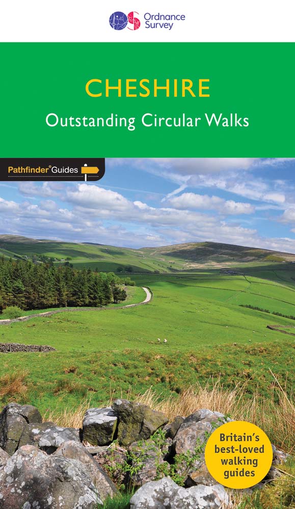
<div> 175 miles of delightfully pastoral country walking from Thurstaston Common on the Wirral to Tegg's Nose on the north-western fringes of the Peak District National Park . . .</div> <div> </div> <div> Uncover 28 beautiful walks around Cheshire with the OS Pathfinder Guidebooks, graded by length and ranging from 3 ½ to 10 ½ miles.</div> <div> </div> <div> The routes range from extended strolls to longer hikes, something for all levels! Each walk includes a detailed description, an OS map, GPS waypoints, and notes of key features and things to see.</div> <div> </div> <div> This is one of a series of books with great walking routes covering the most popular and scenic areas of Britain. Printed with weather-resistant covers featuring durable rounded corners, they are the perfect companion for country walking throughout Britain.</div> <div> </div> <div> Publication Date: 2019</div> <div> </div> <div> Walks in this book:</div> <div> </div> <ul> <li> Wirswall Hill and Big Mere</li> <li> Bollington and Nab Head</li> <li> Little Budworth Country Park</li> <li> Styal and the Bollin Valley</li> <li> Dane Valley</li> <li> Chester and the River Dee</li> <li> Boothsdale</li> <li> Astbury mere and Village</li> <li> Delamere Forest</li> <li> Audlem and the Shropshire Union Canal</li> <li> Bulkeley Hill and Raw Head</li> <li> Sandbach</li> <li> Disley and Lyme Park</li> <li> Dunham Park and the Bridgewater Canal</li> <li> Wybunbury</li> <li> Farndon and Churton</li> <li> Gawsworth Hall and North Rode</li> <li> Trent and Mersey Canal and Great Budworth</li> <li> Beeston Castle and the Shropshire Union Canal</li> <li> Caldy Hill, Thurstaston and the Wirral Way</li> <li> Wirral Way, Parkgate and the Dee Estuary</li> <li> Above Helsby and Frodsham</li> <li> Mow Cop and Litle Moreton Hall</li> <li> Timberbrook and the Cloud</li> <li> Shutlingsloe</li> <li> Mapas</li> <li> Tegg's Nose and Macclesfield Forest</li> <li> Etherow and Goyt Valley</li> </ul>
€18,50
Bekijk product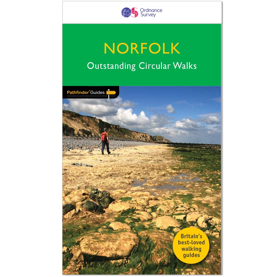
<div> 200 miles of inland and coastal walking visiting windpumps and watermills . . .</div> <div> </div> <div> Walk 28 beautiful trails across Norfolk with the OS Pathfinder Guidebooks, graded by length and ranging from 3 ¾ to 11 miles.</div> <div> </div> <div> The routes range from extended strolls to longer hikes, offering something for all levels! Explore the area including the stunning coastal scenery in the north of the country, such as the unique inland waterways of the Broads to the east and the remote beauty of the vast fenlands to the west.</div> <div> </div> <div> Walking routes include some historic highlights: Castle rising and Oxburgh Hall, as well as ancient routes such as Boudicca's and the Peddars way. You can also discover stunning seascapes at Overstand and Wells-next-the-Sea.</div> <div> </div> <div> Each walk includes a detailed description, an OS map, GPS waypoints and notes ofkey featuresand things to see.</div> <div> </div> <div> Publication Date: 2019</div> <div> </div> <div> Walks in this book:</div> <div> </div> <ol> <li> Horsey</li> <li> Binham Priory</li> <li> Oxborough and Gooderstone</li> <li> Hales Green from Loddon</li> <li> Marham Fen and the Nar Valley Way</li> <li> Tyrrel's Wood and Shelton</li> <li> Felbrigg Park and Metton</li> <li> Langmere and the Devil's Punchbowl</li> <li> River Bure and Upton Marshes</li> <li> How Hill and Ludham</li> <li> The Buckenhams</li> <li> Hardley Cross</li> <li> Blickling and the River Bure</li> <li> Peddars Way Fring and Sedgeford</li> <li> Castle Acre and West Acre</li> <li> Boudca's Way Shotesham & Saxlingham Nethergate</li> <li> Thompson Common and the Pingos</li> <li> Westwick Woods and the Weaver's Way</li> <li> West Runton and Beacons Hill</li> <li> Wiveton Downs and Cley next the Sea</li> <li> The Burnhams</li> <li> Denver Sluice a three rivers walk</li> <li> Wells-next-the-Sea, Warham, and Wighton</li> <li> The Weaver's Way to The Berney Arms</li> <li> Reepham, Marriott's Way, and Salle</li> <li> Weeting Castle and Grime's Graves</li> <li> Castle Rising and Roydon Common</li> <li> Ringstead Downs and the Norfolk Coast</li> </ol>
€18,50
Bekijk product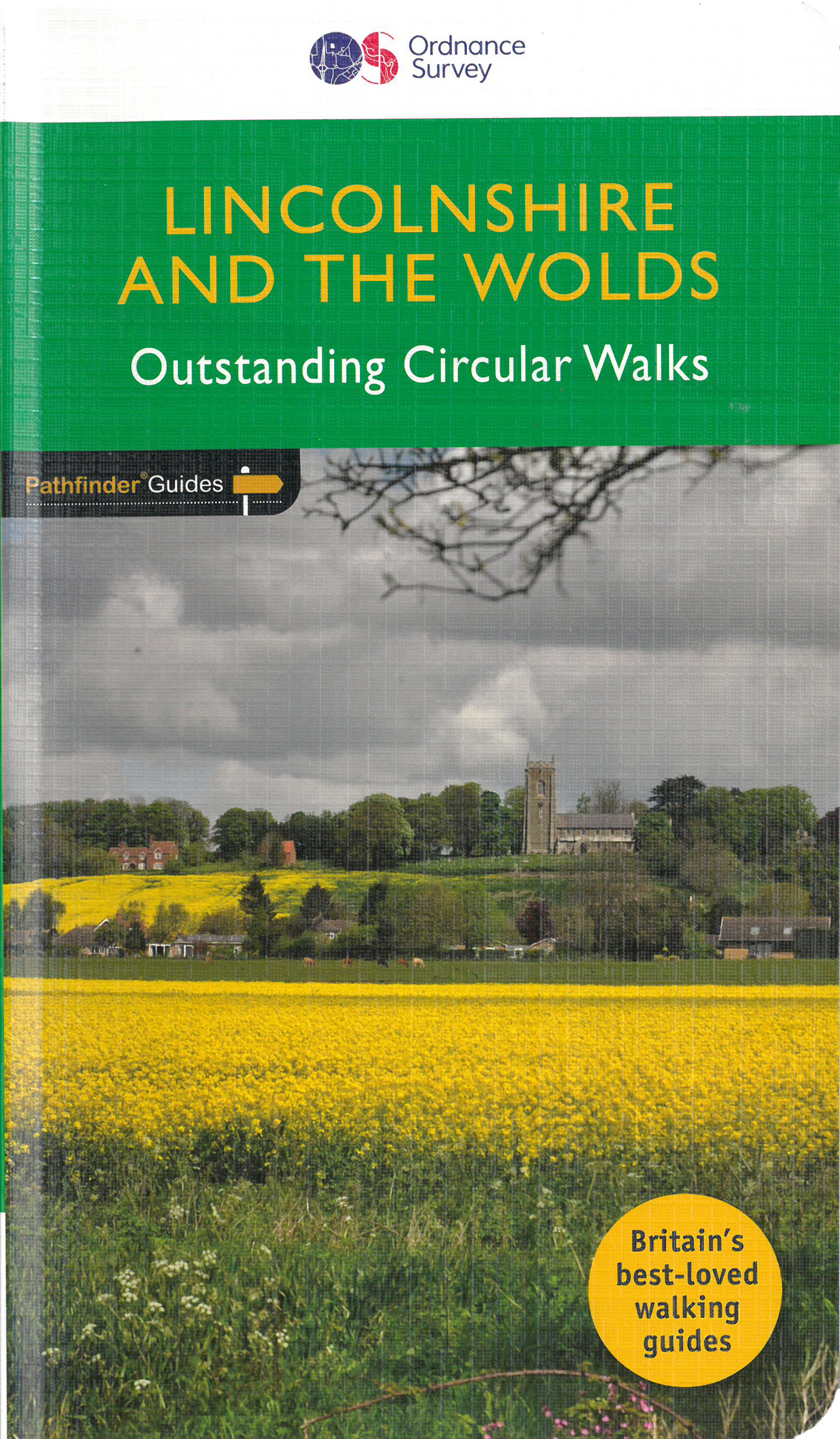
<div> Discover 28 beautiful walks across Lincolnshire & the Wolds with the OS Pathfinder Guidebooks, graded by length and ranging from 3 to 11 miles.</div> <div> </div> <div> Explore the second largest county in England, Lincolnshire. The county is largely unspoilt and offers a great opportunity for new and unique walking experiences. Routes in this book include Thornton Abbey, Sway Valley, Horncastle, the Vale of Belvoir, and Frampton Marsh.</div> <div> </div> <div> Each walk includes a detailed description, an OS map, GPS waypoints and notes of key features and things to see.</div> <div> </div> <div> This is one of a seriess of books with great walking routes covering the most popular and scenic areas of Britain. Printed with weather-resistant covers featuring durable rounded corners, they are the perfect companion for country walking throughout Britain.</div>
€18,50
Bekijk product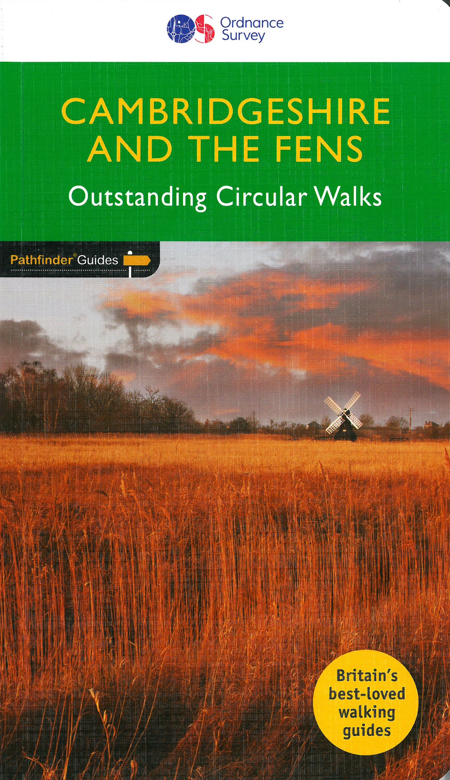
<div> Explore 28 beautiful walks across Cambridgeshire and the Fens with the OS Pathfinder Guidebooks, graded by length and ranging from 3 to 11 miles.</div> <div> </div> <div> It is the flattest place in the country - but there is still a lot of landscape to discover. The Fens cover a large section of Cambridgeshire, with low-lying wetlands, tranquil riverside scenery, charming towns, villages, and country houses. The area is rich in heritage, wildlife and history just waiting to be discovered.</div> <div> </div> <div> Each walk includes a detailed description, an OS map, GPS waypoints and notes of key features and things to see.</div> <div> </div> <div> This is one of a series of books with great walking routes covering the most popular and scenic areas of Britain. Printed with weather-resistant covers featuring durable rounded corners, they are the perfect companion for country walking throughout Britain.</div>
€18,50
Bekijk product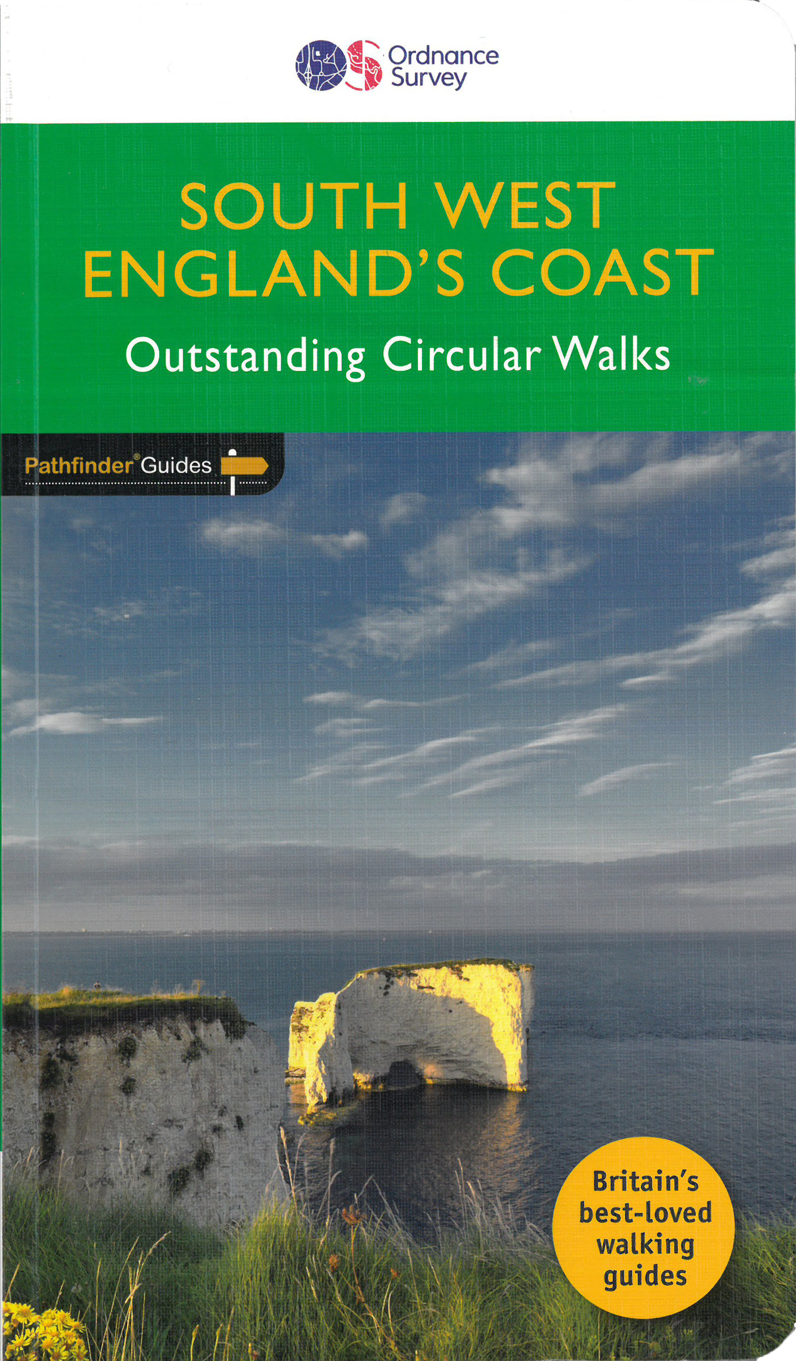
<div> Immerse yourself in 28 beautiful walks along the South West Coast of England with the OS Pathfinder Guidebooks, graded by length and ranging from 3 to 9 miles.</div> <div> </div> <div> The routes range from extended strolls to longer hikes, something for all levels! Each walk includes a detailed description, an OS map, GPS waypoints and notes of key features and things to see.</div> <div> </div> <div> Routes include Lulworth Cove, Old Harry rocks, Chesil beach, Lizard Point, and Sidmouth.</div> <div> </div> <div> This is one of a series of books with great walking routes covering the most popular and scenic areas of Britain. Printed with weather-resistant covers featuring durable rounded corners, they are the perfect companion for country walking throughout Britain.</div>
€18,50
Bekijk product
<div> The all-revised edition contains 27 carefully selected walks, all chosen to be easily accessible from London's main railway stations. The routes lie across Essex, Bedfordshire, Oxfordshire, Surrey, West Sussex, East Sussex, and Kent. With routes ranging from 2 to 11 miles - offering something for everyone.</div> <div> </div> <div> Each route includes the station (and time from Central London), an extract of the OS Explorer map showing the route and waypoints, notes on the route, and useful information on this history of the area.</div> <div> </div> <div> This is the perfect book for those looking to find beautiful countryside walks accessible from the capital.</div> <div> </div> <div> Previous editions of this book were called 'Country walks near London'.</div>
€18,50
Bekijk product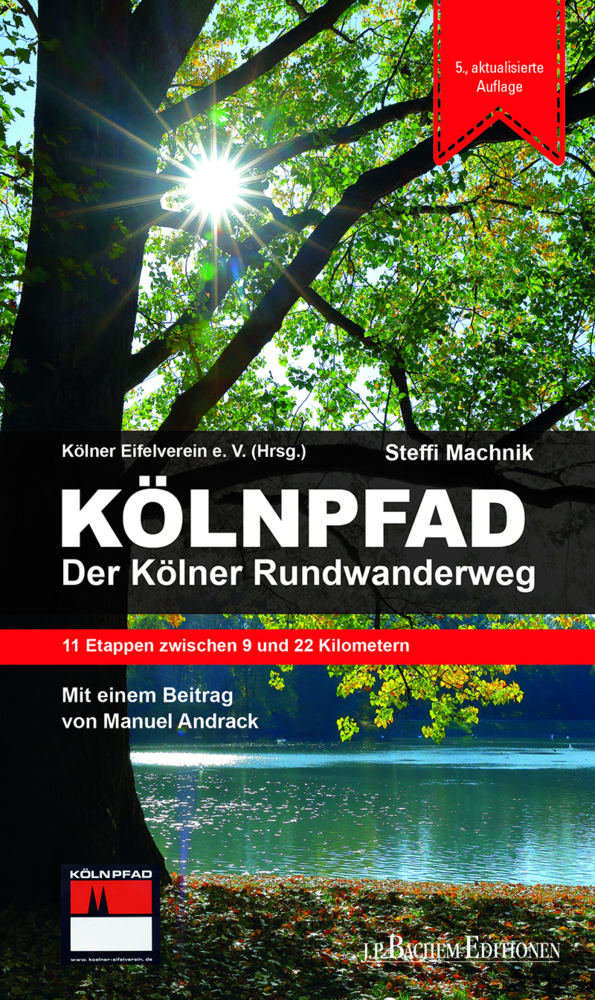
<p> Der aktualisierte und überarbeitete Wanderführer zum beliebten Kölnpfad durchquert auf 171 Kilometern idyllische Vororte und quirlige städtische Abschnitte. Rechts- und linksrheinisch führt er durch das Stadt(rand)gebiet, entlang an Wäldern, Wiesen und am Rhein. Ein kurzer Besuch im Bergischen Land darf auf dem Rundwanderweg natürlich auch nicht fehlen. Ganz im Sinne der Kölnpfad-Hymne geht es für alle Wander-Fans "Eimol öm Kölle röm". Im Serviceteil finden sich viele gemütliche Einkehrmöglichkeiten sowie unterhaltsame Fakten zu den zahlreichen Sehenswürdigkeiten am Wegesrand.</p>
€16,95
Bekijk product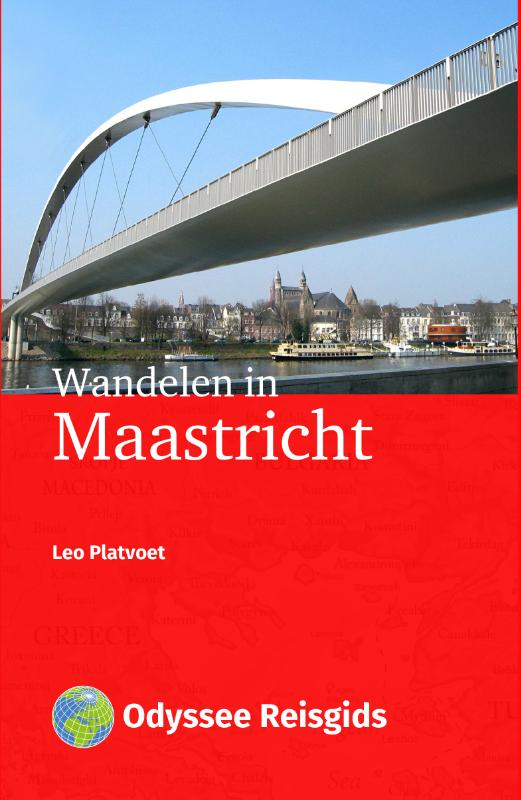
<p> Deze Odyssee-gids bevat vier wandelingen die je de vele gezichten van Maastricht laten zien. Maastricht heeft een on-Nederlandse uitstraling. Zowel Maastrichtenaren als bezoekers omschrijven de stad als Bourgondisch, buitenlands, mondiaal, gezel- lig, typisch zuidelijk en zonnig. De stad ligt fraai aan de Maas, met zijn historische binnenstad die ruim 1500 monumenten telt. De monumentale pleinen, de vierhonderd cafés, de chique res- taurants en de luxe winkels trekken veel dagjesmensen.</p> <p> Maar er valt zoveel meer te zien. De Sint-Pietersberg is omgetoverd van een groeve tot een natuurpark met historische elementen. Het Jekerkwartier, met de universiteit en haar vele internationale studenten is toch kleinschalig en gezellig. De nieuwe toevoegin- gen aan de stad zijn spectaculair: de wijk Céramique met het Bonnefantenmu- seum en het Sphinxkwartier, dat cultuur met geschiedenis verbindt.</p>
€18,50
Bekijk product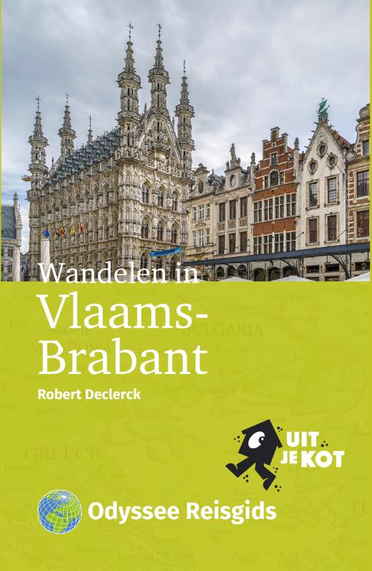
<p> Tien wandelingen in Vlaams-Brabantse steden Na de gidsen Wandelen in Oost-Vlaanderen en Wandelen in Limburg neemt Robert Declerck je mee naar de jongste provincie van België: Vlaams-Brabant. Hij wandelt in steden en stadjes in Hageland, Haspengouw en Pajottenland. Alle routes hebben een lengte van ongeveer vijf kilometer.</p> <p> Onderweg loop je langs bijzondere plekken: van onverwachte bezienswaardigheden tot groene (stads)parken. De auteur heeft een scherp oog voor details waaraan je gemakkelijk voorbij loopt. Een van de wandelingen brengt je naar het kleine Galmaarden, de parel van Pajottenland. Deze Odyssee-wandelgids biedt: Gedetailleerde routebeschrijvingen en kaarten Verrassende tussenstops Startpunten bij het station Leuke uit-je-kot tips voor onderweg</p>
€18,50
Bekijk product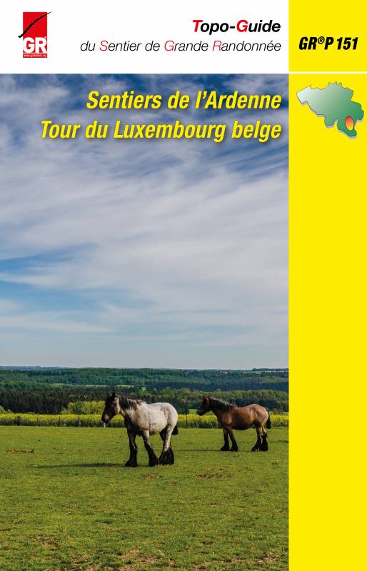
<div> Le « Tour du Luxembourg belge » démarre de Neufchâteau, gagne Libramont par le plateau de Recogne, puis, dans les bois, longe la Lomme vers Poix-Saint-Hubert et Mirwart. Après Nassogne, il arrive àMarche-en-menne. De là, il part vers Sibret, pénètre dans la forêt d’Anlier et suit longuement la Sûre jusqu’à Martelange. Ensuite, il parcourt de nouveau la forêt vers Habay, Marbehan et Rossignol. Et encore dans la forêt, il regagne </div> <div> Neufchâteau, en passant par Suxy. Pour cette deuxième édition, deux longues variantes ont été ajoutées. La première, globalement nord - sud, démarre de la discrète chapelle Saint-Joseph des Bois à Chenogne et rejoint Marbehan en 49 kilomètres. La deuxième, orientée est-ouest, part de Bodange et, après 34 kilomètres, atteint Neufchâteau. Ces deux variantes parcourent les plateaux ardennais aux vastes paysages découverts.</div> <div> </div> <div> Sur son parcours ouest, le GR® se rapproche des lignes de chemin de fer 162 et 43 : </div> <div> des liaisons sont balisées vers les gares de Marbehan, Libramont, Grupont, Forrières, Rochefort-Jemelle, Marloie et Marche. </div> <div> </div> <div> À pied, en randonnant, il faut plusieurs semaines pour découvrir le Luxembourg belge, lentement, calmement, tranquillement : la « belle et verte province » ne se laisse apprivoiser que par ceux qui veulent bien prendre le temps de la rencontrer au-delà des clichés.Monde aux visages multiples, elle n’est pas que forêts ténébreuses, sangliers ombrageux, horizons venteux. C’est bien sûr un pays de bois, de prairies, de ruisseaux et de </div> <div> villages tranquilles, mais aussi de surprises. Elles se dévoilent dans des endroits tels que le musée des Celtes (Libramont) ou le FAM (Marche), des églises exceptionnelles comme à Waha, des châteaux chargés d’histoire :</div> <div> </div> <div> Mirwart, le Pont d’Oye ou les murailles de Neufchâteau en sont des témoins. Et aussi dans les traces d’un passé industriel : les ardoisières de Martelange, les forges de Habay, les moulins de Poix-Saint-Hubert… parmi tant d’autres.Aujourd’hui, l’économie du Luxembourg belge est plutôt vive et dynamique. Mais surtout, la « belle province » est riche de sa qualité de vie. Le topo-guide du GR®P 151 « Sentiers de l’Ardenne - Tour du Luxembourg belge » vous invite à la découvrir. Que votre randonnée soit riche de surprises.</div> <div> </div> <div> JPW</div> <p> </p>
€22,50
Bekijk product