
Beantwoord enkele vragen, en binnen seconden geeft AI je een persoonlijk aankoopadvies op maat.
Beantwoord enkele vragen, en binnen seconden geeft AI je een persoonlijk aankoopadvies op maat.

<p> Uitstekende wandelgids, goed beschreven met veel praktische informatie om de route te kunnen lopen, inclusief redelijke kaarten</p> <div> There's far more to Cyprus than just the bustling resorts: the favourable climate, attractive scenery and many kilometres of footpaths and nature trails make it an ideal destination for walkers. This guidebook presents 44 graded walks spread across the island, covering both southern and northern Cyprus, with a slight focus on the central Troodos region. Clear description and mapping is presented for each route and a route summary table makes it easy to choose an appropriate walk.</div> <div> </div> <div> The walks, of 3 to 20km, range from gentle strolls to longer, more demanding routes, sometimes involving steep ascents, difficult terrain or navigational challenge. They showcase Cyprus's captivating landscapes, from the sun-kissed coastline lapped by clear turquoise waters to the pine-clad slopes of the Troodos and Besparmak Mountains. Many visit sites of historical interest – including UNESCO-listed Byzantine monasteries, Venetian bridges, defensive castles and hideouts from the 1950s independence struggle – and other highlights include the stunning Avakas Gorge, the caves of Cape Greco and the striking Besparmak range.</div> <div> </div> <div> As well as the walks, the guide offers plenty of information to help you organise and get the most out of your trip, with advice on transport, bases and border crossings. There is a summary of the island's fascinating and turbulent history and an overview of its plants and wildlife. Blending information with inspiration, 'Walking in Cyprus' contains all you need to discover a hidden side to this Mediterranean gem.</div> <div> </div> <div> Steden en Dorpen</div> <div> Paphos, Polis, Troodos Square, Platres, Kakopetria, Kyrenia/Girne, Lapta, Alevkaya</div>
€23,95
Bekijk product
<p> Kleine wandelgids van een deelgiebied in het zuiden van Albanië. Routes zijn redelijk beschreven en de kaarten die er bij gevoegd zijn, zijn ook van redelijk nivo. </p> <p> </p> <p> </p>
€10,50
Bekijk product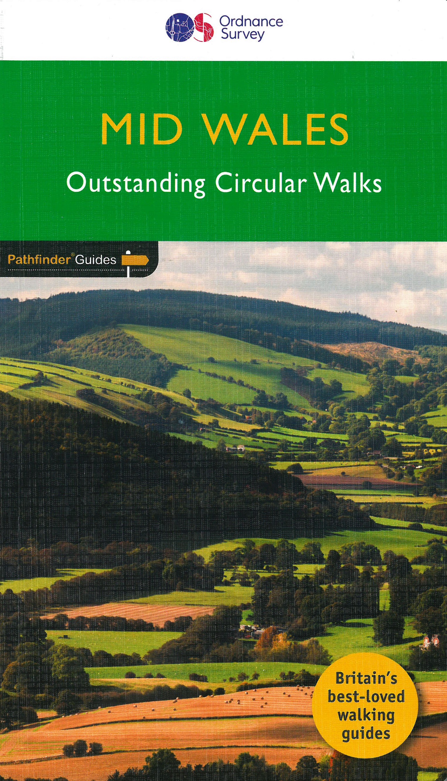
<p> Wandelgids van midden Wales. Deze gids bevat 28 dagwandelingen, variërend van korte tochten tot pittige dagtochten. De bijbehorende kaarten zijn uitstekend: men heeft de topografische kaarten van Ordnance Survey gebruikt waarop de route is ingetekend. Daarnaast praktische informatie over de wandeling en wat beschrijvingen van het gebied.</p> <div> Explore Mid Wales over 28 walks with this walking guidebook from the Pathfinder series. Each walk is listed by distance and difficulty, and range from a family-friendly 4km (2.5 miles) to a challenging 20km (12 miles)</div> <div> </div> <div> Often ignored in favour of the more popular Snowdonia and Brecon Beacons National Parks to the north and south, mid Wales still offers some stunning views and beautiful walks. Both coastal routes and upland walks are featured, and include Catti's Cave, Devil's Bridge and the Mynach Valley, The Claerwen Valley and the source of the river Severn</div> <div> </div> <div> Each of the 28 circular walks has been created by experienced walkers, and includes a route description, extracts of the OS Explorer map for the route and key features and points of historical interest to look out for. Printed with weather-resistant covers featuring durable rounded corners, the Pathfinder Guides are Britain’s best-loved walking guides and are the perfect companion for country walking throughout Britain.</div>
€18,50
Bekijk product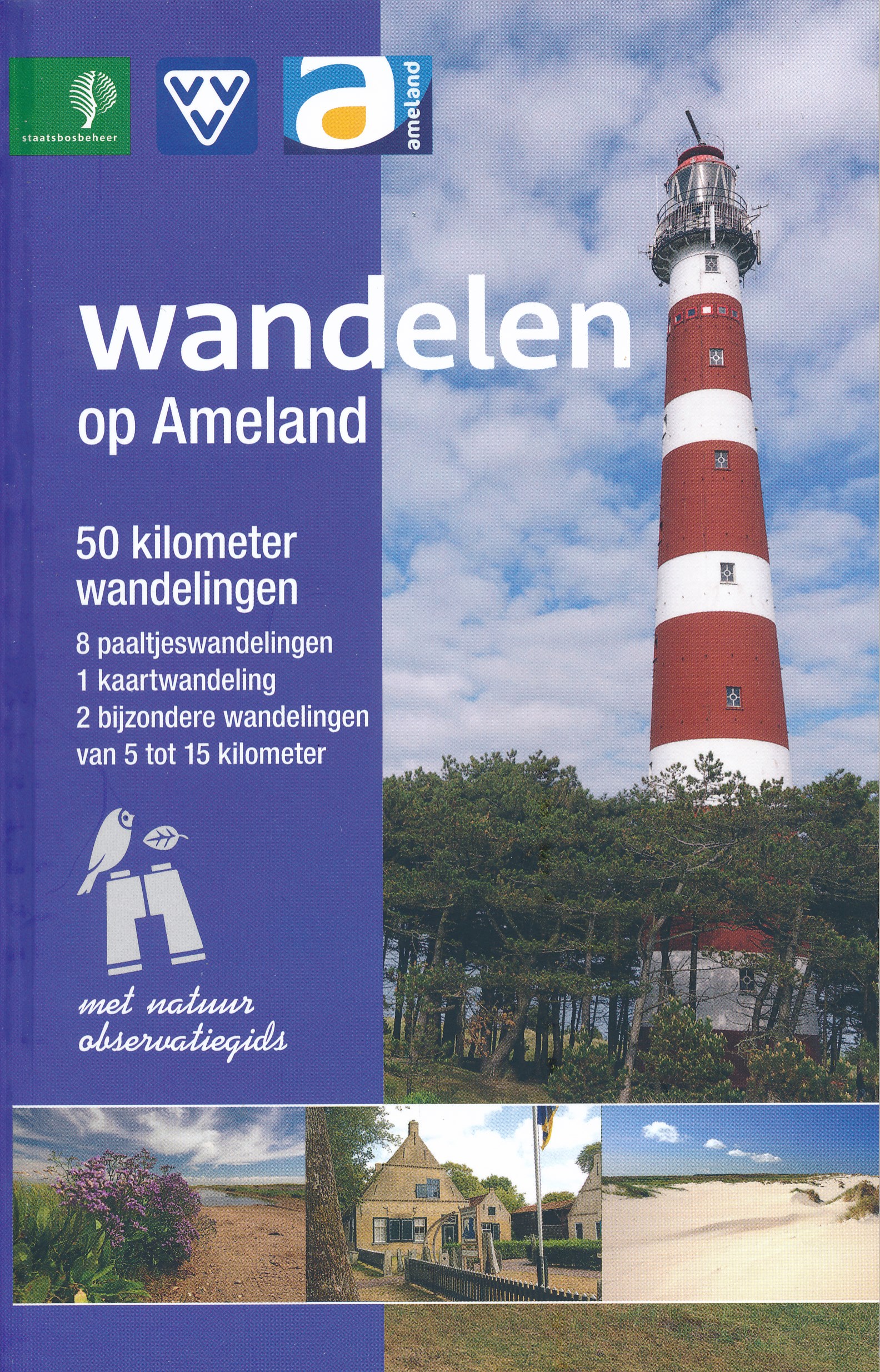
<div> Deze meest complete wandelgids van Ameland is samengesteld door Staatsbosbeheer, Natuurcentrum, Rijkswaterstaat, It Fryske Gea en VVV Ameland en staat boordevol informatie. Naast paaltjeswandelingen met uitgebreide landschaps- en fenomeenbeschrijvingen, een kaartwandeling en twee themawandelingen bevat dit boekje ook een vogelkaart. </div> <div> </div> <div> 'Wandelen op Ameland' is geschikt voor alle soorten wandelaars, van jong tot oud.</div>
€7,50
Bekijk product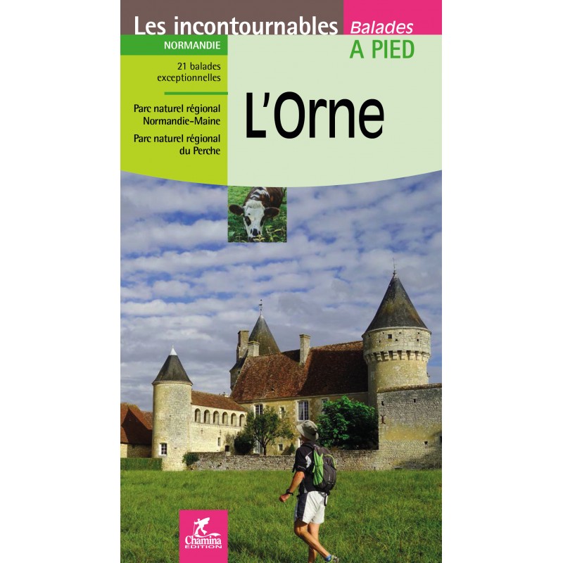
<p> Franstalige wandelgids met 21 dagwandelingen in de Orne (omgeving Alencon in Normandie). De gids bevat achtergrond informatie, deelkaartjes, beschrijvingen, en foto's.</p> <div> Situé aux limites du Massif armoricain, du Pays d'Auge, du bocage normand et de la région montueuse du Perche, l'Orne est un département vallonné (excepté au niveau de la plaine d'Argentan).</div> <div> </div> <div> S’il ne culmine qu'à 413 m d'altitude, il peut s'enorgueillir de sa Suisse normande et de ses Alpes mancelles.</div> <div> </div> <div> L’ouvrage propose 21 balades exceptionnelles, réparties sur tout le territoire et notamment au cœur des Parcs naturels régionaux du Perche et de Normandie-Maine.</div>
€12,50
Bekijk product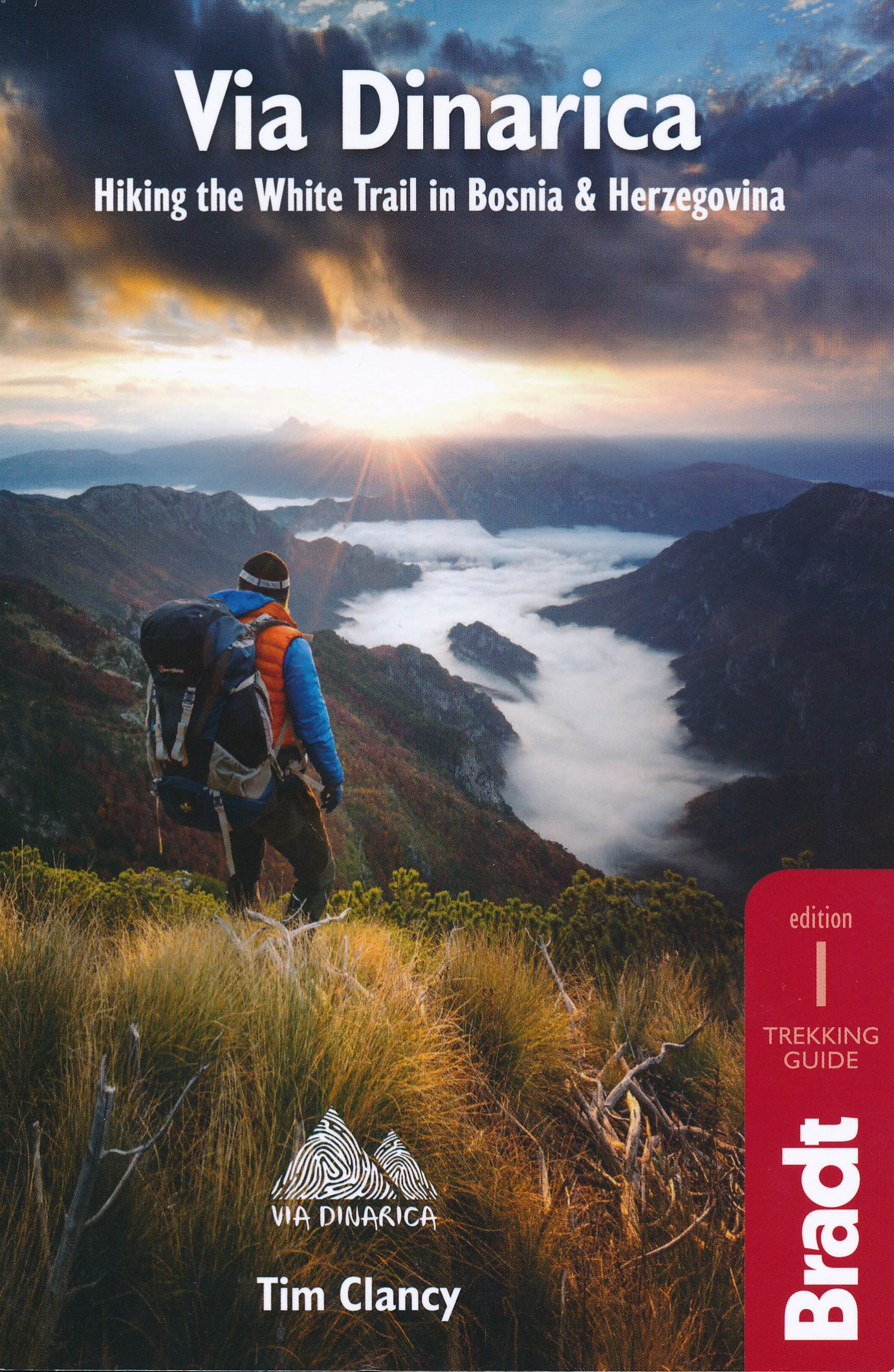
<p> Bijzondere wandelgids : het beschrijft de wandelroute in Bosnie Herzegovina van de Via Dinarica, the White trail. Veel praktische informatie, redelijk kaartmateriaal en een goede beschrijving van de route. </p> <p> This is the first detailed guide to the Bosnian part of the new Via Dinarica hiking trail that carves its way through the Dinaric Alps, one of Europe's least explored mountain ranges and last true wilderness frontiers, connecting the seven nations of Slovenia, Croatia, Bosnia and Herzegovina, Montenegro, Serbia, Kosovo, and Albania. In total, this trail system will span over 1,350km, 333km of which is in Bosnia Herzegovina.</p> <p> The Via Dinarica consists of three routes - White, Green and Blue - and this guide focuses primarily on the White Trail through Bosnia and Herzegovina, following the natural flow of the highest peaks of the Dinaric Alps. Detailed descriptions of each of the 12 stages of the White Trail through Bosnia and Herzegovina are included, along with maps, altitude charts and helpful tips, as well as recommendations for waypoint visits and nearby highlights. Also included are an overview of the flora and fauna of the region, details of accommodation for each step of the way, and information on local public transport, culture, food and language. </p> <p> The natural and cultural wonders of the Dinaric Alps are the best-kept secret of the Balkans, a region with some of the wildest, most impressive natural beauty in the world. All of the countries along the Via Dinarica boast beautiful mountains, alpine lakes, karst caves, forest preserves and pristine rivers that have forged extraordinary canyons and gorges. Here, there is also an abundance of enduring mountain communities that maintain their traditional ways of life and sustainable reliance on the land.</p> <p> <br /> Although the Via Dinarica is primarily a hiking trail, there are opportunities for many different outdoor adventure sports along the way, such as rafting, skiing, mountain biking, rock climbing, canyoning, caving, etc. The Via Dinarica White Trail in Bosnia and Herzegovina is 333km long, takes an estimated 125 hours to complete, climbs the highest, often snow-capped mountains of the Dinaric Alps, and passes through or near over 5 national parks and many nature preserves, as well as one of the two remaining European rainforests, the Perucica primeval forest. With this handy, portably guide, you can discover it all.</p>
€20,95
Bekijk product
<div> Verrassend goede wandelgids van een deel van de E4 in Bulgarije. Goede kaarten, hoogteprofielen, prima beschrijvingen en praktische informatie maken het een volwaardige wandelgids die je in eerste instantie van dit gebied niet zou verwachten.</div> <div> </div> <div> Guidebook along the main ridge of the great alpine route E4 in Bulgaria, also known as „the five mountains“</div> <div> Vitosha – Verila – Rila – Pirin – Slavyanka</div> <div> </div> <div> 260 km for 13 days through the highest mountains on the Balkan Peninsula. E4, also known as “The five mountains”, is the longest and most attractive alpine tourist route in Bulgaria.</div> <div> </div> <div> The hike is divided into 13 stages, each containing:</div> <div> – detailed description</div> <div> – overview map</div> <div> – displacement scheme</div> <div> – landmarks</div> <div> – accommodation options</div> <div> – author’s photos</div> <div> </div> <div> The layout of texts and materials in the book allows quick and intuitive finding of</div> <div> the information.</div>
€20,50
Bekijk product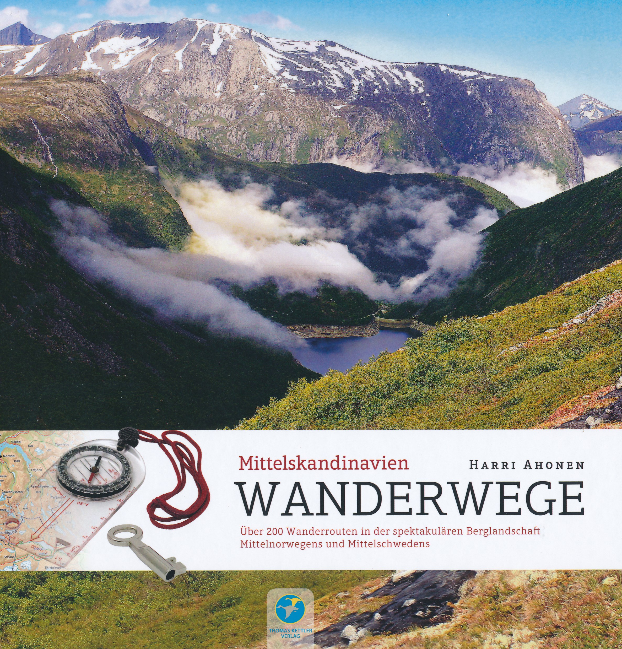
<div> Prachtig overzichtsboek voor wandeltochten in Midden Noorwegen en Midden Zweden. Per streek volgt een beschrijving van de route. Deze gids is vooral te gebruiken als naslagwerk en ideeënboek, het is te groot om in je rugzak te stoppen en kaartmateriaal te summier. Maar juist als ideeënboek is het geweldig: vele mogelijkheden worden aangeduid en besproken.</div> <div> </div> <div> Wanderwege – Mittelskandinavien ist nicht nur Ideengeber für die Tourenplanung in den weitläufigen Fjällgebieten Schwedens und der schroffen Berglandschaft Norwegens, sondern vermittelt auch das Erlebnis, das Wanderer angesichts dieser Naturkulisse erwartet.</div> <div> Die mehr als 200 vorgestellten Wanderrouten können teils miteinander kombiniert werden, was tage-, ja wochenlange Wanderungen ermöglicht.</div> <div> Stimmungsvolle und informative Fotos sowie eine Fülle von Informationen zur Übernachtung in Hütten, zur Anreise, Wanderzeit und viele andere praktische Wandertipps machen das Buch zu einem unverzichtbaren Nachschlagewerk.</div> <div> </div> <div> Inhalt:</div> <div> • Anreise nach Nordskandinavien</div> <div> • Vorbereitung & Planung</div> <div> • Hütten & Übernachtungsmöglichkeiten</div> <div> • Zelten, Feuermachen, Trinkwasser, Brücken, Flussquerungen und Bootstransporte, Wegmarkierungen, Gefahren</div> <div> • 7 Regionen mit farbiger Übersichtskarte</div> <div> • schöne und informative Farbfotos</div> <div> </div> <div> Wandergebiete:</div> <div> </div> <div> Sylarna</div> <div> Femundsmarka und Rogen</div> <div> Rondane</div> <div> Dovrefjell</div> <div> Trollheimen</div> <div> Nordmøre</div> <div> Tafjordfjellene</div>
€32,50
Bekijk product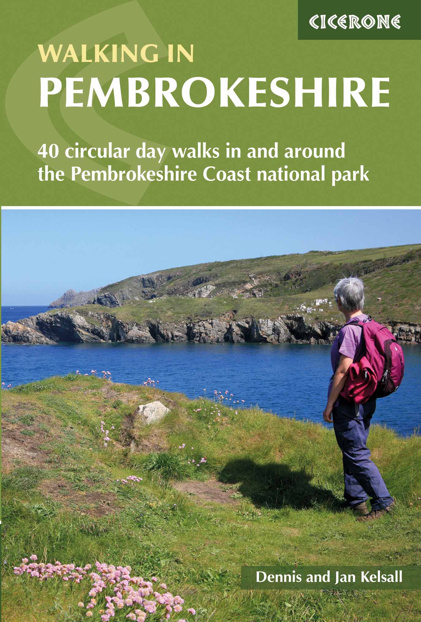
<p> Uitstekende wandelgids van dit mooie gebied aan de kust van Wales: het Pembrokeshire Coast national park. Goed beschreven met veel praktische informatie om de route te kunnen lopen, inclusief redelijke kaarten.</p> <div> Guidebook to 40 circular walks in Pembrokeshire in Wales. The routes, which range from 1 to 12 miles, take in the dramatic beauty of the national park and its coast, the Daugleddau and the Preseli Hills, while exploring wooded gorges, prehistoric hillforts and medieval castles.</div> <div> </div> <div> Step-by-step route descriptions are accompanied by 1:50,000 mapping. For each route, information is also given regarding parking and public transport options, as well as toilets and refreshments available along the way. The guide also includes a useful route summary table, plus information on tides, the terrain, and weather in the region.</div> <div> </div> <div> This collection of walks includes something for everyone, from novices to experienced ramblers. None of the walks demand technical skill and, in good weather, pose few navigational problems. Whether following the coast, wandering the hills or exploring the valleys and woods, the walking everywhere is superb and will invariably reveal something unexpected along the way.</div> <div> </div> <div> <strong>Steden en Dorpen</strong></div> <div> <div> Tenby, Pembroke, Narberth, Haverfordwest, St David's, Fishguard, Cardigan</div> <div> </div> </div> <p> </p>
€18,50
Bekijk product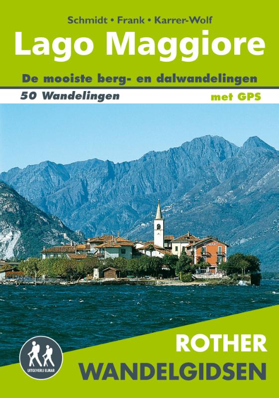
<div> De 50 mooiste berg- en dalwandelingen rond het Lago Maggiore. Zoals gebruikelijk zijn er verschillende wandelingen voor beginnende en ervaren wandelaars en is er onmisbare informatie over de streek, de bezienswaardigheden en recreatiemogelijkheden.</div> <div> </div> <div> De betrouwbare routebeschrijvingen, gedetailleerde kaarten en hoogteprofielen zorgen voor een onvergetelijke wandelervaring.</div> <div> </div> <div> <div> Let op: er is enige verwarring omtrent het jaartal van deze Nederlandse wandelgidsen van uitgever Elmar. Dit is een vertaling van de Duitse uitgever Rother maar daarna NIET bijgewerkt. De datum die wij vermelden is het moment van vertaling; er zijn andere – meer recente jaartallen – in omloop maar dat is de datum van een nieuwe druk ZONDER aanpassingen. Wilt u de meest recente wandelgids van dit gebied van deze uitgever: kies dan de Duitstalige versie van uitgever Rother. Deze zijn recent en WEL bijgewerkt. </div> <div> </div> </div> <p> </p>
€19,99
Bekijk product