
Beantwoord enkele vragen, en binnen seconden geeft AI je een persoonlijk aankoopadvies op maat.
Beantwoord enkele vragen, en binnen seconden geeft AI je een persoonlijk aankoopadvies op maat.
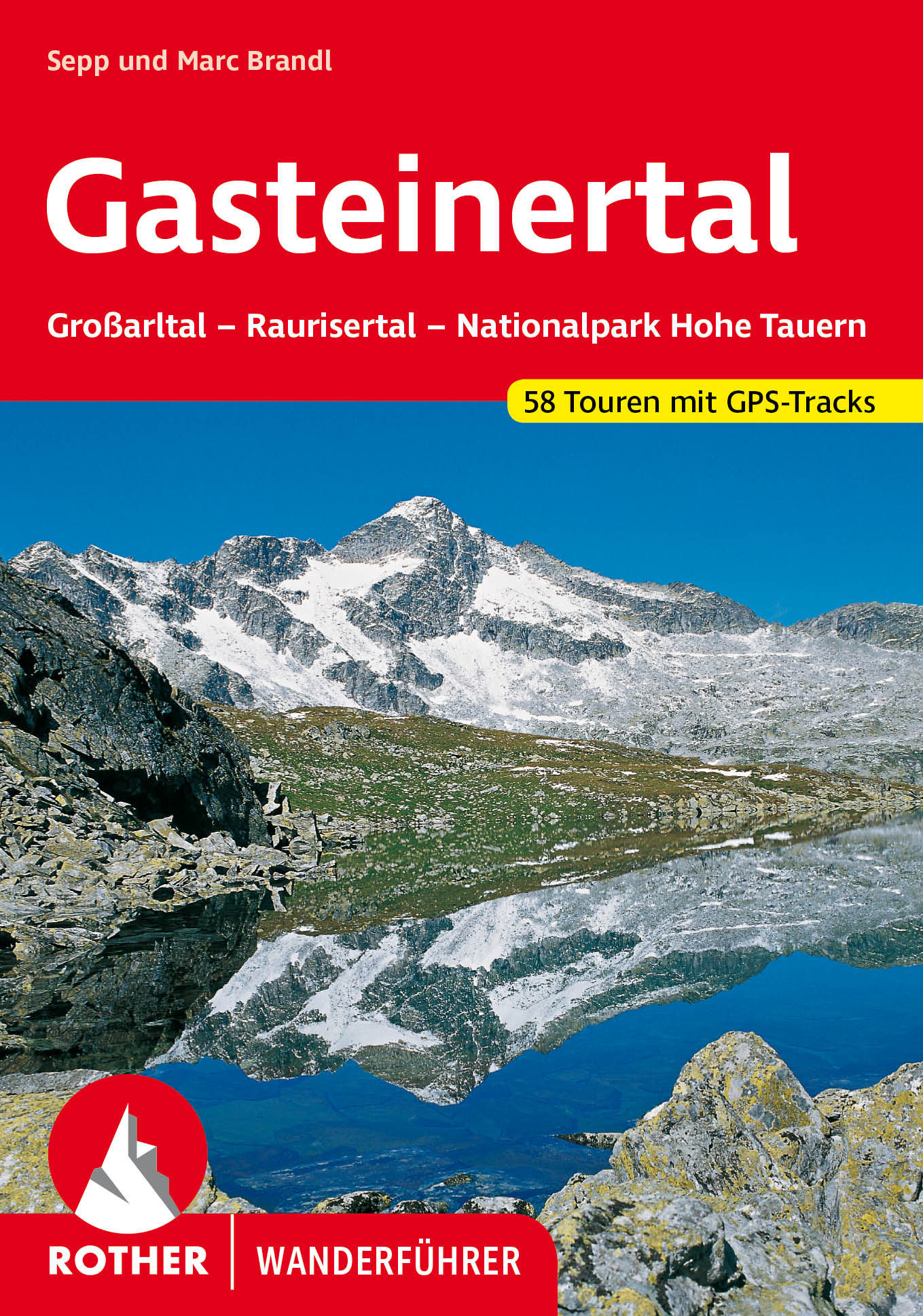
<p> Uitstekende wandelgids met een groot aantal dagtochten in dal en hooggebergte. Met praktische informatie en beperkt kaartmateriaal! Wandelingen in verschillende zwaarte weergegeven in rood/blauw/zwart.</p> <p> <strong>Aanbevolen wandelkaarten bij deze gids</strong></p> <p> 1:25.000</p> <p> <a href="https://www.dezwerver.nl/r/europa/oostenrijk/tirol/c/kaarten/wandelkaarten/9783928777803/wandelkaart-451-alpenvereinskarte-niedere-tauern-i-alpenverein/">Wandelkaart 45/1 Alpenvereinskarte Niedere Tauern I</a></p> <p> of </p> <p> 1:50.000</p> <p> <a href="https://www.dezwerver.nl/r/europa/oostenrijk/tirol/c/kaarten/wandelkaarten/9783990447116/wandelkaart-40-gasteiner-tal-goldberggruppe-kompass/">Wandelkaart 40 Gasteiner Tal - Goldberggruppe | Kompass</a></p> <p> Die Tauerntäler rund um Bad Gastein - das Großarltal, das Gasteinertal und das Raurisertal - berühren Teile der Radstädter Tauern sowie der Ankogel- und Goldberggruppe. Weite Bereiche dieser ursprünglichen Bergwelt wurden als "Nationalpark Hohe Tauern" unter Naturschutz gestellt. Die Talorte der Region gelten seit langem als hervorragende Kur- und Erholungszentren. Sepp Brandl stellt in diesem Wanderführer die 53 schönsten Tal-, Höhen- und Gipfelwanderungen rund um die beliebten Talorte Großarl, Dorfgastein, Bad Hofgastein, Bad Gastein und Rauris vor.<br /> Bei der neu getroffenen Tourenauswahl wurde besonderer Wert auf ein vielseitiges Angebot gelegt. Der Naturfreund wandert mit diesem Büchlein durch Täler und über Höhenzüge, erlebt Höhlen, Stollen und Klammen, steigt auf Aussichtskuppen und luftige Gipfel, übernachtet auf hoch gelegenen Hütten und kann an den schönsten Rastplätzen schauen und genießen. Mit diesem Rother Wanderführer kommt jeder Wanderer voll auf seine Kosten. Die Tourenpalette reicht vom einfachen zweistündigen Spaziergang bis hin zu anspruchsvollen Wanderungen in der Gletscher- und Gipfelregion des Alpenhauptkammes. Ein Höhepunkt ist z.B. die Besteigung des Hohen Sonnblick, 3105 m.<br /> Ausführliche Wegbeschreibungen, detaillierte Kartenausschnitte im Maßstab 1.50.000 sowie aussagekräftige Höhenprofile machen alle Tourenvorschläge leicht und sicher nachvollziehbar. Die farbige Schwierig-keitsbewertung erleichtert die Auswahl der Ziele. Durch die vollständige Überarbeitung und komplette Neugestaltung der auf nunmehr 53 Touren erweiterten dritten Auflage hat jeder Wanderer einen absolut zuverlässigen Tourenbegleiter.</p>
€18,50
Bekijk product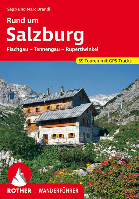
<p> Uitstekende wandelgids met een groot aantal dagtochten in dal en hooggebergte. Met praktische informatie en beperkt kaartmateriaal! Wandelingen in verschillende zwaarte weergegeven in rood/blauw/zwart.</p> <div> Es war kein Geringerer als der Forscher und Weltreisende Alexander von Humboldt, der bereits vor rund 200 Jahren die Gegend rund um Salzburg zu den drei schönsten Regionen der Erde zählte. Die unermessliche Vielfalt an landschaftlichen wie kulturellen Höhepunkten lockt auch heute noch Gäste aus aller Welt vor die Tore der Mozartstadt. Der Rother Wanderführer Rund um Salzburg beschreibt 59 abwechslungsreiche Touren in der Umgebung. Da sind die beschaulichen Seen im nördlichen Alpenvorland, der sagenumwobene Untersberg und das Hagengebirge, das ruhige, karstige Tennengebirge oder die waldreiche Osterhorngruppe und natürlich das angrenzende Berchtesgadener Land, das mit Salzburg kulturell seit Jahrhunderten im so genannten Rupertiwinkel verbunden ist.</div> <div> </div> <div> Der Autor Sepp Brandl, ein hervorragender Kenner der Region, hat die schönsten Wandermöglichkeiten ausgewählt. Da finden sich erholsame Halbtagestouren zu ruhigen Seen und gemütlichen Almen, spannende Abstiege in die »Unterwelt«, aber auch ausgedehnte Tageswanderungen über blumenreiche Matten bis hinauf in die Karstflächen des Hochgebirges. Abgerundet wird das Angebot durch mehrtägige Durchquerungen sowie 40 Kurzwanderungen, die garantiert auch jene Salzburgbesucher begeistern können, die den Wanderschuh sonst eher selten schnüren.</div>
€18,50
Bekijk product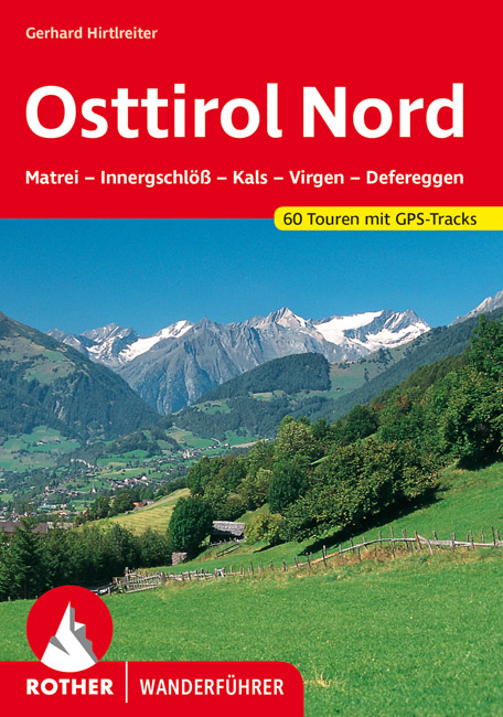
<p> Uitstekende wandelgids met een groot aantal dagtochten in dal en hooggebergte. Met praktische informatie en beperkt kaartmateriaal! Wandelingen in verschillende zwaarte weergegeven in rood/blauw/zwart.</p> <div> Das »Sonnenland« Osttirol - fast zur Hälfte höher als 2000 Meter - zählt zu den attraktivsten Wanderregionen der Alpen. Der Rother Wanderführer »Osttirol Nord« stellt den Teil des Landes vor, der überwiegend zum Nationalpark Hohe Tauern gehört - überragt von beeindruckenden und berühmten Fels- und Eisgipfeln wie dem Großglockner und dem Großvenediger. Mit 60 ausgewählten Touren führt der Wanderführer durch die Osttiroler Nationalparkregion. Darunter sind Routen für Genusswanderer ebenso wie anspruchsvolle Gipfeltouren für engagierte Bergsteiger. Die Schwierigkeitsskala reicht von beschaulichen Talspaziergängen über gemütliche Hütten- und Almwanderungen bis hin zu alpinen (aber eisfreien) Touren auf imposante Dreitausender: Muntanitz, Hochschober, Lasörling, und Böses Weibl sind die bekanntesten. Ein alpines Highlight ist außerdem die mehrtägige Durchquerung der Schobergruppe.Die vorgestellten Touren verlaufen durch verschiedene Gebirgsgruppen: die Venediger-, Granatspitz-, Glockner-, Schober-, Lasörling- und Rieserfernergruppe sowie das Defereggengebirge. Diese imponierenden Bergkulissen und die Ursprünglichkeit der Osttiroler Täler bieten eine Vielzahl abwechslungsreicher Wanderungen - zusammengestellt von zwei renommierten Autoren und Kennern Osttirols: Helmut Dumler und Gerhard Hirtlreiter. Zu jeder Tour gibt es eine zuverlässige Tourenbeschreibung, ein detailliertes Wanderkärtchen mit eingetragenem Routenverlauf und ein aussagekräftiges Höhenprofil. Eine übersichtliche Toureninfo liefert Hinweise zur Erreichbarkeit des Ausgangspunktes, Höhenunterschied, Anforderungen, Einkehr- und Übernachtungsmöglichkeiten und vielem mehr. Zudem stehen GPS-Tracks zum Download von der Internetseite des Bergverlag Rother bereit.</div>
€17,50
Bekijk product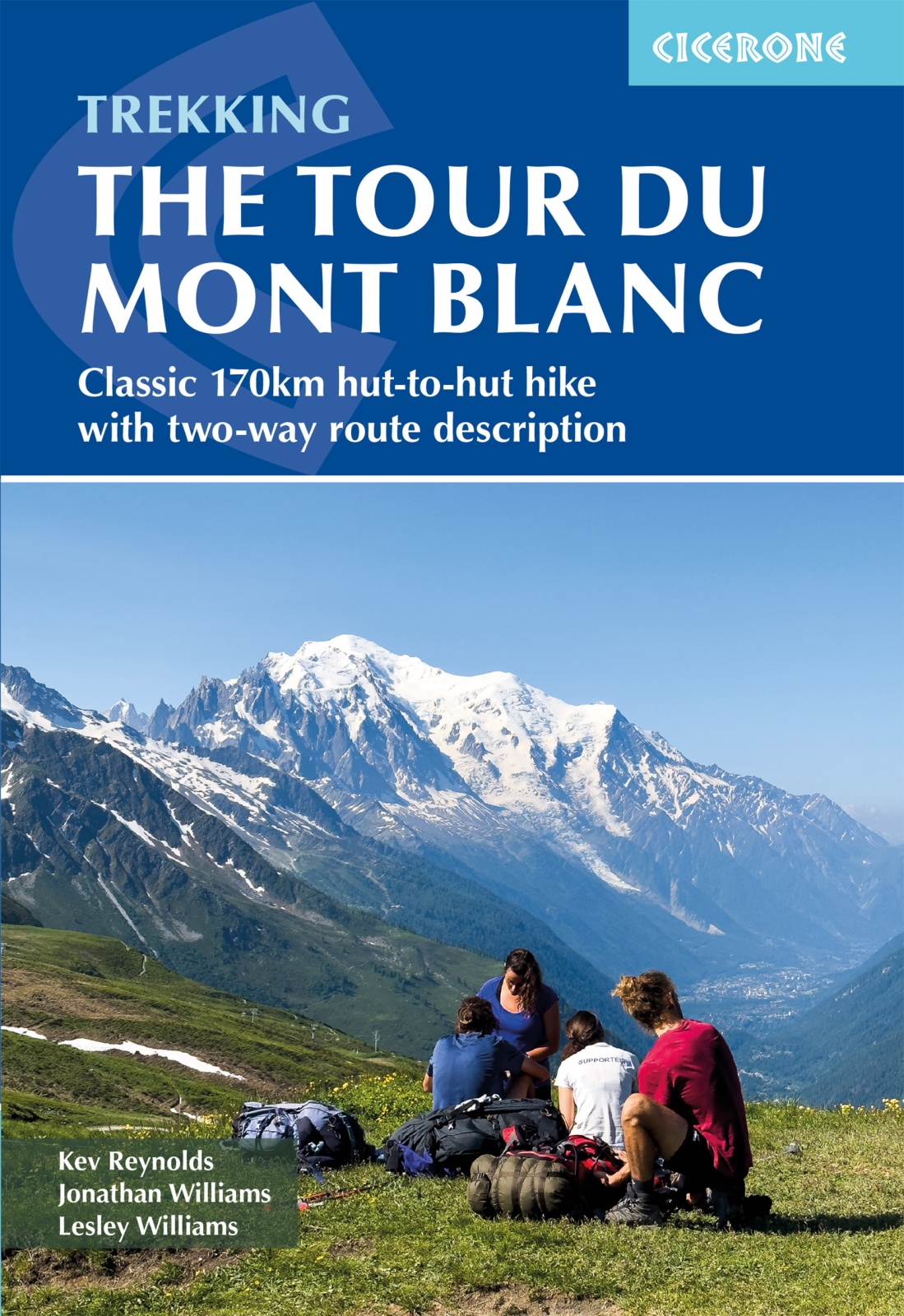
<p> Uitstekende wandelgids die in etappes de route nauwkeurig beschijft; ook de zijtakken en alternatieve routes koman aan bod. Kaarten zijn schetsmatig en in onze ogen onvoldoende bij slechte weersomstandigheden. Wij raden dan ook om er losse kaarten bij te kopen.</p> <div> <div> A guidebook to hiking the Tour du Mont Blanc (TMB), a spectacular circuit around Mont Blanc, Western Europe's highest mountain. Covering 170km (105 miles), the TMB takes around 11 days to walk from its official start at Les Houches (France), passing through Courmayeur (Italy) and Champex (Switzerland) before returning to France via the Chamonix valley. A well-serviced introduction to high-level mountain trekking for walkers with good levels of fitness, it can also be run, fastpacked or hiked in 5–9 days.</div> <div> </div> <div> The route is described in both directions in 11 daily stages between 7 and 21km (5–13 miles) in length. Variant routes and alternative stages are also provided, giving the option of visiting cols, refuges and viewpoints not included on the official TMB route.</div> <div> </div> <div> Contains step-by-step description of the route alongside 1:100,000 maps</div> <div> Handy facilities planner, route summary tables and accommodation listings help you plan your itinerary</div> <div> Includes transport info, a French–English glossary, notes on local history and sites of interest</div> <div> An accompanying map booklet, containing 1:25,000 IGN mapping and route line, is available separately from Cicerone</div> <div> GPX files available to download</div> </div> <p> </p>
€25,95
Bekijk product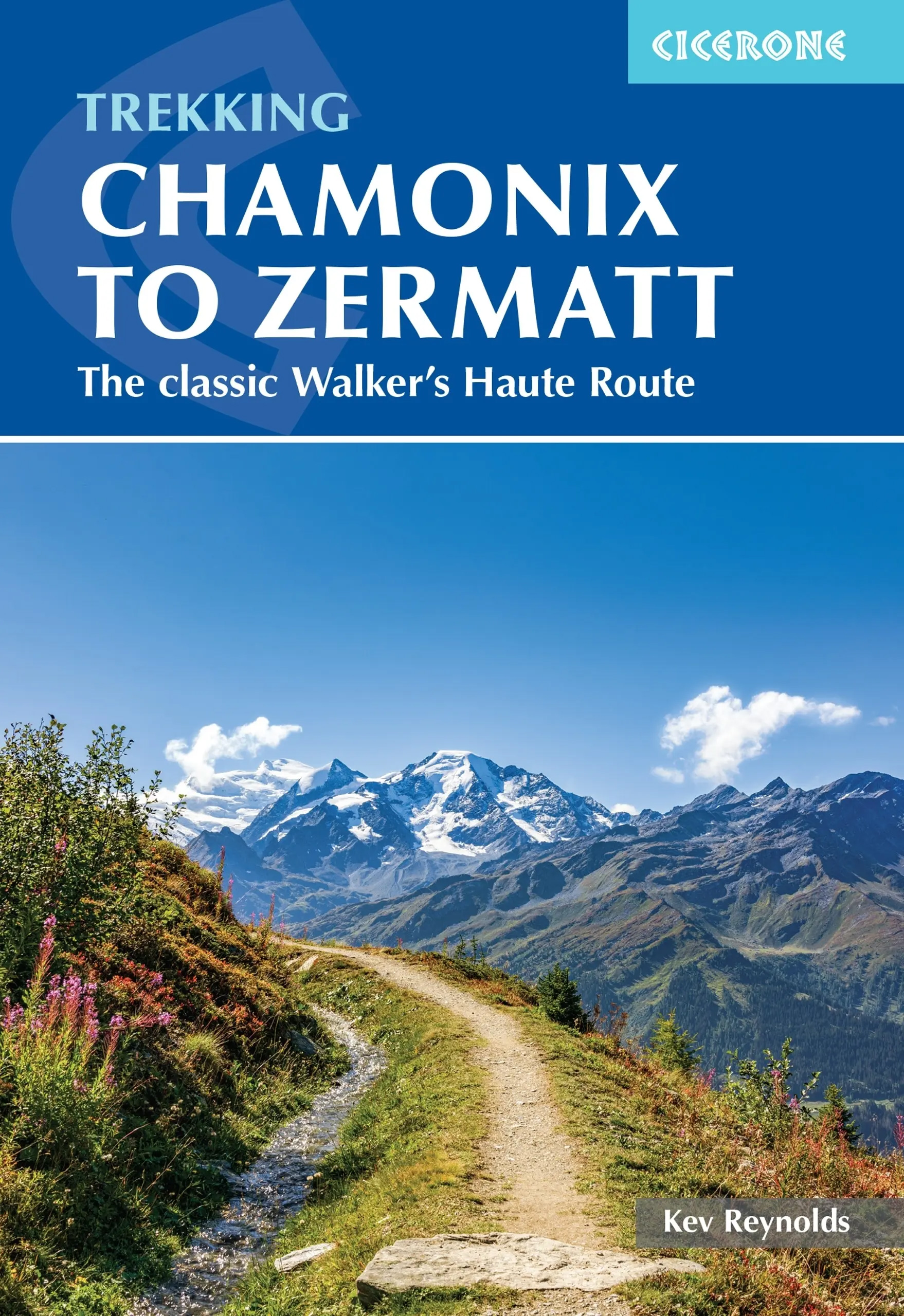
<p> Uitstekende wandelgids die in etappes de route nauwkeurig beschrijft; ook de zijtakken en alternatieve routes koman aan bod. Kaarten zijn schetsmatig en in onze ogen onvoldoende, zeker bij slechte weersomstandigheden. Wij raden dan ook om er losse kaarten bij te kopen.</p> <div> A guidebook to the classic Chamonix to Zermatt trek from Mont Blanc to the Matterhorn. The 225km Walker's Haute Route through the French and Swiss Alps crosses 11 passes, gains more than 14,000m in height and is a strong contender for the title of Most Beautiful Walk in Europe. The high-level route is described in 14 day stages, with optional variants, and is suitable for walkers with a good level of fitness and some previous alpine trekking experience. The final approach to Zermatt adopts the dramatic Europaweg, a high-level traverse of the east wall of the Mattertal, crossing the 500-metre suspension bridge at Randa. An alternative valley route to Zermatt can be taken if this does not appeal.</div> <div> Alongside clear route descriptions and mapping for each stage of the trek, there is essential practical information on travel to Chamonix and return from Zermatt, as well as advice on accommodation in alpine villages and mountain refuges, trekking safety, equipment, itinerary planning and preparation. </div> <div> Taking 2 weeks to complete, this challenging but rewarding trek encompasses the greatest collection of 4000 metre peaks in the Alps – Mont Blanc, the Grand Combin, Dent Blanche, Weisshorn and the Matterhorn – and visits some of the most spectacular valleys, including the Val d’Hérens, Val d’Annivers and the Mattertal.</div> <div> </div> <div> Steden en Dorpen</div> <div> Chamonix, Argentière, Trient, Champex, Sembrancher, Le Chable, Verbier, Arolla, Les Haudères, La Sage, Zinal, Gruben, St Niklaus, Zermatt</div>
€22,95
Bekijk product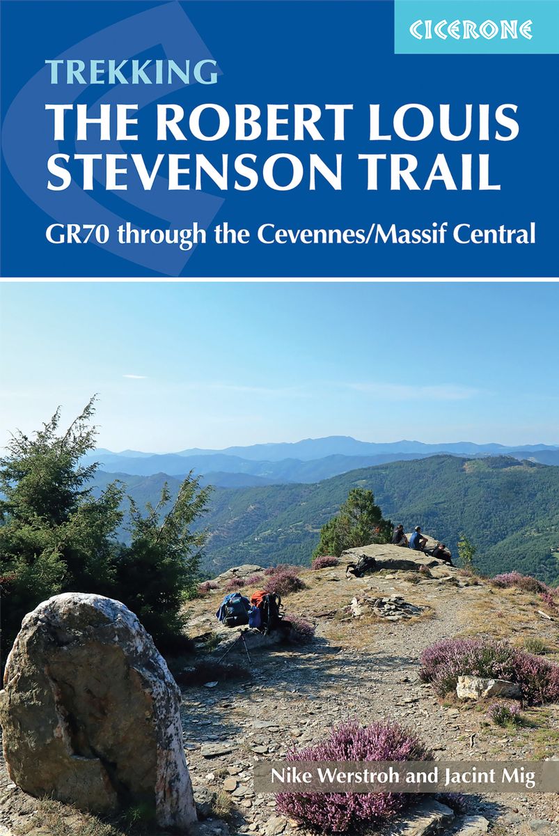
<p> Uitstekende wandelgids van een gerenommeerde Engelse uitgever. De tochten zijn met zorg beschreven en voorzien van allerhande nuttige informatie. Met beperkt kaartmateriaal.</p> <p style="padding: 0px; margin: 0px 0px 1em; box-sizing: border-box; line-height: 1.4; color: rgb(0, 0, 0); font-family: "Helvetica Neue", Helvetica, sans-serif, Arial;"> <strong style="padding: 0px; margin: 0px; box-sizing: border-box; line-height: inherit;">Aanbevolen wandelkaarten bij deze gids</strong></p> <p style="padding: 0px; margin: 0px 0px 1em; box-sizing: border-box; line-height: 1.4; color: rgb(0, 0, 0); font-family: "Helvetica Neue", Helvetica, sans-serif, Arial;"> 1:100.000</p> <p style="padding: 0px; margin: 0px 0px 1em; box-sizing: border-box; line-height: 1.4; color: rgb(0, 0, 0); font-family: "Helvetica Neue", Helvetica, sans-serif, Arial;"> <a href="https://www.dezwerver.nl/r/europa/frankrijk/auvergne/c/kaarten/wandelkaarten/9782758536352/wandelkaart-gr-70-the-stevenson-trail-ign-institut-geographique-national/" style="padding: 0px; margin: 0px; box-sizing: border-box; outline: none; color: rgb(130, 125, 0);">Wandelkaart GR 70 The Stevenson Trail | IGN - Institut Géographique National</a> Als overzichtskaart</p> <p style="padding: 0px; margin: 0px 0px 1em; box-sizing: border-box; line-height: 1.4; color: rgb(0, 0, 0); font-family: "Helvetica Neue", Helvetica, sans-serif, Arial;"> Of</p> <p style="padding: 0px; margin: 0px 0px 1em; box-sizing: border-box; line-height: 1.4; color: rgb(0, 0, 0); font-family: "Helvetica Neue", Helvetica, sans-serif, Arial;"> <a href="https://www.dezwerver.nl/r/europa/frankrijk/ardeche/c/kaarten/fietskaarten/9782758547686/fietskaart-wegenkaart-landkaart-156-le-puy-en-velay-privas-mende-ign-institut-geographique-national/" style="padding: 0px; margin: 0px; box-sizing: border-box; outline: none; color: rgb(130, 125, 0);">Wegenkaart 156 Le Puy en Velay - Privas - Mende | IGN - Institut Géographique National</a></p> <p style="padding: 0px; margin: 0px 0px 1em; box-sizing: border-box; line-height: 1.4; color: rgb(0, 0, 0); font-family: "Helvetica Neue", Helvetica, sans-serif, Arial;"> <a href="https://www.dezwerver.nl/r/europa/frankrijk/ardeche/c/kaarten/fietskaarten/9782758547723/fietskaart-wegenkaart-landkaart-163-avignon-nimes-ign-institut-geographique-national/" style="padding: 0px; margin: 0px; box-sizing: border-box; outline: none; color: rgb(130, 125, 0);">Wegenkaart 163 Avignon - Nimes | IGN - Institut Géographique National </a></p> <p style="padding: 0px; margin: 0px 0px 1em; box-sizing: border-box; line-height: 1.4; color: rgb(0, 0, 0); font-family: "Helvetica Neue", Helvetica, sans-serif, Arial;"> of 1:25.000</p> <p style="padding: 0px; margin: 0px 0px 1em; box-sizing: border-box; line-height: 1.4; color: rgb(0, 0, 0); font-family: "Helvetica Neue", Helvetica, sans-serif, Arial;"> 1. <a href="https://www.dezwerver.nl/r/europa/frankrijk/ardeche/c/kaarten/topografische-kaarten/9782758543145/wandelkaart-topografische-kaart-2835ot-le-puy-en-velay-ign-institut-geographique-national/" style="padding: 0px; margin: 0px; box-sizing: border-box; outline: none; color: rgb(130, 125, 0);">Wandelkaart - Topografische kaart 2835OT Le Puy-en-Velay | IGN - Institut Géographique National</a></p> <p style="padding: 0px; margin: 0px 0px 1em; box-sizing: border-box; line-height: 1.4; color: rgb(0, 0, 0); font-family: "Helvetica Neue", Helvetica, sans-serif, Arial;"> 2. <a href="https://www.dezwerver.nl/r/europa/frankrijk/ardeche/c/kaarten/topografische-kaarten/9782758545453/wandelkaart-topografische-kaart-2836ot-gerbier-de-jonc-ign-institut-geographique-national/" style="padding: 0px; margin: 0px; box-sizing: border-box; outline: none; color: rgb(130, 125, 0);">Wandelkaart - Topografische kaart 2836OT Gerbier de Jonc | IGN - Institut Géographique National</a></p> <p style="padding: 0px; margin: 0px 0px 1em; box-sizing: border-box; line-height: 1.4; color: rgb(0, 0, 0); font-family: "Helvetica Neue", Helvetica, sans-serif, Arial;"> 3. <a href="https://www.dezwerver.nl/r/europa/frankrijk/auvergne/c/kaarten/topografische-kaarten/9782758548867/wandelkaart-topografische-kaart-2736sb-monistrol-dallier-solignac-sur-loire-cayres-ign-institut-geographique-national/" style="padding: 0px; margin: 0px; box-sizing: border-box; outline: none; color: rgb(130, 125, 0);">Wandelkaart - Topografische kaart 2736SB Monistrol d'Allier, Solignac-sur-Loire, Cayres | IGN - Institut Géographique National</a></p> <p style="padding: 0px; margin: 0px 0px 1em; box-sizing: border-box; line-height: 1.4; color: rgb(0, 0, 0); font-family: "Helvetica Neue", Helvetica, sans-serif, Arial;"> 4. <a href="https://www.dezwerver.nl/r/europa/frankrijk/auvergne/c/kaarten/topografische-kaarten/9782758548874/wandelkaart-topografische-kaart-2737sb-langogne-grandrieu-ign-institut-geographique-national/" style="padding: 0px; margin: 0px; box-sizing: border-box; outline: none; color: rgb(130, 125, 0);">Wandelkaart - Topografische kaart 2737SB Langogne - Grandrieu | IGN - Institut Géographique National</a></p> <p style="padding: 0px; margin: 0px 0px 1em; box-sizing: border-box; line-height: 1.4; color: rgb(0, 0, 0); font-family: "Helvetica Neue", Helvetica, sans-serif, Arial;"> 5. <a href="https://www.dezwerver.nl/r/europa/frankrijk/cevennen/c/kaarten/topografische-kaarten/9782758546283/wandelkaart-topografische-kaart-2738sb-le-bleymard-ign-institut-geographique-national/" style="padding: 0px; margin: 0px; box-sizing: border-box; outline: none; color: rgb(130, 125, 0);">Wandelkaart - Topografische kaart 2738SB Le Bleymard | IGN - Institut Géographique Nationa</a>l</p> <p style="padding: 0px; margin: 0px 0px 1em; box-sizing: border-box; line-height: 1.4; color: rgb(0, 0, 0); font-family: "Helvetica Neue", Helvetica, sans-serif, Arial;"> 6. <a href="https://www.dezwerver.nl/r/europa/frankrijk/cevennen/c/kaarten/topografische-kaarten/9782758543107/wandelkaart-topografische-kaart-2739ot-mont-lozere-florac-ign-institut-geographique-national/" style="padding: 0px; margin: 0px; box-sizing: border-box; outline: none; color: rgb(130, 125, 0);">Wandelkaart - Topografische kaart 2739OT Mont Lozère - Florac | IGN - Institut Géographique National</a></p> <p style="padding: 0px; margin: 0px 0px 1em; box-sizing: border-box; line-height: 1.4; color: rgb(0, 0, 0); font-family: "Helvetica Neue", Helvetica, sans-serif, Arial;"> 7. <a href="https://www.dezwerver.nl/r/europa/frankrijk/cevennen/c/kaarten/topografische-kaarten/9782758546597/wandelkaart-topografische-kaart-2740et-corniche-des-cevennes-ign-institut-geographique-national/" style="padding: 0px; margin: 0px; box-sizing: border-box; outline: none; color: rgb(130, 125, 0);">Wandelkaart - Topografische kaart 2740ET Corniche des Cevennes | IGN - Institut Géographique National</a></p> <p style="padding: 0px; margin: 0px 0px 1em; box-sizing: border-box; line-height: 1.4; color: rgb(0, 0, 0); font-family: "Helvetica Neue", Helvetica, sans-serif, Arial;"> 8. <a href="https://www.dezwerver.nl/r/europa/frankrijk/cevennen/c/kaarten/topografische-kaarten/9782758543114/wandelkaart-topografische-kaart-2741et-saint-hippolyte-du-fort-ign-institut-geographique-national/" style="padding: 0px; margin: 0px; box-sizing: border-box; outline: none; color: rgb(130, 125, 0);">Wandelkaart - Topografische kaart 2741ET Saint-Hippolyte-du-Fort | IGN - Institut Géographique National</a></p> <p> Early one morning in the autumn of 1878 RLS set out from the sleepy village of Le Monastier-sur-Gazeille with his donkey, Modestine, to traverse the Velay and Cévennes to the small town of Saint-Jean-du-Gard in the south. Robert Louis Stevenson’s account of his 140-mile trek through southern France has long captured the imagination of walkers and lovers of literature alike. Today, the RLS Trail has become a classic route across the hills and along the valleys of this delightful region of rural France.</p> <p> The route, which is well served by accommodation of all types, is divided into twelve day-stages in the guide, so that the Trail easily fits into a fortnight’s holiday. The book includes details of the facilities for the traveller and places of interest en route, together with a detailed route description and an account of Stevenson’s adventures with Modestine. For those with more time available, trails that link the beginning and end of the route are also described, making it is possible to walk all the way from the historic town of Le Puy to Alés.</p> <p> Packed with snippets of fascinating information about this historic region, the guide is also of use to cyclists and motorists keen to trace a parallel road route, following in the footsteps of Stevenson and Modestine.</p> <p> The Robert Louis Stevenson Trail is a linear long-distance walk through the Velay, Gévaudan and Cévennes regions of southern France. It follows closely, but not exactly, the route taken by the writer Robert Louis Stevenson (affectionately known as RLS), accompanied by his donkey, Modestine, during the autumn of 1878, and later recounted in his first successful book, Travels with a Donkey in the Cévennes (1879).</p> <p> The trail meanders south for some 225km (140 miles), from Le Monastier-sur-Gazeille near Le Puy in the Velay, across the Cévennes mountains, to finish at Saint-Jean-du-Gard, west of Alès. In so doing, it crosses some of the most remote and finest country in rural France, and visits numerous towns and villages of historical importance, including Pradelles, Le Pont-de-Montvert and Florac. The latter sections of the trail pass through the land of the Camisards, an area ravaged by nearly 100 years of religious war between the local Protestants and their Catholic rulers.</p> <p> Steden en Dorpen</p> <p> Le Puy and St Jean de Gard at each end of the route. Also Florac, Fouzillac, La Bastide-Puylaurent, Pradelles, Le Pont de Montvert</p> <p> </p>
€23,95
Bekijk product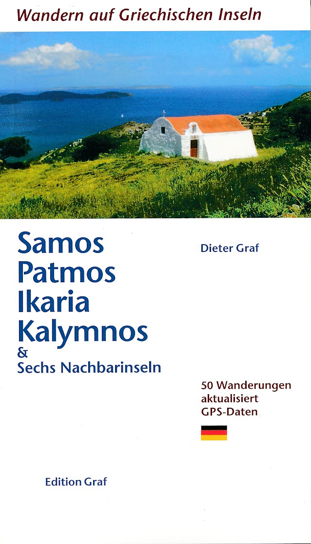
<p> In deze gids worden 50 wandelingen beschreven op de volgende eilanden:</p> <p> Agathoníssi,<br /> Arkí,<br /> Astipálea,<br /> Foúrni,<br /> Ikaría,<br /> Kálymnos,<br /> Léros,<br /> Lipsí,<br /> Pátmos,<br /> Sámos</p> <p> Elke wandeling is voorzien van looptijd, afstand en kaartje.</p>
€19,50
Bekijk product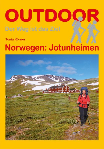
<p> Duitstalige wandelgids Jotunheimen (Noorwegen) met beschrijvingen van meerdaagse wandeltochten door het gebied</p> <p> Jotunheimen – das Heim der Riesen - ist eine der beeindruckendsten Bergwanderregionen Norwegens. Es trägt seinen Namen zu Recht, denn schließlich finden sich alle norwegischen Gipfel über 2.300 m hier, mit Galdøppingen (2.469 m), Glittertind (2.452 m) und Store Skagastølstind (2.405) sogar die drei höchsten Berge Norwegens. 1.140 km² des zentralen Hochgebirges stehen als Nationalpark unter Schutz. Markante Gebirgskämme, hoch aufragende Gipfel, weit oben gelegene Plateaus und natürlich die Gletscher. Viele von ihnen füllen Täler und Schluchten und stellen herrliche Ziele für Wanderer und Skifahrer dar. Zwischen Gipfeln und scharfen Graten liegen tiefe Täler mit Flüssen, zahlreichen Wasserfällen und wunderschönen Seen. Das Gebiet ist durchzogen von einem Geflecht an markierten Wanderwegen und Hütten und gilt als das besterschlossene Wandergebiet Norwegens. Jotunheimen ist sowohl für Wanderneulinge als auch für den erfahrenen Kletterer und Bergsteiger attraktiv. Die in diesem Buch vorgestellten Touren – eine West-Ost-Querung (6 Tage, eine kleine und eine große Rundwanderung (4 und 7 Tage) führen zu den schönsten Punkten in Jotunheimen.</p> <p> Galdhøppigen, Glittertind, Hochgebirge, Jotunheimen, Nationalpark, Norwegen, Skandinavien, Store Skagastølstind, Tonia Körner</p>
€16,95
Bekijk product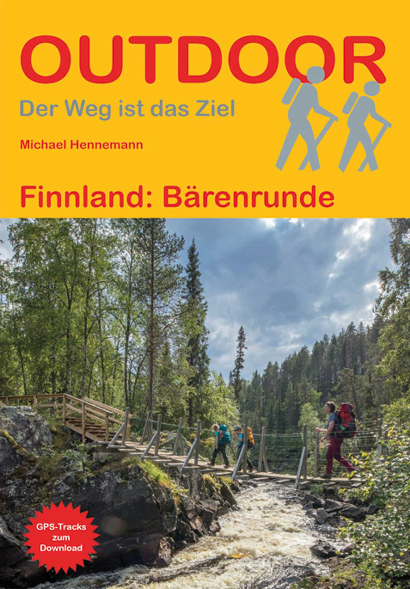
<p> Duitstalige wandelgids met beschrijvingen van de meerdaagse wandeltocht door dit prachtige gebied.</p> <p> Rauschende Stromschnellen und Wasserfälle, unberührte Wälder und Moore, tiefe Schluchten und Canyons: In der Wildnis des Oulanka-Nationalparks erwartet Sie eine faszinierende Landschaft. Die 80 bis 95 km lange Bärenrunde „Karhunkierros“, die bekannteste Wanderroute Finnlands, ist vorbildlich markiert; zahlreiche Hütten entlang des Weges laden zum Übernachten ein. Dieses Buch enthält eine detaillierte Darstellung der Bärenrunde und beschreibt Kanutouren auf Flüssen und Seen in der Region Kuusamo im nordöstlichen Finnland. Karten, Höhenprofile und GPS-Tracks helfen Ihnen bei der Orientierung. Darüber hinaus finden Sie im Buch ausführliche allgemeine Reiseinformationen, Hinweise zu Wintertouren und Wissenswertes zum Nationalpark.</p> <p> Bärenrunde, Finnland, Karhunkierros, Kuusamo, Nationalpark, Oulanka, </p> <p> Berenronde</p>
€14,90
Bekijk product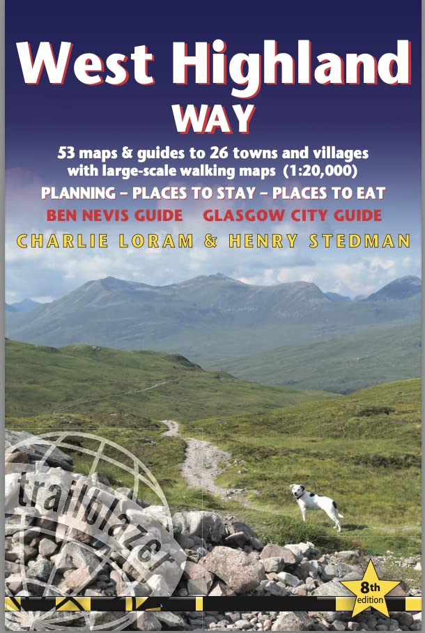
<div> All the information you need to enjoy your hiking adventure along the West Highland Way in this fully revised 8th edition.</div> <div> </div> <div> The West Highland Way passes through some of the most spectacular scenery in all of Britain. From the outskirts of Glasgow it winds for 96 miles (154.5km) along the wooded banks of Loch Lomond, across the wilderness of Rannoch Moor, over the mountains above Glencoe to a dramatic finish passing Ben Nevis - Britain's highest mountain - into the centre of Fort William.</div> <div> </div> <ul> <li> 4 large-scale town plans, 8 overview maps and 53 large-scale walking maps, in NEW two-colour style - at just under 1:20,000 - showing route times, places to stay, places to eat, points of interest and much more. These are not general-purpose maps but fully-edited maps drawn by walkers for walkers.</li> <li> Itineraries for all walkers - whether walking the route in its entirety over a week to 10 days or sampling the highlights on day walks and short break.</li> <li> Practical information for all budgets - camping, bunkhouses, hostels, B&Bs, pubs and hotels; Glasgow through to Fort William - where to stay, where to eat, what to see, plus detailed street plans.</li> <li> Comprehensive public transport information - for all access points on the West Highland Way.</li> <li> Climb Ben Nevis - route descriptions to the top of Britain's highest mountain and other peaks.</li> <li> Flora and fauna - four page full colour flower guide, plus an illustrated section on local wildlife.</li> <li> Green hiking - understanding the local environment and minimizing our impact on it.</li> <li> Includes GPS waypoints. - also downloadable from the Trailblazer website.</li> <li> Plus extra colour sections: 16pp colour introduction and 10pp of colour mapping for stage sections (one stage per page) with trail profiles.</li> </ul>
€19,95
Bekijk product