
Beantwoord enkele vragen, en binnen seconden geeft AI je een persoonlijk aankoopadvies op maat.
Beantwoord enkele vragen, en binnen seconden geeft AI je een persoonlijk aankoopadvies op maat.
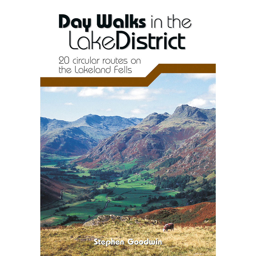
<div> Day Walks in the Lake District features 20 circular routes between 5 and 13 miles (8 and 21 kilometres) in length, suitable for hillwalkers of all abilities. The routes are split into four geographical areas - north, east, south and west - and include walks from the main tourist bases, such as Keswick and Ambleside, as well as sought after peaks, such as Scafell Pike, Great Gable, Blencathra and Helvellyn. Also included for the adventurous are the Lake District's best known scrambles - Striding Edge on Helvellyn and Sharp Edge on Blencathra - together with more accessible alternatives.</div> <div> </div> <div> The author of this guidebook, Stephen Goodwin, is a former freelance journalist (former staff writer for The Independent), and a Lake District local. In his introductions to each route he recalls the tales of Wordsworth, Walpole and the fascinating history of Lakeland and its peaks and fells. Each route in this guide is described with easy-to-follow directions and details of distance, navigation information, refreshment stops, stunning location photography and is plotted on clear and easy to use Ordnance Survey 1:25,000 mapping.</div>
€20,95
Bekijk product
<div> Day Walks on the North York Moors showcases 20 circular walks, between 5 and 13.7 miles (8 and 22 kilometres) in length, suitable for hillwalkers of all abilities. The routes are split into three areas - The Cleveland Hills and Hambleton Hills, Central Moors and Coastal Walks - and include walks to the most historic and beautiful areas of the Moors, including: Lord Stones, Wainstones and Clay Bank, Rievaulx Abbey, Blakey Ridge and Farndale, the Hole of Horcum, and the stunning coastline at Robin Hood's Bay and Ravenscar. The author of this guidebook, Tony Harker, is a Moors local and keen hillwalker.</div> <div> </div> <div> Each route in this guide is described with easy-to-follow directions and details of distance, navigation information and refreshment stops, and is plotted on clear and easy to use Ordnance Survey 1:25,000 maps. The walks are illustrated with stunning photography by Adam Long. Also included is a detailed Appendix.</div>
€20,95
Bekijk product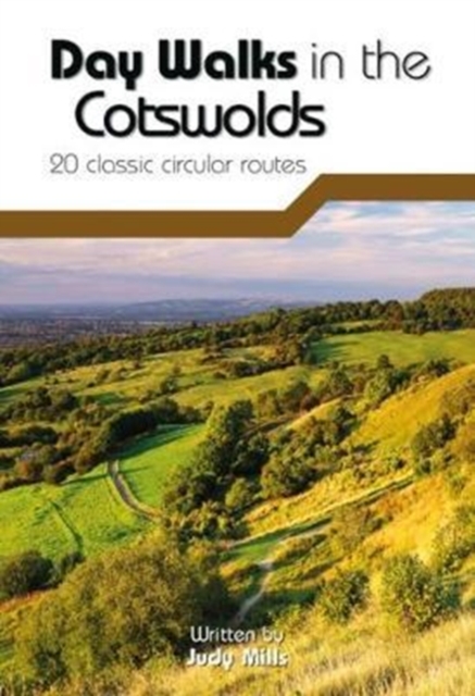
<div> Day Walks in the Cotswolds features 20 circular routes, between 7.1 and 12.6 miles (11.5km and 20.2km), suitable for hillwalkers of all abilities. Split across three areas - North-East Cotswolds, North-West Cotswolds and South Cotswolds - local author Judy Mills shares her favourite walks in this Area of Outstanding Natural Beauty. These walks take in a variety of local landmarks, including the World War II airfield and Roman villa at Chedworth; Neolithic long barrows such as Hetty Pegler's Tump; grand country estates like Badminton; magnificent Cotswold manor houses and historic churches; high points at Bredon Hill and North Nibley; and the many charming rural villages, such as the Duntisbournes and the Slaughters, for which the Cotswolds are famous.</div> <div> </div> <div> Each route features Ordnance Survey 1:25,000 maps, easy-to-follow directions, details of distance and navigation information, and refreshment stops and local information. The walks are illustrated with stunning photography by outdoor photographer Adam Long.</div>
€20,95
Bekijk product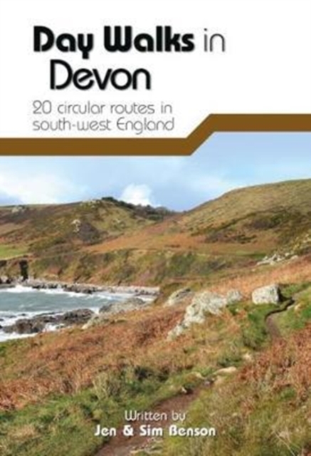
<div> Day Walks in Devon features 20 circular routes, between 8.8 and 17.6 miles (14.1km and 28.3km), suitable for hillwalkers of all abilities. The routes are split into five geographical areas: North Devon and Exmoor, Torridge and West Devon, Mid and East Devon, Dartmoor, and South Devon and the South Hams. Devon has some of the most diverse and beautiful terrain of any county in England.</div> <div> </div> <div> Local authors Jen and Sim Benson share their favourite walks in the region, including coastal circuits taking in sections of the South West Coast Path past Baggy Point and Hartland Point; moorland loops of Dartmoor's granite tors such as Haytor and High Willhays; and tours through the county's rich history at Berry Pomeroy Castle and Castle Drogo. Together with stunning photography, each route features Ordnance Survey 1:25,000 maps, easy-to-follow directions, details of distance and navigation information, and refreshment stops and local information.</div>
€20,95
Bekijk product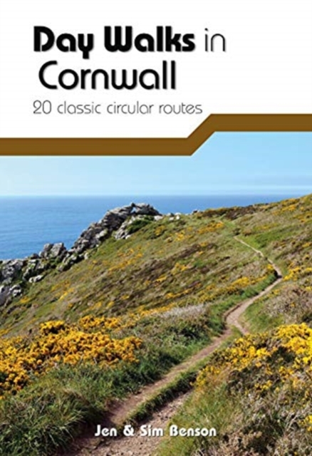
<div> Day Walks in Cornwall features 20 circular routes between 7.2 and 13.7 miles (11.6km and 22km) in length, suitable for hillwalkers of all abilities. Researched and written by experienced authors Jen and Sim Benson, and covering the extremities of this stunning peninsula, the walks reach areas from Bude to the Isles of Scilly, and from Rame Head near Plymouth to Lizard Point on the southernmost tip. Taking advantage of the South West Coast Path, discover a unique view of the charming coastline at every turn in this Area of Outstanding Natural Beauty.</div> <div> </div> <div> Explore Chapel Porth caves, and countless coves, archways and waterfalls, or simply immerse yourself in a leisurely stroll along white sands and blue waters. Head for the Merry Maidens stone circle in Lamorna, examine the serpentinite rock formations at Lizard Point, watch over medieval Tintagel Castle and parade past Cromwell's Castle. Find serenity overlooking St Enodoc's Church or soak up the vibe of trendy fishing village St Mawes, nestled in its sheltered bay; you'll find Cornwall has it all.</div> <div> </div> <div> Together with stunning photography, each route features Ordnance Survey 1:25,000 maps, easy-to-follow directions, distance and navigation information, refreshment stops and local information.</div>
€20,95
Bekijk product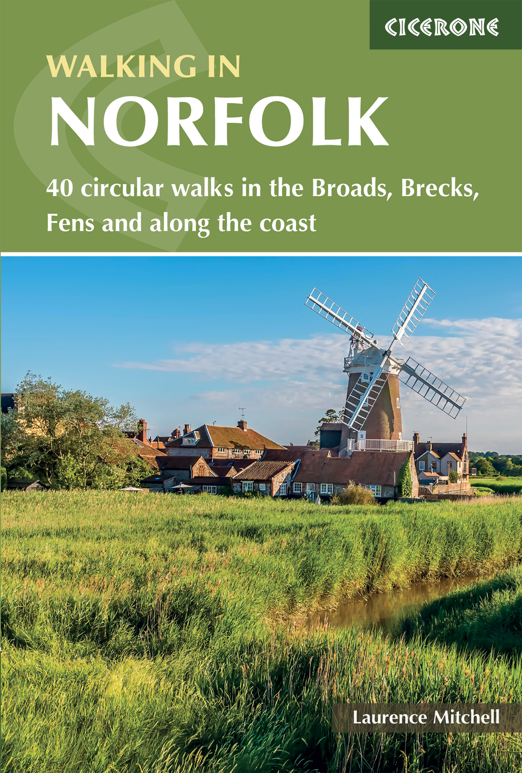
<div> This guidebook describes 40 circular walks in Norfolk, including walks along the coast and walks exploring the Fens and the Broads. From 4 to 12 miles, these mostly flat walks use footpaths, bridleways and quiet country lanes, and some involve parts of long-distance paths, including the Peddars Way, Norfolk Coast Path, Boudica's Way and Weavers Way. The walks are divided into five sections: walks on the northeast coast and the Broads; walks in south Norfolk, the Yare and Waveney; walks in North Norfolk and the Coast; walks in Central Norfolk and Breckland; and walks in West Norfolk and the Fens. All routes are easy to moderate and can be done by anyone of reasonable fitness and enjoyed all year round.</div> <div> </div> <div> Each route is described step-by-step, illustrated with 1:40K OS map extracts and packed with historical, geological and other information about the landscape the route passes through. The Fenland region of Norfolk's far west is flat and low-lying, as are the marshes and waterways of the Broads in the east, but between these two extremes there is a great deal of topography going on. The county is far more varied than most outsiders imagine, with several distinct and unique landscapes.</div> <div> </div> <div> As well as Broads and the Fens, it has the sandy Brecks, rolling farmland, ancient woodland, meandering rivers and the gorgeous North Norfolk coast with its beaches, shingle banks, salt marshes and tidal mud flats.</div>
€20,95
Bekijk product
<p> This guide covers walks in the rugged, empty landscape of West Sutherland, in the far north-west of Scotland. Walks range from 1 mile to 14 miles (1.5-22.5km). Routes include: Point of Stoer, Suilven, Cape Wrath, the path to Sandwood Bay and a number of signposted walks from Lochinver.</p>
€5,95
Bekijk product
<div> This guide covers the less mountainous, eastern side of the county of Sutherland: an area of small coastal villages and wide, empty moorland. Walks range from 0.5 miles to 11 miles (0.5-17km). Routes include: a walk around Bettyhill, Shin Falls, the wonderful woodland walks at Ledmore and Migdale and the path between Dornoch and Embo.</div> <div> </div>
€5,95
Bekijk product
<div> This guide covers the walks around Royal Deeside: Banchory, Aboyne, Ballater and Braemar, as well as Balmoral. Routes include climbs in the Cairngorm National Park, hill paths around Loch Muick and gentler walks in the Dee valley. Walks range from 0.5 miles to 21.5 miles (0.8-34.5km). Routes include: Ben Macdui, Lochnagar, Jock’s Road and Craigendarroch.</div> <div> </div>
€5,95
Bekijk product