
Beantwoord enkele vragen, en binnen seconden geeft AI je een persoonlijk aankoopadvies op maat.
Beantwoord enkele vragen, en binnen seconden geeft AI je een persoonlijk aankoopadvies op maat.
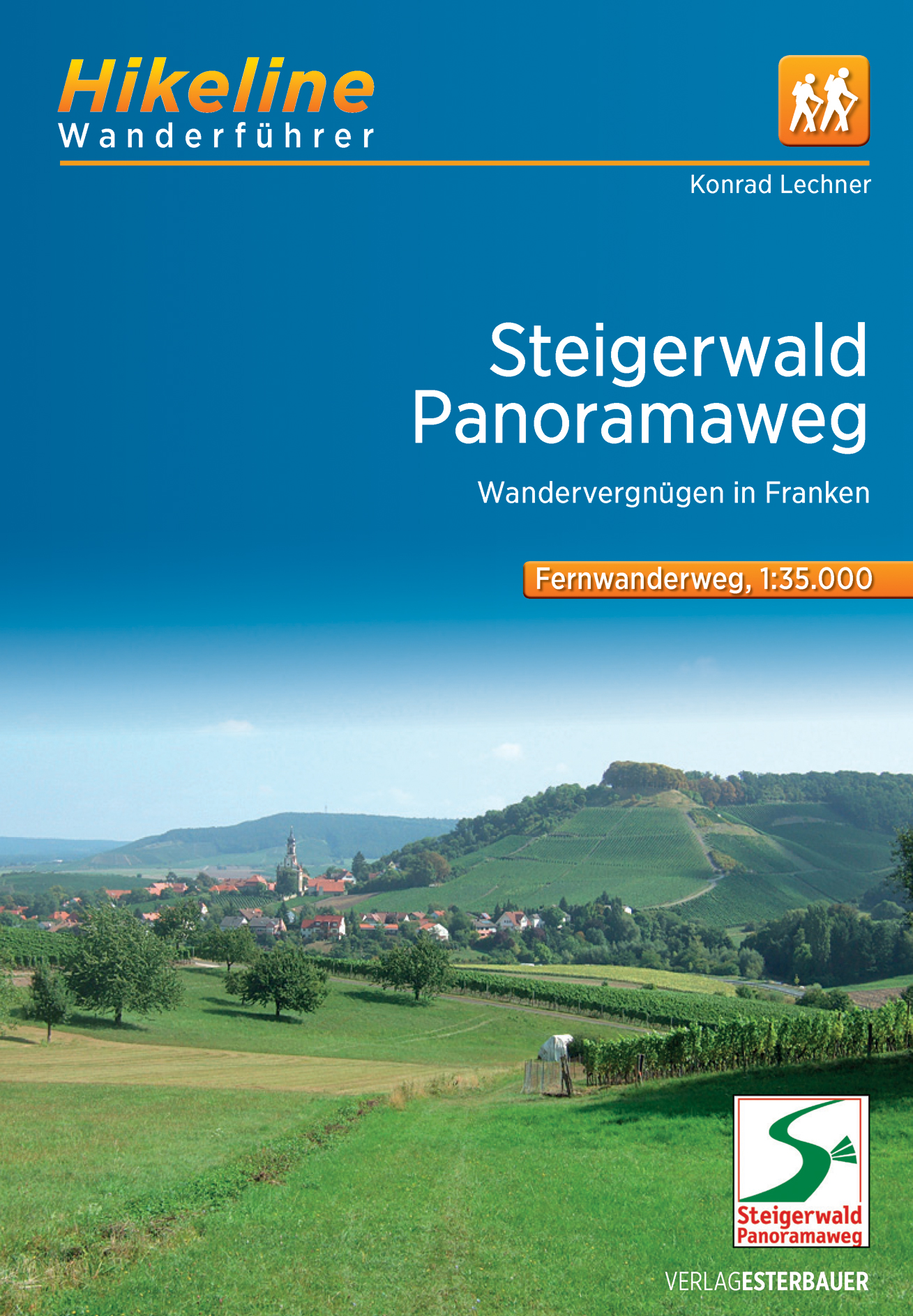
<p> Degelijke gids van de lange afstands wandeling in Franken: de Steigerwald Panoramaweg. Goede beschrijving met behoorlijk kaartmateriaal en praktische informatie. </p> <div> Dieser bestens beschilderte Fernwanderweg wird seinem Namen mehr als gerecht: Herrliche Panoramen und weite Ausblicke begleiten den Wanderer auf der gesamten Strecke – von Schloss Frankenberg über den Vogelsangberg bis hin zum Schlossberg in Castell und den Eulenberg in Michelau. Neben ausgedehnten Buchenwäldern ist die Landschaft vor allem durch Weingärten und Streuobstwiesen geprägt, eine Besonderheit der Tierwelt finden Sie im südlichen Steigerwald, wo sich rund tausend verschiedene Schmetterlingsarten tummeln. So manche Kloster- oder Burganlage und natürlich die Altstadt von Bamberg, die zum Weltkulturerbe zählt, ergänzen das Naturerlebnis mit interessanten, historischen Plätzen und geschichtsträchtigen Gemäuern.</div> <div> Natürlich kommen im Fränkischen auch Gaumen und Kehle keineswegs zu kurz!</div>
€14,50
Bekijk product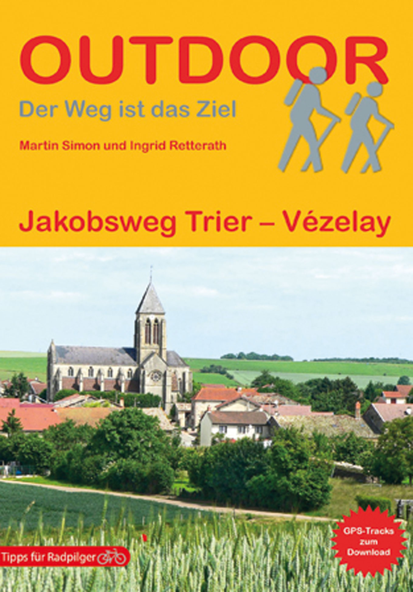
<p> Handzaam boekje met de wandelroutebeschrijving inclusief een heleboel praktische informatie. De beschrijving is uitstekend, maar kaarten zijn beperkt en schetsmatig aanwezig. Duits.</p> <p> Über 550 km führt der Jakobsweg vom rheinland-pfälzischen Trier nach Vézelay in Frankreich. Er streift dabei auf wenigen Metern luxemburgischen Boden bevor er an der Mosel entlang nach Frankreich übergeht. Der Pilger trifft unterwegs auf imposante Kathedralen in Metz, Toul und Auxerre und durchquert in großen Teilen die Champagne. Dabei passiert er die bis an den Horizont reichenden Weinranken und wird vom Fluss Maas begleitet. Der Autor beschreibt präzise den Wegverlauf und die sich am Wegesrand befindlichen kulturellen und sakralen Sehenswürdigkeiten sowie einen Abstecher nach Nancy. Der Höhepunkt des Pilgerweges ist die Kathedrale in Vézelay, die ebenso ausführlich wie der Dom in Trier beschrieben wird.</p> <p> 194, Auxerre, Burgund, Champagne, Deutschland, Frankreich, Ingrid Retterath, Jakobsweg, Lothringen, Martin Simon, Metz, Pilgern, Pilgern in Deutschland, Pilgern in Frankreich, Retterath, Saarland, Trier, Vézelay</p>
€18,95
Bekijk product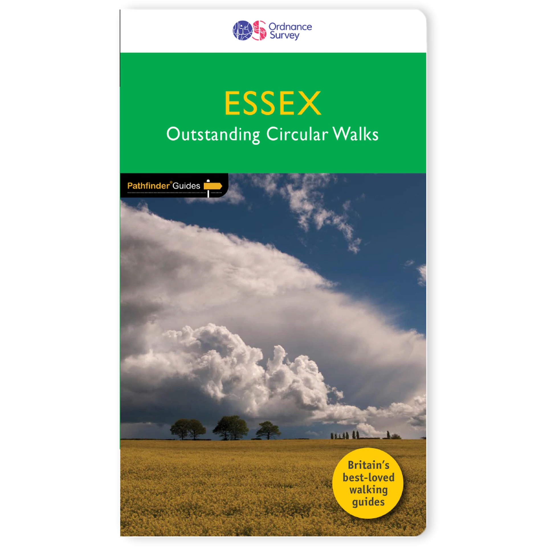
<p> Pathfinder Guide to Essex offers excellent lowland walking in the south-east of England. The routes are all circular exploring the finer countryside of the county, in a series of parkland, farmland, woodland and coastal and estuarine walks, visiting its places of historic interest, attractive towns and charming villages. Given the pleasant and undramatic nature of the terrain, routes only really vary in length in terms of difficulty and there is a general progression through the book from shortest to longest. Beginning with a short walk linking Laindon Common with Great and Little Burstead, encountering the infant River Crouch, the book progresses to a near 10-mile excursion across Bradwell Marsh, with its wide open horizons, and a visit to the isolated and tiny Saxon chapel of St Peter-on-the-Wall. Sea air can also be taken on walks from Walton-on-the-Naze, a circuit of the eastern end of Mersea Island, along St Osyth Creek, at Maldon, from Burnham-on-Crouch, and overlooking Benfleet Creek. Inland, varied routes range from a walk in the upper Chelmer valley with the small medieval town of Thaxted as the focal point, to a gentle walk around Hatfield Forest through what is probably the finest surviving medieval woodland landscape, and in the Blackwater valley linking Coggeshall and Feering. County parks make good starting points for readers new to country walking and visits to Thorndon and Weald Country Parks are easily accessible from Brentwood, ditto for the Lee Valley Country Park from Waltham Abbey, and Hadleigh Castle Country Park from Southend. 28 outstanding circular walks in Essex from 3 to 9¾ miles with clear, large scale Ordnance Survey route maps, GPS waypoints, where to park, good pubs and places of interest en route. All routes have been researched and written by expert outdoor writers Dennis and Jan Kelsall and showcase beautiful photography of scenes from the walks. Pathfinder® Guides are Britain s best-loved walking guides. Printed with weather-resistant covers featuring durable rounded corners, they are the perfect companion for country walking throughout Britain. With 80 titles in the series, and 2000 routes to choose from, a wealth of walks is available throughout England, Scotland and Wales from Land's End to Inverness and the Lleyn Peninsula to Southwold.</p>
€18,50
Bekijk product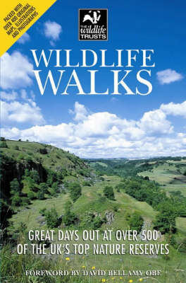
<p> This guide offers both nature lovers and families everything they need to know when looking for a day out in the fresh air and being part of the UK's conservation drive. It provides the key to exploring these open spaces and the creatures great and small that inhabit them. Published in association with The Wildlife Trust.</p>
€7,95
Bekijk product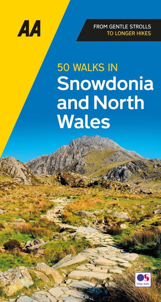
<p> Uitstekende wandelgids met een aantal dagtochten tussen de 3 en 15 kilometer. Niet heel erg lang dus, maar wel op de mooiste plekken en goed beschreven en prima kaartmateriaal.</p> <p> Featuring a variety of mapped walks to suit all abilities, this helpful guide features all the necessary practical details for a successful trip, including information on distance, gradient, level of difficulty, landscape, dog friendliness, parking availability, and restroom locations. Fascinating background on the history and wildlife of each area is provided, and local points of interest are indicated on accompanying full-color maps. All walks are annotated with places to visit along the way--including churches, country houses, museums, villages, and towns--as well as information on local restaurants, tea rooms, and pubs. Revised with new routes and updated maps and information, these guides are your key to experiencing the beauty and variety of the British landscape.</p> <p> Casgliad o 50 taith gerdded amrywiol yn Eryri a rhannau eraill o Ogledd Cymru, rhwng 2 a 10 milltir o hyd, yn cynnwys cyfarwyddiadau manwl a mapiau clir ynghyd â nodiadau diddorol am fannau diddorol lleol, hanes, byd natur a chyfleusterau bwyd.</p>
€19,95
Bekijk product
<p> Uitstekende wandelgids van dit geweldige gebied. goed beschreven met veel praktische informatie om de route te kunnen lopen, inclusief redelijke kaarten. Bedenk wel - zie het overzicht- dat het voornamelijk routes zijn in het westen en zuiden van Oostenrijk.</p> <div> A comprehensive guidebook detailing walking routes in Austria. The 101 walks reflect the diversity of this popular region and cover Austria's magnificent Alps - including the Rätikon, Silvretta, Stubai and Zillertal - as well as the Dachsteingebirge, Hohe Tauern and the Karawanken. Graded according to difficulty and ranging from short walks of a few kilometres to day hikes and multi-day hut-to-hut tours, from the classic to the lesser-known, there is something to suit every level of ability and ambition. </div> <div> </div> <div> A full description of each route is accompanied by clear sketch maps. This book has all the information you need to make the most of an active walking holiday in Austria, including information on public transport, accommodation, gear required and safety issues, full details of over 100 mountain huts and a German–English glossary. </div> <div> </div> <div> Austria is one of Europe's most walker-friendly countries. Its 40,000km of well-maintained and waymarked trails pass more than a thousand Austrian mountain huts and countless attractive villages, hospitable hotels, inns and restaurants. It also boasts an extensive, integrated public transport system that is particularly useful for walkers. The Austrian landscape is enchanting in its beauty, featuring rugged limestone spires, towering snowy peaks, majestic lakes and tranquil valleys.</div> <div> </div> <div> <strong>Steden en Dorpen</strong></div> <div> <div> Brand, Schruns, Tschagguns, Gargelle, St Gallenkirch, Gaschurn, Bielerhöhe, Galtür, Ischgl, Feichten, Plangeross, Mandarfen, Längenfeld, Sölden, Obergurgl, Längenfeld, Kühtai, Gries im Sellrain, Neustift, Zell am Ziller, Mayrhofen, Finkenberg, Westendorf, Brixen, Kitzbühel, Söll, Scheffau, Ellmau, Saalbach, Hinterglemm, Zell am See, Kufstein, Scheffau, Ellmau, Going, St Johann in Tirol, Filzmoos, Ramsau, Hallstatt, Badgastein, Kaprun, Matrei in Osttirol, Kals am Grossglockner, Ferlach, Bad Eisenkappel</div> <div> </div> </div> <p> </p>
€24,95
Bekijk product
<p> Franstalige wandelgids. Uitstekende beschrijving met gedetailleerd kaartmateriaal (topografisch, IGN) en veel praktische informatie over zwaarte, hoogte en hutten. Bijna onmisbaar voor het lopen van deze route. In andere beschrijvingen zijn geen goede kaarten bijgevoegd! De gids bevat een lijst met overnachtingsadressen inclusief telefoonnummers en vaak websites en mailadressen.Wij leveren er een beknopte Frans-Nederlandse woordenlijst bij.</p> <div> La Loire est mondialement connue pour ses châteaux et ses jardins, aujourd'hui classés au Patrimoine mondial de l'Unesco. Le site du Val de Loire, berceau de la Renaissance, présente une densité exceptionnelle de monuments historiques des XVe et XVIe siècles.</div> <div> </div> <div> Dès l'époque du roi René d'Anjou, on rénove de vieilles demeures ou on leur adjoint des bâtiments nouveaux avec de larges fenêtres, des balcons et des escaliers ouvragés. On les entoure de jardins d'agrément qui donnent non seulement des fleurs mais aussi des fruits et des légumes pour accompagner le produit de la chasse.</div> <div> </div> <div> Plus tard, la présence de la Cour favorisera la construction de nombreux châteaux résidentiels. À côté de ces sites de notoriété internationale, le Val de Loire dispose d'un patrimoine touristique varié : paysages sauvages du fleuve, faune et flore des parcs et réserves, vastes forêts, habitat troglodytique, patrimoine de la viticulture et de la marine de Loire.</div>
€19,95
Bekijk product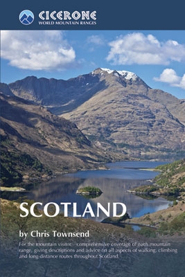
<p> Als je wilt wandelen in Schotland is dit het ultieme naslagwerk.</p> <p> A resource book covering the finest walks and climbs in Scotland, with its variety of wild landscapes ranging from the Southern Uplands to the great granite plateaus of the Cairngorms to the jagged arêtes of the Cuillin hills on the Isle of Skye. Whatever activity you are planning this guide has the information the independent mountain lover needs.</p> <p> Scotland is a mountainous country with a wide variety of wild landscapes: there are the rolling hills of the Southern Uplands, the great granite plateaus of the Cairngorms, the steep castellated rock peaks of Torridon and the jagged narrow aretes and spires of the Cuillin hills on the Isle of Skye. Of the many majestic summits, 284 reach 3000ft or more; these are the Munros, the ascent of which is the aim of many walkers. Below them lie splendid pine forests, beautiful lochs, deep glens, rushing rivers; a magnificent northern landscape.</p> <p> Whether you are planning a day scramble or a long-distance walk, Scotland World’s Mountain Range guide has the information the independent mountain lover needs.</p> <p> • area-by-area descriptions of the Scottish mountains from south to north to help you identify the best locations for hill walking, mountaineering and ski touring</p> <p> • classic ascents and walks described, from scrambles up Ben Nevis to ski tours in the Cairngorms</p> <p> • information on accommodation, maps and guides</p> <p> • a planning tool for long-distance treks in Scotland</p> <p> </p>
€35,95
Bekijk product
<p> Uitstekende wandelgids met een groot aantal dagtochten. Met praktische informatie en beperkt kaartmateriaal! Wandelingen in verschillende zwaarte weergegeven in rood/blauw/zwart.</p> <p> <span style="color: rgb(0, 0, 0); font-family: Arial; text-align: justify;">Dünen, Wattenmeer und Hochmoore, Vogelschutzgebiete und Hafenstädte – Ostfriesland ist ein ein-zigartiger Naturraum und lässt sich am intensivsten zu Fuß erleben. In 50 Touren erschließt der Rother Wanderführer »Ostfriesland« die Küstenlandschaften und Inseln im UNESCO-Weltnaturerbe Wattenmeer sowie Glanzpunkte im Binnenland zwischen Ems und Jade.</span></p> <p> <br style="color: rgb(0, 0, 0); font-family: Arial; text-align: justify;" /> <span style="color: rgb(0, 0, 0); font-family: Arial; text-align: justify;">Eindrucksvoll sind die Wanderungen am Wattenmeer: Sie führen die Küste entlang, über die Salzwie-sen und grünen Deiche, vorbei an Leuchttürmen und Kutterhäfen. Nicht nur Dünen und Strände, sondern auch Pflanzenoasen lassen sich auf den angrenzenden Inseln entdecken. Die Touren im ostfriesischen Binnenland führen vorbei an herrschaftlichen Schlösser und Windmühlen, durch alte Alleen und auf künstlichen Hügeln erbaute Warfendörfer mit ihren trutzigen mittelalterlichen Kirchen. Auch in Deutschlands größtem Hochmoor, dem »Ewigen Meer«, bieten sich attraktive Wanderungen an und für Ornithologen sind die Vogelrückzugsgebiete während der Zugzeiten ein Highlight. </span></p> <p> <br style="color: rgb(0, 0, 0); font-family: Arial; text-align: justify;" /> <span style="color: rgb(0, 0, 0); font-family: Arial; text-align: justify;">Die Touren sind durch Kurzinfos, exakte Wegbeschreibungen, Kartenausschnitte mit Routenverlauf und Streckenprofile gut nachvollziehbar. Ergänzend stehen auf der Internetseite des Bergverlag Rother GPS-Daten zum Download bereit. Einkehrtipps, Hinweise auf Sehenswürdigkeiten und die zahlreichen Fotos machen Lust, in diesem einzigartigen Naturraum auf Entdeckungstour zu gehen.</span></p> <p> <br style="color: rgb(0, 0, 0); font-family: Arial; text-align: justify;" /> <span style="color: rgb(0, 0, 0); font-family: Arial; text-align: justify;">Der in Ostfriesland lebende, erfahrene Wanderbuchautor Bernhard Pollmann hat die 2. Auflage seines Wanderführers sorgfältig aktualisiert und etliche Touren durch neue ersetzt.</span></p>
€19,50
Bekijk product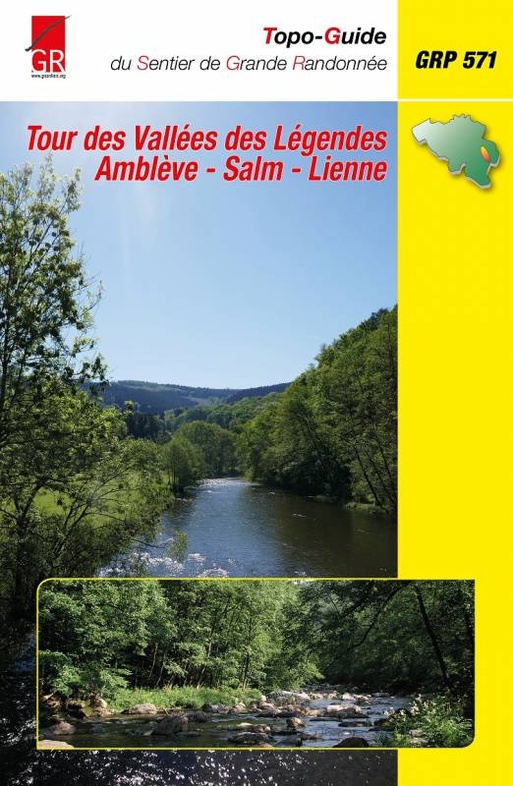
<p> De vernieuwde GR 571 vervangt de vroegere GR 571 + 572 + 578. Op die wijze werd een pittige en boeiende route gecreëerd door de Luikse en Luxemburgse Ardennen. Franstalig!</p> <p> Het oude ardense massief is een regio waar je nog mysterieuze verhalen en legendes kan horen. Maar de contreien die in deze gids beschreven worden, begeesteren, nog meer dan elders, de romantische ziel van vele vertellers. Niemand ontsnapt aan de mysterieuze sfeer die heerst over het landschap. Laat je betoveren en ga mee op zoek naar de diepste geheimen in de valleien van de Salm, de Lienne en de Amblève.</p> <p> De GR 571 start in Comblain-au-Pont, waar de Amblève in de Ourthe vloeit, en trekt dan onmiddellijk bergop naar Oneux, om wat verder af te dalen naar Aywaille, de poort van de Ardennen. Van Aywaille gaat het naar Remouchamps en naar de Ninglinspo. In de “Fonds de Quarreux” zien we de Amblève op zijn mooist, maar de lange klim langs de Chefnabeek is misschien nog mooier. Stoumont en Coo bieden ons prachtige vergezichten. Het GR-pad loopt over de waterval. In Trois-Ponts zien we de laatste keer de Amblève. Vanaf nu is de Salm onze gids langs een alweer prachtige route. In Grand-Halleux zien we weer even de bewoonde wereld, maar daarna herneemt de tocht door het bos. Aan de mooie kerk van Vielsalm kunnen we een drankje wel gebruiken om te bekomen van de inspanningen. Het pad loopt verder naar het kasteel van Salmchâteau, dat toaal verbouwd is. In Cierreux zitten we op het hoogplateau, zien een laatste maal de Salm (die hier Glain heet) en dalen wat verder af naar het grensstation Gouvy. Hier maakt de GR 571 een kwartdraai naar rechts en gaat in zig-zag naar Lierneux, waar we de Lienne ontmoeten. Na een grote lus door de bossen van Arbrefontaine komen we weer in de diepe en beboste Liennevallei, die we volgen tot in Chevron en verder tot Targnon, waar de Lienne in de Amblève vloeit. Hier verlaten we noodgedwongen dit geheimzinnig riviertje en trekken noordwaarts door een even mooie streek naar Nonceveux.</p> <p> </p>
€22,50
Bekijk product