
Beantwoord enkele vragen, en binnen seconden geeft AI je een persoonlijk aankoopadvies op maat.
Beantwoord enkele vragen, en binnen seconden geeft AI je een persoonlijk aankoopadvies op maat.
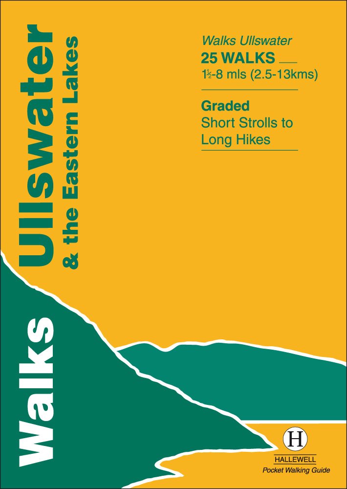
<div> Rewalked and updated in 2016, Walks Ullswater & the Eastern Lakes features walks in The Lake District - the famous area of spectacular peaks and lakes in the north-west of England. This guide covers the eastern part of the district, with most of the routes clustered around Ullswater. The routes included are largely hill climbs, plus some lower lakeside routes. The 25 walks featured range from 1.5 miles to 8 miles (2.5-13km). Routes include: Brothers Water, Angle Tarn and walks from Patterdale and Glenridding. Part of a popular series of A6 pocket walking guides that describe routes which are suitable for walkers of all abilities and to suit all tastes. Route descriptions are accompanied by 2-colour sketch maps. The guides are illustrated with line illustrations, and will provide walkers with a good introduction to what each area covered has to offer.</div> <div> </div>
€5,95
Bekijk product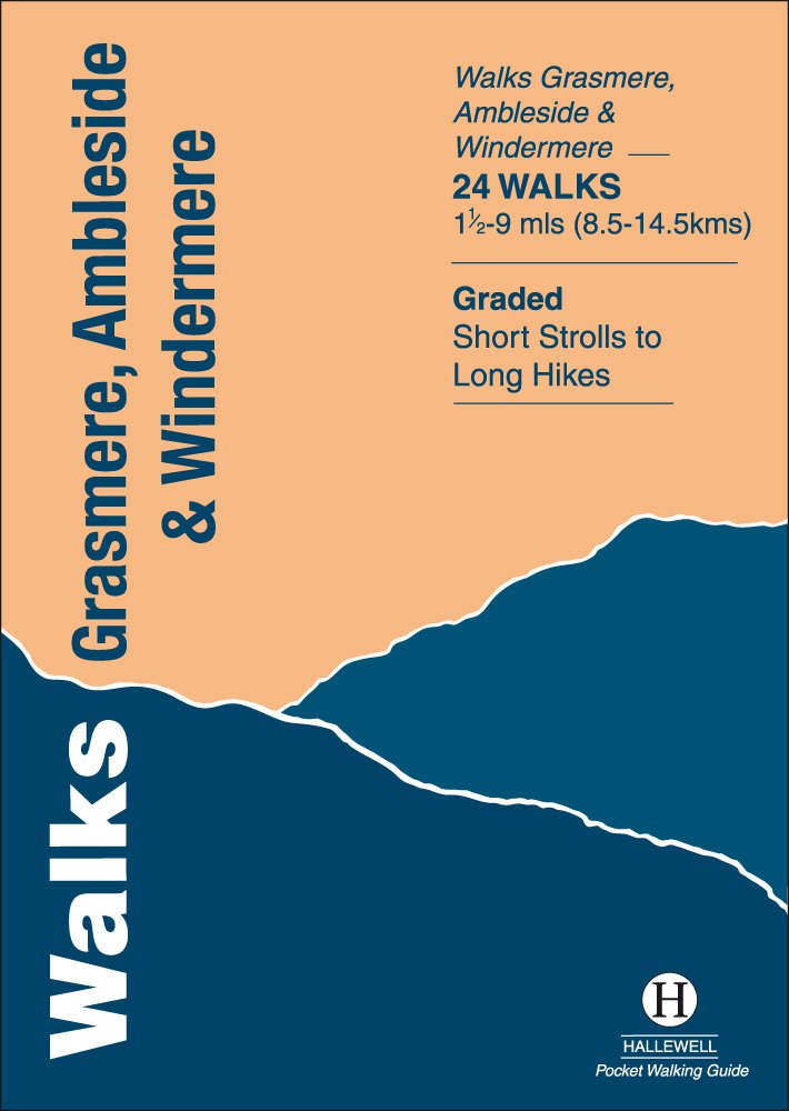
<div> Rewalked and revised in 2021, Walks Grasmere, Ambleside & Windermere features walks in The Lake District - the famous area of spectacular peaks and lakes in the north-west of England. This guide covers the central part of the area, which contains many of the most popular towns and villages in the area; not only those mentioned in the title, but also Hawkshead and Rydal. The guide contains walks from all the main centres and around the northern half of Lake Windermere and Grasmere. The 23 walks featured range from 1.5 miles to 9 miles (2.5-14.5km). Routes include: Helm Crag, Alcock Tarn, Great Langdale, Ambleside to Troutbeck, Orrest Head and Tilberthwaite. Last rewalked and updated 2014 - Walks Grasmere is part of a popular series of A6 pocket walking guides which describe routes which are suitable for walkers of all abilities and to suit all tastes. Route descriptions are accompanied by 2-colour sketch maps. The guides are illustrated with line illustrations, and will provide walkers with a good introduction to what each area covered has to offer.</div> <div> </div>
€5,95
Bekijk product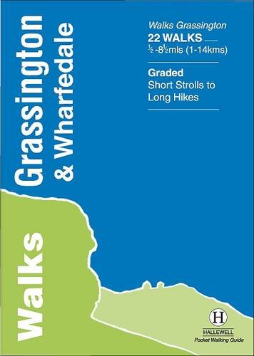
<div> The Yorkshire Dales National Park - an area of rolling green hills, dramatic limestone features and quaint villages - has five main dales (valleys). Walks Grassington & Wharfedale covers Wharfedale - containing the villages of Grassington and Kettlewell - plus the town of Skipton. In the north the walks run by the riverside or climb onto the grassy hills; in the south the rock changes from limestone to sandstone and there are routes through the narrow wooded valley north of Castle Bolton or onto the heather moors to either side. The 22 walks featured range from 0.5 miles to 8.5 miles (1-14km). Routes include: Buckden Loop, a circuit from Kettlewell via Starbotton and Moor End, Grassington to Burnsall, Bolton Abbey & The Strid and Skipton Woods. Part of a popular series of A6 pocket walking guides which describe routes which are suitable for walkers of all abilities and to suit all tastes. Route descriptions are accompanied by 2-colour sketch maps. The guides are illustrated with line illustrations, and will provide walkers with a good introduction to what each area covered has to offer.</div> <div> </div>
€5,95
Bekijk product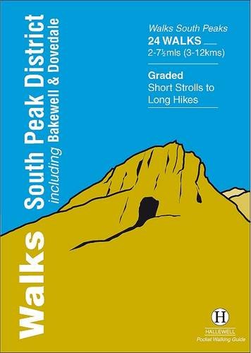
<div> Rewalked and updated in 2017/19, Walks South Peak District features walks in the gentler, southern half of the Peak District National Park; an area of low, green hills intersected by narrow valleys. The area's limestone is worked into numerous rock formations notably the famous spires and caves in Dovedale, and the long, low 'edges' above Curbar and Baslow. The main towns in the area are Buxton and Bakewell, but the walks pass numerous picturesque villages, as well as the splendid stately home of Chatsworth House. Walks range from 2 to 7.5 miles (3-12kms). Routes include Curbar Edge, Bakewell to Chatsworth, Thor's Cave & Wetton Hill, Dovedale and Mill Dale and The Roaches. This guide is part of a popular series of A6 pocket walking guides which describe routes which are suitable for walkers of all abilities and to suit all tastes. Route descriptions are accompanied by 2-colour sketch maps. The guides are illustrated with line illustrations, and will provide walkers with a good introduction to what each area covered has to offer.</div> <div> </div>
€5,95
Bekijk product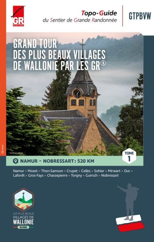
<div> <div> Wandelgids in 3 delen langs de mooiste dorpen van Wallonië</div> <div> </div> <div> Deze route is grotendeel gebaseerd op het bestaande GR- en GRP-netwerk en vormt een 1.500 kilometer lange route die deze 32 karaktervolle dorpen met elkaar verbindt. De gidsen bevatten routes, beschrijvingen en gedetailleerde kaarten. Een specifieke GTPBVW-markering werd geplaatst om de route te markeren. Deze staat verder uit elkaar dan de traditionele GR streepjesmarkeringen.</div> <div> </div> <div> Je wandelt door prachtige landschappen en regio's die soms weinig bekend zijn, maar die je elke keer betoverende plekken laten ontdekken, gelegen in een rijke natuurlijke omgeving en in goed bewaarde oorden waar het onroerend erfgoed de geschiedenis van onze voorouders laat weerklinken.</div> <div> </div> <div> Deel 1: Namur - Nobressart (520 km)</div> <div> Deel 2: Nobressart - Mélin (480 km)</div> <div> Deel 3: Mélin - Namur (525 km)</div> <div> </div> <div> Le topo-guide à thème (GRT), "LES BEAUX VILLAGES DE WALLONIE PAR LES GR GTPBVW®" rédigé en trois tomes, vous invite à parcourir la Wallonie et ses régions si particulières avec pour objectif la découverte des 33 villages labellisés « Plus Beaux Villages de Wallonie » qui font la fierté de leurs habitants et des Wallons amoureux du patrimoine. Cet itinéraire s’appuie sur le réseau GR et déroule un tapis rouge long de 1500 kilomètres reliant 33 villages de caractère. De manière plus espacée, une balise spécifique GTPBVW jalonne le parcours.</div> <div> </div> <div> Vous sillonnerez des paysages magnifiques et des contrées parfois mal connues mais qui, à chaque fois, vous feront découvrir des endroits enchanteurs, logés dans un environnement naturel riche, des endroits préservés où le patrimoine bâti fait résonner l’histoire de nos ancêtres.</div> <div> </div> <div> Les Plus Beaux Villages de Wallonie par les Sentiers GR sont à vos pieds… À vous d’en profiter !</div> <div> </div> <div> La plupart des chemins empruntés sont basés sur le réseau des GR et GRP existant. Parcours, descriptifs et cartographies détaillées sont à votre disposition dans ce guide rédigé en trois tomes. Vous accommoderez vos parcours selon vos envies, par tronçons, en organisant de courts séjours ou en ciblant une région. À vous de choisir ! L’essentiel est d’inciter chacun à voyager au plus près de chez soi : là où la nature et les richesses se trouvent, au coin d’un sentier ou d’une ruelle … l’aventure commence et est accessible à tous.</div> <div> </div> <div> Le Tome 1 démarre à Namur et vous mènera dans 13 villages jusqu’au Beau Village de Nobressart en province de Luxembourg. Vous sillonnerez le Condroz, la Fagne-Famenne, l’Ardenne et la Lorraine.</div> <div> </div> <div> <div> Tome 1 - de Namur à Nobressart</div> <div> </div> <div> Étape 1 : Namur – Mozet </div> <div> Étape 2 : Mozet – Thon-Samson </div> <div> Étape 3 : Thon-Samson – Crupet </div> <div> Étape 4 : Crupet – Celles </div> <div> Étape 5 : Celles – Sohier</div> <div> <div> Étape 6 : Sohier – Mirwart</div> <div> Étape 7 : Mirwart – Our </div> <div> Étape 8 : Our – Laforêt </div> <div> Étape 9 : Laforêt – Gros-Fays </div> <div> Étape 10 : Gros-Fays – Chassepierre </div> <div> Étape 11 : Chassepierre – Torgny </div> <div> Étape 12 : Torgny – Guirsch </div> <div> Étape 13 : Guirsch – Nobressart</div> </div> </div> </div> <p> </p>
€25,95
Bekijk product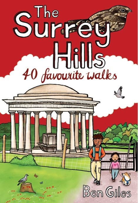
<div> Although Surrey is not far from metropolitan London, it famously has more mature woodland than any other county in England and has long been renowned for its rolling hills and valleys, ancient heathlands, beautiful waterways and charming villages.</div> <div> </div> <div> There is a surprisingly extensive network of local paths and bridleways and, to the south of the North Downs chalk ridge, the hills are intersected by three long-distance walking trails. All these feature in this collection of 40 walks, which explore glorious parklands, country estates, ruined abbeys, impressive castles and wildlife-rich woodlands along the way.</div>
€10,95
Bekijk product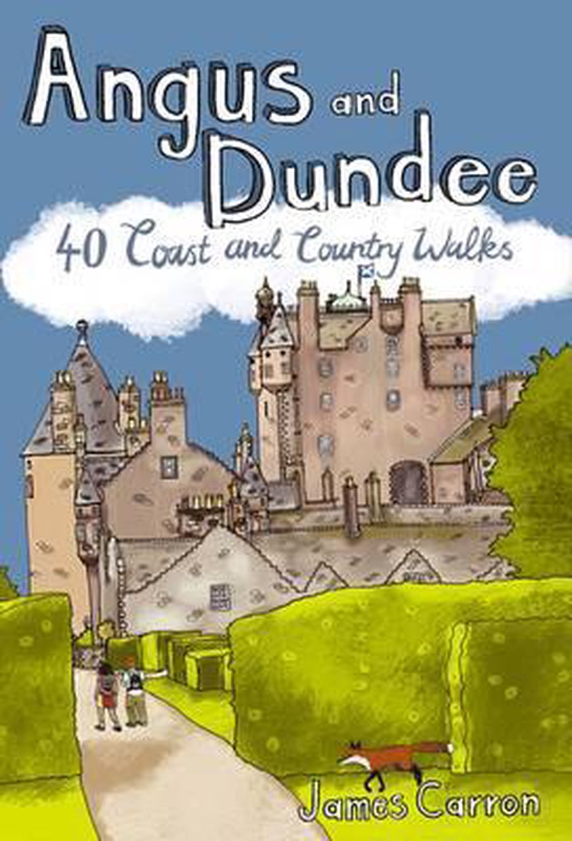
<div> Angus is the historical heartland of Scotland, a county where the past has left an indelible mark on the present. Prehistoric forts, ancient castles and Pictish standing stones dot a rich and varied landscape where bracing coastal hikes, tranquil riverside rambles, sheltered woodland wanders and more challenging hill ascents await the walker. This book features 40 walks, combining exploration of the county's stunning coastline where rocky cliffs and coves reveal swathes of golden sand, with gentle inland trails and more adventurous forays into the celebrated Angus Glens where the terrain is altogether wilder and more dramatic.</div> <div> </div>
€10,95
Bekijk product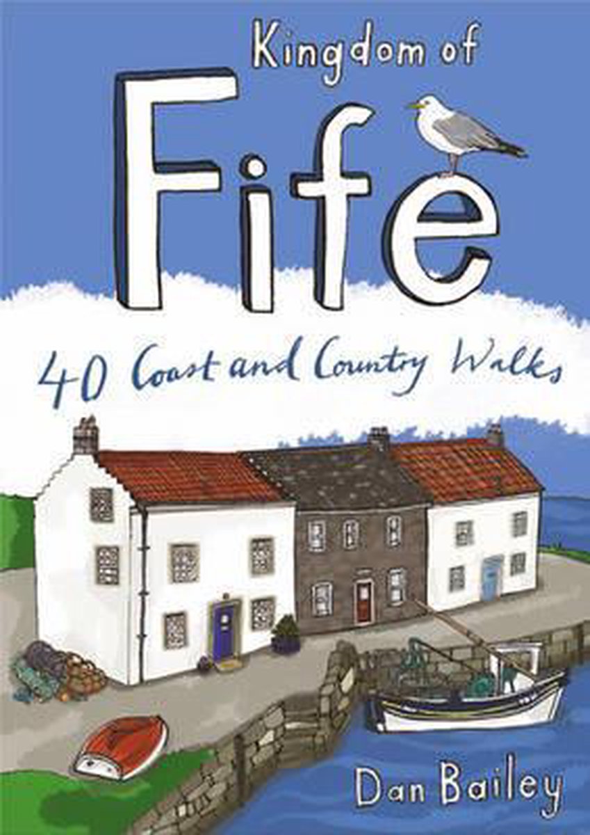
<div> Following on from the new "Pocket Mountains Town and Country" series of shorter walks, this guidebook explores the stunning coast and countryside of the Kingdom of Fife.Featured here you'll find 40 inspiring short walks in and around the Kingdom, stretching from the north side of the famous Forth Bridges, along the Firth of Forth to Culross, and Gleneagles and Dollar further north, and then east beyond Kirkcaldy to the string of picturesque fishing villages of the East Neuk. The volume travels north through Dunfermline and Glenrothes to Falkland and beyond to St Andrews, Tentsmuir Forest and the mighty Tay, with forays also into Kinross.Ranging from lochside nature trails to short, exhilarating routes up into the Lomond and Ochil Hills to the best stretches of the Fife Coastal Trail and circuits around historic towns and villages, this book is all you need to really discover Fife.Many of these circular routes are suitable for families and accessible by public transport.</div> <div> </div>
€10,95
Bekijk product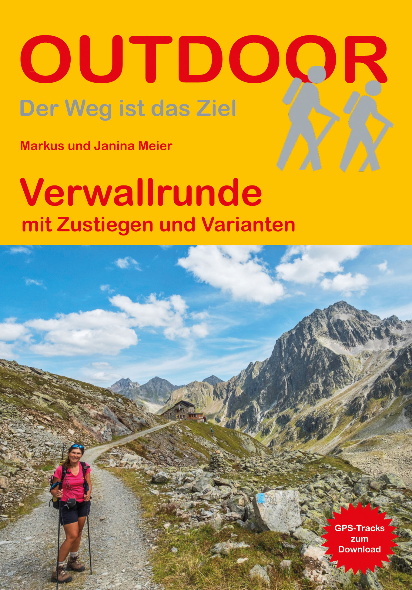
<p> Handzaam boekje met de routebeschrijving inclusief een heleboel praktische informatie. De beschrijving is uitstekend, maar kaarten zijn beperkt en schetsmatig aanwezig. Duits.</p> <p> <strong>Aanbevolen wandelkaarten bij deze gids</strong></p> <p> <strong>1:25.000</strong></p> <p> <a href="https://www.dezwerver.nl/r/europa/oostenrijk/vorarlberg/c/kaarten/wandelkaarten/9783937530543/wandelkaart-28-alpenvereinskarte-verwallgruppe-alpenverein/">Wandelkaart 28 Alpenvereinskarte Verwallgruppe | Alpenverein</a></p> <div> Of</div> <div> </div> <div> <strong>1:50.000</strong></div> <div> <a href="https://www.dezwerver.nl/r/europa/oostenrijk/vorarlberg/c/kaarten/wandelkaarten/9783990444962/wandelkaart-41-silvretta-verwallgruppe-kompass/">Wandelkaart 41 Silvretta - Verwallgruppe | Kompass</a></div> <div> </div> <div> Das Verwall liegt zwischen den beiden bekannten Skiorten St. Anton am Arlberg und Ischgl. In acht Tagen können Sie in dem Gebirge mit seinen wilden Gipfeln und kleinen Gletschern auf einer traumhaften Runde von Hütte zu Hütte wandern. Dabei überwinden Sie knapp 75 km und über 6.000 Höhenmeter und erleben fantastische Ausblicke, ursprüngliche Berglandschaften und gemütliche Hütten.<br /> </div> <div> Eine detaillierte Beschreibung der Verwallrunde finden Sie in diesem Wanderführer, der neben der Hauptroute auch Varianten sowie einen weiteren Zustieg aus dem Montafon vorstellt. Genaue Karten und Höhenprofile erleichtern beim Wandern die Orientierung, Angaben zu den Hütten am Weg helfen bei der Suche nach einer Übernachtungsmöglichkeit.</div>
€13,50
Bekijk product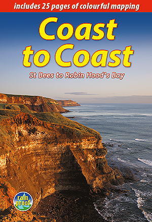
<p> Lange afstandswandelgids van de Coast to Coast wandeling. Wandelgids met kaarten en beschrijving. op waterbestendig papier, in spiraalbinding.</p> <div> This challenging walk of 184 miles (296 km) crosses the north of England from St Bees on the Cumbria coast to Robin Hood’s Bay on the North Sea. It passes through three National Parks – the Lake District, Yorkshire Dales and North York Moors – with splendidly varied scenery. Many walkers complete it within 12 to 16 days, although some divide it into two separate week-long walks.</div> <div> </div> <div> Devised by the legendary Alfred Wainwright, the Coast to Coast is justly famous as England's most popular walk. It is waymarked, has plenty of accommodation and features welcoming pubs. Both its ends and two midpoints (Kirkby Stephen and Richmond) are accessible by public transport.</div> <div> </div> <div> The new edition features many photographs by the award-winning landscape photographer Karen Frenkel. It also has freshly commissioned mapping, which appears on 25 of its 126 pages. It covers many more route options than before, but it weighs only 295g/10 oz. It contains all that a walker needs:</div> <div> </div> <ul> <li> concise directions (revised 2018) for the route walked west to east</li> <li> 25 pages of easy-to-follow mapping (1:55,000)</li> <li> altitude profiles for each section and for route options</li> <li> background on geology, history and wildlife</li> <li> pros and cons of high-level route options</li> <li> ten top tips from experienced Coast-to-Coasters</li> <li> bonus content free to download</li> <li> contact details for accommodation and transport</li> <li> features on St Bees, Grasmere, Richmond and Robin Hood’s Bay</li> <li> over 150 superb colour photographs</li> <li> rainproof, rucksack-friendly format.</li> </ul>
€22,50
Bekijk product