
Beantwoord enkele vragen, en binnen seconden geeft AI je een persoonlijk aankoopadvies op maat.
Beantwoord enkele vragen, en binnen seconden geeft AI je een persoonlijk aankoopadvies op maat.
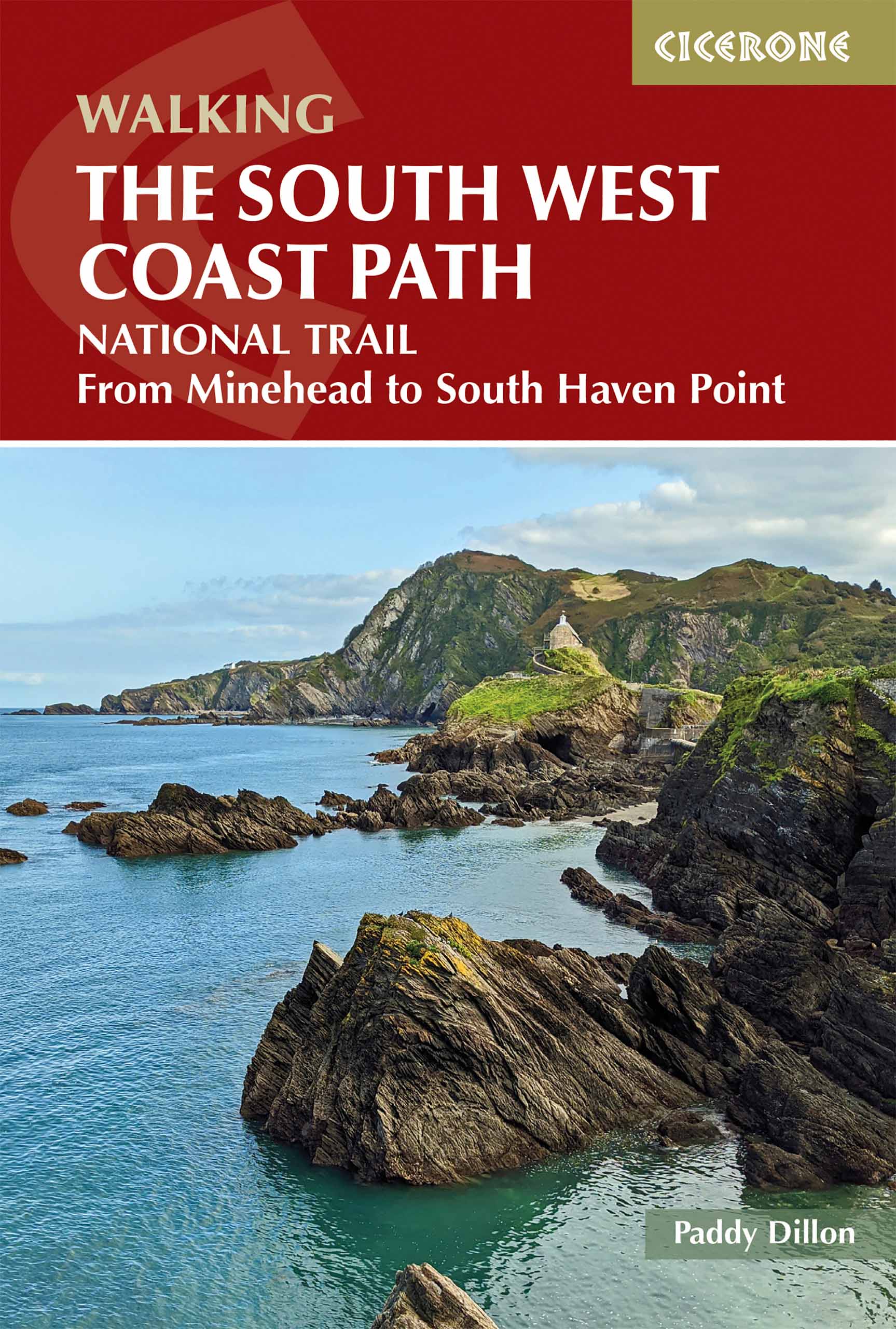
<p> Goede wandelgids van het langste gemarkeerde wandelpad van Groot Brittanië; 1015 km! Uit de bekende Cicerone serie, dus met mooie foto's en duidelijke routebeschrijvingen en kaartjes.</p> <p> The South West Coast Path is Britain's longest way-marked trail, measuring a staggering 1015km (630 miles). Written by the well-known outdoor writer, Paddy Dillon, the guide provides a wealth of detailed knowledge to help tackle this immense route with confidence. It describes the way-marked trail from Minehead to Poole along the north Devon, Cornish and south Devon coastline to finish at Poole Harbour. A full introduction provides the route's historical background, advice on accommodation along the route and details on travelling to and around the South West.There is detailed information on how to use this guide to make the most of your walk, whether you choose to walk the whole route in one go or decide to achieve sections at intervals.Day-by-day route summaries accompany the 45-day stages and the final inland coast walk.The guide is illustrated with the author's own stunning photographs and with Ordnance Survey maps.For those with interests in history, geology, photography (or just walking) there is no other such route.</p> <p> The South West Coast Path is described from Minehead to Poole. The tradition of walking the route anti-clockwise has arisen because in this direction there are more miles with the wind and weather behind you than against you.</p> <p> To assist forward planning of both day walks and continuous long-distance hikes, the guide divides the coast path into sections, beginning and ending where there are amenities for refreshment or accommodation (or access inland to them).<br /> <br /> Each section begins with a summary of its length, the kind of terrain and gradients to be expected, along with details of amenities and access points. An attempt has been made to grade the walking for difficulty, although such an exercise will always be subjective.<br /> <br /> Whether your coastal journey is a modest jaunt or a long-distance trek, you will surely gain new perspectives, a sharpening of the senses and a fuller appreciation of the interplay between nature and the hand of man.</p> <p> <strong>Steden en Dorpen</strong></p> <p> Minehead, Lynmouth, Westward Ho!, Clovelly, Bude, Padstow, Newquay, St Ives, Penzance, Falmouth, Mevagissey, Polperro, Plymouth, Salcombe, Brixham, Portland, Swanage and Poole.</p>
€24,95
Bekijk product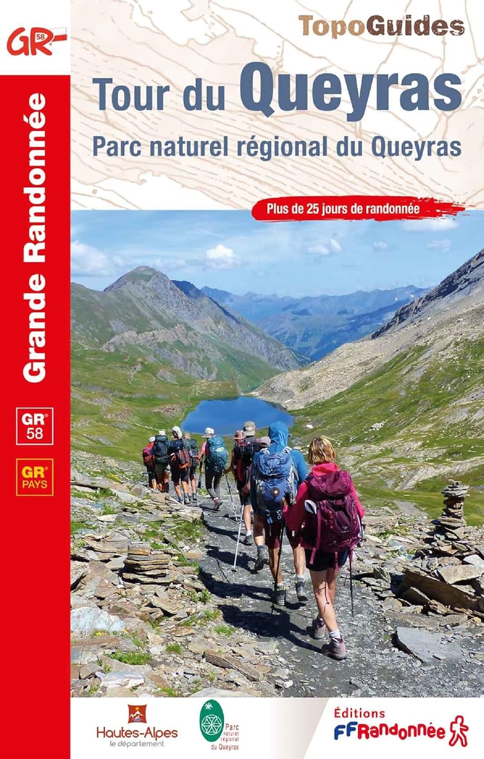
<p> Franstalige wandelgids met een beschrijving van een aantal dagtochten / rondwandelingen. Uitstekende beschrijvingen met duidelijk kaartmateriaal. Mislopen is nauwelijks mogelijk, maar ja .. de franse taal! Ook praktische informatie staat in deze gids. De gids bevat een lijst met overnachtingsadressen inclusief telefoonnummers en vaak aangevuld met websites/mailadressen. Alle gidsen bevatten een door ons toegevoegde uitgebreide frans - nederlandse wandelwoordenlijst.</p> <p> <span style="font-family: Arial, Helvetica, sans-serif; font-size: small;">En dépit de son altitude élevée (3 114 m au Grand-Queyras, de nombreux cols autour de 2 500 m), ce massif a le charme aimable de la montagne pastorale, avec ses forêts de mélèzes, ses eaux abondantes, ses alpages au pied des barres rocheuses. Ici, point de pentes de caillasse avant d'accéder aux cimes, mais des prairies ensoleillées, dont l'éblouissante floraison du mois de juin est connue de tous les botanistes.</span></p> <p style="font-family: Arial, Helvetica, sans-serif; text-align: -webkit-left; font-size: small; "> De nombreux lacs et cascades alimentent les ruisseaux qui courent près des hameaux aux chalets séculaires. Les sentiers décrits permettent de se bâtir un itinéraire à la carte, d'une journée de marche à 20 jours si l'on emprunte l'intégralité des GR<sup>®</sup>.</p>
€19,95
Bekijk product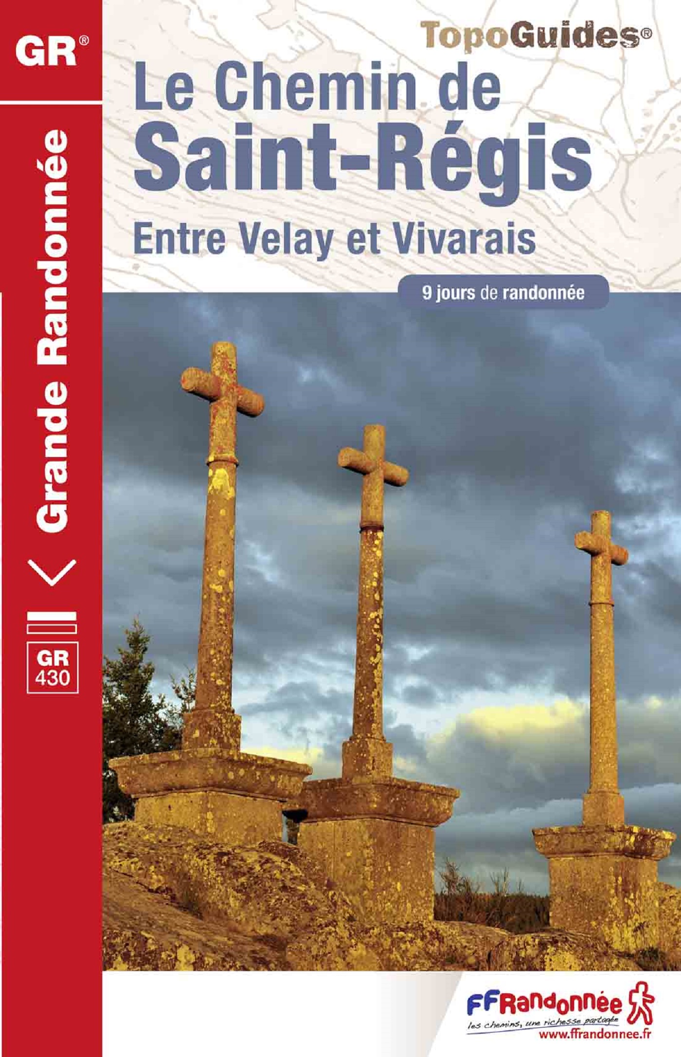
<p> Franstalige wandelgids met een beschrijving van een aantal dagtochten / rondwandelingen. Uitstekende beschrijvingen met duidelijk kaartmateriaal. Mislopen is nauwelijks mogelijk, maar ja .. de franse taal! Ook praktische informatie staat in deze gids. Alle gidsen bevatten een door ons toegevoegde uitgebreide frans - nederlandse wandelwoordenlijst.</p> <p> Criez " Régis " dans les rues de la plupart des villes, bourgs, hameaux de l'est de la Haute-Loire et des plateaux d'Ardèche...<br style="margin-top: 0px; margin-right: 0px; margin-bottom: 0px; margin-left: 0px; font-family: Arial, Helvetica, Verdana, sans-serif; text-align: left; background-color: rgb(251, 251, 251); " /> la moitié des hommes se retourneront ! Etonnant non ? Plus de 350 ans après sa mort, canonisé en 1737, Saint Régis fait toujours recette ! Saint patron des dentellières à la main, il aurait pu être également celui des marcheurs. Pour évangéliser dans le Velay et le Vivarais secoués par les Guerres de Religion, ne s'élance-t-il pas par tous temps dans de folles courses à travers monts, bois, gorges, landes ? Pèlerins et randonneurs d'aujourd'hui lui emboîtent le pas pour découvrir, en toute sérénité, des paysages émouvants à couper le souffle...</p>
€19,95
Bekijk product
<p> Franstalige wandelgids met een beschrijving van een aantal dagtochten. Uitstekende beschrijvingen met duidelijk kaartmateriaal. Mislopen is nauwelijks mogelijk, maar ja .. de franse taal! Ook praktische informatie staat in deze gids. Alle gidsen bevatten een door ons toegevoegde uitgebreide frans - nederlandse wandelwoordenlijst.</p> <p> La Provence Verte, terre de patrimoine, berceau de la culture provençale, vous offre une multitude de sentiers propices à la pratique de la randonnée pédestre. Cours d'eau, lacs, vignobles, oliveraies, abbayes, chapelles ont façonné le paysage de cette région bercée par le chant des cigales et riche en activités touristiques. Nous vous invitons à découvrir un autre visage de la Provence, plus doux, moins aride. Ce territoire doit son nom à la protection naturelle que lui apportent le Verdon, la Sainte Victoire, les Bessillons et le mythique massif de la Sainte-Baume. L’eau y est omniprésente, par le passage de l’Argens, par des rivières comme le Caramy, l’Huveaune, le Cauron et par des lacs comme ceux de Carcès et de Quinson. Conjuguée à la douceur du climat méditerranéen et au travail de l’homme, la nature a façonné des paysages vallonnés de forêts, de vignes et de champs d’oliviers.</p> <p> </p>
€15,50
Bekijk product
<p> Guidebook to walks and multi-day treks in the Carpathian mountains of Romania. Includes routes in the Maramures and Bucovina regions, Piatra Craiului ridge, and the Retezat and Fagaras mountains.</p> <div> This guide describes 27 short treks of 2-6 days and 10 day walks in the mountains of Romania. Although there is a slight focus on Transylvania, most of the main massifs are included, with chapters covering the Mountains of Maramures, the Eastern Carpathians, the mountains around Brasov, the Fagara?, the region between the Olt and the Jiu, the Retezat, the mountains of Banat and the Apuseni. Also included is an ascent of Moldoveanu, Romania's highest peak at 2544m.</div> <div> </div> <div> There is a wealth of advice to help you plan your trip and organise the logistics of your walk or trek. Some routes avail of the network of mountain huts; others offer opportunities to camp in attractive wild locations. Overviews and a route summary table make it easy to choose an appropriate excursion. Each route includes clear description and mapping, as well as notes on accommodation and access (some can be accessed by public transport, although others require either pre-arranged pick-up or hitchhiking). There are fascinating insights into Romania's colourful culture and history and appendices containing hut listings, useful contacts and a helpful glossary.</div> <div> </div> <div> The graded routes are as varied as Romania's diverse landscapes. They take in rolling hills, craggy karst peaks, glacial lakes and Europe's last virgin forests, with other highlights including Transylvanian castles, wooden churches, the Piatra Craiului ridge and the spectacular Sapte Scari (Seven Ladders) and Turda Gorges. Historic towns such as the medieval towns of Brasov and Sibiu and the spa resort of Vatra Dornei offer easy access to the mountains; other routes visit remote villages that have changed little over the centuries, where self-sufficiency is still very much the way of life. All in all, the guide is a perfect companion to discovering the unspoilt beauty of Romania's enchanting mountain regions.</div>
€26,50
Bekijk product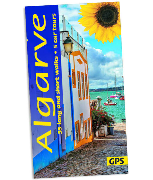
<p> Wandelgids voor de Algarve: vele dagtochten worden degelijk beschreven met openbaar vervoer informatie, goede routebeschrijvingen en kaartmateriaal. Tevens enkele autotochten. (Engelstalig)</p> <p> 'Few visitors explore beyond the beautiful Algarve coastline, but the Andersons did. They say, ‘We found a countryside full of interest and beauty. From flowers and fountains, hilltops and history, to windmills and watermills, we can set your feet wandering to find them all. But you can explore Algarve by car, too, searching out little-known points of interest — like the huge rose compass on the barren promontory of Sagres, where Prince Henry the Navigator founded his school of navigation. But don’t think that we have ignored the beautiful and rugged coastline. Wherever it is still unspoilt and free from development, we have incorporated it into a walk.’</p> <div> Area covered: from the west coast east to the Spanish border and north to the area around Monchique.</div> <div> When to go: The best months for walking in the Algarve are March to May or September and October, but winter walking is enjoyable too.</div> <div> </div> <div> 5 car tours, 55 long and short walks, picnic suggestions</div>
€21,95
Bekijk product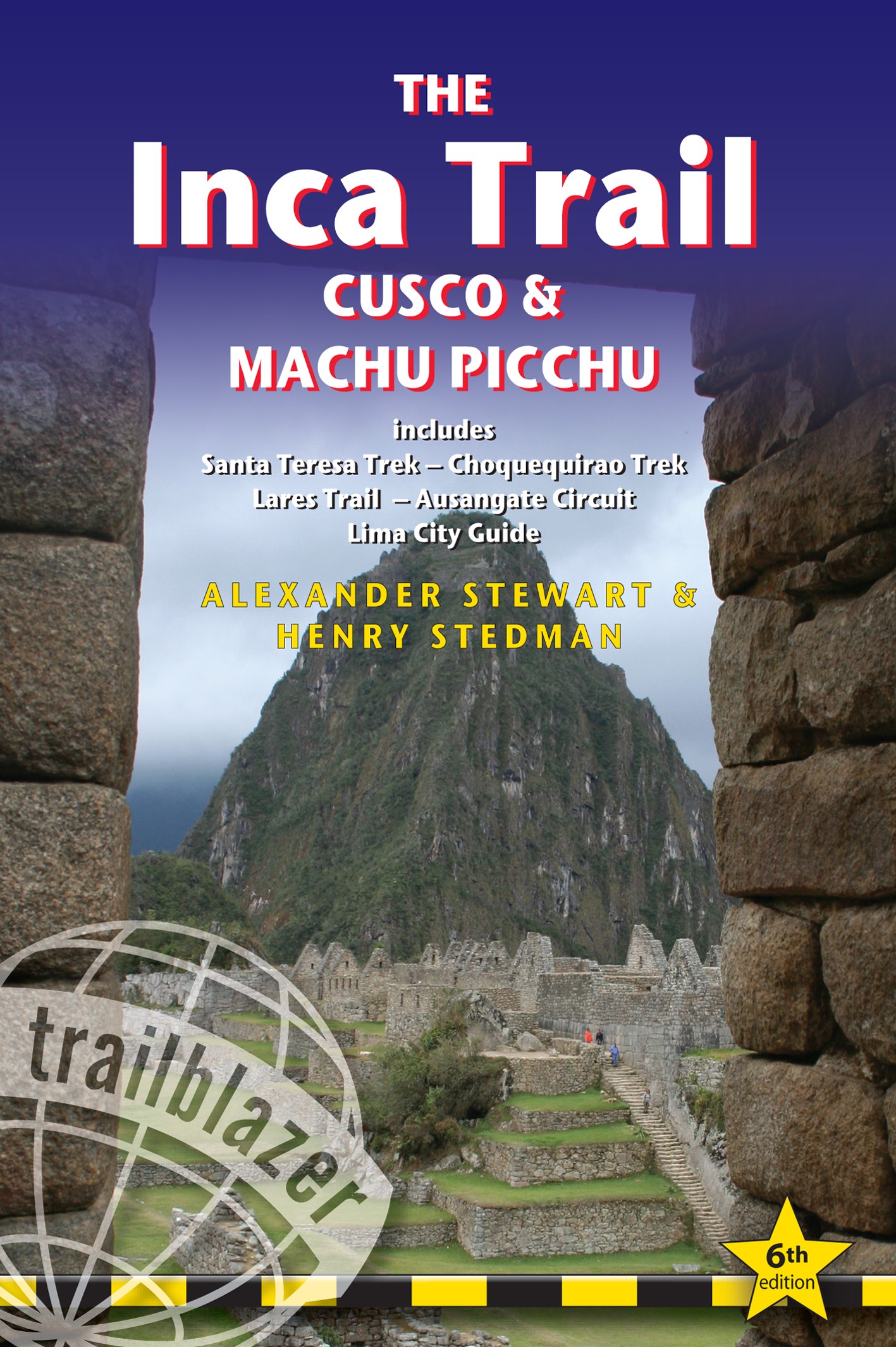
<p> Uitgebreide inleiding van de streek met veel aandacht voor geschiedenis, flora & fauna en tevens een stuk over Peru als geheel. Veel praktische informatie over de trekkings, een handleiding voor de ruïnes van Machu Picchu, uitgevoerd met veel schetskaarten. Engelstalig</p> <div> Fully revised 6th edition of this best-selling, all-in-one guide for hiking the Inca Trail. Includes Lima and Cusco city guides, route guide and maps for Classic Inca Trail, High Inca Trail, Salkantay, Choquequirao, Lares and Ausangate treks plus a full Machu Picchu guide.</div> <div> New for this edition</div> <div> </div> <div> Lares Trek - with 9 maps and trail profile</div> <div> Ausangate Trek - with 10 maps and trail profile</div> <div> Lost to the jungle for centuries, Machu Picchu was rediscovered by Hiram Bingham 100 years ago. It's now probably the most famous sight in South America – and justifiably so. Perched high above the river on a knife-edge ridge, the ruins are truly spectacular. The best way to reach them is on foot, following parts of the original paved Inca Trail over passes of 4200m (13,500ft) .</div> <div> </div> <div> This guide includes hiking options from two days to three weeks with 35 detailed hiking maps showing walking times, camping places & points of interest:</div> <div> Route guides and maps to: ● Classic Inca Trail ● High Inca Trail ● Salkantay Trek ● Choquequirao Trek ● Lares Trek ● Ausangate Trek</div> <div> Detailed guide to Machu Picchu</div> <div> In-depth information on all the other ruins around Cusco, as well as major sites such as Choquequirao, all the sites along the Inca Trail Vitcos, Espiritu Pampa etc</div> <div> Machu Picchu – Lost City of the Incas and one of the world's greatest sights</div> <div> Lima – street plans, what to see, where to stay and getting to Cusco</div> <div> Cusco – where to stay, where to eat, and what to see in the ancient Inca capital</div> <div> Practical information – planning your trip and getting to Peru</div> <div> History of the Incas – written by explorer and historian, Hugh Thomson</div> <div> Green hiking – how to minimise your impact on a fragile region</div> <div> Language guides – Spanish and Quechua</div> <div> Over 70 maps – town plans, Inca ruins, hiking maps</div> <div> Downloadable GPS waypoints</div>
€21,95
Bekijk product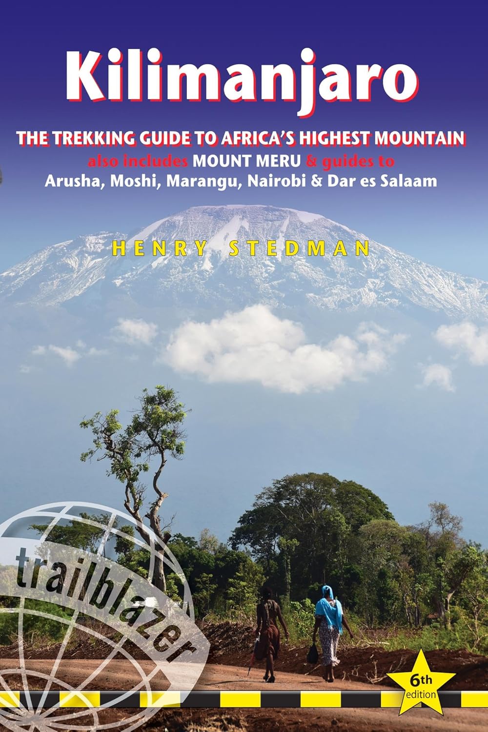
<p> Dat dit boek je met de planning helpt is geen loze kreet. Werkelijk alle facetten van de berg en zijn omgeving komen aan bod. De auteur geeft informatie over hoe je een reis naar de Kili kunt boeken, hoe je er komt, wat je er kunt verwachten en hoe je vervolgens de top kunt bereiken. Maar hij is ook erg duidelijk voor wat betreft het bereiken van die top: doe dat alleen onder begeleiding van een erkende gids en doe het op je gemak. Kilimanjaro is immers niet voor niets de hoogste berg van Afrika en daarmee één van de beruchte 'seven summits'.</p> <div> <div> Practical, best-selling guide to climbing Mount Kilimanjaro, Africa's highest mountain and most popular trek.</div> <div> </div> <div> Fully updated 6th edition with amendments in 2024.</div> <div> </div> <div> At 5895m (19,341ft) Kilimanjaro is Africa's highest mountain. Yet with no mountaineering skills necessary to reach the summit, even non-climbers can experience the thrill of climbing one of the world's greatest peaks. Taking you from the dusty plains of East Africa through jungle and moorland to the glacier-clad summit, this is one of the most beautiful and challenging treks there is.</div> <div> Trailblazer's Kilimanjaro guide includes:</div> <div> </div> <div> Comprehensive trail guide and maps (with GPS waypoints also downloadable from the Trailblazer website) to the six major routes: Machame, Marangu, Rongai (Loitokitok), Lemosho, Shira and Umbwe by an author who's climbed them all numerous times</div> <div> City guides - Where to stay, eat and what to see en route to Kili in: Dar es Salaam, Nairobi and gateway towns of Arusha, Moshi and Marangu</div> <div> Planning your trip and booking a trek with full reviews of trekking agencies - when to go, how to book</div> <div> Mount Meru - a popular pre-Kilimanjaro trek</div> <div> Background information - comprehensive history, geology, climate, flora and fauna - including a detailed bird spotter's guide and a flora identification section - plus cultural information on the Chagga people</div> <div> Porters' rights - how to help</div> <div> Health and safety</div> <div> Fully updated 6th edition of this best-selling guidebook to Africa's most popular trek. Kilimanjaro is the world's tallest freestanding peak. It's the most popular trek in Africa, both for independent trekkers and for charity organisations</div> <div> Routes covered on 35 detailed walking maps in the proven Trailblazer style; all walking times are indicated along with points of interest and gradients</div> <div> Extra colour sections plus a 16pp colour introduction to Kilimanjaro and the climb</div> </div> <p> </p>
€25,95
Bekijk product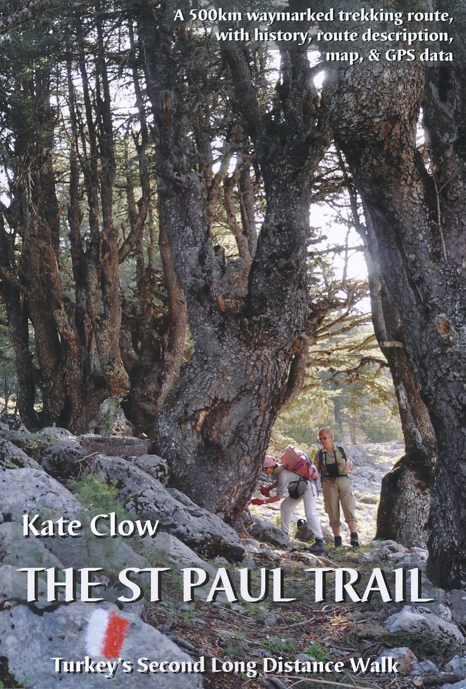
<p> De St Paul Trail is een nieuw bewegwijzerd pad in Turkije. Zoals het eerste GR-pad in Turkije, de Lycian Way, is ook dit pad vooral de creatie van de onvermoeibare Kate Clow, een engelse vrouw die al meer dan 15 jaar in Turkije woont. De afstand bedraagt ruwweg 600 km en het pad is volledig gemarkeerd vanaf 2003 en beschreven. Bovendien wordt alles “op de voet” gevolgd en begeleid met een uitstekende website. Erg uitgebreid gaat het boek in op de geschiedenis en exploratie van een aantal archeologische plaatsen die je op de tocht passeert. Hierdoor is het boek ook bruikbaar voor zij die niet zo geïnteresseerd zijn in wandelen maar wel in afgelegen en eerder onbekende vergane steden uit de klassieke periode. Het boek staat bol van praktische info en tips verzameld door jaren te wandelen in dit gebied.</p> <div> The landscape of Turkey's Toros mountains and lake district contrasts and combines inA brand new edition of the St Paul Trail guidebook, following the saint's journey from Perge, near Antalya, Turkey to Antioch in Pisidia. This book is the essential guide and map to Turkey's second long-distance walking route. St Paul Trail consists of about 500km of waymarked walking trail following Roman roads, village paths and medieval trails through the Toros mountains. The book is complemented by a map (included with the book), a website with updates to the trail (www.cultureroutesinturkey.com), an iphone app and downloadable GPS points. </div> <div> </div> <div> The landscape of Turkey's Toros mountains and lake district contrasts and combines in a jumbled geography of forest, canyon and ridges; the byways resound in history; hospitality is a natural instinct in every home. This enticing combination will delight any walker on Turkey's second long-distance trekking and Cultural Route. The peaks, lakes and valleys on this route offer a different perspective on Turkey from the Aegean and Mediterranean coastlines which draw so many tourists. Unlike the mountains of Eastern Turkey - the fabulous Kackar and the Aladaglar which attract adrenaline-fuelled adventure seekers during a short trekking season - the Toros mountains and lake district are easily accessible. Most importantly, the area has a visible, walkable history with some interesting challenges thrown in. St Paul's travels in the area provided the inspiration for this walking route.</div> <div> </div> <div> Turkey now has 15 long-distance routes for walkers, through a variety of terrain, and welcomes both day walkers and long-distance hikers. Both independent walkers and those walking with a group or agency will find the background information in this book adds to the enjoyment of their holiday.</div>
€25,95
Bekijk product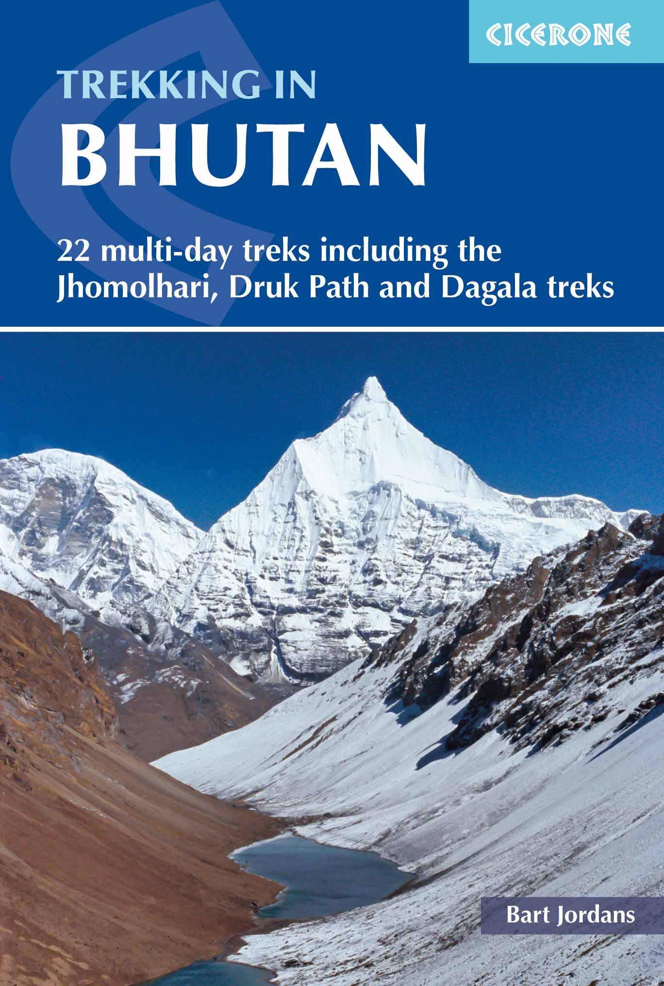
<p> Bijzondere uitgave van deze gerenommeerde wandelgidsen-uitgever: vol met dagtochten en meerdaagse trekkings in dit fascinerende koninkrijk. Praktische informatie als route, zwaarte etc en schetsmatig kaartmateriaal.</p> <p> A guidebook to 22 multi-day treks in the Himalayan Kingdom of Bhutan, including the Jhomolhari, Druk Path and Dagala treks. The trails vary from 2 to 23 days long. The routes are mostly in western and central Bhutan, and range from easy to strenuous depending on the length, altitude and difficulty. Includes advice on cultural awareness.</p> <div> Boasting soaring snow-clad peaks and tranquil valleys, and a rich Buddhist culture, Bhutan is an ideal destination for trekkers wishing to experience the magic of the Himalaya without the commercialism. Although independent trekking is not permitted, it can nonetheless prove difficult to obtain information. This guide describes 22 official treks and a handful of trek variants, with comprehensive advice about planning and preparation and plentiful cultural information to enhance any visit.</div> <div> </div> <div> You will find thorough coverage of all the practicalities, with notes on trekking seasons, outfitters, transport, accommodation and food, ethics and etiquette, equipment and medical considerations (including safety at altitude). The guide also offers a fascinating insight into Bhutanese mountain life, from local superstitions and beliefs to plants, wildlife and yak husbandry. Route description is presented alongside sketch mapping and information on local points of interest.</div> <div> </div> <div> Included are the classic Lunana 'Snowman' Trek, the Jhomolhari and Dagala Treks, and the Druk Path, as well as many other treks – both well-established trails and other routes of a more exploratory nature, venturing into remote and seldom-visited areas of the country. Visitors to Bhutan can expect breathtaking mountain scenery and unspoilt landscapes, a vibrant culture and genuine hospitality. Trekking here is a truly unique experience, promising memories that will last a lifetime</div>
€27,95
Bekijk product