
Beantwoord enkele vragen, en binnen seconden geeft AI je een persoonlijk aankoopadvies op maat.
Beantwoord enkele vragen, en binnen seconden geeft AI je een persoonlijk aankoopadvies op maat.
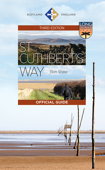
<p> This 100k (60 mile) walk was opened in 1996 and has rapidly increased in popularity, with thousands of walkers walking all or parts of it every year. Visiting a number of places closely associated with St Cuthbert's life, the journey is full of historical interest and natural beauty. It can be tackled in its entirety, or sections can be walked separately, making an ideal day or weekend outing. Today's pilgrims travel from Melrose in the Scottish Borders to the Holy Island causeway at Beal. In the right conditions, the path across the sand here makes a superb finale to the walk.<br /> <br /> This completely revised edition of the Official Guide adds an entirely new full-colour folding map, prepared by leading Scottish cartographer Nicolson Maps for this edition, and packaged with the Guide in a weatherproof wallet. It is illustrated in full colour with photographs throughout and new maps (also by Nicolson Maps) at the opening of each section. Full of information about the historical and natural features of the route, the Guide also covers appropriate equipment for walkers, way-marking, car parking, accommodation and the Country Code. After the walk, the Guide makes a wonderful souvenir of one of Britain's most evocative long-distance ways.</p>
€23,95
Bekijk product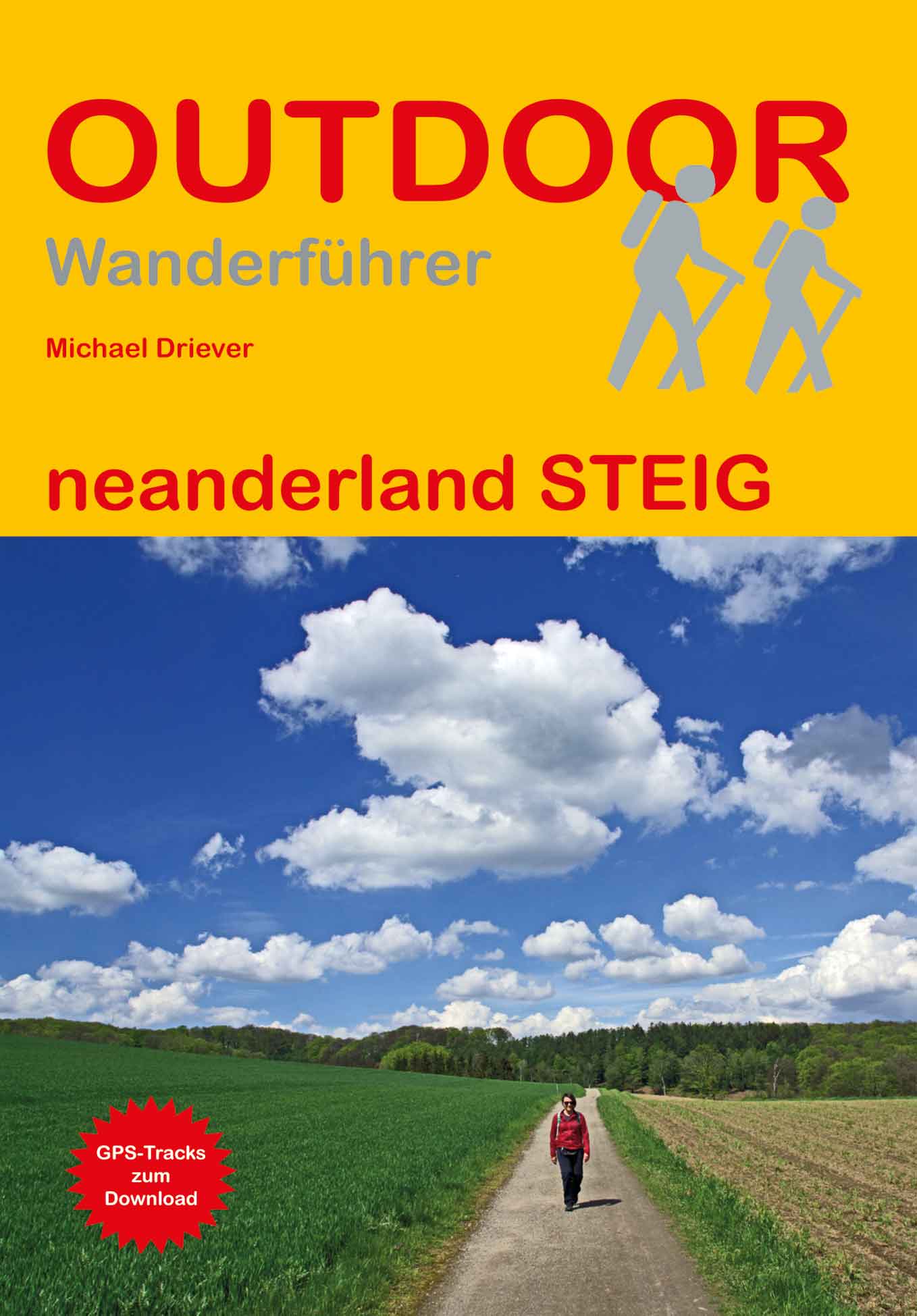
<p> Handzaam boekje met de routebeschrijving inclusief een heleboel praktische informatie. De beschrijving is uitstekend, maar kaarten zijn beperkt en schetsmatig aanwezig. Duits.</p> <div> Im Neandertal zwischen Erkrath und Mettmann wurden 1856 die Überreste eines vor 40.000 Jahren ausgestorbenen Urmenschen gefunden. Er erhielt den Namen Neandertaler. Hier, im sogenannten Neanderland, zeigt das Neanderthal Museum die Geschichte der Menschheit.</div> <div> In 17 Etappen führt der Rundwanderweg neanderland STEIG über 240 km durch Wälder und Moore, vorbei an Seen und Heiden, aber auch zu Bauernhöfen, Fachwerkhäusern, Gasthäusern, Museen und Überresten der Industrialisierung. Besonders attraktiv: Der neanderland STEIG kann von Großstädten wie Düsseldorf, Essen und Wuppertal in Tagesetappen erwandert werden. Jede Etappe ist auch gut mit Bus und Bahn zu erreichen.</div> <div> Der Wanderführer bietet eine ausführliche Wegbeschreibung mit Karten, Höhenprofilen, einer Übersichtskarte und GPS-Tracks gepaart mit Informationen zu Kultur und Geschichte, Anreise, Einkehr- und Unterkunftsmöglichkeiten. Empfehlungen für kurze Abstecher zu Sehenswürdigkeiten ergänzen die Wegbeschreibung.</div>
€17,50
Bekijk product
<p> Uitstekende wandelgids van dit gebied. Goed beschreven met veel praktische informatie om de routes te kunnen lopen, inclusief redelijke kaarten.</p> <div> This guidebook describes 38 walking routes in Ticino, the Swiss canton with a Mediterranean twist. Towering snowcapped mountains and lush, narrow valleys overlook stylish lakeside resorts with palm-fringed promenades and handsome Italianate architecture. It's not just the Italian language that sets Ticino apart: the food, sunny weather and stunning landscapes attract millions of visitors to this part of the southern Alps every year.</div> <div> </div> <div> As for the walks, it's the variety - as much as the fabulous scenery - that provides the draw. In this book you'll find everything from level walks along the shores of Lakes Lugano and Maggiore, to more challenging trails through craggy, forested valleys with gushing waterfalls and ancient stone-built villages, to isolated mountain huts right at the permanent snowline. If you think you already know Switzerland, but haven't walked in Ticino, a stunning experience awaits you - and all of the routes are easily accessible through a network of buses, trains, funiculars, cable cars and chairlifts.</div>
€24,95
Bekijk product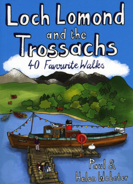
<div> <div> Handige compacte wandelgids met 40 dagwandelingen. Deze gids bevat kleine kaartjes en leuke uitgebreide informatie over wat er langs de route te zien is. Goede wandelkaarten zijn echter we noodzakelijk voor deze tochten: de Ordnance Survey explorer maps of Landanger maps zijn zeer geschikt.</div> <div> </div> </div> <div> </div> <div> The new Loch Lomond National Park has ensured protection for what is not only Britain's largest freshwater lake, but one of its most beautiful, celebrated in ballad and song. West of Loch Lomond are the steep Arrochar Alps towering above Loch Long together with scores of much less visited lower hills stretching down to the seaboard. To the east is the Trossachs - a delightful landscape of forests, lochs and hills that has long been known as Scotland in miniature.</div> <div> </div> <div> This latest pocket guide features 40 of the best walks in this popular area in an attractive and accessible format.</div>
€10,95
Bekijk product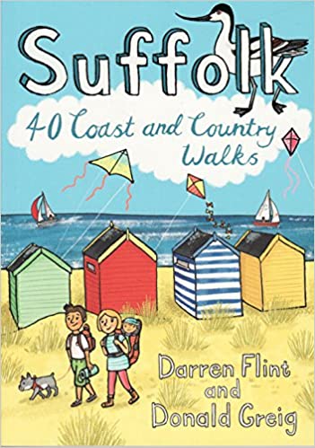
<div> <div> Handige compacte wandelgids met 40 dagwandelingen. Deze gids bevat kleine kaartjes en leuke uitgebreide informatie over wat er langs de route te zien is. Goede wandelkaarten zijn echter we noodzakelijk voor deze tochten: de Ordnance Survey explorer maps of Landanger maps zijn zeer geschikt.</div> <div> </div> </div> <div> </div> <div> Suffolk has long been a place of retreat, somewhere to escape to, far from everyday life. It may have its busier town centres, but in the main Suffolk remains a rural area of enormous variety , from heather covered heathland to softly rolling hills, long shingle spits to genteel coastal enclaves and kiss-me-quick seaside resorts. Whether you are looking for a morning hike or an afternoon stroll, Darren Flint and Donald Grieg's hand picked selection of 40 walks is guaranteed to fit the bill - or the boot.</div> <div> </div> <div> Suffolk boasts 5,600km of public rights of way; take your pick, put your best foot forward and discover this most gentle of English counties.</div>
€10,95
Bekijk product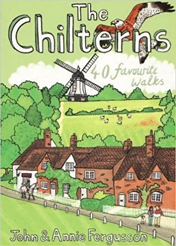
<div> <div> Handige compacte wandelgids met 40 dagwandelingen. Deze gids bevat kleine kaartjes en leuke uitgebreide informatie over wat er langs de route te zien is. Goede wandelkaarten zijn echter we noodzakelijk voor deze tochten: de Ordnance Survey explorer maps of Landanger maps zijn zeer geschikt.</div> <div> </div> </div> <div> </div> <div> With some of the most picturesque countryside in England, yet only a short hop from London, the Chiltern Hills are just waiting to be explored. The glorious views from high ridges, ancient woodlands brimming with wildlife and downs alive with wild flowers and butterflies make the Chilterns and the communities within them English to the core. The vast network of well-established paths provides a wonderful walking country with history and nature keeping you company at every step.</div> <div> </div> <div> If you are planning to get away from it all in the Chilterns, this collection of 40 moderate walks is your perfect guide.</div>
€10,95
Bekijk product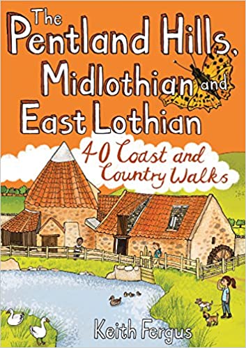
<div> <div> Handige compacte wandelgids met 40 dagwandelingen. Deze gids bevat kleine kaartjes en leuke uitgebreide informatie over wat er langs de route te zien is. Goede wandelkaarten zijn echter we noodzakelijk voor deze tochten: de Ordnance Survey explorer maps of Landanger maps zijn zeer geschikt.</div> <div> </div> </div> <div> </div> <div> Think of East Lothian and Midlothian and a low-lying, predominantly rural landscape may well spring to mind, yet the Pentland Hills, just south of Edinburgh, rise to nearly 600m in height and provide some of the finest hillwalking in Scotland with wonderful views from the summits. To the east, the Lammermuir Hills may not have quite the same appeal as their near neighbours but they still offer superb hillwalking options, while North Berwick Law, Traprain Law and the Garleton Hills make up for what they lack in height with a succession of incredible panoramas. Away from the high ground there a lovely pockets of woodland, wildlife-rich country parks, fascinating historic sites and forty miles of coastline between Musselburgh and Dunbar with some of the best dune-backed beaches in the country to enjoy.</div> <div> </div>
€10,95
Bekijk product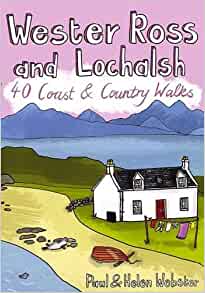
<div> <div> Handige compacte wandelgids met 40 dagwandelingen. Deze gids bevat kleine kaartjes en leuke uitgebreide informatie over wat er langs de route te zien is. Goede wandelkaarten zijn echter we noodzakelijk voor deze tochten: de Ordnance Survey explorer maps of Landanger maps zijn zeer geschikt.</div> <div> </div> </div> <div> </div> <div> Wester Ross and Lochalsh are amongst the most popular areas for walks in the Scottish Highlands. The Lochalsh peninsula between the shores of Loch Duich and Loch Carron offers varied walking from villages such as Plockton as well as the region's main town at Kyle of Lochalsh. Across the dramatic Mam Ratagan pass is the remote and secluded Glenelg peninsula, a tranquil and peaceful haven far from busy routes.</div> <div> </div> <div> Further north are Applecross and Lochcarron, with mountains that yield nothing in ruggedness to their more famous counterparts in Torridon, as well as attractive fishing villages and forest walks. Finally around Gairloch is an area that has long been famous for its fine sandy beaches, many of them still very quiet. Inland is a vast area of little-visited, rocky peaks known to walkers as 'The Great Wilderness'.</div> <div> </div> <div> This latest pocket guide features 40 of the best walks in this popular area in an attractive and accessible format.</div>
€10,95
Bekijk product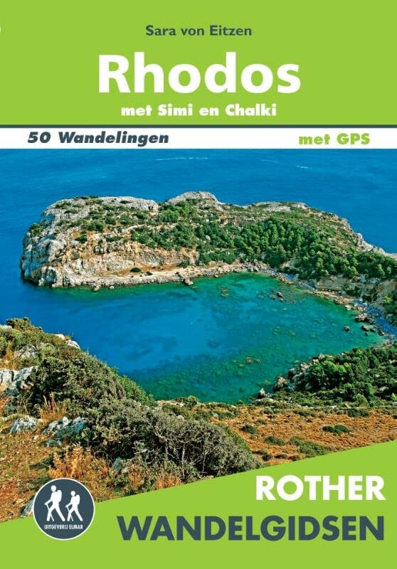
<p> De Rother wandelgids Rhodos bevat 50 wandelingen voor zowel de beginnende als de ervaren wandelaar. Met: * Betrouwbare routebeschrijvingen * Gedetailleerde kaarten * Informatieve hoogteprofielen * Downloadbare GPS Tracks</p> <div> Let op: er is enige verwarring omtrent het jaartal van deze Nederlandse wandelgidsen van uitgever Elmar. Dit is een vertaling van de Duitse uitgever Rother maar daarna NIET bijgewerkt. De datum die wij vermelden is het moment van vertaling; er zijn andere – meer recente jaartallen – in omloop maar dat is de datum van een nieuwe druk ZONDER aanpassingen. Wilt u de meest recente wandelgids van dit gebied van deze uitgever: kies dan de Duitstalige versie van uitgever Rother. Deze zijn recent en WEL bijgewerkt. </div> <div> </div>
€19,99
Bekijk product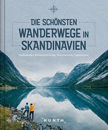
<p> Wer über das Fernwandern in Skandinavien spricht, der wird früher oder später auch vom Kungsleden erzählen. Immerhin ist der Königsweg einer der bekanntesten Trekking-Trails Europas. Endlose Weiten der Tundra, die hohen Gipfel des Fjells, Seen und Fjorde - die Natur im hohen Norden ist abwechslungsreich und besitzt mit Elchen und Co. eine faszinierende Tierwelt. Und gibt es eine bessere Möglichkeit, diese überwältigende Landschaft zu erkunden, als zu Fuß? Die schönsten Wanderwege in Skandinavien umfasst dabei nicht nur Fernwanderwege wie den Kungsleden oder den Olavsvegen, sondern auch Tagestouren, die zeigen, dass die Natur oft schon direkt vor den Stadttoren beginnt. Echte Abenteuer und pure Wildnis erleben, Ausführliche Vorstellung der Treks in Wort und Bild, Mit detailreichen Karten zur Orientierung.</p>
€32,50
Bekijk product