
Beantwoord enkele vragen, en binnen seconden geeft AI je een persoonlijk aankoopadvies op maat.
Beantwoord enkele vragen, en binnen seconden geeft AI je een persoonlijk aankoopadvies op maat.
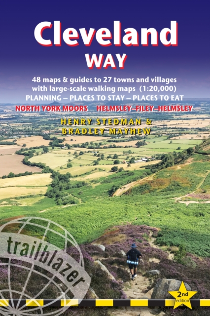
<div> All the information you need to enjoy your hiking adventure along the Cleveland Way in this fully revised and updated 2nd edition. In the beautiful, wild countryside of the North York Moors National Park in northern England lies this fabulous trail, the Cleveland Way. The 110-mile route runs from Helmsley near Thirsk around the western edge of the park to reach the coast at Saltburn-by-the-Sea.</div> <div> </div> <div> It then continues along the eastern edge of the park south down the coast through Whitby, Robin Hood's Bay and Scarborough to finish in Filey. Combining moorland and coast there's wonderful scenic variety to this walk, with crumbling castles and idyllic fishing villages to explore. The guide includes:48 large-scale walking maps - at just under 1:20,000 - showing route times, places to stay, places to eat, points of interest, and 8 town plans10 colour stage maps to help plan your walk, including hills and descents, and two colour overview mapsPlaces to stay with reviews - campsites, bunkhouses, hostels, B&Bs, pubs and hotelsPlaces to eat with reviews - cafes, teashops, pubs, takeaways, restaurantsWhat to see from the path - history, culture, natural historyComprehensive public transport information - for all access points on the WayFlora and fauna - four page full colour flower guide, plus an illustrated section on local wildlifeItineraries for all walkers - whether walking the route in its entirety over two weeks or sampling the highlights on day walks and short breaksGreen hiking - understanding the local environment and minimizing our impact on itGPS waypoints</div>
€21,95
Bekijk product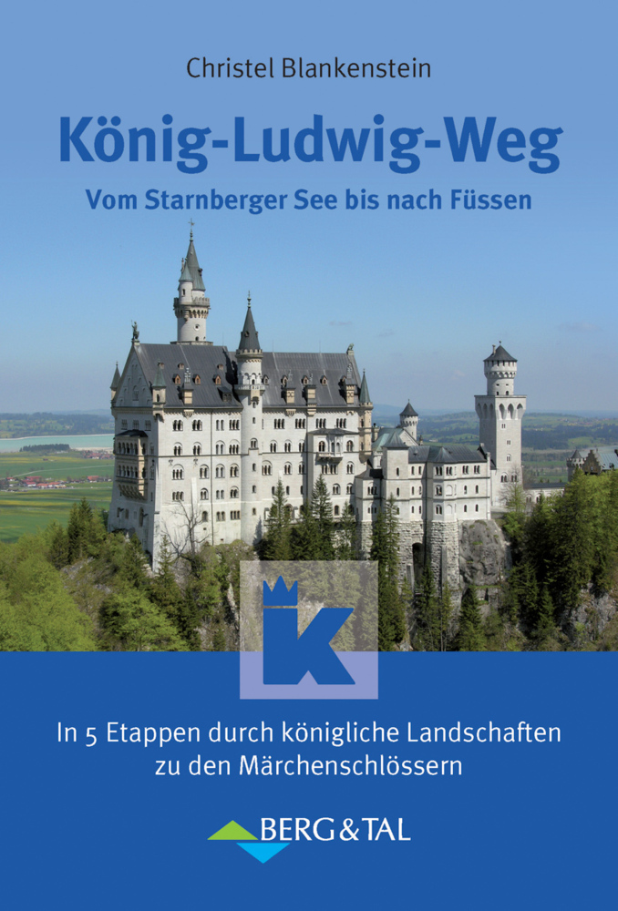
<p> Einer der beliebtesten Weitwanderwege im süddeutschen Raum ist der König-Ludwig-Weg. Durch die romantische Landschaft des Pfaffenwinkels geht es auf leichten Wegen und Steigen vom Starnberger See zum Ammersee, hinauf zur Prachtaussicht auf den auch "Bayerischer Rigi" genannten Hohen Peißenberg, hinab in die wilde Ammerschlucht, über liebliche Hügel zu barocken Kirchen und Klöstern, bis letztlich die Schlösser Neuschwanstein und Hohenschwangau und das malerische Städtchen Füssen erreicht werden. In 5 bis 8 Tagen oder mehr können auch Wanderanfänger die rund 110 oder 150 km lange Strecke bewältigen. Im Buch finden sich dazu genaue Wegbeschreibungen, Übersichtskarten, Touristik- und Internetadressen, ein Übernachtungsverzeichnis sowie Angaben zu Wandern ohne Gepäck, außerdem ein Service-Teil. Hervorzuheben sind die vielen Informationen zu Sehenswürdigkeiten, Natur, Kultur und Geschichte.</p>
€17,95
Bekijk product
<p> The Annandale Way is a charming long walk in a little-known, but very accessible, part of southern Scotland. Walked southward from source to the sea, it starts in the sheep town of Moffat, and runs for 56 miles (90 km) via Lochmaben, with superb views from the top of Almagill Hill. A slightly shorter branch of the route goes via Lockerbie and Eskrigg Nature Reserve. The two branches rejoin north of Annan to reach the Solway Firth at Newbiebarns. </p> <div> This guidebook contains everything you need to plan and enjoy your trip:</div> <div> </div> <ul> <li> detailed route description for walking from north to south</li> <li> foreword by broadcaster Stephen Jardine</li> <li> background on the history and economy of Annandale</li> <li> seven pages of habitats and wildlife with superb images</li> <li> planning information for transport and accommodation</li> <li> seven pages of detailed mapping of the route at 1:44,000</li> <li> summary of each section showing distance, terrain and food/drink stops</li> <li> concise directions for those who prefer to walk south to north</li> <li> lavishly illustrated, with over 100 colour photographs</li> <li> rucksack-friendly format, printed on rainproof paper.</li> </ul>
€19,95
Bekijk product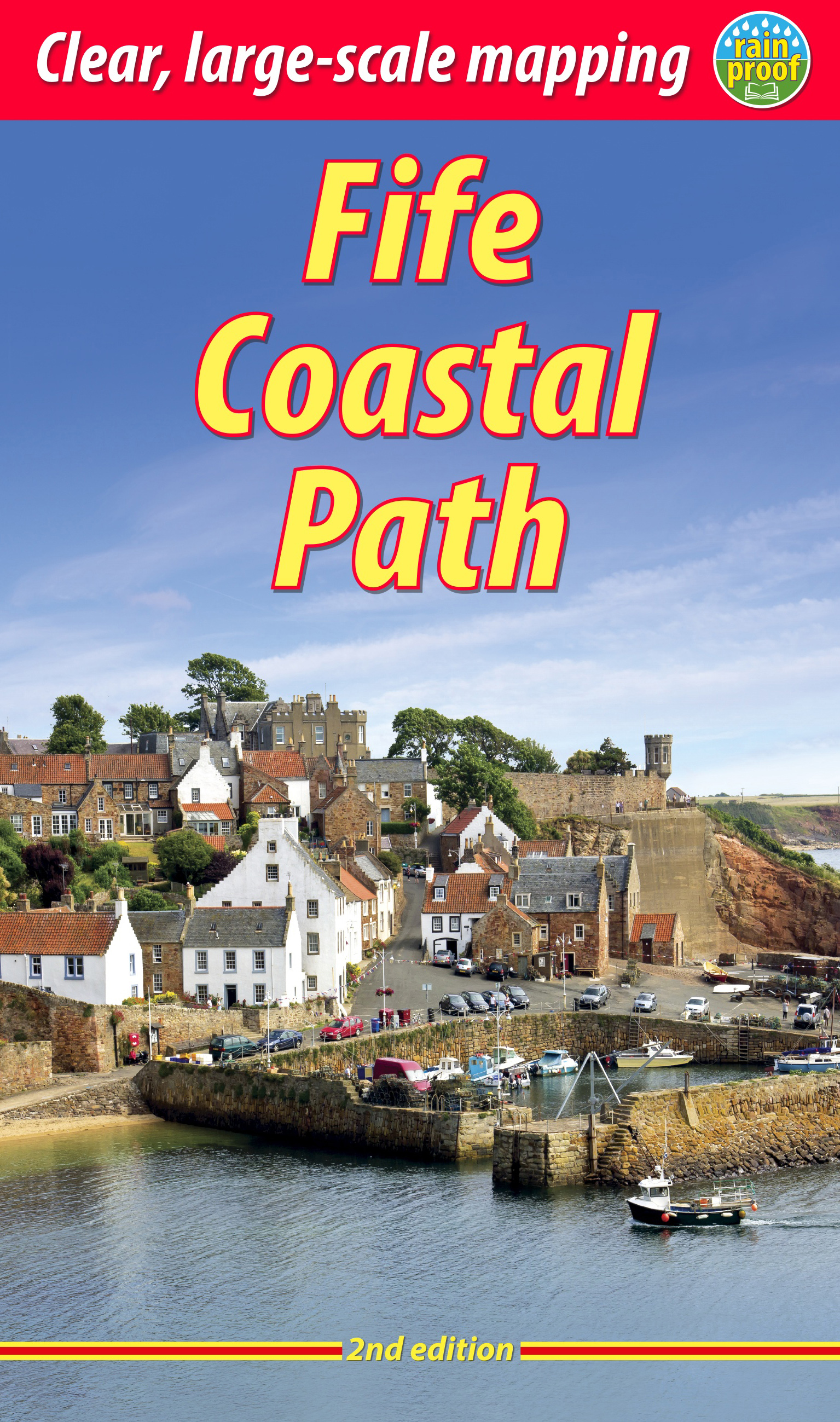
<p> The Fife Coastal Path runs around the coastline of eastern Scotland for 117 miles (187 km) from Kincardine on the Forth to Newburgh on the Tay. Starting west of the famous Forth bridges, the route heads through former mining towns towards the villages of Fife's East Neuk (corner), with their rich tradition of smuggling and fishing. After rounding Fife Ness, the route follows the coastline through St Andrews, golf capital of the world and former religious centre of Scotland.Fife has long played an important part in Scottish history and the route passes many castles, towers and churches. There are splendid views along the coast and over the Firths of Forth and Tay, with great chances to sight seabirds, seals and dolphins. The villages have welcoming pubs, famous fish-and-chip shops and good B&Bs. Transport by train and bus makes for easy access throughout.</p> <div> The guidebook contains everything you need to plan and enjoy the Fife Coastal Path – on foot, or on a bike where cycling is appropriate:</div> <div> </div> <ul> <li> detailed directions for each section (walked anticlockwise from Kincardine)</li> <li> summaries showing distance, side-trips and food/drink stops</li> <li> background on history, landscapes and wildlife</li> <li> planning information for travel by bus, train, car and plane</li> <li> lavishly illustrated, with 100 colour photographs</li> <li> includes 16 pages of mapping at 1:45,000</li> <li> rucksack-friendly format, and printed on rainproof paper.</li> </ul>
€23,95
Bekijk product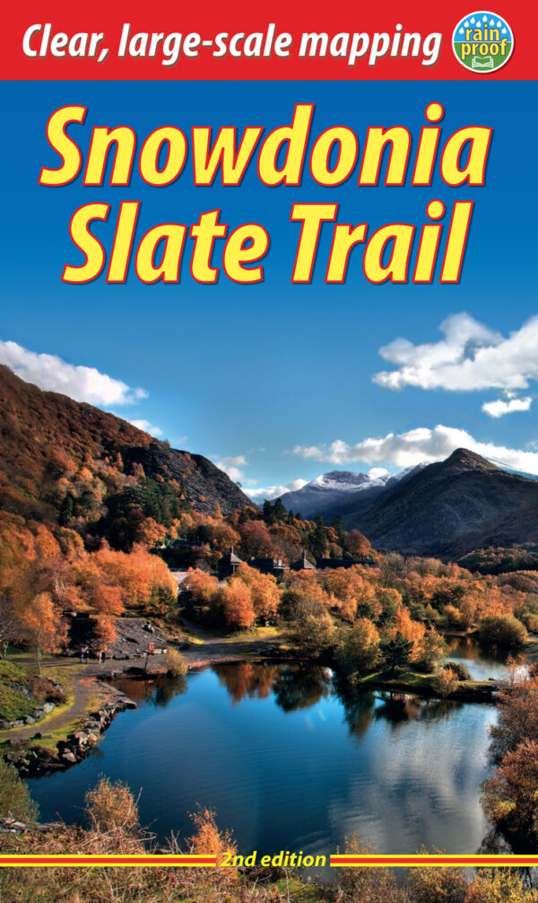
<div> <div> The Snowdonia Slate Trail is a waymarked trail that runs for 83 miles from Bangor on the North Wales coast, making a circuit through the heart of Snowdonia to end at Bethesda. The trail joins up villages with a choice of welcoming accommodation. The walking is varied, ranging from easy valleys to mountain passes, from wild moorland to river gorges.</div> <div> </div> <div> Highlights include the National Slate Museum of Wales, stunning views of Snowdon and nearby mountains, and abandoned slate villages high in the hills. The trail also passes the Penrhyn quarry with its impressive galleries of slate crossed by the longest, fastest zip-wire in Europe.</div> <div> </div> <div> This guidebook is in rucksack-friendly format and printed on rainproof paper. Lavishly illustrated with 95 colour photos, it contains large-scale mapping and all you need to plan and enjoy your holiday:</div> <div> </div> <ul> <li> 14 pages with clear mapping of the route at 1: 40,000</li> <li> practical information about public transport and travel</li> <li> section with inside knowledge on how best to climb Snowdon</li> <li> detailed route descriptions including where to find refreshments and accommodation</li> <li> background on the slate industry heritage, the ‘Great Little Trains of Wales’ and wildlife.</li> </ul> </div> <p> </p>
€22,50
Bekijk product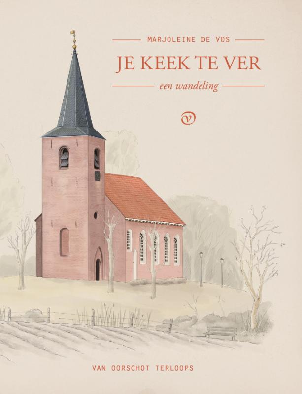
<p> Marjoleine de Vos wandelt elke dag een rondje vanuit haar huis in het Noord-Groningse Zeerijp. Onder een strakblauwe hemel, een grijs wolkendek of genadeloze regen, ze zijn er altijd: de akkers in bloei of kaal, de kraaien, de bomen in alle stadia van blad of niet blad, het kerkje van Eenum. Soms uien op het land, soms dollende hazen? alles is altijd hetzelfde en altijd anders, dat is de kracht van de herhaling. Er is niets te zien, en tegelijk heel veel.0Wie wandelt is verhevigd in de wereld en er tegelijkertijd helemaal uit. Je benen lopen, het zonlicht kijkt je ogen in of de regen maakt je aan het lachen onder je capuchon en je hoeft even nergens anders te zijn. Maar vaak zijn de gedachten maar al te druk bezig, alsof je helemaal niet door een landschap loopt maar uitsluitend door je eigen bange, drukke hoofd. Kijk om je heen, moet je dan tegen jezelf zeggen. Niet de tijd in, maar over het land. Je keek te ver. Dat wat je zoekt is hier.</p>
€13,50
Bekijk product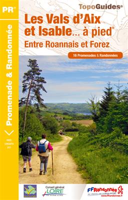
<p> Franstalige wandelgids met een beschrijving van een aantal dagtochten. Uitstekende beschrijvingen met duidelijk kaartmateriaal. Mislopen is nauwelijks mogelijk, maar ja .. de franse taal! Ook praktische informatie staat in deze gids. Alle gidsen bevatten een door ons toegevoegde uitgebreide frans - nederlandse wandelwoordenlijst.</p> <p> Situés à 30 min de Roanne et à moins d’une heure de Saint-Etienne, Lyon ou Clermont-Ferrand, les vals d'Aix et Isable vous attendent pour un grand bol d'air au plus près des gorges de la Loire !</p> <p> Nés de deux rivières, les Vals d'Aix et Isable descendent jusqu'au fleuve Loire, entre Roannais et Forez. Ici, les sentiers vous emmènent goûter à la fraîcheur et à la tranquillité de multiples cours d'eaux. petits et grands. Villages, chapelles, prieuré ou bourg médiéval prolongeront vos découvertes d'un territoire riche en hébergements touristiques. Desservis par les autoroutes A 72 et A 89, les Vals d'Aix et Isable sont à 30 min de Roanne et à moins d'une heure de Saint-Etienne, Lyon ou Clermont-Ferrand.</p>
€14,50
Bekijk product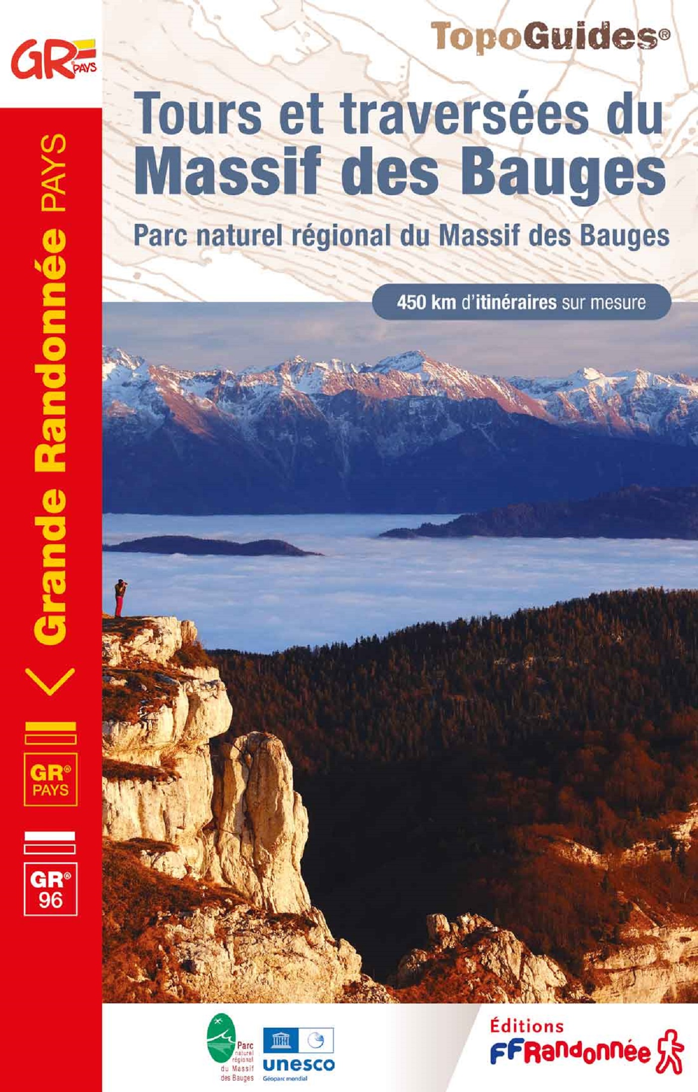
<p> Fout lopen wordt op deze manier wel erg moeilijk. Met symbolen is weergegeven welke voorzieningen (openbaar vervoer / winkels / overnachtingen) er zijn langs of bij de route. De gids bevat een lijst met overnachtingsadressen inclusief telefoonnummers, soms aangevuld met websites/mailadressen. Alle gidsen bevatten een door ons toegevoegde uitgebreide frans nederlandse wandelwoordenlijst.</p> <p> Les Bauges, du lac d'Annecy à Chambéry ou d'Albertville à Aix-les-Bains. Plus de 500 km de randonnée à la carte.</p> <div> Ambiances méditerranéennes des coteaux secs dominant Chambéry, sensations déjà alpines au cœur des Hautes-Bauges, ce massif riche de contrastes a su garder une authenticité montagnarde.</div> <div> </div> <div> Ses itinéraires de grande randonnée sont une invitation à la découverte de ses paysages, de ses habitants, de sa nature préservée, de ses hauts sommets et de ses produits du terroir.</div> <div> </div> <div> Des tours de un à six jours, des traversées reliant le lac d'Annecy à Chambéry, ou Albertville et Ugine à Aix-les-Bains, le réseau de chemins du Parc naturel régional du Massif des Bauges vous est offert.</div>
€19,95
Bekijk product
<p> Handzaam boekje van Kreta met de routebeschrijving inclusief een heleboel praktische informatie. De beschrijving is uitstekend, maar kaarten zijn beperkt en schetsmatig aanwezig. Duits.</p> <p> Hohe Berge, tiefe Schluchten, einsame Strände, dazu so viel Sonne wie kaum anderswo in Europa: Nicht ohne Grund ist Kreta ein beliebtes Ziel zum Wandern. Auf dem Fernwanderweg E4 kann man die Kultur und Landschaft der Mittelmeerinsel besonders intensiv erleben – allerdings wurde abgesehen von beliebten Tageswanderzielen kaum in die Instandhaltung des Weges investiert. </p> <p> Nach dem Motto „Qualität statt Quantität“ beschreibt dieser Wanderführer deshalb nicht den gesamten E4, sondern begleitet Sie auf Touren durch die Lefka Ori (Weiße Berge) sowie in der Lasithi-Region. Detaillierte Karten, Höhenprofile und GPS-Tracks helfen bei der Orientierung, außerdem finden Sie Tipps für gute Zeltplätze sowie allgemeine Infos zum Weg und zur Region.</p>
€15,50
Bekijk product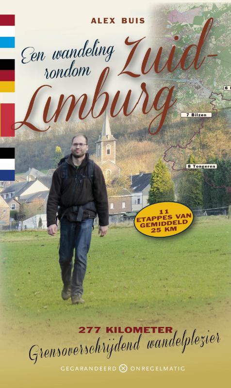
<p> Alex Buis is geen man van de gebaande paden. Na zijn Magnum Opus Wandelen buiten de binnenstad van Amsterdam vond hij rondom Zuid-Limburg een compleet nieuwe uitdaging. In 11 etappes van gemiddeld 25 kilometer komt de wandelaar terecht op plaatsen waarvan hij het bestaan niet had kunnen vermoeden. Zorgvuldig vermijdt hij in deze gids de platgetreden wandelpaden van ons toeristische Limburg.</p> <p> Het zijn stevige wandelingen langs ingeslapen dorpjes, waar de plaatselijke bevolking nog opkijkt als een toerist aan de toog verschijnt en meegeniet van een goede pot bier. Hij doet in zijn tocht van 11 etappes maar liefst drie landen aan en -als we Neutraal Moresnet nog mee zouden rekenen- eigenlijk vier. Hij doorkruist het ene na het andere taalgebied en de wandelaar moet doorlopend schakelen van Duits naar Frans en Nederlands. Misschien kan hij in het voormalige Neutraal Moresnet zelfs nog met Esperanto terecht.</p> <p> Het is een op en top internationale wandeling waarbij alle begin- en eindpunten rechtstreeks met de bus of met de trein vanuit Zuid-Limburg bereikbaar zijn.</p>
€17,95
Bekijk product