
Beantwoord enkele vragen, en binnen seconden geeft AI je een persoonlijk aankoopadvies op maat.
Beantwoord enkele vragen, en binnen seconden geeft AI je een persoonlijk aankoopadvies op maat.

<p> Goede - Duitstalige - wandelgids met veel dagtochten verspreid over het gebied. Beschrijvingen zijn voldoende en praktische informatie is handig. Kaartjes beperkt.</p> <p> Das sagenumwobene Riesengebirge lockt mit einer fast unerschöpflichen Fülle hervorragender Wanderziele. In diesem höchsten und meistbesuchten Gebirgszug der Sudeten findet der Wanderer Gipfel und Bergwiesen mit phänomenalen Aussichten, gewaltige Felsszenerien, wasserfalldurchtoste Schluchten, artenreiche Laubwälder, Wollgrasmoore und Seen sowie die fantastischen Felsenstädte von Adersbach, Teplice und Prachov. Gemeinsam mit dem Isergebirge bildet das Riesengebirge eine naturräumliche Einheit, die zu einem großen Teil unter Naturschutz gestellt wurde.<br /> Die wandertouristische Infrastruktur im vorgestellten Gebiet ist vorbildlich. Das dichte, perfekt ausgeschilderte Routennetz bietet vom bequemen Weg über gesicherte Felssteige bis zum naturnahen Pfad viele Möglichkeiten. Die zahlreichen Bauden offerieren neben einer köstlichen Küche auch die Möglichkeit zu herrlichen Mehrtageswanderungen. In diesem Gebirge, das zu einem Drittel auf polnischem, zu zwei Dritteln auf tschechischem Gebiet liegt, kommen gemütliche Wanderer ebenso auf ihre Kosten wie abenteuerfreudige; für Radfahrer ist es dank der zahlreichen für den öffentlichen Verkehr gesperrten Wirtschaftswege ein vorzügliches Radwandergebiet und Kletterer finden Tausende von Kletterrouten in den Felsenstädten. Ein besonderer Reiz dieses gar nicht riesenhaften Riesengebirges (flächenmäßig ist es nicht einmal halb so groß wie der Harz) liegt darin, dass man nach kürzester Zeit mit der Gegend vertraut wird - kurz: Im Riesengebirge kann man sich rundum wohlfühlen!<br /> Die dritte, überarbeitete Auflage bietet neben detaillierten Tourenbeschreibungen und Wanderkärtchen mit eingetragenem Routenverlauf nun auch aussagekräftige Höhenprofile zu jeder Tour. Ein gelungener Wanderführer, der neugierig macht, ein interessantes und vielfältiges Wandergebiet wiederzuentdecken.</p>
€18,50
Bekijk product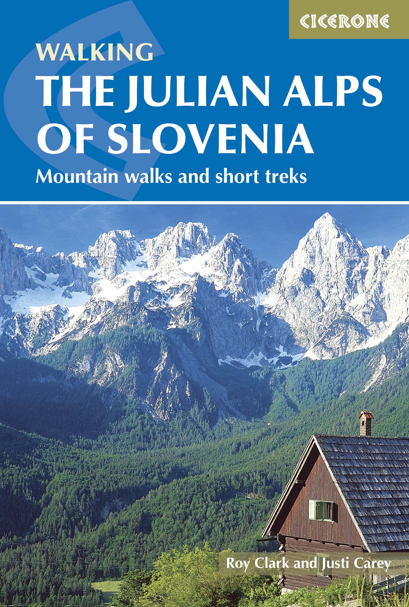
<p> Engelstalige wandelgids met 57 dagtochten en 4 trekkings door de Julische Alpen. Goede omschrijvingen van de tochten met alle noodzakelijke praktische info alsmede - beperkt - kaartmateriaal.</p> <p> <strong>Aanbevolen wandelkaarten bij deze gids</strong></p> <p> Gebied 1 <a href="https://www.dezwerver.nl/r/europa/oostenrijk/karinthie/c/kaarten/wandelkaarten/9783990444580/wandelkaart-064-julische-alpen-alpi-giulie-kompass/">Wandelkaart 064 Julische Alpen - Alpi Giulie | Kompass</a> 1:25.000</p> <p> <a href="https://www.dezwerver.nl/r/europa/slovenie/julische-alpen/c/kaarten/wandelkaarten/3830008646330/wandelkaart-triglav-kranjska-gora-bohinj-julische-alpen-sidarta/">Wandelkaart Triglav - Kranjska Gora – Bohinj – Julische Alpen | Sidarta</a> 1:25.000</p> <p> Gebied 2 <a href="https://www.dezwerver.nl/r/europa/slovenie/julische-alpen/c/kaarten/wandelkaarten/3830008646316/wandelkaart-bohinj-triglav-krn-crna-prst-julische-alpen-sidarta/">Wandelkaart Bohinj Triglav, Krn, Crna prst – Julische Alpen | Sidarta</a> 1:25.000</p> <p> Gebied 3 <a href="https://www.dezwerver.nl/r/europa/slovenie/julische-alpen/c/kaarten/wandelkaarten/3830008646361/wandelkaart-bovec-trenta-julische-alpen-sidarta/">Wandelkaart Bovec Trenta - Julische Alpen | Sidarta</a></p> <p> Gebied 4 <a href="https://www.dezwerver.nl/r/europa/slovenie/julische-alpen/c/kaarten/wandelkaarten/3830048523202/wandelkaart-2-pocketmap-bled-kartografija/">Wandelkaart 2 Pocketmap Bled | Kartografija</a></p> <p> Gebied 5 <a href="https://www.dezwerver.nl/r/europa/slovenie/julische-alpen/c/kaarten/fietskaarten/3830048522540/wandelkaart-fietskaart-posocje-kartografija/">Wandelkaart - Fietskaart Posocje | Kartografija</a> 1:40.000</p> <p> Of</p> <p> Voor vrijwel het hele gebied beschreven in de gids.</p> <p> <a href="https://www.dezwerver.nl/r/europa/slovenie/julische-alpen/c/kaarten/wandelkaarten/9783850847353/wandelkaart-141-wk-julische-alpen-freytag-berndt/">Wandelkaart 141 WK Julische Alpen | Freytag & Berndt </a> 1:50.000</p> <p> </p> <p> Over 60 walks which bring the best of Slovenia’s Julian Alps to the English-speaking walker. The walks are organized around five bases – Kranjska Gora, Bovec, Kobarid, Bled and Bohinj. The routes range from easy valley walks and rougher forest trails to high-mountain protected routes and multi-day treks.</p> <div> This guidebook contains over 60 walks which explores the best of the Julian Alps of Slovenia. The walks and treks in this guidebook are organised around five bases in the Julian Alps - Kranjska Gora, Bovec, Kobarid, Bled and Bohinj - all of which have a range of accommodation and public transport facilities.</div> <div> </div> <div> There is something here for everyone - from easy valley walks and rougher forest trails to high-mountain protected routes, some of which require Alpine mountaineering experience. Several possibilities for multi-day walks are included. </div> <div> </div> <div> The Julian Alps are situated in the small independent republic of Slovenia, at the south-eastern end of the Alpine chain. Their highest peak, Triglav, at 2864m, may be smaller than some of the better-known western giants, but what the mountains lack in stature they make up for in interest and accessibility. The dramatic limestone peaks drop steeply through forests to flower meadows, and will give you a feast for the eyes no matter which direction you turn.</div>
€26,95
Bekijk product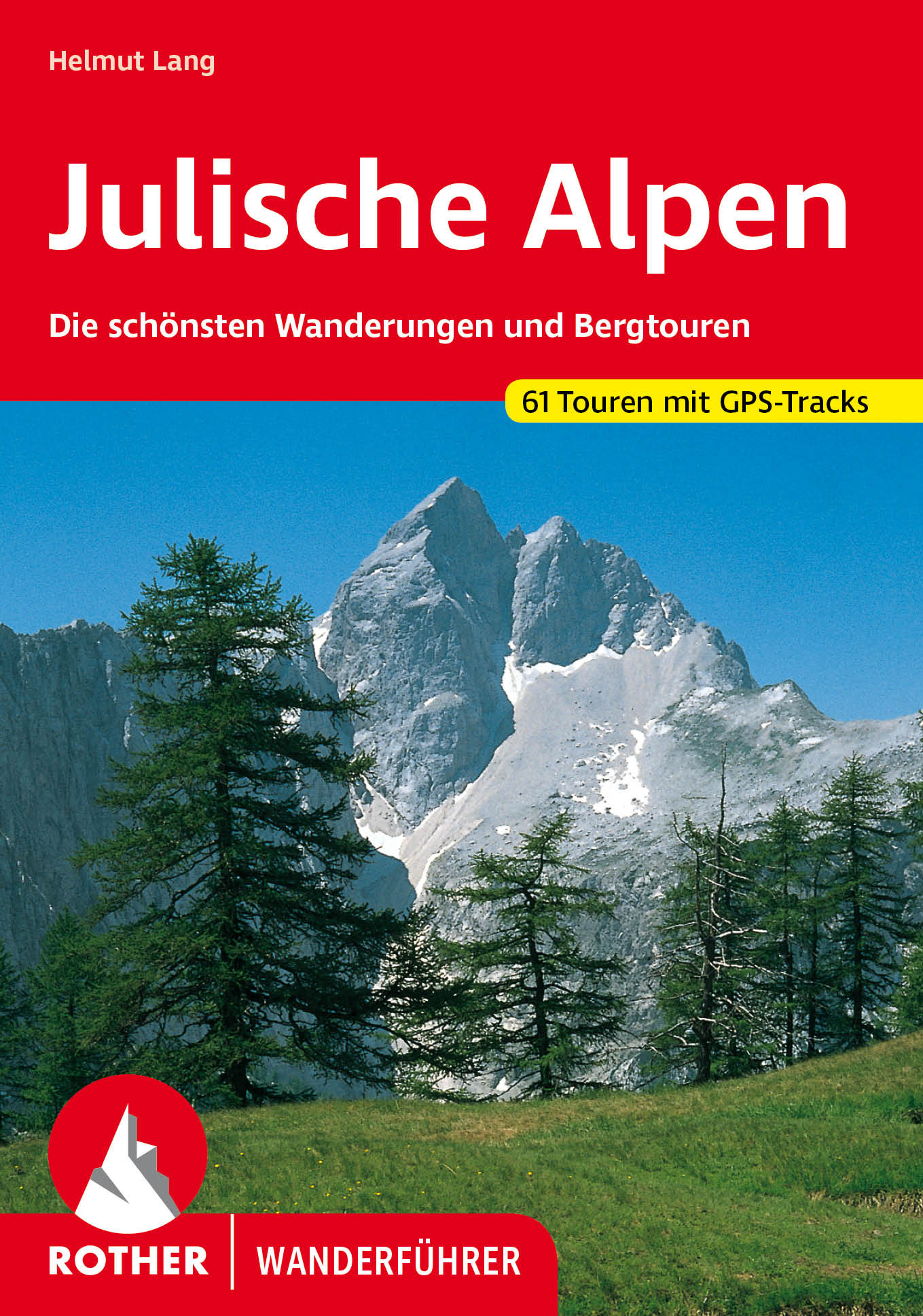
<p> Goede duitstalige wandelgids. Veel dagtochten, met gradaties en kleuren in zwaarte gerangschikt. Veel praktische informatie. Handzaam formaat.</p> <div> Steile Wände, scharfe Grate, liebliche Almen und smaragdblaue Gebirgsbäche – die Julischen Alpen sind voll spektakulärer Kontraste, die es zu entdecken lohnt! Das südöstliche Ende des Alpenbogens, wo Slowenien, Italien und Österreich zusammentreffen, bietet Wanderern und Bergsteigern eine ursprüngliche Gebirgslandschaft mit zahlreichen stillen und unbekannten Tourenmöglichkeiten. Der Rother Wanderführer »Julische Alpen« stellt 53 der schönsten Wanderungen und Bergtouren vor.</div> <div> </div> <div> Die Tourenauswahl umfasst sowohl einfache, genussreiche Wege durch reizvolle Kultur- und Bauernlandschaften als auch anspruchsvolle alpine Steige, die Trittsicherheit und Schwindelfreiheit erfordern. Der Triglav, der höchste Berg der Julischen Alpen und Sloweniens, ist ein absolutes Muss für Wanderer. Alle bedeutenden Anstiege auf den 2864 Meter hohen Berg im Triglav-Nationalpark werden in diesem Wanderführer vorgestellt. Doch nicht nur die großen Berge begeistern: viele Gipfel ringsum bieten herrliche Tourenmöglichkeiten und Panoramen in unberührte Natur.</div> <div> </div> <div> Jeder Tourenvorschlag umfasst eine zuverlässige Wegbeschreibung, ein aussagekräftiges Höhenprofil und ein Wanderkärtchen mit eingezeichnetem Routenverlauf. Ein übersichtlicher Tourensteckbrief informiert über Ausgangspunkt, Anforderungen, Einkehrmöglichkeiten und Varianten. GPS-Tracks können von der Internetseite des Bergverlag Rother heruntergeladen werden.</div>
€18,50
Bekijk product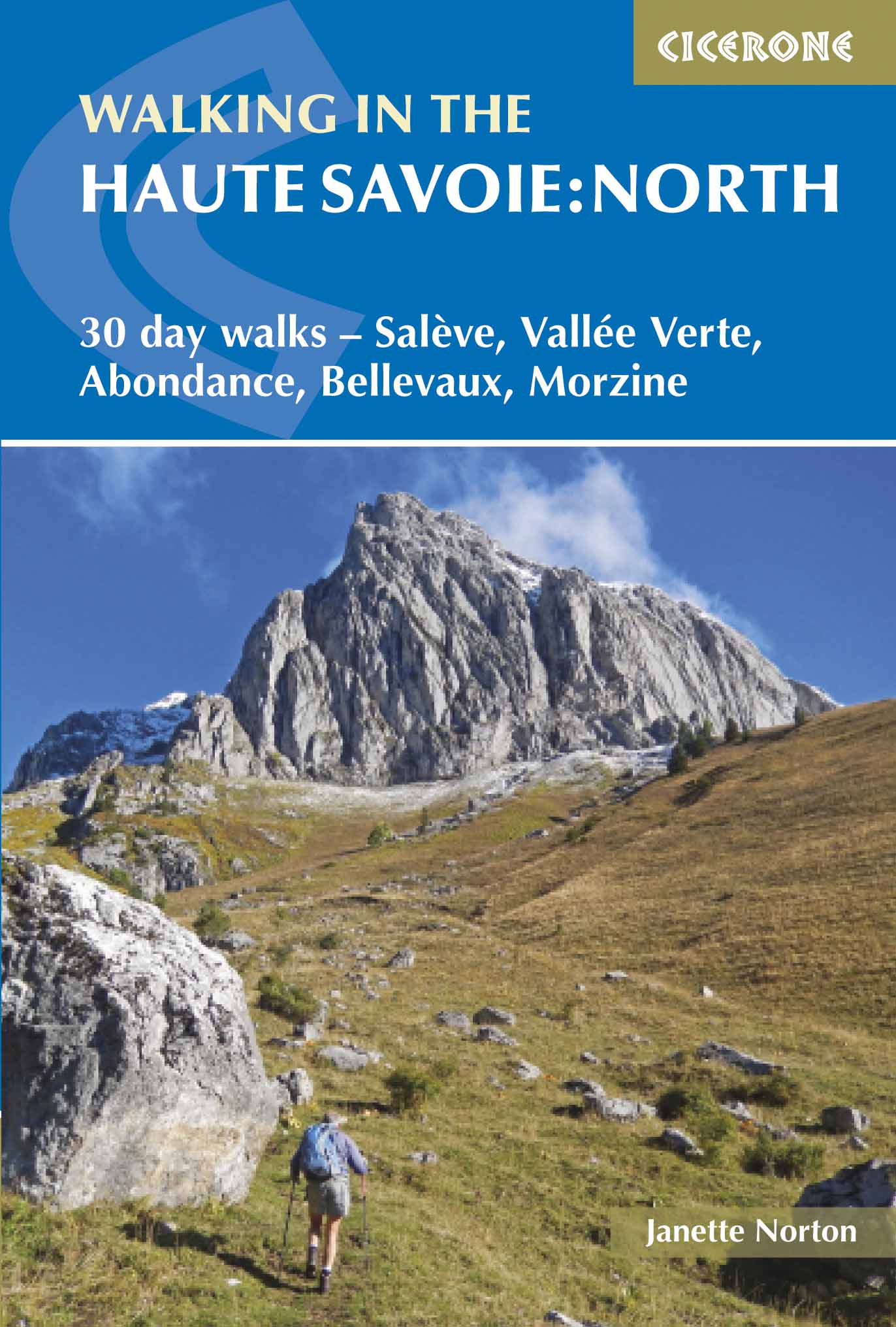
<p> Uitstekende wandelgids van dit geweldige gebied. Goed beschreven met veel praktische informatie om de route te kunnen lopen, inclusief redelijke kaarten.</p> <div> A guidebook of half and full-day walks in the lovely Haute Savoie mountains of France. This guide describes 30 circular routes of between 7 and 13km, based around Evian-les-Bains, Morzine, Abondance, Châtel, St-Julien-en-Genevois, Bellevaux, Boège and Habère-Poche. Graded from easy to difficult, there are walks to suit most abilities, but a few have some exposed sections and need a head for heights.</div> <div> </div> <div> The guide is divided into 6 areas covering the Salève and Vuache, the Vallée Verte, the Vallée du Brevon, Pre-Alpes du Léman and Val d'Abondance. Alongside a detailed route description and map, each walk has a summary of all you need to know before you set out (distance, time to walk, ascent, maximum altitude and instructions for accessing the start). The guidebook includes advice on travel, accommodation and equipment, as well as information about local wildlife and Savoyard food and drink, and a glossary of useful French words.</div> <div> </div> <div> Visitors flock to the Chamonix area and the Mont Blanc range, but that is only part of what the Haute Savoie has to offer. With highlights including Cornettes de Bise, Mont de Grange, Dent d-Oche and Pic Boré, the walks in this guide will show you a quieter, less busy side to this outstandingly beautiful area.</div> <div> </div> <div> <strong>Dorpen en Steden</strong></div> <div> Evian-les-Bains, Morzine, Abondance, Châtel, St-Julien-en-Genevois, Bellevaux, Boège, Habère-Poche</div> <p> </p>
€20,95
Bekijk product
<p> Uitstekende wandelgids van een gerenommeerde Engelse uitgever. De tochten zijn met zorg beschreven en voorzien van allerhande nuttige informatie.</p> <p> With its white sandy beaches, pine forests, snow-capped peaks, traditional villages, lush river valleys and olive groves, the GR7 in Andalucía takes you on a journey through the most geographically diverse region on the Iberian peninsula.</p> <p> This wonderfully varied route starts at the southernmost tip of Spain at Tarifa, and meanders through the provinces of Cádiz and Málaga before dividing. The northern route heads through Córdoba and Jaén provinces (711km in total), whilst the southern route passes through Almería and Granada (720km). The route crosses seven stunning natural parks and the Sierra Nevada national park.</p> <p> • The first guide to cover the whole of the GR7 in Andalucía.<br /> • Detailed route description for around 60 days of walking, with options for creating shorter sections and days.<br /> • Information on all the villages en route offering accommodation so that you can plan your own route.</p> <div> The GR7 is one of Europe's longest GR long-distance routes, stretching from Tarifa, the southernmost town of continental Europe, through Spain, Andorra and France to Alsace. This guide presents the Andalucian section of the route, which offers well over 700km of fantastic walking through the diverse landscapes of one of Spain's most evocative regions. The route splits at the small village of Villanueva de Cauche, and the guide describes both the northern and southern variants. Although walking is on good footpaths, country tracks and, occasionally, minor roads, some of the stages are long and can involve considerable ascent, meaning that a good level of fitness is required. The full Andalucian GR7 takes well over a month to walk; however, the guide also includes suggestions for highlight sections that can be walked in a week or fortnight.</div> <div> </div> <div> In addition to clear route description, mapping and elevation profiles, the guide provides background information on local history, plants and wildlife, and advice for planning your trip, such as when to go, what to take and where to stay.</div> <div> </div> <div> The route showcases Andalucia's rich history and culture and varied landscapes, which include pine forests, semi-arid desert, snow-capped peaks, fertile plains, lush valleys, olive groves, cultivated terraces and hills of cork woodland. Historic towns and traditional whitewashed villages offer overnight accommodation and a chance to sample local cuisine.</div>
€26,50
Bekijk product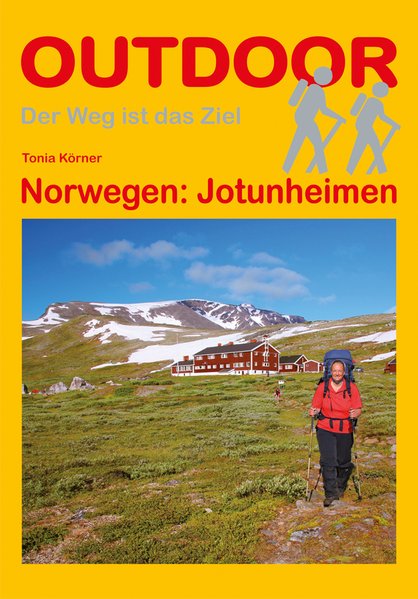
<p> Duitstalige wandelgids Jotunheimen (Noorwegen) met beschrijvingen van meerdaagse wandeltochten door het gebied</p> <p> Jotunheimen – das Heim der Riesen - ist eine der beeindruckendsten Bergwanderregionen Norwegens. Es trägt seinen Namen zu Recht, denn schließlich finden sich alle norwegischen Gipfel über 2.300 m hier, mit Galdøppingen (2.469 m), Glittertind (2.452 m) und Store Skagastølstind (2.405) sogar die drei höchsten Berge Norwegens. 1.140 km² des zentralen Hochgebirges stehen als Nationalpark unter Schutz. Markante Gebirgskämme, hoch aufragende Gipfel, weit oben gelegene Plateaus und natürlich die Gletscher. Viele von ihnen füllen Täler und Schluchten und stellen herrliche Ziele für Wanderer und Skifahrer dar. Zwischen Gipfeln und scharfen Graten liegen tiefe Täler mit Flüssen, zahlreichen Wasserfällen und wunderschönen Seen. Das Gebiet ist durchzogen von einem Geflecht an markierten Wanderwegen und Hütten und gilt als das besterschlossene Wandergebiet Norwegens. Jotunheimen ist sowohl für Wanderneulinge als auch für den erfahrenen Kletterer und Bergsteiger attraktiv. Die in diesem Buch vorgestellten Touren – eine West-Ost-Querung (6 Tage, eine kleine und eine große Rundwanderung (4 und 7 Tage) führen zu den schönsten Punkten in Jotunheimen.</p> <p> Galdhøppigen, Glittertind, Hochgebirge, Jotunheimen, Nationalpark, Norwegen, Skandinavien, Store Skagastølstind, Tonia Körner</p>
€16,95
Bekijk product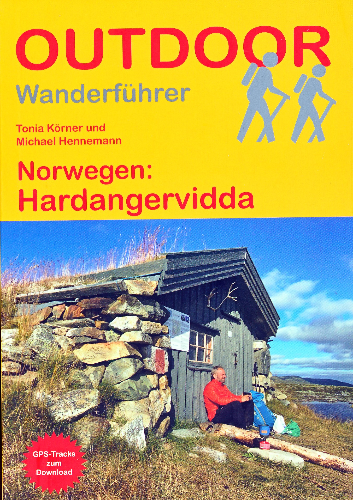
<p> Wandelgids - duitstalig - Haddangervidda - ook geschikt voor skitouren - wandelen Noorwegen: goede en informatieve tekst, per etappe beschreven, kaartmateriaal wat beperkt.</p> <div> Fast 1.200 km markierte Wanderwege in einer beeindruckenden Landschaft und ein dichtes Hüttennetz laden zu Touren in der Hochebene Hardangervidda in Südnorwegen ein. Der Wanderführer stellt zwei besonders empfehlenswerte Wanderrouten (Nord-Süd- und Ost-West-Querung) und eine Radtour auf dem bekannten Rallarvegen vor. </div> <div> </div> <div> Jeder Weg wird in mehreren Etappen detailliert beschrieben, zudem gibt es Empfehlungen für Abstecher und Varianten. Genaue Angaben zu Etappenlänge, Zeitbedarf und Übernachtungsmöglichkeiten sowie Kartenskizzen und Höhenprofile erleichtern die Planung. Ein ausführliches Kapitel mit allgemeinen Reise-Infos hilft Ihnen bei der Vorbereitung der Reise, ein landeskundlicher Teil bringt die Besonderheiten der Region näher.</div>
€17,50
Bekijk product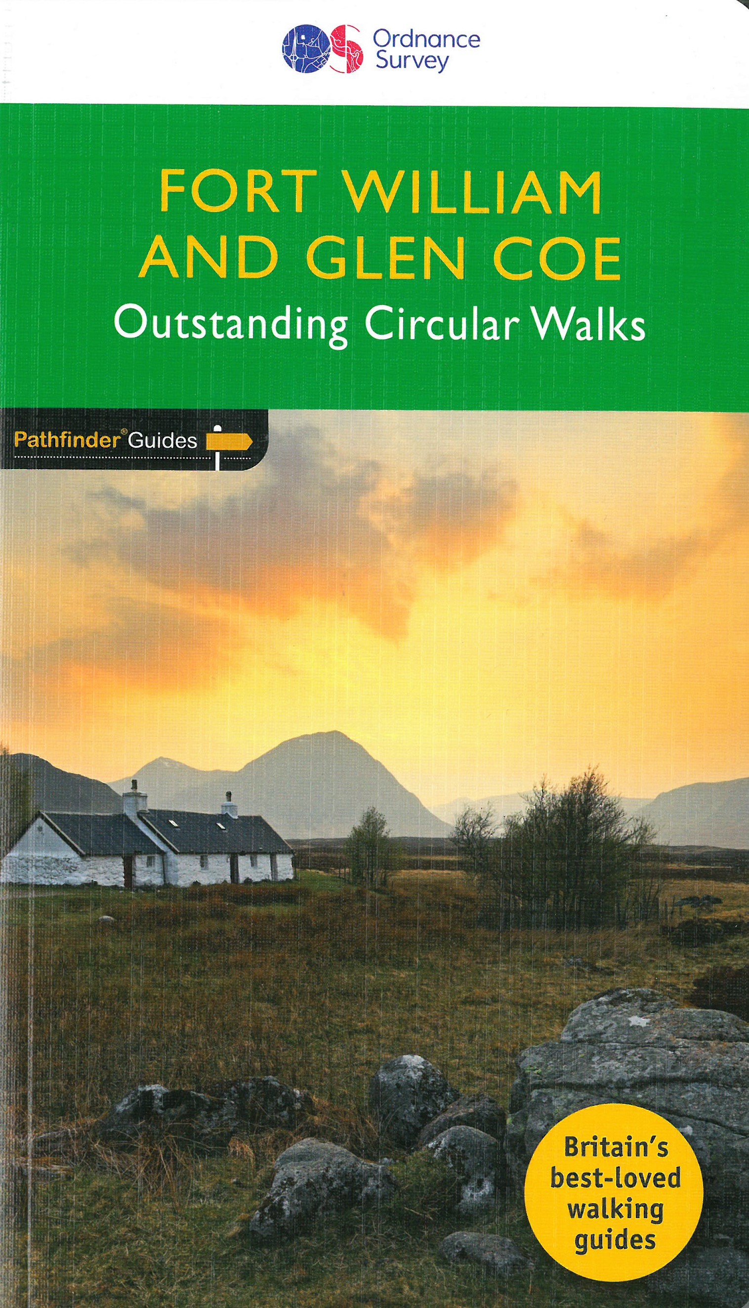
<p> Wandelgids van een deel Schotland. Deze gids bevat 28 dagwandelingen, variërend van korte tochten tot pittige dagtochten. De bijbehorende kaarten zijn uitstekend: men heeft de topografische kaarten van Ordnance Survey gebruikt waarop de route is ingetekend. Daarnaast praktische informatie over de wandeling en wat beschrijvingen van het gebied.</p> <div> Fort William and Glen Coe encompass one of the greatest areas of sea and mountain landscape in Scotland, backed by some of the biggest and most demanding peaks. This is Scotland's fjord land, a drowned coastland with long sea arms wending far inland, and steep climbs from sea level to Ben Nevis, the highest summit in Britain.</div> <div> </div> <div> This walking guidebook contains 28 carefully selected walking routes around Fort William and Glen Coe of 5km (3 miles) to 16km (10 miles), each planned and tested by experienced walkers. Each route includes a full description, an extract of the OS Explorer 1 25 000 scale map, photos and notes of key features and wildlife to look for on the way.</div> <div> </div> <div> The walks include Ben Nevis, the Caledonian Canal, Kinlochleven, Loch Ossian, and Rannoch Moore.</div> <div> </div> <div> Pathfinder Guides are Britain’s best-loved walking guides. Printed with weather-resistant covers featuring durable rounded corners, they are the perfect companion for walking throughout Britain.</div>
€18,50
Bekijk product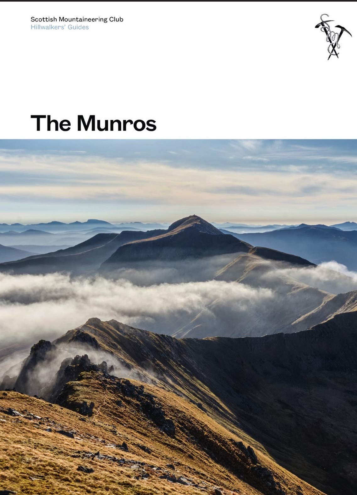
<p> Toonaangevend boek over alle Munros in Schotland, de bergen boven de 3000 feet. Er zijn talloze mensen die in hun leven alle Munros willen beklimmen; het is een hele cultus.</p> <div> This fully revised edition of the Scottish Mountaineering Club’s original and best-selling guidebook The Munros describes the best walking routes on Scotland’s 282 mountains above 3000ft.</div> <div> </div> <div> Comprehensive descriptions in this definitive guide recommend ascent and descent routes for each of the Munros and their 226 subsidiary Tops, with maps of the peaks and principal surrounding hills to help you plan the most enjoyable journeys through Scotland’s wild landscape. The descriptions are brought to life throughout with vivid photography that illustrates the dramatic beauty of these much-loved mountains.</div> <div> </div> <div> In addition to routes themselves the book contains Munros Tables, a complete list of the 508 Munros and subsidiary Tops, listed in height order. Whether you are an occasional walker looking for inspiration or a dedicated Munroist planning to tick off your next peak, The Munros is essential reading for anyhillwalking enthusiast.</div>
€37,95
Bekijk product
<p> Uitstekende wandelgids, sommige meerdaags, voor dit uitdagende wandelgebied in Schotland.</p> <div> <div> This guidebook contains over 100 routes for walking in the Scottish Cairngorms. It includes 18 Munro summits and smaller viewpoint hills. Walks range in length from 1 to 26 miles and are graded for difficulty. </div> <div> </div> <div> For the adventurous there are the best of the area's rocky scrambles, and the classic through-routes including the Lairig Ghru. For those looking for a more gentle alternative, there are easy, sandy trails wandering among the tall pines and along the banks of the great rivers Spey, Nethy and Dee. </div> <div> </div> <div> Britain's biggest mountain range is home to exceptional and varied scenery - from the ancient Caledonian forest to the granite plateau, the glacial glens and high corries where green lochans lie below great crags of the plateau rim. </div> <div> Along with the main Cairngorm range between Speyside and Deeside, the guidebook covers Lochnagar. It includes practical information on snack stops, public transport and accommodation, as well as a route summary table and scrambles summary.</div> </div> <p> <strong>Steden en Dorpen</strong></p> <p> Aviemore, Glenmore village, Kingussie, Newtonmore, Tomintoul, Cock Bridge, Ballatar, Braemar</p>
€20,95
Bekijk product