
Beantwoord enkele vragen, en binnen seconden geeft AI je een persoonlijk aankoopadvies op maat.
Beantwoord enkele vragen, en binnen seconden geeft AI je een persoonlijk aankoopadvies op maat.
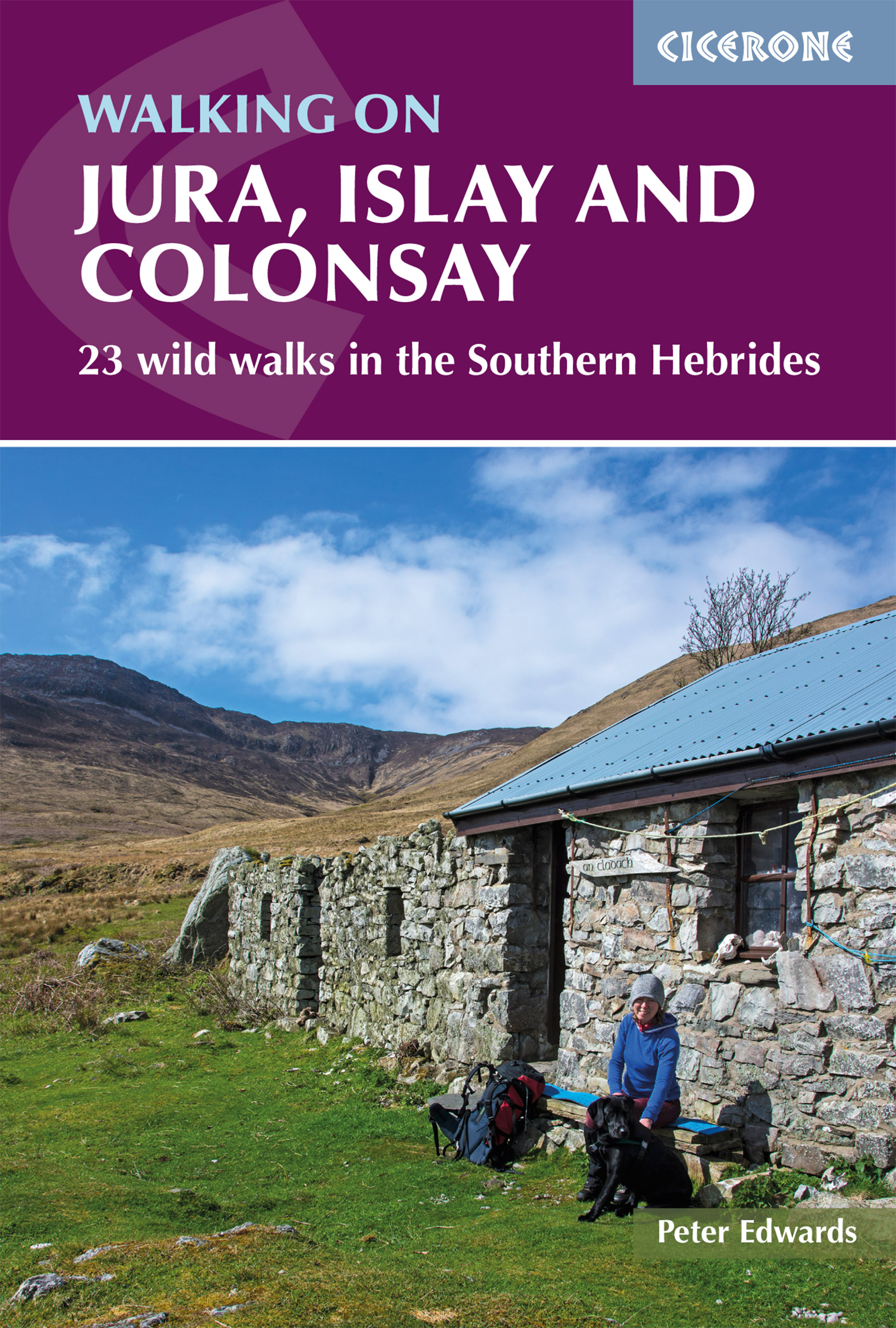
<p> Uitstekende wandelgids van deze weldadige eilanden. goed beschreven met veel praktische informatie om de route te kunnen lopen, inclusief redelijke kaarten.</p> <div> This guidebook presents a selection of 23 walking routes on the wild and beautiful southern islands of Scotland's Inner Hebrides, with nine walks on Jura, one on neighbouring Scarba, seven on Islay and five on Colonsay, plus a spectacular 5-day trek along Jura's dramatic west coast. The wildest of the southern Hebrides, the walking on Jura is frequently rugged, with many routes crossing remote and often pathless terrain that calls for fitness, self-reliance and navigational competence. The routes on the other islands are somewhat easier, but should still not be underestimated.</div> <div> </div> <div> In addition to clear route description illustrated with 1:50,000 OS mapping, the guide offers practical advice on the various options for getting to the islands, accommodation and amenities. There are suggestions for linking walks and notes on the islands' bothies and wild-camping recommendations, making it easy to devise longer day walks or multi-day itineraries. Also included are fascinating overviews of the islands' rich history, geology, plants and wildlife. Beautiful colour photography completes the package.</div> <div> </div> <div> The routes showcase the islands' magnificent scenery, which is as diverse as it is beautiful, ranging from wild moorland to flower-strewn machair and small pockets of native woodland. The coastline is arguably the jewel in the crown, with geological wonders aplenty: sea-cliffs, caves, stacks and arches, sand and shingle bays and the characteristic Hebridean raised beaches. Abundant wildlife and birdlife is a further highlight. These carefully chosen walks will inspire you to get out and discover the magic of these captivating islands.</div> <div> </div> <div> Steden en Dorpen</div> <div> JURA - Feolin, Craighouse, Tarbert, Ardlussa, Kinuachdrachd, Glengarrisdale, Ruantallain, Cruib, Glenbatrick Bay ISLAY - Port Askaig, Port Ellen, Port Charlotte, Bowmore, Bridgend, Ballygrant, Bunnahabhain, Ardbeg COLONSAY - Scalasaig, Oronsay, Kilchattan, Kiloran SCARBA - Kilmory Lodge, Gleann a' Mhaoil bothy</div>
€20,95
Bekijk product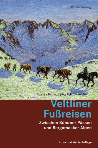
<p> Alle kennen den Veltliner Wein. Aber nur wenige das Veltlin, dieses faszinierende Grenzgebiet, das fast so gross ist wie das Wallis und so südliche wie das Tessin.<br /> Als erstes deutschsprachiges Buch seit über hundert Jahren beschreibt 'Veltliner Fussreisen' Wanderungen in allen Gebieten dieser weitläufigen italienischen Alpenprovinz, die sich vor genau 200 Jahren von der Bündner Herrschaft löste.</p> <p> <br /> Ursula Bauer und Jürg Frischknecht schlagen Routen durch die Veltliner Weinberge vor, zu den alten Badeorten in den Rhätischen Alpen und durch die Bergamasker Alpen. Ihre Wanderungen führen mitten in die Alpenstädtchen Chiavenna, Morbegno, Sondrio, Tirano und Bormio.<br /> 'Veltliner Fussreisen' liefert auch Ideen und Esstips für lange Wochenenden in diesen Orten - Ausflugs- und Wanderziele für alle Jahreszeiten.<br /> Ähnlich wie in ihrem Wanderbuch 'Grenzschlängeln' begleitet 'Hintergründiges' zur Gegend die 37 Etappenbeschriebe.</p>
€20,95
Bekijk product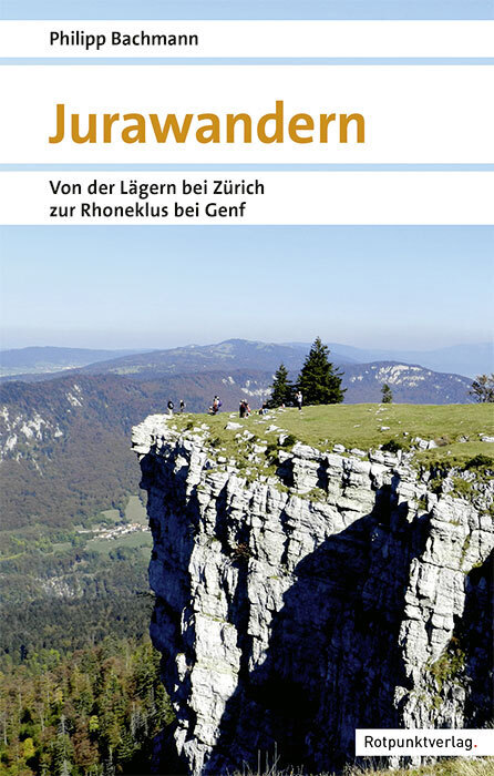
<p> <span style="caret-color: rgb(51, 51, 51); color: rgb(51, 51, 51); font-family: "PT Sans", sans-serif; font-size: 14px; -webkit-tap-highlight-color: rgba(0, 0, 0, 0); -webkit-text-size-adjust: 100%;">Der Jura ist eine andere Welt: Geografisch, kulturell und politisch hebt er sich deutlich von der übrigen Schweiz ab. Der Jura ist unbekannt. Die meisten kennen nur bestimmte Ausschnitte des Jurabogens. Der Jura wird unterschätzt - zum Glück: Landschaftlich und historisch weniger spektakulär als die Alpen, sind die großartigen Juralandschaften bisher weitgehend vom Massentourismus verschont geblieben. In 22 Etappen führen die Wanderungen gemächlich und auf Umwegen durch den ganzen Jura. </span><br style="box-sizing: border-box; caret-color: rgb(51, 51, 51); color: rgb(51, 51, 51); font-family: "PT Sans", sans-serif; font-size: 14px; -webkit-tap-highlight-color: rgba(0, 0, 0, 0); -webkit-text-size-adjust: 100%;" /> <br style="box-sizing: border-box; caret-color: rgb(51, 51, 51); color: rgb(51, 51, 51); font-family: "PT Sans", sans-serif; font-size: 14px; -webkit-tap-highlight-color: rgba(0, 0, 0, 0); -webkit-text-size-adjust: 100%;" /> <span style="caret-color: rgb(51, 51, 51); color: rgb(51, 51, 51); font-family: "PT Sans", sans-serif; font-size: 14px; -webkit-tap-highlight-color: rgba(0, 0, 0, 0); -webkit-text-size-adjust: 100%;">Drei Wochen im Jura unterwegs</span></p>
€40,50
Bekijk product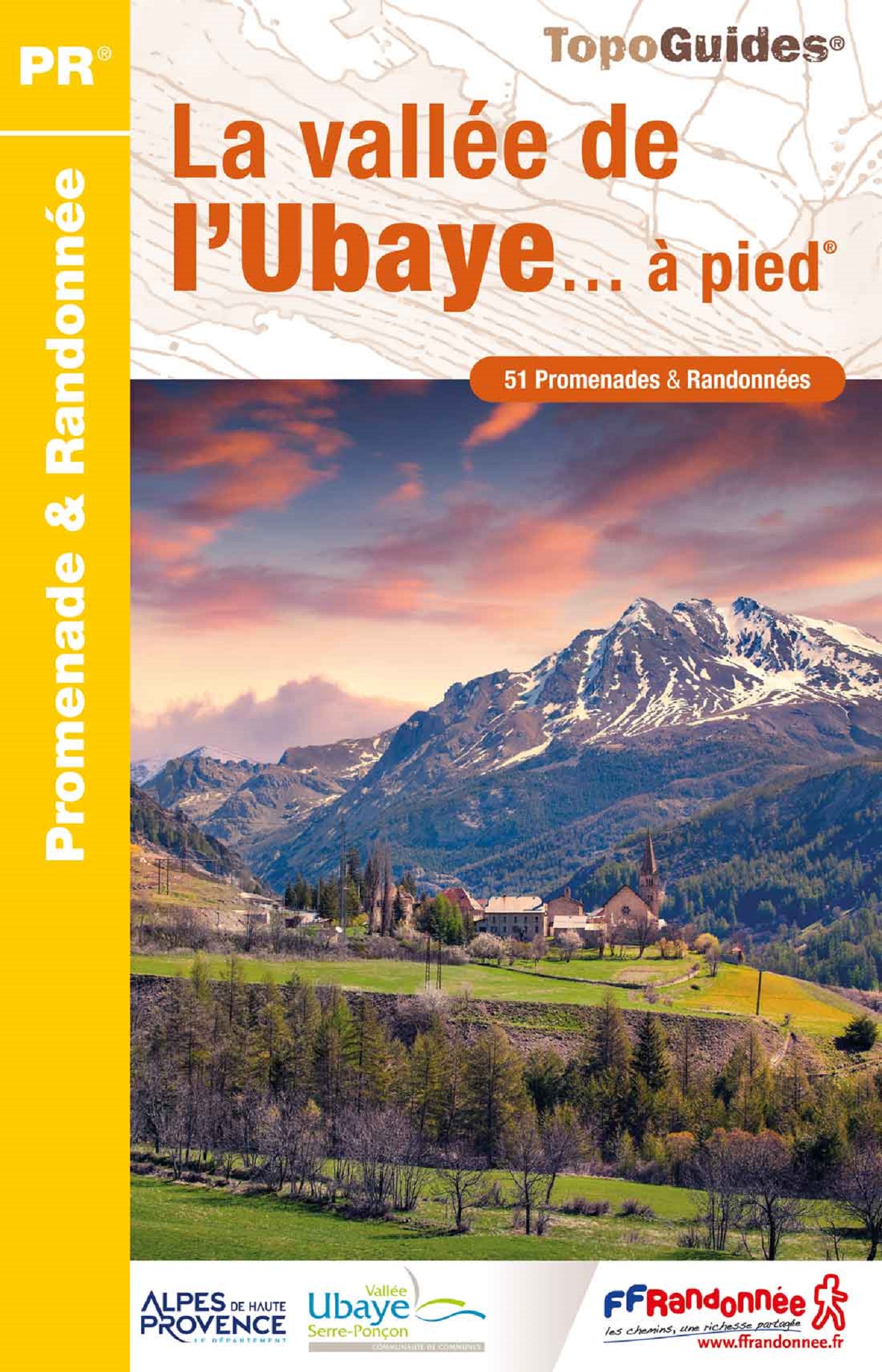
<p> Franstalige wandelgids met een beschrijving van een aantal dagtochten. Uitstekende beschrijvingen met duidelijk kaartmateriaal. Mislopen is nauwelijks mogelijk, maar ja .. de franse taal! Ook praktische informatie staat in deze gids. Alle gidsen bevatten een door ons toegevoegde uitgebreide frans - nederlandse wandelwoordenlijst.</p> <p> La vallée de l'Ubaye est une destination incontournable des promeneurs et randonneurs amoureux des Alpes. Du Queyras au Mercatour, du Piémont italien au lac de Serre-Ponçon, les 51 itinéraires décrits dans ce topo-guide sont une invitation à la découverte de la richesse de ses patrimoines : lacs d'altitude, bouquetins, tétras-lyres, edelweiss, mélèzes, cadrans solaires, fortifications militaires et mille et une autres curiosités à découvrir à pied. </p>
€18,95
Bekijk product
<p> Uitstekende wandelgids met een groot aantal dagtochten in dal en hooggebergte. Met praktische informatie en beperkt kaartmateriaal! Wandelingen in verschillende zwaarte weergegeven in rood/blauw/zwart.</p> <div> Das Kaunertal und das Oberinntal in Tirol locken mit einer beeindruckend vielfältigen Bergwelt. Es geht weit hinaus in den Hochtälern mit hohen Grasbuckeln, vielen Dreitausender-Gipfeln und hoch gelegenen Dörfern. Manche Bergbauernhöfe stehen derart exponiert, dass der Volksmund behauptet, selbst die Hühner würden dort oben Steigeisen tragen. Der Rother Wanderführer »Kaunertal – Oberinntal« lädt ein, die mannigfaltige Berglandschaft rund um Landeck, Serfaus, Pfunds und Nauders zu entdecken: Bei der Auswahl von 50 abwechslungsreiche Touren ist für jeden Geschmack die geeignete Tour dabei.</div> <div> </div> <div> Beschauliche Ausflüge führen in romantische Hochtäler, zu abgeschiedenen Bergseen und in wilde Schluchten. Traumhafte Höhenwege bieten faszinierende Ausblicke auf die zerhackten Firste des Kaunergrats. Und so manche Tour lässt die magische 3000-Meter-Grenze überschreiten. Die Tourenauswahl umfasst viele leichte bis mittelschwere Touren auf leicht erreichbare Aussichtsgipfel und zu einladenden Hütten und Almen. Aber auch einige schwierigere, gletschernahe Touren werden vorgestellt. Praktisch: Fast alle Ausgangspunkte sind mit öffentlichen Verkehrsmitteln zu erreichen.</div> <div> </div> <div> Jede Tour wird durch eine zuverlässige Wegbeschreibung, ein Wanderkärtchen mit eingetragenem Routenverlauf und ein aussagekräftiges Höhenprofil anschaulich gemacht. Übersichtliche Kurzinfos mit Hinweisen zu Anforderungen, Höhenunterschied, Einkehrmöglichkeiten und Varianten erleichtern die Auswahl. Ergänzend stehen GPS-Tracks zum Download bereit. </div>
€17,50
Bekijk product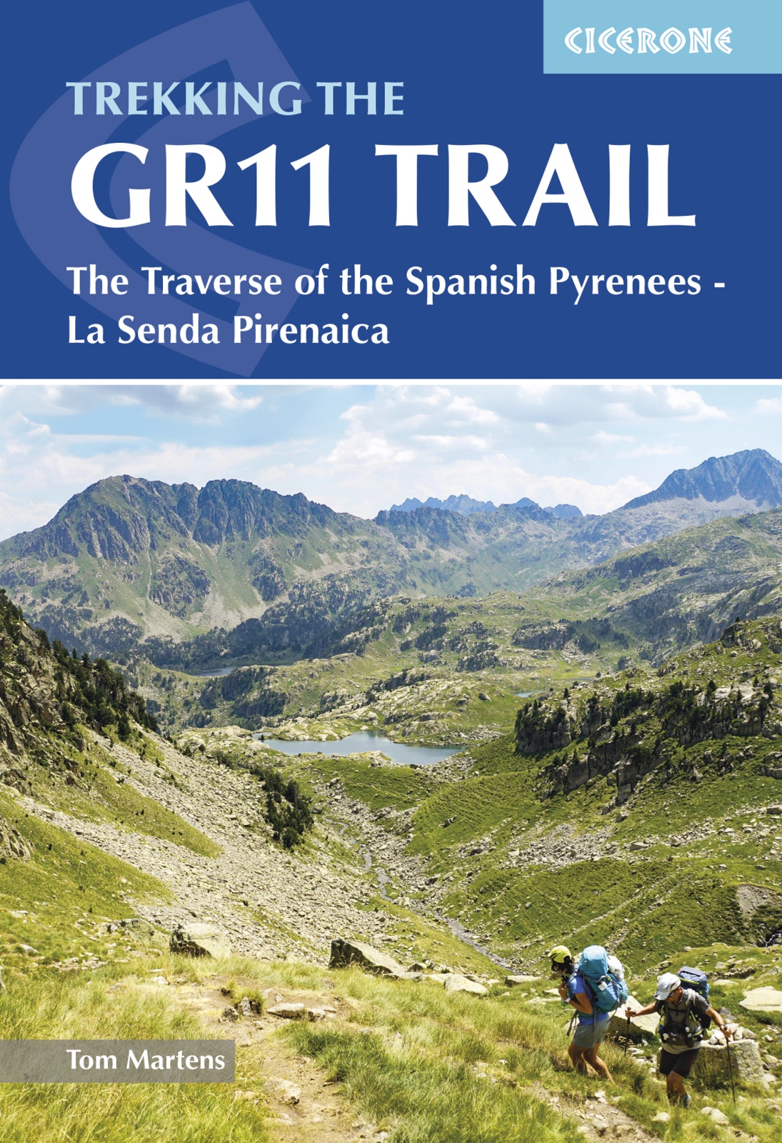
<p> Uitstekende wandelgids van dit geweldige gebied. goed beschreven met veel praktische informatie om de route te kunnen lopen, inclusief redelijke kaarten. Beschrijving van de GR 11, het lange afstandswandelpad aan de Spaanse kant van de Pyreneeën.</p> <p style="padding: 0px; margin: 0px 0px 1em; box-sizing: border-box; line-height: 1.4; color: rgb(0, 0, 0); font-family: "Helvetica Neue", Helvetica, sans-serif, Arial;"> <strong style="padding: 0px; margin: 0px; box-sizing: border-box; line-height: inherit;">Aanbevolen wandelkaarten</strong></p> <p style="padding: 0px; margin: 0px 0px 1em; box-sizing: border-box; line-height: 1.4; color: rgb(0, 0, 0); font-family: "Helvetica Neue", Helvetica, sans-serif, Arial;"> Schaal 1:50.000</p> <p style="padding: 0px; margin: 0px 0px 1em; box-sizing: border-box; line-height: 1.4; color: rgb(0, 0, 0); font-family: "Helvetica Neue", Helvetica, sans-serif, Arial;"> <a href="https://www.dezwerver.nl/r/europa/spanje/spaanse-pyreneeen/c/kaarten/wandelkaarten/9788416918041/wandelkaart-senda-pirenaica-gr11-editorial-alpina/" style="padding: 0px; margin: 0px; box-sizing: border-box; outline: none; color: rgb(130, 125, 0);">Wandelkaart Senda Pirenaica GR11 | Editorial Alpina</a> - Set van 21 kaarten</p> <p style="padding: 0px; margin: 0px 0px 1em; box-sizing: border-box; line-height: 1.4; color: rgb(0, 0, 0); font-family: "Helvetica Neue", Helvetica, sans-serif, Arial;"> Of</p> <p style="padding: 0px; margin: 0px 0px 1em; box-sizing: border-box; line-height: 1.4; color: rgb(0, 0, 0); font-family: "Helvetica Neue", Helvetica, sans-serif, Arial;"> <a href="https://www.dezwerver.nl/series/Rando-Pyreneeen/" style="padding: 0px; margin: 0px; box-sizing: border-box; outline: none; color: rgb(130, 125, 0);">Wandelkaarten van Rando Pyreneeën</a> - 10 losse kaarten</p> <div> This comprehensive guidebook to the magnificent GR11 trail, which runs 820km from the Atlantic to the Mediterranean, provides everything trekkers will need to take up the challenge - detailed route description, excellent photographs, lots of background information and unique, custom-produced maps. This glorious traverse of the Pyrenees, on the Spanish side, is a serious challenge - passing over a succession of high alpine passes where boulderfields, scree slopes and occasional snowfields may need to be crossed. It is presented in 47 stages of 8-31km. </div> <div> </div> <div> It is well waymarked and has regular opportunities to top up on food and drink, described within the routes and in a detailed place-by-place appendix at the back. Also included are bad weather options - although the weather is often good along this route - detours to find accommodation at some points, and advice on where to stay, supplies, language and logistics, as well as a glossary including Aragon, Basque and Catalan words, to help you find your way.</div> <div> </div> <div> GR-11</div> <div> </div> <div> <div> The Basque country, Anayet lakes, Ordessa and Monte Perdido National Park, Aiguestortes and Estany de Sant Maurici National Park, the Maladeta range, Andorra, Cap de Creus Natural Park.</div> <div> </div> </div> <p> </p>
€23,95
Bekijk product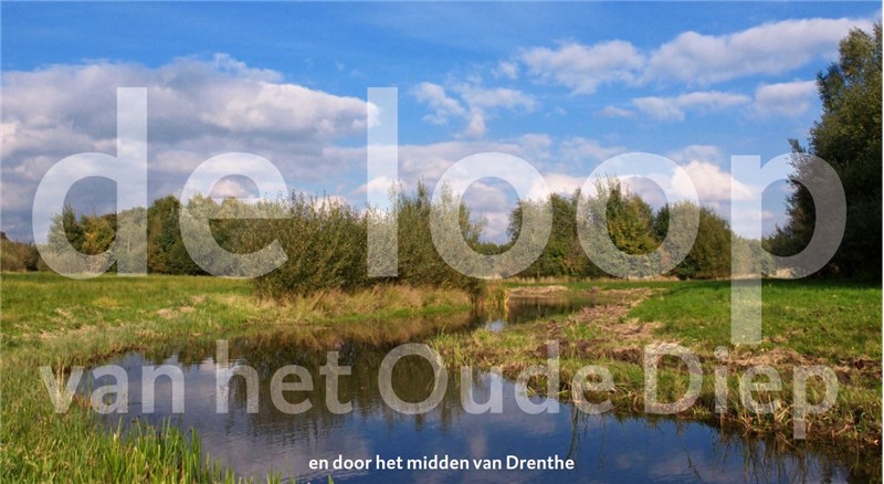
<p> Tussen Beilen en Hoogeveen zoekt het Oude Diep door de groenlanden zijn weg vanaf het Drents plateau. Nog niet zo lang geleden was er van dit Drentse beekje niet veel meer over dan een rechte sloot door de aardappelvelden. De afgelopen jaren hebben overheden en natuurorganisaties alles op alles gezet voor het herstel van het Oude Diep.</p> <p> De Loop van het Oude Diep is een langeafstandswandeling om u met deze onbekende wereld. Het Drentse Landschap geeft een routeboekje uit dat onderweg uw gids zal zijn.</p> <p> Het routeboekje De Loop van het Oude Diep is uw gids onderweg met meer dan 100 pagina's met heldere routebeschrijvingen, duidelijke kaarten en heel veel wetenswaardigheden over het gebied en zijn bewoners. U stopt het boekje zo in uw broekzak. Onderweg is het gemakkelijk in gebruik vanwege de handige spiraal-bindwijze. Een boekje ook om de 120 kilometer van De Loop van het Oude Diep later thuis nog een keer te beleven…</p> <div> De Loop van het Oude Diep laat u kennismaken met de onbekende wereld tussen Westerbork en Hoogeveen waar het Oude Diep zijn weg zoekt vanaf het Drents plateau. Aan het eind van de twintigste eeuw scheelde het niet veel of het Oude Diep was letterlijk van de kaart verdwenen. Gelukkig konden de beek en het beekdal de afgelopen jaren op veel plaatsen worden hersteld. Onderweg bent u ooggetuige van de wedergeboorte van een Drentse beek.</div> <div> </div> <div> Dit boekje is de 2e en geheel herziene druk. 9 Etappes van gemiddeld 13 kilometer brengen u van Assen naar Hoogeveen (of omgekeerd). Beide richtingen staan in de tekst beschreven.</div> <div> </div> <div> Deze nieuwe (2e druk) van de Loop van het Oude Diep sluit aan op de Loop van de Drentsche Aa.</div>
€13,50
Bekijk product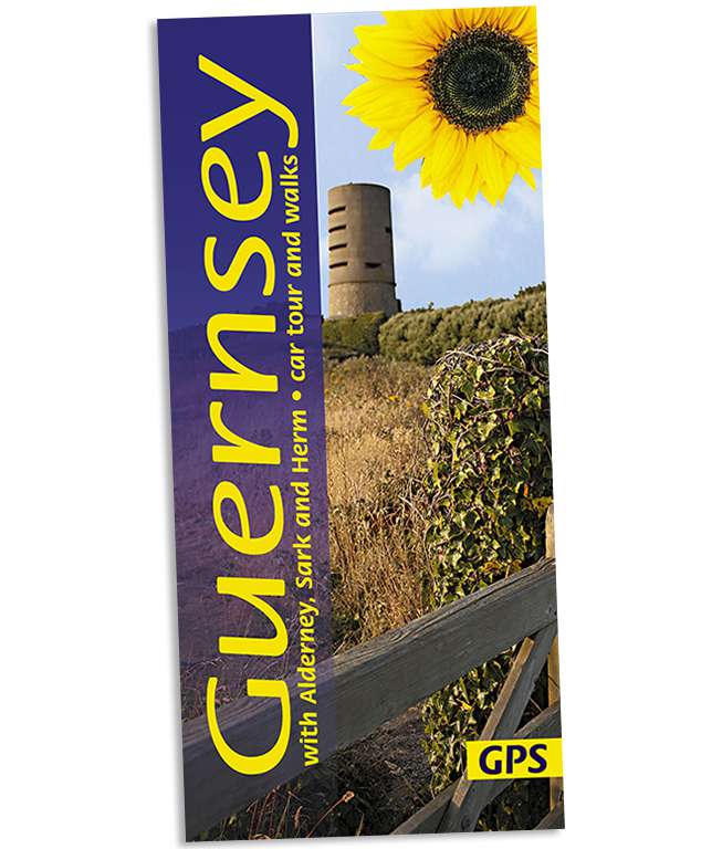
<p> Wandelgids voor Guernsey met een goede kaart en leuke routes.</p> <div> An ideal introduction for the first-time visitor, this book also provides new ideas for those who come year after year. Apart from marvellous coastal scenery that’s been compared to that of Cornwall and Brittany, there is much to explore of the island’s past. For example, you could follow some of Guernsey’s ‘green lanes’ and ‘water lanes’ — centuries-old paths once used by pack-horses and donkeys, or follow a route that takes in the relics of prehistoric burial grounds as well as remnants of the German Occupation during World War II. Guernsey cliff walks, with steep climbs and lots of steps, are quite challenging, but elsewhere walking in Guernsey is very easy — the terrain is almost flat and ideal for the casual stroller.</div> <div> </div> <div> Area covered: all of Guernsey, plus the nearby islands of Alderney, Sark and Herm</div> <div> </div> <div> Best time to walk is in the spring, especially April/May when the spring flowers are out. But walking is enjoyable through to October, and even in the winter months if you don’t mind showers and bracing breezes.</div>
€13,50
Bekijk product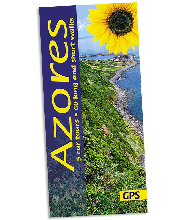
<p> Wandelgids: vele dagtochten worden degelijk beschreven met openbaar vervoer informatie, goede routebeschrijvingen en kaartmateriaal. Tevens enkele autotochten. Deze gids staat goed bekend! Engelstalig, want nederlandstalige is uitverkocht en niet meer leverbaar.</p> <div> 5 car tours (on São Miguel, Terceira and Faial), 60 long and short walks, 21 picnic suggestions</div> <div> 136 pages + two touring maps; plans ofPonta Delgada (São Miguel), Angra do Heroísmo (Terceira) and Horta (Faial), large-scale (1:50,000) topo maps</div> <div> Table of contents:</div> <div> Foreword 5</div> <div> Some words of thanks; Useful books; Useful addresses;</div> <div> Web sites focussing on the Azores</div> <div> Introduction 7</div> <div> How to get there 7</div> <div> Getting about on the islands 7</div> <div> Where to stay 8</div> <div> Climate and weather 9</div> <div> Language 10</div> <div> Geology and vulcanology 11</div> <div> Vegetation 12</div> <div> The islands in detail 13</div> <div> Picnicking 20</div> <div> Picnic suggestions 21</div> <div> TOURING</div> <div> TOUR 1: WESTERN SÃO MIGUEL (with plan of Ponta Delgada) 27</div> <div> TOUR 2: CENTRAL SÃO MIGUEL 32</div> <div> TOUR 3: EASTERN SÃO MIGUEL 36</div> <div> TOUR 4: TERCEIRA 38</div> <div> TOUR 5: FAIAL (with plan of Horta) 42</div> <div> WALKING 46</div> <div> Waymarking, maps 46</div> <div> Weather 46</div> <div> What to take 47</div> <div> Walkers’ checklist 48</div> <div> Country code 48</div> <div> Organisation of the walks 49</div> <div> </div>
€19,50
Bekijk product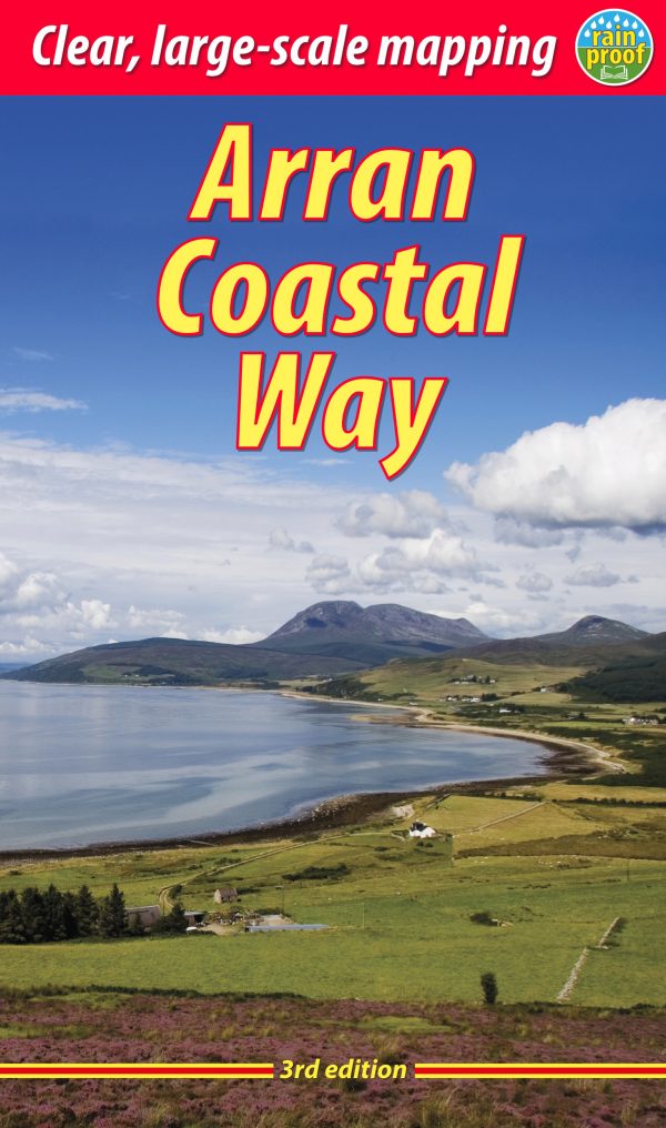
<p> The Arran Coastal Way is perhaps Scotland's finest circular long-distance trail, running 65 miles (105 km) around the Isle of Arran in a memorable week-long hike from Brodick. It's accessible from near Glasgow by the Ardrossan ferry. Famous as`Scotland in miniature', Arran is rich in scenery, castles, caves and standing stones. The walking is varied, from mountain paths to deserted beaches, from minor road-walking to boulder-hopping, and in places it is refreshingly rugged. Arran's wildlife is uniquely approachable, and its residents welcoming.</p> <p> Our second edition was thoroughly updated during 2017 with many route changes and extra options.</p> <div> <div> This guidebook contains all you need to plan and enjoy the Arran Coastal Way, including:</div> <div> </div> <ul> <li> detailed description of the route walked anticlockwise, updated for 2021</li> <li> background on geology, pre-history and history</li> <li> whisky-making, wildlife and habitats</li> <li> boat trip to the Holy Isle</li> <li> Foreword by wilderness walker Cameron McNeish</li> <li> clear mapping of the entire route (1:55,000)</li> <li> information about public transport and travel</li> <li> lavishly illustrated, with 125 colour photographs</li> <li> on rainproof paper.</li> </ul> </div> <p> Meer informatie kun je vinden op de officiele website: <a href="http://www.coastalway.co.uk/" onclick="window.open(this.href); return false;" title="http://www.coastalway.co.uk/">http://www.coastalway.co.uk/</a></p>
€22,50
Bekijk product