
Beantwoord enkele vragen, en binnen seconden geeft AI je een persoonlijk aankoopadvies op maat.
Beantwoord enkele vragen, en binnen seconden geeft AI je een persoonlijk aankoopadvies op maat.

<p> Een uitstekende wandelgids van een beroemd lange-afstands-wandelpad in Bulgarije, onderdeel van de E3 route. Goede beschrijving, mooie kaarten en praktische informatie. Onverwacht hoog nivo van de gids voor een land waar tot voor kort weinig beschikbaar was. </p> <div> Kom-Emine is a long distance path in Bulgaria, part of the E3 European Long Distance Path, just like Camino de Santiago in Spain. This route gains more and more popularity among the travellers not only from Bulgaria but also foreign hikers from Poland, Germany, The Netherlands, Spain and France. The mountain trail heads from west and crosses the whole country eastward to the Black sea cost. It is a 650 kilometers long journey in the heart of Bulgaria that takes you to more than 100 peaks and through over 21 mountain passes. The Balkan Mountains are famous for the huge variety of flora and fauna and the innumerous sites of cultural, historical and natural heritage they treasure.</div> <div> </div> <div> “Kom-Emine” guidebook by Zhivko Momchev is the first ever guide to the route in English language. Issued by Oilaripi Trekking Association.</div> <div> </div> <div> Beautifully designed and user-friendly, it provides all the essential information about the route, accommodation and sights in a well structured way.</div> <div> </div> <div> The guide is divided into 20 daily stages of the route, each of them providing:</div> <div> </div> <div> – detailed route description with ridge and bypass options;</div> <div> – map of the route;</div> <div> – elevation chart (hiking, biking, skiing);</div> <div> – sights and facts;</div> <div> – sleeping accommodations</div>
€24,95
Bekijk product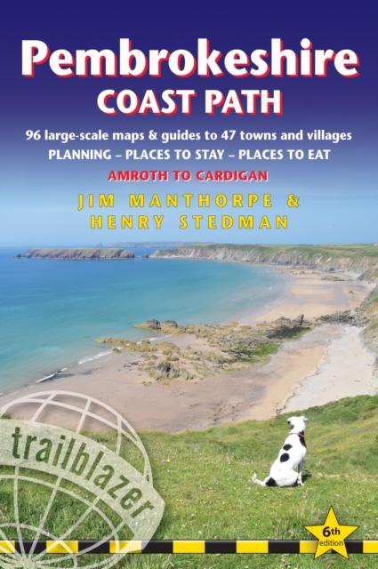
<p> <span style="font-family: "Helvetica Neue", Helvetica, sans-serif, Arial;">Goede wandelgids waarin met veel details alle etappes zijn beschreven. Tevens informatie over overnachtingen en openbaar vervoer.</span></p> <div> Practical guidebook to walking the Pembrokeshire Coast Path. The walk follows a National Trail around the coastline in south-west Wales. Includes maps, accommodation, pubs and restaurants, and what to see along the coastal path. 102 maps: 96 large-scale walking maps, 6 town plans, 10 stage with trail profiles and 2 overview maps. Detailed accommodation: B&Bs, campsites, pubs, hotels, bunkhouses. Where to eat: cafes, pubs and restaurants. Detailed public transport information with frequency of services. Downloadable GPS waypoints. Itineraries for all walkers, whether hiking the entire route or sampling highlights on day walks, weekends or short breaks.</div> <div> </div> <div> </div> <div> 96 walking maps – 1:20,000 (3-1/8 inches to 1 mile) – the largest-scale maps available.</div> <div> </div> <div> 10 stage maps with trail profiles and 2 overview maps</div> <div> Unique mapping features – walking times, directions, tricky junctions, places to stay, places to eat, points of interest.</div> <div> Includes day walks and short breaks.</div> <div> Practical information for all budgets – what to see, where to stay, where to eat: pubs, B&Bs, hotels, campsites, hostels.</div> <div> Comprehensive public transport information – for all access points on the Coast Path</div> <div> Flora and fauna – four page full color flower guide, plus an illustrated section on local wildlife</div> <div> Green hiking – understanding the local environment and minimizing our impact on it</div> <div> Includes GPS waypoints. These are also downloadable from the Trailblazer website</div>
€19,95
Bekijk product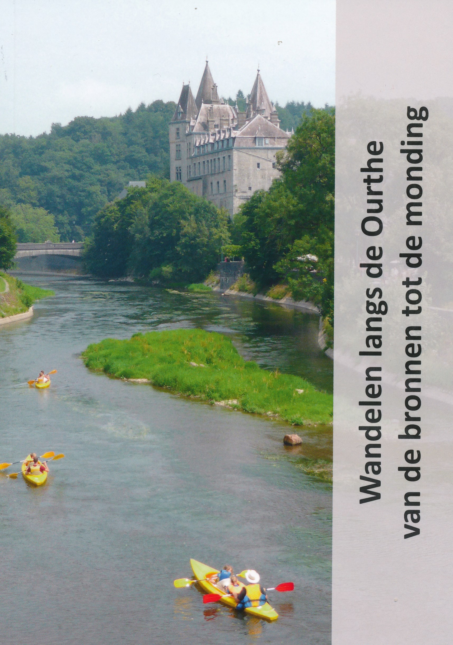
<p> Goede beschrijving van de wandelroute van de bronnen tot de monding van de Ourthe. Veel foto's, maar zeker ook routebeschrijving, verdere praktsche informatie over zaken langs de route is wat beperkt. Kaatmateriaal uitstekend ingetekend op topografische kaarten van Belgie op schaal 1:50.000</p>
€17,50
Bekijk product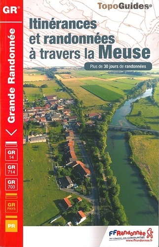
<p> Franstalige wandelgids met een beschrijving van een aantal dagtochten / rondwandelingen. Uitstekende beschrijvingen met duidelijk kaartmateriaal. Mislopen is nauwelijks mogelijk, maar ja .. de franse taal! Ook praktische informatie staat in deze gids. Alle gidsen bevatten een door ons toegevoegde uitgebreide frans - nederlandse wandelwoordenlijst.</p> <p> Plus de 30 jours de randonnées à travers la Meuse de Bar-le-Duc à Verdun, en passant par Avioth.</p> <div> Terre de randonnées, la Meuse est désormais située à une heure de Paris en TGV. A une époque, la devise de Verdun était "On ne passe pas".</div> <div> </div> <div> Aujourd'hui, nous vous invitons à "y passer", à vous arrêter pour découvrir des territoires vallonnés où alternent forêts et cultures, patrimoine et histoire, des sites exceptionnels, mémoire de guerre, l'Argonne et son massif forestier, Verdun et sa Forêt d'Exception®, Bar-le-Duc et la Renaissance, le lac de Madine, l'étang de Lachaussée, le fleuve Meuse, sauvage et navigable, les Côtes de Meuse, synoymes de vergers, mirabelles et vignobles.</div> <div> </div> <div> La Meuse est un département rural où règne le calme, dans des villages typiques, riches d'un patrimoine naturel, architectural, gastronomique, culturel, parfois inattendu et surprenant. </div>
€19,95
Bekijk product
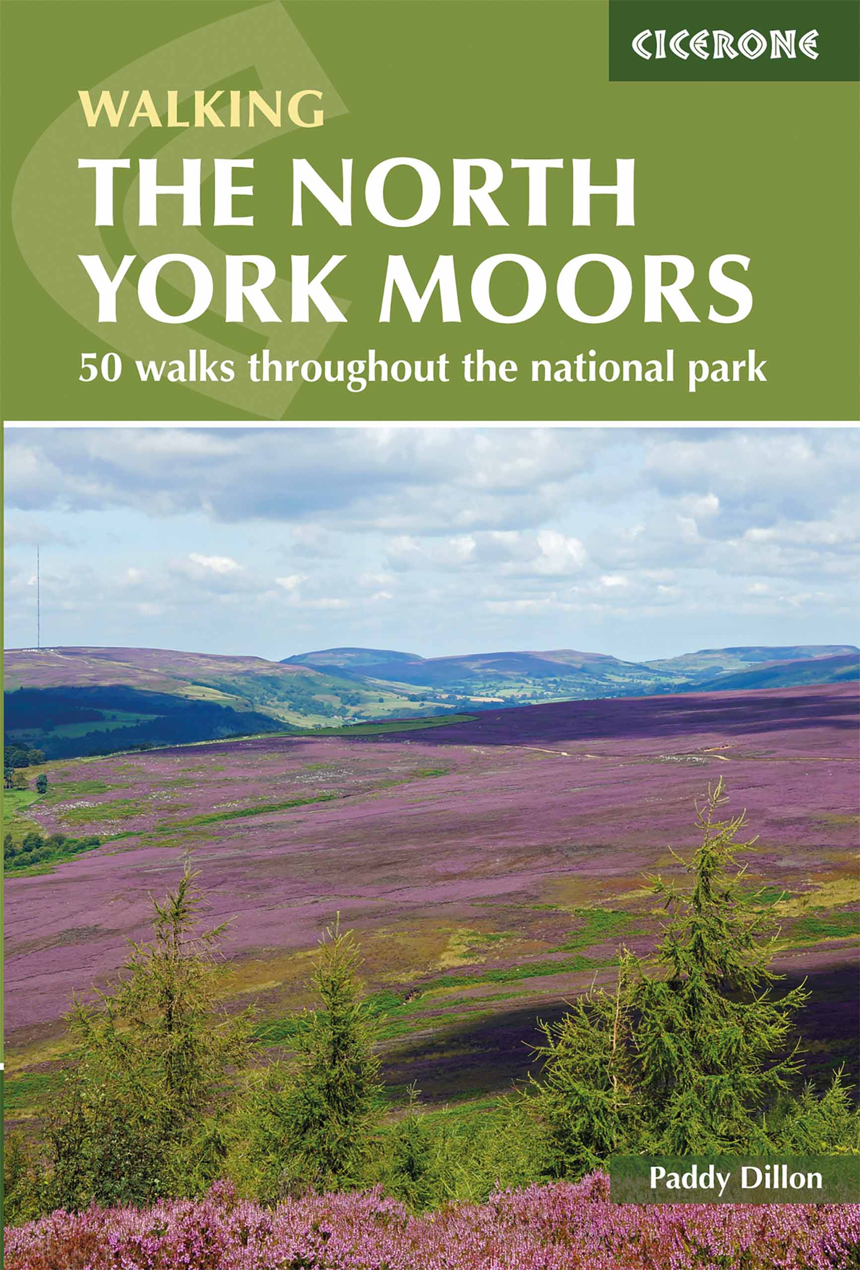
<p> Uitstekende wandelgids van dit geweldige gebied. Goed beschreven met veel praktische informatie om de routes te kunnen lopen, inclusief redelijke kaarten.</p> <div> Guidebook to 50 walks in the North York Moors National Park. The walks, which range from 4 to 13 miles, are distributed through seven regions within the park, enabling walkers to discover and appreciate the Tabular Hills, Hambleton Hills, Cleveland Hills, Northern Moors, High Moors, Eastern Moors and Cleveland Coast. For those who like a challenge, the course of the classic Lyke Wake Walk, crossing the national park from east to west, is also described.</div> <div> </div> <div> For each walk (most of which are circular), step-by-step route description is accompanied by extracts of OS mapping. Points of interest are highlighted, and background information provided, detailing the history and industry of the area. The guidebook also includes planning and preparation details such as when to go, where to stay, and how to get around using public transport.</div> <div> </div> <div> Comprising the largest continuous expanse of heather moorland in England, the North York Moors offer a wonderful sense of spaciousness, with extensive views under a 'big sky'. People have crossed the North York Moors since time immemorial and some of their routes survive to this day. It is a place of great history and undeniable charm, making it a worthy walking destination.</div> <div> </div> <div> Steden en dorpen</div> <div> <div> Staithes, Whitby, Robin Hood's Bay, Scarborough, Pickering, Helmsley, Hutton-le-Hole, Bilsdale, Osmotherley, Great Ayton, Guisborough, Eskdale and Goathland.</div> <div> </div> </div> <p> </p>
€18,50
Bekijk product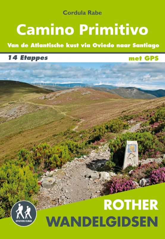
<div> Deze wandelgids is een vertaling van de oorspronkelijke duitse versie. Het zijn klassiekers onder de wandelgidsen. Uitstekende wandelgids met een groot aantal dagtochten in dal en hooggebergte. Met praktische informatie en beperkt kaartmateriaal!</div> <div> </div> <div> Deze wandelgids beschrijft in 14 etappes en zes varianten de Camino Primitivo van Villaviciosa aan de Atlantische kust via Oviedo naar Santiago de Compostela en in nog eens vijf etappes de voortzetting naar Finisterre en Muxía.</div> <div> </div> <div> * Hostels en andere accommodatie voor pelgrims</div> <div> * Details van de infrastructuur onderweg</div> <div> * Informatie over bezienswaardigheden en historische achtergronden</div> <div> * Gedetailleerde wandelkaarten op een schaal van 1: 100.000</div> <div> * informatieve hoogteprofielen</div> <div> * GPS-tracks om te downloaden</div> <div> </div> <div> <div> Let op: er is enige verwarring omtrent het jaartal van deze Nederlandse wandelgidsen van uitgever Elmar. Dit is een vertaling van de Duitse uitgever Rother maar daarna NIET bijgewerkt. De datum die wij vermelden is het moment van vertaling; er zijn andere – meer recente jaartallen – in omloop maar dat is de datum van een nieuwe druk ZONDER aanpassingen. Wilt u de meest recente wandelgids van dit gebied van deze uitgever: kies dan de Duitstalige versie van uitgever Rother. Deze zijn recent en WEL bijgewerkt. </div> <div> </div> </div> <p> </p>
€19,99
Bekijk product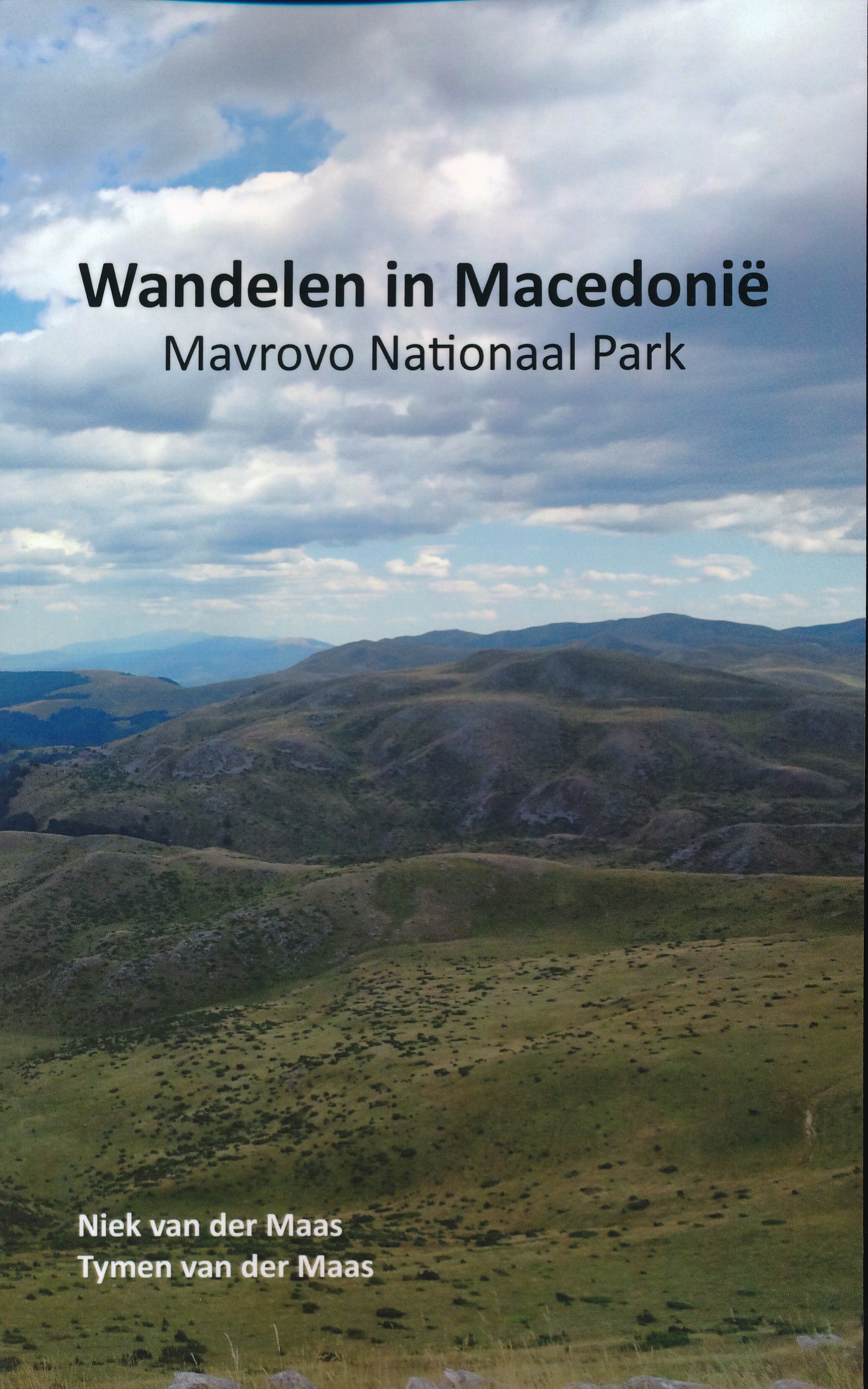
<p> Macedonië is nog onontdekt en in Mavrovo Nationaal Park ervaar je dit. Het is er bosrijk, bergachtig en de diverse primitieve bergdorpjes lijken stil in de tijd te hebben gestaan. Aan de hand van 13 verschillende wandelingen vertelt dit boekje uitgebreid over de omgeving en kenmerken van het gebied. Dit is daarmee de ideale wandelgids om kennis te maken met de schoonheid van Nationaal Park Mavrovo. Daarnaast worden diverse tips gegeven over eetgelegenheden, verblijfsmogelijkheden en bezienswaardigheden.</p> <p> Het boek heeft redelijke kaartjes en vooral ook goede beschrijvingen en praktische informatie.</p>
€25,95
Bekijk product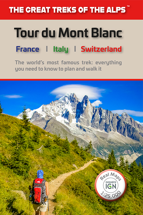
<div> Overzichtelijke routegids van deze prachtige wandelroute. Per etappe vind je een hoogteprofiel, goede beschrijvingen van de wandelroute, een topografische kaart op gedetailleerde schaal. Voor en achterin de gids staat aanvullende praktische informatie zoals adressen van campings, andere accommodaties en bijvoorbeeld een paar pagina's over de flora en fauna. </div> <div> </div> <div> Complete guidebook for planning and trekking the Tour du Mont Blanc, the world's most famous trek</div> <div> </div> <div> Real maps for each stage: 1:25,000. No need to buy a separate map!</div> <div> </div> <div> Unique Itinerary Planner: plan a bespoke itinerary to match your ability and vacation schedule. All difficult calculations of time, distance and altitude gain are done for you</div> <div> </div> <div> Everything the trekker needs to know: route descriptions, costs, budget, difficulty, weather, how to get there, and more</div> <div> </div> <div> Full accommodation listings: spectacularly situated mountain huts, villages and hamlets</div> <div> </div> <div> Full section on camping: a complete list of camping locations</div> <div> </div> <div> 10 exciting variants to the main route!</div> <div> </div> <div> Information for both self-guided and guided trekkers</div>
€20,95
Bekijk product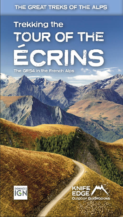
<p> Overzichtelijke routegids van deze prachtige wandelroute. Per etappe vind je een hoogteprofiel, goede beschrijvingen van de wandelroute, een topografische kaart op gedetailleerde schaal. Voor en achterin de gids staat aanvullende praktische informatie zoals adressen van campings, andere accommodaties en bijvoorbeeld een paar pagina's over de flora en fauna. </p> <div> <div> The Tour of the Ecrins National Park is also known as the GR54. It is arguably the best trek in the Alps. It is an incredible walk of 193km (120 miles) around the incomparable Ecrins National Park in the Southern French Alps. It takes 9-12 days. On the way, 14 magnificent mountain passes are crossed. It is almost certainly the finest trek that you have never heard of! The Ecrins Massif is the second highest range of mountains in the French Alps: the Mont Blanc Massif is of course the highest.</div> <div> </div> <div> Unspoilt and remote high mountain terrain: snow frosted summits, beautiful valleys and pastures, sparkling azure lakes, carpets of wild flowers, the soothing sound of cow bells and easy to follow paths. What more could you ask for from a hike in the Alps?</div> <div> </div> <div> Hiking in the Ecrins National Park is a tranquil experience as there are much fewer walkers than in other Alpine regions. And there are plenty of other activities to experience on rest days such as mountain biking or via ferrata. </div> <div> </div> <div> All our walking guidebooks include Real 1:25,000 Maps for each stage or hike. So there is no need to buy a separate map.</div> </div> <p> </p>
€26,95
Bekijk product