
Beantwoord enkele vragen, en binnen seconden geeft AI je een persoonlijk aankoopadvies op maat.
Beantwoord enkele vragen, en binnen seconden geeft AI je een persoonlijk aankoopadvies op maat.
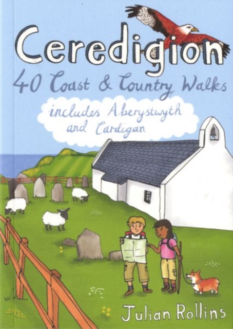
<p> <span style="color: rgb(0, 0, 0); font-family: "Helvetica Neue", Helvetica, sans-serif, Arial;">Handige compacte wandelgids met 40 dagwandelingen. Deze gids bevat kleine kaartjes en leuke uitgebreide informatie over wat er langs de route te zien is. Goede wandelkaarten zijn echter we noodzakelijk voor deze tochten: de Ordnance Survey explorer maps of Landanger maps zijn zeer geschikt.</span></p> <p> Encompassing the southern half of Cardigan Bay on the wild west coast of Wales, Ceredigion is famed for its glorious sandy beaches, dramatic sea cliffs and caves, spectacular sunsets and a wonderful array of wildlife, including the largest colony of bottlenose dolphins in Europe. Away from the sea, rolling farmland, fertile river valleys and characterful market towns give way to the brooding Cambrian Mountains, the main watershed of Wales. As one of the least populated regions of Wales, there is plenty of room to walk and in these 40 rambles Julian Rollins leads you through the best countryside and seascapes Ceredigion has to offer.</p>
€10,95
Bekijk product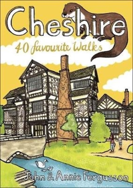
<div> Handige compacte wandelgids met 40 dagwandelingen. Deze gids bevat kleine kaartjes en leuke uitgebreide informatie over wat er langs de route te zien is. Goede wandelkaarten zijn echter we noodzakelijk voor deze tochten: de Ordnance Survey explorer maps of Landanger maps zijn zeer geschikt.</div> <div> </div> <div> Full of surprises and infused with history, Cheshire is a wonderful place to go for a walk! From the wild and open hills of the Peaks to the low-lying pastures of the Plain, Cheshire is covered in a spider's web of footpaths, bridleways, towpaths and trails and is well served by welcoming pubs and cosy cafes. There is so much to see in this corner of England and there is no better way to explore it than by lacing up your boots and setting off on foot - armed of course with this selection of 40 circular walks.</div>
€10,95
Bekijk product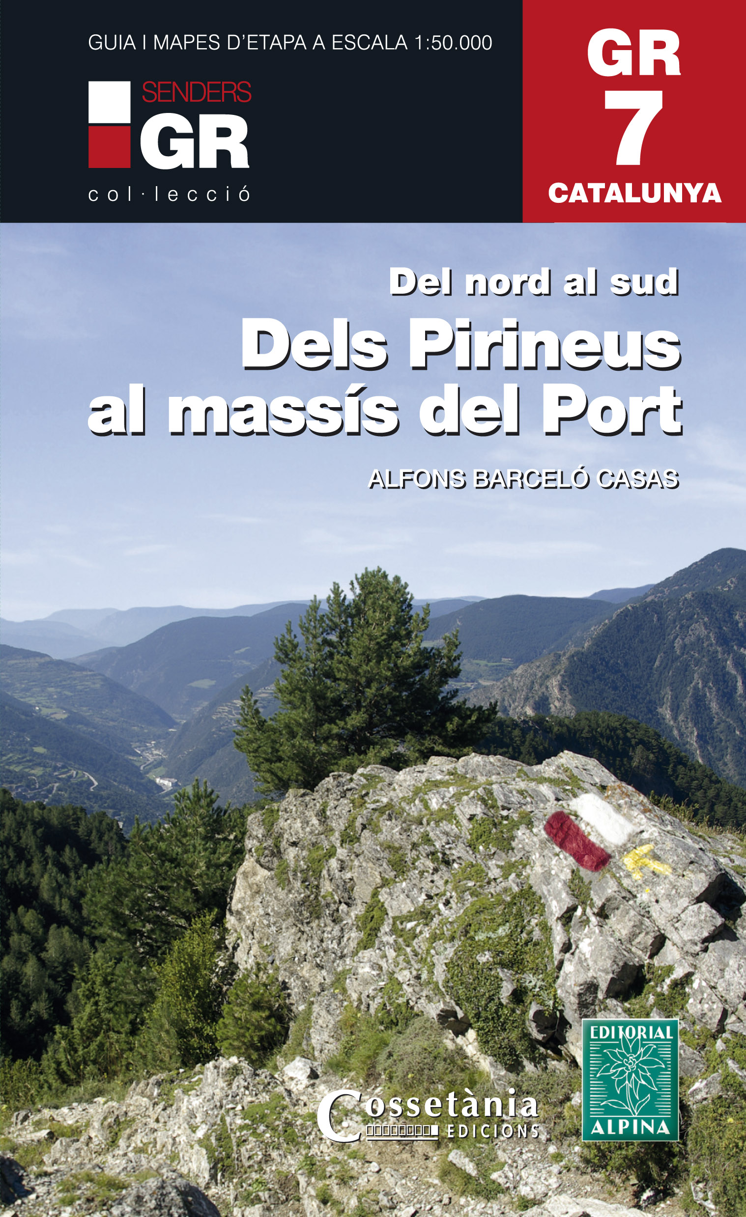
<p> Prachtige uitvoering van een beschrijving van de GR7 in Catalonie in 21 etappes van Porte naar Fredes, helaas wel in het Catalaans!. Veel details en een nauwkeurige routebeschrijving, uitgevoerd in een ringband. Nadeel is dat het een vrij zware gids is geworden. Belangrijk is echter de set losse kaarten op schaal 1:50.000; op deze topografische kaarten staat de route nauwkeurig ingetekend, daarmee moet je toch een heel eind kunnen komen. </p> <p> El GR 7 és el primer dels senders de gran recorregut de tot l’estat espanyol. Aquest llibre engloba 21 capítols que es corresponen als 21 dies que transcorren entre Porta, a la Catalunya Nord, i Fredes, al País Valencià. Permet recórrer tota mena de paisatges, des de l’alta muntanya andorrana a les serres prepirinenques, de les modestes muntanyes del centre del país a la serralada prelitoral, amb les muntanyes de Prades i el Port com a massissos més destacats. Cadascuna de les etapes afegeix una introducció exhaustiva de les característiques de la jornada, amb els seus atractius, problemes i virtuts; una descripció de les poblacions que travessen el recorregut i de les seves zones rellevants; uns textos literaris d’autors diversos que parlen de punts determinats dels senders; la temporització precisa dels itineraris; una gràfica amb els desnivells de la jornada, i un mapa a escala 1:50000, que complementa i ajuda a interpretar el text.</p>
€28,95
Bekijk product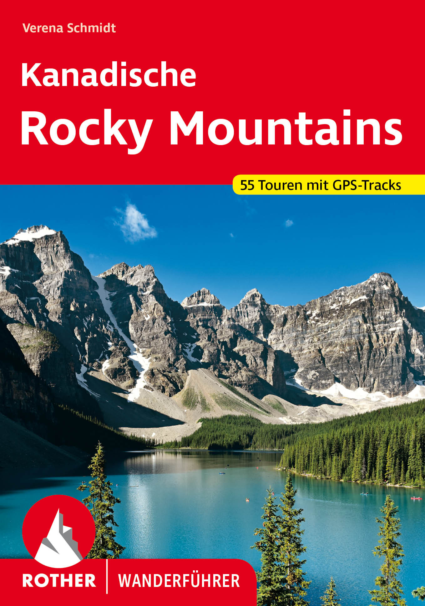
<p> Uitstekende wandelgids met een groot aantal dagtochten in dal en hooggebergte. Met praktische informatie en beperkt kaartmateriaal! Wandelingen in verschillende zwaarte weergegeven in rood/blauw/zwart.</p> <div> Gigantische Berge, tiefblaue Seen und endlose Wälder – die Kanadischen Rocky Mountains faszinie-ren. Nur punktuell ist die raue Gebirgskette von Menschenhand berührt. Die »Rockies« vereinen felsige, windumtoste Gipfel, massive Gletscher, idyllische Bergseen, alpine Wildblumenwiesen und mystische, mit Flechten verhangene Wälder, in denen Orchideen gedeihen. Elche und Bären, Pumas und Kolibris haben in dieser wilden Schönheit ihre Heimat. Der Rother Wanderführer »Kanadische Rocky Mountains« stellt 55 Tages- und Mehrtagestouren in dieser unvergleichlichen Bergwildnis vor.</div> <div> </div> <div> Die Highlights sind die Mehrtagestouren, die fernab von jeder Straße in die atemberaubende Natur führen. Hier kann man tagelang unterwegs sein, entlang von eisblauen Flüssen trekken, einsame Täler erkunden und wohl kaum einem anderen Menschen begegnen. Auch auf den vorgestellten Tagestouren kann man diese Natur genießen: Die Wanderungen führen zu türkisfarbenen Gletscherseen, auf windige Pässe und aussichtsreiche Gipfel. Auch kurze Spaziergänge in Zivilisationsnähe finden sich in der Auswahl.</div> <div> </div> <div> Eine rechtzeitige Planung ist für viele Touren unerlässlich. Dieser Rother Wanderführer ist dafür die beste Grundlage. Er liefert außerdem viele wichtige Informationen zum Wandern in der Wildnis, zur Ausrüstung, zu Übernachtungsmöglichkeiten, zu Genehmigungen und vielem mehr. Sämtliche Touren verfügen über zuverlässige Wegbeschreibungen, Tourenkärtchen mit eingezeichnetem Routenverlauf und aussagekräftige Höhenprofile. GPS-Tracks stehen zum Download von der Internetseite des Berg-verlag Rother bereit. Viele Fotos wecken daheim schon die Vorfreude auf die Entdeckungsreise der Rocky Mountains.</div>
€22,50
Bekijk product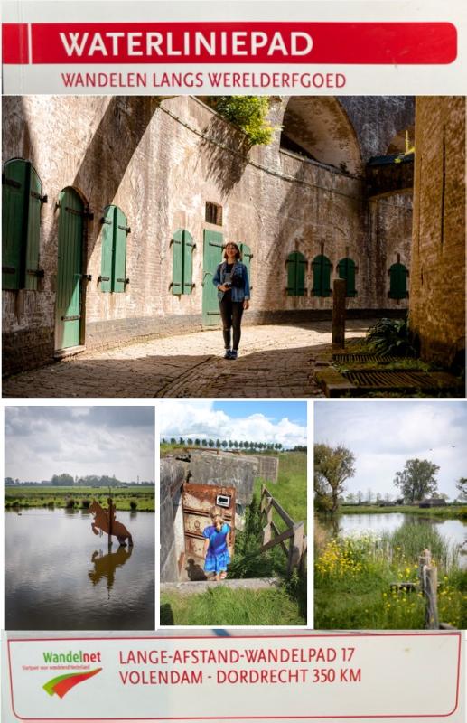
<p> Overstromingen, dijkdoorbraken: ons land strijdt al eeuwen tegen het water. Tot op de dag van vandaag. Maar dat water ook een bondgenoot kan zijn, bleek in het Rampjaar 1672. Door een brede strook land onder water te zetten, konden we de Franse soldaten op veilige afstand houden. Een laagje van 40 á 50 centimeter was genoeg. Te diep voor man en paard, te ondiep voor schepen. Het water werd de ruggengraat van ons defensiesysteem. Er verrees een ingenieus stelsel van sluizen, dijken en kanalen waarmee we het land konden inunderen, onder water zetten. Zwakke plekken in de linie werden versterkt met imposante forten. Ze lagen verscholen in het landschap, onzichtbaar voor de vijand. Omdat bebouwing rondom de forten niet was toegestaan, is op veel plekken langs de linie een prachtig open landschap ontstaan waar de natuur haar gang kan gaan.</p> <p> De voormalige verdedigingslinies vormen nu de leidraad voor het vernieuwde Waterliniepad. Veel forten zijn de afgelopen decennia gerestaureerd en inmiddels zijn ze opengesteld voor publiek. Ze vormen een authentiek decor voor evenementen, pleisterplaatsen en natuurreservaten. Overal langs de route bevinden zich inundatiesluizen en -kanaaltjes, dammen en dijken, bunkers en forten. Dat maakt dit Lange-Afstand-Wandelpad (LAW) tot een boeiende en afwisselende route. Wandel door oude vestingstadjes, struin door nieuwe natuurgebieden, bestel een hapje of drankje in een fort en ja, zelfs overnachten in een bunker of remise is mogelijk.</p>
€19,90
Bekijk product
<div> Zeer complete wandelgids van Californië met een groot aantal wandelingen beschreven verspreid over de hele staat. Dit is eigenlijk dë gids om te kunnen kiezen welk deel van Californië je wilt bezoeken en welke wandelingen je wilt doen. Beschrijvingen zijn een beetje beperkt, maar wel weer met veel praktische zaken als startpunt, lengte, zwaarte etc.</div> <div> </div> <div> Pack a lunch, lace up your boots, and head out to discover the best hiking trails in the Golden State with Moon California Hiking.</div> <div> A Hike for Everyone: Pick the right hike for you, from breathtaking coastal walks to challenging backcountry treks, with options ranging from easy day hikes to multi-day backpacking trips</div> <div> Best Hikes Lists: Choose from strategic lists like Best Desert Hikes, Best Hikes for Redwoods, Fall Colors, Hikes with Kids, Waterfalls, Wildflowers, and more</div> <div> Essential Planning Details: Each hike is marked with round-trip distance and hiking time and rated for scenic beauty and trail difficulty</div> <div> Maps and Directions: Find easy-to-use maps, driving directions to each trailhead, and details on where to park</div> <div> Skip the Crowds: Have the trail to yourself with Moon California Hiking's many off-the-radar hikes</div> <div> Expert Advice: Seasoned hikers Tom Stienstra and Ann Marie Brown offer their experienced insight and honest opinions on each trail</div> <div> Tips and Tools: Advice on gear, first aid, and camping permits, plus background information on climate, landscape, and wildlife</div>
€23,95
Bekijk product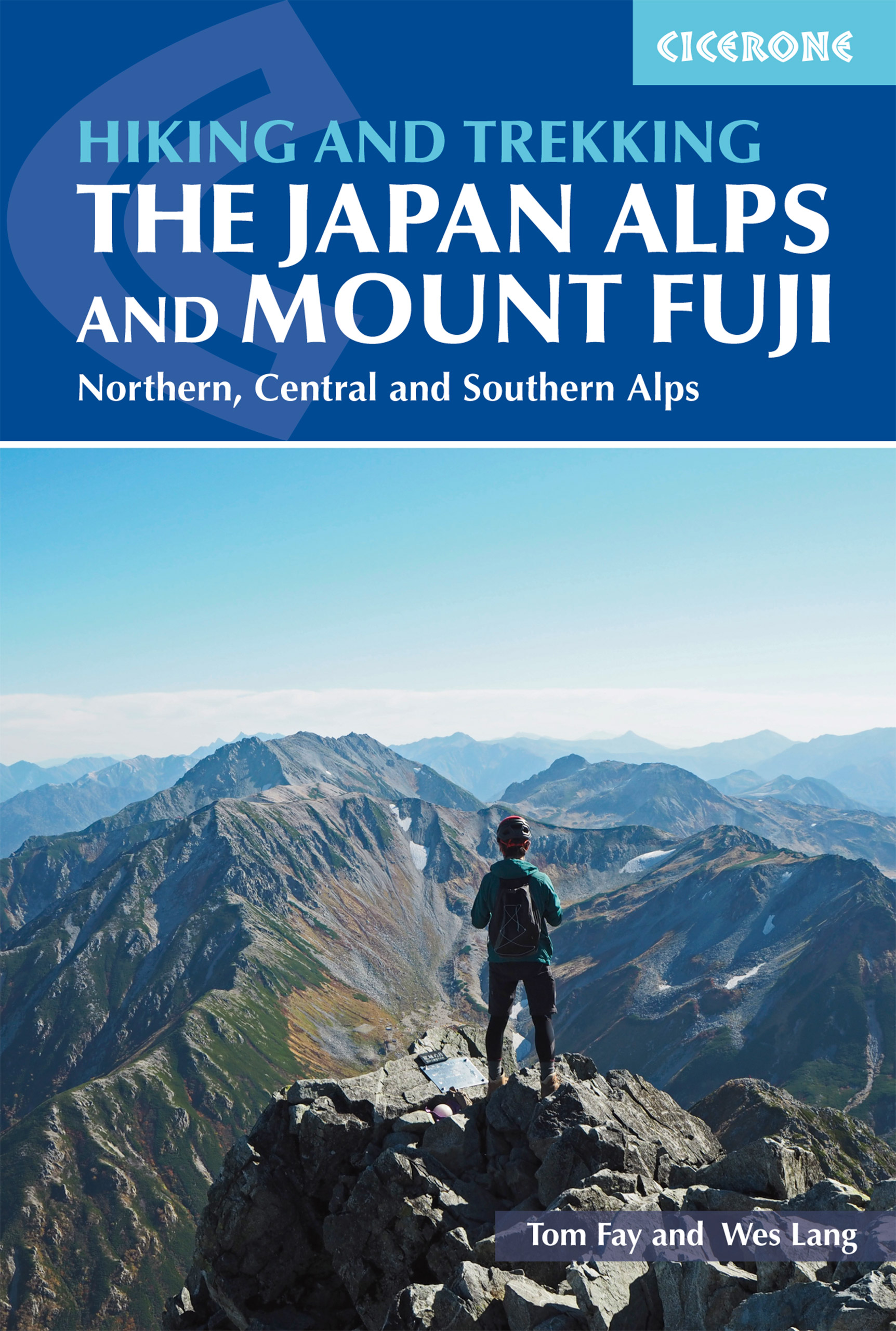
<p> This guidebook presents nine day-walks and thirteen treks of 2-8 days in the magnificent Japanese Alps, plus the four main routes up Japan's highest mountain, Mount Fuji (3776m), and a further route on neighbouring Mount Kurodake. The Japanese Alps stretch across the middle of the main island of Honshu and include several peaks over 3000m. Mount Fuji lies to the south: an active stratovolcano (though with minimal risk of eruption), it has become an iconic symbol of Japan and sees 300,000 visitors to its summit every year.<br /> <br /> The guide includes all the information you will need to plan a successful walking or trekking holiday, with a wealth of advice on travel, bases, accommodation and facilities. The Japan Alps and Mount Fuji boast a well-developed walking infrastructure, and the routes make use of the many mountain huts and campgrounds, full details of which are given in the guide. Some also include the opportunity to visit a traditional hot spring bath for a refreshing soak after your hike.</p> <p> The routes visit many of the region's key summits, including several over 3000m. They are graded according to difficulty, although several entail steep ascents and difficult terrain and some include scrambling and exposure calling for a sure foot and a good head for heights. Comprehensive step-by-step route descriptions are accompanied by clear mapping and there are additional notes on plants and wildlife, the history of hiking in Japan and safety in the mountains, as well as full mountain hut listings and a helpful glossary. Inspirational colour photography completes the package.</p> <div> Hakuba, Murodō and Kamikōchi (North Alps), Komagane (Central Alps), Hirogawara and Sawarajima (South Alps), Kawaguchiko and Mt Fuji area</div> <div> </div>
€29,95
Bekijk product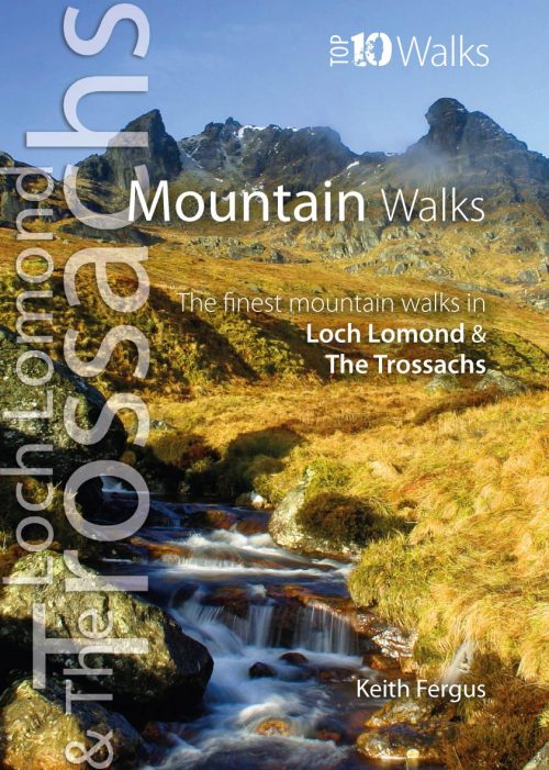
<p> One of four books in the popular Loch Lomond and The Trossachs: Top 10 Walks series. Handy, pocket-sized, full colour walking guides written by experts. The perfect impulse buy. The other titles in the series are: Lochside Walks, Hill Walks and Easy Summits and Pub Walks. This attractive and cleverly structured guide gives walkers ten of the finest short circular mountain walks in the Loch Lomond and The Trossachs National Park in a popular pocketable format.</p> <p> With clear information, an overview and introduction for each walk, expertly written numbered directions, large scale Ordnance Survey maps, superb eye-grabbing panoramic photographs, and interpretation of points of interest along the way, these guides set a new standard in clarity and ease-of-use. Featured walks include: Ben Lomond & Ptarmigan Ridge, Ben Donich, The Cobbler, Beinn Ime and Beinn Narnain, Ben Vorlich, An Caisteal & Beinn a¿ Chroin, Cruach Ardrain and Beinn Tulaichean, Beinn Odhar and Meall Buidhe, Stob Binnein, Ben Venue and Ben Ledi.</p>
€10,95
Bekijk product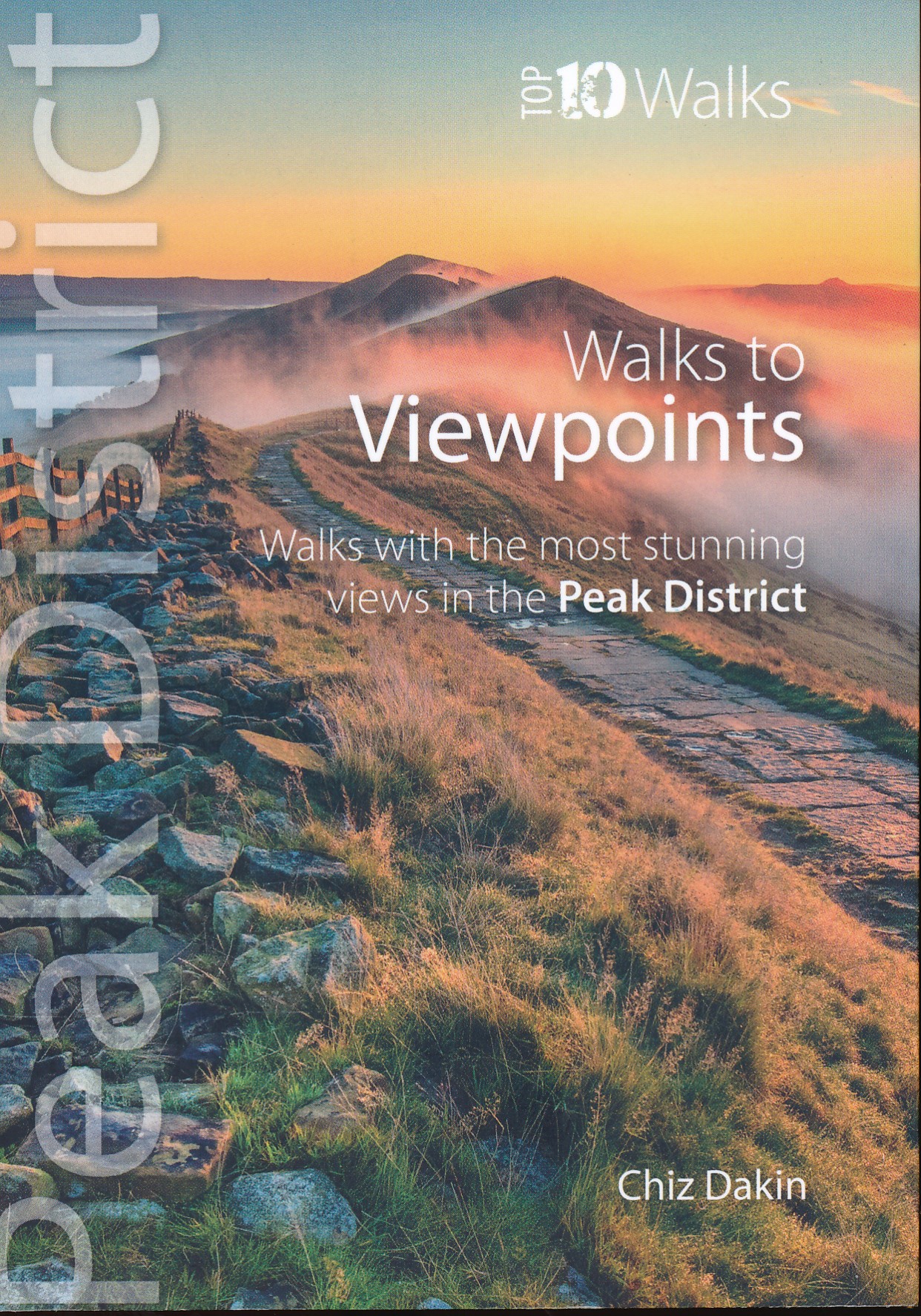
<div> This handy pocket size book will take you on short circular walks to the ten finest views and viewpoints in the Peak District.</div> <div> </div> <div> Views are why many of us venture into the hills and countryside in the first place. Nothing beats a sweeping view from a moorland edge or hill, or an arching panorama over a pleasant valley. Sometimes it’s just the simple pleasure of the patterns of light and shade, the textures and colours of the woodland or the flowing beauty of the stream we’re walking beside. But typically there’s a feeling that you’ve earned a great view through sheer effort – even if the easiest approach had been taken to reach it.</div> <div> </div> <div> Perhaps that’s why so many of the great Peak District views are atop minor summits, at moorland edges, or overlooking deep valleys.</div>
€10,95
Bekijk product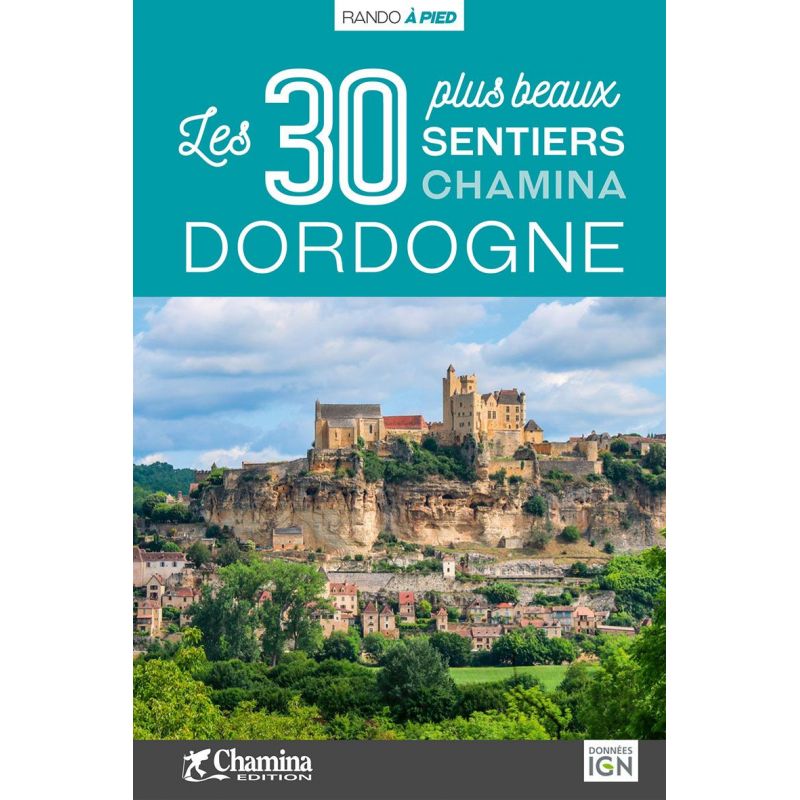
<p> Het betreft hier een Franstalig wandelgidsje met uitgebreide beschrijvingen en kaartmateriaal van 30 dagwandelingen. De gids geeft veel informatie over wat er te zien is tijdens de wandeling zowel textueel als met enige foto's. Tevens is duidelijk aangegeven wat het moeilijkheidsniveau is en de duur van de wandeling. Iedere wandeling is beknopt beschreven en ingetekend op een topografisch kaartje van het IGN op schaal 1:25.000. </p> <div> Troisième département français pour la superficie, la Dordogne est plurielle.</div> <div> Chacune des 4 régions qui la composent est visitée par le guide :</div> <div> • Le Périgord noir, autour de Sarlat.</div> <div> • Le Périgord pourpre et sa capitale Bergerac.</div> <div> • Le Périgord blanc, le long de la vallée de l’Isle et autour de Périgueux.</div> <div> • Le Périgord vert, accès aux monts du Limousin.</div> <div> Le guide</div> <div> • 30 itinéraires de 1h45 à 5h00 pour une pratique familiale et sportive.</div> <div> • Cartographie sur fond IGN au 1 : 25 000 pour se repérer facilement</div> <div> • Détail des centres d’intérêts</div> <div> • Renseignements pratiques et adresses utiles.</div> <div> </div> <div> Cette nouvelle édition du livre Les 30 plus beaux sentiers Chamina Dordogne est entièrement renouvelée et mise à jour. Les circuits sont situés sur tout le département, de Varaignes au nord à Biron au sud, et de Saint-Michel-de-Montaigne à l'ouest, à Borrèze à l'est. Les balades sélectionnées font la part belle à la riche histoire de la Dordogne (sites préhistoriques, abbaye de Cadouin, Brantôme...) et à ses intérêts naturels (vallée de la Dronne, tourbière de Vendoire...). De quoi largement arpenter les Périgord noir, blanc, pourpre et vert ! </div>
€15,95
Bekijk product