
Beantwoord enkele vragen, en binnen seconden geeft AI je een persoonlijk aankoopadvies op maat.
Beantwoord enkele vragen, en binnen seconden geeft AI je een persoonlijk aankoopadvies op maat.
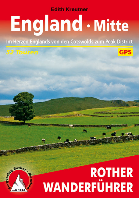
<p> Uitstekende wandelgids met een groot aantal dagtochten in dal en hooggebergte. Met praktische informatie en beperkt kaartmateriaal! Wandelingen in verschillende zwaarte weergegeven in rood/blauw/zwart.</p> <div> 184 Seiten mit 109 Farbabbildungen </div> <div> 52 Höhenprofile, 52 Wanderkärtchen im Maßstab 1:50.000 und 1:75.000, zwei Übersichtskarten</div> <div> </div> <div> <div> Wer sich im Herzen Englands die Wanderschuhe anzieht, durchschreitet vor allem altes Kulturland –also typisch englische Landschaft mit fruchtbarem Weideland und beeindruckenden Herrenhäusern, aber auch moorige Hochplateaus und eichenbewachsene Flusstäler. Die für diesen Rother Wander-führer ausgewählten Touren leiten die Wanderer zu einigen der Wander-Highlights in Mittelengland: über die sanften Hügel der durch Schafzucht zu Reichtum gekommenen Cotswolds mit ihren kleinen Weilern, die rauen Hochplateaus und durch die tiefgrünen Täler des Peak District National Park bis in die Grenzregion zu Wales, von den geschützten Eichenwäldern des Forest of Dean im Süden bis zu den aus der Eisenzeit stammenden Seen im Norden der Grafschaft Shropshire.</div> <div> Das englische Wetter kann zwar durchaus die Ausrüstung herausfordern, aber dafür gleicht die Natur den Regenreichtum mit Teppichen aus Narzissen im März, wilden Hyazinthen und weißem Bärlauch im Mai, tiefgrünem Weideland im Sommer und mit in die schönsten Herbstfarben getauchten Wäldern im Oktober aus. Aufgrund der eher milden Temperaturen und der seltenen Schneefälle lässt es sich auch im Winter gut wandern.</div> <div> Vorgestellt wird eine Vielzahl unterschiedlicher Wanderungen, von kürzeren Touren, die man gut mit Sightseeing verbinden kann, bis hin zu Tageswanderungen, die auch einiges an Orientierungsvermö-gen voraussetzen. Alle Tourenvorschläge sind leicht nachvollziehbar und mit einer zuverlässigen Wegbeschreibung, einem Kartenausschnitt mit eingetragenem Routenverlauf und einem aussagekräftigen Höhenprofil ausgestattet. GPS-Daten stehen für alle Touren zum Download bereit.</div> </div> <p> </p>
€17,50
Bekijk product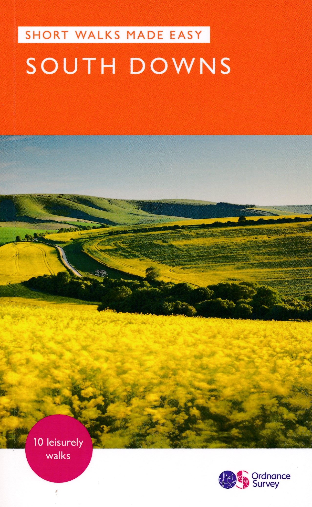
<div> Stroll up on the Downs, explore charming villages and wander woodland trails with ten hand-picked leisurely walks suitable for the whole family. Enjoy some of the loveliest and most accessible walks in the South Downs National Park and discover the benefits of being active outside.</div> <div> </div> <div> South Downs Short Walks Made Easy include:</div> <div> </div> <div> - Climb the Zig-Zag Path above charming Selborne, made famous by naturalist Gilbert White, for wonderful views</div> <div> - Explore the historic village of Bramber, once an important river port and full of intrigue, and enjoy the beautiful ‘Walk For All’ along the banks of the Adur</div> <div> - See the iconic Devil’s Dyke, offering great views in all directions from the hillfort above the longest and deepest dry valley in the country</div> <div> - Wander the Seven Sisters Country Park, part of the spectacular Sussex coastline between Eastbourne and Seaford</div> <div> - Follow the South Downs Way up Old Winchester Hill to find a hill-fort and barrows, as well as excellent views as far as the Solent and the Isle of Wight</div> <div> - Discover the historic market town of Arundel with its castle and cathedral and stroll along the banks of Swanbourne Lake and the River Arun</div> <div> </div> <div> OS Pathfinder Guides: Short Walks Made Easy:</div> <div> </div> <div> - 10 accessible walks suitable for the whole family</div> <div> - All routes are between 2 to 5 miles and can be completed all year round</div> <div> - Know what to expect before you go: Information on locations of cafes/pubs and toilets, terrain, hilliness and accessibility for pushchairs and wheelchairs</div> <div> - Large-scale Ordnance Survey maps for ultra-easy navigation and route-finding, featuring intuitive pictorial symbols</div> <div> - Numbered points which tie maps to route descriptions and walk profiles</div> <div> - Route photographs for each numbered point so you know exactly where you’re going</div> <div> - Discover GPS waypoints, parking information and detailed route descriptions for foolproof navigation</div> <div> - Enhance your adventure with stories behind each walk and nature notes</div> <div> - Get active outside and enjoy the physical and mental health benefits</div>
€10,95
Bekijk product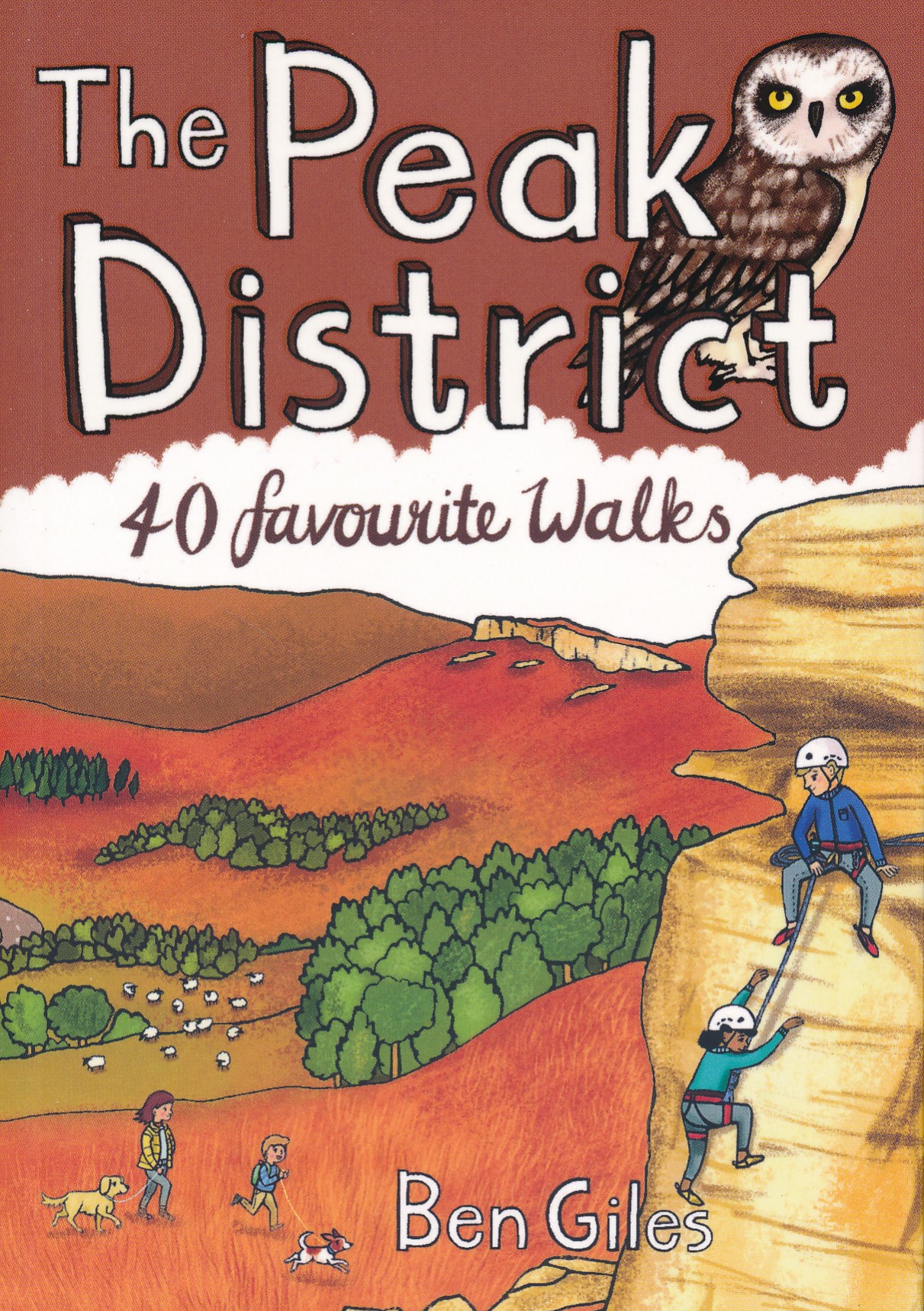
<div> Leuk wandelgidsje met een ruime keuze aan wandelingen, meestal tussen de 5 en 10 km. Goed beschreven en een redelijk schetsmatig kaartje. Handzaam zakformaat!</div> <div> </div> <div> The Peak District is an upland area at the southern end of the Pennines and includes parts of Derbyshire, Greater Manchester, Staffordshire, West Yorkshire and South Yorkshire. Mostly split between the gritstone of the Dark Peak and the limestone area of the White Peak, the Peak District National Park became the UK's first national park in 1951. Tourism had been growing since the advent of the railways, with visitors attracted by the spa towns of Buxton and Matlock Bath, Castleton's show caves, and Bakewell, the national park's only town.</div> <div> </div> <div> The stunning landscape accessed by an extensive network of public footpaths now draws outdoors enthusiasts from far and wide. This new volume from Pocket Mountains Ltd includes 40 of the most popular walks in the Peak District.</div>
€10,95
Bekijk product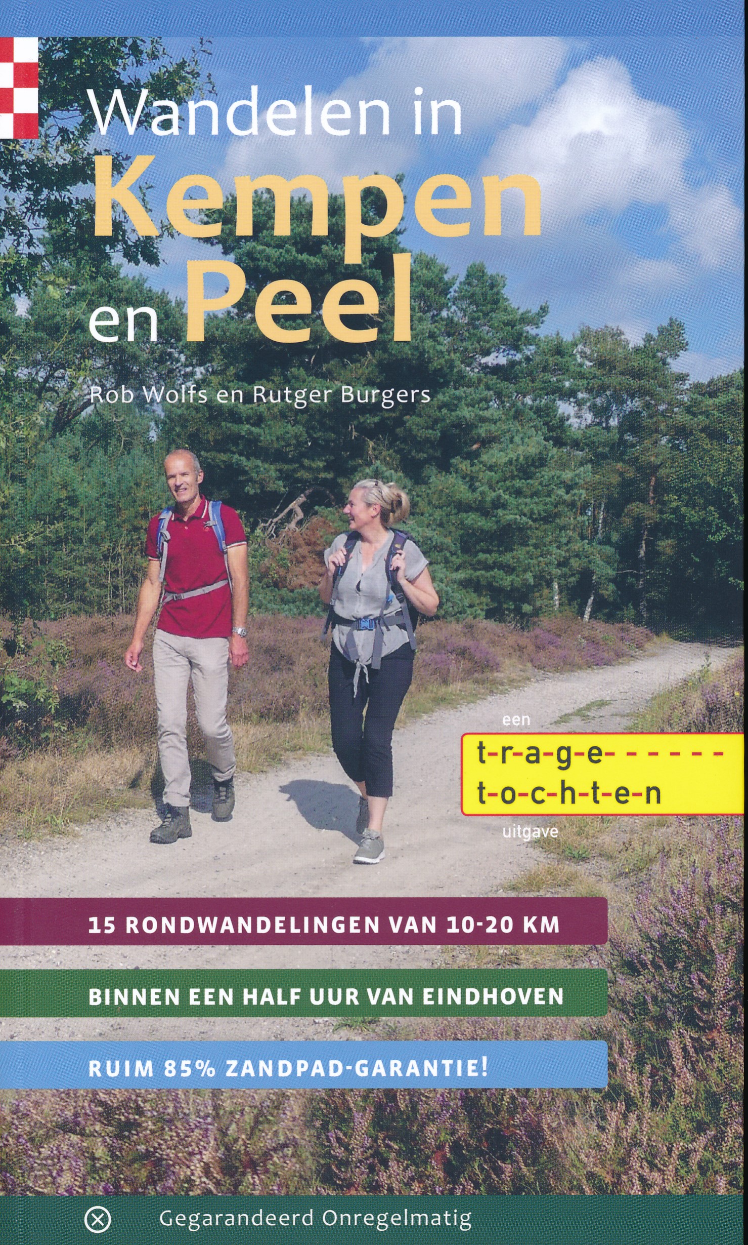
<p> Goede beschrijvingen en gedetaillerde topografische kaarten maken verdwalen zo ongeveer onmogelijk!</p> <p> Voor de liefhebber van onverhard wandelen is Zuidoost-Brabant een paradijsje. Je vindt er de mooiste paadjes op de oevers van kronkelende beken als de Tongelreep, de Beerze en natuurlijk de Dommel. In het boerenland kun je eindeloos uit de voeten op de zandwegen tussen akkers en weiden. En wat te denken van alle bospaadjes en schapendreven in een bonte aaneenschakeling van natuurgebieden.</p> <p> Deze wandelgids staat helemaal in het teken van Trage Tochten over onverharde paden. Zandpadgarantie heet dat: minimaal 70% van iedere route is onverhard. Uit de landelijke reeks van bijna 600 Trage Tochten zijn vijftien wandelingen in de regio Eindhoven geselecteerd. Stuk voor stuk routes met een kwaliteitsstempel.</p>
€17,95
Bekijk product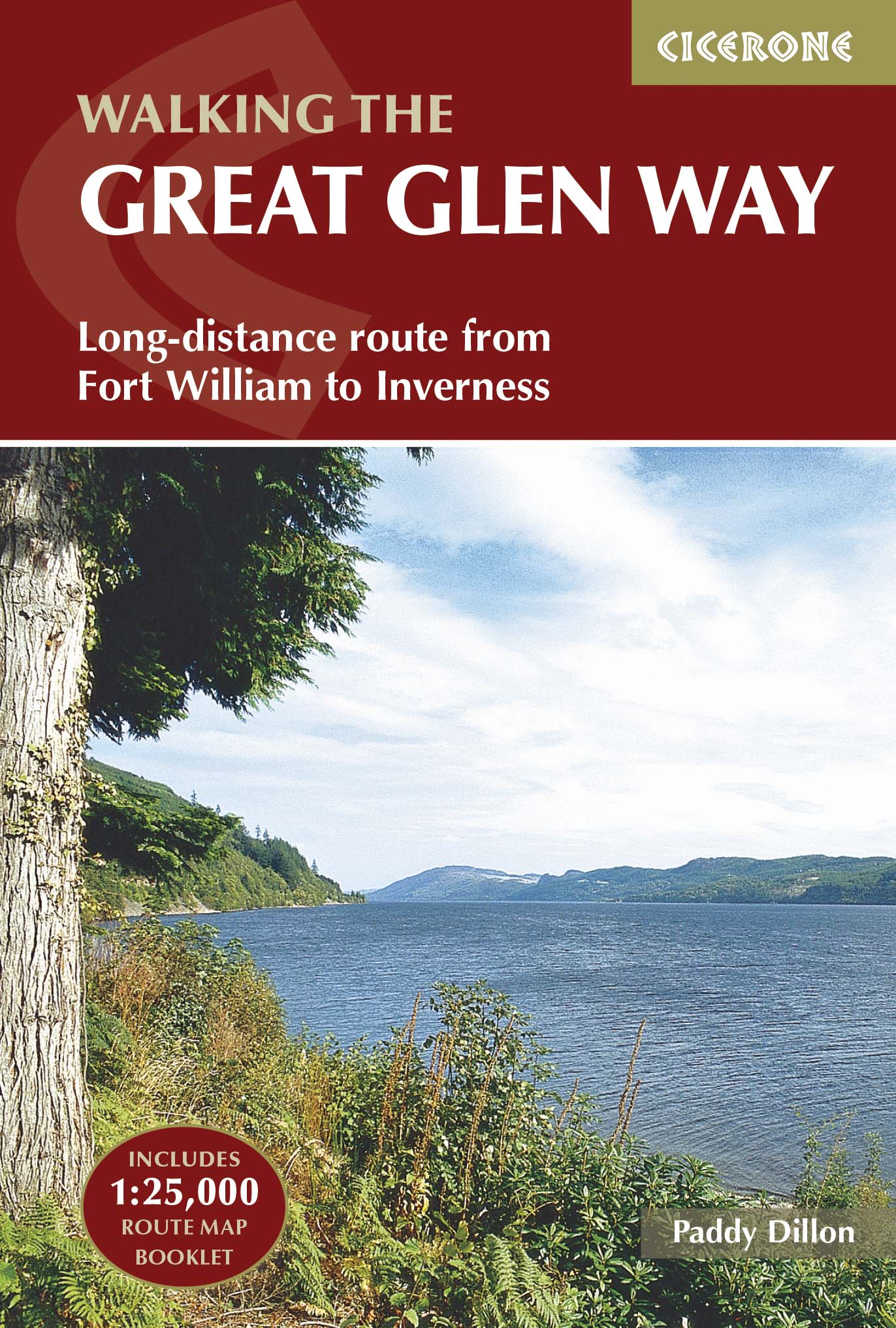
<div> Uitstekende wandelgids van de Great Glen Way, waarbij naast alle noodzakelijke informatie ook gebruik gemaakt wordt van de echte topografische kaart. inclusief gidsje met routekaarten van 1:25000 (deze is <a href="https://www.dezwerver.nl/r/europa/schotland/ben-nevis-eo/c/kaarten/wandelkaarten/9781852848958/wandelkaart-great-glen-way-cicerone/">hier</a> ook los te bestellen)</div> <div> </div> <div> Guidebook to walking the Great Glen Way, one of Scotland’s Great Trails that runs along the Great Glen between Fort William and Inverness. The guidebook - which includes both a guide to the route and a separate OS map booklet – describes the route in both directions.</div> <div> </div> <div> Ideal as an introduction to long-distance walking, the 79-mile Great Glen Way is split into six stages easily walked within a week, with high- and low-level options given for two of these. An alternative route past the northern side of Loch Oich (via Invergarry) is also described.</div> <div> </div> <div> The guidebook includes practical information, 1:100,000 OS mapping, step-by-step route descriptions for every stage of the walk and lists the facilities found along the way. A separate booklet of 1:25,000 OS mapping provides all the mapping needed to walk the trail. The trail stretches alongside the scenic Caledonian Canal, which links Loch Lochy and Loch Oich with the famous Loch Ness. The route uses undulating forest tracks, lakeside paths, old drove roads and military roads, as well as contrasting stretches over heather moorlands or through city suburbs. The Great Glen is one of the most remarkable features in the Scottish landscape - a ruler-straight valley along an ancient fault line through the Highlands.</div> <div> </div> <div> The route in this guidebook is described in both directions, and given the connection with the West Highland Way at Fort William there is no reason why both trails shouldn’t be walked together in one long journey between Glasgow and Inverness, or vice versa.</div> <div> </div> <div> Steden en Dorpen</div> <div> Inverness, Drumnadrochit, Invermoriston, Fort Augustus, North Laggan, Gairlochy, Fort William</div>
€24,95
Bekijk product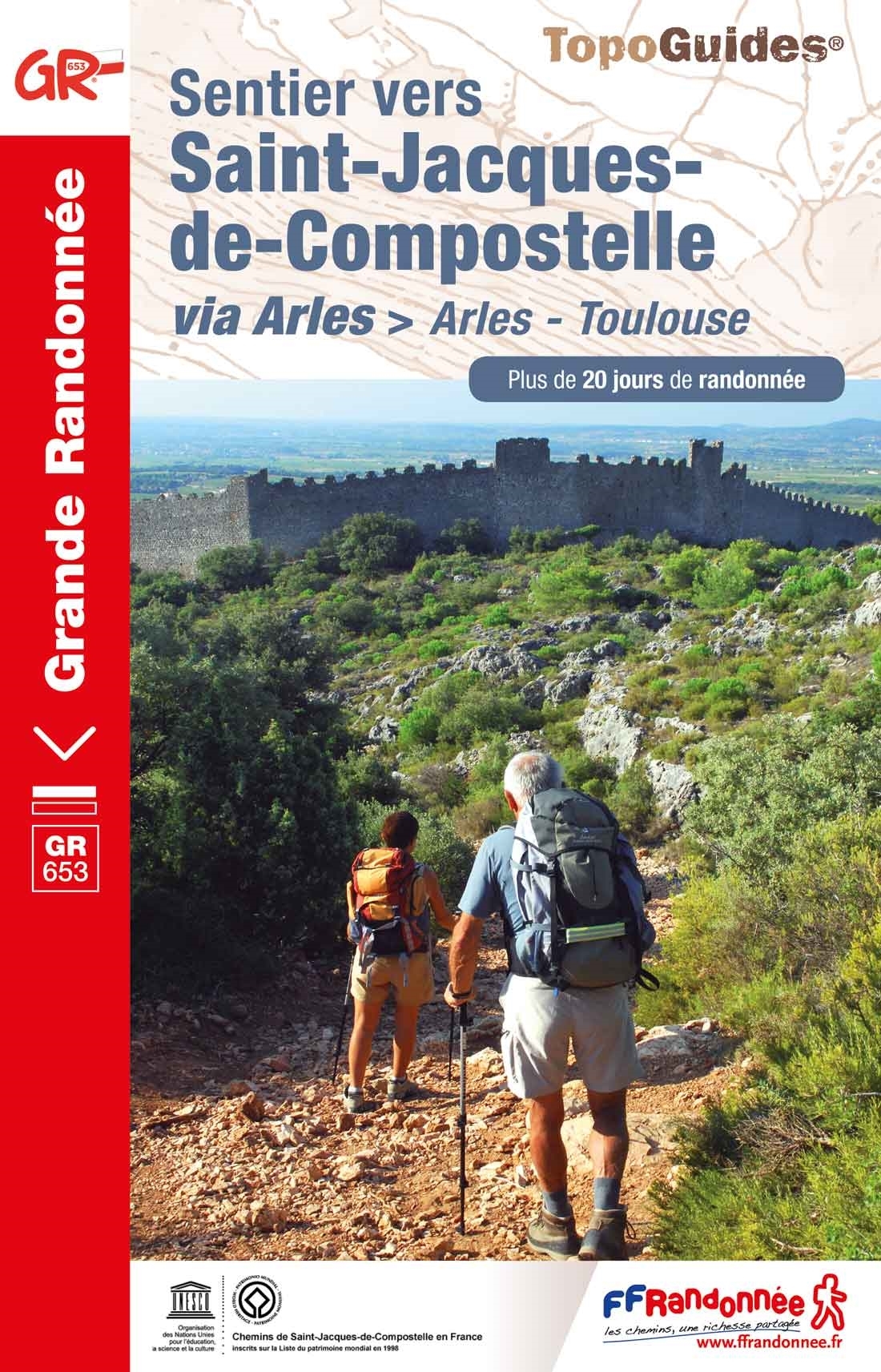
<p> Franstalige wandelgids met een beschrijving van een aantal dagtochten / rondwandelingen. Uitstekende beschrijvingen met duidelijk kaartmateriaal. Mislopen is nauwelijks mogelijk, maar ja .. de franse taal! Ook praktische informatie staat in deze gids. Alle gidsen bevatten een door ons toegevoegde uitgebreide frans - nederlandse wandelwoordenlijst.</p> <div> Ce topo-guide qui permettra aux pèlerins et randonneurs d’arpenter les sentiers de la via tolosana et, pour certains, de poursuivre leur périple entamé au fil des pages de "Sentier vers Saint-Jacques-de-Compostelle : Montgenèvre - Arles" (réf. 6531). </div> <div> </div> <div> Ce voyage en pays d’oc vous fera traverser 5 départements au patrimoine d’exception et aux paysages variés. Les villes de départ et d’arrivée sont à ce titre symptomatiques des richesses à admirer. À Arles, vous découvrirez notamment l’Eglise et le cloître Sainte-Trophime ainsi que le Théâtre antique et l’amphithéâtre. À Toulouse vous attendent le Pont Neuf, plus vieux pont de la ville, et la basilique Saint-Sernin, fondée pour abriter les reliques de saint Saturnin, qui comprend une nef romane vertigineuse et un déambulatoire à neuf absidioles.</div> <div> </div> <div> Tout au long de votre avancée sur les sentiers, la nature vous offrira ses multiples trésors : marais et étangs de la Camargue, garrigue et vignes du Languedoc, massifs boisés et chaos granitiques de l’Hérault et du Tarn...</div>
€19,95
Bekijk product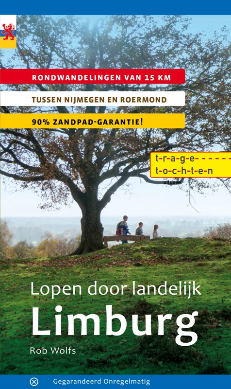
<p> In deze wandelgids rekent Rob Wolfs af met het vooroordeel dat Noord- en Midden-Limburg slechts gebieden zijn waar je doorheen moet rijden om in Zuid-Limburg te komen. In 18 prachtige routes laat hij zien dat het de moeite loont om eerder uit te stappen. Kuier door pittoreske plaatsjes in het Maasdal en ontdek de wouden rond de Limburgse meren.</p> <p> Een onontdekte wereld waar de schaapsherderin haar schapen hoedt en menig café over een duimendikke bierkaart beschikt. Een lofzang op landelijk Limburg. Rob Wolfs is de ongekroonde koning van het zandpad. Dit is alweer zijn zesde gids met ‘zandpadgarantie’: al zijn routes gaan zoveel mogelijk over paden waar de wandelaar niet gestoord wordt door mountainbikes, of elektrische fietsen. Gegarandeerd genieten van zandpaden!</p> <p> Goede wandelgids met veel informatie, goede beschrijvingen en uitstekende topografische kaarten met de route keurig ingetekend.</p> <p> Rondwandelingen van ca 15. km</p> <p> Tussen Nijmegen en Roermond</p> <p> 90% zandpad garantie</p>
€17,95
Bekijk product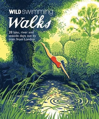
<div> Wild Swimming Walks leads you on 28 adventures into the beautiful countryside of southern England. Discover swimming meadows along the Thames, secret coves of the Sussex seashore and hidden islands of the Essex coast. All the walking routes are accessible by train and each comes with ideas for places to visit and refreshments along the route. Includes suggestions for longer weekends away as well.</div> <div> </div> <div> Includes downloadable route information to print out, or take with you on your phone or tablet.</div> <div> </div> <div> <div> The famous swimming ladies of London’s Hampstead ponds share their favourite walks with a dip. Leave the car at home this summer with 28 days out across southern and eastern England.</div> <div> </div> <div> Featuring secret lakes, river meadows and sandy seaside beaches, Wild Swimming Walks is rich with stories, photos and natural history. Complete with detailed directions, maps and practical inspiration, this book is perfect for families, walkers and swimmers alike.</div> <div> </div> <div> The Kenwood Ladies’ Pond on Hampstead Heath has been a women’s swimming pond since 1926. World famous for its history and idyllic setting, it has become a magnet for London residents and visitors alike. Margaret Dickinson (editor) is a year-round wild swimmer, documentary film-maker and writer who campaigned to save swimming on the Heath.</div> </div> <p> </p>
€20,95
Bekijk product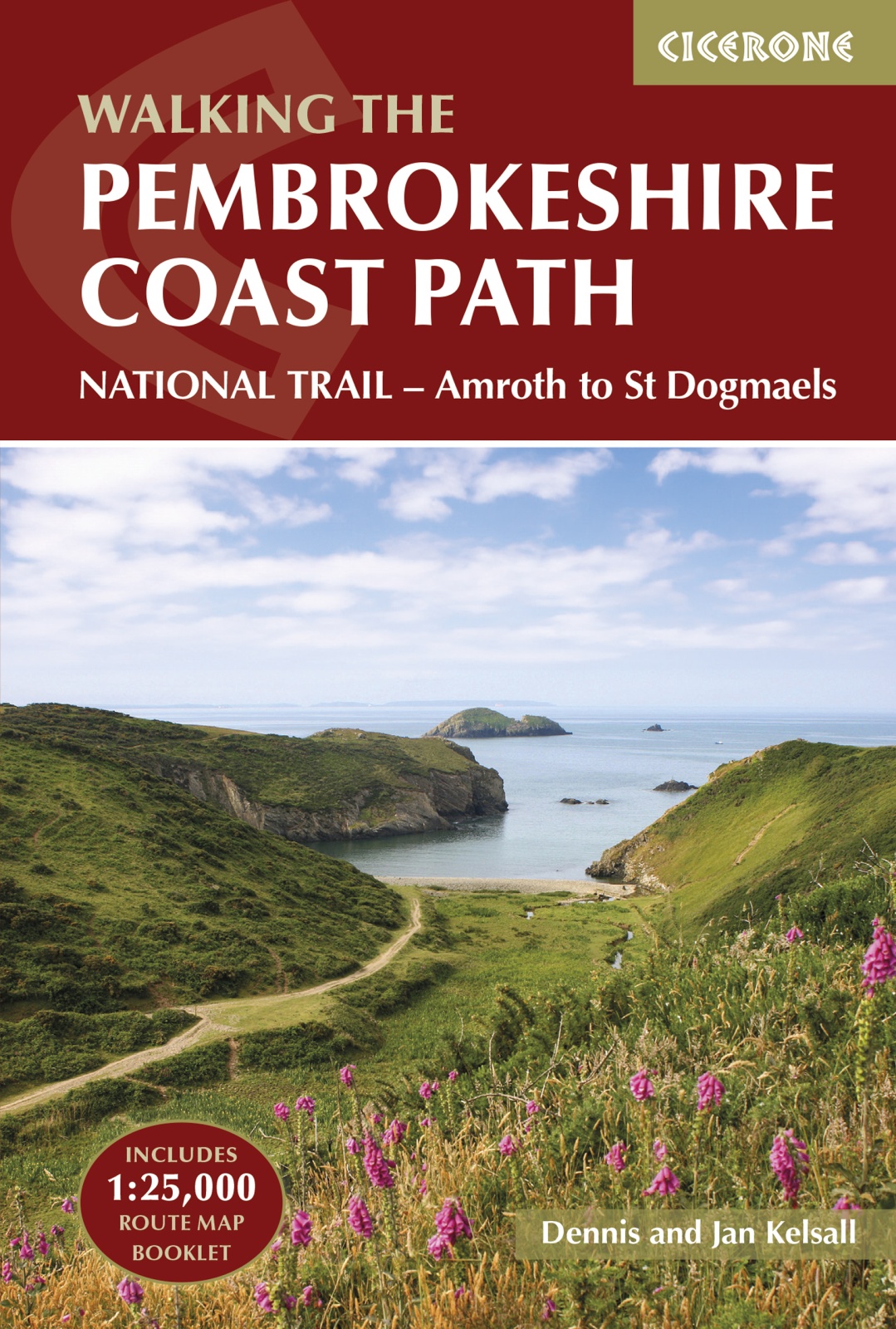
<p> Engelstalige beschrijving van een mooie wandeltocht in Wales. De gids voldoet aan alle verwachtingen die je kunt hebben. Met apart gidsje met prima wandelkaarten. </p> <div> This guidebook describes the Pembrokeshire Coast Path National Trail, a scenic 180-mile long-distance walk from Amroth, near Tenby, to St Dogmaels, north of Newport. The route, which takes roughly two weeks to complete, is divided into 14 stages of between 9 and 16 miles. Neither technically demanding nor difficult to navigate, the trail is suitable both for experienced distance walkers and those looking to cut their teeth on a long-distance route.</div> <div> </div> <div> Detailed two-way route instructions are accompanied by 1:100,000 OS mapping. A route summary table and comprehensive trek planner are also included, with invaluable information on transport, accommodation and facilities en route. The guidebook is packed with interesting snippets of information about the places, landscapes and wildlife encountered along the way. It also includes a 1:25,000 OS map booklet which shows the full route, providing all the mapping needed to complete the trail. </div> <div> </div> <div> Showcasing the region's spectacular coastal scenery, this National Trail takes in soaring rugged cliffs, serene inlets, broad sandy beaches and quaint coastal villages as it follows the twists and turns of this magical coastal path.</div>
€25,95
Bekijk product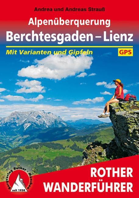
<p> Goede wandelgids met kaartmateriaal, hoogteprofielen en praktische informatie. Duitstalig.</p> <div> <div> Aus eigener Kraft über die Alpen? Früher ein notwendiges Übel, heute als Freizeitidee populärer denn je – so populär, dass die klassischen Transalp-Routen schon beinahe überlaufen sind. Höchste Zeit also für eine neue Strecke, die genau das bietet, was man von einer gelungenen Alpenüberquerung erwartet: Landschaftserlebnis, gute Hütteninfrastruktur, überschaubarer zeitlicher und logistischer Aufwand. Die Autoren Andrea und Andreas Strauß haben einen Weg quer über die Alpen ausgekundschaftet, der nicht nur diese Wunschliste erfüllt, sondern auch das Zeug zu einem echten Transalp-Klassiker hat: Im Rother Wanderführer Alpenüberquerung Berchtesgaden – Lienz präsentieren sie ihre »Entdeckung«.</div> <div> </div> <div> Auf der Strecke vom Königssee durch das Steinerne Meer in den Berchtesgadener Alpen, über die Salzburger Schieferberge, die Hohen Tauern mit dem Großglockner als Highlight und die stille Schobergruppe bis in die »Sonnenstadt« Lienz mit ihrem südlichen Flair zeigen die Ostalpen ihre schönsten Seiten. Die Hauptroute schaffen normale Wanderer in neun bis zehn Tagen; für ambitionierte Bergsteiger gibt es jede Menge Tipps für anspruchsvollere Varianten und knackige Gipfelbesteigungen zwischendurch. Und falls das Wetter einmal gar nicht mitspielt: Auch alternative Ein- und Ausstiegsmöglichkeiten aus der Tour sind im Buch zu finden.</div> <div> </div> <div> Kompakte Informationen zur Infrastruktur, farbige Karten mit eingezeichnetem Routenverlauf, prägnante Höhenprofile und klare Wegbeschreibungen machen den Führer äußerst benutzerfreundlich und erlauben eine effektive Planung und genussvolle Durchführung der neuen Transalp. Zudem stehen zu allen Touren GPS-Tracks zum Download zur Verfügung. Viel Wissenswertes zu Land und Leuten sowie exzellente Farbbilder machen Lust aufs Lesen und noch viel mehr aufs Rucksack-Packen und Losziehen.</div> </div> <p> </p>
€17,50
Bekijk product