
Beantwoord enkele vragen, en binnen seconden geeft AI je een persoonlijk aankoopadvies op maat.
Beantwoord enkele vragen, en binnen seconden geeft AI je een persoonlijk aankoopadvies op maat.

<p> Uitstekende wandelgids van een gerenommeerde Engelse uitgever. De tochten zijn met zorg beschreven en voorzien van allerhande nuttige informatie.</p> <p> Italy's Alta Via 1, a 180km hiking trail through the Italian Alps following the northern flank of the Aosta Valley, boasts magnificent views of the Alpine giants: Mont Blanc, the Matterhorn, the Grand Combin and Monte Rosa. Indeed, it is sometimes known as the Giants' Trail and can be combined with a sister-route, the Alta Via 2 (covered in a separate Cicerone guide), which runs along the southern flank of the valley, to form the Tor des Geants. Stretching from Donnas to Courmayeur, the Alta Via 1 offers fantastic alpine walking, with welcoming refuges and small hotels providing overnight accommodation (and great food) along the way. The guide presents the route in two sections, for the advantage of those who can't spare the full fortnight-plus needed to walk the entire AV1. The trail is described in 16 stages, with alternative stages covering some popular variants, including an optional detour to visit the famed monastery at the Great St Bernard Pass. Each stage includes clear route description and mapping, plus notes on local points of interest and accommodation options. An alternative itinerary, list of useful contacts, kitlist and glossary can be found in the appendices.</p>
€23,95
Bekijk product
<div> <div> The 72 mile (116km) Ribble Way is described in seven stages, ranging from 8.25 to 17 miles (13.3 to 27.4km). The route follows the Ribble valley, from the estuary mouth near Preston to the river's source on Cam Fell in the Yorkshire Dales. The route might not be the most challenging of Long Distance routes, but the contrast through a succession of different landscapes can be immensely satisfying for novice and experienced walkers alike.</div> <div> </div> <div> The guide provides detailed route descriptions, OS mapping and a route summary table, with variants included for day walkers. Information is included on points of interest along the route, plus there's also background information on the landscape, wildlife, and history, and planning details on when to go, where to stay and what to take. The River Ribble springs from the limestone of the Yorkshire Dales, high on Cam Fell in the heart of Three Peak country.</div> <div> </div> <div> Initially forcing a passage between high, rugged moorland hills, it then breaks free to wind through gentler countryside south of Settle, meandering lazily through alternating pasture and ancient woodland, where old manor houses and early 18th-century village cottages still hold sway against the pervasive tide of modernity. Beyond Preston, the river dramatically changes yet again, trained to run straight to the Irish Sea, but further to the west, a vast expanse of the salt marsh still remains and attracts huge populations of birds, particularly in winter.</div> </div> <p> </p>
€23,95
Bekijk product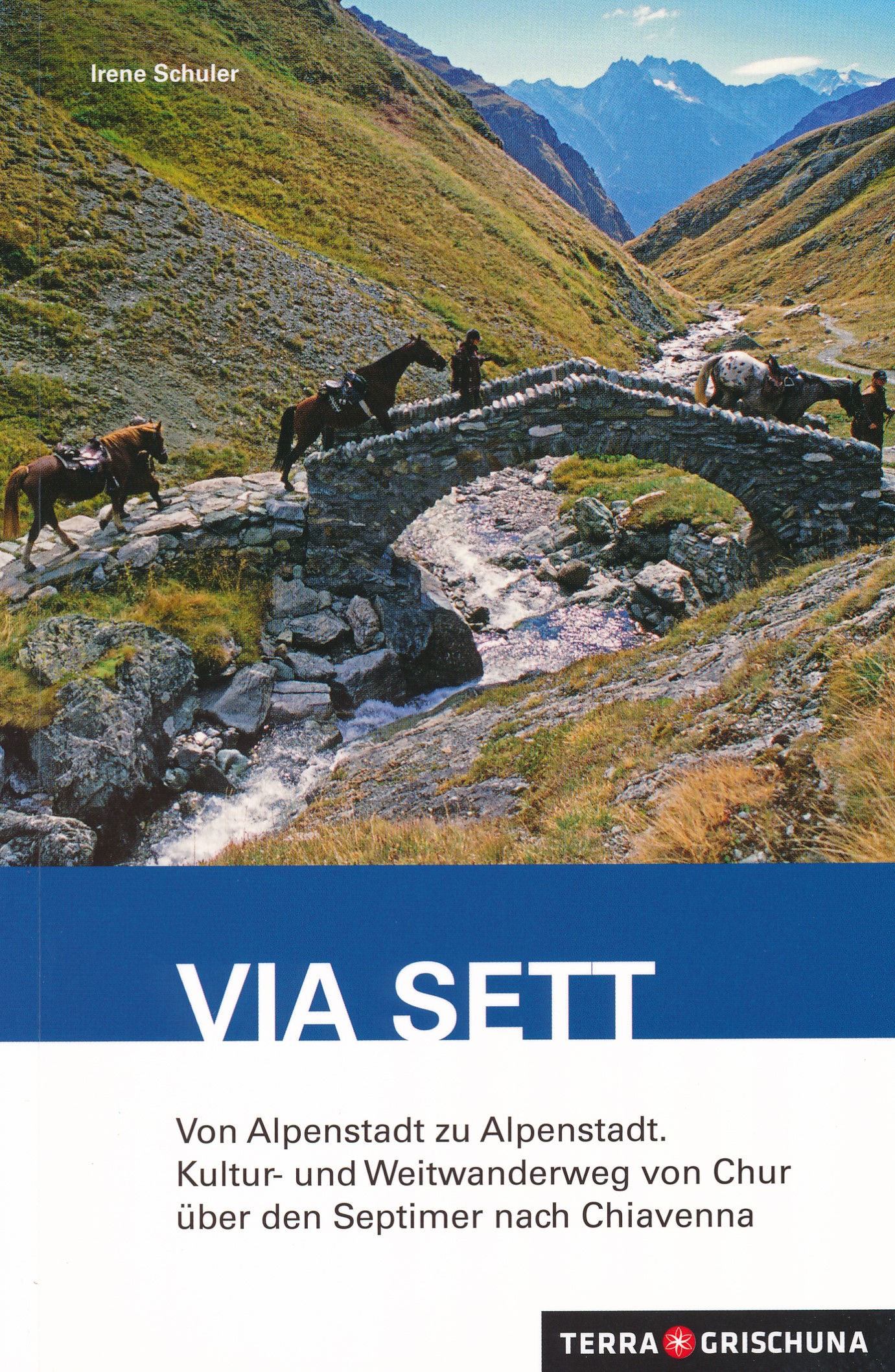
<div> Die Via Sett führt in sieben Etappen von Chur auf die Lenzerheide, durchs Surses nach Bivio und über den Septimer ins Bergell nach Chiavenna.</div> <div> </div> <div> Bereits in der Römerzeit war der Septimer einer der bedeutendsten Alpenübergänge. Im Mittelalter bescherte der Pass dem Bischof von Chur Reichtum. Könige, Heere, Pilger und Händler überquerten die Alpen via Septimer. Dieser Wanderführer enthält neben Informationen zur Geschichte und Gegenwart der Septimerroute einen umfangreichen Serviceteil. Hintergrundberichte von Fachleuten, unter anderem zur historischen Bedeutung des Septimers oder zu den drei Sprach- und Kulturräumen, bieten fundierte Einblicke. Zu entdecken gibt es vieles, darunter die Altstädte von Chur und Chiavenna, die Klosterkirche Churwalden, den Parc Ela - der grösste Naturpark der Schweiz mit dem sonnenverwöhnten Hochtal Surses, einst Wirkungsstätte von Giovanni Segantini. Im Bergell das historische Passdorf Casaccia, das Atelier von Giovanni Giacometti in Stampa oder die römische Talsperre «Müraia» bei Promontogno.</div> <div> </div> <div> Spektakulär sind die tosenden Wasserfälle von Acquafraggia und die Gletschermühlen im Park «Marmitte dei Giganti» bei Chiavenna. Ob luftgetrocknetes Bünderfleisch im Churwaldnertal, eine soppa da giotta im Surses oder ein Stück Mascarplin im Bergell, die Via Sett bietet auch kulinarische Höhepunkte.</div>
€29,50
Bekijk product
<p> Handxaam kleine wandelgids met 30 niet al te lange wandeltochten aan de noordkust van Bretagne, van de baai van Mont-Saint-Michel tot het schiereiland Crozon. Leuke mix van natuur en cultuur, goed beschreven, maar wel in het Frans! </p> <div> Van de baai van Mont-Saint-Michel tot het schiereiland Crozon</div> <div> - 30 familiewandelingen om op het douanepad te wandelen op zoek naar natuur en erfgoed.</div> <div> - De kusten van 3 bezochte departementen: Ille-et-Vilaine (5 wandelingen), Côtes-d'Armor (16 wandelingen) en Finistère (9 wandelingen).</div> <div> - Een algemene kaart en een gedetailleerde kaart per wandeling. </div> <div> - Praktische informatie (duur, afstand, toegang tot de start).</div> <div> - Toeristisch toezicht tijdens de wandelingen (fauna en flora...).</div>
€13,95
Bekijk product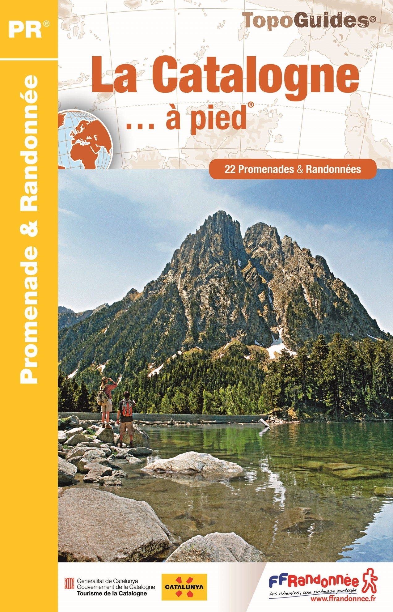
<p> Franstalige wandelgids met een beschrijving van een aantal dagtochten. Uitstekende beschrijvingen met duidelijk kaartmateriaal. Mislopen is nauwelijks mogelijk, maar ja .. de franse taal! Ook praktische informatie staat in deze gids. Alle gidsen bevatten een door ons toegevoegde uitgebreide frans - nederlandse wandelwoordenlijst.</p> <p> Entre chaîne pyrénéenne, Delta de l'Ebre et littoral méditerranéen, la Catalogne offre une extrême diversité de paysages, mise en valeur par le développement d'un tourisme responsable. Avec son parc national d'Aigüestortes i Estany de Sant Maurici et ses multiples parcs naturels (Delta de l'Ebre, Cadi-Moixero, serra de Montsant, Montseny, Sant Llorenç del Munt i l'Obac), la Catalogne déploie un éventail de territoires sauvages et préservés, véritable paradis du randonneur, étoffé par un patrimoine artistique et culturel d'exception.</p>
€12,50
Bekijk product
<p> Uitstekende wandelgids met een groot aantal dagtochten in dal en hooggebergte. Met praktische informatie en beperkt kaartmateriaal! Wandelingen in verschillende zwaarte weergegeven in rood/blauw/zwart.</p> <p> Dass die Hallertau »das größte zusammenhängende Hopfenanbaugebiet der Welt« ist, weiß zumindest in Bayern jedes Kind, und Feinschmecker schätzen den Spargel aus dieser Gegend im Herzen Bayerns. Die Hallertau als Wanderregion ist dagegen noch weitgehend unbekannt – zu Unrecht, wie die 50 Touren im Rother Wanderführer »Hallertau« anschaulich zeigen!</p> <p> Natürlich dreht sich auch beim Wandern in der Hallertau vieles um den Hopfen: Zwischen endlosen Hopfenfeldern dahinzuschlendern – ab Mai, wenn sich die frischen hellen Triebe nach oben recken, bis in den August, wenn die dunkelgrünen Kletterpflanzen in voller Größe und Pracht dastehen – das muss man einmal erleben. Lehrpfade oder auch das Hopfenmuseum in Wolnzach vermitteln tiefere Einblicke in das Thema Hopfen, und das Endprodukt Bier lässt sich in zahlreichen gemütlichen Gasthäusern verkosten. Herrlich wandern kann man aber auch über sanfte Hügel mit Fernblick bis in die Alpen, entlang von Flüssen, durch Wälder und Kulturlandschaften sowie malerische Dörfer, vorbei an imposanten Kirchen und Klöstern und durch die mittelalterlichen Städte Landshut und Ingolstadt.</p> <p> Autor Joachim Burghardt hat für diesen Wanderführer eingehend in der Hallertau recherchiert, die schönsten Wege herausgesucht und zu abwechslungsreichen Touren mit unterschiedlichem Charakter zusammengestellt. Neben zuverlässigen Wegbeschreibungen helfen Informationen zur Infrastruktur sowie aussagekräftige Streckenprofile, Kärtchen mit eingezeichnetem Wegverlauf und downloadbare GPS-Tracks bei der Planung und Durchführung der Ausflüge. Interessantes zu Land und Leuten sowie zahlreiche Fotos stimmen schon beim Lesen – vielleicht bei einem Glas Bier – darauf ein, die »Heimat des Hopfens« wandernd zu entdecken.</p>
€18,50
Bekijk product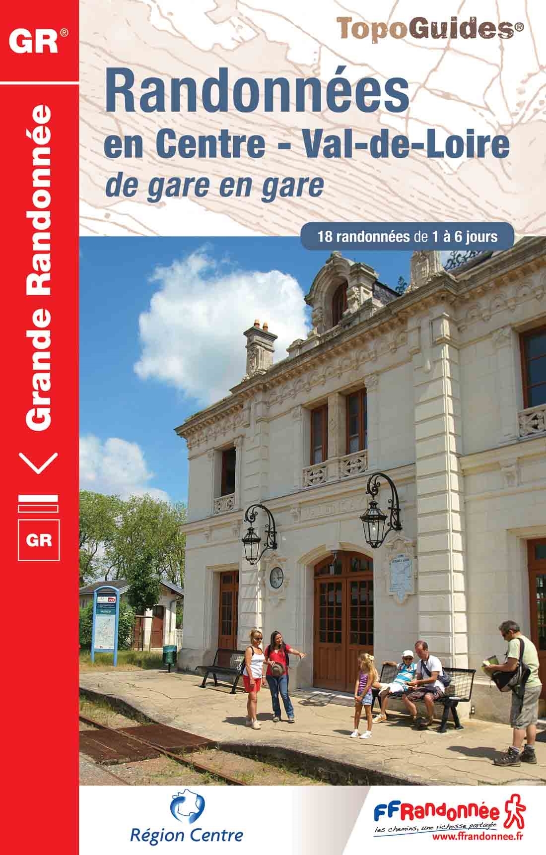
<p> Fout lopen wordt op deze manier wel erg moeilijk. Met symbolen is weergegeven welke voorzieningen (openbaar vervoer / winkels / overnachtingen) er zijn langs of bij de route. De gids bevat een lijst met overnachtingsadressen inclusief telefoonnummers, soms aangevuld met websites/mailadressen. Alle gidsen bevatten een door ons toegevoegde uitgebreide frans nederlandse wandelwoordenlijst.</p> <p> 18 randonnées de 1 à 6 jours au départ des gares du Val de Loire. La crème de la région Centre sans émission de gaz carbonique !</p> <div> Le topo-guide reprend des tronçons de GR® déjà publiés dans d'autres Topo-guides, mais aussi de nombreuses portions inédites. Des morceaux de GR® reliant des villes desservies par les trains. Ou des boucles au départ de villes. Et ceci dans les 6 départements de la région (Eure-et-Loir, Loiret, Loir-et-Cher, Indre-et-Loire, Cher, Indre).</div> <div> Quelques villes prestigieuses : Chartres, Vendôme, Gien, Orléans, Blois, Cheverny, Tours, Azay-le-Rideau, Bourges, Sancerre, Châteauroux, Argenton-sur-Creuse. Le patrimoine exceptionnel du Val de Loire, Touraine, Berry, Orléanais, Sancerrois, Pays de Chartres, Pays Vendômois, le Centre en long en large et en travers, en utilisant le réseau ferré.</div>
€20,95
Bekijk product
<p> Uitstekende wandelgids van de Hebridean Way, waarbij naast alle noodzakelijke informatie ook gebruik gemaakt wordt van de echte topografische kaart.</p> <div> <div> Officially launched in 2017, the Hebridean Way offers walkers the opportunity to experience the magic of Scotland's Outer Hebrides in one inspirational journey. The waymarked route stretches 247km (155 miles) from Vatersay to Stornaway, linking ten major islands of the archipelago by means of causeways and two ferry crossings: Vatersay, Barra, Eriskay, South Uist, Benbecula, Grimsay, North Uist, Berneray, Harris and Lewis. Suitable for most walkers with a moderate level of fitness, it can be completed in 8-14 days and is rich in natural, historical and cultural interest.</div> <div> </div> <div> This guidebook presents the Hebridean Way in 10 stages of 16-35km (10-22 miles), plus two additional stages to extend the route to the Butt of Lewis in line with future plans. Detailed route description is accompanied by 1:50,000 OS mapping, stunning photography to whet your appetite and a wealth of information about local points of interest. The introduction offers an overview of the islands' geology, history, plants and wildlife as well as comprehensive practical advice for walking the route, such as when to go, how to get there (and back) and what to take.</div> <div> </div> <div> Accommodation listings can be found in the appendices. The route is a celebration of the diverse landscapes of the Hebrides, from dazzling white shell beaches to wild moorland and flower-strewn machair. It visits Neolithic and Bronze Age remains, ruined forts and castles and monuments commemorating Bonnie Prince Charlie and the Highland Land Struggle.</div> <div> </div> <div> The islands are also a great location to spot seabirds, raptors and a number of migratory species. Informative and inspiring, Richard Barrett's guidebook is an ideal companion to discovering this captivating route.</div> <div> </div> <div> Starting at Vatersay, the routes crosses Barra, Eriskay, South Uist, Benbecula, Grimsay, North Uist, Berneray, Harris and Lewis to its current end in Stornoway.</div> </div> <p> </p>
€20,95
Bekijk product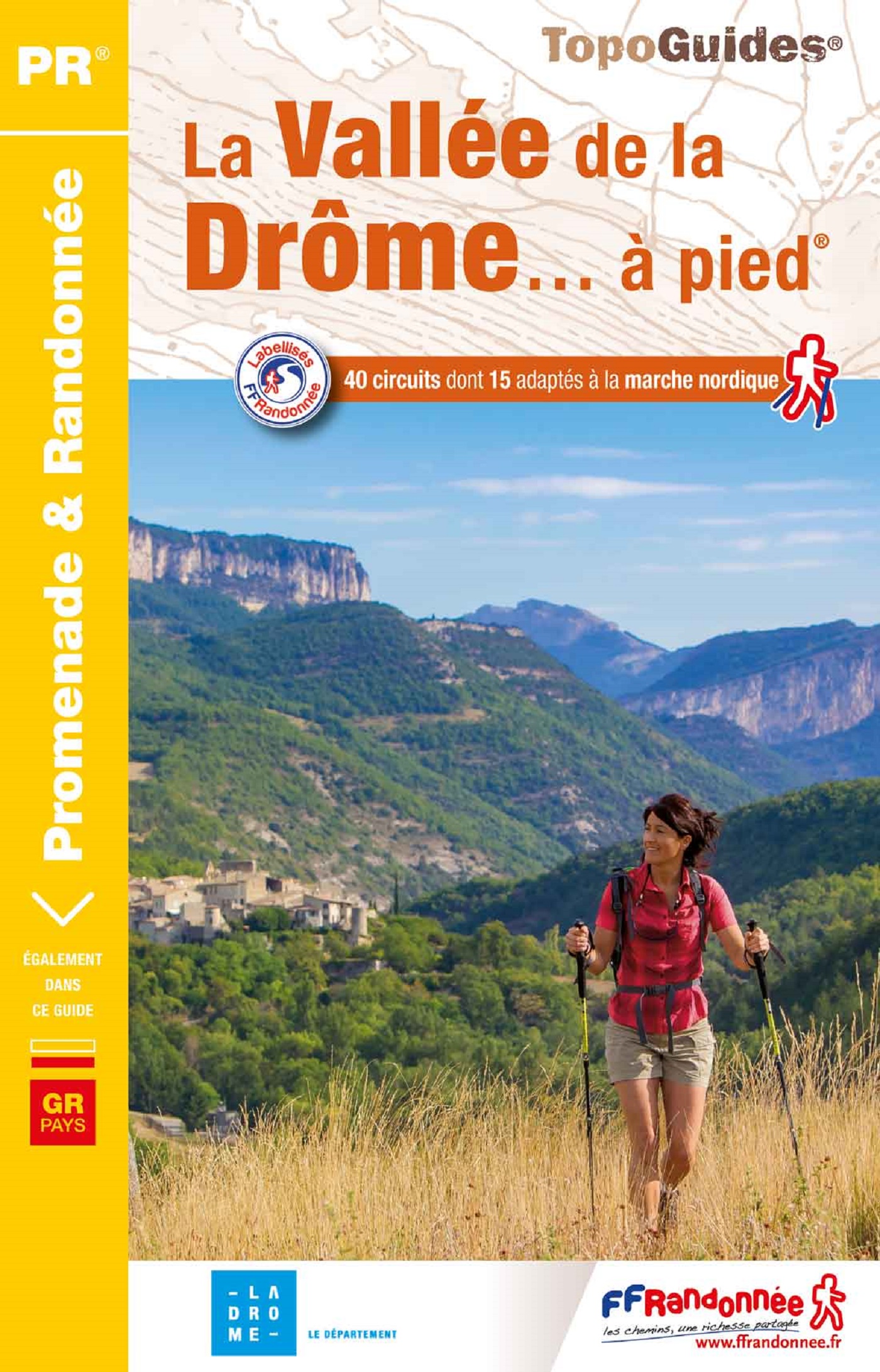
<p> Franstalige wandelgids met een beschrijving van een aantal dagtochten. Uitstekende beschrijvingen met duidelijk kaartmateriaal. Mislopen is nauwelijks mogelijk, maar ja .. de franse taal! Ook praktische informatie staat in deze gids. Alle gidsen bevatten een door ons toegevoegde uitgebreide frans - nederlandse wandelwoordenlijst.</p> <p> Entre les forêts, les grandes et lumineuses falaises, les canyons sauvages où coulent des eaux cristallines, les pelouses préalpines et les garrigues inondées d’un soleil déjà provençal, le Pays de Gervanne, marqué par la beauté majestueuse des vallées de la Drôme, dévoile une palette de paysages et de milieux naturels aussi variés que contrastés. </p>
€18,50
Bekijk product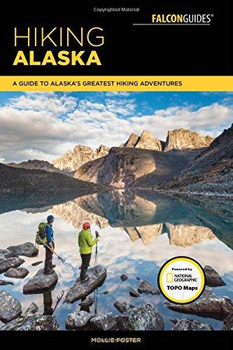
<p> Fully updated and revised, this guide is the perfect introduction to hiking the great state of Alaska, with millions of acres of wilderness waiting to be explored. It features one hundred hikes in Alaska's national parks, wildlife refuges, national forests, wilderness areas, and state parks. Also included are hikes for all ages and abilities as well as maps for each hike and full-color color photos.</p> <p> Alaska-based editor, photographer, and writer Mollie Foster is passionate about storytelling, specializing in outdoor lifestyle and adventure. She loves to spend her time exploring by human power—hiking, biking, skiing, and packrafting. Mollie has been a contributing editor to Alaska Magazine, directed and guided week-long educational programs and teaches field-based photography courses in Denali. Mollie moved to Alaska, fell in love with the Alaskan lifestyle, and now she can’t imagine living anywhere else. She splits her time between Anchorage and Denali.</p>
€24,95
Bekijk product