
Beantwoord enkele vragen, en binnen seconden geeft AI je een persoonlijk aankoopadvies op maat.
Beantwoord enkele vragen, en binnen seconden geeft AI je een persoonlijk aankoopadvies op maat.
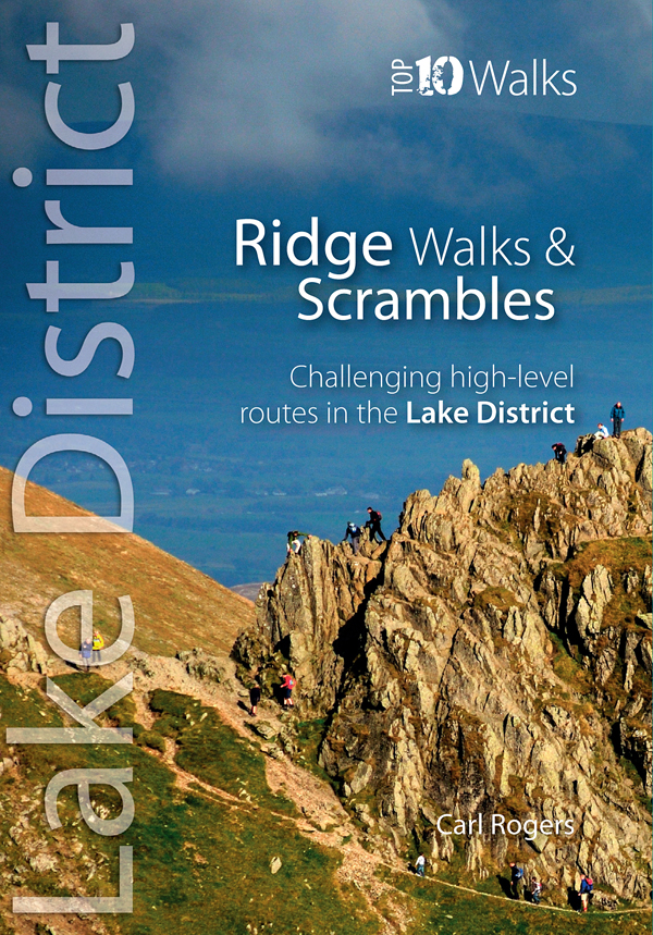
<div> The Lakeland Fells have some of the finest ridge walks in the country. Exploring these ridges offers fell walking at its most satisfying — staying high, taking in several summits and enjoying the spectacular settings.</div> <div> </div> <div> Many of the Lake District’s ridge walks have become classics, like the grassy edges of the Fairfield and Kentmere Horseshoes, or rocky aretes of Striding Edge and Swirral Edge and the aptly named Sharp Edge of Blencathra.</div>
€10,95
Bekijk product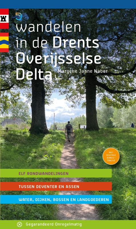
<p> Routemaakster Marycke Janne Naber uit Zwolle ging op verkenning in het werkgebied van het waterschap Drents Overijsselse Delta. Tussen Deventer en Assen zette ze 11 prachtige wandelingen uit. Ze zwierf over heidevelden en langs vennen, trof een schaapskudde en ontdekte hoe leuk Meppel was. Bij Wijhe, Zwolle en Kampen struinde ze door de uiterwaarden en over dijken van -wat sommigen wel de mooiste rivier ter wereld noemen- de IJssel. Ook langs de Reest en de Vecht, waar de ooievaar inmiddels gemeengoed is geworden, dwaalde ze wandelingen bij elkaar. En in het zuidelijker gelegen Salland vergaapte ze zich aan landhuizen in het prachtige coulissenlandschap. Het waterschap voorzag haar van leuke weetjes over waterwerken en regelmatig streek ze neer op een fijn terras om zich te verdiepen in de geschiedenis van de prachtige, waterrijke gebieden die ze aandeed. Met de uitgebreide routebeschrijvingen, kaartjes en te downloaden tracks deelt ze haar enthousiasme over dit gebied met de wandelaar die van een stevige wandeling van tussen 12 en 17 kilometer houdt.</p>
€17,95
Bekijk product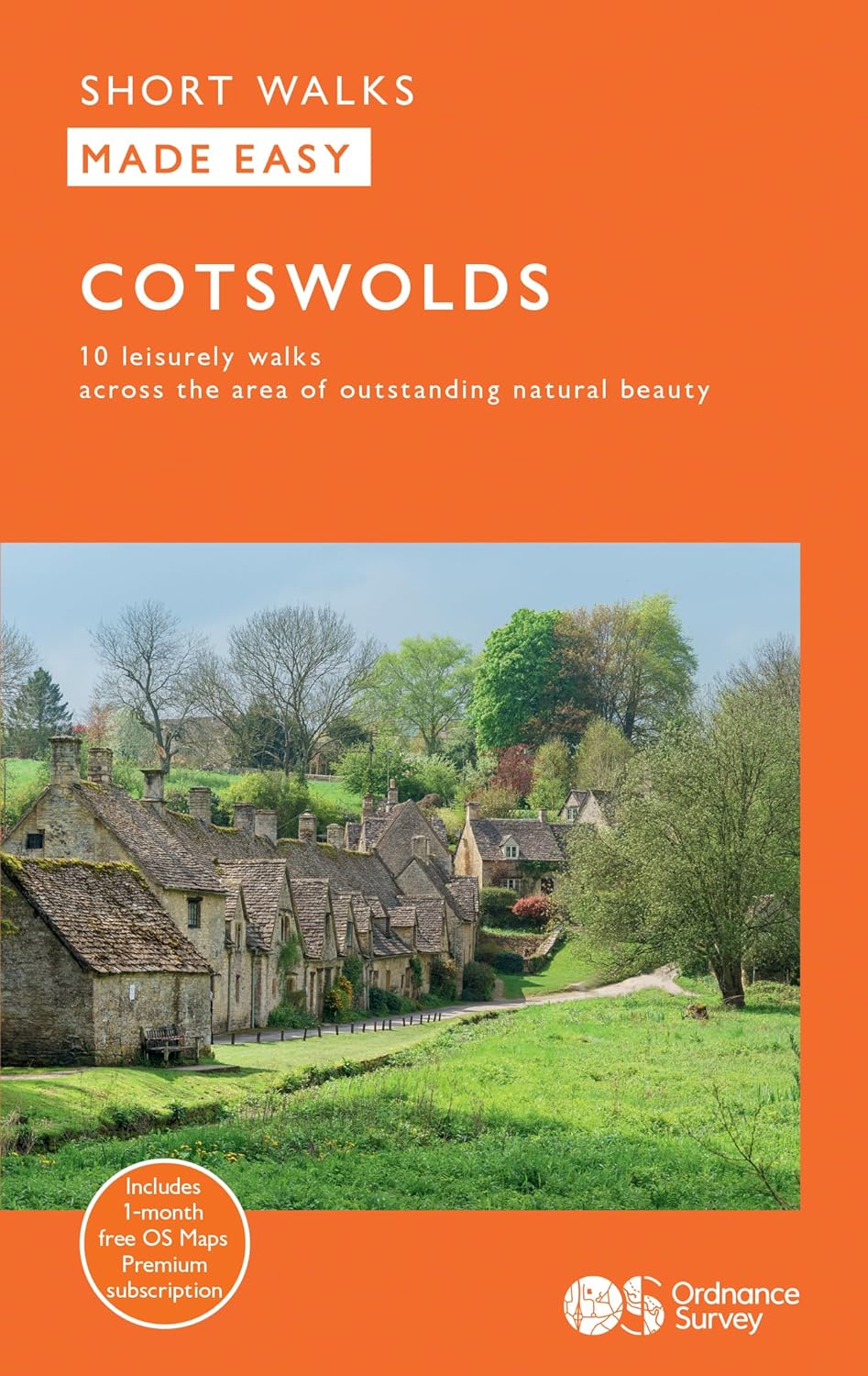
<div> Explore ten easy-paced, family-friendly short walks across the Cotswolds Area of Outstanding Natural Beauty. Originating from a Saxon term meaning ‘wooded hollows, amid gentle hills’, the AONB straddles six counties, and is best known for its honey-coloured stone cottages, lush rolling hills, and deeply-cut wooded valleys. Walks explore quieter corners of the region, covering fine gardens, rivers, parkland, and charming villages.</div> <div> </div> <div> </div> <div> </div> <div> What to expect from Cotswolds Short Walks Made Easy:</div> <div> </div> <div> • For quintessential Cotswold views, follow the trail from Broadway, escaping the crowds up a gently sloping hill to a sleepy hamlet and tempting tearooms</div> <div> </div> <div> • Take a stroll down the magnificent Broad Ride in Cirencester Park, briefly enjoying the beautiful Roman town of Cirencester</div> <div> </div> <div> • Have your camera ready to snap the country’s most photographed cottages at Arlington Row, whilst on an outing from Bibury</div> <div> </div> <div> • Admiring formal gardens at the stately homes of Sudeley Castle and Blenheim Palace, you can relax in the Arts and Crafts-inspired planting at Hidcote</div> <div> </div> <div> • The beautifully wooded valley of Woodchester Park and the ancient deer parkland at Cornbury offer away-from-it-all rambles</div> <div> </div> <div> • Don’t miss the waterside wildlife-spotting opportunities along the Thames and Severn canal from Chalford</div> <div> </div> <div> </div> <div> </div> <div> OS Short Walks Made Easy:</div> <div> </div> <div> • 10 accessible walks suitable for the whole family – no walking experience needed!</div> <div> </div> <div> • All routes are between 1½ to 4½ miles and can be completed all year round</div> <div> </div> <div> • Know what to expect before you go: Information on locations of cafes/pubs and toilets, terrain, hilliness and accessibility for pushchairs and wheelchairs</div> <div> </div> <div> • Large-scale Ordnance Survey maps for ultra-easy navigation and route-finding, featuring intuitive pictorial symbols</div> <div> </div> <div> • Numbered points and route photographs which tie maps to route descriptions and walk profiles</div> <div> </div> <div> • Enhance your adventure with stories behind each walk and nature notes</div> <div> </div> <div> • Get active outside and enjoy the physical and mental health benefits</div>
€12,95
Bekijk product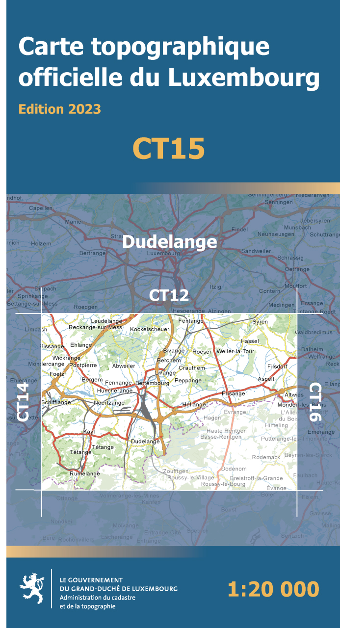
<div> Wandelkaart Dudelange - TD Luxemburg</div> <div> </div> <div> Productomschrijving: Een nieuwe reeks topografische wandelkaarten, wel duidelijk te verstaan, ZONDER toeristische informatie. De schaal van de kaart is op 1:20.000, dus nog dichter dan de klassieke 1 op 25:000. Voor wandelaars die specifiek deze locatie kiezen.</div> <div> </div> <div> Perfect voor iemand die een duidelijk zicht wenst op een topografische kaart. Met de bekende toeristische informatie weg, is de kaart duidelijker om te lezen.</div>
€10,95
Bekijk product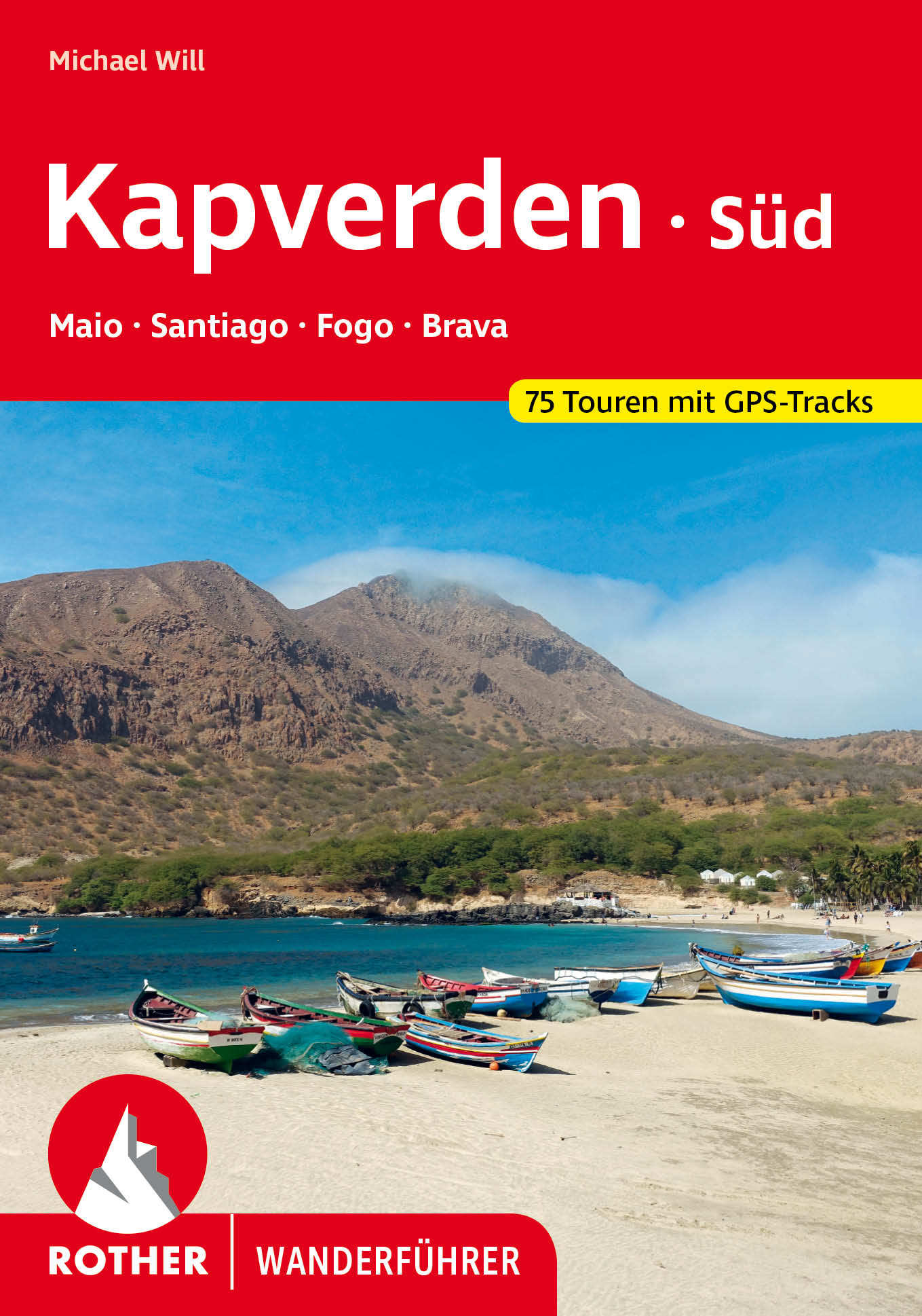
<p> Uitstekende wandelgids met een groot aantal dagtochten in dal en hooggebergte. Met praktische informatie en beperkt kaartmateriaal! Wandelingen in verschillende zwaarte weergegeven in rood/blauw/zwart.</p> <div> 75 traumhafte Wanderungen zu Traumstränden, auf Vulkangipfel und Täler mit tropischer Vegetation</div> <div> viele Touren mit Bus erreichbar</div> <div> mit detaillierten Wanderkarten, aussagekräftigen Höhenprofilen und geprüften GPS-Tracks</div> <div> Unendliche Sandstrände, tropische Vegetation, spektakuläre Vulkanlandschaften: Die Kapverdischen Inseln sind nicht nur ein einzigartiges – und bislang nahezu unentdecktes – Juwel im Atlantischen Ozean, sondern auch eine perfekte Wanderdestination. Der besondere Reiz der »Ilhas de Sotavento« liegt im Facettenreichtum der Natur, kombiniert mit einer bunten Mischung aus portugiesischer und afrikanischer Kultur. Markierte Wanderwege findet man noch kaum, somit ist der Rother Wanderführer »Kapverden Süd« der ideale Begleiter für das Archipel. Er präsentiert die 75 schönsten Touren auf den Inseln Maio, Santiago, Fogo und Brava mit allen nötigen Details.</div> <div> </div> <div> Auf Maio führen einsame Wanderungen zu kilometerlangen weißen Stränden und abgelegenen Buchten. Spektakulär ist die Insel Fogo mit dem knapp 3000 Meter hohen Vulkan Pico de Fogo und einer Mondlandschaft aus Lavaströmen, Vulkankegeln und schwarzen Lapillifeldern. Santiago, die größte Insel und Sitz der Hauptstadt Praia, bietet neben herrlichen Wandermöglichkeiten auch Einblicke in die Geschichte der Kapverden. Und auf der »Blumeninsel« Brava ziehen zahlreiche Maultierpfade kreuz und quer durch das Hochland – genügend Stoff für einen gelungenen Wanderurlaub!</div> <div> </div> <div> Der Rother Wanderführer »Kapverden Süd« liefert für jeden Geschmack die passende Tour, inklusive genauer Wegbeschreibungen, Wanderkärtchen mit eingezeichnetem Routenverlauf, Höhenprofilen und GPS-Daten zum Download. Hinzu kommen detaillierte Angaben zur Infrastruktur wie Einkehrmöglichkeiten und Verkehrsmittel. Der Autor Michael Will, begeisterter »Weltwanderer« und Wanderbuchautor, bietet außerdem interessante Infos zu Flora, Fauna und Geologie, anschaulich illustriert durch wunderschöne Fotos, die Lust auf eine Entdeckungsreise zu den Kapverdischen Inseln machen.</div>
€20,50
Bekijk product
<p> The magnificent South Downs Way traverses the chalk hills of Hampshire and Sussex for 100 miles between Winchester and Eastbourne, building in drama from west to east. Cosy rolling countryside, wooded escarpment slopes and rolling grassland downs - this national trail has it all, including the dazzling spectacle of the world-famous Seven Sisters and Beachy Head. Walk with the ghosts of our prehistoric ancestors across an arrestingly empty landscape, with breath-catching views at almost every step. * the latest 1:25,000 OS mapping, with the trail highlighted so you can see it at a glance * information nuggets throughout bring the countryside alive – past and present, seen and unseen * a handy slip-into-your-pocket design, with cover flaps to mark your page * planning info – practical help to plan your hike, including an overview map of the whole trail * stage descriptors, giving you an overview of what to expect on each leg * accommodation ideas – B&Bs, hotels, pubs and campsites close to the path * links to inspirational resources – websites and books to help you dive deeper * flora & fauna – pictorial guides to nature’s riches along the trail</p>
€20,95
Bekijk product
<p> The beauty of the Cotswolds is in no way lessened by its popularity, and the Cotswold Way leads you through the best of this most comforting of regions. The trail follows a snaking path along the western edge of the hills for 102 miles, from the pristine market town of Chipping Campden to the stately city of Bath – through deep-cut valleys and over beech-clad hills, across open pasture and past ancient barrows. You are never far from a view of the Severn Vale and the Welsh hills, or from a welcoming pub in a village of amber-hued stone. * the latest 1:25,000 OS mapping, with the trail highlighted so you can see it at a glance * information nuggets throughout bring the countryside alive – past and present, seen and unseen * a handy slip-into-your-pocket design, with cover flaps to mark your page * planning info – practical help to plan your hike, including an overview map of the whole trail * stage descriptors, giving you an overview of what to expect on each leg * accommodation ideas – B&Bs, hotels, pubs and campsites close to the path * links to inspirational resources – websites and books to help you dive deeper * flora & fauna – pictorial guides to nature’s riches along the trail</p>
€20,95
Bekijk product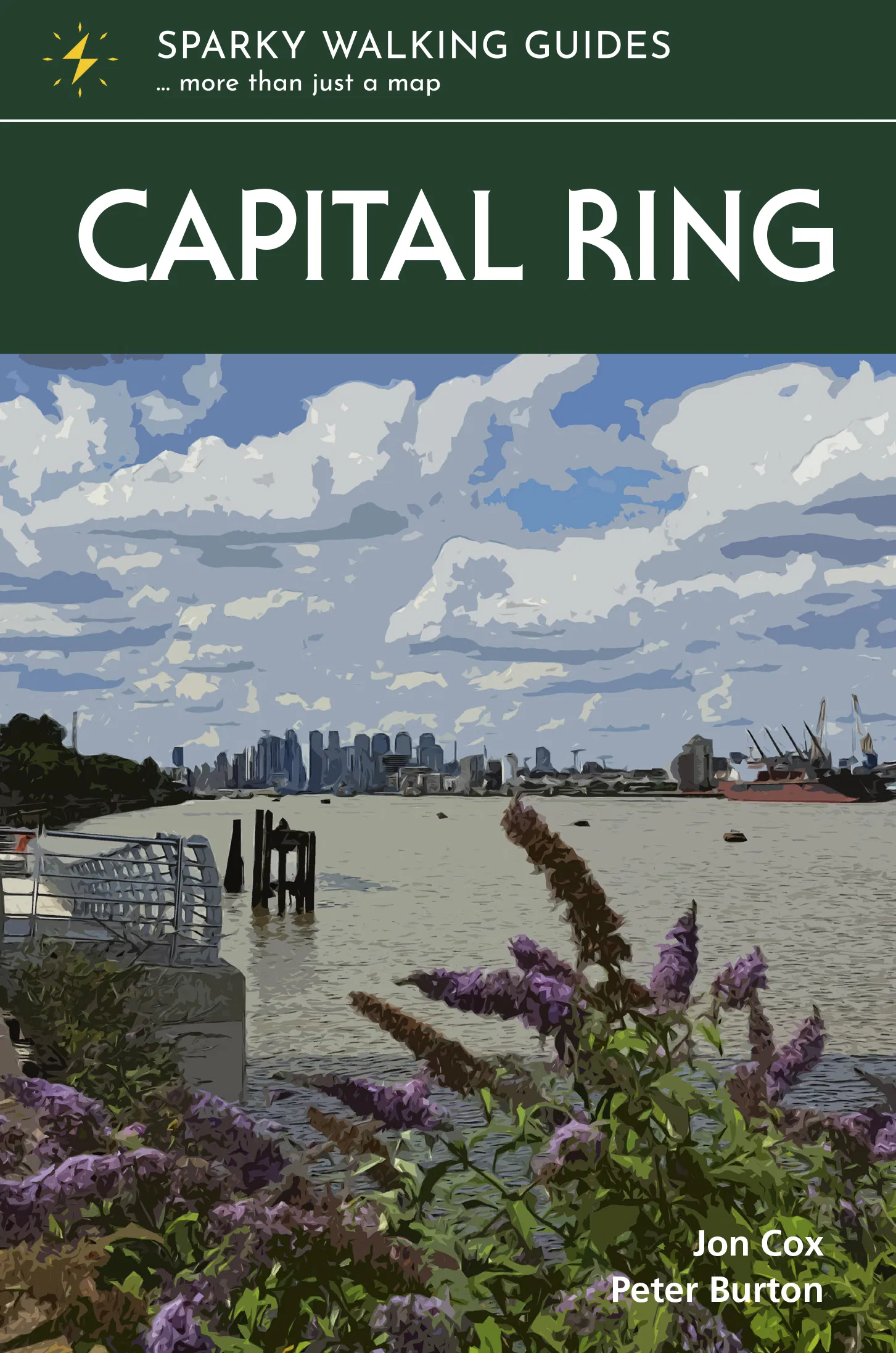
<p> The Capital Ring traces a 78-mile loop between outer and inner London. Linking the city’s diverse communities and districts via green corridors, it provides a fascinating window into the ever-changing capital and the stories of those who have made it home. The variety is dizzying. Flitting between the urban and bucolic, you walk streets humble and high-class, across parks and woodlands, past palaces and factories, beside canals and rivers, taking in world-renowned sights and intriguing backwaters, and with frequent stunning views. No matter how well you think you know the metropolis, the Capital Ring will help you see London with fresh eyes. Guaranteed. </p> <p> * super-clear OS town mapping, with the trail highlighted so you can see it at a glance</p> <p> * information nuggets throughout bring the city alive – past and present, seen and unseen</p> <p> * a handy slip-into-your-pocket design, with cover flaps to mark your page</p> <p> * planning info – practical help to plan your hike, including an overview map of the whole trail</p> <p> * stage descriptors, giving you an overview of what to expect on each leg</p> <p> * links to inspirational resources – websites and books to help you dive deeper * flora & fauna – pictorial guides to nature’s riches along the trail</p>
€24,95
Bekijk product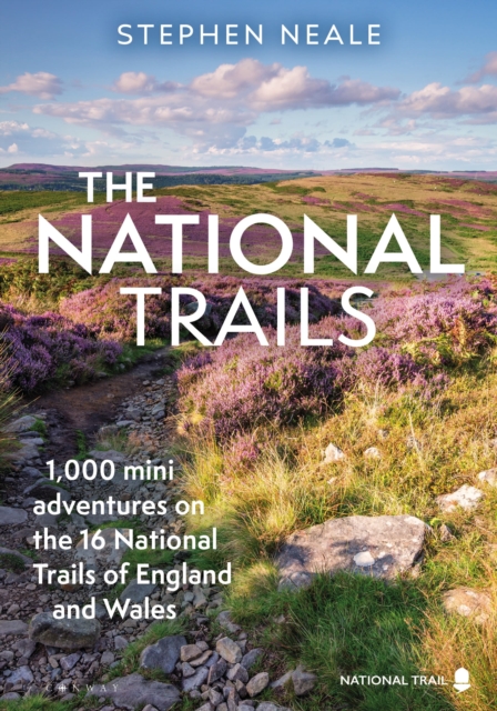
<p> <b>Exploring each of our 17 unique and varied National Trails, this beautiful and inspiring guidebook highlights over 1,000 adventures to enjoy along the way.</b><br /> <br /> Our National Trails encapsulate and embody the character of England and Wales, ensuring that people from all different backgrounds can enjoy our nation's most precious asset: 24/7 access to the wild outdoors.<br /> <br /> Following on from Stephen Neale's successful guides to the England Coast Path and the South West Coast Path, the publication of this book coincides with the opening of the Coast to Coast Path National Trail in 2025 (a 197-mile route from St Bees in Cumbria to Robin Hoods Bay in the North York Moors). This guide is the first to feature all 17 of the National Trails, from the Cleveland Way to Hadrian's Wall Path and the Thames Path, from the South West Coast Path to the Pennine Way and the Cotswold Way, and promotes a more accessible and modern take on the traditional 'turn left at the stile' walking guide.<br /> <br /> Read on for the story of how our National Trails were created in the first place, and the best places for backpacking, wild swimming, ruins, views and packrafting. And of course 1,000 fantastic places, adventures and highlights to be found on or around our wonderful and unique National Trails.<br /> <br /> Walked and researched by the author over many months, beautifully designed and crammed with stunning photography, this is an inspiring and practical guidebook.</p>
€27,95
Bekijk product