
Beantwoord enkele vragen, en binnen seconden geeft AI je een persoonlijk aankoopadvies op maat.
Beantwoord enkele vragen, en binnen seconden geeft AI je een persoonlijk aankoopadvies op maat.
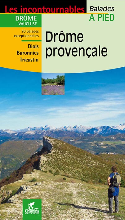
<div> Franstalig wandelgidsje voor de Drôme provençale (tot 30km) met beschrijving en gedetailleerd kaartmateriaal op schaal 1:25.000 van 20 dagwandelingen tussen de 2 en 8.45 uur. Bevat veel informatie over wat er te zien tijdens de wandeling, ook is duidelijk aangegeven wat het moeilijkheidsniveau is en de duur van de wandeling. <span style="font-family: 'Helvetica Neue', Helvetica, sans-serif, Arial; line-height: 16.799999237060547px;">Mislopen is nauwelijks mogelijk, maar ja .. de franse taal! . Alle gidsen bevatten een door ons toegevoegde uitgebreide frans - nederlandse wandelwoordenlijst.</span></div> <div> </div> <div> Le territoire concerné :</div> <div> La Drôme provençale correspond au tiers sud du département, entre couloir rhodanien, Haut-Vaucluse et Haute-Provence. Elle enclave un petit territoire vauclusien, dit « Enclave des Papes », autour de Valréas. Montélimar, Crest, Die, Dieulefit, Nyons ou Buis-les-Baronnies sont les villes et bourgs touristiques principaux du territoire. Son altitude varie de 50 mètres à Saint-Paul-Trois-Châteaux à plus de 1600 mètres.</div> <div> </div> <div> Le guide</div> <div> • Format pratique : 12 x 21 cm</div> <div> • Introduction générale avec présentation du territoire (plusieurs thèmes développés qui</div> <div> enrichissent la connaissance des sites traversés)</div> <div> • 20 itinéraires de 1h30 à 5h00 pour une pratique familiale et sportive</div> <div> • Cartographie sur fond IGN au 1 : 25 000 pour se repérer facilement</div> <div> • Détail des centres d’intérêts</div> <div> • Renseignements pratiques pour randonner en toute sécurité</div> <div> • Adresses utiles</div>
€12,50
Bekijk product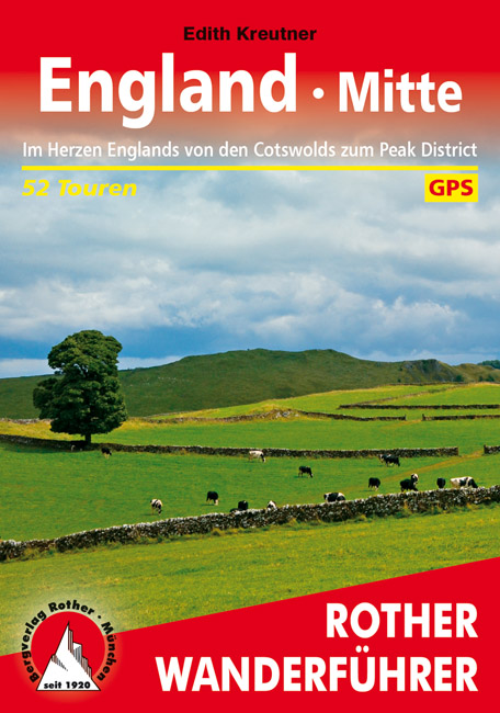
<p> Uitstekende wandelgids met een groot aantal dagtochten in dal en hooggebergte. Met praktische informatie en beperkt kaartmateriaal! Wandelingen in verschillende zwaarte weergegeven in rood/blauw/zwart.</p> <div> 184 Seiten mit 109 Farbabbildungen </div> <div> 52 Höhenprofile, 52 Wanderkärtchen im Maßstab 1:50.000 und 1:75.000, zwei Übersichtskarten</div> <div> </div> <div> <div> Wer sich im Herzen Englands die Wanderschuhe anzieht, durchschreitet vor allem altes Kulturland –also typisch englische Landschaft mit fruchtbarem Weideland und beeindruckenden Herrenhäusern, aber auch moorige Hochplateaus und eichenbewachsene Flusstäler. Die für diesen Rother Wander-führer ausgewählten Touren leiten die Wanderer zu einigen der Wander-Highlights in Mittelengland: über die sanften Hügel der durch Schafzucht zu Reichtum gekommenen Cotswolds mit ihren kleinen Weilern, die rauen Hochplateaus und durch die tiefgrünen Täler des Peak District National Park bis in die Grenzregion zu Wales, von den geschützten Eichenwäldern des Forest of Dean im Süden bis zu den aus der Eisenzeit stammenden Seen im Norden der Grafschaft Shropshire.</div> <div> Das englische Wetter kann zwar durchaus die Ausrüstung herausfordern, aber dafür gleicht die Natur den Regenreichtum mit Teppichen aus Narzissen im März, wilden Hyazinthen und weißem Bärlauch im Mai, tiefgrünem Weideland im Sommer und mit in die schönsten Herbstfarben getauchten Wäldern im Oktober aus. Aufgrund der eher milden Temperaturen und der seltenen Schneefälle lässt es sich auch im Winter gut wandern.</div> <div> Vorgestellt wird eine Vielzahl unterschiedlicher Wanderungen, von kürzeren Touren, die man gut mit Sightseeing verbinden kann, bis hin zu Tageswanderungen, die auch einiges an Orientierungsvermö-gen voraussetzen. Alle Tourenvorschläge sind leicht nachvollziehbar und mit einer zuverlässigen Wegbeschreibung, einem Kartenausschnitt mit eingetragenem Routenverlauf und einem aussagekräftigen Höhenprofil ausgestattet. GPS-Daten stehen für alle Touren zum Download bereit.</div> </div> <p> </p>
€17,50
Bekijk product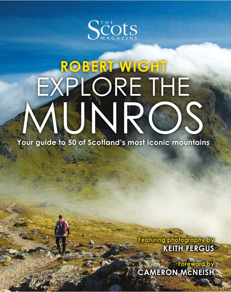
<p> The Scottish landscape has a unique majesty like no other. It will sweep you away with the Alpine grandeur of the Skye Cuillin or enchant with the Arctic domes of the Cairngorms. There are ancient rocky formations, rolling hills and the sublime, glowering peaks of Glen Coe and Ben Nevis. Within these cherished environments stand Scotland's 282 Munros--mountains that top 3,000 feet. With details of the best time of year to climb, how to get there, what you'll see (wildlife, romantic ruins, caves, waterfalls and lochs), intriguing historical info, and the author's lived experience of the hills, <i> Explore the Munros</i> will inspire your discovery of Scotland's most beautiful mountains.</p>
€19,95
Bekijk product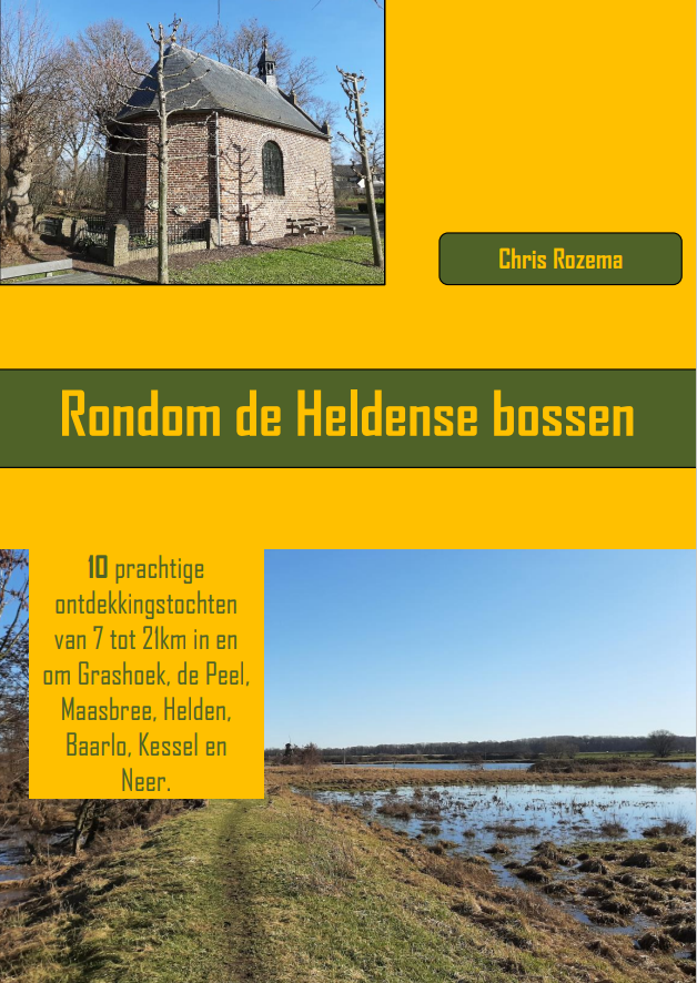
<p> Leuke wandelgids van een deel van Limburg. De wandelingen zijn heel goed beschreven en met de bijbehorende - bijna topografische - kaart in de gids kan foutlopen nauwelijks gebeuren. Als start- en eindpunt zijn de parkeerplaatsen op de kaart duidelijk ingetekend.</p> <p> 10 prachtige ontdekkingstochten van 7 tot 21km in en om Grashoek, de Peel, Maasbree, Helden, Baarlo, Kessel en Neer.</p>
€8,95
Bekijk product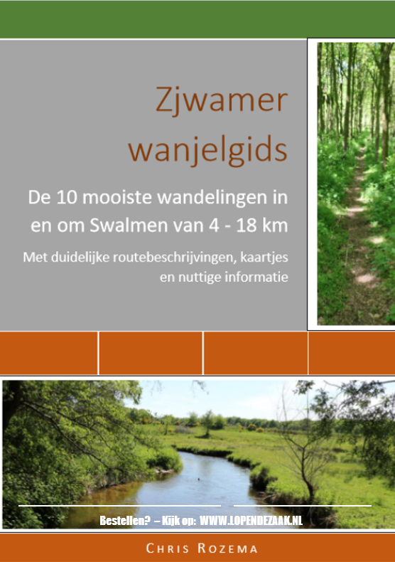
<p> Leuke wandelgids van een deel van Limburg. De wandelingen zijn heel goed beschreven en met de bijbehorende - bijna topografische - kaart in de gids kan foutlopen nauwelijks gebeuren. Als start- en eindpunt zijn de parkeerplaatsen op de kaart duidelijk ingetekend.</p> <p> De 10 mooiste wandelingen in en om Swalmen van 4 tot 18km</p>
€5,95
Bekijk product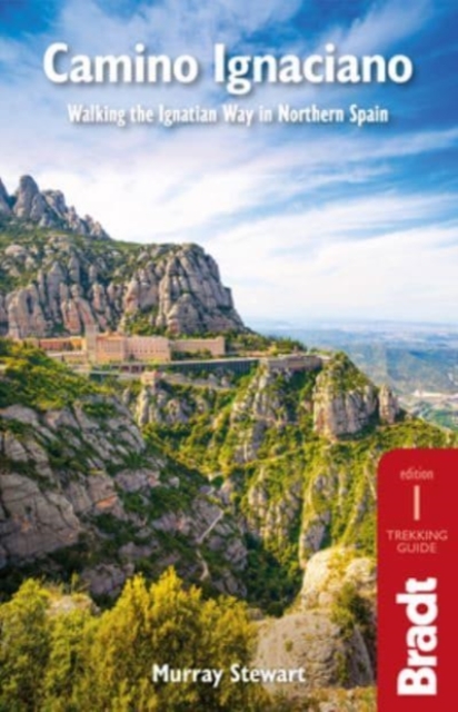
<p> In 1522 Ignatius of Loyola made a pilgrimage from his home in Spain's Basque country to Montserrat and Manresa. This new guide from Bradt provides all the information needed to follow in his footsteps in a neat, easy-to-carry portable format, including an essential mix of practicalities, such as when to go, where to stay along the route, national parks and public transport, and a detailed breakdown of the route's 27 stages. Start and finish points, level of difficulty, duration, distance, ascent and descent, and route descriptions are all included, as well as elevation charts, maps and what to see along the way. This is a unique secular walking guide to a religious-themed walk which takes intrepid hikers from the imposing tower house and sanctuary of Loyola in the Basque Country, up through the stunning Basque mountains and down to the beautiful town of Laguardia with its myriad wine caves. Through the vineyards of Alava and world-famous La Rioja, the trail visits lively Logroño and follows the River Ebro eastwards, through the lesser-visited cities of Zaragoza and Lleida.Navarre and Aragón autonomous communities are covered, then on to powerful, independent-minded Catalonia, allowing walkers to connect with a region of Spain less-visited than the sparkling costas or the huge conurbations of Madrid or Barcelona. For its grandstand finish, the route returns to Montserrat and then Manresa, where Ignatius lived for months in the spartan surroundings of a cave to write his seminal work, the Spiritual Exercises. Having had their pilgrim passports stamped along the way, walkers are rewarded with a certificate to demonstrate their resilience in completing the route.</p> <div> PART TWO: THE OFFICIAL STAGES OF THE CAMINO IGNACIANO</div> <div> Gateway town: Loyola</div> <div> Stage 1: Loyola-Zumarraga</div> <div> Stage 2: Zumarraga-Arantzazu</div> <div> Stage 3: Arantzazu-Araia</div> <div> Stage 4: Araia-Alda</div> <div> Stage 5: Alda-Genevilla</div> <div> Stage 6: Genevilla-Laguardia</div> <div> Stage 7: Laguardia-Navarrete</div> <div> Stage 8: Navarrete-Logroño</div> <div> Stage 9: Logroño-Alcanadre</div> <div> Stage 10: Alcanadre-Calahorra</div> <div> Stage 11: Calahorra-Alfaro</div> <div> Stage 12: Alfaro-Tudela</div> <div> Stage 13: Tudela-Gallur</div> <div> Stage 14: Gallur-Alagón</div> <div> Stage 15: Alagón-Zaragoza</div> <div> Stage 16: Zaragoza-Fuentes de Ebro</div> <div> Stage 17: Fuentes de Ebro-Venta de Santa Lucia</div> <div> Stage 18: Venta de Santa Lucia-Bujaraloz</div> <div> Stage 19: Bujaraloz-Candasnos</div> <div> Stage 20: Candasnos-Fraga</div> <div> Stage 21: Fraga-Lleida (Lerida</div> <div> Stage 22: Lleida-El Palau d’Anglesola</div> <div> Stage 23: El Palau d’Anglesola-Verdú</div> <div> Stage 24: Verdú-Cervera</div> <div> Stage 25: Cervera-Igualada</div> <div> Stage 26: Igualada-Montserrat</div> <div> Stage 27: Montserrat-Manresa</div> <p> </p>
€23,95
Bekijk product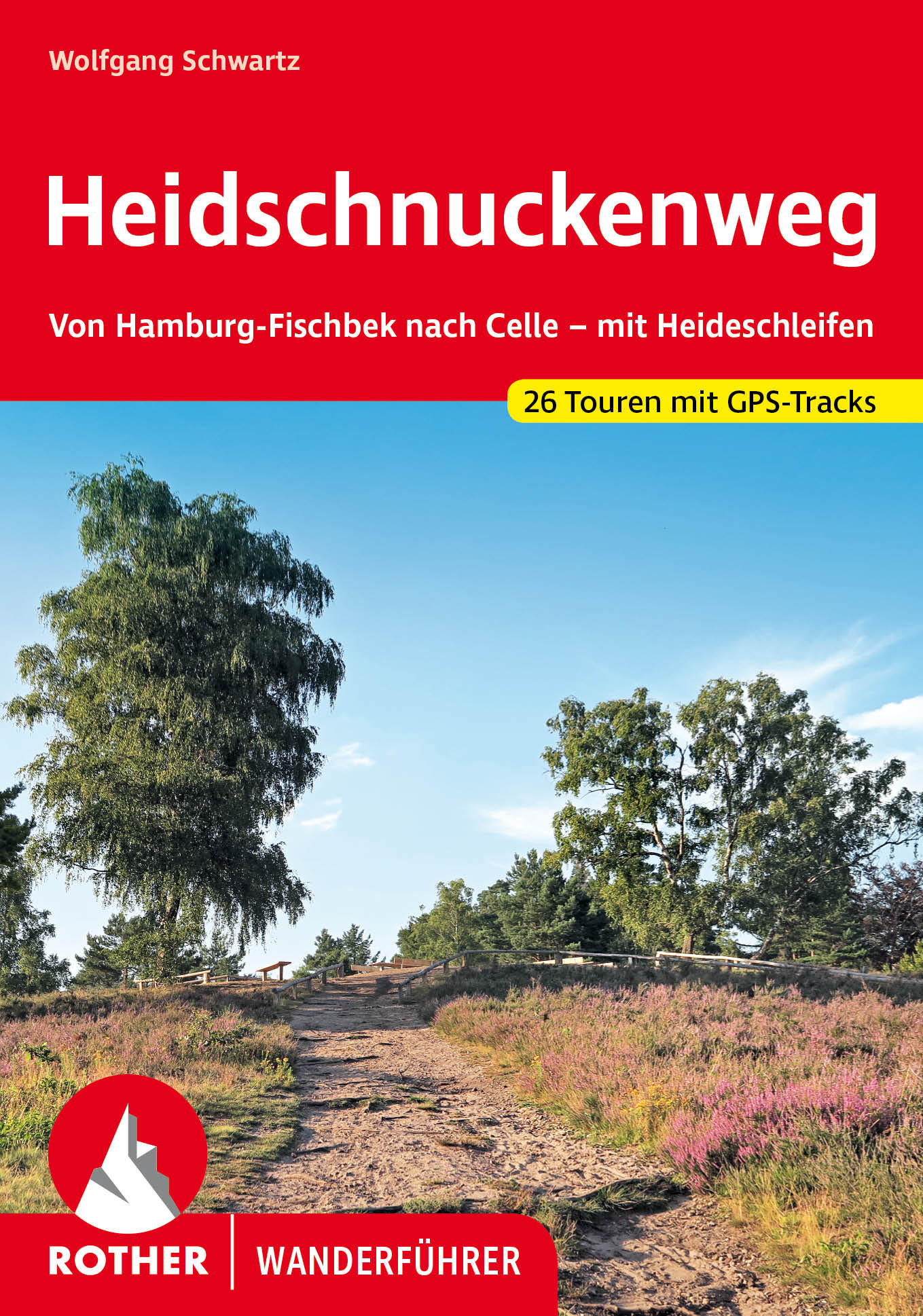
<p> <span style="color: rgb(0, 0, 0); font-family: "Helvetica Neue", Helvetica, sans-serif, Arial;">De Rother wandelgidsen beschrijven zeer goed de wandelingen in specifieke gebieden. In de gids vindt men kaarten, routebeschrijvingen en de nodige praktische informatie om van de wandelingen/trekkings een geslaagde onderneming te maken.</span></p> <p> </p> <p> Heidschnucken - diesen Schafen wird man auf dem gleichnamigen Weitwanderweg, dem Heidschnuckenweg, sicher oft begegnen. Vom Südrand Hamburgs verläuft der attraktive Heidschnuckenweg durch den Naturpark Lüneburger Heide bis in die niedersächsische Residenzstadt Celle. Die im Spätsommer violett leuchtende Heide, schöne Wälder, idyllische Fachwerkdörfer und nicht zuletzt die weidenden Heidschnucken werden unvergessliche Eindrücke hinterlassen.</p> <p> Der Rother Wanderführer »Heidschnuckenweg« stellt die zwölf Etappen sowie zwei Varianten des Weitwanderwegs umfassend vor. Außerdem beschreibt er die »Heideschleifen«, zwölf weitere Rundwanderungen entlang der Hauptroute. Mit diesen Extratouren lässt sich der Fernwanderweg bestens erweitern oder aber man erwandert sie als genussvolle Tagestouren.</p> <div> Jede Etappe in diesem Wanderführer verfügt über eine zuverlässige Wegbeschreibung, ein Wanderkärtchen mit eingetragener Route und ein Streckenprofil. GPS-Tracks stehen zum Download von der Internetseite des Rother Bergverlags zur Verfügung. Vorgestellt werden auch eine große Auswahl an Übernachtungs- und Einkehrmöglichkeiten sowie die Verbindungen mit Bus und Bahn.</div> <div> </div> <div> Der 222 Kilometer lange Heidschnuckenweg ist ausgezeichnet als »Qualitätsweg wanderbares Deutschland« und gehört damit zu den rund 15 »Top Trails of Germany«. Einige Etappen landeten sogar auf dem Siegertreppchen bei der Wahl der schönsten Wanderwege Deutschlands. Autor Wolfgang Schwartz beschreibt den Heidschnuckenweg sowie die Heideschleifen mit viel Liebe zum Detail und stellt zahlreiche Sehenswürdigkeiten vor.</div>
€18,50
Bekijk product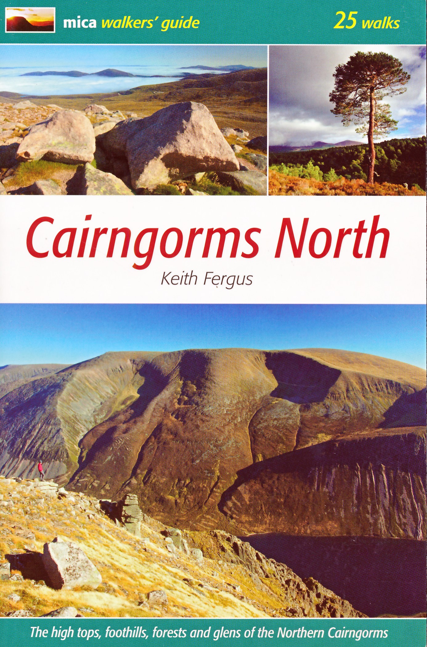
<div> A detailed and superbly illustrated guidebook to walking the high tops, foothills, forests and glens of the Northern Cairngorms, one of Scotland's most popular mountain ranges, easily accessed from the town of Aviemore.</div> <div> </div> <div> 25 varied walks from glen to mountain top, with accompanying maps and information panels on fauna, flora and local interest</div> <div> </div> <div> An ideal guidebook for anyone seeking to explore all, or parts of these hills.</div>
€20,95
Bekijk product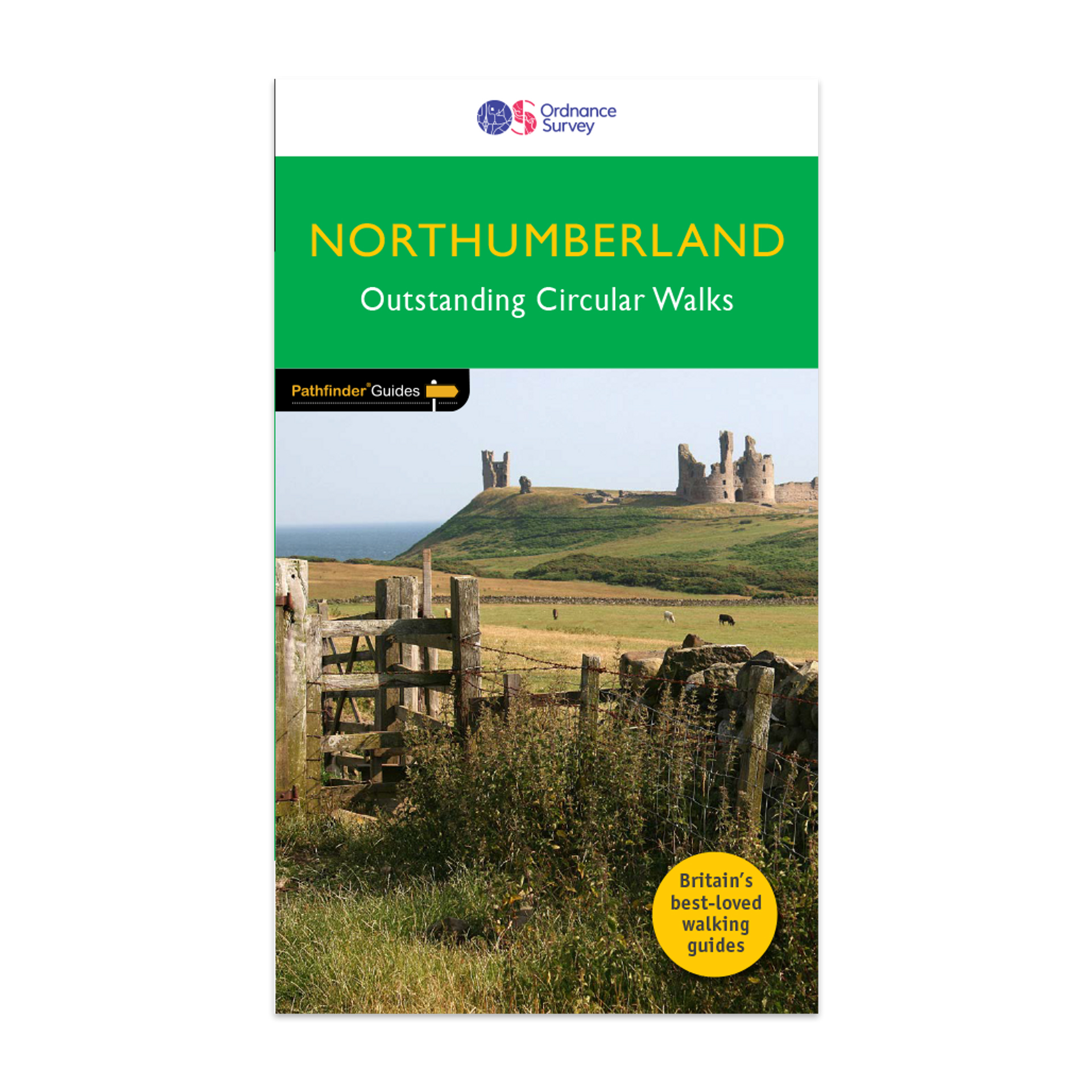
<div> <div> Pathfinder® Guide to Northumberland, featuring 28 outstanding walks designed for a range of abilities covering 180 miles of walking.</div> <div> </div> <div> Features:</div> <div> </div> <div> 28 guided walks for a range of abilities</div> <div> Large detailed Ordnance Survey map extracts</div> <div> Key information such as parking and type of terrain</div> <div> GPS waypoints for each route</div> <div> Weather-resistant book cover</div> <div> Durable rounded corners</div> <div> </div> <div> This new guide to Northumberland has ten brand-new Pathfinder walks across the county. There are new short walks at Berwick-upon-Tweed, Almouth and Bellingham. There are new half-day walks in the Coquet Valley at Felton, in the Humbleton Hills from Wooler, exploring the countryside south of the River Tyne from Hexham, and taking you along the scenic Wansbeck Valley to Morpeth from Bothal. And there are new longer walks in Hulne Park, Alnwick; along the coast and inland from Bamburgh; and a lengthy but hugely enjoyable ramble in a circuit from Druridge Bay to Warkworth and a return via Amble along the Northumberland Coast Path/England Coast Path.</div> <div> </div> <div> The other much-loved walks in the book feature circuits along the most impressive sections of Hadrian’s Wall; in the Northumberland National Park and the Cheviot Hills; and along stretches of the stunning Northumbrian coastline at Holy Island and Dunstanburgh Castle.</div> <div> </div> <div> Walks are professionally authored and depicted with GPS waypoints, Ordnance Survey maps and beautiful photography.</div> </div> <div> </div>
€18,50
Bekijk product
<div> The all-revised edition contains 27 carefully selected walks, all chosen to be easily accessible from London's main railway stations. The routes lie across Essex, Bedfordshire, Oxfordshire, Surrey, West Sussex, East Sussex, and Kent. With routes ranging from 2 to 11 miles - offering something for everyone.</div> <div> </div> <div> Each route includes the station (and time from Central London), an extract of the OS Explorer map showing the route and waypoints, notes on the route, and useful information on this history of the area.</div> <div> </div> <div> This is the perfect book for those looking to find beautiful countryside walks accessible from the capital.</div> <div> </div> <div> Previous editions of this book were called 'Country walks near London'.</div>
€18,50
Bekijk product