
Beantwoord enkele vragen, en binnen seconden geeft AI je een persoonlijk aankoopadvies op maat.
Beantwoord enkele vragen, en binnen seconden geeft AI je een persoonlijk aankoopadvies op maat.
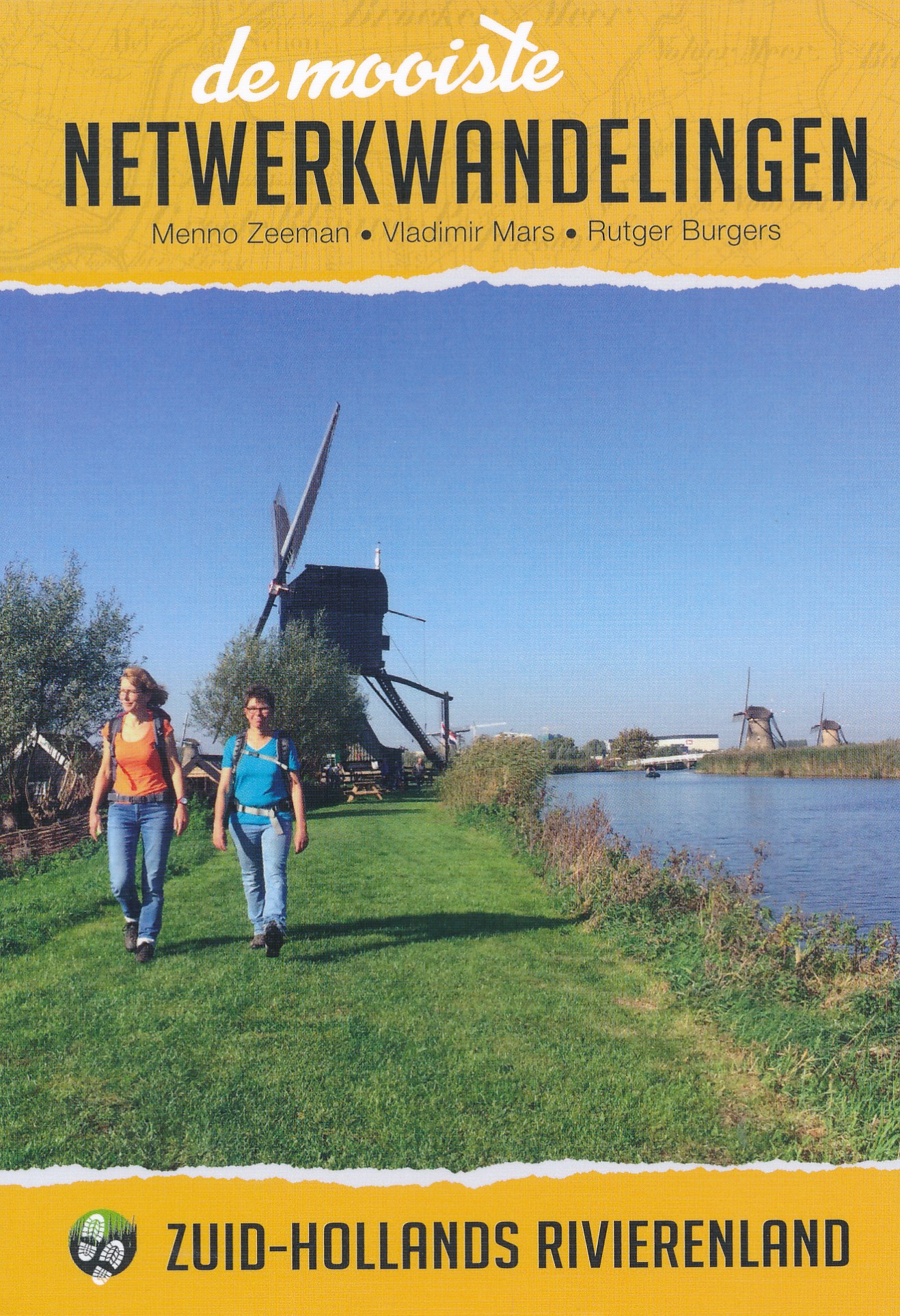
<p> De ware wandelliefhebber geeft de voorkeur aan het lopen over gras, half- tot onverhard. In het westen van het land waren de mogelijkheden daarvoor tot voor kort schaars. Maar juist de afgelopen jaren zijn er veel 'zachte' voetpaden bijgekomen, dankzij de medewerking van boeren, waterschappen en gemeenten. De meeste van die paden zijn opgenomen in de regionale wandelnetwerken van Utrecht, Noord- en Zuid-Holland. Anno 2018 is het overgrote deel van die provincies bedekt met een fijnmazig netwerk van uniform bewegwijzerde wandelroutes. De wandelaar kan z'n eigen route uitzoeken aan de hand van allerlei criteria: lang-kort, met of zonder hond, bossig of open, verhard of onverhard, thematisch of niet-thematisch. Maar waar te beginnen als wandelaar? Waar is het nu 'echt genieten', wat zijn de mooiste rondwandelingen? De auteurs, routemakers en ontwerpers van diverse wandelnetwerken, weten dat als geen ander. Daarom hebben ze het initiatief genomen om een nieuwe serie gidsen te starten. Op basis van eigen ervaringen hebben ze de leukste wandelrondjes en lijnwandelingen geselecteerd. Het resultaat is gebundeld in gidsjes per regio met steeds 15 wandelpareltjes van tussen de 5 en 15 km, waarvan minstens 50% uit half- of onverharde paden bestaat. De routes zijn zo beschreven, in kaart en beeld gebracht dat de lezer er zin in krijgt, dat hij ook te voet de polder in wil. De liefde voor het wandelen spat er vanaf. Een grote inspiratiebron vormde de gidsenserie Lopen over gras van Jouke van der Meij en Kees ten Holt (†) uit de jaren 1980. Zakgidsjes met liefde gemaakt naar Engels voorbeeld: met getekende kaartjes en sfeervolle schetsjes van landschappen. Er is voor een compact formaat gekozen. Groot verschil met vroeger is het gebruik van kleuren en van topografische kaartjes. Voor de kleurstelling en de plaatsnamen op die kaartjes is gekeken naar stafkaarten van rond 1900 - in retrostijl dus. Naast eigen foto's hebben de auteurs historische plaatjes en kaartjes opgenomen. Ook dat is een verschil, evenals het ontbreken van routebeschrijvingen: ze geven alleen de nummers van de te volgen knooppunten en de kleuren van de richtingpijlen.</p>
€16,99
Bekijk product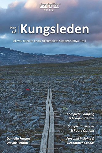
<p> Plan & Go Kungsleden is the definitive guide to hiking Sweden's famous King's Trail between Abisko and Hemavan. In a clear and concise manner, the book illustrates the highlights and unique characteristics of the Kungsleden and provides details on all essential planning topics to save you time and effort with your own preparations. Supported by step-by-step instructions and first-hand recommendations, you will be well-equipped and feel more confident about venturing into the Arctic Circle as part of this phenomenal trek.</p> <p> The book provides answers to the following questions (and more):</p> <ul> <li> How do I prepare for the trail?</li> <li> When is the best time to go?</li> <li> How many days will it take me?</li> <li> Where to resupply food & water?</li> <li> What are my lodging options?</li> <li> What kind of gear works best?</li> <li> How do I get there and back?</li> </ul> <p> In addition, Plan & Go Kungsleden offers practical advice on athletic training, which food to pack and in what quantities, how to select appropriate gear, and various other essentials for the trail. The book further includes relevant overview maps of the trail and descriptions of popular multi-day section hikes to help you create an itinerary that best suits your personal preferences. The wealth of facts and figures is topped off with the entertaining and motivating account of the authors' own 21-day journey amidst the vast and varied Swedish wilderness.</p>
€18,50
Bekijk product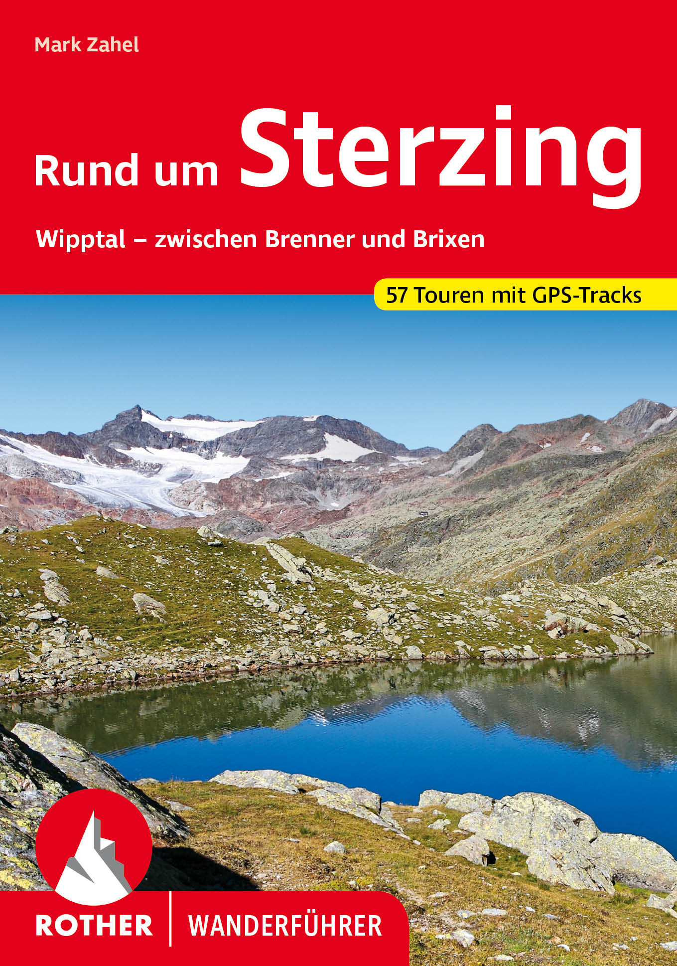
<p> Uitstekende wandelgids met een groot aantal dagtochten in dal en hooggebergte. Met praktische informatie en beperkt kaartmateriaal! Wandelingen in verschillende zwaarte weergegeven in rood/blauw/zwart.</p> <p> 56 Höhenprofile, 56 Wanderkärtchen im Maßstab 1:50.000 und 1:75.000, zwei Übersichtskarten, GPS-Tracks zum Download</p> <p> Bergsteigerische Hochgefühle im alpinen Ambiente, kulinarischer Genuss auf sonnig-gemütlichen Hütten und Almen und malerische Idylle auf talnahen Wegen – Spannung und Abwechslung sind in der Bergwelt gleich südlich des Brenners garantiert! Weiträumig, überraschend vielseitig und kaum überlaufen präsentiert sich dieses Tourengebiet. 56 vielfältige Touren stellt der Rother Wanderführer »Rund um Sterzing« vor.<br /> »Den Süden« erahnt man in der Region direkt südlich des Brenners allenfalls verhalten; die Bergwelt zeigt sich zentralalpin und dementsprechend klimatisch rau. Doch die Spannbreite zwischen den eisbewehrten Dreitausendern am Alpenhauptkamm und dem milden Brixner Becken, wo bereits Weinreben gedeihen, erscheint natürlich enorm. Die geografische Vielfalt führt zu einer großen Fülle unterschiedlichst geprägter Touren – hochalpine Gipfelbesteigungen bis in Höhen von 3500 Metern, genussvolle Alm- und Hüttenwanderungen und einfache Talwanderungen stehen zur Auswahl. Neben dem Wipptal umfasst das Tourengebiet auch die schönen Seitentäler von Pflersch, Ridnaun, Ratschings und Pfitsch.<br /> Tourensteckbriefe, ausführliche Wegbeschreibungen, aussagekräftige Höhenprofile und detaillierte Kartenausschnitte machen alle Touren leicht und sicher nachvollziehbar. Zudem stehen GPS-Tracks zum Download von der Internetseite des Bergverlag Rother bereit. Die farbige Schwierigkeitsbewertung erleichtert die Planung, und zahlreiche Farbfotos wecken die Lust, den Rucksack zu packen und loszuwandern.<br /> Mit dieser neuen Auflage hat der Südtirol-Kenner und renommierte Autor Mark Zahel die Autorenschaft übernommen und den Wanderführer komplett neu konzipiert, verfasst und bebildert.</p>
€18,50
Bekijk product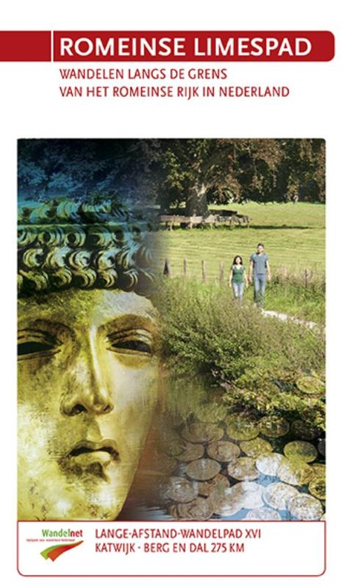
<div> <span style="color: rgb(49, 49, 47); font-family: "Open Sans", Arial, Helvetica, sans-serif; font-size: 14px;">Katwijk aan Zee- Berg en Dal(Duivelsberg) 275 km</span></div> <div> </div> <div> 'Sin, sin, sin…dex, sin'</div> <div> 'Links, links, links…rechts, links' </div> <div> Een Romeinse centurio roept commando's naar zijn soldaten die op hun sandalen keurig in gelid marcheren. Ze zijn op weg naar hun castellum…</div> <div> Waarom kwamen de Romeinen zo'n 2000 jaar geleden naar ons koude, natte land? Stap in de voetsporen van de Romeinen en ontdek het antwoord. Wandel 275 kilometer langs gereconstrueerde wachttorens en castella langs de Romeinse Limes, bewonder de op-gegraven artefacten in topmusea zoals het Rijkmuseum voor Oudheden in Leiden en Het Valkhof in Nijmegen. Leer meer over de uitwisseling van goederen en cultuur tussen Romeinen en andere in het gebied wonende volken, zoals de Bataven.</div> <div> De noordelijke grens van het Romeinse Rijk loopt in het Nederlandse gebied langs de Rijn (nu de Oude Rijn, Leidse Rijn, Kromme Rijn en Nederrijn) van Katwijk aan Zee tot aan Nijmegen. Je wandelt door steden, polders, over dijken en jaagpaden, langs forten en molens en door nieuwe natuur. </div> <div> Dit deel van de Romeinse Limes, het grootste archeologische monument van Nederland, staat op de nominatie voor de UNESCO Werelderfgoedlijst.</div>
€19,85
Bekijk product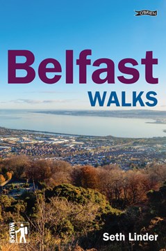
<p> Belfast and the surrounding countryside have so much to offer, and are waiting to be explored!</p> <p> Hike through wooded glades and past plunging waterfalls, or stroll through the Titanic Quarter and hear about the city's industrial history. Take the Van Morrison walk through the singer's native East Belfast, or follow in the footsteps of football legend George Best and Narnia creator C.S. Lewis. See the famous republican and loyalist murals, or enjoy the spectacular view from Cave Hill.</p> <p> ROUTES THOUGH THE PAST AND PRESENT: Lagan Towpath, Cave Hill Country Park, Colin Glen Forest Park, Divis and Black Mountain, Shankill Walk, Titanic Quarter, Falls Road, Stormont Estate, City Hall to Cathedral Quarter...</p> <p> Caters for: all tastes and levels of fitness; casual strollers, family groups and serious walkers</p> <ul> <li> 25 walks ranging from 1 to 10 miles and from 45 minutes to 31⁄2 hours</li> <li> clear, detailed instructions</li> <li> an easy-to-follow map of each walk</li> <li> information on history, flora and fauna</li> </ul>
€13,50
Bekijk product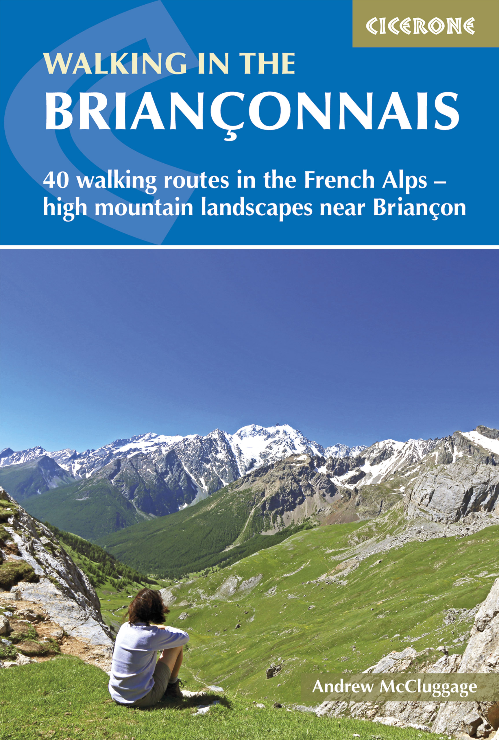
<div> Handige duidelijke wandelgids van een mooi wandelgebied. De routes zijn accuraat beschreven met praktische informatie erbij. Kaartmateriaal is redelijk, soms wat schetsmatig. In berggebieden zijn wandelkaarten wel belangrijk! Bij de routes worden de juiste kaartnummers gegeven. </div> <div> </div> <div> This guidebook presents 40 walks exploring the area around Briançon in France. The walks are divided into 6 sections covering the valleys of Clarée, Cerveyrette, Ayes, Durance and Guisane, as well as the area around Vallouise and Montgenèvre. The walks are circular and range in distance from 4 to 21 km. Graded easy to very hard, there is a walk to suit all abilities. </div> <div> </div> <div> Dominated on all sides by jagged peaks, and perched on a rocky spur at the nucleus of five beautiful valleys, the city of Briançon lies almost at the southernmost tip of the main Alpine range. The Briançonnais, the surrounding region to which it gives its name, is a stunning mountain wilderness packed with everything one would expect from a high alpine environment - snow-capped peaks, green valleys and pastures filled with the sound of cow bells, sparkling alpine lakes, an abundance of wild flowers and a labyrinth of paths available to walkers. </div> <div> </div> <div> As well as maps and detailed route descriptions the guidebook provides advice on when to go, what to take and the best bases for exploring the region. There are detailed notes on wildlife and history and information on the many hill forts in the area.</div> <div> </div> <div> <strong>Dorpen en steden</strong></div> <div> Briançon, La Grave, Le Monetier-les-Bains, Montgenèvre, Névache, Vallouise</div>
€23,95
Bekijk product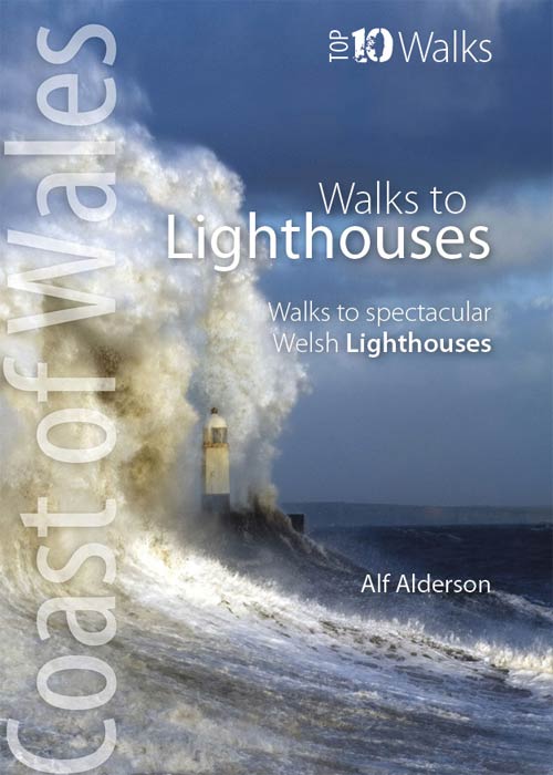
<p> Klein, handzaam wandelgidsje met spectaculaire wandelingen naar vuurtorens. Met goede kaartjes van Ordnance Survey.</p> <p> This attractive and cleverly structured guide gives walkers ten of the finest walks to the ten most spectacular lighthouses in Wales in a popular pocketable format. With clear information, an overview and introduction for each walk, expertly written numbered directions, large scale Ordnance Survey maps, superb eye-grabbing panoramic photographs, and interpretation of points of interest along the way, these guides set a new standard in clarity and ease-of-use. Featured walks include: Talacre and Great Orme, North Wales Coast; Penmon Point, South Stack and Llandwyn Island, Anglesey; Strumble Head and St Anne's Head, Pembrokeshire; Whiteford, Carmarthen Bay; and Nash Point, South Wales Coast.</p> <div> The ten walks featured here highlight the very best Welsh lighthouses and huge variety of the coastline of Wales.</div> <div> </div> <div> From vast expanses of sand, sea and sky, such as at Whiteford Point and Llanddwyn Island, to rugged coastline where seabirds wheel and skrike and porpoise and seals slide through the waves, like Strumble Head and South Stack, these walks to lighthouses guarantee a fine day out.</div> <div> </div> <div> All are circular, and vary from short and easy, like the to Talacre lighthouse, to longer and more demanding, such as that to St. Ann’s Head lighthouse — but none are beyond any reasonably fit and enthusiastic walker.</div>
€10,95
Bekijk product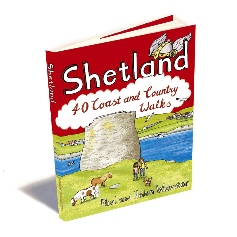
<p> <span style="color: rgb(0, 0, 0); font-family: "Helvetica Neue", Helvetica, sans-serif, Arial;">Handige compacte wandelgids met 40 dagwandelingen. Deze gids bevat kleine kaartjes en leuke uitgebreide informatie over wat er langs de route te zien is. Goede wandelkaarten zijn echter we noodzakelijk voor deze tochten: de Ordnance Survey explorer maps of Landanger maps zijn zeer geschikt.</span></p> <p> The most northerly of Britain's island groups, Shetland is so far removed from the rest of the UK that it usually appears as an inset on maps. Although relatively little known to those from outside the islands, Shetland is a magnificent terrain for walkers, especially those who love to really explore and get away from the beaten track. The coastal walking here includes some of the finest in the country, with superb cliffs, towering sea stacks, caves and natural arches seemingly around every corner.</p> <p> Added to this is Shetland's better known claim to fame for its spectacular seabird colonies, huge gannetries, moorland packed with arctic and great skuas, arctic terns in the more sheltered spots, and everyone's favourite, the puffins. The islands also enjoy a dense population of otters, many seals, and a chance to see killer whales or other giants of the deep.</p> <p> Beyond all this natural grandeur, Shetland's history is fascinating too. The archaeological attractions are much less known than those on Orkney, but sites such as Jarlshof have amazingly preserved remains from prehistory right up to more recent times. These include iron age villages, chambered cairns, viking longhouses, pictish carvings, and impressive brochs, including the most complete of all these iron-age defensive towers, on Mousa.</p> <p> Size 105 x 148mm</p> <p> Featured Places</p> <p> Aywick, Balta Sound, Banna Minn, Bigton, Bressay, Bruray, Bur Wick, Burga Stacks, Burravoe, Culswick, Da Sneck Ida Smaalie, Da Sneug, Bay of Deepdale, East Burra, Esha Ness, Eshaness Lighthouse, Fair Isle, Fethaland, Fitful Head, Foula, Framgord, Fugla Ness, Gloup Ness, Grimister, Grunay, Grutness, Hamnavoe, The Hams, Heoga Ness, Hermaness, Hill of Clibberswick, Hillwell, Hillswick, Horns of Hagmark, Housay, Isbister, Isleburgh, Jarlshof, Keen of Hamar, Kettla Ness, Kirkabister Ness, Ladies Hole, Lang Ayre, Lerwick, Loch of Funzie, Lunna Ness, Malcolm’s Head, Mavis Grind, Mousa, Muckle Roe, Ness of Burgi, Ness of Hillswick, No Ness, North Roe, Isle of Noss, Otterswick, Outrabister, Papa Stour, Quendale, Ronas Hill, St Ninian’s Isle, Sand of Meal, Sandness Hill, Sands of Breckon, Sandvoe, Sandwick, Saxa Vord, Scalloway, Scatness, Sheep Rock, Silwick, Skerries, The Snap, Stanes of Stofast, Strandburgh , Stuis of Graveland, Sumburgh Head, Tangwick, Uyea, Ward Hill, Ward of Bressay, West Burra, Wester Wick, The White Wife</p>
€10,95
Bekijk product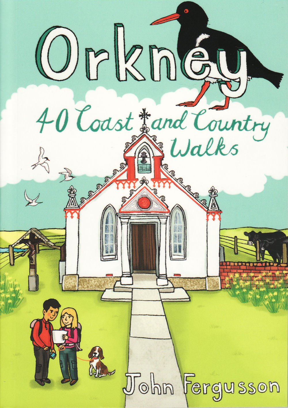
<div> Handige compacte wandelgids met 40 dagwandelingen. Deze gids bevat kleine kaartjes en leuke uitgebreide informatie over wat er langs de route te zien is. Goede wandelkaarten zijn echter we noodzakelijk voor deze tochten: de Ordnance Survey explorer maps of Landanger maps zijn zeer geschikt.</div> <div> </div> <div> The 40 walks in this guide range from a short stroll to hikes of several hours, but most can be completed in half a day or less. The majority are circular, several are lollipop-shaped and some require you to return by the same route. They all, however, end up back where they started, so you will not find yourself miles from your car. Each route is prefaced by an indication of the distance involved and the time it is likely to take. The latter is estimated on the time it took the author to walk the route (averaging around 3.5km per hour) before adding a little for tea, toilet and tourism stops. The timings should be regarded as a rough guide, and if you have to catch a bus or boat at the end of the walk, leave plenty of extra time!</div> <div> </div> <div> Only on a couple of routes will you be asked to set off across the heather without a path to follow, and never without your immediate destination being in view in clear visibility. That said, walking in Orkney should not be underestimated and good visibility cannot be relied upon. The sketch maps are to help in planning your trip and are not sufficiently detailed to navigate by. It is advisable to carry the relevant Ordnance Survey map. Any compass directions are approximate, and lefts and rights are relative to the direction of travel. Where a walk involves crossing to a tidal island, it will be mentioned in the notes. Always ensure you get reliable advice on the state of the tides before crossing. If you get it wrong, you could have a cold, wet and lonely few hours before getting back across.</div>
€10,95
Bekijk product
<div> Goede wandelgids van een prachtig wandelgebied. De routes zijn goed beschreven met veel details, daarnaast de noodzakelijke praktische informatie en men maakt gebruik van goed leesbare, voldoende gedetailleerde kaarten. Met zorg uit gekozen wandelingen door één van Engelands meest gerenommeerde wandelaars!</div> <div> </div> <div> This guidebook presents 50 half-day and day walks in Mallorca's Serra de Tramuntana, the striking limestone range that stretches along the northwestern flank of the island. Whilst the region promises breathtaking scenery and some fantastic walks, there is also some potentially challenging terrain, making guidance when choosing, planning and walking routes all the more valuable. As many involve steep ground, navigational challenge and hands-on scrambling, they are primarily geared towards those with some experience of mountain walking. </div> <div> </div> <div> Comprehensive route description is illustrated with 1:25,000 Alpina mapping and each walk includes a statistics box to aid route selection. Useful contacts are listed in the appendix. There is also background information on history, plants and wildlife, plus language notes in native Catalan and Castilian Spanish. The routes are spread across the Serra de Tramuntana, with characterful towns and villages such as Sóller, Deià, Fornalutx, Valldemossa and Pollença serving as potential bases for a walking holiday. </div> <div> </div> <div> Ranging from 5.5km to 24km, the carefully selected routes showcase the region's rugged limestone peaks, mountain and coastal vistas and rich mountain heritage manifested in numerous drystone constructions, charcoal-burning sites and irrigation systems. Highlights include the lush island of sa Dragonera and the dramatic gorge of Torrent de Pareis. The majority of walks are accessible by public transport and many can be linked, opening up further possibilities for exploration</div>
€20,95
Bekijk product