
Beantwoord enkele vragen, en binnen seconden geeft AI je een persoonlijk aankoopadvies op maat.
Beantwoord enkele vragen, en binnen seconden geeft AI je een persoonlijk aankoopadvies op maat.
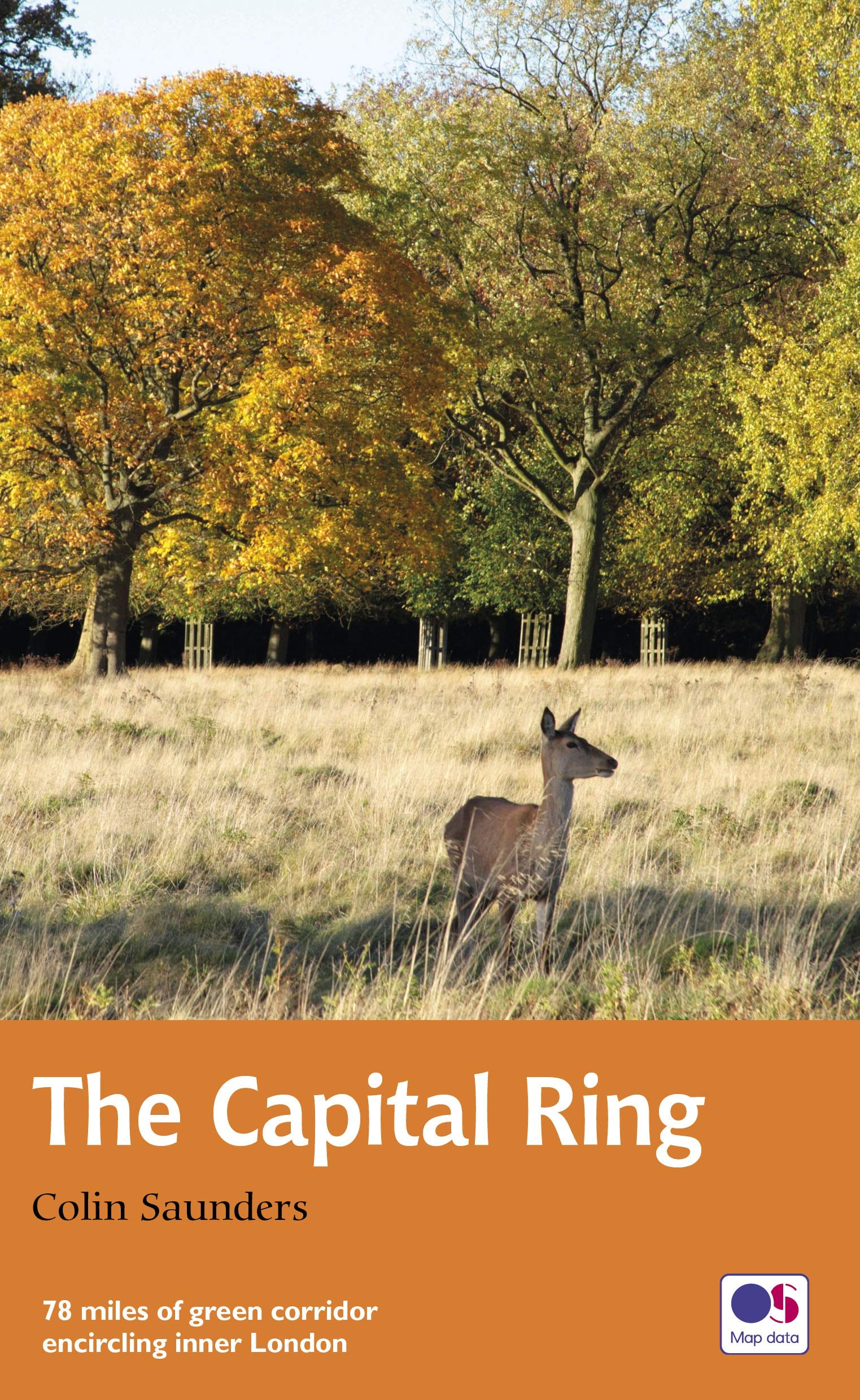
<p> The Capital Ring is a 78-mile (125 km) walking route encircling inner London that links the astonishing number of islands of green space - parks, woodlands, abandoned railway lines, towpaths and nature reserves - which still survive in the very heart of the city.<br /> <br /> The Ring takes in many of London's leading attractions - for example, the Thames Barrier, Eltham Palace and Richmond Park - as well as overlooked gems such as Oxleas Meadows, the Parkland Walk and Abbey Mills Pumping Station, and gives a close-up view of the ever-changing Olympic Park.<br /> <br /> This guide divides the route into 15 sections, each starting and finishing at a public transport point, and is packed with a vast amount of information.</p>
€20,95
Bekijk product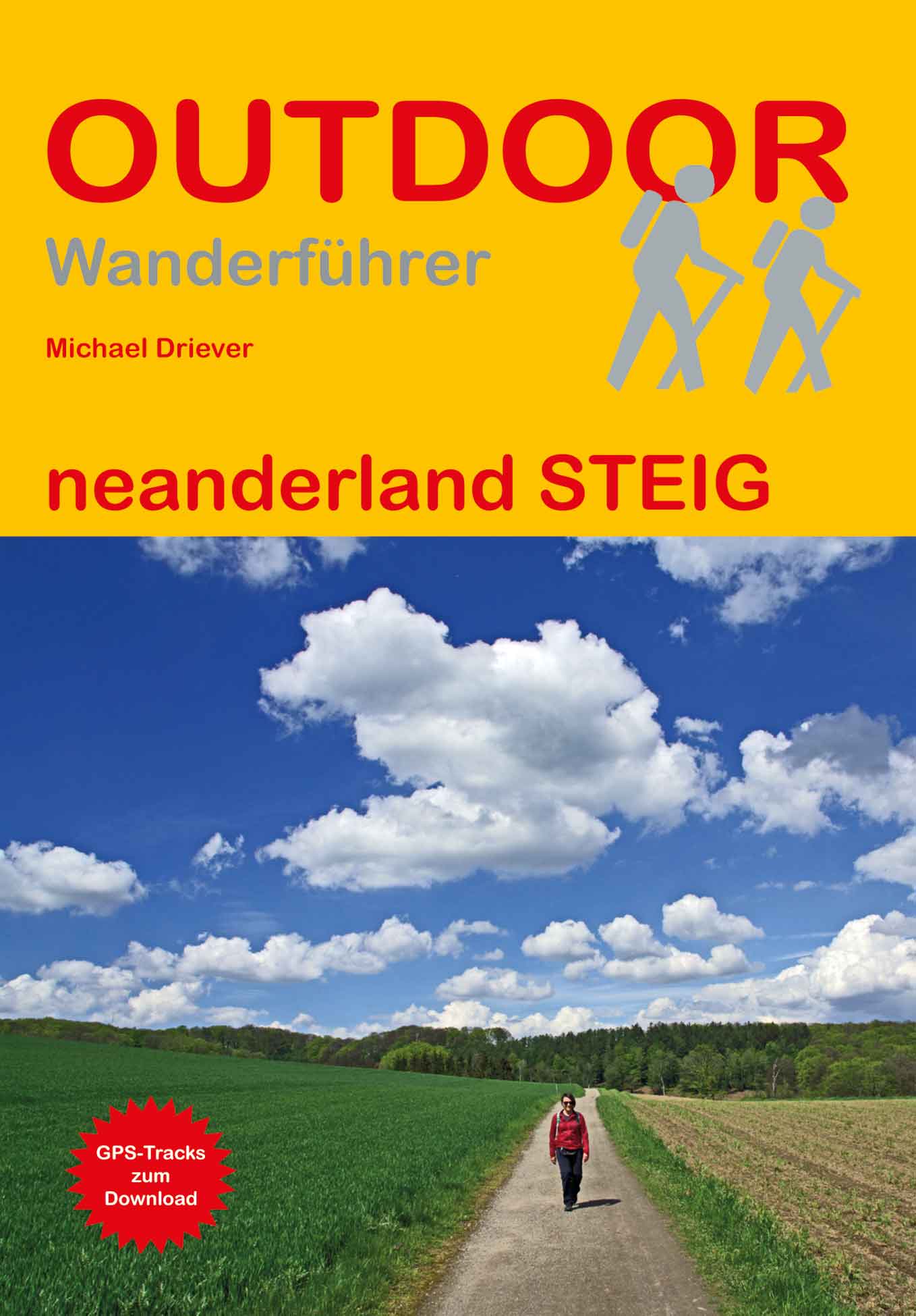
<p> Handzaam boekje met de routebeschrijving inclusief een heleboel praktische informatie. De beschrijving is uitstekend, maar kaarten zijn beperkt en schetsmatig aanwezig. Duits.</p> <div> Im Neandertal zwischen Erkrath und Mettmann wurden 1856 die Überreste eines vor 40.000 Jahren ausgestorbenen Urmenschen gefunden. Er erhielt den Namen Neandertaler. Hier, im sogenannten Neanderland, zeigt das Neanderthal Museum die Geschichte der Menschheit.</div> <div> In 17 Etappen führt der Rundwanderweg neanderland STEIG über 240 km durch Wälder und Moore, vorbei an Seen und Heiden, aber auch zu Bauernhöfen, Fachwerkhäusern, Gasthäusern, Museen und Überresten der Industrialisierung. Besonders attraktiv: Der neanderland STEIG kann von Großstädten wie Düsseldorf, Essen und Wuppertal in Tagesetappen erwandert werden. Jede Etappe ist auch gut mit Bus und Bahn zu erreichen.</div> <div> Der Wanderführer bietet eine ausführliche Wegbeschreibung mit Karten, Höhenprofilen, einer Übersichtskarte und GPS-Tracks gepaart mit Informationen zu Kultur und Geschichte, Anreise, Einkehr- und Unterkunftsmöglichkeiten. Empfehlungen für kurze Abstecher zu Sehenswürdigkeiten ergänzen die Wegbeschreibung.</div>
€17,50
Bekijk product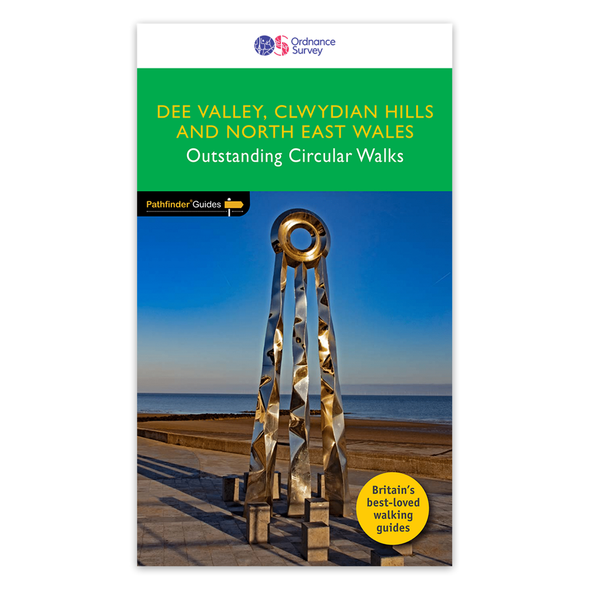
<p> Fraaie, goed verzorgde wandelgidsjes met 28 wandelingen van max. een dag, (beginnend bij korte, eindigend bij langere wandelingen). Weergegeven op duidelijke topografische kaartjes (1:25.000). Bevat verder wetenswaardigheden en praktische informatie voor onderweg.</p> <div> Enjoy 145 miles of lush green walks in north-east Wales with 28 superb country walks, graded by length and difficulty. Choose from 14 routes in the Cylwdian Range and Dee Valley Area of Outstanding Natural Beauty, three on the North Wales coast between Great Orme and Point of Ayr and 11 in Denbighshire and Flintshire to the east of the River Conwy – or do them all!</div> <div> </div> <div> Featured Dee Valley, Clwydian Hills and North-East Wales walks include:</div> <div> </div> <div> - Follow the Wales Coast Path along the coastal sand dunes to Point of Ayr and Prestatyn</div> <div> - Circle Great Orme for impressive views of Llandudno, the coast and the mountains of Snowdonia</div> <div> - Stroll along the Llandudno Canal to the magnificent Pontcysyllte Aqueduct, a World Heritage Site</div> <div> - Ramble the Prestatyn hillsides in the north of the Clwydian mountain range for views of Prestatyn, Rhyl and along the coast to Llandudno</div> <div> - Take Offa’s Dyke Path from Llandegla to the viewpoint of Moel y Wan and tranquil lanes filled with wildflowers</div> <div> - See the Penycloddau and Moel Arthur Iron Age hillforts on an undulating hike through the Clwydians from Llangwyfan</div> <div> - Climb to the summit of Castell Dinas Bran from Llangollen for views of the green Denbighshire countryside</div> <div> </div> <div> OS Pathfinder Guides: Outstanding Circular Walks</div> <div> </div> <div> - The definitive pocket book guide to Great Britain’s great outdoors</div> <div> - 28 mostly circular walks in one guidebook, ranging from 3-12½ miles</div> <div> - Walks are graded by length and difficulty ensuring a range of routes suitable for walkers of varying experience and mobility</div> <div> - Includes OS Explorer 1:25 000 scale map extracts for every route (4cm to 1km or 2½ inches to one mile)</div> <div> - Discover GPS waypoints, parking information and detailed route descriptions for foolproof navigation</div> <div> - Enhances your walk with information on rare wildlife, natural habitats and points of historical interest</div>
€18,50
Bekijk product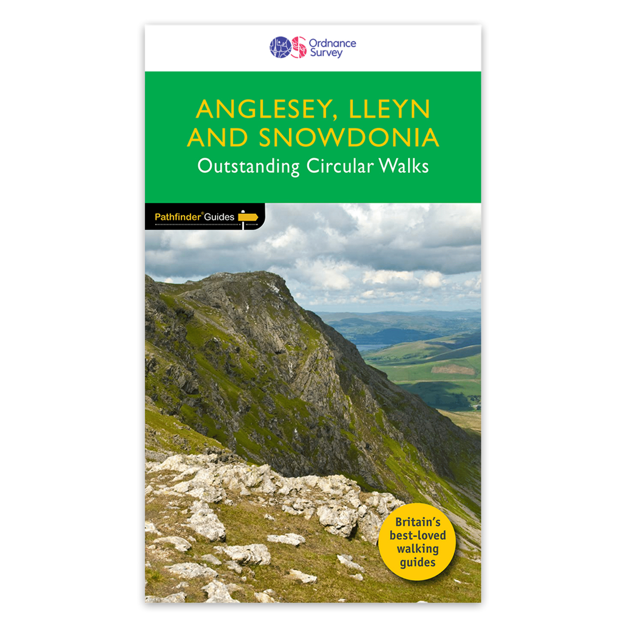
<p> Fraaie, goed verzorgde wandelgidsjes met 28 wandelingen van max. een dag, (beginnend bij korte, eindigend bij langere wandelingen). Weergegeven op duidelijke topografische kaartjes (1:25.000). Bevat verder wetenswaardigheden en praktische informatie voor onderweg.</p> <div> Experience breathtaking north Wales with 28 unforgettable walks through Anglesey, the Lleyn Peninsula and the Snowdonia National Park. Find stunning views of the Welsh coast, the ‘holy isle’ of Ynys Mon and sublime Snowdonia with a range of walks graded by length and difficulty, from relaxed rambles to challenging climbs.</div> <div> </div> <div> Featured Anglesey, Lleyn and Snowdonia walks include:</div> <div> </div> <div> - Enjoy views of Snowdon from the shores of Llyn Padarn, dotted with remnants of the Llanberis slate quarries and a medieval castle</div> <div> - Climb to Holyhead Mountain, Anglesey’s highest point, through the South Stacks Cliff Nature Reserve</div> <div> - See the glorious Lleyn Heritage Coast from the headland of Trywn-y-Tâl, circling back to the pleasant village of Trefor</div> <div> - Take in the Aber Falls as you follow the North Wales Coast Path on this extended walk around Aber</div> <div> - Follow in the footsteps of medieval pilgrims around the tip of the Lleyn Peninsula to Aberdaeron and Land’s End</div> <div> - Ascend Snowdon (Yr Wyddfa) from Rhyd Ddu, crossing dramatic ridges and a landscape marked by industrial quarrying</div> <div> - Ramble to Rhoscolyn along a coastal path to an ancient holy well, exploring the intriguing geology and rocky Anglesey coastline</div> <div> </div> <div> OS Pathfinder Guides: Outstanding Circular Walks</div> <div> </div> <div> - The definitive pocket book guide to Great Britain’s great outdoors</div> <div> - 28 mostly circular walks in one guidebook, ranging from 3-12½ miles</div> <div> - Walks are graded by length and difficulty ensuring a range of routes suitable for walkers of varying experience and mobility</div> <div> - Includes OS Explorer 1:25 000 scale map extracts for every route (4cm to 1km or 2½ inches to one mile)</div> <div> - Discover GPS waypoints, parking information and detailed route descriptions for foolproof navigation</div> <div> - Enhances your walk with information on rare wildlife, natural habitats and points of historical interest</div>
€18,50
Bekijk product
<p> Uitstekende wandelgids van dit gebied. Goed beschreven met veel praktische informatie om de routes te kunnen lopen, inclusief redelijke kaarten.</p> <div> This guidebook describes 38 walking routes in Ticino, the Swiss canton with a Mediterranean twist. Towering snowcapped mountains and lush, narrow valleys overlook stylish lakeside resorts with palm-fringed promenades and handsome Italianate architecture. It's not just the Italian language that sets Ticino apart: the food, sunny weather and stunning landscapes attract millions of visitors to this part of the southern Alps every year.</div> <div> </div> <div> As for the walks, it's the variety - as much as the fabulous scenery - that provides the draw. In this book you'll find everything from level walks along the shores of Lakes Lugano and Maggiore, to more challenging trails through craggy, forested valleys with gushing waterfalls and ancient stone-built villages, to isolated mountain huts right at the permanent snowline. If you think you already know Switzerland, but haven't walked in Ticino, a stunning experience awaits you - and all of the routes are easily accessible through a network of buses, trains, funiculars, cable cars and chairlifts.</div>
€24,95
Bekijk product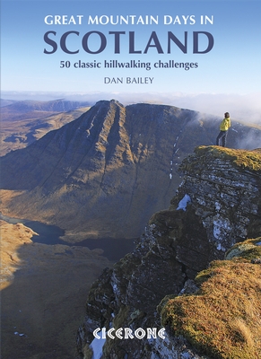
<p> The 50 testing routes in this larger-format guidebook are spread across an epic mountainous landscape that is one of the wildest areas in Europe.</p> <p> These routes show the rich diversity and the sheer quality of Scotland's finest peaks. Some of the 50 hikes described are well known classic challenges, while others approach a favourite mountain in a novel way or combine several in a testing round; they can be crammed into a single hard day or backpacked over two.</p> <p> The collection spans Scotland, right across its magnificent upland areas and dramatic peaks. Routes range from 12 to 25 miles and many would make a good two-day adventure. Some can be approached by kayak or mountain bike. Over 270 ranges and summits feature in settings as varied as the snowbound Cairngorm plateaus and the land-sea jigsaw of the Hebrides, where rugged peaks rise from clear water. Few walking destinations are better suited to routes at the longer, tougher end of the scale.</p>
€27,50
Bekijk product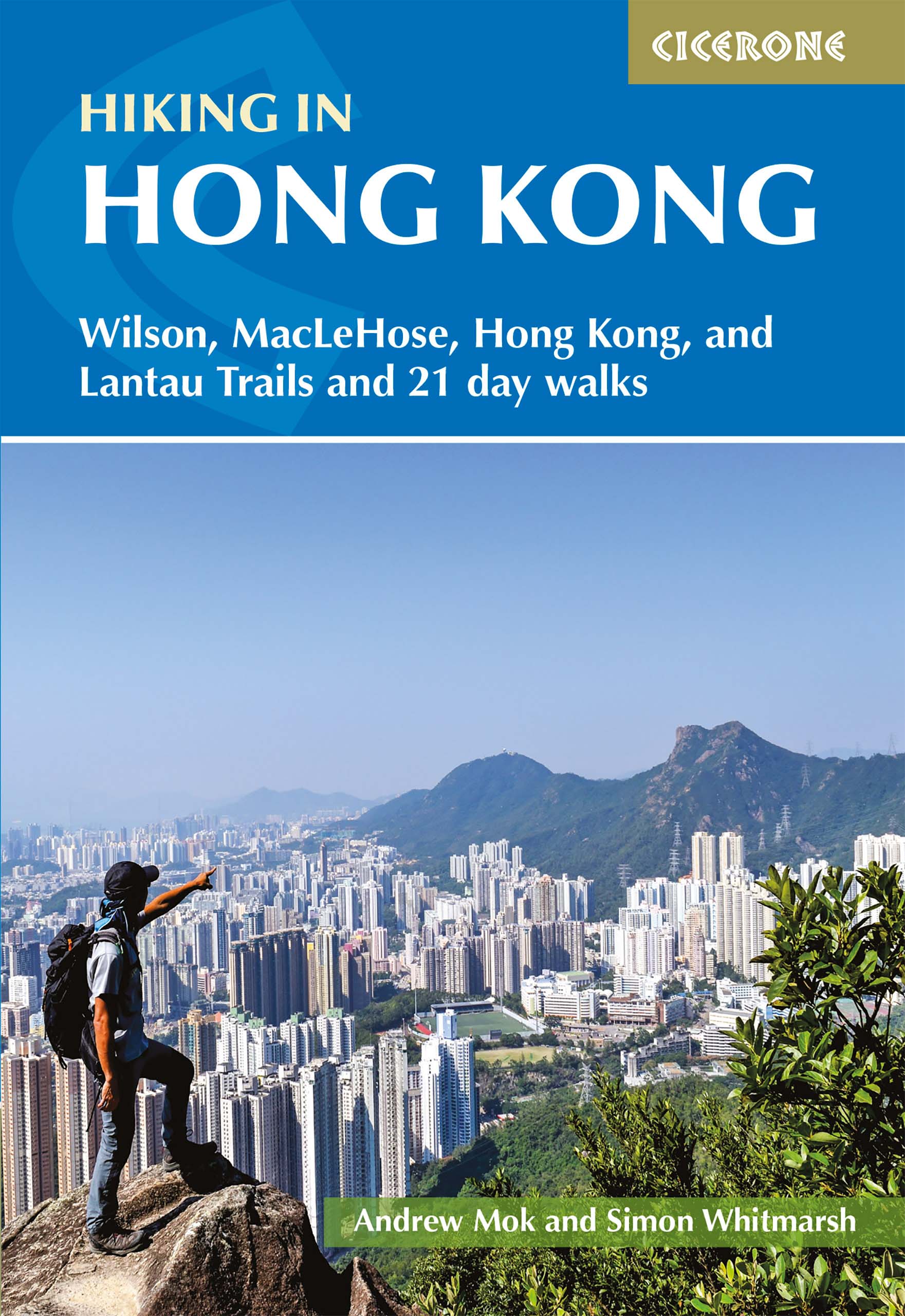
<div> Although Hong Kong is often thought of as intrinsically urban, just a short distance from the big cities are lush mountains and attractive and varied countryside. This guide presents the highlights of this hiking-friendly territory, detailing 21 graded day walks and four short treks: Hong Kong Trail (presented in 3 day stages), Lantau Trail (5 days), MacLehose Trail (5 days) and Wilson Trail (5 days). The day walks - of 5 to 22.5km - cover Hong Kong, Kowloon, the New Territories and the islands and range from easy hikes suitable for families to challenging ascents of Hong Kong's highest peaks. The territory's compact nature and excellent public transport infrastructure make it easy to access the routes.</div> <div> </div> <div> The guide has all you need to explore Hong Kong's excellent network of trails. Route description is accompanied by clear mapping and there are comprehensive notes - including Chinese place names - to help visitors navigate the public transport system. Alongside practicalities such as getting there, equipment and weather, information on local points of interest offers an insight into Hong Kong's rich geology, history and culture.</div> <div> </div> <div> The Hong Kong archipelago is one of surprising diversity and contrast, where high-rise modern cities are set against a backdrop of verdant green mountains, and sandy beaches lie right alongside dense jungle. There are also plenty of opportunities for wildlife-spotting and chances to experience the fascinating 'East meets West' culture. This guide is the perfect companion to discovering the fantastic walking on offer in the 'Pearl of the Orient'.</div>
€24,95
Bekijk product
<div> Our authors have chosen 15 of the best short walks around Windermere, Ambleside and Grasmere for you to explore. Our guide comes with easy-to-read Ordnance Survey maps and clear route descriptions, perfect if you're new to walking or are looking for something you can enjoy with the whole family.</div> <div> </div> <div> We've included information on local beauty spots and tasty refreshment stops, and most of the walks can be completed in under 3 hours.</div> <div> </div> <div> We haven't included any walks with challenging terrain or complicated navigation, and all you'll need to take with you are a waterproof jacket and a pair of comfortable trainers.</div>
€13,95
Bekijk product
<div> Our authors have chosen 15 of the best short walks around the Surrey Hills for you to explore. Our guide comes with easy-to-read Ordnance Survey maps and clear route descriptions, perfect if you're new to walking or are looking for something you can enjoy with the whole family.</div> <div> </div> <div> We've included information on local beauty spots and tasty refreshment stops, and most of the walks can be completed in under 3 hours.</div> <div> </div> <div> We haven't included any walks with challenging terrain or complicated navigation, and all you'll need to take with you are a waterproof jacket and a pair of comfortable trainers.</div>
€13,95
Bekijk product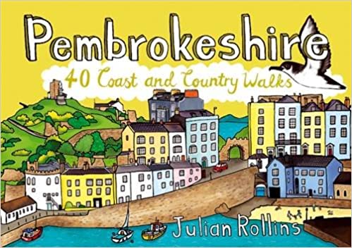
<div> <div> Handige compacte wandelgids met 40 dagwandelingen. Deze gids bevat kleine kaartjes en leuke uitgebreide informatie over wat er langs de route te zien is. Goede wandelkaarten zijn echter we noodzakelijk voor deze tochten: de Ordnance Survey explorer maps of Landanger maps zijn zeer geschikt.</div> <div> </div> </div> <div> </div> <div> As the home of Britain's one and only national coastal park, Pembrokeshire is rightly famed for its marine wildlife, unspoilt beaches, towering cliffs and charming harbours. Inland, however, you will also find ancient woodlands and rolling hills, as well as archaeological mysteries and crumbling castles which suggest that this peaceful part of Wales has a far more turbulent past.The 40 moderate walks in this volume from award winning publisher Pocket Mountains, explore the stunning coastline as well as the heartland of the county, with several routes making use of sections of established long-distance walking trails.</div> <div> </div>
€10,95
Bekijk product