
Beantwoord enkele vragen, en binnen seconden geeft AI je een persoonlijk aankoopadvies op maat.
Beantwoord enkele vragen, en binnen seconden geeft AI je een persoonlijk aankoopadvies op maat.

<p> Goede Duitstalige wandelgids met heldere beschrijvingen van de wandeltochten. Met hoogteprofiel, kaartje en de benodigde praktische informatie als bijvoorbeeld de startlocatie met GPS coordinaten. De wandelingen zijn ingedeeld in zwaarte en dan op verschillende kleuren weergegeven. Beschreven worden eenvoudige wandelingen tot pittige (berg)tochten, voor getrainde en ongetrainde wandelaars, een aantal wandelingen zijn geschikt om met kinderen te doen. Belangrijke toevoeging bij de Kompass wandelgidsen is een bijgevoegde losse wandelkaart van het betreffende gebied waarop de wandelingen uit de gids op de kaart heel duidelijk zijn ingetekend.</p> <p> </p>
€18,50
Bekijk product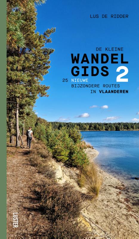
<div> Ontdek 25 magische wandelplekken in Vlaanderen met Lus De Ridder! Haar vele enthousiaste volgers op Instagram (@staycation.belgium) weten wat dat betekent: gevarieerde routes door de natuur, zo ver mogelijk van platgetreden of verharde paden. </div> <div> </div> <div> Net zoals voor haar eerste Kleine wandelgids (2021) testte ze voor dit vervolg talloze wandelingen in Vlaanderen persoonlijk uit, om vervolgens 25 nieuwe en minstens even mooie en verrassende routes uit te kiezen. </div> <div> In dit handige boekje vind je 25 uitgestippelde tochten: 5 in elke provincie, van 4 tot 24 kilometer.</div> <div> Ze leiden je door bijzondere en ongerepte landschappen en natuurgebieden, van de duinen aan de kust tot de Vlaamse Ardennen, van de Groene Gordel tot het Limburgse Bosland. Voor wie zin heeft in meer, deelt Lus ook haar favoriete plekken in de omgeving, van nog andere knappe routes tot de beste stops voor een hapje en een drankje of een geweldig logeeradres.</div> <div> </div> <div> Naast heldere beschrijvingen, kaartjes en een overzichtje met praktische informatie, vind je bij elke wandeling ook een QR-code. Scan ze met je smartphone om rechtstreeks naar de juiste digitale wandelkaart op RouteYou geleid te worden. Zo kan je navigeren met je gsm, of je downloadt het gpx-bestand op je wandel-gps of sporthorloge.</div>
€21,95
Bekijk product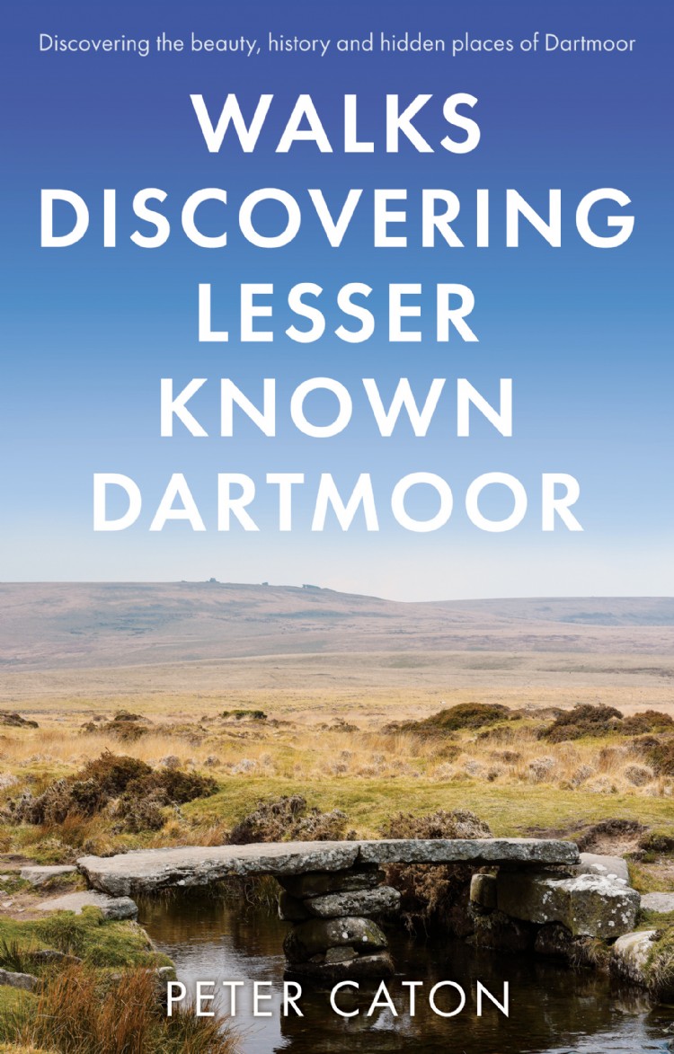
<div> A guide describing routes of 1½ to 10 miles, enabling walkers to discover the beauty, history and hidden places of Dartmoor, the wildest, most remote and arguably the most beautiful area in Southern England.</div> <div> </div> <div> The walks will take you to antiquities dating from the Bronze Age and even earlier, to hidden waterfalls and gorges, abandoned remote dwellings, fascinating industrial archaeology, majestic tors and wonderful viewpoints.</div> <div> </div> <div> For those who don’t know Dartmoor they provide routes for interesting walks of varying length and difficulty. Whilst some of the points of interest will be familiar to those who know the moor well, the walks will take you to places that very few people visit, passing little known artefacts with something new for almost everyone.</div> <div> </div> <div> Produced in full colour with routes clearly marked on OS maps, the book includes comprehensive background information on the moor and the history, stories and legends of the many places visited on each walk.</div> <div> </div> <div> An author of walking and travel books, Peter Caton has walked on Dartmoor for more than 50 years.</div>
€18,50
Bekijk product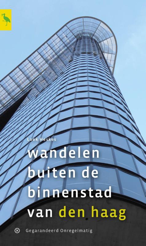
<div> Auteur Loek Heskes en zijn vrouw Irene zullen u in 'Wandelen buiten de binnenstad van Den Haag' al snel verleiden om te gaan wandelen in de Haagse 'buitenstad', die tussen het centrum en het buitengebied gelegen is: de wijken rond het centrum, van Bezuidenhout tot Kijkduin en van Scheveningen tot de Schilderswijk. Al lopend ontdekt u het karakter van de wijken door bewust te kijken naar de inrichting van de openbare ruimte, architectuur en cultuurhistorie. De wijken in de buitenstad stammen veelal uit de 19e en 20e eeuw en liggen vaak onder druk binnen stadsvernieuwingsprojecten. </div> <div> </div> <div> Ondanks dat Den Haag de dichtstbevolkte stad van ons land is loopt u veel door parken en langs water. En bijna altijd is er wel een uitspanning in de buurt om de vele indrukken te verwerken. De tien wandelingen in deze gids zijn allemaal rond de 10 kilometer lang en bieden u een uitgelezen gelegenheid om de Hofstad in al haar geledingen te leren kennen.</div>
€17,95
Bekijk product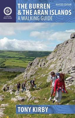
<p> Duidelijke wandelgids van dit specifieke deel van Ierland. Goede praktische informatie en zeker voor de GPS wandelaar handig met vermelde waypoints. Kaarten zijn schetsmatig, maar er wordt verwezen naar de benodigde topografische kaarten van Ierland. </p> <div> The Burren and the Aran Islands, with their unique combination of flora, fauna and landscape, are explored by large numbers of walkers annually. This is a revised guide to some of the best walking routes in the region, with lucid descriptions and additional information to enhance the walkers' enjoyment and appreciation of the place. From the rugged interior to spectacular coastal scenery, from challenging upland walks to shorter road and waterside excursions, this selection has something for everyone. Every part of the region is covered. Walks vary from two-hour strolls to the longer Burren Way, a six-hour walk from Lisdoonvarna to Ballyvaughan.</div> <div> </div> <div> The author has put his considerable experience and detailed knowledge of the area to great use in putting together an easy-to-use guide that introduces the best of this region for locals and visitors alike. Each route, prefaced with a quick-reference summary, is illustrated with a clear sketch map; descriptions include detailed access information while points of interest are highlighted – geology, flora and fauna, history, archaeology and folklore.</div>
€22,50
Bekijk product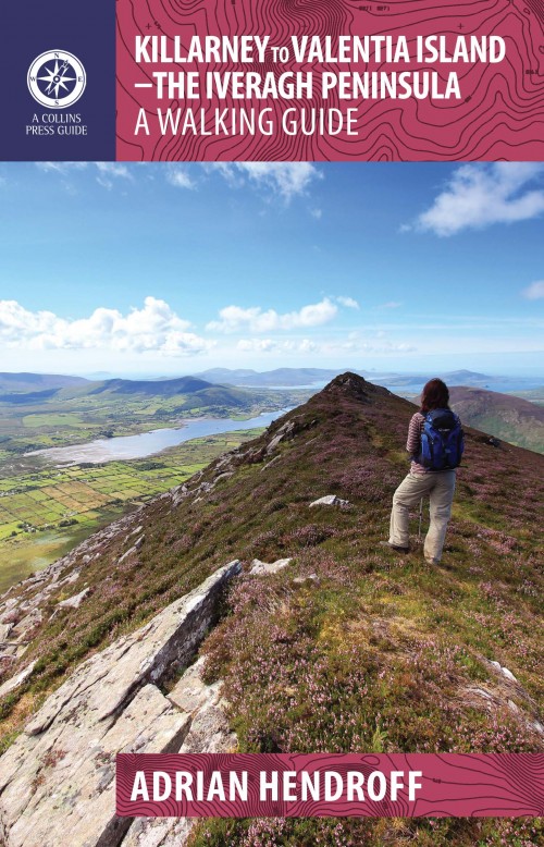
<p> Duidelijke wandelgids van dit specifieke deel van Ierland. Goede praktische informatie en zeker voor de GPS wandelaar handig met vermelde waypoints. Kaarten zijn schetsmatig, maar er wordt verwezen naar de benodigde topografische kaarten van Ierland. </p> <p> The Iveragh Peninsula, the largest in southwest Ireland, stretches from Killarney to Bolus Head and attracts thousands of visitors annually. The Ring of Kerry coastal road winds along its fringes and sandstone peaks soar high above. It is a landscape of raw and stunning beauty from the lakes that fill the corries to the spectacular cliff scenery along its coast. There is no better way to explore this landscape than on foot. This book helps you do just that with routes ranging from a few hours to full-day walks. Explore Valentia Island, the majestic MacGillycuddy’s Reeks and sections of The Kerry Way. Go off the beaten track and explore the coast, hills and woodlands from Killarney to Cahersiveen to Kenmare. Each route is prefaced with a reference summary and illustrated with maps and photographs. Route descriptions include GPS coordinates, navigation guidance, access notes and short variations. There is also material on the fauna, flora, folklore, history, geology and place names of each area.</p>
€22,50
Bekijk product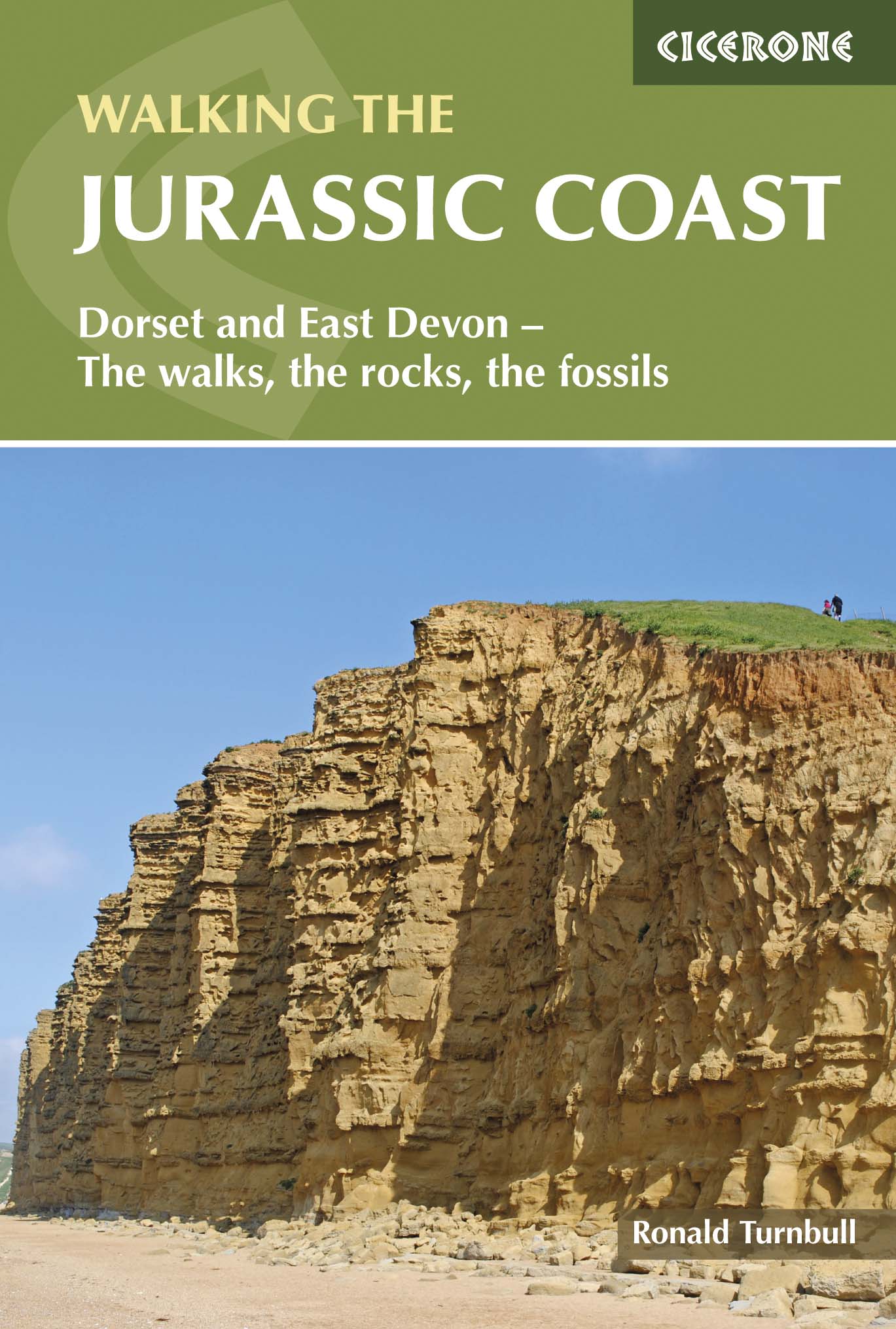
<div> The Jurassic Coast of Devon and Dorset, stretching between Exeter and Bournemouth, is a geological wonderland. Natural wonders like Chesil Beach, Durdle Door and fossils so numerous you'll be tripping over them, combine with southern England's rolling Downs, tiny villages, beaches and sunny summers to provide a stunning and awe-inspiring landscape to explore.</div> <div> </div> <div> The 30 walks in this guide let walkers discover the best and most spectacular areas on the coast. The walks are between 5 and 25km (3 to 16 miles) and provide a range suitable for all abilities. The guide has been divided into areas: Devon's Red Beds, the Lias, Chesil Beach, Chalk walks (Lulworth and inland) and the Isle of Purbeck. </div> <div> </div> <div> The geological descriptions are accompanied by strata diagrams, geological timelines, explanations of the creation of the various sedimentary rocks along the coast, and discussion of how and why the various formations formed millennia ago. The incredible - yet readable - detail brings these walks and the landscape alive. And yet, the routes can just as easily be walked for their own sake and the pleasure of rolling downs, high cliffs and beach sunshine.</div> <div> </div> <div> As well as detailed descriptions for every walk, accompanied by OS maps, there are details on available parking, points of interest along the way (on rocks and other sights) and advice on the terrain covered. The general and geological introductions provide background on the region and the appendices give thorough information on local museums and information centres, cliff diagrams, a glossary of geological terms and a quick, look-up guide to the rocks of the Jurassic Coast. More than just a walking guidebook, this book is an invitation to explore and learn about this spectacular Natural World Heritage area.</div> <div> </div> <div> Steden en Dorpen</div> <div> Budleigh Salterton, Sidmouth, Beer/Seaton, Lyme Regis/Charmouth, Bridport, Dorchester, Portland, Cerne Abbas, Lulworth, Swanage</div>
€19,95
Bekijk product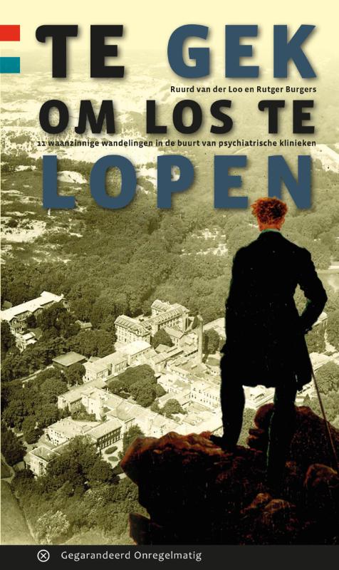
<div> In vroeger tijden werd de psychiatrie verstopt in afgelegen gebieden van Nederland om de gekte te verbergen en de maatschappij te beschermen. De tijden zijn veranderd, de psychiatrie is naar de maatschappij gehaald. Maar de oude inrichtingen liggen nog op die verstopte plekken. Eenieder uit de streek kent de namen wel van bijvoorbeeld Wolfheze, Zuidlaren, Den Dolder of Santpoort. Naar de gebouwen van weleer wordt nu met andere ogen gekeken; het zijn brokjes cultuurhistorie midden in de natuur , die het waard zijn om te bezoeken en te ontdekken. Te gek om daar nu los te lopen.</div> <div> </div>
€17,95
Bekijk product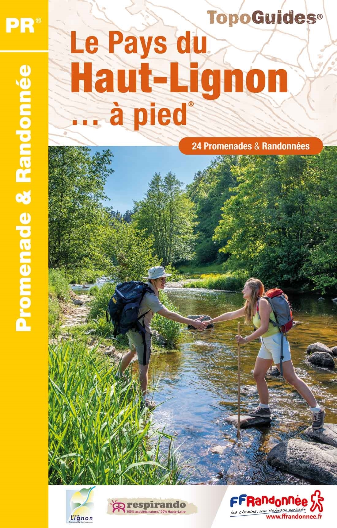
<p> Franstalige wandelgids met een beschrijving van een aantal dagtochten. Uitstekende beschrijvingen met duidelijk kaartmateriaal. Mislopen is nauwelijks mogelijk, maar ja .. de franse taal! Ook praktische informatie staat in deze gids. Alle gidsen bevatten een door ons toegevoegde uitgebreide frans - nederlandse wandelwoordenlijst.</p> <div> Formé par l'activité volcanique, le pays du Haut-Lignon présente une mosaïque de paysages insolites. Entre Velay et Vivarais, les sentiers serpentent et s'invitent dans les prairies de jonquilles et de genêts, fièrement surveillés par le pic du Lizieux. Le Lignon façonne cet étonnant plateau en traversant le pays de toutes parts, et en permettant aux truites et autres chevreuils d'habiter cet environnement protégé.</div> <div> </div> <div> Les habitants ont utilisé les ressources pour y bâtir de remarquables maisons fortes et un habitat typique et traditionnel. À 1 000 mètres d'altitude, les chemins du Haut-Lignon vous feront voyager au coeur d'une nature entre moyenne montagne et plaines boisées.</div>
€15,50
Bekijk product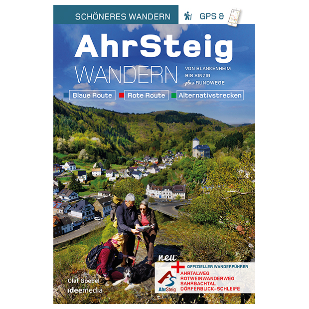
<p> Premium-Wandern und genießen: Ahr-Kenner Olaf Goebel beschreibt detailliert die aktuellsteTrassenführung 2017 des AhrSteigs sowie alle Halb- und Ganztagesetappen auf traumhaften Wandertouren durch Deutschlands Rotweinparadies. Zusätzlich werden Rund- und Kombi-Touren mit dem Rotweinwanderweg sowie der Ahrtalweg, die Sahrbachtal- und Dörferblick-Schleife vorgestellt. Mit einfacher Anbindung an die App „traumtouren“.</p> <div> Zwischen Wäldern und Weinbergen führt der neue Premiumwanderweg über weite Höhen und tiefe Täler mitten ins Herz des deutschen Rotwein-Anbaus: Der AhrSteig verbindet Blankenheim in der Eifel mit Sinzig am Rhein. Das Buch mit unkomplizierter Anbindung via QR-Code an die App „traumtouren“ macht Planung und Ausführung besonders einfach. Autor Olaf Goebel kennt das Ahrtal und seine Geheimtipps wie seine Westentasche – er war viele Jahre Redaktionsleiter der Regionalredaktion Bad Neuenahr-Ahrweiler der Rhein-Zeitung.</div> <div> </div> <div> Von Blankenheim aus führt die Route über den Ahrtalweg zum Freilinger See und über die alte Römerstrasse nach Eichenbach. Bei Schuld erwartet die Wanderer ein traumhafter Blick auf die Ahrschleife, bevor es am Fluss entlang und über schmale Pfade nach Sierscheid, Dümpelhard und Liers geht. Mythen und Sagen begleiten die AhrSteiger auf ihrem weiteren Weg nach Ahrbrück und zum Hexenrichtplatz von Pützfeld. Die neue Königsetappe zwischen Kreuzberg und Walporzheim verbindet herrliche Ausblicke im wilden Abschnitt des Ahrgebirges mit romantischen Weindörfern wie Mayschoss und Rech. Über Walporzheim und vorbei an der Lourdeskapelle geht es über den Neuenahrer Berg zum Idienbachtal, bevor im romantischen Ahrdorf Heimersheim der Endspurt für die letzte Etappe zum Schloss nach Sinzig und zur Rheinmündung beginnt.</div> <div> </div> <div> Mit Scan-to-go® können sich Wanderer via QR-Code die jeweiligen Startpunkte auf GoogleMaps anzeigen lassen, die kostenfreie App „traumtouren“ zeigt Wanderern durch Abscannen des QR-Codes auf dem Smartphone-Display den Weg. Pfiffig aufgemacht, praktisch für unterwegs – und dennoch erstaunlich preiswert, so urteilte die Presse über die Pocket-Reihe aus dem Verlag ideemedia. Und wer vom AhrSteig noch nicht genug hat, der kann zusätzlich den Rotweinwanderweg, die Sahrbachtal- und die Dörferblick-Schleife erkunden…</div> <div> </div> <div> NEU: Mit der neuen App „traumtouren“ stehen die wichtigsten Routeninfos und Navigationsdaten für die meisten Smartphones (iOS und Android) zur Verfügung. Einfach QR-Code über die App abscannen und loswandern!</div>
€14,50
Bekijk product