
Beantwoord enkele vragen, en binnen seconden geeft AI je een persoonlijk aankoopadvies op maat.
Beantwoord enkele vragen, en binnen seconden geeft AI je een persoonlijk aankoopadvies op maat.
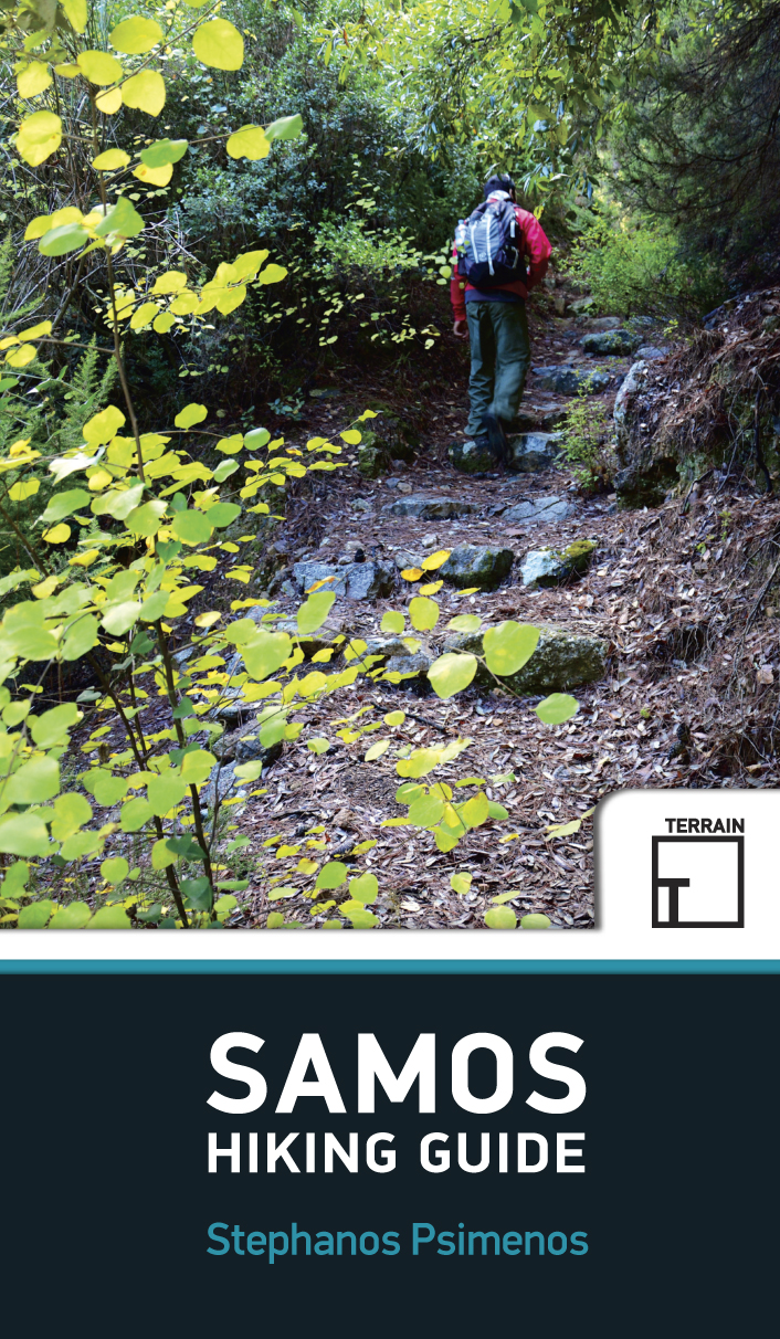
<p> Engelstalige wandeligds voor het Griekse eiland Samos. Met 32 wandelingen voor zowel de beginnende als gevorderde wandelaars.</p> <div> Samos island is a hiker’s paradise! Hundreds of kilometres of forest trails and cobbled paths crossing through a beautiful countryside link many of the most interesting places of the island: traditional villages and monasteries, mountain tops and impressive ridges, remote beaches and ancient ruins. Lush landscapes and amazing ocean views alternate for a most rewarding experience. Through 32 well-designed hikes for both the casual stroller and the adventurous hiker, this hiking guidebook aims to help you discover the most authentic face of Samos island. </div> <div> </div> <div> THIS GUIDEBOOK CONTAINS: </div> <ul> <li> Detailed step-by- step descriptions of a total of 32 hikes and walks</li> <li> More than 150 color photos to inspire your trip</li> <li> An introduction to the Samian landscape, flora and fauna</li> <li> Maps based on the most up-to- date TERRAIN hiking map of Samos</li> </ul>
€20,95
Bekijk product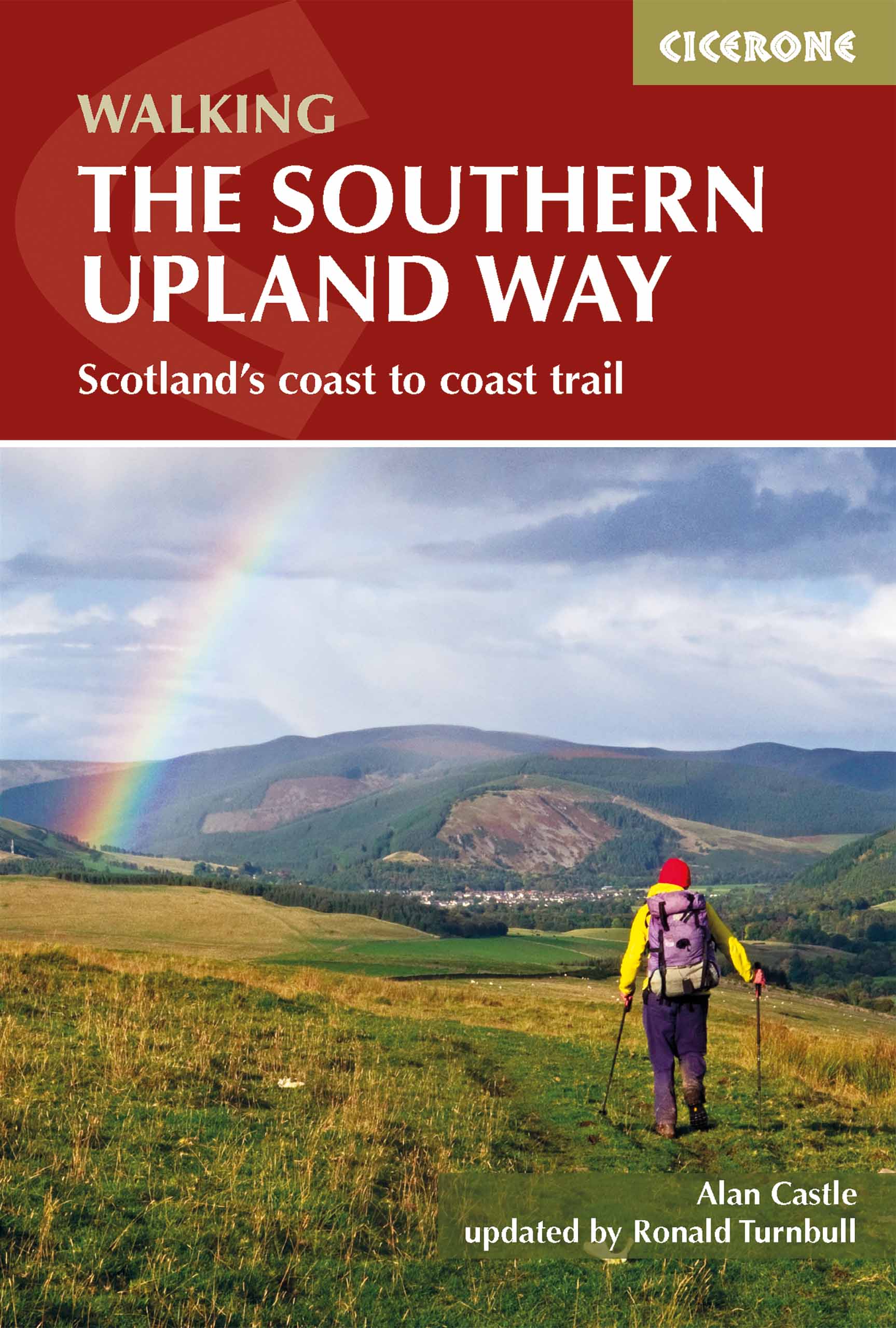
<div> Uitstekende wandelgids van de Southern Upland Way, waarbij naast alle noodzakelijke informatie ook gebruik gemaakt wordt van de echte topografische kaart.</div> <div> </div> <div> <div> The Southern Upland Way is Scotland's coast-to-coast walk and the longest of the nation's Great Trails. 215 miles long, it links the pretty harbour village of Portpatrick on the west coast with Cockburnspath, a little south of Dunbar, in the east. The walk is at times a strenuous one, crossing the remote high moorland of the Galloway Hills, Carsphairn range, Lowthers, Ettrick Hills and Lammermuirs, calling for competence, fitness and self-reliance. </div> <div> </div> <div> This guide presents advice on how best to plan and tackle this challenging but highly rewarding journey. The waymarked trail is presented in fourteen stages of 9–19 miles and suggestions for a rest day exploring Moffat and its environs are also included. It is possible either to backpack, taking advantage of five bothies and unlimited wild camping possibilities, or to stay in towns and hill villages, B&Bs and inns (facilitated by vehicle pick-up to avoid excessively long walking days). </div> <div> </div> <div> The guide covers all the practicalities, with tips on planning, transport, accommodation, luggage transfer and vehicle support services. Clear step-by-step route description is provided for each stage, accompanied by 1:50,000 OS mapping and notes on local history and points of interest. A trek planner and useful contacts can be found in the appendices.</div> <div> </div> <div> The Southern Upland Way showcases the wild beauty of southern Scotland, taking in rugged moorland, rolling hills, wooded river valleys, lochsides and coast, as well as some of the attractive border towns that scatter the region. There are also numerous historical sites, offering an insight into a fascinating past – from ancient cairns to bastles, Covenanters' memorials and literary connections – plus opportunities to visit local attractions, including Castle Kennedy Gardens, Wanlockhead Lead Mining Museum, Traquair House, Melrose Abbey and Thirlestane Castle.</div> <div> </div> <div> <strong>Dorpen en steden</strong></div> <div> <div> Portpatrick, Castle Kennedy, New Luce, Bargrennan, St John's Town of Dalry, Sanquhar, Wanlockhead, Beattock/Moffat, Traquair, Galashiels, Melrose, Lauder, Longformacus, Abbey St Bathans, Cockburnspath</div> <div> </div> </div> </div> <p> </p>
€20,95
Bekijk product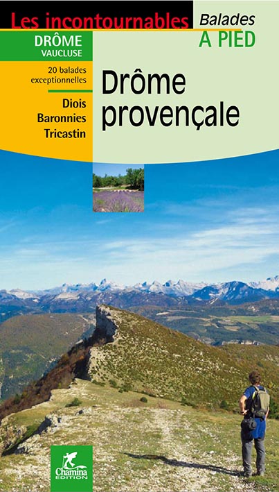
<div> Franstalig wandelgidsje voor de Drôme provençale (tot 30km) met beschrijving en gedetailleerd kaartmateriaal op schaal 1:25.000 van 20 dagwandelingen tussen de 2 en 8.45 uur. Bevat veel informatie over wat er te zien tijdens de wandeling, ook is duidelijk aangegeven wat het moeilijkheidsniveau is en de duur van de wandeling. <span style="font-family: 'Helvetica Neue', Helvetica, sans-serif, Arial; line-height: 16.799999237060547px;">Mislopen is nauwelijks mogelijk, maar ja .. de franse taal! . Alle gidsen bevatten een door ons toegevoegde uitgebreide frans - nederlandse wandelwoordenlijst.</span></div> <div> </div> <div> Le territoire concerné :</div> <div> La Drôme provençale correspond au tiers sud du département, entre couloir rhodanien, Haut-Vaucluse et Haute-Provence. Elle enclave un petit territoire vauclusien, dit « Enclave des Papes », autour de Valréas. Montélimar, Crest, Die, Dieulefit, Nyons ou Buis-les-Baronnies sont les villes et bourgs touristiques principaux du territoire. Son altitude varie de 50 mètres à Saint-Paul-Trois-Châteaux à plus de 1600 mètres.</div> <div> </div> <div> Le guide</div> <div> • Format pratique : 12 x 21 cm</div> <div> • Introduction générale avec présentation du territoire (plusieurs thèmes développés qui</div> <div> enrichissent la connaissance des sites traversés)</div> <div> • 20 itinéraires de 1h30 à 5h00 pour une pratique familiale et sportive</div> <div> • Cartographie sur fond IGN au 1 : 25 000 pour se repérer facilement</div> <div> • Détail des centres d’intérêts</div> <div> • Renseignements pratiques pour randonner en toute sécurité</div> <div> • Adresses utiles</div>
€12,50
Bekijk product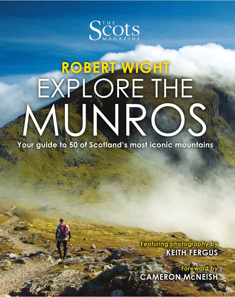
<p> The Scottish landscape has a unique majesty like no other. It will sweep you away with the Alpine grandeur of the Skye Cuillin or enchant with the Arctic domes of the Cairngorms. There are ancient rocky formations, rolling hills and the sublime, glowering peaks of Glen Coe and Ben Nevis. Within these cherished environments stand Scotland's 282 Munros--mountains that top 3,000 feet. With details of the best time of year to climb, how to get there, what you'll see (wildlife, romantic ruins, caves, waterfalls and lochs), intriguing historical info, and the author's lived experience of the hills, <i> Explore the Munros</i> will inspire your discovery of Scotland's most beautiful mountains.</p>
€19,95
Bekijk product
<div> Die griechische Halbinsel Peloponnes ist das gebirgige Südende des Balkans und gilt noch als Geheimtipp für das Weitwandern. Auf dem Teilstück des Europäischen Fernwanderwegs E4 lässt sie sich auf gut 300 km von Nord nach Süd durchqueren - von Diakopto am Golf von Korinth nach Gythio am Lakonischen Golf. Dabei durchwandern Sie Ausläufer des Berges Chelmos, das Menalo-Gebirge und das Parnon-Gebirge und die letzten Tage führen durch das höchste Gebirge der Peloponnes, das Taygetos. Auf der Wanderung wechseln sich erlebnisreiche Passagen durch einsame Natur, wilde Flusstäler, dramatische Schluchten und alpines Gelände mit winzigen Bergdörfern, belebten Ortschaften und den Städten Tripoli und Sparta ab. Außerdem passieren Sie die UNESCO-Weltkulturerbestätte Mystras. Dieser Wanderführer enthält Vorschläge zu Etappen und zur Aufteilung, detaillierte Wegbeschreibungen, Hinweise zu Unterkünften und Verpflegungsmöglichkeiten sowie viele Tipps zu Highlights, Ortschaften, Transport und mehr. Ergänzt werden die Beschreibungen durch Karten und Höhenprofile sowie GPS-Tracks zum Download.</div> <div> </div>
€15,50
Bekijk product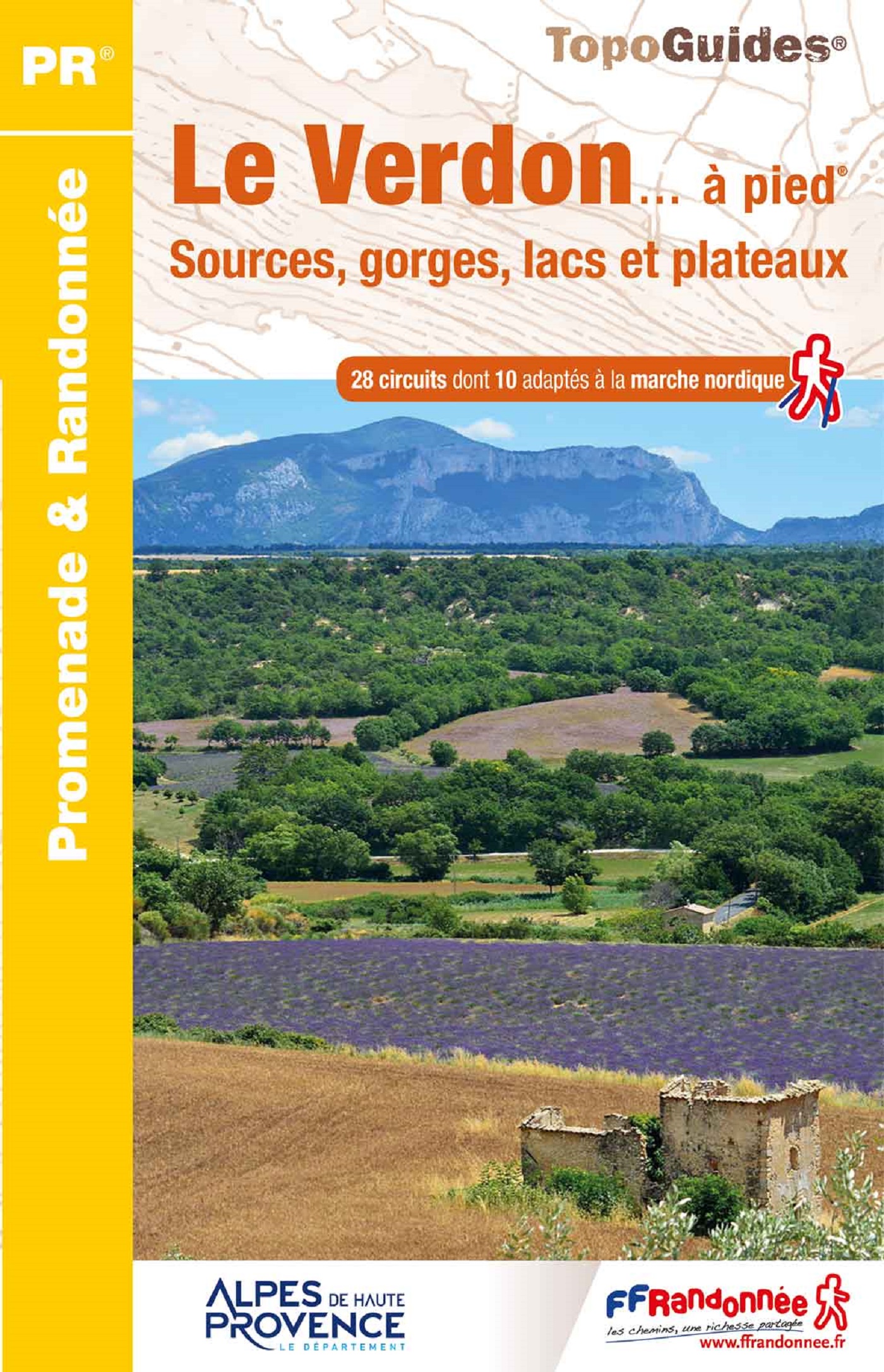
<p> Franstalige wandelgids met een beschrijving van een aantal dagtochten. Uitstekende beschrijvingen met duidelijk kaartmateriaal. Mislopen is nauwelijks mogelijk, maar ja .. de franse taal! Ook praktische informatie staat in deze gids. Alle gidsen bevatten een door ons toegevoegde uitgebreide frans - nederlandse wandelwoordenlijst.</p> <p> "Le Verdon s'étire d'est en ouest entre Var et Alpes-de-Haute-Provence. Il traverse une vaste zone de moyenne montagne jalonnée d'agglomérations perchées sur les reliefs ou installées au cour du plateau de Valensole. Longer la rivière, c'est découvrir des paysages rares : escarpements enrésinés, eaux vertes des lacs de barrages, chaos rocheux, falaises et canyons vertigineux, sérénité des collines, oliviers et lavandes à perte de vue. C'est marcher au paradis de la randonnée. les marcheurs sportifs et entraînés apprécieront le célèbre sentier Martel, qui descend au fond du Grand Canyon. Les familles aimeront flâner dans les ruelles et autours des antiques cités de Castellane, Riez et Moustiers-Ste-Marie."</p>
€16,50
Bekijk product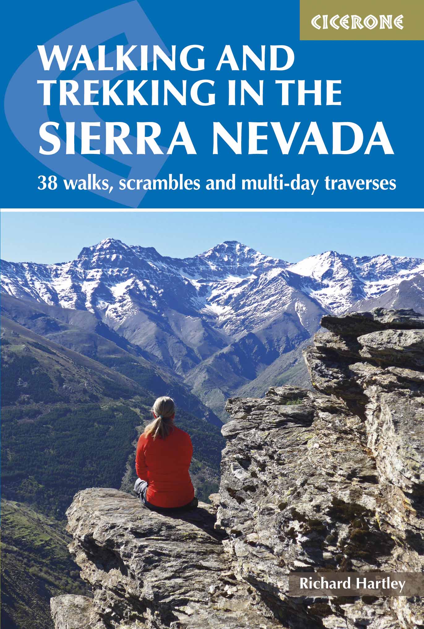
<p> Uitstekende wandelgids voor de Sierra Nevada. Goed beschreven met veel praktische informatie om de route te kunnen lopen, inclusief redelijke kaarten.</p> <p> <strong>Aanbevolen wandelkaarten</strong></p> <p> <a href="https://www.dezwerver.nl/r/europa/spanje/andalusie/c/kaarten/wandelkaarten/9788494365294/wandelkaart-np-sierra-nevada-met-alpujarras-editorial-penibetica/">Wandelkaart NP Sierra Nevada met Alpujarras | Editorial Penibetica</a> 1:40.000</p> <p> of</p> <p> <a href="https://www.dezwerver.nl/r/europa/spanje/andalusie/c/kaarten/wandelkaarten/9788480908177/wandelkaart-sierra-nevada-en-alpujarras-editorial-alpina/">Wandelkaart Sierra Nevada en Alpujarras | Editorial Alpina</a> - 1:40.000</p> <div> <a href="https://www.dezwerver.nl/r/europa/spanje/andalusie/c/kaarten/wandelkaarten/9788493787493/wandelkaart-sierra-nevada-la-integral-de-los-3000-editorial-piolet/">Wandelkaart Sierra Nevada - la integral de los 3000 | Editorial Piolet</a> 1:25.000</div> <div> </div> <div> This guidebook presents 33 graded walks and 5 high mountain scrambles in the striking Sierra Nevada, the highest mountain range in mainland Spain and in western Europe outside the Alps. Easily accessible from Granada and Málaga, it is a world of soaring, snow-clad peaks and deep valleys, far removed from the crowded beaches of the Costa del Sol just two hours away. The routes are spread across the national park, with attractive towns and villages such as Trevélez, Lanjarón, Hoya de la Mora and Cumbres Verdes serving as potential bases for a walking holiday.</div> <div> </div> <div> The walks have been carefully chosen to showcase the Sierra Nevada's dramatic scenery, taking in barren rocky peaks, lush green valleys, arid badlands and tranquil lakes. From more leisurely outings in the Cumbres Verde area to ascents of mainland Spain's highest summit, Mulhacén, there are routes to suit a range of abilities, although most require a reasonable degree of fitness, navigational skill and experience of high mountain terrain. Whilst some are day or half-day walks, others take advantage of the region's network of mountain shelters or offer an opportunity to wild camp. Also included are three longer traverses: 'Los Tres Picos' (the Spanish Three Peaks – Veleta, Mulhacén and Alcazaba), 'Los Tres Miles' Integral (a multi-day trek covering all the major 3000m peaks in the range) and an overview of the 302km Sulayr GR240. The walks can be enjoyed most of the year, however conditions may prove too hot at the peak of summer and extra care and equipment will be required in snow or ice: the descriptions assume summer conditions, but include additional notes for winter walking.</div> <div> </div> <div> The guide also includes advice on transport, bases and safety, a tick-list of the 3000m peaks and a Spanish-English glossary. Information on plants, wildlife and local points of interest will further enhance your visit and the glorious colour photos provide a taste of what the region has to offer. For those who like their mountains rough and rugged, Walking and Trekking in the Sierra Nevada is a perfect companion to escaping the crowds and discovering a different side to Andalucía.</div> <div> </div> <div> <strong>Dorpen en steden</strong></div> <div> Trevélez, Capileira, Lanjarón, Nigüelas, Dílar, Cumbres Verdes, Granada, Sierra Nevada ski area, Güéjar Sierra, Jérez de Marsquesado</div>
€20,95
Bekijk product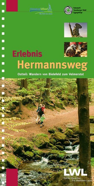
<p> Zeer goede wandelgids met een prima beschrijving, zeer duidelijke kaarten en veel informatie. Bovendien in een ringband, dus uitermate handig in gebruik! Route van Bielefeld naar Horn - Bad Meinberg</p> <p> Östlicher Teil des zweibändigen Wanderführers "Erlebnis Hermannsweg" - Der Hermannsweg im Teutoburger Wald gilt als einer der schönsten Kammwanderwege der deutschen Mittelgebirge! Als Ergänzung zu seinem erfolgreichen Schwesterband "Erlebnis Hermannsweg - Westlicher Teil: Wandern von Rheine bis Bielefeld" stellt dieser Wanderführer die knapp 50 km Hermannsweg zwischen Bielefeld und Horn-Bad Meinberg vor. Von der Sparrenburg über die Bergstadt Oerlinghausen, das Hermannsdenkmal und die Externsteine führt die aussichts- und geschichtsreiche Wanderung bis zum Endpunkt in Leopoldstal am Fuß des Velmerstot. Die Gesamtstrecke hat Autor Horst Gebaulet (LWL-Denkmalpflege, Landschafts- und Baukultur in Westfalen) wieder in 10 praktische Wanderetappen eingeteilt. Zahlreiche Tipps und Exkurse vertiefen den Text, rund 140 Fotos und Grafiken illustrieren ihn. Besonders praktisch sind die auf 9 Doppelseiten beigefügten Karten mit Reliefdarstellung im Maßstab 1:25000, die den Verlauf des Weges, Rückwanderrouten, Erlebnisschwerpunkte, Parkplätze, Nahverkehrshaltepunkte und Gastronomie am Wege darstellen.</p>
€16,50
Bekijk product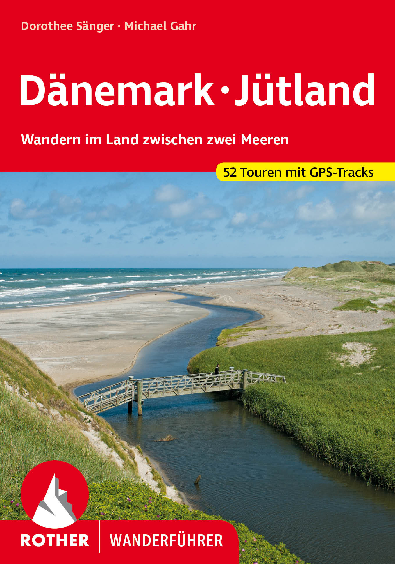
<p> Het eerste en enige wandelgidsje van Denemarken met 52 dagwandelingen! Leuk boekje met goede kaartjes, hoogteprofielen en routetypering (looptijd etc.)</p> <div> <div> Sonne, Strand und weites Meer – Dänemark ist ein herrliches Wandergebiet mit einer Vielzahl fast unentdeckter Ziele. Auf der dänischen Halbinsel Jütland zeigt sich die Westküste herb und schön, lieblich grün ist dagegen die Ostseeküste. Der Rother Wanderführer »Dänemark – Jütland« präsentiert 52 ausgewählte Touren in diesem Land zwischen zwei Meeren.</div> <div> </div> <div> Viele der fast durchwegs familienfreundlichen Wanderungen folgen der vielgestaltigen Küste Jütlands mit weiten Stränden, malerischen Fjorden und atemberaubenden Steilküsten. Spannend sind auch die Wanderungen durchs Binnenland, durch die einsamen Heide- und Dünenlandschaften, die ausgedehnten Marsch- und Sumpfgebiete und die eigentümlichen Wälder. Unterwegs trifft man auf zahlreiche Hügelgräber aus der Bronzezeit und Relikte der Wikingerkultur. Auch naturkundlich Interessierte kommen an Vogelbeobachtungsplätzen und in Naturschutzgebieten auf ihre Kosten. Schmucke Dörfer mit Windmühlen und gemütlichen Gasthäusern laden zur genussvollen Pause ein.</div> <div> </div> <div> Dorothee Sänger und Michael Gahr sind seit Jahren in Jütland unterwegs und haben eine abwechslungsreiche Auswahl von Wanderungen zusammengestellt. Jede Tour wird mit einer Kurzinformation zu den wichtigsten Fakten und einer detaillierten Wegbeschreibung vorgestellt, ergänzt von Wanderkärtchen mit eingezeichneter Route sowie einem Streckenprofil, das Auskunft über Gehzeiten, Weglänge und Höhenunterschiede gibt. GPS-Tracks stehen zum Download bereit. Viele Tipps zu Ausflugszielen und Sehenswürdigkeiten machen diesen Rother Wanderführer zum idealen Begleiter für jeden Dänemark-Urlauber.</div> </div> <p> </p>
€18,50
Bekijk product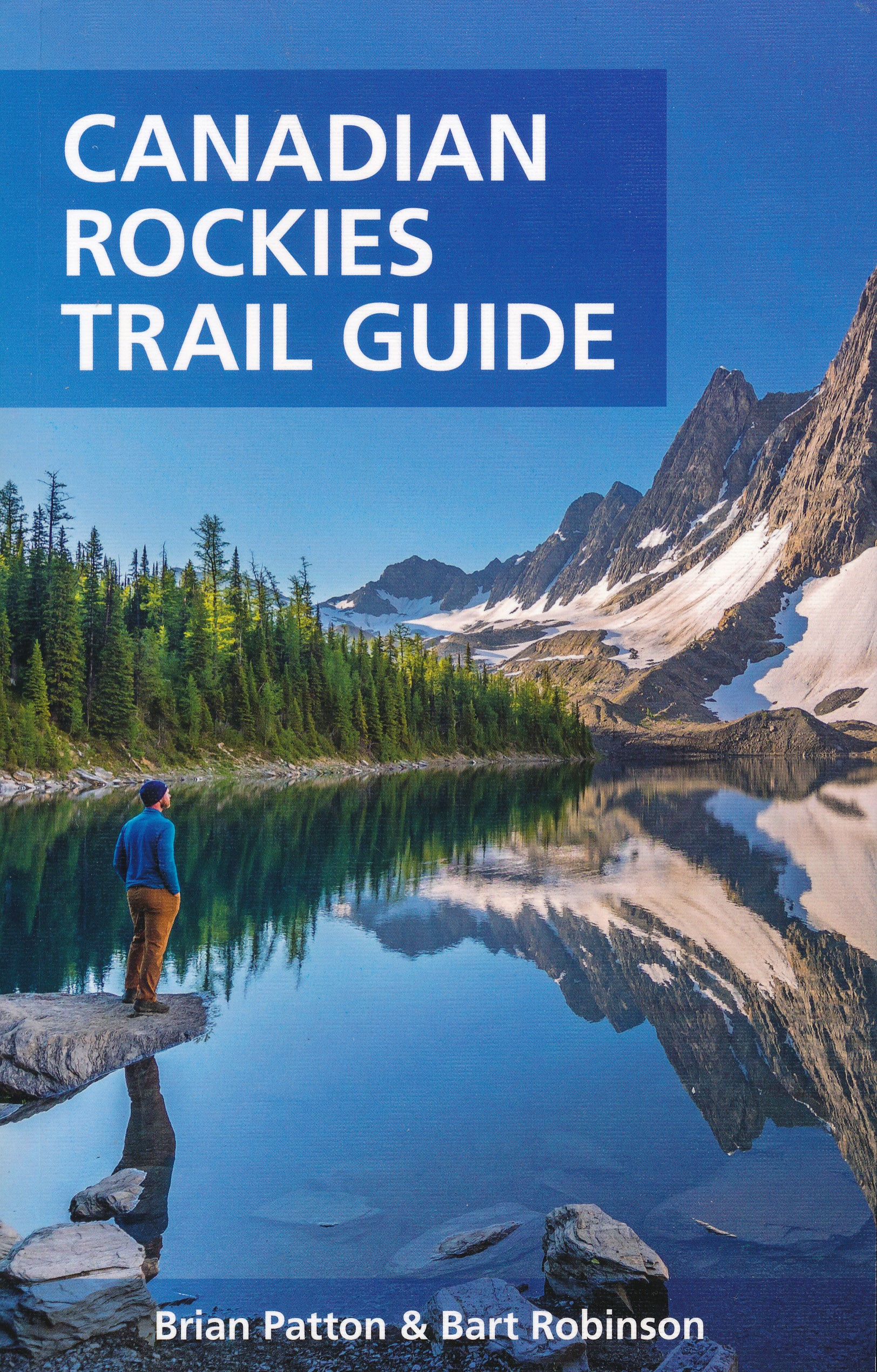
<div> The best loved and most detailed Canadian Rockies hiking guidebook is now in full color.</div> <div> </div> <div> First published in 1971 and now in its 10th edition, the Canadian Rockies Trail Guide was the original guidebook with accurate distances and detailed descriptions to the trails of the Canadian Rockies.</div> <div> </div> <div> Whether you’re a Canadian Rockies local or a visitor, the Canadian Rockies Trail Guide provides the best resource for hiking in the region, with everything from short interpretive trails to week-long backcountry treks. Now in its 10th edition and known affectionately as the “Bible” by outdoor enthusiasts, the popular tome is the most comprehensive and well-known guidebook to hiking in the region.</div> <div> </div> <div> Having spent their entire adult lives hiking in the Canadian Rockies and writing about their experiences, authors Brian Patton and Bart Robinson are regarded as the ultimate authority on hiking in the Canadian Rockies. The Canadian Rockies Trail Guide is the only hiking guide to the region recommended by Fodor’s, Frommer’s, Moon, and Lonely Planet, and has even been recommended by the New York Times. With over 280,000 copies in print, the Canadian Rockies Trail Guide is one of the best-selling non-fiction books in Canadian publishing history.</div> <div> </div> <div> The Canadian Rockies Trail Guide features:</div> <div> </div> <div> - 227 Canadian Rockies hiking trails, as well as dozens of interesting side trips.</div> <div> - Hikes for everyone: Pick the perfect trail for your ability and interests, from short interpretive strolls to week-long backcountry treks.</div> <div> - Full colour: Over 250 colour photos and 34 regional colour topo maps.</div> <div> - Planning Details: Trail outlines, distance, elevation, and estimated hiking time for every trail.</div> <div> - Directions: Trailhead driving directions, including GPS location.</div> <div> - Advice from the experts: Authors Brian Patton and Bart Robinson are the ultimate Canadian Rockies hiking resource for accurate trail information and trusted opinions.</div> <div> - Hiking Tips: Expert advice on gear, first aid, camping permits, and ethical hiking, plus background information on climate, landscape, and wildlife.</div> <div> - Trip planning: Information sources, backcountry lodges, map recommendations, and safety tips.</div> <div> </div>
€29,95
Bekijk product