
Beantwoord enkele vragen, en binnen seconden geeft AI je een persoonlijk aankoopadvies op maat.
Beantwoord enkele vragen, en binnen seconden geeft AI je een persoonlijk aankoopadvies op maat.

<p> Uitstekende wandelgids, sommige meerdaags, voor dit uitdagende wandelgebied. 20 dagwandelingen en 7 korte trekkings. Goede beschrijvingen en praktische informatie, kaartmateriaal is wat summier.</p> <div> This guide describes 20 walks and 7 short treks in beautiful Croatia. Around half the routes focus on the striking limestone ranges of Gorski kotar and Velebit, which form part of the Dinaric Alps, but there are also routes in Dalmatia and on the Istrian peninsula, as well as four walks centred around the capital, Zagreb. They are easily accessible from the coastal resorts and main cities such as Zagreb, Rijeka and Split, and the guide includes advice on the most convenient bases.</div> <div> </div> <div> Showcasing Croatia's majestic scenery, the routes range from short, easy walks to more challenging treks and mountain traverses. Step-by-step route description is accompanied by clear mapping, and there are notes highlighting where refreshments are available on or near the trails. The treks make use of mountain huts and shelters, details of which are provided, although it is also possible to camp. The guide also includes information on local points of interest, fascinating overviews of Croatian history, plants and wildlife and a comprehensive English-Croatian glossary.</div> <div> </div> <div> Many routes take in the dramatic karst landscapes and peaks of Croatia's mountains; others explore the country's stunning national and nature parks – including the breathtaking UNESCO-listed Plitvice Lakes; yet more visit local attractions and highlights, such as Vrelo Cave and Pazin's castle and gorge. They are sure to inspire you to put on your boots and discover the many pleasures of Croatia's magnificent landscapes.</div> <div> </div> <div> Steden en Dorpen</div> <div> Zagreb, Rijeka, Opatija, Delnice, Skrad, Fužine, Karlobag, Starigrad-Paklenica, Zadar, Split, Dubrovnik </div>
€23,95
Bekijk product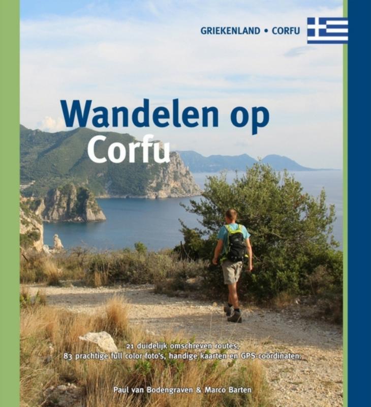
<div> 3e druk van de gids Wandelen op Corfu, met 21 rondwandelingen, waaronder drie nieuwe tochten.</div> <div> </div> <div> Het groenste stukje Griekenland, zo wordt Corfu wel genoemd. Niet verwonderlijk als je bedenkt dat het ook het meest noordelijke eiland is. Italië lijkt hier dichterbij dan het Griekse vasteland en dat zie je op de meest uiteenlopende manieren terug; in het landschap, met overal olijfbomen. Maar ook in de bouwkunst en in het eten dat hier wordt geserveerd. </div> <div> </div> <div> De eerste indruk die je krijgt als je voor het eerst Corfu bezoekt, is misschien wel het beste te omschrijven als die van een vermoeide oude dame, met een weelderige, groene jurk. Het eiland was één van de eerste bestemmingen die vanaf 1960 in trek raakten toen het massatoerisme op gang kwam. Nog steeds wordt Corfu jaarlijks bezocht door meer dan één miljoen toeristen. Het eiland zucht en steunt onder de drukte die dat met zich meebrengt. Maar ook onder de welvaart en het bouwgeweld die voortvloeien uit deze inkomstenbron.</div> <div> </div> <div> Desondanks blijft Corfu een dame, voornaam in haar grandeur en schoonheid, een tikje aristocratisch en een gewilde plaats voor de rich & famous. Keizerin Sissi en Kaiser Wilhelm waren in dat licht bezien de voorhoede van de jetset die nog steeds het eiland aandoet. </div> <div> </div> <div> En dan is er die andere kant van Corfu, waar rust en kalmte het tempo van de dag bepalen. Waar toeristen nauwelijks komen, waar je door rustige dorpjes struint waar een lome stilte hangt die maakt dat je vergeet dat de stranden op dit eiland in de zomer vol liggen. Met charmante kerkjes en kapelletjes, vervallen en verlaten huizen in het buitengebied, verstopt tussen de immer groene olijfbomen. </div> <div> </div> <div> Het is juist die tegenstelling tussen druk en stil die Corfu zo de moeite waard maakt. Met de voorzieningen van een mooie, levendige hoofdstad vol musea en andere bezienswaardigheden. Maar ook met vergeten ezelpaadjes waarop je geen mens tegenkomt, imposante berghellingen, verscholen dorpen en stukken kust waar nauwelijks een mens komt.</div> <div> </div> <div> De eenentwintig wandelingen in deze gids bieden een dwarsdoorsnede van al het moois dat Corfu te bieden heeft aan de nieuwsgierige wandelaar. Trek erop uit en ontdek de andere kant van het eiland in je eigen tempo.</div>
€16,95
Bekijk product
<p> Wandelgids van een deel van Engeland. Deze gids bevat 28 dagwandelingen, variërend van korte tochten tot pittige dagtochten. De bijbehorende kaarten zijn uitstekend: men heeft de topografische kaarten van Ordnance Survey gebruikt waarop de route is ingetekend. Daarnaast praktische informatie over de wandeling en wat beschrijvingen van het gebied.</p> <p> Each of the Pathfinder titles features 28 circular routes, all tried and tested by seasoned walkers. The routes range from extended strolls to exhilarating hikes, so there is something for everyone.</p> <p> They also contain:</p> <p> -Ordnance Survey mapping;<br /> -background details of each area;<br /> -details of refreshment stops and parking;<br /> -walking safety advice; and<br /> -information about walkers and the law</p>
€18,50
Bekijk product
<p> Wandelgids van een deel van Engeland. Deze gids bevat 28 dagwandelingen, variërend van korte tochten tot pittige dagtochten. De bijbehorende kaarten zijn uitstekend: men heeft de topografische kaarten van Ordnance Survey gebruikt waarop de route is ingetekend. Daarnaast praktische informatie over de wandeling en wat beschrijvingen van het gebied.</p> <p> Each of the Jarrold Pathfinder titles features 28 circular routes, all tried and tested by seasoned walkers. The routes range from extended strolls to exhilarating hikes, so there is something for everyone.</p> <p> They also contain:</p> <p> -Ordnance Survey mapping;<br /> -background details of each area;<br /> -details of refreshment stops and parking;<br /> -walking safety advice; and<br /> -information about walkers and the law</p>
€18,50
Bekijk product
<p> Engelstalige beschrijving van de mooiste wandeltocht in Wales. De gids voldoet aan alle verwachtingen die je kunt hebben, het enige dat je mist is een overzichtskaart. Inclusief gidsje met routekaarten van 1:25000 (deze is <a href="https://www.dezwerver.nl/r/europa/engeland/wales/c/kaarten/wandelkaarten/9781852848941/wandelkaart-offas-dyke-path-wales-cicerone/">hier</a> ook los te bestellen)</p> <div> This guidebook - which includes both a guide to the route and a separate OS map booklet - describes Offa's Dyke Path National Trail from south to north, following the longest linear earthwork in Britain, running 177 miles along the English-Welsh border between Sedbury (near Chepstow) and Prestatyn on the north Wales Coast. It links the Severn Estuary and the Irish Sea, following the longest linear earthwork in Britain, contouring above the Wye and Dee, visiting hillforts and Norman castles and exploring the hidden heritage of the Marches. The route is exceptional in all seasons, although the Black Mountains and Clwydian range deserve respect in winter conditions.</div> <div> </div> <div> The guidebook splits one of Britain's classic trails into 12 stages, with suggestions for alternative 8 and 16 day schedules. This is a long but not too difficult walk for walkers of all abilities. Step-by-step route descriptions are accompanied by 1:100,000 OS mapping. A trek planner gives at a glance information about facilities, public transport and accommodation available along the route. Also included is a convenient booklet of 1:25,000 OS maps, which provides all the mapping needed to complete the trail. </div> <div> </div> <div> The walk is astonishingly varied, taking in the lower Wye gorge, the Severn and the Dee rift valley, the pastures and woodlands of the border country, the remote moorland of the Black Mountains and the Clwydian range, and the dramatic limestone escarpments of Eglwyseg mountain. What makes it even more special is over 60 miles walking alongside the Saxon earthwork of Offa's Dyke, the path sometimes on the Dyke and sometimes alongside. </div> <div> </div> <div> Steden en Dorpen</div> <div> <div> Chepstow, Hay-on-Wye, Kington, Bishops Castle, Montgomery, Welshpool, Oswestry, Llangollen, Denbigh, Prestatyn</div> <div> </div> </div> <p> </p>
€25,95
Bekijk product
<p> Engelstalige beschrijving van een van de mooiste wandeltochten in Engeland: een stuk boordevol cultuur en geschiedenis!. De gids voldoet aan alle verwachtingen die je kunt hebben. Met apart gidjes met prima wandelkaarten. </p> <div> <div> A guidebook to walking the Thames Path, a 182-mile National Trail from the Woolwich Foot Tunnel in London to the river's source in near Cirencester, passing from central London through Windsor, Henley, and Oxford, and rural countryside. Described in 20 sections, of between 4 and 16 miles (6.5-32km), it is an mainly flat route with good access by public transport and typically takes two weeks to walk. On its way it passes historic sites such as Greenwich, Kew Gardens, Hampton Court, Runnymede, Windsor Castle and Oxford.</div> <div> </div> <div> This guidebook features complete OS 1:50,000 scale mapping of the route and comprehensive information about accommodation, facilities, refreshments and transport links for each stage of the route. It is crammed with fascinating details about the places and features passed along the way. A separate pocket-sized map booklet is also included showing the full route on 1:25,000 scale OS maps, providing all the mapping needed to complete the trail.</div> <div> </div> <div> The Thames Path is an easy riverside walk that discovers the constantly changing character of the River Thames.</div> </div> <p> </p>
€24,95
Bekijk product
<p> Franstalige wandelgids met een beschrijving van een aantal dagtochten. Uitstekende beschrijvingen met duidelijk kaartmateriaal. Mislopen is nauwelijks mogelijk, maar ja .. de franse taal! Ook praktische informatie staat in deze gids. Alle gidsen bevatten een door ons toegevoegde uitgebreide frans - nederlandse wandelwoordenlijst.</p> <div> Aux environs de Carpentras, les beautés du Ventoux se dévoilent. </div> <div> </div> <div> Détaché des Alpes, le mont Ventoux dresse sa solitude au nord de la Provence. Ce "mont Chauve", parfois casqué de nuages et encerclé par la lumière, revêt un manteau forestier bigarré bordé de vignobles renommés ; il offre une mosaïque de climats et de paysages, à l'image de ses quatre faces très dissemblables.</div> <div> </div> <div> De l'abrupt versant nord au doux versant sud, il faut pénétrer en son sein par les crêtes, combes et valats pour découvrir un patrimoine rural préservé et une grande diversité d'espèces végétales et animales. Du sommet (1 910 mètres d'altitude), s'ouvre un panorama à couper le souffle.</div> <div> </div> <p> </p>
€18,50
Bekijk product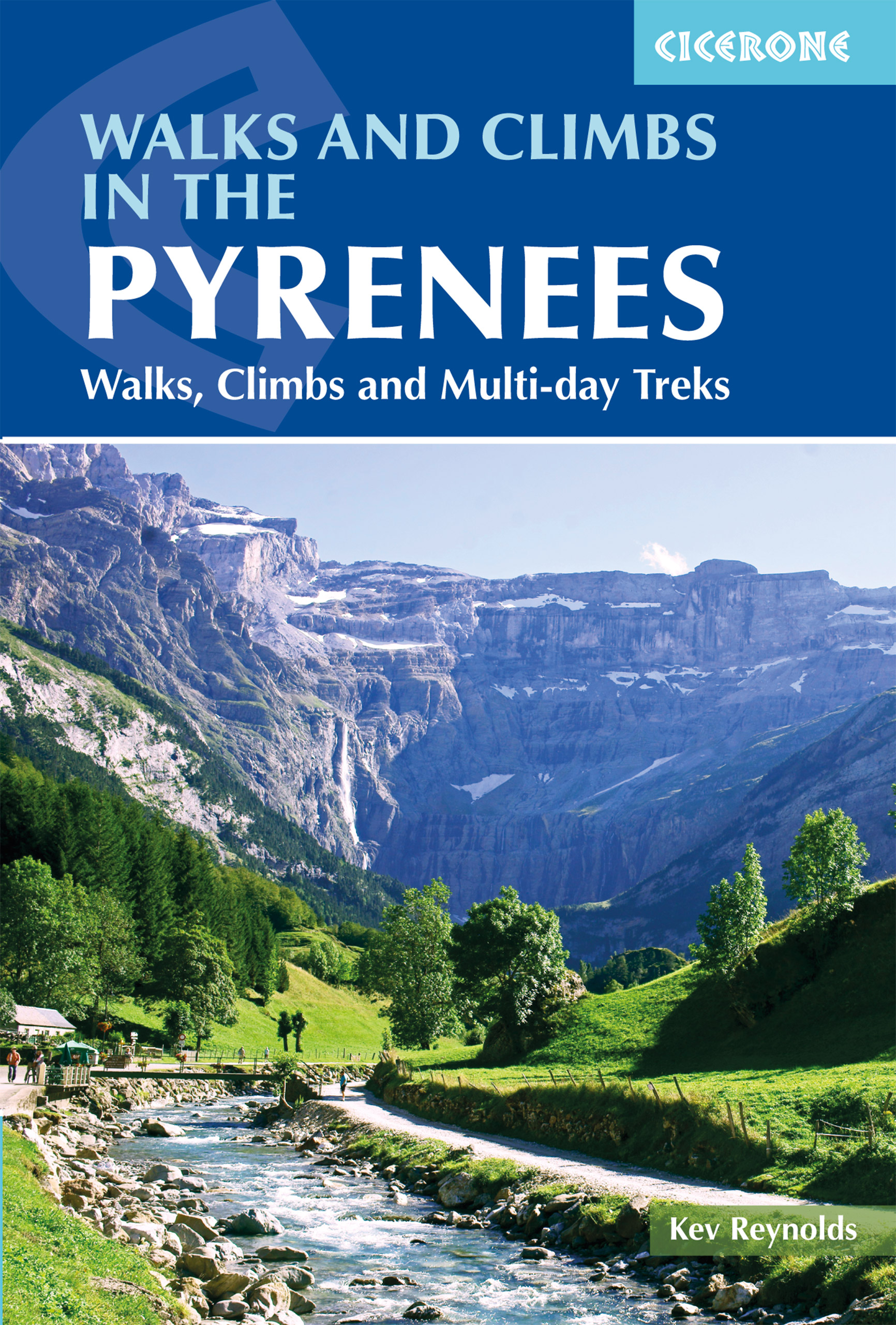
<p> Uitputtende beschrijving van alle wandel- en klimmogelijkheden in de Pyreneeen. Ongekende diepgang in informatie over wat, waar en hoe de gebieden in elkaar zitten. Geschreven door een van de toonaangevende bergwandelaars op dit moment: Kev Reynolds.</p> <div> <div> Essential guidebook of walks and climbs in the Pyrenees, one of Europe's finest mountain ranges. The guide includes 170 day walks, multi-day walks, climbing routes and mountaineering ascents, and covers all valleys and peaks on both sides of the border with France and Spain, with through routes and peaks to bag.</div> <div> </div> <div> The guidebook divides the range into 21 sections, including Andorra, the Ordesa National Park, the Carlit Massif, Gavarnie and the Cirque du Lescun to name a few. Each area includes practical information on travel, accommodation and mountain refuges, as well sketch mapping.</div> <div> </div> <div> Between short, half-hour walks, to 12-day treks and 25 summits, this guidebook will help any walker, climber or trekker experience the best of the Pyrenees. There are exquisite valleys and passes to wander and summits of 3000m and more within the reach of most hill walkers. The landscape is full of diversity and contrast, with Alpine-style peaks, small glaciers, deep gorges and more than 1000 mountain lakes.</div> </div> <p> <strong>Steden en Dorpen</strong></p> <div> Etsaut, Borce, Lescun, Laruns, Gabas, Eaux-Bonnes, Gourette, Arrens, Lac d'Estaing, Cauterets, Gavarnie, Torla, Bielsa, Gèdre, Héas, Barèges, St-Lary, Benasque, Eriste, Arties, Salardu, Bohi, Espot, Capdella, Àreu, Vicdessos, Andorra, Ax-les-Thermes, Porté-Putmorens</div> <div> </div>
€24,95
Bekijk product
<p> Uitstekende wandelgids van dit geweldige gebied. Goed beschreven met veel praktische informatie om de route te kunnen lopen, inclusief redelijke kaarten.</p> <div> This guidebook describes 50 circular walks and scrambles exploring the Costa Blanca mountains, around the resorts of Alicante, Benidorm and Calp. These routes range from gentle strolls to demanding days with steep climbs, and from 3-20km in distance.</div> <div> The Mediterranean coast is one of Europe's most popular winter sun adventure destinations. In general UK visitors are best suited to the heat from late autumn to early spring. Beyond the beaches and high rises lies a completely different world of accessible, rocky mountains and knife-edge ridges that stretch away in long chains of gleaming white limestone pinnacles, and the range of walks ensures that everyone can enjoy this spectacular Spanish landscape.</div> <div> Walking on Costa Blanca also includes background information on local geology, wildlife and history, and planning details on where to go, where to stay and what to take.</div> <p> <strong>Dorpen en st</strong>eden</p> <p> From the the bustling coastal resorts of Calp, Altea and Benidorm to charming mountain towns and village like Xalo (Jalon), Alcalali, Parcent, Pego, Sella, Finestrat, Castell de Castells and Guadalest.</p> <p> Inhoud</p> <div> The North</div> <div> Walk 1 Traverse of Montgo</div> <div> Walk 2 Tossal Grau</div> <div> Walk 3 Serra Segaria</div> <div> Walk 4 Fonts de Pedreguer</div> <div> Walk 5 Castell d’Aixa</div> <div> Walk 6 Tossal del Moro and the Serrillas</div> <div> Walk 7 Castell de Granadella</div> <div> Inland from Calp</div> <div> Walk 8 Penon de Ifach</div> <div> Walk 9 Serra de Olta</div> <div> Walk 10 Circuit of the Serra Bernia</div> <div> Walk 11 Bernia East Summit</div> <div> Walk 12 Bernia West Summit</div> <div> Walk 13 Serra Ferrer South Ridge</div> <div> Walk 14 Serra Ferrer North Ridge</div> <div> Walk 15 Cau Ridge</div> <div> Walk 16 Alt de L’Ample</div> <div> Walk 17 Carrascal de Parcent</div> <div> Walk 18 Penya Talai (Rates)</div> <div> Walk 19 Penyo Roig</div> <div> Walk 20 Cavall Verd Ridge</div> <div> Walk 21 Collado de Garga</div> <div> Walk 22 10,000 Steps</div> <div> Walk 23 Barranc de Racons or 5000 Steps</div> <div> Walk 24 Almadic Ledge Circuit</div> <div> Walk 25 Barranc de Malafi</div> <div> Walk 26 Serra Forada</div> <div> Inland from Benidorm</div> <div> Walk 27 Serra Gelada</div> <div> Walk 28 Head of the Algar Valley</div> <div> Walk 29 Bolulla Castle</div> <div> Walk 30 Bolulla Circuit/Raco Roig</div> <div> Walk 31 Cim de Aixorta</div> <div> Walk 32 Els Arcs</div> <div> Walk 33 Embassament de Guadalest</div> <div> Walk 34 Aitana</div> <div> Walk 35 Penya Mulero</div> <div> Walk 36 Alt de la Penya de Sella</div> <div> Walk 37 Barranc de l’Arc and Barranc del Xarquer</div> <div> Walk 38 Tour of Xanchet</div> <div> Walk 39 Monte Ponoig</div> <div> Puig Campana</div> <div> Walk 40 Volta del Puig Campana</div> <div> Walk 41 Coll del Pouet</div> <div> Walk 42 Puig Campana Summit from the Coll del Pouet</div> <div> The Serrella</div> <div> Walk 43 Penya del Castellet</div> <div> Walk 44 Mallada del Llop</div> <div> Walk 45 Pla de la Casa</div> <div> Walk 46 El Recingle Alt (Pic de Serrella)</div> <div> Alcoi and the West</div> <div> Walk 47 Cabeco d’Or</div> <div> Walk 48 Penya Migjorn</div> <div> Walk 49 Barranc del Cint</div> <div> Walk 50 Montcabrer</div> <div> </div>
€23,50
Bekijk product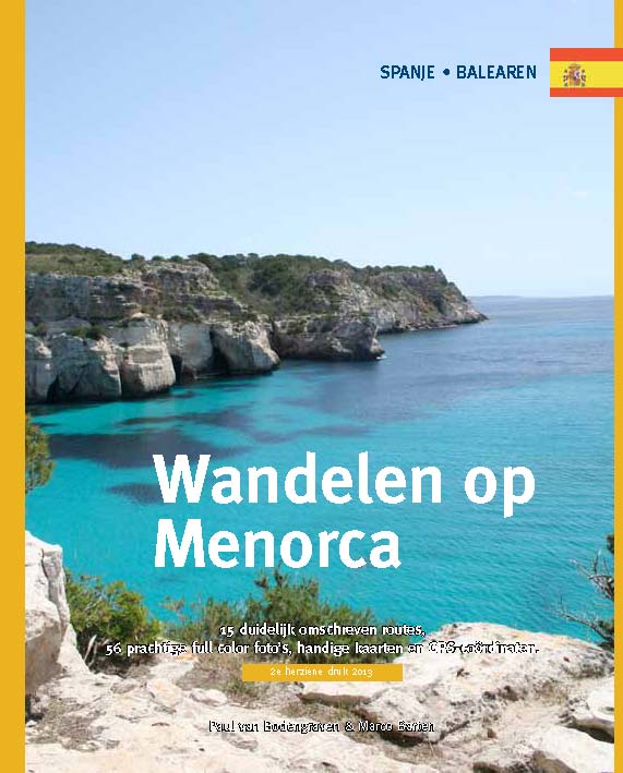
<p> Menorca is één van de minst toeristische eilanden van de Balearen (Spanje). In deze eerste en enige Nederlandstalige wandelgids vind je 20 uitgebreid beschreven dagtochten en rondwandelingen van een paar uur. Met duidelijk omschreven routes, 70 prachtige full colour foto's van alle bezienswaardigheden, handige kaarten en GPS-coördinaten.</p> <p> ‘Prachtig boekje met mooie foto’s en duidelijke beschrijvingen.’<br /> Dagblad Trouw</p> <p> </p>
€15,95
Bekijk product