
Beantwoord enkele vragen, en binnen seconden geeft AI je een persoonlijk aankoopadvies op maat.
Beantwoord enkele vragen, en binnen seconden geeft AI je een persoonlijk aankoopadvies op maat.
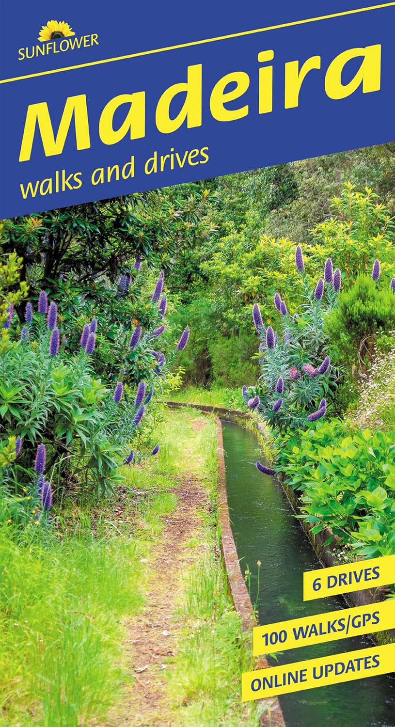
<p> Wandelgids: vele dagtochten worden degelijk beschreven met openbaar vervoer informatie, goede routebeschrijvingen en kaartmateriaal. Tevens enkele autotochten. Deze gids staat goed bekend! Engelstalig, want nederlandstalige is uitverkocht en niet meer leverbaar.</p> <div> <div> The go-to Madeira travel guide for over 30 years. </div> <div> </div> <div> Strap on your boots and discover Madeira on foot with the Sunflower Madeira travel guide. And on the days when your feet may have had enough, enjoy some spectacular scenery on one of our legendary car tours. </div> <div> </div> <div> The Sunflower Madeira guide is indispensable for hiking in Madeira or seeing Madeira by car. Not only has this 14th edition been updated to take into account treks recently out of bounds for one reason or another, but the format of the book has been expanded with larger type and a wider layout. The maps have been annotated with waypoints, and there are free downloadable GPS tracks for all the walks.</div> <div> </div> <div> While dedicated hikers will revel in the island’s mountainous terrain (Madeira is one of Europe’s top destinations for mountain walks), walking the ‘levada’ paths is one of the most popular activities with visitors. Levadas are watercourses that carry rainfall from the mountains to irrigate the cultivated terraces. Whatever your age or ability we’ve got some glorious walks and car tours to ensure you have a memorable Madeira holiday.</div> <div> </div> <div> Inside the Sunflower Madeira guide book you’ll find:</div> <div> </div> <div> 100 long and short walks for all ages and abilities – each walk is graded so you can easily match your ability to the level of walk</div> <div> Topographical walking maps – give you a clear sense of the surrounding terrain</div> <div> Free downloadable gps tracks – for the techies</div> <div> Satnav guidance to walk starts for motorists </div> <div> 6 car tours and fold-out touring map – for easy reference on your tour </div> <div> Strolls to idyllic picnic spots – enjoy our recommendations for where to picnic along the way</div> <div> Timetables for public transport – ideal if you want to link two walks or avoid hiring a car on your holiday</div> <div> Online update service for the latest information </div> <div> Includes Funchal (guide) town plan and coastal walk</div> <div> </div> <div> </div> <div> Whether you tour the island by car or explore on foot, this book – which first introduced levada-walking to a large audience – has been the guide to Madeira’s countryside for more than 30 years. We look forward to showing you around. </div> </div> <p> </p>
€24,95
Bekijk product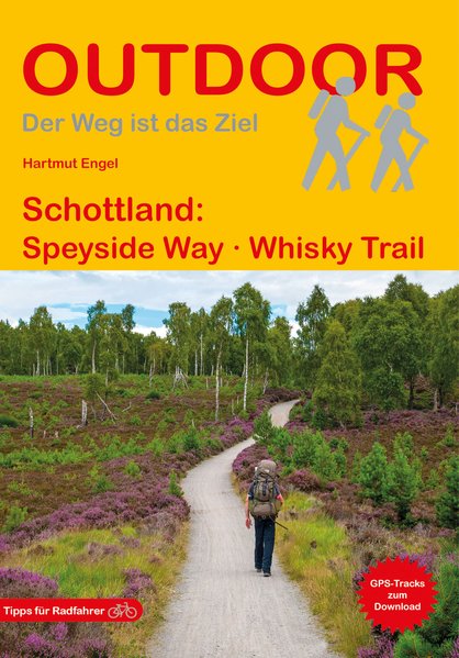
<p> Wandelgids met een routebeschrijving van de Speyside weg in Schotland met veel praktische informatie en een goede beschrijving van de route. De kaarten zijn zeer leesbaar, maar wel een beetje grof van schaal.. Duitstalig.</p> <p> Der Speyside Way ist neben dem West Highland Way und dem Southern Upland Way der dritte im Bunde der klassischen schottischen Fernwanderwege. Er führt von Buckie erst an der Nordsee, dann am River Spey entlang durch das Zentrum der schottischen Whiskyherstellung bis in die mächtigen Grampian Mountains. Auf diesem Weg kommen Sie direkt an einigen der renommiertesten Whiskydestillerien vorbei. Die gesamte Tour wird in mehreren abgeschlossenen Einzeletappen beschrieben. Damit haben Wanderer, die nicht den gesamten Weg laufen möchten, die Möglichkeit, sich auf bestimmte Abschnitte des Weges zu beschränken. </p> <p> Jede Etappenbeschreibung umfasst neben dem Wegverlauf wichtige Tipps zu Übernachtungsmöglichkeiten, Verkehrsverbindungen usw. sowie Informationen zu verschiedenen Aspekten von Natur, Landschaft, Kultur und Geschichte. Zusätzlich gibt der Autor wertvolle Tipps für alle, die die Gegend mit dem Fahrrad kennen lernen wollen. Darüber hinaus werden lohnende Abstecher und Ziele beschrieben, die abseits des Weges liegen.</p>
€17,50
Bekijk product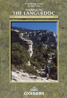
<p> Uitstekende wandelgids van dit geweldige gebied. goed beschreven met veel praktische informatie om de route te kunnen lopen, inclusief redelijke kaarten.</p> <p> 31 walks in the stunningly beautiful Parc Naturel du Haut-Languedoc. The climate is warm, the vineyards stretch out below you, and above is the towering Espinouse Massif.</p> <p> The Languedoc has for too long been in the shadow of Provence. Sharing the same Mediterranean climate and vegetation, it has not had done to it what Peter Mayle did for the Luberon - yet! Apart from its beaches, it is a quiet, beautiful place which retains more than a hint of the old France.</p> <p> This book is the fruit of 10 years' exploration of the central part of the Languedoc, north of Béziers. Much of this area forms the Parc Naturel du Haut-Languedoc, at the heart of which is the stunning Espinouse massif, rising abruptly some 850m from the valley floor. Close by is the valley of Lac du Salagou, an enormous man-made lake surrounded by impressive hills. A little further east is the valley of the river Hérault, which provides the explorer with wonderful limestone gorges, caves and cliffs. All three of these areas are well provided with footpaths on which it is rare to see another human being; and, because this is France, a fine dinner awaits you at the end of the day.</p> <p> The book aims to provide walks into these areas for hikers of all standards; some are very straightforward, others are for the very fit and experienced. All the walks described are circular.</p>
€20,95
Bekijk product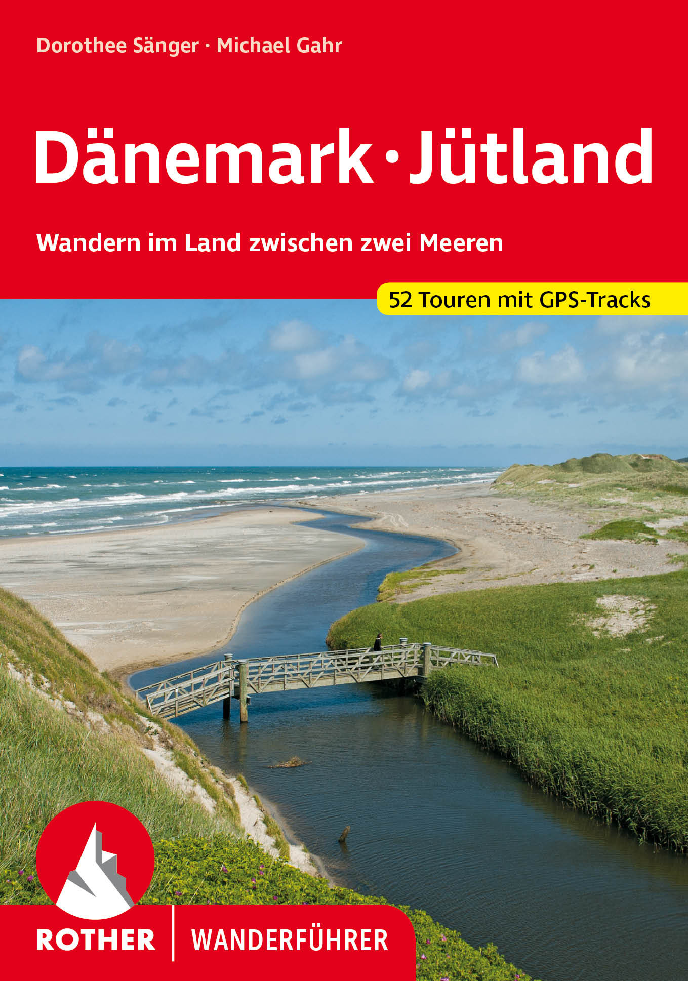
<p> Het eerste en enige wandelgidsje van Denemarken met 52 dagwandelingen! Leuk boekje met goede kaartjes, hoogteprofielen en routetypering (looptijd etc.)</p> <div> <div> Sonne, Strand und weites Meer – Dänemark ist ein herrliches Wandergebiet mit einer Vielzahl fast unentdeckter Ziele. Auf der dänischen Halbinsel Jütland zeigt sich die Westküste herb und schön, lieblich grün ist dagegen die Ostseeküste. Der Rother Wanderführer »Dänemark – Jütland« präsentiert 52 ausgewählte Touren in diesem Land zwischen zwei Meeren.</div> <div> </div> <div> Viele der fast durchwegs familienfreundlichen Wanderungen folgen der vielgestaltigen Küste Jütlands mit weiten Stränden, malerischen Fjorden und atemberaubenden Steilküsten. Spannend sind auch die Wanderungen durchs Binnenland, durch die einsamen Heide- und Dünenlandschaften, die ausgedehnten Marsch- und Sumpfgebiete und die eigentümlichen Wälder. Unterwegs trifft man auf zahlreiche Hügelgräber aus der Bronzezeit und Relikte der Wikingerkultur. Auch naturkundlich Interessierte kommen an Vogelbeobachtungsplätzen und in Naturschutzgebieten auf ihre Kosten. Schmucke Dörfer mit Windmühlen und gemütlichen Gasthäusern laden zur genussvollen Pause ein.</div> <div> </div> <div> Dorothee Sänger und Michael Gahr sind seit Jahren in Jütland unterwegs und haben eine abwechslungsreiche Auswahl von Wanderungen zusammengestellt. Jede Tour wird mit einer Kurzinformation zu den wichtigsten Fakten und einer detaillierten Wegbeschreibung vorgestellt, ergänzt von Wanderkärtchen mit eingezeichneter Route sowie einem Streckenprofil, das Auskunft über Gehzeiten, Weglänge und Höhenunterschiede gibt. GPS-Tracks stehen zum Download bereit. Viele Tipps zu Ausflugszielen und Sehenswürdigkeiten machen diesen Rother Wanderführer zum idealen Begleiter für jeden Dänemark-Urlauber.</div> </div> <p> </p>
€18,50
Bekijk product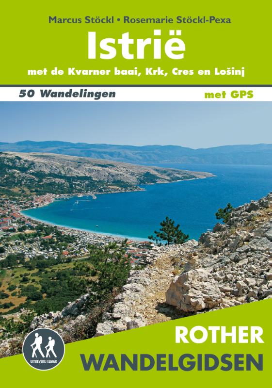
<div> De Rother wandelgids Istrië beschrijft de 50 mooiste wandelingen langs de kust en in het binnenland van het schiereiland Istrië, in het bergachtige achterland van Reijeka en op de eilanden Krk, Cres en Lošinj.</div> <div> </div> <div> Zoals gebruikelijk zijn er verschillende wandelingen voor beginnende en ervaren wandelaars en is er onmisbare informatie over de streek, de bezienswaardigheden en recreatiemogelijkheden.</div> <div> </div> <div> De betrouwbare routebeschrijvingen, gedetailleerde kaarten en hoogteprofielen zorgen voor een onvergetelijke wandelervaring.</div> <div> </div> <div> <div> Let op: er is enige verwarring omtrent het jaartal van deze Nederlandse wandelgidsen van uitgever Elmar. Dit is een vertaling van de Duitse uitgever Rother maar daarna NIET bijgewerkt. De datum die wij vermelden is het moment van vertaling; er zijn andere – meer recente jaartallen – in omloop maar dat is de datum van een nieuwe druk ZONDER aanpassingen. Wilt u de meest recente wandelgids van dit gebied van deze uitgever: kies dan de Duitstalige versie van uitgever Rother. Deze zijn recent en WEL bijgewerkt. </div> <div> </div> </div> <p> </p>
€18,99
Bekijk product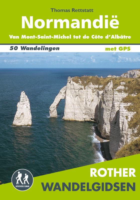
<div> De Rother wandelgids Normandië beschrijft 50 prachtige wandelingen aan de kust en in het binnenland van Normandië. Langs mooie zandstranden en wilde kliffen en door idyllische weiden en moerasgebieden.</div> <div> </div> <div> Zoals gebruikelijk zijn er verschillende wandelingen voor beginnende en ervaren wandelaars en is er onmisbare informatie over de streek, de bezienswaardigheden en recreatiemogelijkheden.</div> <div> </div> <div> De betrouwbare routebeschrijvingen, gedetailleerde kaarten en hoogteprofielen zorgen voor een onvergetelijke wandelervaring.</div> <div> </div> <div> <div> 1 3.10 uur Pointe de Roche Torin</div> <div> 2 3.00 uur Le Grouin du Sud</div> <div> 3 3.30 uur Aan de Bec d’Andaine </div> <div> 4 2.15 uur Falaises de Champeaux</div> <div> 5 2.45 uur Le Roc de Granville </div> <div> 6 3.10 uur Havre de la Vanlée </div> <div> 7 3.30 uur Rondom La Pointe d’Agon </div> <div> 8 2.15 uur Pointe du Becquet en Havre de St-Germain-sur-Ay </div> <div> 9 4.30 uur Pointe du Banc en de duinen van Surville </div> <div> 10 2.30 uur Portbail en Lindbergh-Plage </div> <div> 11 4.20 uur Van Carteret naar Portbail-Plage </div> <div> 12 2.45 uur Cap de Carteret en Dunes d’Hatainville </div> <div> 13 2.30 uur Rond Cap du Rozel </div> <div> 14 2.15 uur De steile kust van Flamanville </div> <div> 15 2.30 uur De duinen van Biville en het moeras van Vauville </div> <div> 16 3.15 uur Nez de Jobourg </div> <div> 17 2.50 uur Cap de la Hague </div> <div> 18 2.10 uur Pointe Jardeheu </div> <div> 19 2.00 uur Cap Lévi en het strand van Mondrée </div> <div> 20 3.30 uur Tussen Pointe de Néville en Pointe de la Loge </div> <div> 21 4.30 uur Van Barfleur naar Pointe de Néville </div> <div> 22 3.30 uur De kust tussen Quettehou en Quinéville </div> <div> 23 2.45 uur Pointe du Hoc </div> <div> 24 2.40 uur In het Forêt de Cerisy </div> <div> 25 5.10 uur Omaha Beach </div> <div> 26 3.15 uur Cap Manvieux </div> <div> 27 4.00 uur Gold Beach en het moeras van Ver-sur-Meuvaines </div> <div> 28 2.00 uur Vallon du Cresme </div> <div> 29 3.30 uur Rochers de la Houle en Rochers des Parcs </div> <div> 30 3.00 uur De rotsen van Oëtre </div> <div> 31 3.00 uur Gorges de St-Aubert en Lac de Rabodanges </div> <div> 32 3.30 uur In het Forêt des Andaines </div> <div> 33 2.30 uur Bois de Magny en Gorges de Villiers </div> <div> 34 3.20 uur Forêt en Signal d’Écouves </div> <div> 35 3.30 uur Aan de monding van de Orne </div> <div> 36 2.15 uur Rondom het moeras van Blonville en het meer van Villers </div> <div> 37 4.00 uur Aan de Côte de Grâce </div> <div> 38 3.00 uur De kliffen van Bruneval </div> <div> 39 4.30 uur Porte d’Aval en Valleuse d’Antifer (Étretat I) </div> <div> 40 3.15 uur Porte d’Amont en Fonds d’Étigue (Étretat II) </div> <div> 41 2.45 uur Tussen Yport en Vattetot-sur-Mer </div> <div> 42 3.15 uur St-Pierre-en-Port en Valleuse d’Életot </div> <div> 43 3.00 uur De Grandes en Petites Dalles </div> <div> 44 3.15 uur De Albastkust bij Varengeville-sur-Mer </div> <div> 45 2.15 uur In het Forêt d’Arques </div> <div> 46 5.45 uur De kliffen van Crie </div> <div> 47 5.00 uur De rotsen van Le Tréport en het strand van Criel</div> <div> 48 3.15 uur Forêt d’Eu bij Incheville </div> <div> 49 3.00 uur Haute Forêt d’Eu bij Grandcourt </div> <div> 50 1.30 uur Stadswandeling Rouen</div> <div> </div> <div> <strong>Aanbevolen wandelkaarten bij deze gids:</strong></div> <br /> <div> <strong>Wandeling 1 t/m 27 (schaal 1:25.000)</strong></div> <div> <a href="https://www.dezwerver.nl/r/europa/frankrijk/normandie/c/kaarten/topografische-kaarten/9782758548133/wandelkaart-topografische-kaart-1315sb-brecey-ducey-avranches-ign-institut-geographique-national/"><strong>Wandelkaart - Topografische kaart 1315SB Brécey - Ducey - Avranches | IGN </strong></a></div> <div> <a href="https://www.dezwerver.nl/r/europa/frankrijk/normandie/c/kaarten/topografische-kaarten/9782758546375/wandelkaart-topografische-kaart-1215et-avranches-granville-le-mont-saint-michel-ign-institut-geographique-national/"><strong>Wandelkaart - Topografische kaart 1215ET Avranches, Granville, Le Mont Saint Michel | IGN</strong></a></div> <div> <a href="https://www.dezwerver.nl/r/europa/frankrijk/normandie/c/kaarten/topografische-kaarten/9782758546368/wandelkaart-topografische-kaart-1214et-granville-coutances-iles-chausey-ign-institut-geographique-national/"><strong>Wandelkaart - Topografische kaart 1214ET Granville, Coutances, Iles Chausey | IGN</strong></a></div> <div> <a href="https://www.dezwerver.nl/r/europa/frankrijk/normandie/c/kaarten/topografische-kaarten/9782758545170/wandelkaart-topografische-kaart-1212et-la-haye-du-puits-lessay-ign-institut-geographique-national/"><strong>Wandelkaart - Topografische kaart 1212ET La Haye-du-Puits Lessay | IGN</strong></a></div> <div> <a href="https://www.dezwerver.nl/r/europa/frankrijk/normandie/c/kaarten/topografische-kaarten/9782758544579/wandelkaart-topografische-kaart-1211ot-les-pieux-barneville-carteret-ign-institut-geographique-national/"><strong>Wandelkaart - Topografische kaart 1211OT Les Pieux, Barneville, Carteret | IGN</strong></a></div> <div> <a href="https://www.dezwerver.nl/r/europa/frankrijk/normandie/c/kaarten/topografische-kaarten/9782758542902/wandelkaart-topografische-kaart-1210ot-cherbourg-en-cotentin-cap-de-la-hague-ign-institut-geographique-national/"><strong>Wandelkaart - Topografische kaart 1210OT Cherbourg-en-Cotentin, Cap de la Hague | IGN</strong></a></div> <div> <a href="https://www.dezwerver.nl/r/europa/frankrijk/normandie/c/kaarten/topografische-kaarten/9782758545194/wandelkaart-topografische-kaart-1310ot-cherbourg-pointe-de-barfleur-ign-institut-geographique-national/"><strong>Wandelkaart - Topografische kaart 1310OT Cherbourg, Pointe de Barfleur | IGN</strong></a></div> <div> <a href="https://www.dezwerver.nl/r/europa/frankrijk/normandie/c/kaarten/topografische-kaarten/9782758538776/wandelkaart-topografische-kaart-1412ot-pointe-du-hoc-omaha-beach-ign-institut-geographique-national/"><strong>Wandelkaart - Topografische kaart 1412OT Pointe Du Hoc - Omaha Beach | IGN</strong></a></div> <div> <a href="https://www.dezwerver.nl/r/europa/frankrijk/normandie/c/kaarten/topografische-kaarten/9782758540960/wandelkaart-topografische-kaart-1512ot-bayeux-arromanches-les-bains-plages-normandie-ign-institut-geographique-national/"><strong>Wandelkaart - Topografische kaart 1512OT Bayeux Arromanches Les Bains Plages - Normandië | IGN</strong></a></div> <div> </div> <div> <strong>Wandeling 28 t/m 30 (schaal 1:25.000)</strong></div> <div> <a href="https://www.dezwerver.nl/r/europa/frankrijk/normandie/c/kaarten/topografische-kaarten/9782758538684/topografische-kaart-wandelkaart-1514sb-conde-sur-noireau-ign-institut-geographique-national/"><strong>Topografische kaart - Wandelkaart 1514SB Condé-sur-Noireau | IGN</strong></a></div> <div> </div> <div> <strong>Wandeling 31 (schaal 1:25.000)</strong></div> <div> <a href="https://www.dezwerver.nl/r/europa/frankrijk/normandie/c/kaarten/topografische-kaarten/9782758535454/wandelkaart-topografische-kaart-1614sb-falaise-mortaux-couliboeuf-ign-institut-geographique-national/"><strong>Wandelkaart - Topografische kaart 1614SB Falaise – Mortaux – Couliboeuf | IGN</strong></a></div> <div> </div> <div> <strong>Wandeling 32 (schaal 1:25.000)</strong></div> <div> <a href="https://www.dezwerver.nl/r/europa/frankrijk/normandie/c/kaarten/topografische-kaarten/9782758533740/wandelkaart-topografische-kaart-1516sb-domfront-lassay-les-chateaux-bagnoles-de-lorne-ign-institut-geographique-national/"><strong>Wandelkaart - Topografische kaart 1516SB Domfront, Lassay-les-Châteaux, Bagnoles-de-l'Orne | IGN</strong></a></div> <div> </div> <div> <strong>Wandeling 33 (schaal 1:25.000)</strong></div> <div> <a href="https://www.dezwerver.nl/r/europa/frankrijk/normandie/c/kaarten/topografische-kaarten/9782758533788/wandelkaart-topografische-kaart-1616sb-la-ferte-mace-pre-en-pail-carrouges-ign-institut-geographique-national/"><strong>Wandelkaart - Topografische kaart 1616SB La Ferté-Macé, Pré-en-Pail, Carrouges | IGN</strong></a></div> <div> </div> <div> <strong>Wandeling 34 (schaal 1:25.000)</strong></div> <div> <a href="https://www.dezwerver.nl/r/europa/frankrijk/normandie/c/kaarten/topografische-kaarten/9782758533788/wandelkaart-topografische-kaart-1616sb-la-ferte-mace-pre-en-pail-carrouges-ign-institut-geographique-national/"><strong>Wandelkaart - Topografische kaart 1616SB La Ferté-Macé, Pré-en-Pail, Carrouges | IGN</strong></a></div> <div> </div> <div> <strong>Wandeling 35 t/m 49 (schaal 1:25.000)</strong></div> <div> <a href="https://www.dezwerver.nl/r/europa/frankrijk/normandie/c/kaarten/topografische-kaarten/9782758539117/wandelkaart-topografische-kaart-1612ot-caen-ouistreham-normandie-ign-institut-geographique-national/"><strong>Wandelkaart - Topografische kaart 1612OT Caen - Ouistreham , Normandië | IGN</strong></a></div> <div> <a href="https://www.dezwerver.nl/r/europa/frankrijk/normandie/c/kaarten/topografische-kaarten/9782758539452/wandelkaart-topografische-kaart-1711ot-honfleur-deauville-ign-institut-geographique-national/"><strong>Wandelkaart - Topografische kaart 1711OT Honfleur Deauville | IGN</strong></a></div> <div> <a href="https://www.dezwerver.nl/r/europa/frankrijk/normandie/c/kaarten/topografische-kaarten/9782758541356/wandelkaart-topografische-kaart-1710et-le-havre-etretat-pnr-des-boucles-seine-normandie-ign-institut-geographique-national/"><strong>Wandelkaart - Topografische kaart 1710ET Le Havre, Etretat, PNR des Boucles Seine Normandie | IGN</strong></a></div> <div> <a href="https://www.dezwerver.nl/r/europa/frankrijk/normandie/c/kaarten/topografische-kaarten/9782758538844/wandelkaart-topografische-kaart-1809ot-fecamp-st-valery-en-caux-cote-dalbatre-ign-institut-geographique-national/"><strong>Wandelkaart - Topografische kaart 1809OT Fecamp, St-Valery-en-Caux, Cote d'Albatre | IGN</strong></a></div> <div> <a href="https://www.dezwerver.nl/r/europa/frankrijk/normandie/c/kaarten/topografische-kaarten/9782758538851/topografische-kaart-wandelkaart-1909ot-st-valery-en-caux-veules-les-roses-ign-institut-geographique-national/"><strong>Topografische kaart - Wandelkaart 1909OT St-Valery-en-Caux, Veules-les-Roses | IGN</strong></a></div> <div> <a href="https://www.dezwerver.nl/r/europa/frankrijk/normandie/c/kaarten/topografische-kaarten/9782758536123/wandelkaart-topografische-kaart-2008ot-dieppe-envermeu-fresnoy-folny-ign-institut-geographique-national/"><strong>Wandelkaart - Topografische kaart 2008OT Dieppe - Envermeu - Fresnoy - Folny | IGN</strong></a></div> <div> <a href="https://www.dezwerver.nl/r/europa/frankrijk/normandie/c/kaarten/topografische-kaarten/9782758543404/wandelkaart-topografische-kaart-2108ot-foret-deu-blangy-sur-bresle-gamaches-ign-institut-geographique-national/"><strong>Wandelkaart - Topografische kaart 2108OT Foret d'Eu, Blangy-sur-Bresle, Gamaches | IGN</strong></a></div> <div> </div> <div> <strong>Wandeling 50 (schaal 1:25.000)</strong></div> <div> <a href="https://www.dezwerver.nl/r/europa/frankrijk/normandie/c/kaarten/topografische-kaarten/9782758539544/wandelkaart-topografische-kaart-1911et-rouen-forets-rouennaises-pnr-ign-institut-geographique-national/"><strong>Wandelkaart - Topografische kaart 1911ET Rouen, Forets Rouennaises, PNR | IGN</strong></a></div> <div> </div> <div> Let op: er is enige verwarring omtrent het jaartal van deze Nederlandse wandelgidsen van uitgever Elmar. Dit is een vertaling van de Duitse uitgever Rother maar daarna NIET bijgewerkt. De datum die wij vermelden is het moment van vertaling; er zijn andere – meer recente jaartallen – in omloop maar dat is de datum van een nieuwe druk ZONDER aanpassingen. Wilt u de meest recente wandelgids van dit gebied van deze uitgever: kies dan de Duitstalige versie van uitgever Rother. Deze zijn recent en WEL bijgewerkt. </div> <div> </div> <div> </div> <div> </div> <div> </div> </div> <p> <br /> </p> <p> </p> <p> </p>
€18,99
Bekijk product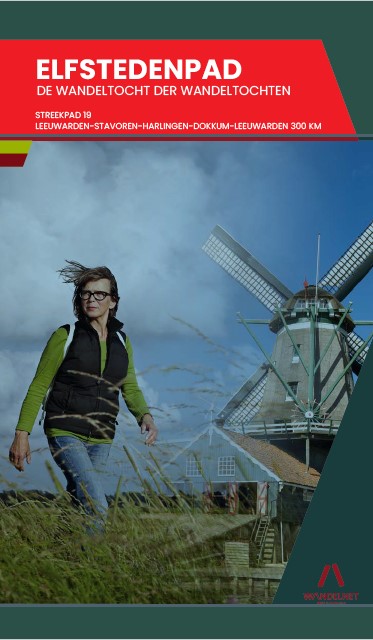
<p> Routegids met gedetailleerde topografische kaarten waar de route duidelijk op ingetekend is. Daarnaast alle noodzakelijke informatie als openbaar vervoer, geen overnachtingsadressen!</p> <p> Gebruikmakend van voormalige jaagpaden en kerkenpaden, van eeuwenoude grasdijken, van veelbetreden handelswegen, zijn routemakers Johan Vellinga en Broer Adema erin geslaagd de Friese steden op een voor wandelaars zo aantrekkelijk mogelijke manier aan elkaar te rijgen. Het Elfstedenwandelpad is met 283 kilometer een stuk langer dan de andere Elfstedentochten. Daar is een goede reden voor. Volgen schaatsers en ook wandelsporters over het algemeen de kortste weg, deze wandelroute zoekt de mooiste paden uit. Meer nog dan om de steden, gaat het om het tussenliggende land en om de paden die de steden verbinden. De schoonheid van de Greidhoeke en het Merengebied staat buiten kijf, maar Friesland is meer dan weiland en water. Het Elfstedenpad maakt een royale slag door de heuvels en bossen van het Gaasterland. Voorbij Dokkum doorkruist het de typische houtwallen in het coulissenlandschap van de Fryske Wâlden. Met het Elfstedenpad is een prachtig stukje Friesland niet alleen voor schaatsers, fietsers en watersporters, maar nu ook voor wandelaars ontsloten is.</p>
€19,95
Bekijk product
<p> Uitstekende wandelgids, goed beschreven met veel praktische informatie om de route te kunnen lopen, inclusief redelijke kaarten</p> <div> There's far more to Cyprus than just the bustling resorts: the favourable climate, attractive scenery and many kilometres of footpaths and nature trails make it an ideal destination for walkers. This guidebook presents 44 graded walks spread across the island, covering both southern and northern Cyprus, with a slight focus on the central Troodos region. Clear description and mapping is presented for each route and a route summary table makes it easy to choose an appropriate walk.</div> <div> </div> <div> The walks, of 3 to 20km, range from gentle strolls to longer, more demanding routes, sometimes involving steep ascents, difficult terrain or navigational challenge. They showcase Cyprus's captivating landscapes, from the sun-kissed coastline lapped by clear turquoise waters to the pine-clad slopes of the Troodos and Besparmak Mountains. Many visit sites of historical interest – including UNESCO-listed Byzantine monasteries, Venetian bridges, defensive castles and hideouts from the 1950s independence struggle – and other highlights include the stunning Avakas Gorge, the caves of Cape Greco and the striking Besparmak range.</div> <div> </div> <div> As well as the walks, the guide offers plenty of information to help you organise and get the most out of your trip, with advice on transport, bases and border crossings. There is a summary of the island's fascinating and turbulent history and an overview of its plants and wildlife. Blending information with inspiration, 'Walking in Cyprus' contains all you need to discover a hidden side to this Mediterranean gem.</div> <div> </div> <div> Steden en Dorpen</div> <div> Paphos, Polis, Troodos Square, Platres, Kakopetria, Kyrenia/Girne, Lapta, Alevkaya</div>
€23,95
Bekijk product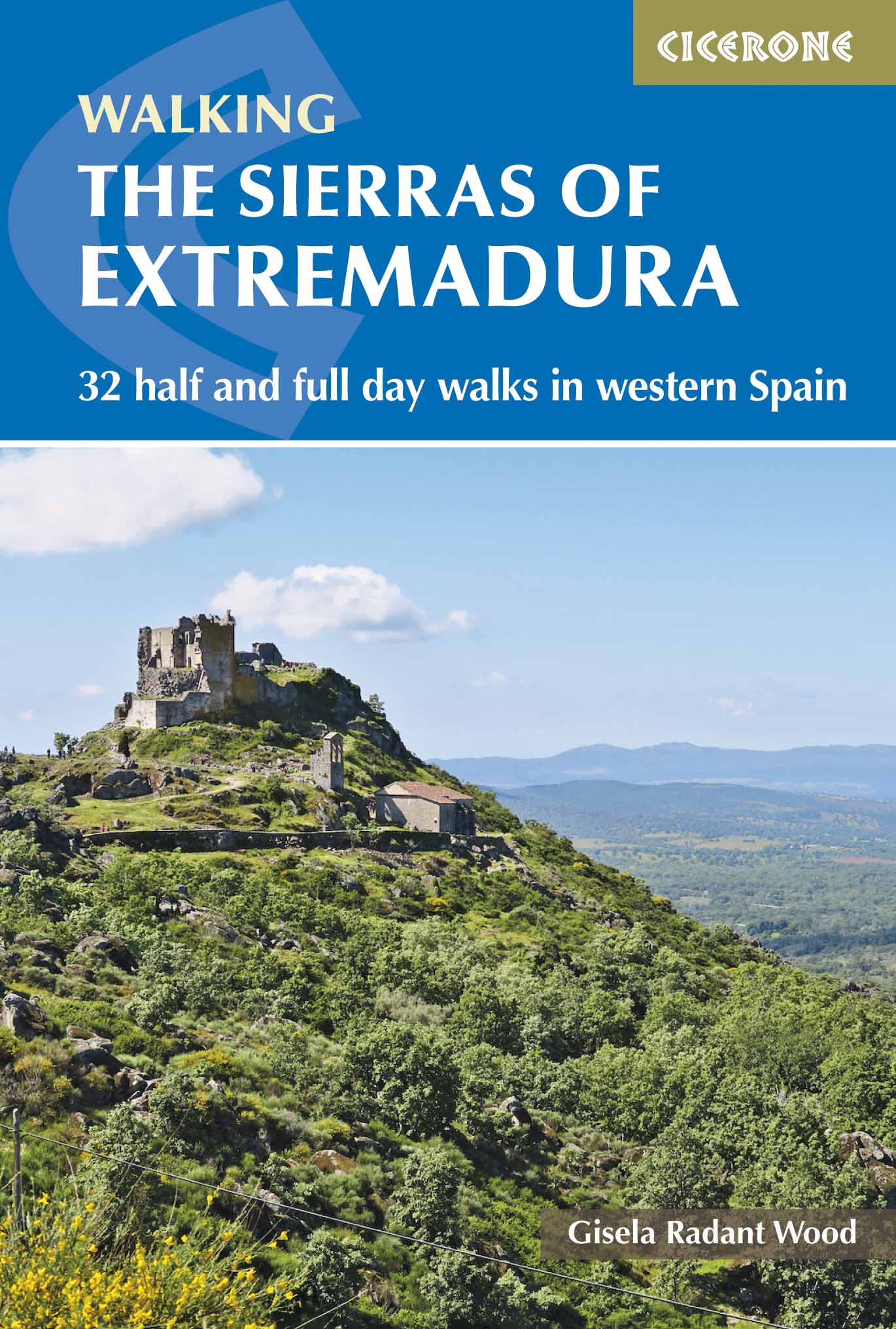
<p> Uitstekende wandelgids, goed beschreven met veel praktische informatie om de route te kunnen lopen, inclusief redelijke kaarten</p> <div> This guidebook showcases 32 walks exploring the sierras of Cáceres and Badajoz, one of Spain’s least known regions and a gem for walkers and nature lovers. Walks range in length from 6 to 20km are suitable for any reasonably fit walker. They can be done from a number of bases in the area including San Martín de Trevejo, Gata, Hervás, Jerte, Jarandilla de la Vera, Montánchez, Guadalupe, Almoharín, Mérida, Alange, Hornachos and Monesterio.</div> <div> Each walk is accompanied by a sketch map and detailed route description, as well as notes on the terrain, refreshments available and access. Background information about the area and the many interesting sites passed along the route combine to give an invaluable guide to an unspoilt and peaceful region. </div> <div> Extremadura is one of the most untouched regions of Spain, a delightful mix of rugged mountain ranges, gently rolling hills, deciduous forests, deep river valleys, olive groves and shady pastures, all criss-crossed by thousands of paths. Superb birdlife and a variety of heritage sites, from cave paintings to monasteries, add to this region’s charms.</div> <div> </div> <div> Steden en Dorpen</div> <div> San Martín de Trevejo, Gata, La Garganta (Hervás), Jerte, Jarandilla de la Vera, Montánchez, Almoharín, Guadalupe, Mérida, Alange, Hornachos, Monesterio.</div>
€23,95
Bekijk product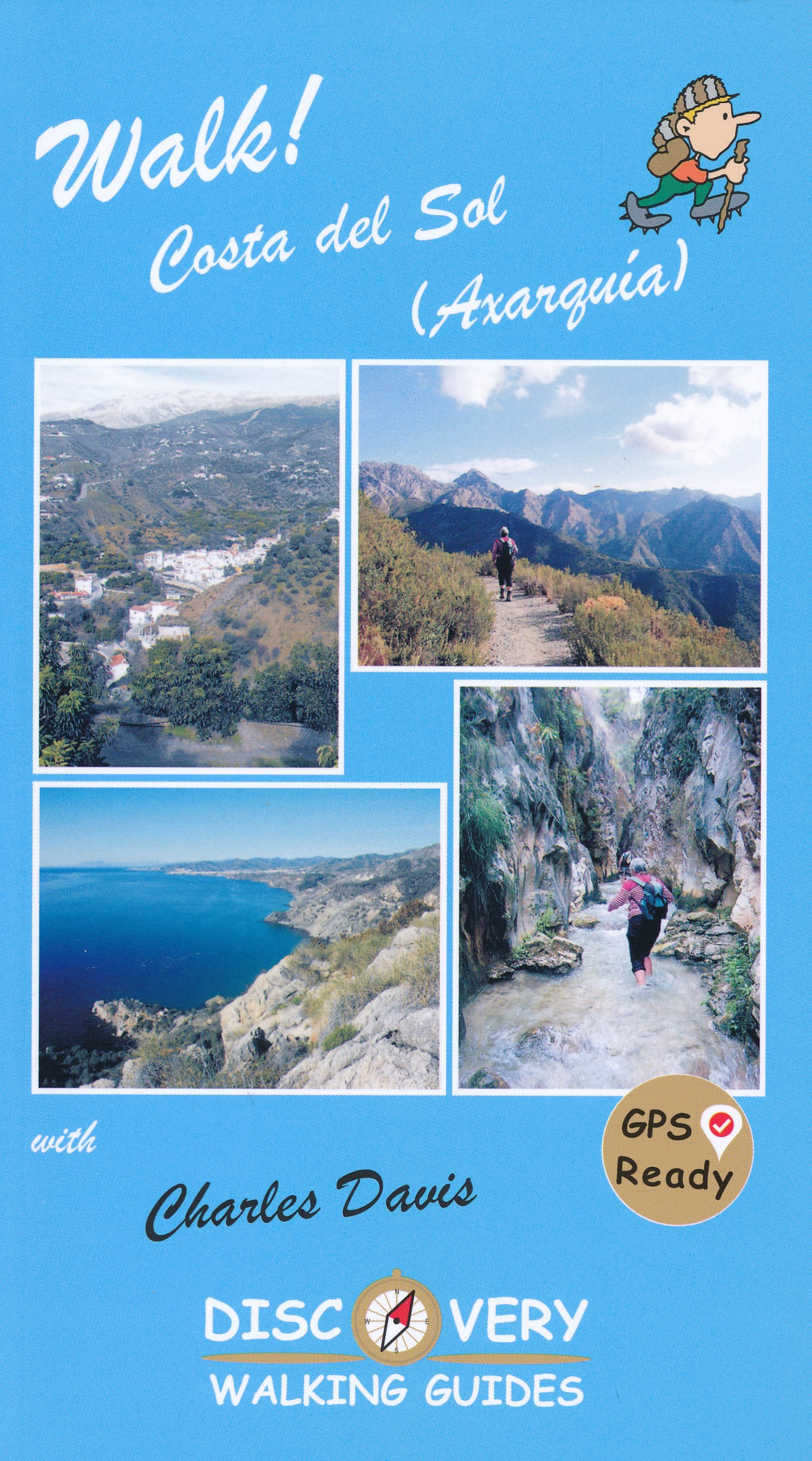
<p> Goede wandelgids van een uitermate geschikt wandelgebied aan de Costa del Sol: het binnenland boven Nerja rond Competa en andere bergdorpen. De beschrijvingen zijn prima, zo ook de praktische informatie en de kaarten.</p> <p> We celebrate a Costa del Sol that does not correspond to the cliches, a Costa del Sol that is all right rather than all wrong, a playground of green valleys and gilded mountain tops, a hidden idyll unknown to most visitors, a haven for dedicated walkers and adventurous tourists alike, a place in which every nook is graced with some gratifying discovery and every outing is a great adventure. The majority of walks are aimed at the adventurous leisure walker, people who will on the whole have some experience of hiking in mountains, are happy to invest a certain amount of effort for a corresponding reward.</p> <p> Covering the best preserved stretch of coastline, the prettiest villages, and most spectacular mountains, Walk! Costa del Sol explores the Axarquia region east of Malaga, an area blessed with grand summits, dizzying pinnacles, dramatic crags, deep ravines, delightful streams, stunning views, and the finest coves on the Costa del Sol, and all of it knitted together by a network of paths, trails, tracks and lanes so beguiling that walking is by far the best way to explore this lovely landscape.</p> <p> THE COAST: TORRE DEL MAR, TORROX COSTA, NERJA, MARO are well-placed for accessing the itineraries between Canillas de Aceituno and Competa. THE MOUNTAINS: THE SIERRAS DE TEJEDA and ALMIJARA The Sierra is a discrete massif defined by cliffs, gullies and gorges, and culminating in the Iberian Peninsula's westernmost 2000 metre summit (La Maroma, Walk 35), while the Sierra Almijara comprises numerous mini-ranges separated by canyons. The traditional dividing point between the two sierras is Puerto de Competa, which we visit in Walk 36. The joys of these mountains are manifold, including bulbous karstic domes and vertiginous pinnacles, dramatic cliffs draped with ragged crags and grand ridges dominating the glittering blue sea; there are uplands patched with ancient pastures and dotted with the ruins of remote cortijos (farmhouses), there are terraces stippled with olive and almond trees, hillsides swaddled in a buttery blanket of yellow-flowering shrubs, valleys flanked by shady forests of conifer and cork oak, and fabulous ravines twisting between towering chicanes (known as cahorros) and tipping over spectacular waterfalls into deep plunge pools, all accessible within 15 minutes of the coast.</p> <p> THE WHITE VILLAGES The Pueblos Blancos of Andalusia with their whitewashed walls and red-tiled roofs are justly famous and the Axarquia does not disappoint in this respect. The best known pueblos blancos and the main gateway destinations for walkers are Competa and Frigiliana. West of Competa are some of the region's prettiest villages, the two Canillas (Aceituno and Albaida), Sedella, Salares and Archez. Walk! Costa del Sol (Axarquia) together with Costa del Sol Tour & Trail Map will give you a series of adventures you'll never forget.Each walk is fully described and accompanied by a detailed map and colour photos, plus an information bar that helps you easily choose the right routes for you, based on difficulty, distance, time needed, ascents and descents and more</p>
€18,50
Bekijk product