
Beantwoord enkele vragen, en binnen seconden geeft AI je een persoonlijk aankoopadvies op maat.
Beantwoord enkele vragen, en binnen seconden geeft AI je een persoonlijk aankoopadvies op maat.
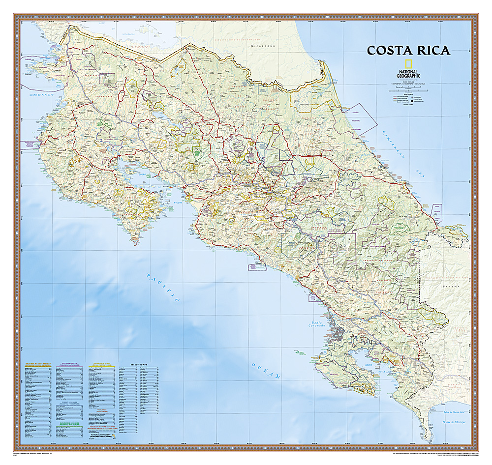
Decoratieve wandkaart van Costa Rica. Naast de mooie kleuren staan er bijzonder veel plaatsen op vermeld. This full-color map is a richly detailed rendering of one of Central America's greatest treasures. From its northern savannahs and plains to lush forests and pristine jungle-lined beaches, Costa Rica's beauty and diversity beckon! The map also includes outlines and information for National Parks, Protection Zones, and more.
€28,95
Bekijk product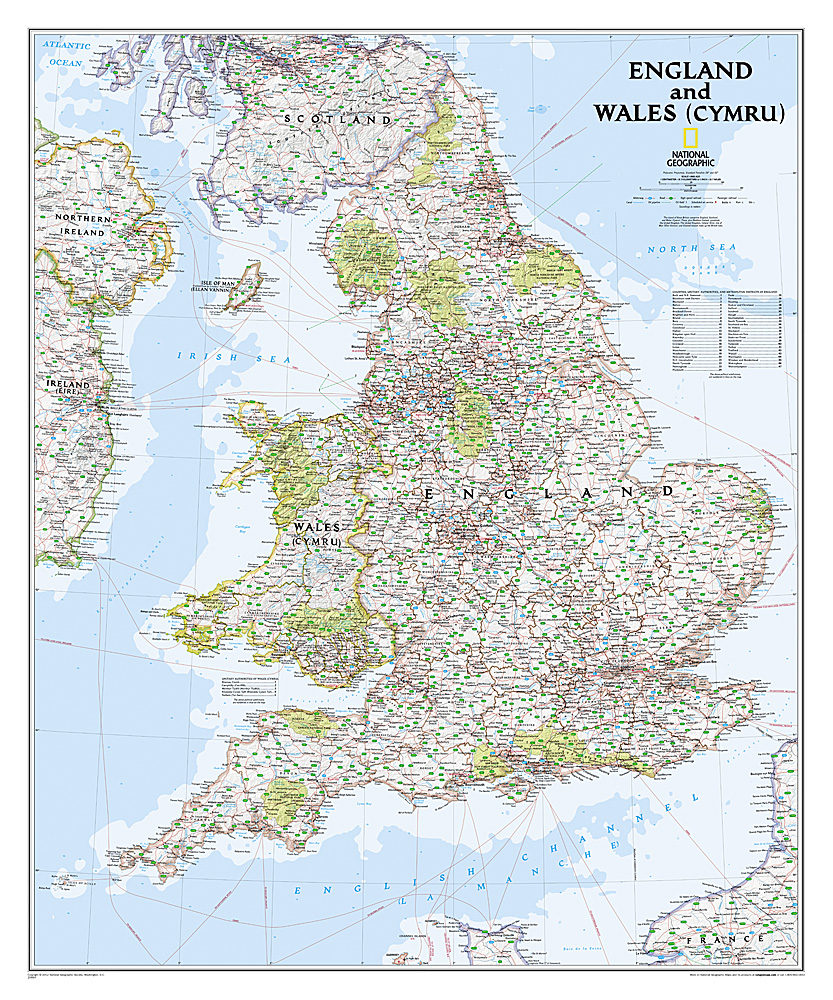
This classic-style map of England and Wales shows political boundaries, major highways and roads, cities and towns, airports, and other geographic details. Thousands of place-names and exact borders are carefully researched by National Geographic’s map researchers and editors ensuring the utmost accuracy.
€31,95
Bekijk product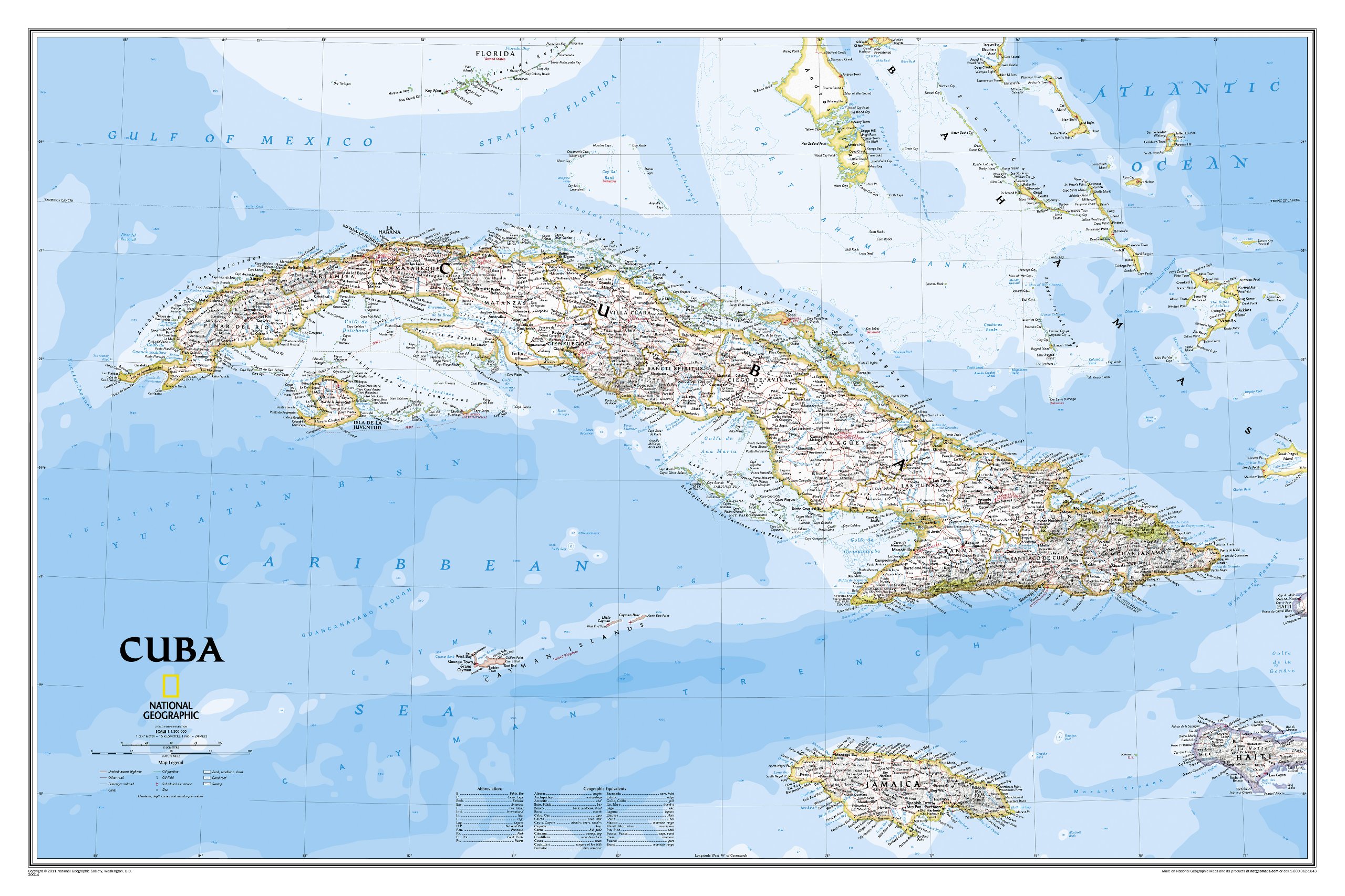
The most accurate and richly detailed reference map available for the iconic Caribbean island nation, our Cuba Classic Map contains National Geographic’s proprietary fonts and world recognized border bands in a bright and appealing color palette with striking blue oceans on a crisp white background. Cuba’s many offshore islands, reefs, and rivers are noted, as are sites of interest. Ocean bathymetry with depth curves and soundings, peak elevations, and handcrafted shaded relief provide topographical detail. Jamaica, the Cayman Islands, the Florida Keys, and most of the Bahamas and Haiti are shown, presenting Cuba in the context of its important geographical position in the Caribbean. Cuba contains thousand of place names, accurate political boundaries, and infrastructure making it the perfect reference for student, home, or business. Additional content unique to this map includes: Sites of interest including national parks and reserves Geographic equivalents provide translations from Spanish to English Transportation detail including highways, roads, canals, ferry routes, and airports Geographical detail including mountain relief, swamps, and coastal reefs Elevations, depth curves, and soundings Coverage includes Havana, Pinar del Rio, Baracoa, Trinidad, Caya Largo, Santa Clara, Varadero, Isla de la Juventad
€34,95
Bekijk product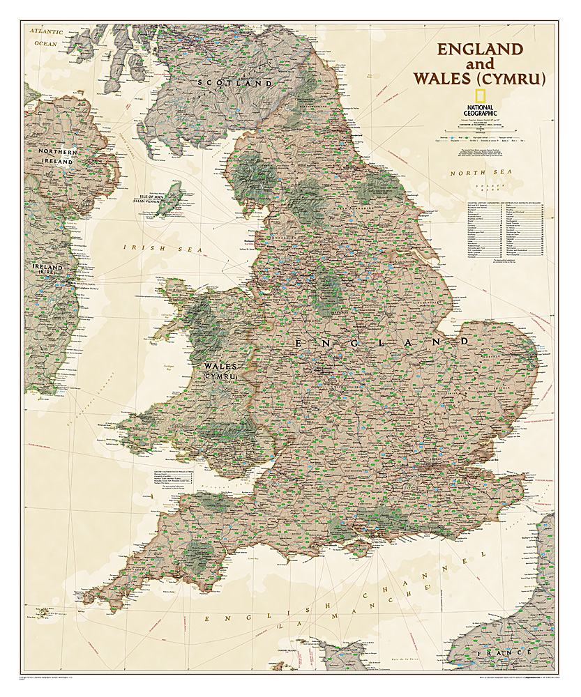
This earth-toned, executive-style map of England and Wales shows political boundaries, major highways and roads, cities and towns, airports, and other geographic details. Thousands of place-names and exact borders are carefully researched by National Geographic's map researchers and editors ensuring the utmost accuracy.
€25,95
Bekijk product
Wandkaart - Falk Nederland met een formaat van 130 (h) X 100 (b) cm. Het is een zeer gedetailleerde en duidelijke wandkaart, met veel plaatsen, wegen met wegnummers, afritten. Deze kaarten zijn echt gericht op plaatsen en wegen, natuurgebieden zijn minder duidelijk aangegeven. Gelamineerd. Wordt geleverd op rol in plastic koker.
€42,95
Bekijk product
Mooi, heldere wandkaart van Canada. This Canada wall map clearly depicts all the cities, major roads and also shows all the Provinces and Territory boundaries. All major cities and areas are displayed bi-lingually. This Canada Wall Map features: • Provincial Boundaries • Provincial Capitals • Cities • National and International Airports • Latitude and Longitude Lines • Physical Features and Terrain Shading • Ocean Bathymetry • Highways, Major Roads and Seasonal Roads • Provincial Flags • Provincial and National Parks • Detailed Scale: 1:5,700,000
€38,95
Bekijk product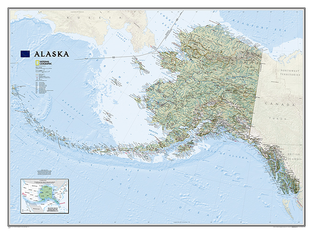
Deze wandkaart van National Geographic is zeer gedetailleerd en bevat alle belangrijke plaatsen. Daarnaast is er ruimte voor de landschappelijke details zoals hoogtelijnen, rivieren, belangrijke wegen en andere items zoals politieke grenzen, luchthavens . Alaska physical wall map, size 103 x 78cm at 1:3,660,000 from the National Geographic, with colouring to show the topography and plenty of place names. Coverage includes the panhandle and the outermost Aleutian Islands in their proper geographical placing. Altitude colouring and relief shading shows the topography, with names of mountain ranges, peaks with heights (in feet), etc. Boundaries of national parks and other protected areas are marked. The map shows Alaska’s road network, the railway line from Anchorage to Fairbanks, numerous local airfields with scheduled air or seaplane services, and ferry routes. The map has a very large number of place names: towns and settlements, geographical features including islands, bays, etc. On the surrounding seas ocean floor is shown in relief with sounding (also in feet). Latitude and longitude lines are drawn at 5° intervals. An inset shows the conterminous part of USA with Alaska and the Aleutian Islands superimposed on it to indicate the size ot the state: from the southern tip of the panhandle to the Attu Island equals Jacksonville in Florida to San Francisco!
€36,95
Bekijk product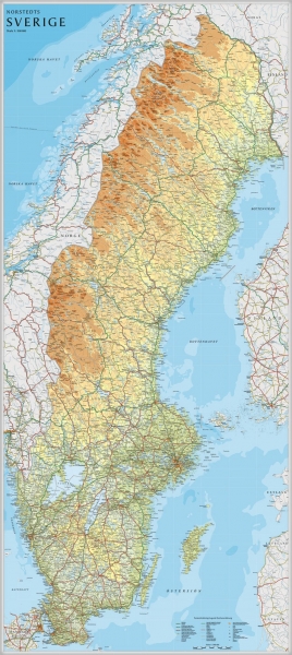
Een grote kaart van Zweden voor aan de muur. Decoratieve kleuren tonen verschillende hoogten en Zweedse bergketens. Belangrijke wegen, spoorwegen en steden zijn duidelijk herkenbaar. Wordt geleverd op rol in stevige kartonnen koker.
€42,95
Bekijk product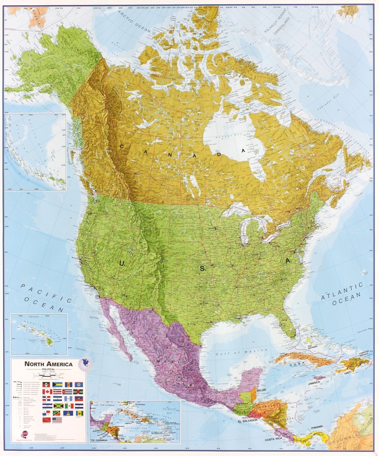
Fraaie politieke kaart van het continent, waarbij vooral de politieke aspecten heel duidelijk te lezen zijn. Alle landen hebben verschillende kleuren, steden en belangrijke verbindingen zijn goed te vinden. Dit is geplastificeerde uitvoering zonder ophangsysteem. Maps International's North America political wall map covers a huge expanse of land from Alaska and Canada through the United States down to Mexico, Central America and the Caribbean. One of the finest maps money can buy! This political wall map of North America features countries shown in different colours, international boundaries and major transport networks. The wall map also contains a panel of flags relating to the countries shown in this North American continent map. Also shown is city population detail, capital cities and all the major towns and cities in this continent of North America. Maps International's North America map is available either plain or laminated. Ideal for an office, classroom or when planning a trip to this American continent.
€38,95
Bekijk product
Het klassieke kaartbeeld van National Geographic, de grenzen van de staten van Amerika zijn apart gekleurd. De wandkaart is heel gedetailleerd met veel plaatsen, wegen, rivieren en nationale parken, het reliëf wordt met schaduw aangegeven. Geplastificeerde versie. The National Geographic Classic United States map uses bright color bands to outline each state. Capitals, major cities, selected towns, bodies of water, highways, and national parks are all shown. Shaded relief, rich in detail, emphasizes the many mountains, valleys, and plateaus of the United States. Our most popular United States wall map. Features all 50 States with insets for Alaska and Hawaii. All major cities, transportation routes, State boundaries, National Parks, inland waterways, and mountain ranges are clearly displayed and labeled.
€36,95
Bekijk product