
Beantwoord enkele vragen, en binnen seconden geeft AI je een persoonlijk aankoopadvies op maat.
Beantwoord enkele vragen, en binnen seconden geeft AI je een persoonlijk aankoopadvies op maat.
<p> National Geographic Wall Maps offer a special glimpse into current and historical events, and they inform about the world and environment. Offered in a variety of styles and formats, these maps are excellent reference tools and a perfect addition to any home, business or school. There are a variety of map options to choose from, including the world, continents, countries and regions, the United States, history, nature and space.</p>
€31,95
Bekijk product
<p> This new map of Scotland, features our rich, antique-inspired Executive style. This beautiful map includes thousands of place names, accurate political boundaries, national parks, archeological sites, and major infrastructure networks such as roads, canals, ferry routes, and railroads. Scotland’s diverse terrain is detailed through accurate shaded relief, coastal bathymetry, and symbolism for water features and other landforms.</p>
€31,95
Bekijk product
<p> Mooie natuurkundige kaart van Griekenland met namen in het Grieks.</p>
€18,95
Bekijk product
<p> National Geographic Wall Maps offer a special glimpse into current and historical events, and they inform about the world and environment. Offered in a variety of styles and formats, these maps are excellent reference tools and a perfect addition to any home, business or school. There are a variety of map options to choose from, including the world, continents, countries and regions, the United States, history, nature and space.</p> <p> This wall map of Brazil contains thousands of place names and accurate political boundaries including Brazil's 26 states. Major and minor cities, superhighways, roads, passenger rail lines, and national parks are clearly depicted. Brazil's diverse terrain is represented through accurate shaded relief and hydrographic symbology. Elevations and depths are in meters.</p>
€37,50
Bekijk product
<p> This new map of Scotland, features our rich, antique-inspired Executive style. This beautiful map includes thousands of place names, accurate political boundaries, national parks, archeological sites, and major infrastructure networks such as roads, canals, ferry routes, and railroads. Scotland’s diverse terrain is detailed through accurate shaded relief, coastal bathymetry, and symbolism for water features and other landforms.</p>
€25,95
Bekijk product
<p> This USA map clearly depicts all the cities, major roads and also shows all the state areas and boundaries.</p>
€37,95
Bekijk product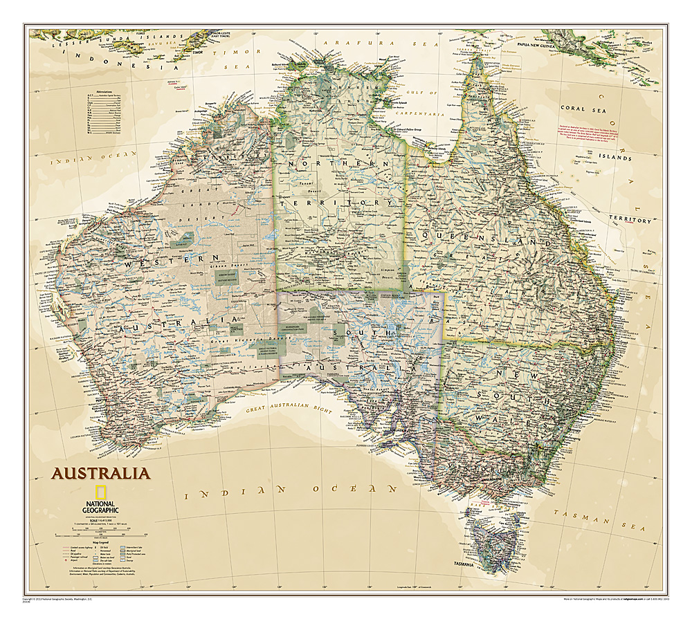
<p> A current political map of Australia in rich, earth-toned colors clearly shows state boundaries, place names, bodies of water, parks and preserves, and more. Includes inset maps for Tasmania and major Australian cities.</p>
€31,95
Bekijk product
<p> National Geographic Wall Maps offer a special glimpse into current and historical events, and they inform about the world and environment. Offered in a variety of styles and formats, these maps are excellent reference tools and a perfect addition to any home, business or school. There are a variety of map options to choose from, including the world, continents, countries and regions, the United States, history, nature and space.</p>
€31,95
Bekijk product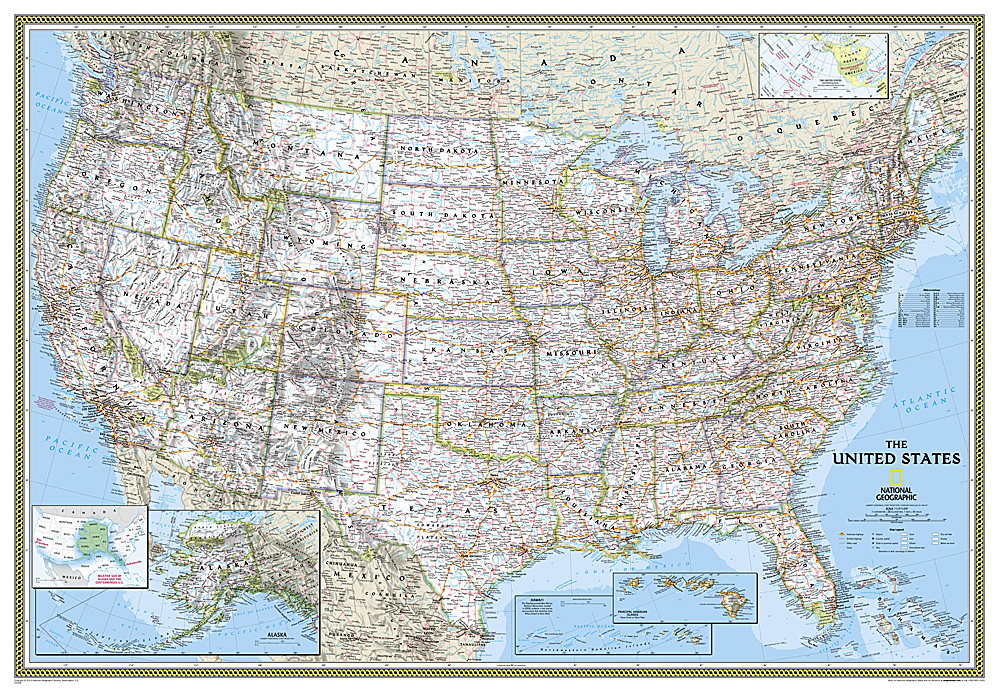
<div> Het klassieke kaartbeeld van National Geographic, de grenzen van de staten van Amerika zijn apart gekleurd. De wandkaart is heel gedetailleerd met veel plaatsen, wegen, rivieren en nationale parken, het reliëf wordt met schaduw aangegeven. Dit is de grote versie (zie afmetingen)</div> <div> </div> <div> The National Geographic Classic United States map uses bright color bands to outline each state. Capitals, major cities, selected towns, bodies of water, highways, and national parks are all shown. Shaded relief, rich in detail, emphasizes the many mountains, valleys, and plateaus of the United States. </div> <div> </div> <div> Our most popular United States wall map. Features all 50 States with insets for Alaska and Hawaii. All major cities, transportation routes, State boundaries, National Parks, inland waterways, and mountain ranges are clearly displayed and labeled. </div>
€68,95
Bekijk product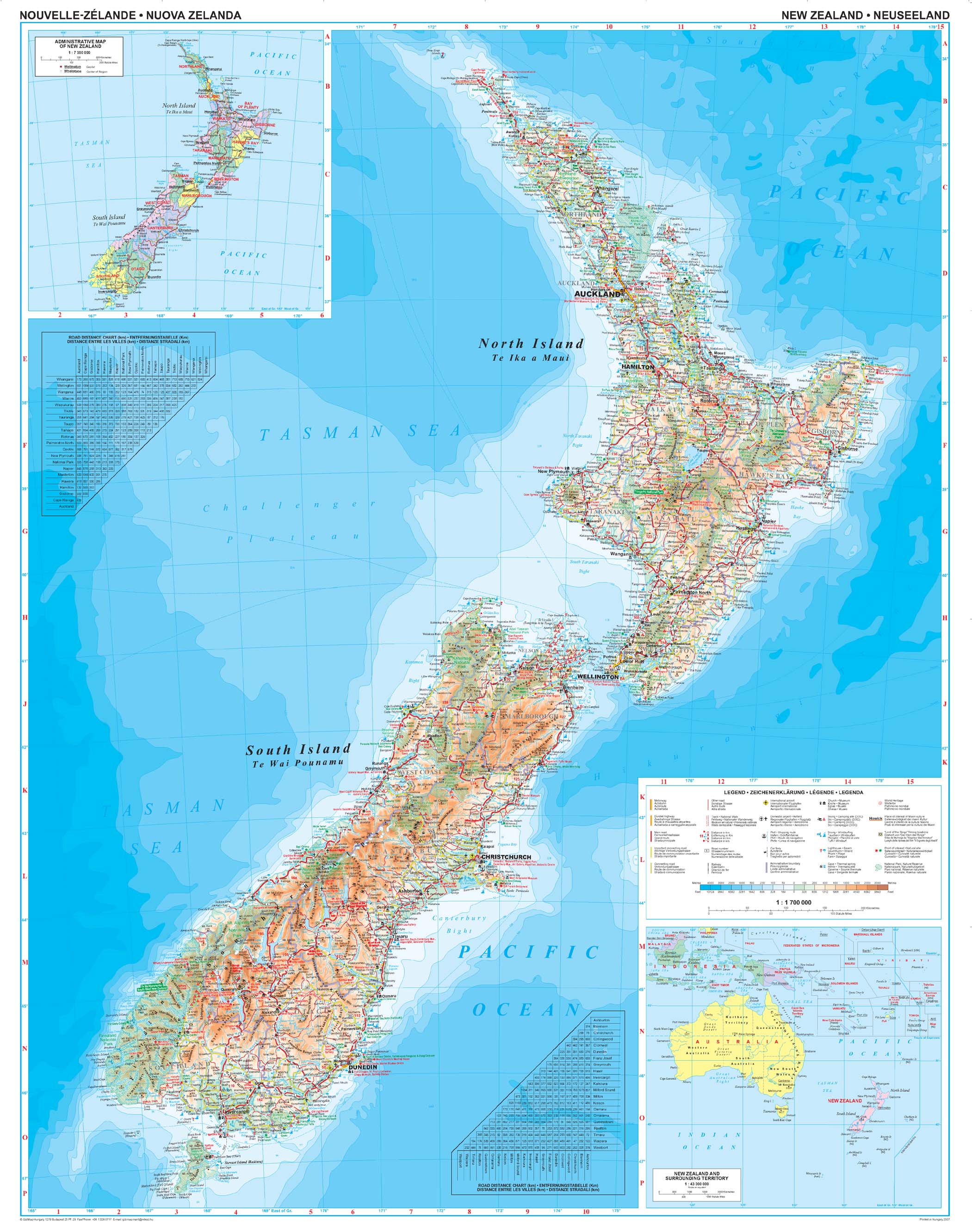
<div> Geïndexeerde wegenkaart van Nieuw-Zeeland, ontworpen om een goed overzicht te geven van de topografie van het land. De kaart heeft hoogtekleuren met punthoogtes en namen van verschillende bergketens en geselecteerde bergtoppen. Nationale parken en beschermde gebieden zijn duidelijk aangegeven.</div> <div> </div> <div> Het wegennet omvat geselecteerde plattelandswegen en toont tussenliggende afstanden op hoofdroutes. Spoorwegen, lokale luchthavens en belangrijkste veerbootverbindingen zijn gemarkeerd en de kaart toont ook lokale interne administratieve divisies met de namen van de regio's.</div> <div> </div> <div> Symbolen markeren verschillende bezienswaardigheden, zoals stranden, duik- en windsurflocaties, skigebieden, grotten, campings, enz. De kaart heeft een rooster voor lengte- en breedtegraden met intervallen van 1º. De legenda van de kaart is in het Engels. De index staat op de achterkant.</div> <div> </div> <div> Er zijn ook aparte afstandstabellen opgenomen voor de Noord- en Zuid-eilanden, een kleine administratieve kaart van het land en een kaart van het zuidwesten van de Stille Oceaan.</div>
€46,95
Bekijk product